
Part of the regional summaries: Chagos Archipelago - Great Chagos Bank West / Brothers / Eagle and Chagos Archipelago
More info
Chagos (NOAA CRW virtual station)BIDI15, at Danger Island, has 20% coral cover and is notable for large gorgonian sea fans on the pavement and some of the finest brain corals photographed in the whole Chagos series, including extreme close-ups resolving individual polyps. A whitetip reef shark was seen cruising the pavement, and the site's published 8.8% bleaching figure could not be confirmed or denied from the limited available photographs. Surveyed on the Living Oceans Foundation's Global Reef Expedition.
One independent survey station shown with the program’s logo — click one to see how far it is from this site.
Five other CRD dive sites within 5 km shown in orange — click a marker to open its page.
🗺 Detailed map of the Global Reef Expedition dive sites, Danger Island, Chagos (Khaled bin Sultan Living Oceans Foundation; opens in a new window)
Site description
General benthic features
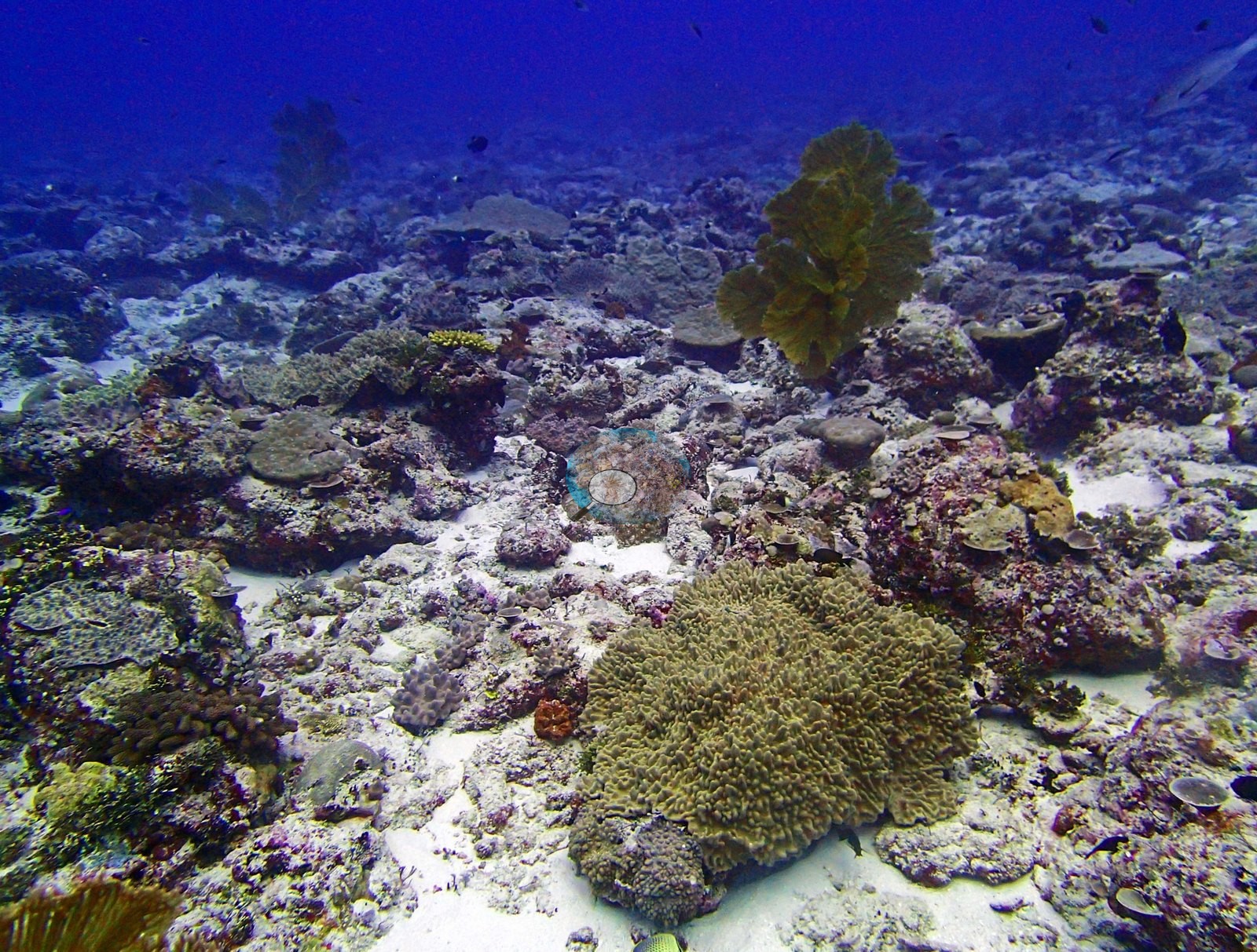
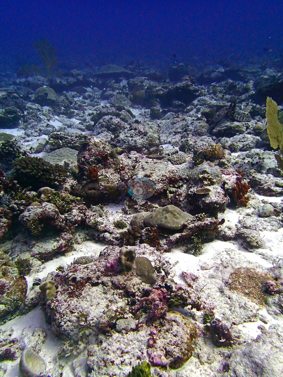
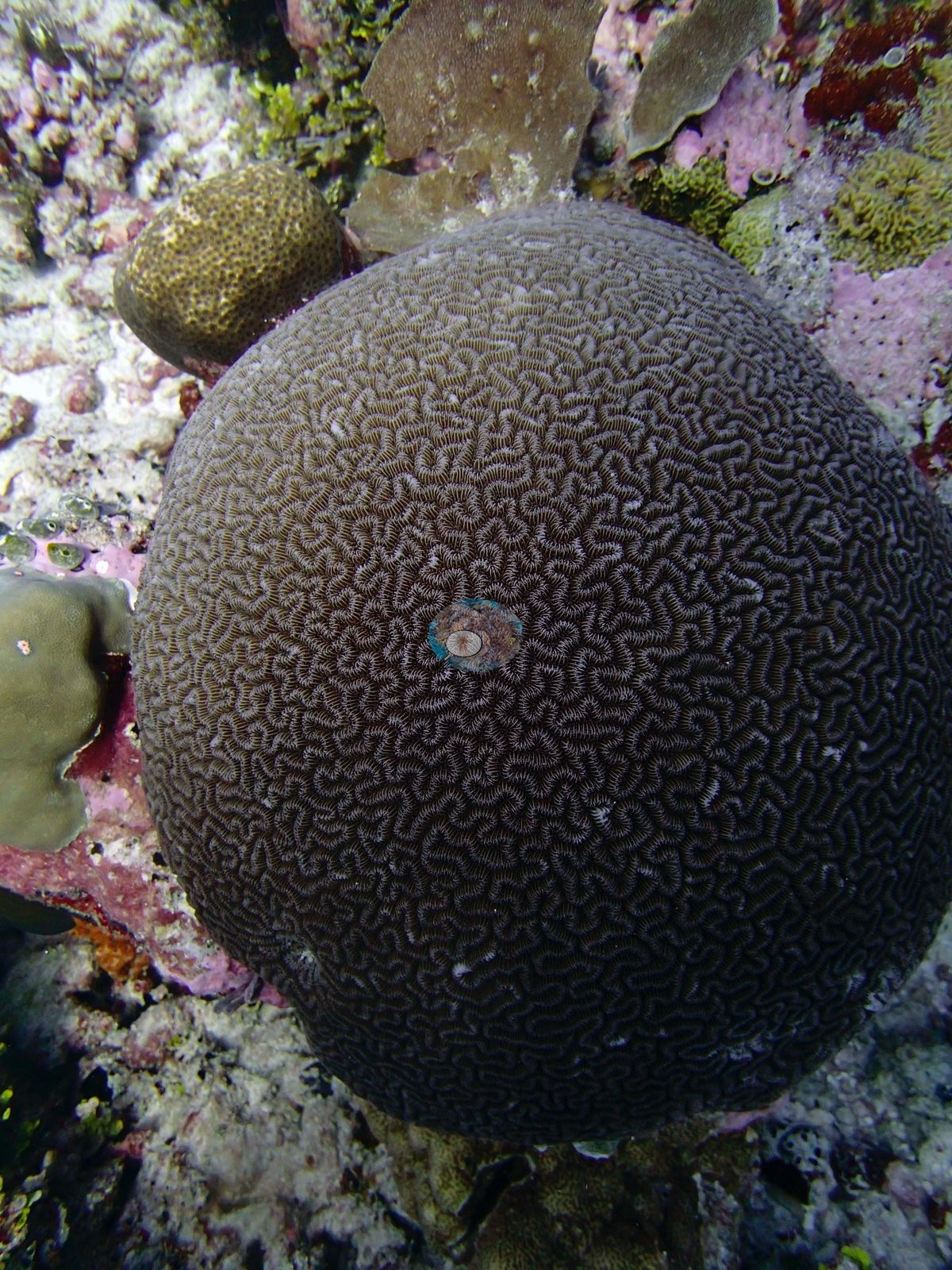
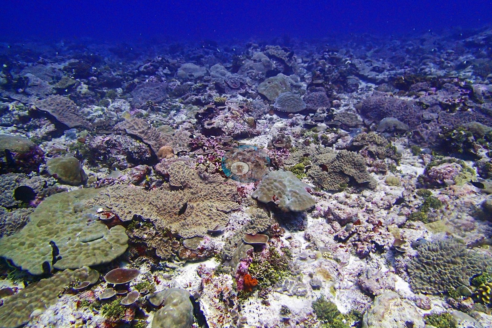
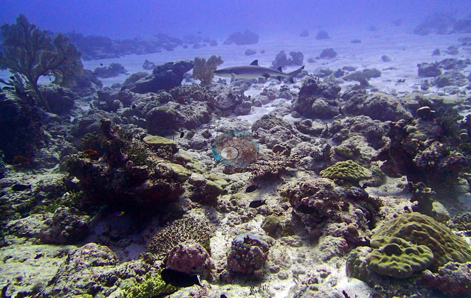
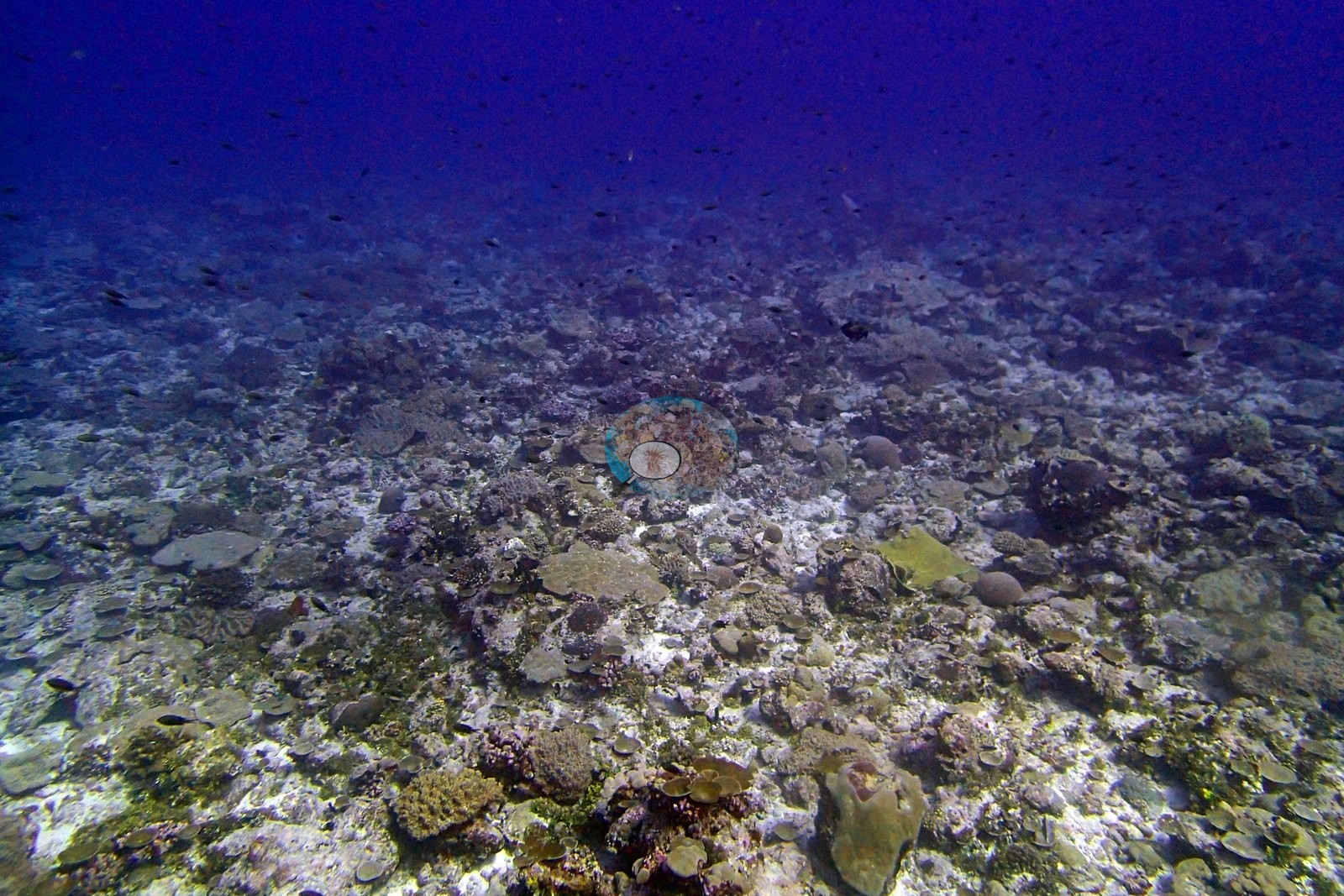
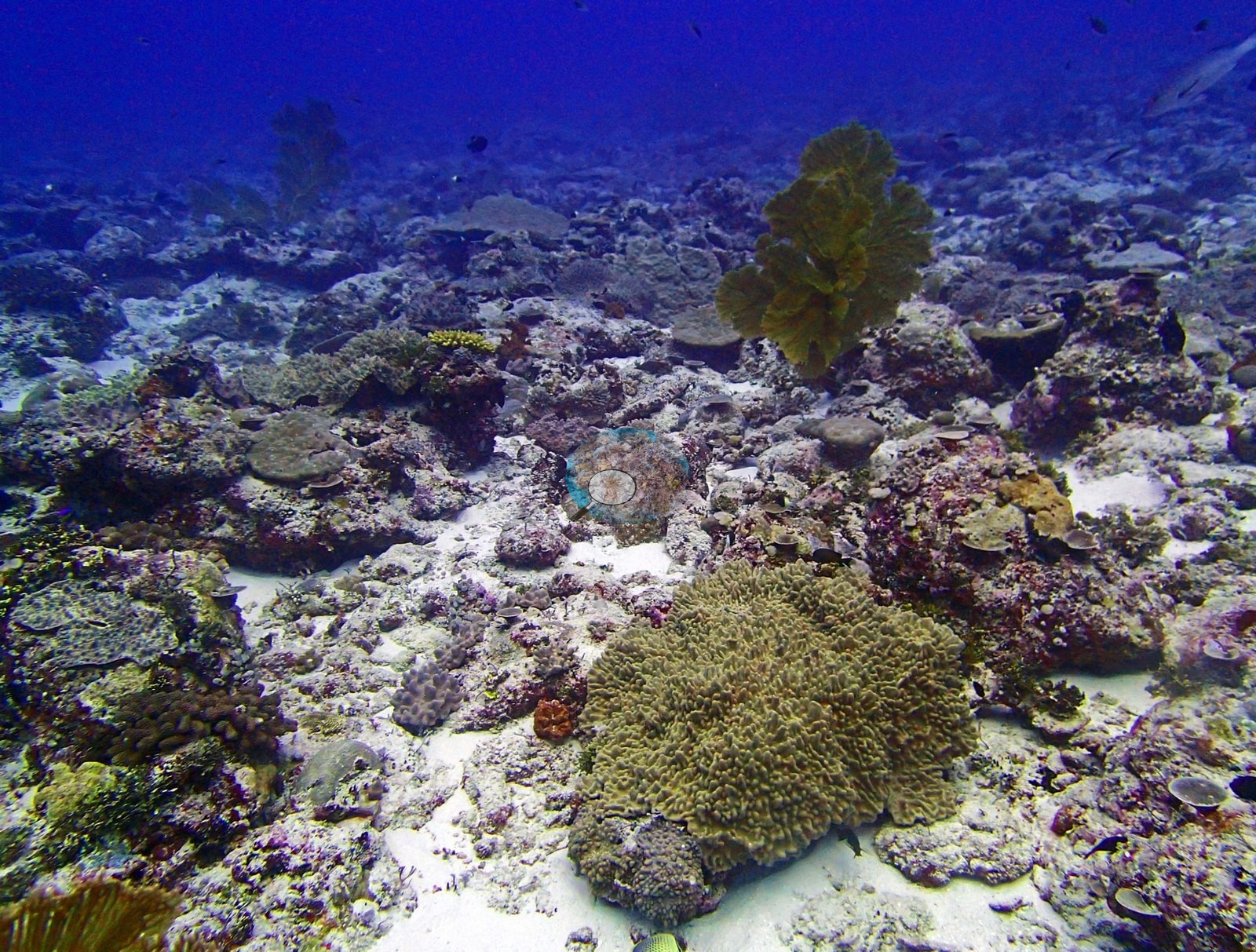
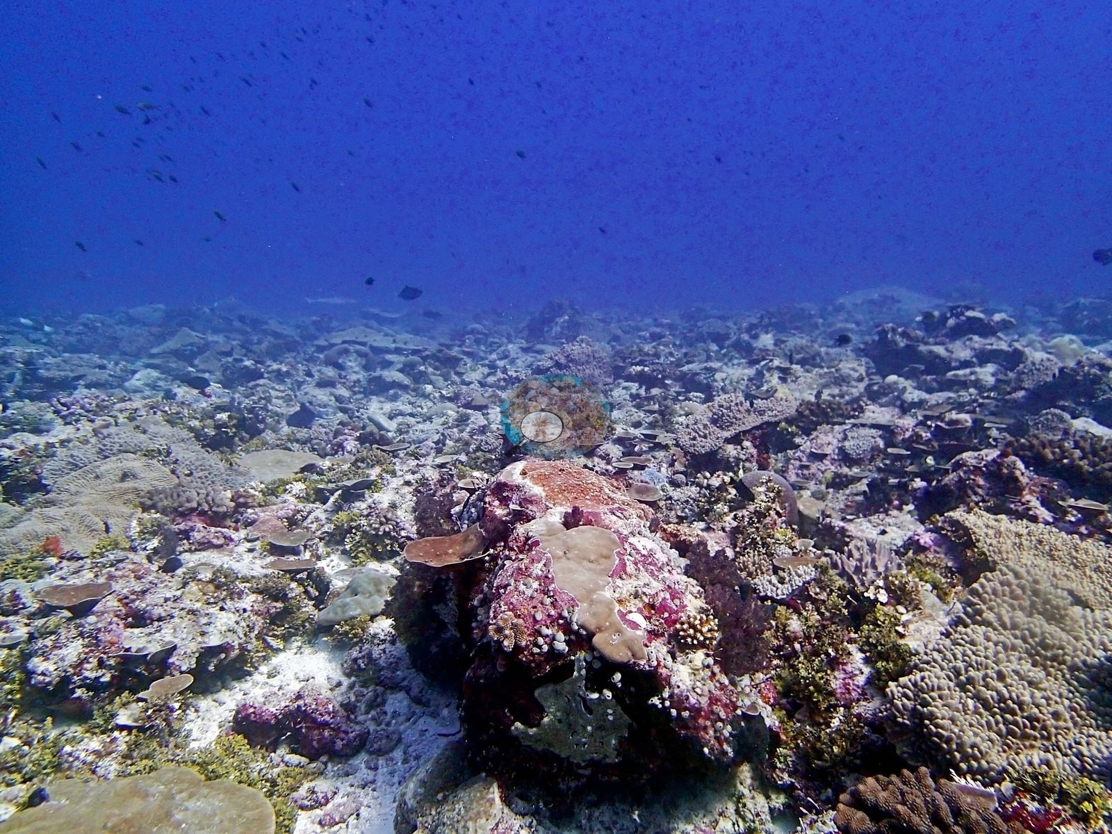
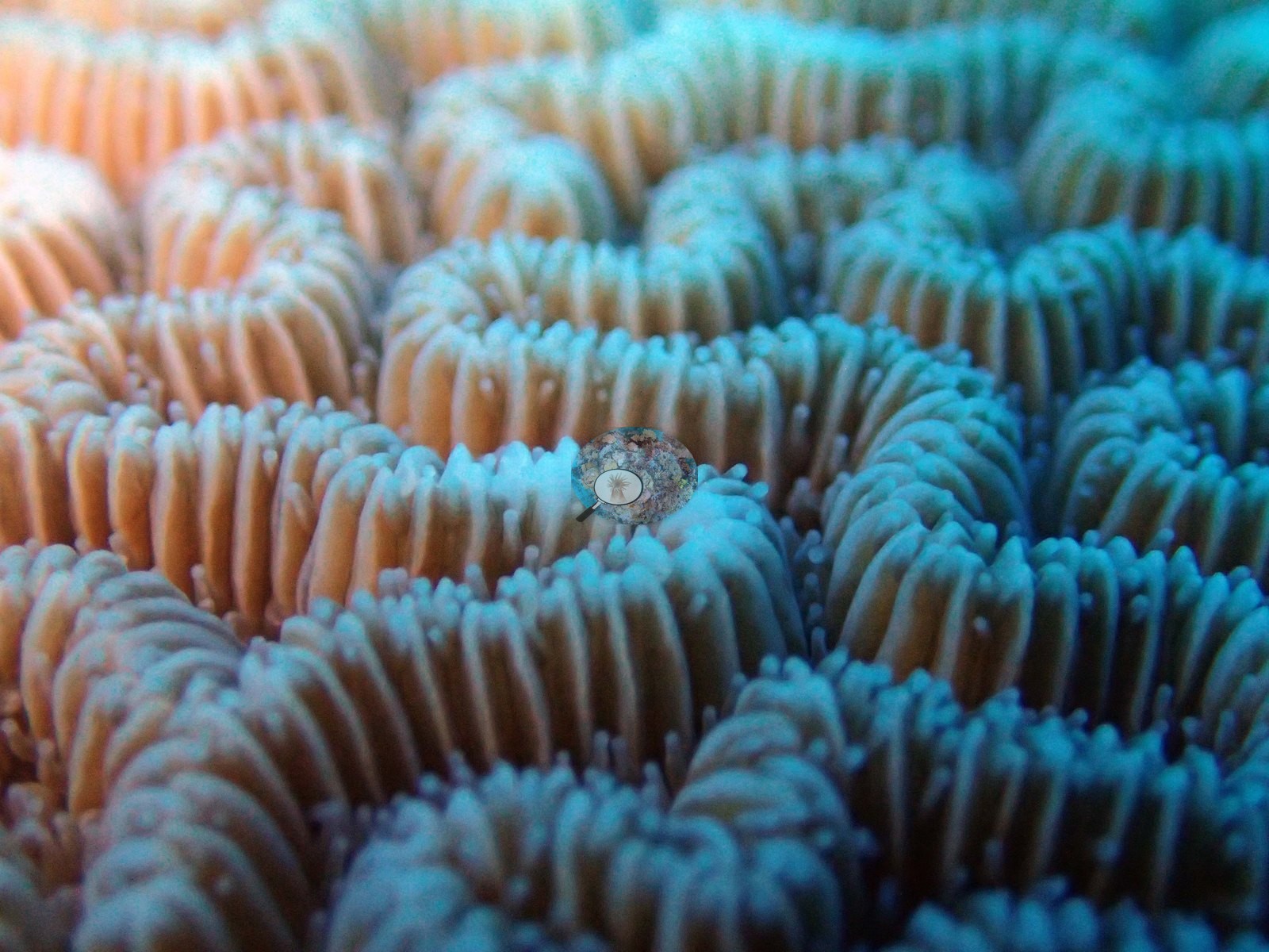
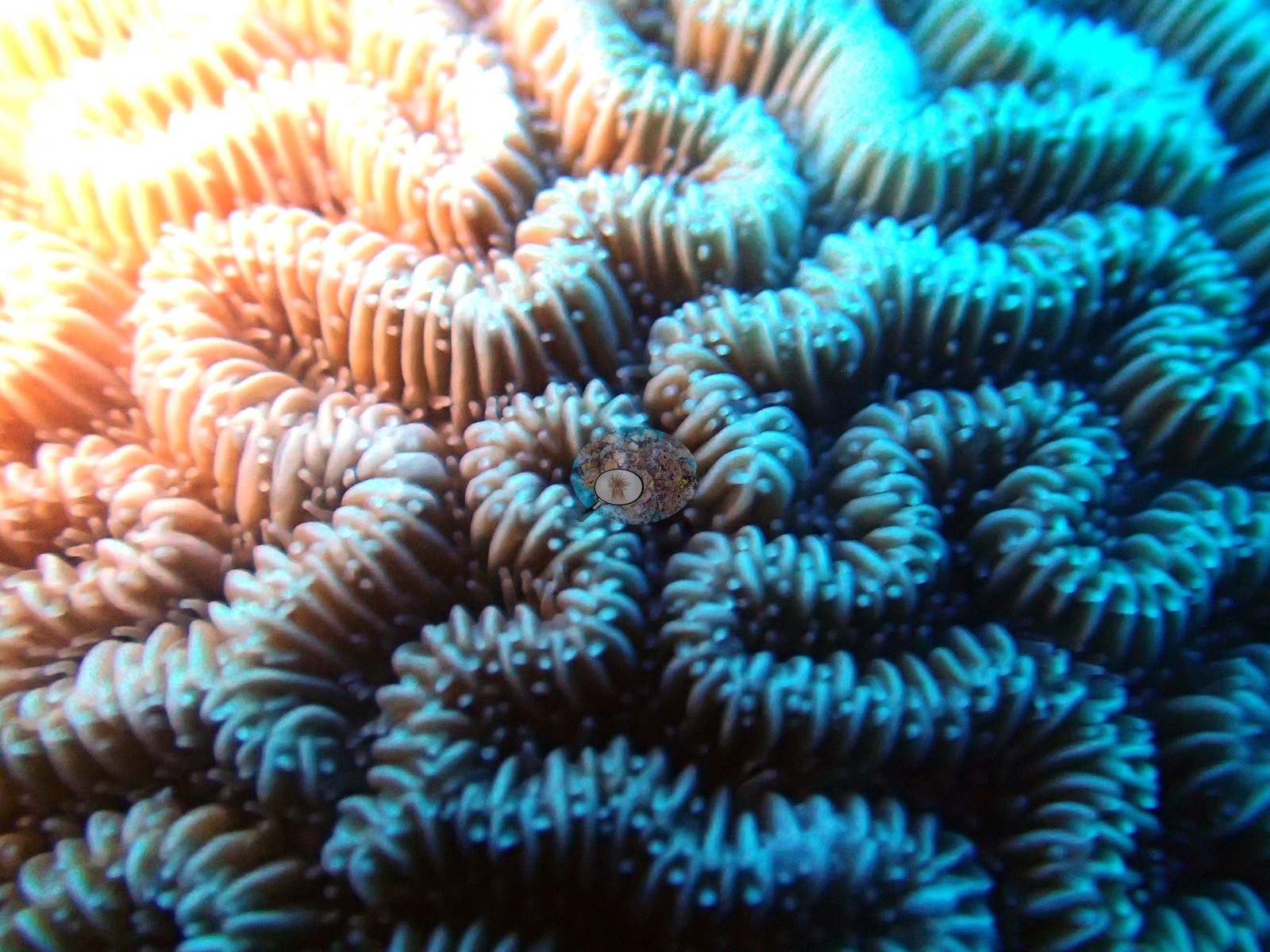
The transect's genus breakdown. Eighteen scleractinian genera were recorded, and this is a Porites reef, not an Acropora reef: Porites alone holds 12.70% of the benthos — 63% of all the live coral at the site. Pocillopora (2.25%) and Montipora (2.17%) form the only other meaningful components. Everything else is a long tail below half a percent: Goniastrea 0.43%, Stylophora 0.37%, Pavona 0.35%, Favites 0.33%, Fungia 0.29%, Acropora only 0.27%, Platygyra 0.25%, Astreopora 0.18%, Leptastrea 0.13%, Echinopora 0.12%, Turbinaria 0.07%, Cantharellus 0.06%, Favia 0.05%, and Gardineroseris and Leptoseris at 0.01% each. The non-coral benthos is dominated by bare substrate at 21.41% — the largest single category and the highest of the Danger Island sites — followed by invertebrates 17.34%, crustose coralline algae 14.14%, erect algae 11.19%, turf-plus-sediment 9.73%, turf 3.88% and macroalgae 2.26%. BIDI15 is a protected, low-relief forereef of eroded pavement and rubble, and the wide frames are consistent and unflattering. P3140246, P3140261, P3140272, P3140283, and P3140291 all show the same country: pale, largely bare carbonate hardground strewn with coarse rubble and open sand, crusted with turf and pink, mauve and magenta coralline algae, across which small and well-spaced colonies are scattered — low tan and olive knobby heads, olive-green foliose and plating colonies compatible with Pavona or Echinopora, domal Porites, a broad pale tabular colony low in P3140261, a large porous olive-yellow dome compatible with Astreopora at the left edge of P3140272, and small meandroid massives. P3140291 in particular is a broad plain in which live coral is a clear minority of the surface, and almost nothing in these frames stands more than a colony's height above the substrate. Two features genuinely distinguish this site in the imagery. First, large gorgonian sea fans — yellow-brown and finely branched — stand clear of the pavement in P3140246, P3140247 and P3140261, a growth form scarce elsewhere in the reviewed Chagos frames and typical of current-swept, low-relief hardground; it is also a growth form invisible to a hard-coral point or mask scheme. Second, and more striking, BIDI15 has the finest brain corals in the collection. P3140268 is a large, near-spherical meandroid colony compatible with Platygyra or Leptoria filling most of the frame, its valleys tightly and evenly sinuous, flanked by a porous yellow-green dome compatible with Astreopora and by pale plating colonies over pink-crusted rock. P3140270 and P3140271 then go closer still — two extreme macros resolving individual polyps and extended tentacles along the valley walls.
Coral cover
The LOF benthic transect is this site's measurement. Coral cover at BIDI15 is 20.1%, from the LOF BIOT-1 in situ transects (Mayfield & Dempsey 2026, Oceans, suppl. S1) — Anderson's own published value and the authoritative record of cover and community here — against algal cover of 41.2% of the benthos. The photographs described below supplement that survey. They are qualitative only, no cover value may be read off any of them, and nothing in them qualifies or disputes the transect. No depth-stratified means (D1–D4) and no per-frame depth data are carried for this site; 20.1% is the site value as published. It is worth registering that the transect ranks the meandroid brains — Platygyra at 0.25% — as a very minor component of cover even though they are the photographic highlight of the folder; the frames and the transect are answering different questions. Coral cover across methods, and why they differ. Method comparison only. Transect 20.1% · CoralNet points 17.3% · Coralscapes masks 33.9% (10 frames). Deviation against the transect runs −2.8 to +13.8 pp; mean of three 23.8% ± 8.9. The two photo methods split by 16.6 pp — the second-largest photo-method disagreement in the archipelago after BIDI12 — and the frame set, not the reef, is what produces it. Three of the ten frames (P3140268, P3140270, P3140271) are close macros in which a single brain coral fills most or all of the image, and an area-based mask will score those at close to 100% coral; with only ten frames in the set, three such images can lift the mask mean by more than 20 points on their own. A fourth frame (P3140294) is empty blue water. A ten-frame opportunistic set containing frame-filling macros cannot produce a site-level cover estimate, whichever method is applied to it. The rule emerging across BIDI12 and BIDI15 is that photo-derived cover should be computed only from frames shot at consistent, reef-scale framing, and that small frame sets should carry a minimum-n and framing check before entering any archipelago summary. Treat the photo-derived figures for this site with caution; the transect is unaffected. Coralscapes reads 33.9% live hard coral against CoralNet's 17.3% and the transect's 20.1% — but the model figure is an artifact of frame composition, not of the reef. Three of the ten frames (P3140268, P3140270, P3140271) are close macros in which a single brain coral fills most or all of the image, and an area-based mask will score those at near-100% coral; with only ten frames in the set, three such images can lift the mean by more than 20 points on their own. A fourth frame is empty blue water. In other words, a ten-frame opportunistic set containing frame-filling macros cannot produce a site-level cover estimate, whichever method is applied to it. The general rule emerging across BIDI12 and BIDI15 is that photo-derived cover should be computed only from frames shot at consistent, reef-scale framing — and that small frame sets should carry a minimum-n and framing check before they enter any archipelago summary. Coral cover: 20%. Live hard coral measured on the in situ benthic transects of the LOF BIOT-1 expedition (Mayfield & Dempsey 2026, Oceans, supplemental S1), against algal cover of 41.2% of the benthos. The transect figure is this site's authoritative cover value; no image-derived product overrides it. Across methods the same reef reads: transects 20.1% · CoralNet points 17.3% · Coralscapes masks 33.9% (10 frames). These products have different sampling footprints and denominators and should not be averaged.
Stressors
Conditions on 14 March 2015 were 29.2°C at 34.6 salinity. These are the highest-magnification coral images in the reviewed Chagos set and the obvious candidates for illustrative or outreach use. Their orange-to-teal gradient is a strobe and white-balance artifact, not natural pigmentation, and nothing about color or condition may be read from those two frames. Condition. Anderson's published per-site bleached fraction for BIDI15 is 8.8% (CoralNet analysis of the informal survey images; Mayfield & Dempsey 2026), and that figure is the authority on this site's bleaching. The imagery is not a measurement of it, and no bleaching percentage has been or should be read off these frames. Qualitatively: no colony in any of the ten frames is white or obviously paled — the brain corals, the Porites domes, the foliose plates, and the gorgonians all read as normally pigmented, with the two extreme macros excluded on color-artifact grounds. That is a statement about ten opportunistic frames, three of them macros of a single colony and one of them empty water. The pale tan mound and whitened surrounding substrate in P3140283 are the only ambiguous feature, and read more as old eroded pavement and coralline crust than as recent bleaching; that is reported as seen and diagnosed no further. No crown-of-thorns starfish (COTS) or other corallivores evident.
Fish and other fauna
Fauna. The dive is quiet — no schooling aggregations of the kind that dominate BIDI08–BIDI14, only scattered damselfishes and small reef fish over the pavement and a scatter of planktivores in the blue above P3140283 and P3140291. The exception is a whitetip reef shark compatible with Triaenodon obesus cruising low over the sand and pavement at mid-distance in P3140247 — the third whitetip record of the expedition, after BIDI08 and BIDI13.
Comparisons with other data
Also on record for this site: Assemblage composition. This site is a methodological caution, and it is the second of its kind after BIDI12.
Other notes
Image-by-image. All ten habitat frames of Anderson's own folder BiDi15-finished were reviewed; there are no sampled-colony frames. The effective reef-scale sample is six frames, since three are macros of one colony and one is open water. P3140294 is open blue water with no subject and no substrate, and should be excluded from any benthic analysis. No quadrat, transect line, diver or scale reference appears in any of the ten frames, so no colony dimension here is measured.
CV model comparison
More info
Those are point counts on the photographs; this is a diver swimming a transect. The models and the reference never saw the same thing. ⚠ SITE-LEVEL ONLY. The 2,500 frames were not associated with any transect taken within 200 m of them, so transect-vs-image comparisons are site means, never frames. The transect value is already in the pin `cover` field (109 of 112 pins, sourced to the paper's suppl. S1) and is read from there, never re-imported. The transect is THE coral-cover value for this site and stands alone. The rows below it are a methods comparison only: no computer-vision value is averaged with it, feeds the headline, or carries over to the site's cover figure (Anderson, 2026-09-22).| Method | Hard-coral cover (%) |
|---|---|
| Transect (published) | 20.1 |
| CoralNet | 24.6 |
| In-house DINOv3 | 37.0 |
| CoralSCOP edited | 20.6 |
| Claude | 36.4 |
Independent surveys nearby
Within 5 km, 1 independent survey station recorded hard coral cover in 2015. The most recent nearby survey is from 2015, so these values predate recent heat stress. This site's own estimate (20%) is indistinguishable from the range of these surveys (25%): the 4.8-point gap is inside the ±7 percentage-point noise between methods; the methods differ, so the comparison is context, not a like-for-like test.
Collected by other programs using different methods (the XL Catlin Seaview Survey uses photo-transects with automated image annotation), so these are context for the figures above, not a like-for-like comparison. Where a station was surveyed more than once the range is shown. Station names are not dive-site names.
| Agency | Site / location | Date | Hard coral cover (%) | Distance | Link |
|---|---|---|---|---|---|
| XL Catlin Seaview Survey | transect 36002 | 2015 | 25% | 3.04 km | — |
Data & links
- Read the full site report ↗
- Download benthic survey data (CSV) ↗
- Download all LOF-GRE data (933 sites) ↗
- CoralNet image repository for this region ↗
- Photo portfolio ↗
- Coral Reef Diagnostics page for this area ↗
All images from Coral Reef Diagnostics. Data are from Coral Reef Diagnostics and the organizations named in the data-sources table above.
 © Coral Reef Diagnostics.