
Part of the regional summaries: Chagos Archipelago - Great Chagos Bank West / Brothers / Eagle and Chagos Archipelago
More info
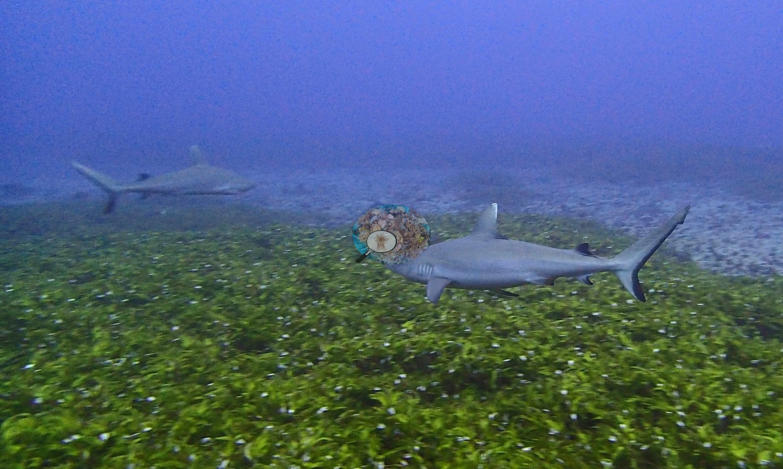
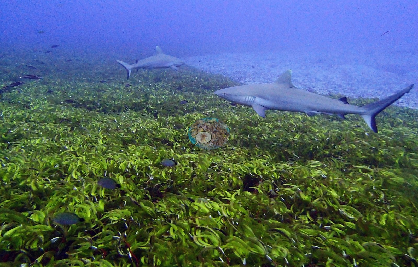
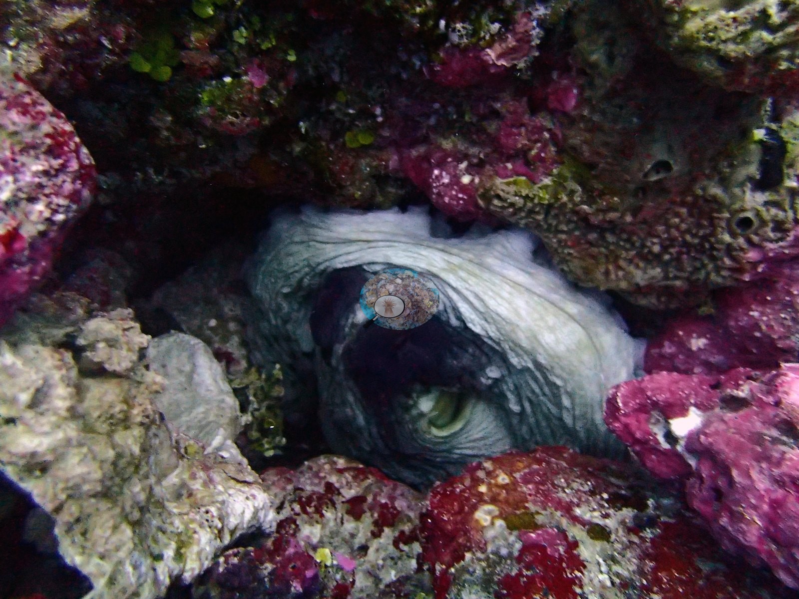
Chagos (NOAA CRW virtual station)BIDI12, at Danger Island, is a low-cover reef (4.2%) dominated by fleshy green macroalgal meadow and algal-turf pavement over coralline rubble, with barely any live coral visible in the photographs. Nine separate frames show gray reef sharks cruising low over the algal meadow, and an octopus was also recorded; whether the heavy algae reflects a lasting phase shift or a seasonal bloom isn't resolved. Surveyed on the Living Oceans Foundation's Global Reef Expedition.
One other CRD dive site within 5 km shown in orange — click a marker to open its page.
🗺 Detailed map of the Global Reef Expedition dive sites, Danger Island, Chagos (Khaled bin Sultan Living Oceans Foundation; opens in a new window)
Site description
General benthic features
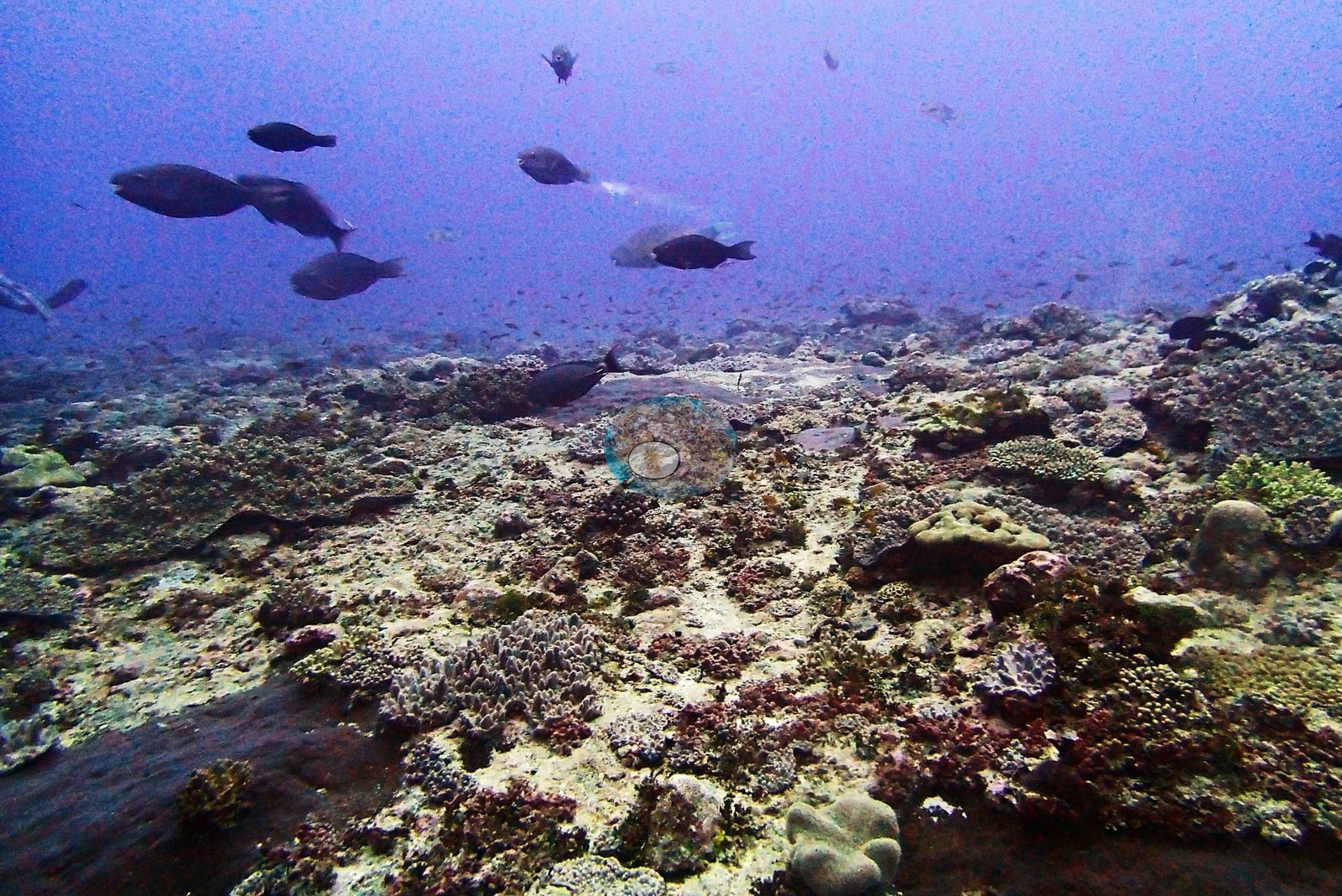
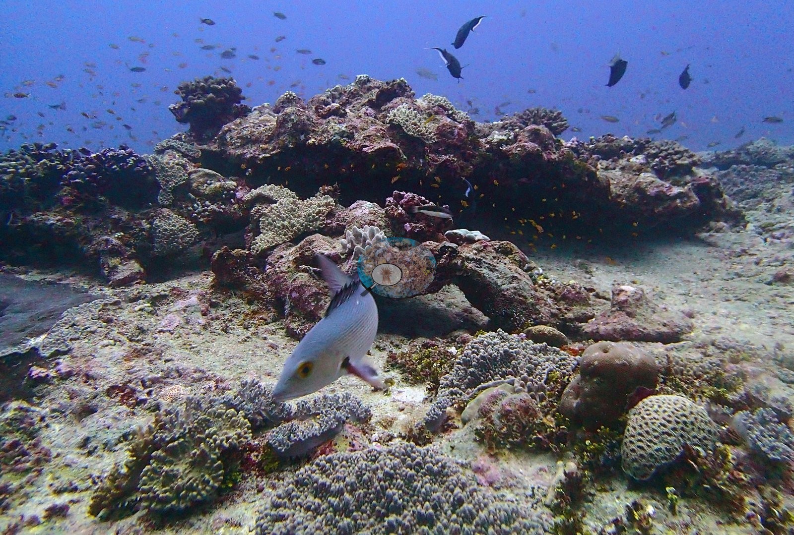
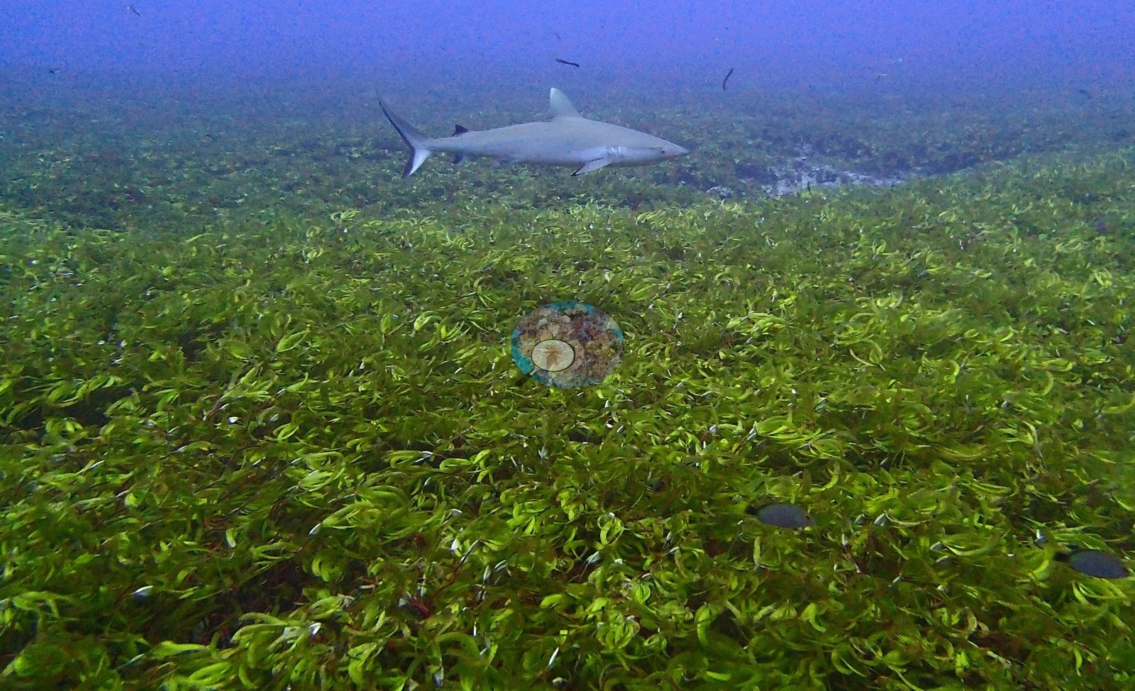
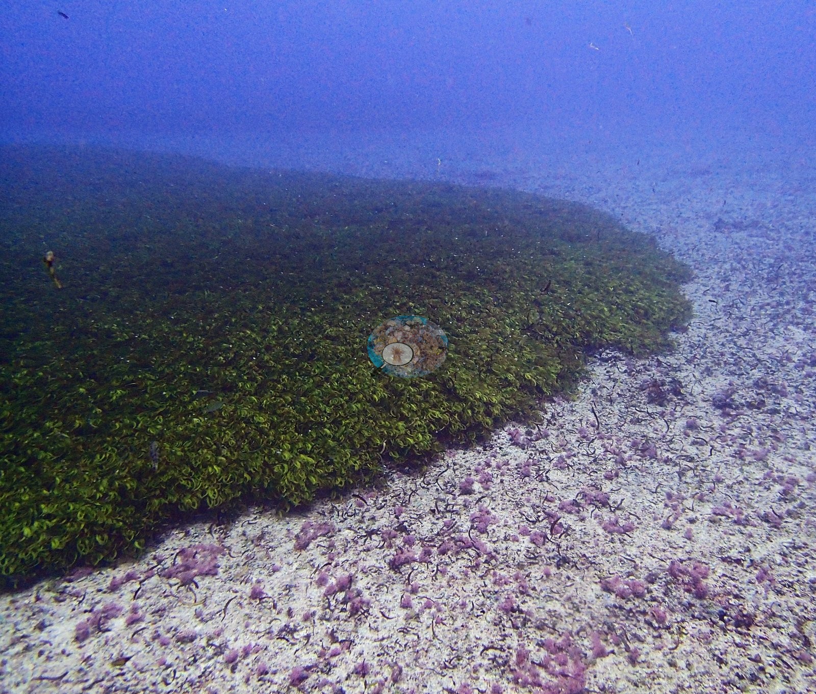
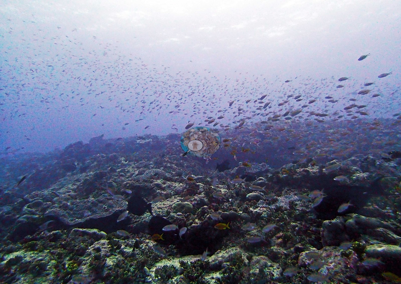
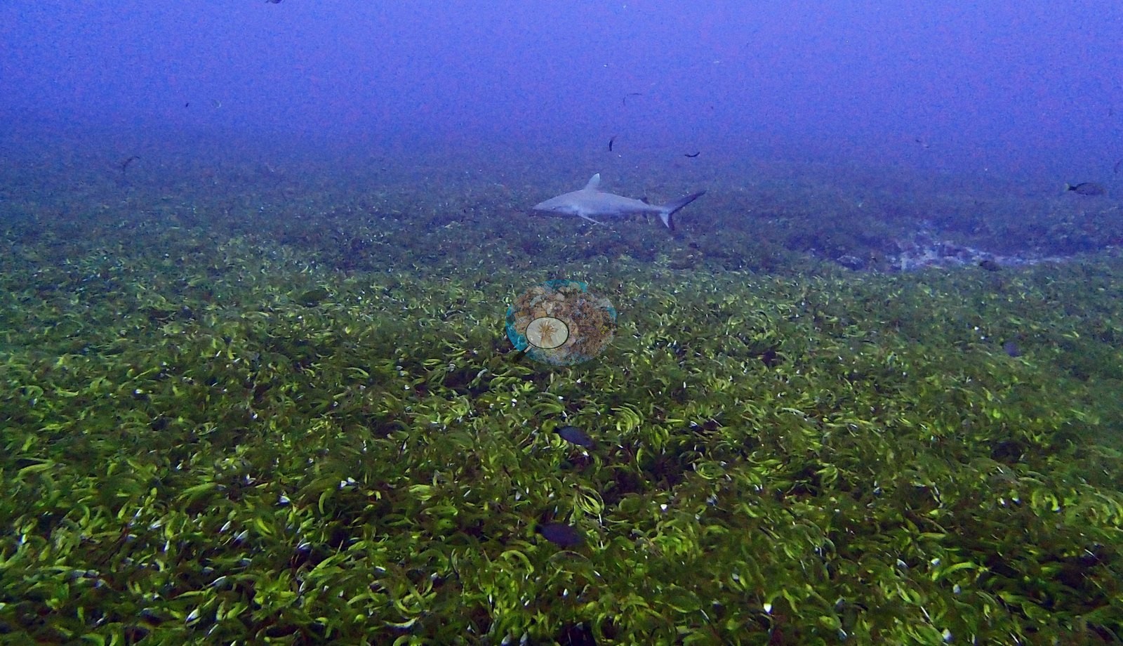
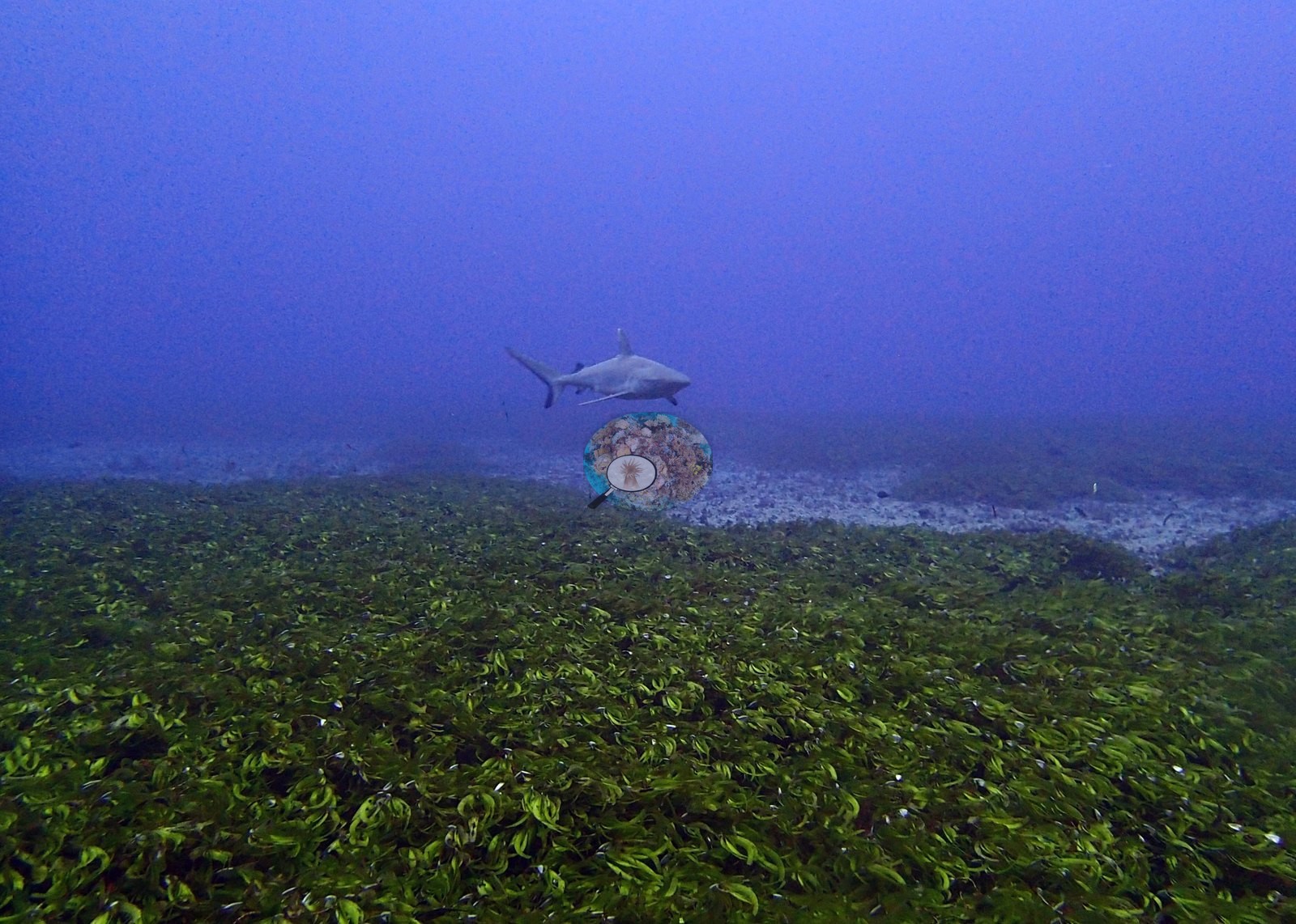
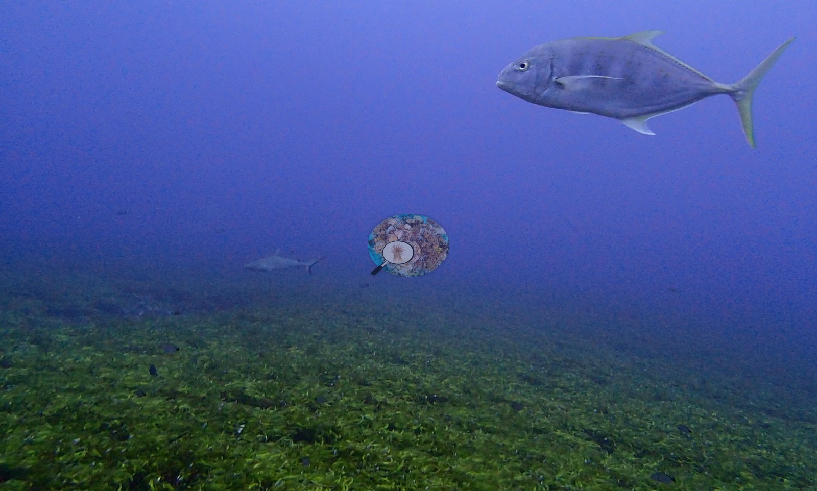
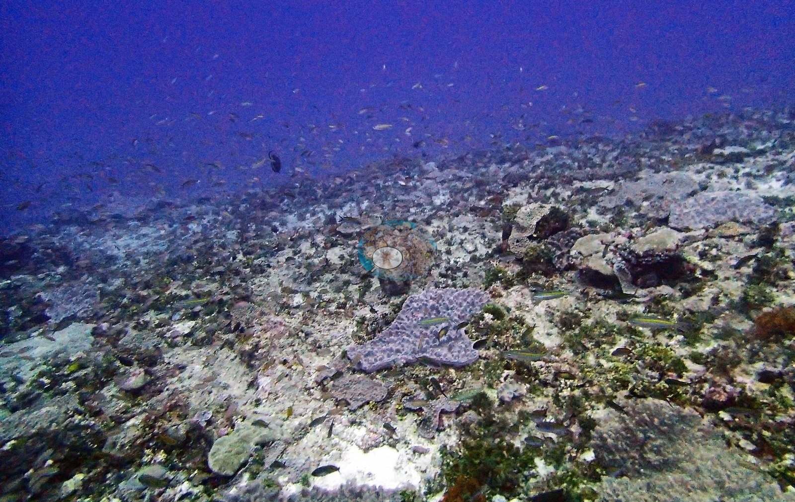
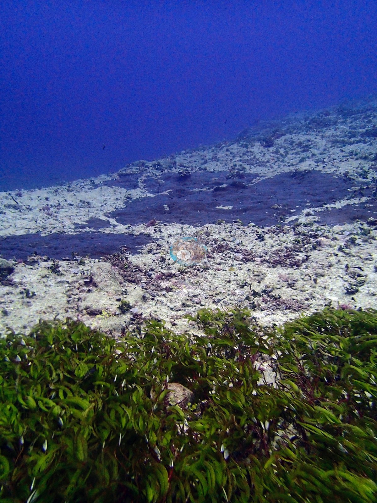
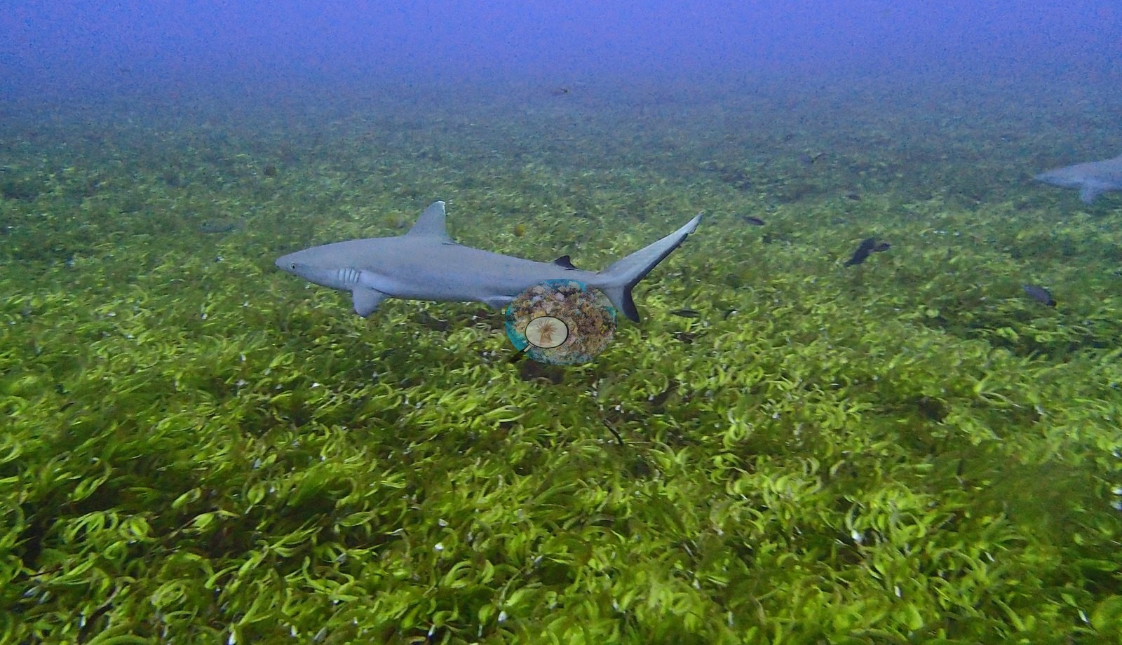
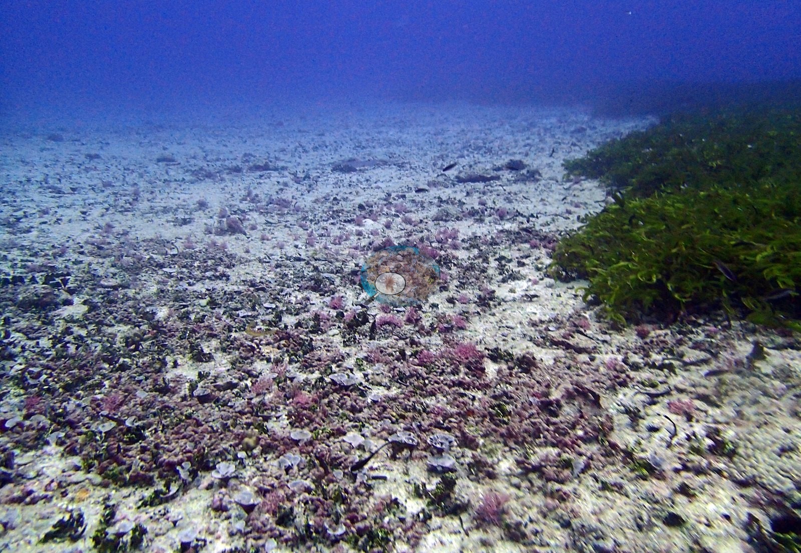
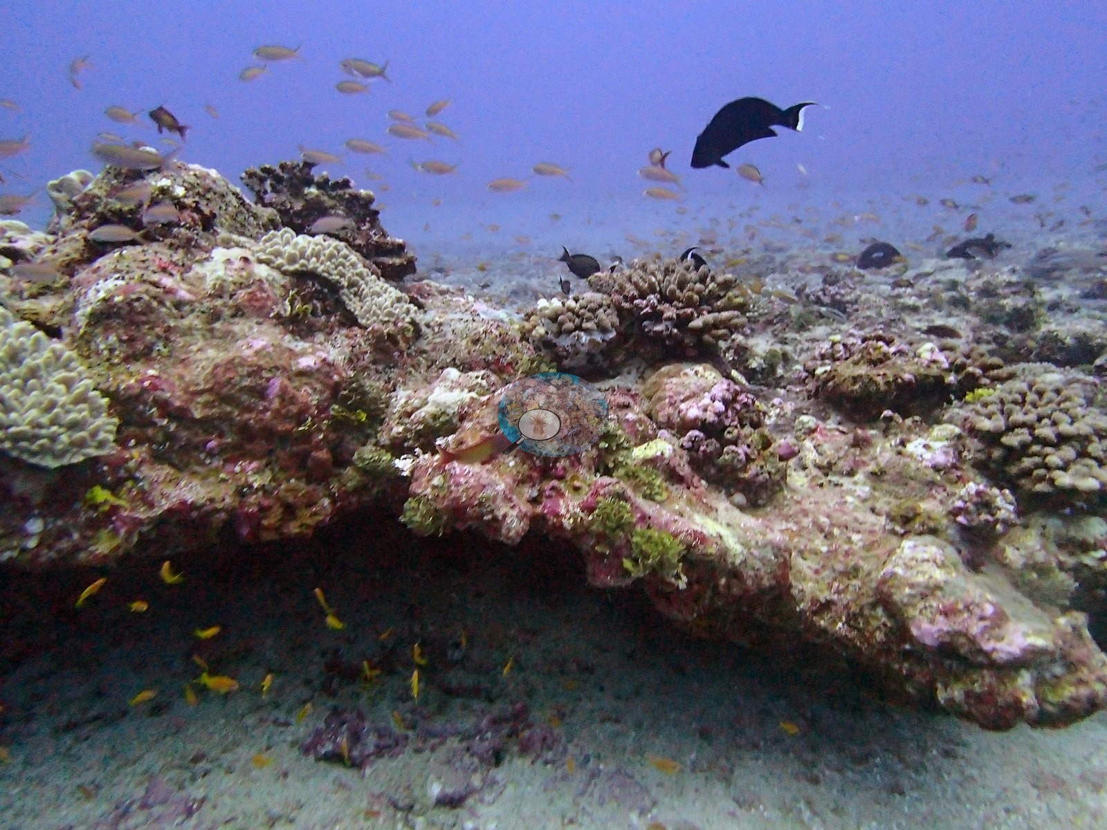
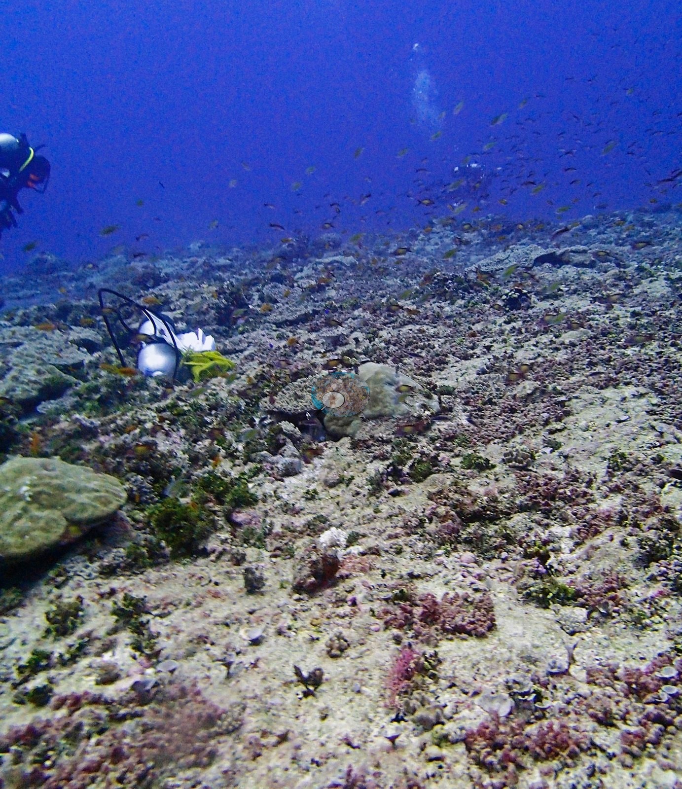
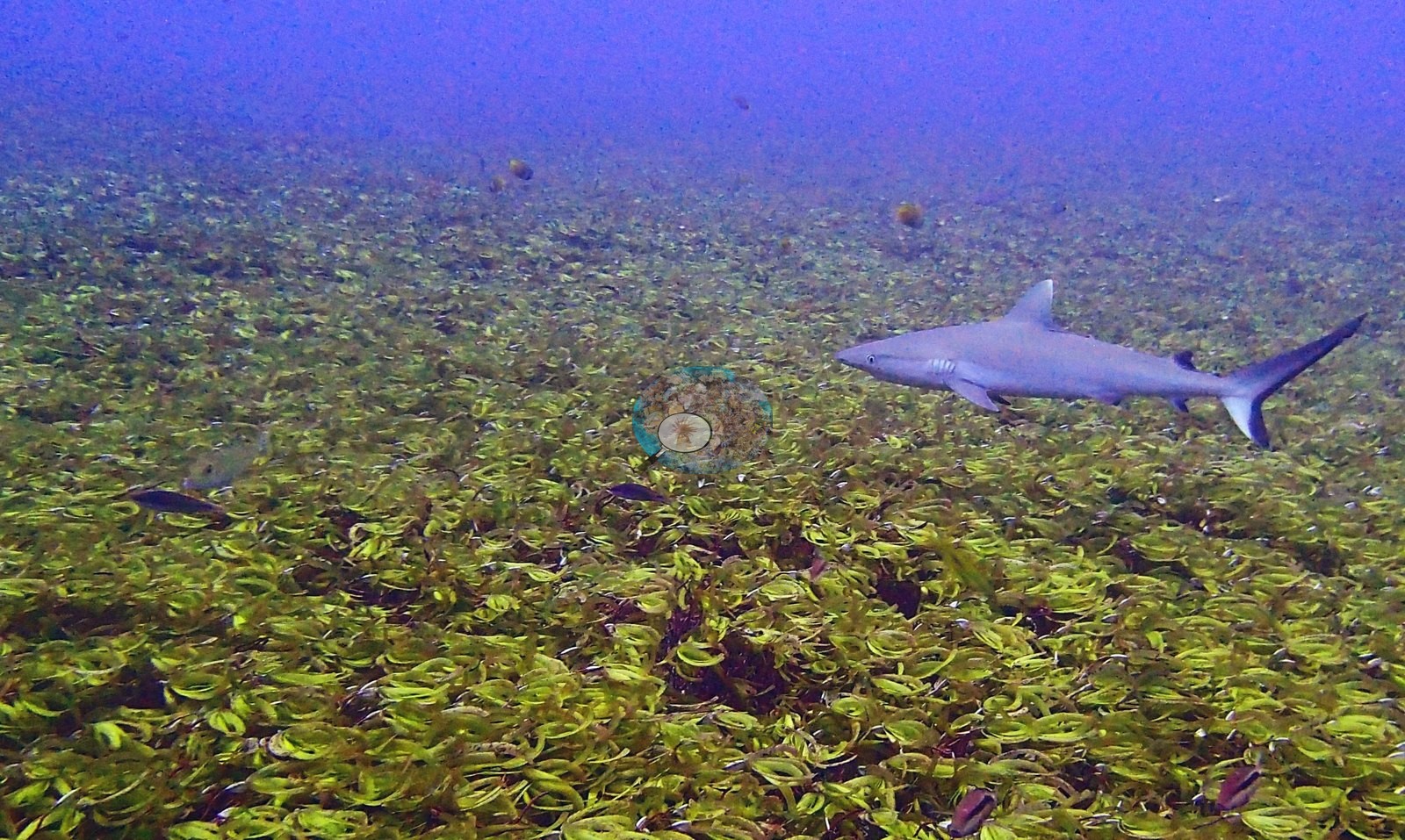
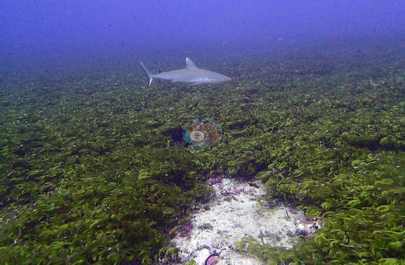
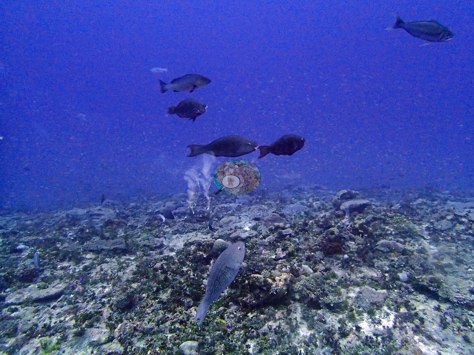
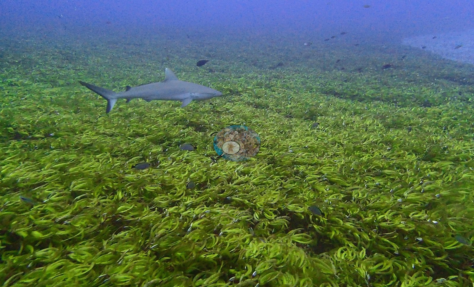
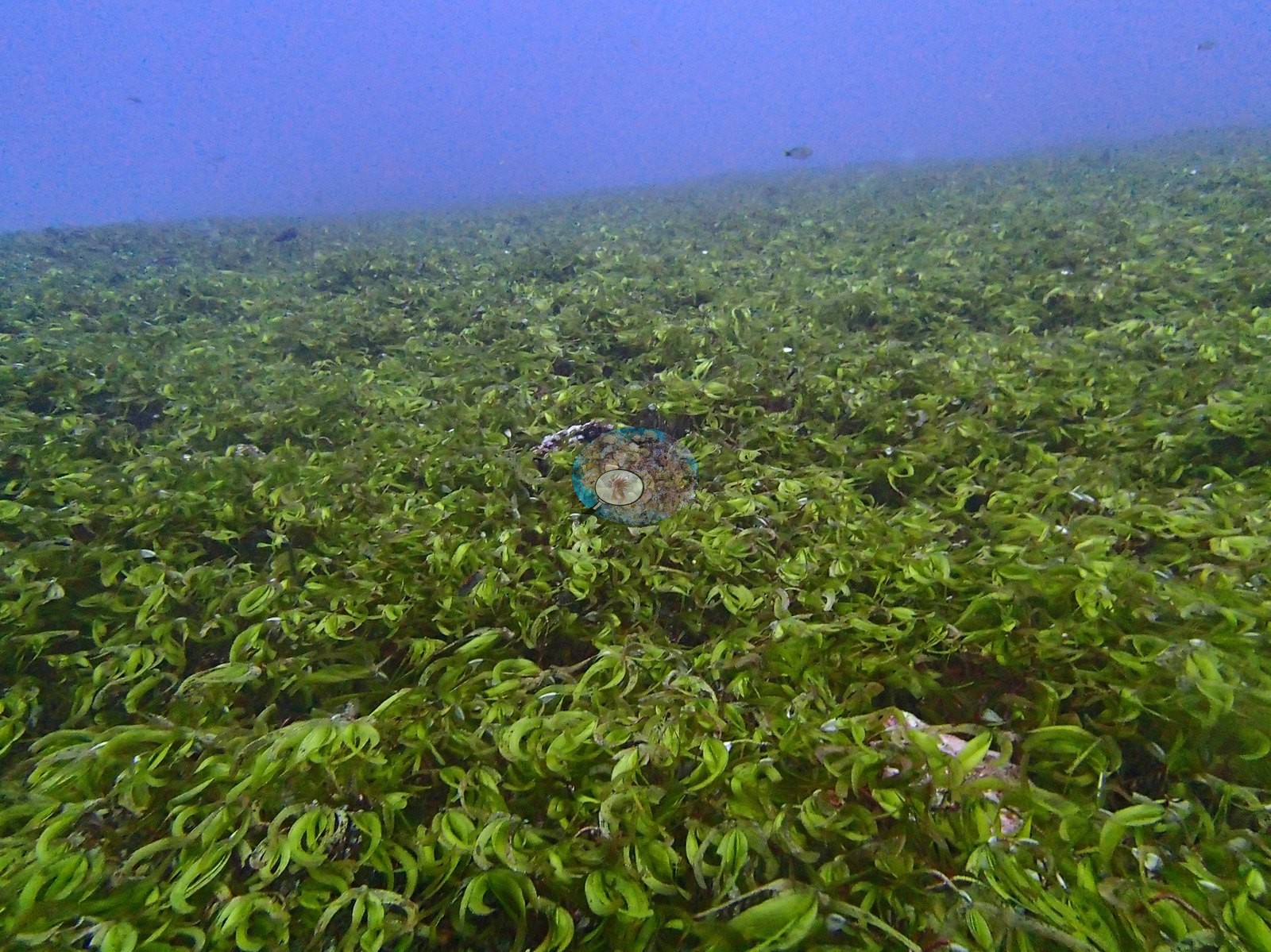
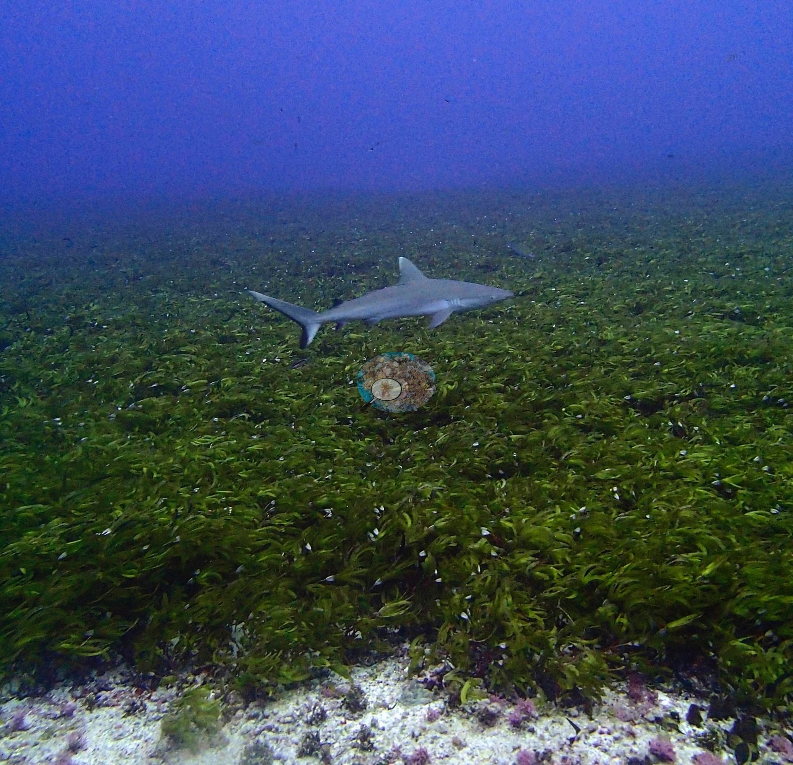
The transect genus list is the site's community record (LOF BIOT-1 survey, supplemental file S1): Pocillopora 1.85%, Porites 0.83%, Montipora 0.58%, Favites 0.18%, Goniastrea 0.18%, Pavona 0.15%, Favia 0.12%, Acropora 0.08%, Millepora 0.08%, Astreopora 0.05%, Caulastrea 0.03%, Leptastrea 0.02% and Montastrea 0.02% — thirteen genera, none of them above 2%, which is the quantitative statement of a reef whose scleractinian community is present but structurally marginal. The substrate categories carry the rest of the story: turf 20.0%, bare substrate 19.3%, crustose coralline algae 14.1%, non-coral invertebrates 13.0%, erect algae 12.9%, macroalgae 8.6%, sediment-laden turf 7.9% and cyanobacteria 0.1%. The most likely mechanism is that 30-point annotation over frames dominated by algal turf, coralline-crusted pavement and fleshy green macroalgal meadow has placed points into hard-coral classes that those frames do not support. Twelve of the 27 — P3130330, P3130331, P3130335, P3130336, P3130337, P3130338, P3130339, P3130340, P3130342, P3130343, P3130344, and P3130346 — are wide views over an unbroken meadow of fleshy green macroalgae, bright yellow-green strap-like blades carpeting the bottom to the limit of visibility. The blade form is compatible with Caulerpa; Halimeda is excluded by the absence of calcified segments, but a firm call needs a specimen. P3130346 catches the margin cleanly, where the meadow terminates against pale sand and pavement patched with pink coralline crusts and scattered purple coralline nodules. Live hard coral is not a meaningful component of any of those frames. Where the bottom is not meadow it is low-relief pavement and rubble: P3130298, P3130299, P3130300, P3130302, P3130303, and P3130332 show consolidated, eroded hardground with algal turf, pink and mauve coralline crusts, scattered rubble and only occasional small colonies, P3130302 carrying a foliose or encrusting colony as the largest coral in frame. Two frames hold a genuinely mixed coral community — P3130301 and P3130323, a coralline-crusted ridge with small branching and digitate colonies, encrusting sheets, small massives, and anthias — and even there the colonies are small and discrete rather than framework-forming. P3130322 and P3130323 hold the modest rubble ridge with small colonies compatible with Pocillopora and Acropora, orange anthias and pink CCA, the closest thing to reef structure at the site. P3130305 is a dense cloud of small planktivores over that same low-relief ground. Ecologically, the honest ordering of this site's benthos is: fleshy green macroalgal meadow > algal-turf pavement > coralline-crusted rubble >> live hard coral — which is exactly what the transect's 4.2% coral against 63.5% algae records.
Coral cover
The measurement at BIDI12 is the LOF BIOT-1 benthic transect survey. Coral cover 4.2%, from LOF BIOT-1 in situ transects (Mayfield & Dempsey 2026, Oceans, suppl. S1) — Anderson's own published value, the lowest of this Chagos batch by a wide margin, and the authoritative record of cover and community at this site. Against it the transects put algal cover at 63.5% of the benthos. No depth-stratified (D1–D4) breakdown is available for this site in the survey material carried on the pin. The photographs and computer-vision products below supplement that transect. They are qualitative or methodological; no cover value may be read off any of them, and where imagery and transect appear to differ, the transect governs. The computer-vision comparison, and why it is a data-quality flag rather than an ecological result. Across the same 27 photographs the two image methods read the reef very differently: Coralscapes masks give 1.7% live hard coral, the 30-point CoralNet annotation gives 19.5%, and the transect stands at 4.2%. A photo method running above a transect at low cover is the normal, expected pattern in this archipelago; what is not normal is the roughly 18-percentage-point split between the two image methods themselves, which no cover-dependent bias explains. Neighboring BIDI13 — same rim, next day, also low-cover, and algal — is the control: there the human points and the model agree within 1.5 pp. BIDI12 is the mirror image of BIDI08, where the two image methods agreed with each other and both fell far below a tabular-dominated transect. Because that 9.6 pp SD encodes an apparent annotation problem rather than method bias or precision, the mean-of-three value (8.5%) is not defensible for BIDI12 and should be suppressed or footnoted in any table, and this site's point annotations should be pulled and re-checked before any archipelago-wide CoralNet summary is published. That open data-quality flag stands and is Anderson's to close. None of this touches the transect: 4.2% remains the site's cover value. With live coral this sparse and the water this hazy, that is a statement about what the photographs can sample, not about the coral population's thermal state, and no bleaching figure is or should be derived from this set: Anderson's published per-site percentage bleached for the Chagos sites is the authoritative number (Mayfield & Dempsey 2026, Oceans).
Also on record for this site: Coral cover: 4.2%. Live hard coral measured on the in situ benthic transects of the LOF BIOT-1 expedition (Mayfield & Dempsey 2026, Oceans, supplemental S1), against algal cover of 63.5% of the benthos. The transect figure is this site's authoritative cover value; no image-derived product overrides it. Across methods the same reef reads: transects 4.2% · CoralNet points 19.5% · Coralscapes masks 1.7% (27 frames). These products have different sampling footprints and denominators and should not be averaged.
Stressors
Survey conditions on 13 Mar 2015 at 6.4534°S, 71.2337°E: in situ temperature 29.3°C, salinity 34.1. Two animals are in frame together in P3130345, and again in one of the mid-meadow frames: the two independent reviews of this set differ on whether that second pairing is P3130338 or P3130340, which is worth one look at full resolution. Condition. No bleached colony is identifiable in any frame, and no disease lesion or predation scar resolves. The condition signal the imagery does carry is the macroalgal dominance itself. Whether that reflects a phase shift following the older mortality seen at neighboring BIDI10, a naturally algal-dominated lagoonal or back-reef habitat, or a seasonal bloom cannot be resolved from a single dive — but on a remote, unfished, unpolluted atoll it is conspicuous and deserves Anderson's attention.
Fish and other fauna
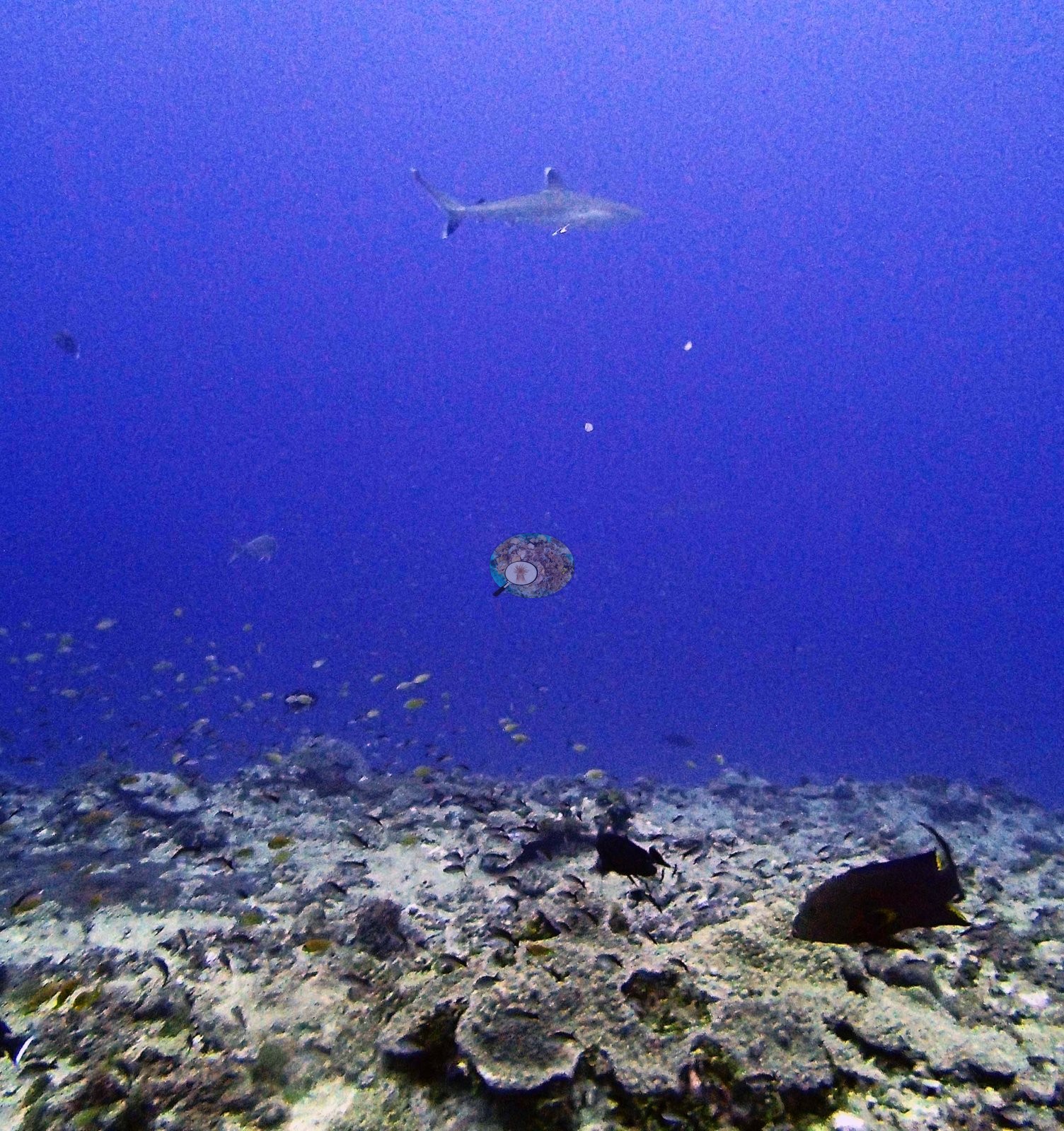
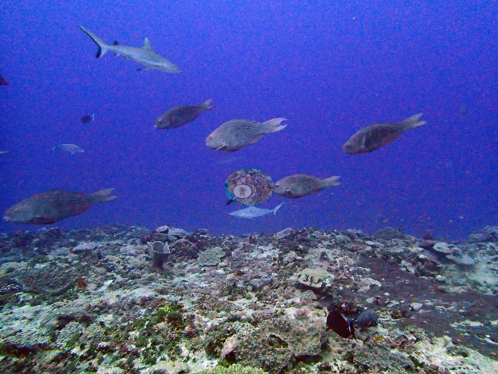
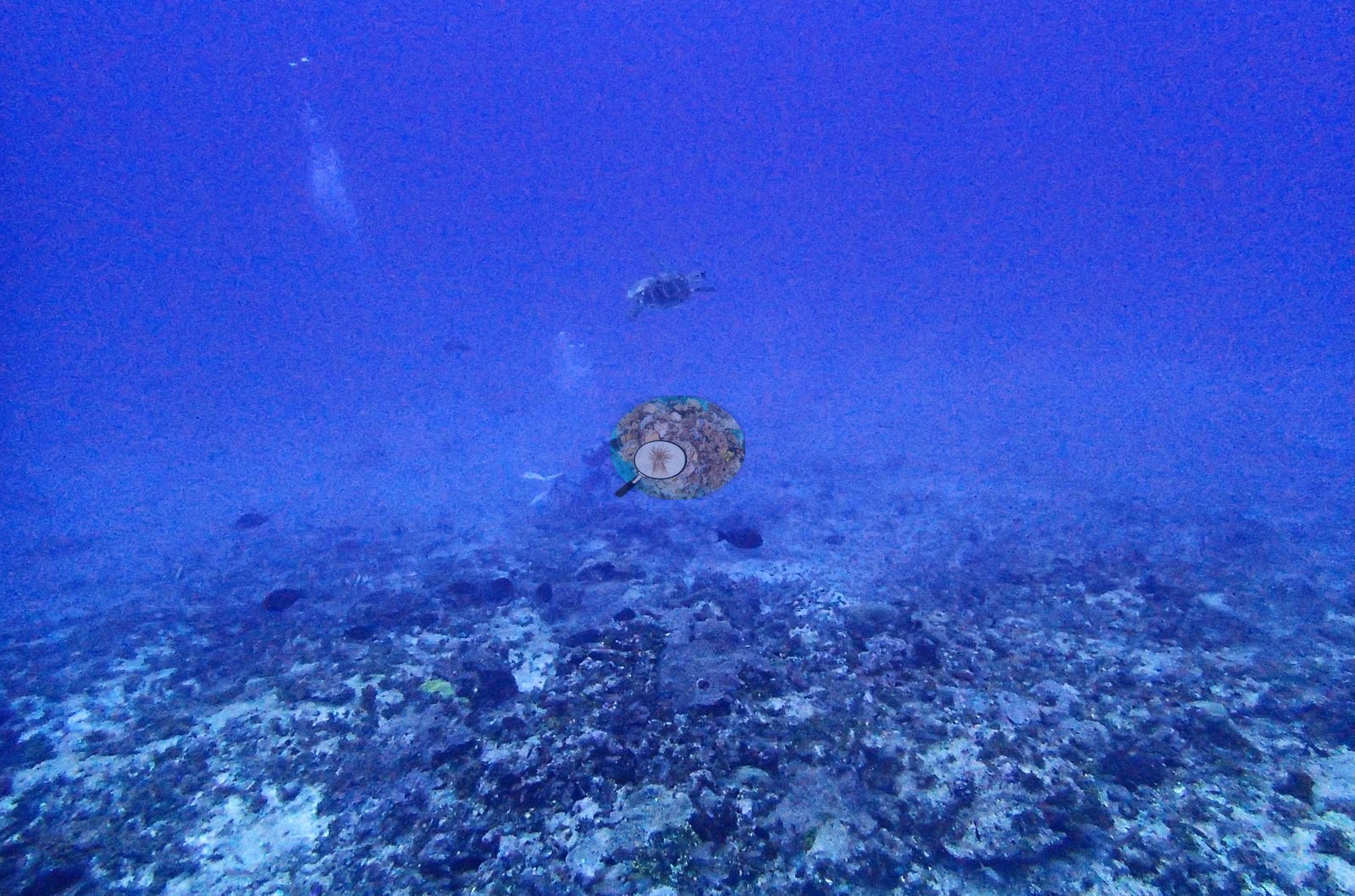
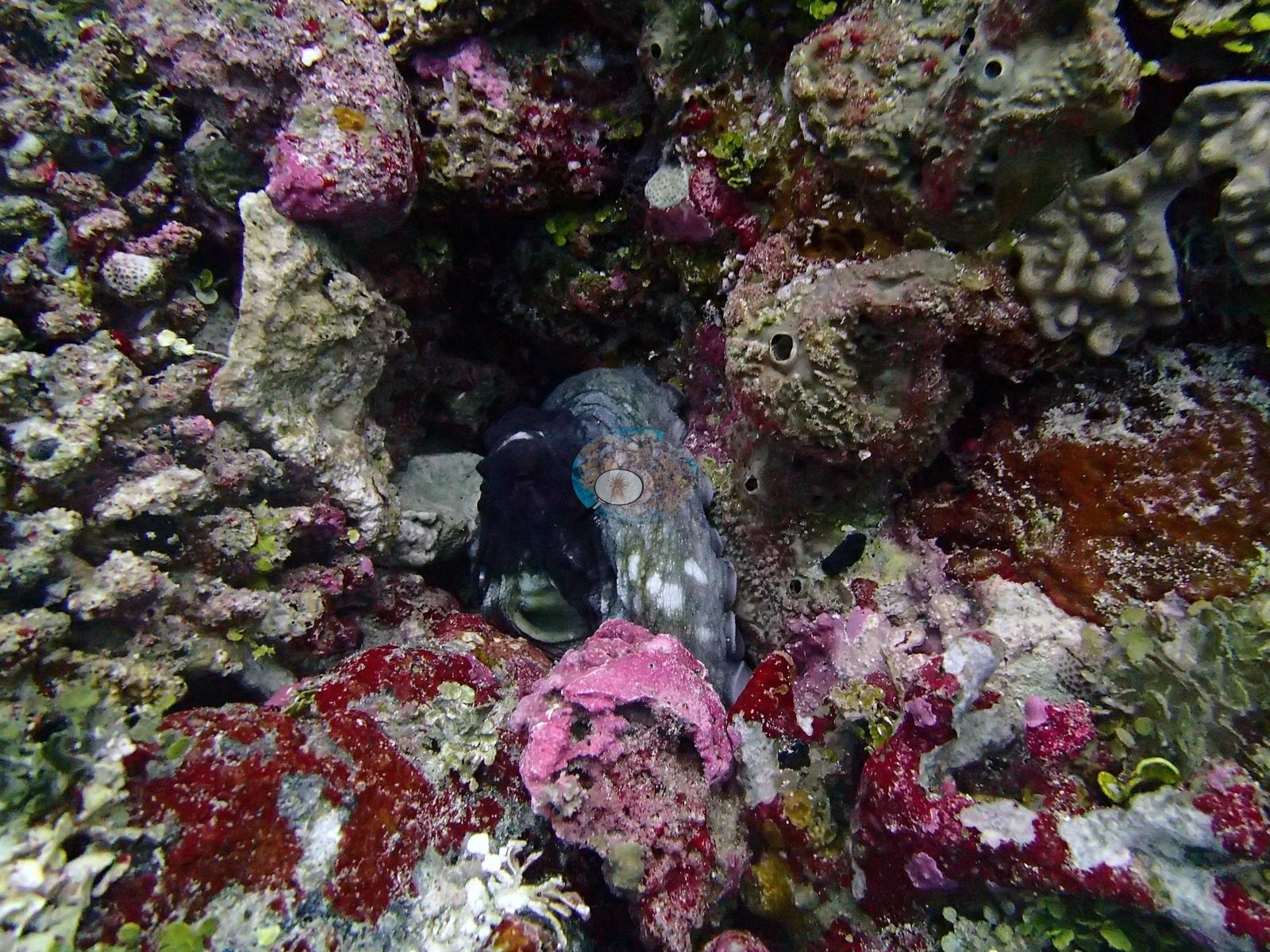
Faunally this dive is dominated by one thing: sharks. Animals compatible with the gray reef shark Carcharhinus amblyrhynchos cruise low over the meadow in P3130298, P3130299, P3130335, P3130336, P3130337, P3130338, P3130339, P3130340, P3130342, P3130343, P3130344, and P3130345 — the densest shark record of the expedition. One further animal sits in the haze of P3130334 beneath a large silver jack compatible with Caranx, and a jack of the same kind patrols above the meadow in P3130338. P3130299 and P3130300 show a school of large parrotfishes working the eroded pavement, one visibly expelling a sand plume — bioerosion photographed in the act, and directly relevant to the state of this substrate. A dark animal crosses the hazy blue of P3130303 at a range that puts identification beyond the frame; its outline is compatible with a turtle, and neither the group nor the species can be taken further. An emperor or bream compatible with Monotaxis grandoculis forages over the rubble ridge in P3130322. An octopus occupies a coralline-crusted crevice in P3130320 and P3130321, the second frame a clean close view of the mantle and eye among red, pink and magenta encrusting crusts and sponges — the best macro subject at the site, and the second octopus record of the expedition after BIEG05.
Comparisons with other data
No prior survey data from this site. If you would like to share yours, please email us.
Other notes
Image-by-image: the algae is the first thing in the frames. All 27 habitat frames from Anderson's folder BiDi12-finished were reviewed at full resolution; there are no sampled-colony frames, so this is a habitat account throughout, and visibility is poorer here than at the other Chagos sites of this batch, with a blue-violet cast and a hazy water column through most of the set. P3130333 is a logistics frame rather than a survey one: staged dive gear — twin cylinders, a yellow mesh collecting bag and camera hardware — resting on the pavement with a diver above. No quadrat, transect line or scale reference appears in any of the 27 frames.
CV model comparison
More info
Those are point counts on the photographs; this is a diver swimming a transect. The models and the reference never saw the same thing. ⚠ SITE-LEVEL ONLY. The 2,500 frames were not associated with any transect taken within 200 m of them, so transect-vs-image comparisons are site means, never frames. The transect value is already in the pin `cover` field (109 of 112 pins, sourced to the paper's suppl. S1) and is read from there, never re-imported. The transect is THE coral-cover value for this site and stands alone. The rows below it are a methods comparison only: no computer-vision value is averaged with it, feeds the headline, or carries over to the site's cover figure (Anderson, 2026-09-22).| Method | Hard-coral cover (%) |
|---|---|
| Transect (published) | 4.2 |
| CoralNet | 10.4 |
| In-house DINOv3 | 11.0 |
| CoralSCOP edited | 17.9 |
| Claude | 2.9 |
Data & links
- Read the full site report ↗
- Download benthic survey data (CSV) ↗
- Download all LOF-GRE data (933 sites) ↗
- CoralNet image repository for this region ↗
- Photo portfolio ↗
- Coral Reef Diagnostics page for this area ↗
All images from Coral Reef Diagnostics. Data are from Coral Reef Diagnostics.
 © Coral Reef Diagnostics.