
Part of the regional summaries: Chagos Archipelago - Great Chagos Bank West / Brothers / Eagle and Chagos Archipelago
More info
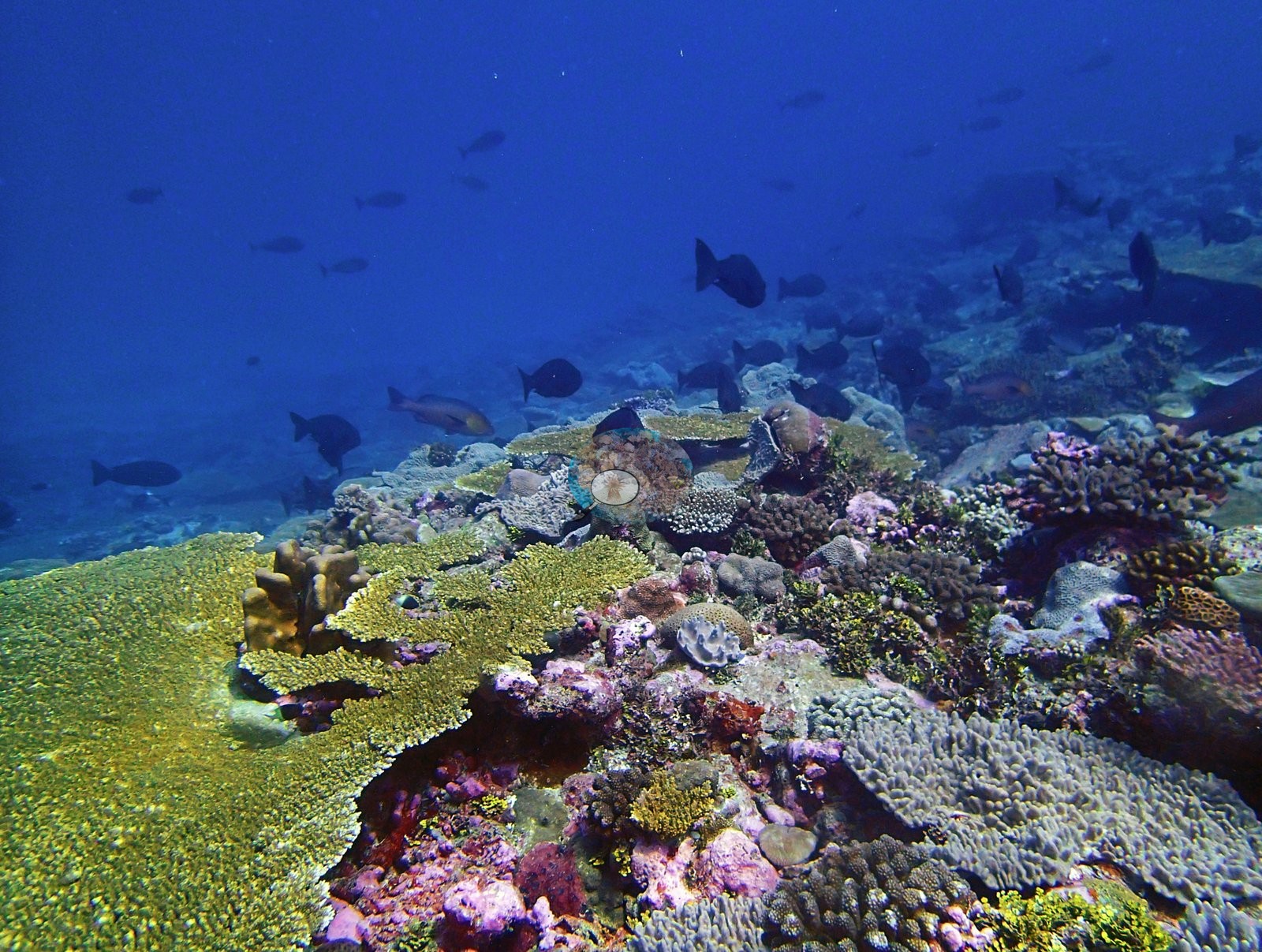
Chagos (NOAA CRW virtual station)BIDI09, at Danger Island, has 38% coral cover and is defined by sheer planktivore biomass - fusilier schools numbering in the hundreds, blue-striped snapper, and multiple large predators, exactly what an unfished remote atoll should look like. Bleaching was minimal, and the site's benthos mixes meandroid brain corals, Pocillopora, and purple digitate Acropora. Surveyed on the Living Oceans Foundation's Global Reef Expedition.
Two independent survey stations shown with the program’s logo — click one to see how far it is from this site.
Five other CRD dive sites within 5 km shown in orange — click a marker to open its page.
🗺 Detailed map of the Global Reef Expedition dive sites, Danger Island, Chagos (Khaled bin Sultan Living Oceans Foundation; opens in a new window)
Site description
Setting
S1) — Anderson's own published value, surveyed 12 March 2015 on the western rim of the Great Chagos Bank at Danger Island (6.37934°S, 71.23359°E; in situ temperature 29.2°C, salinity 34.2).
The dive's first two-thirds cross genuinely excellent reef.
General benthic features
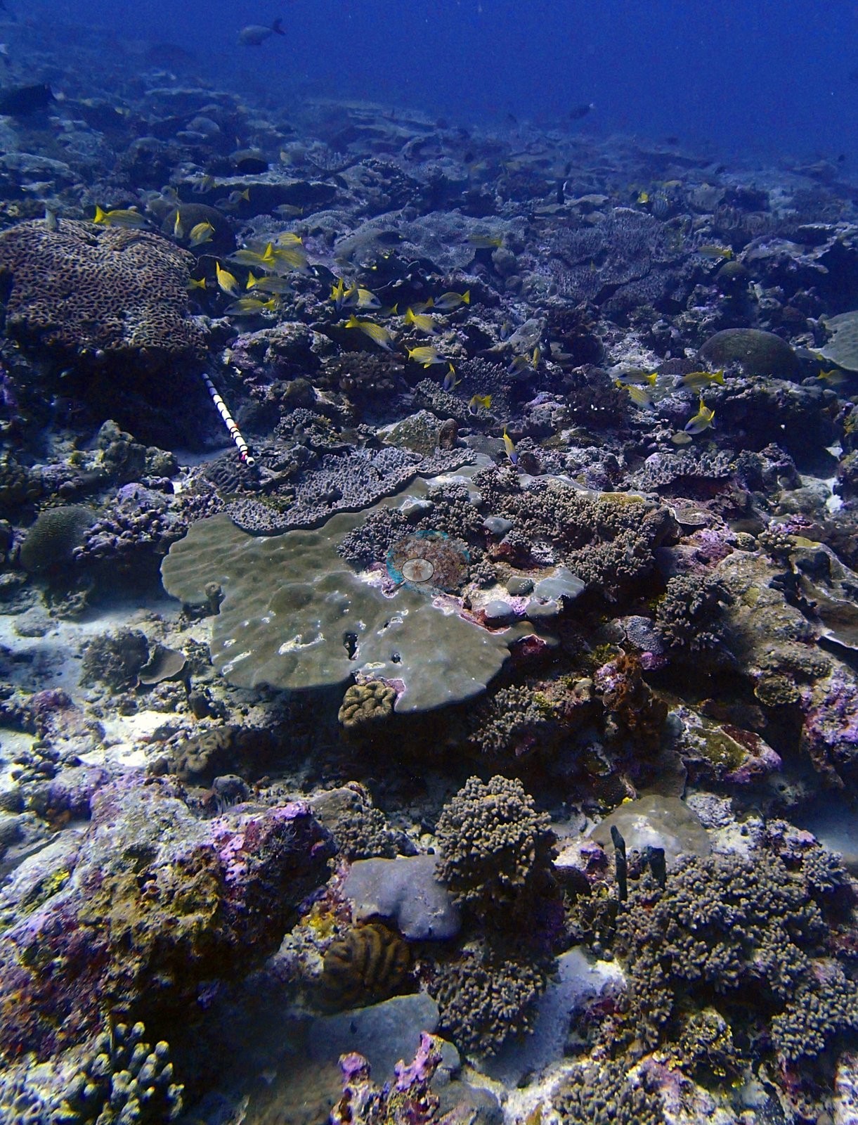
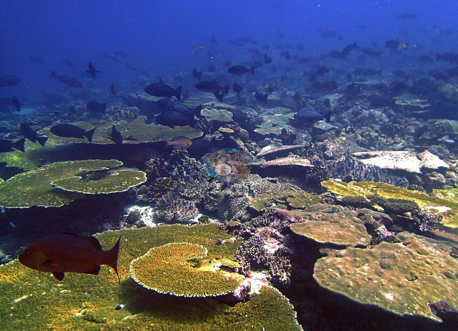
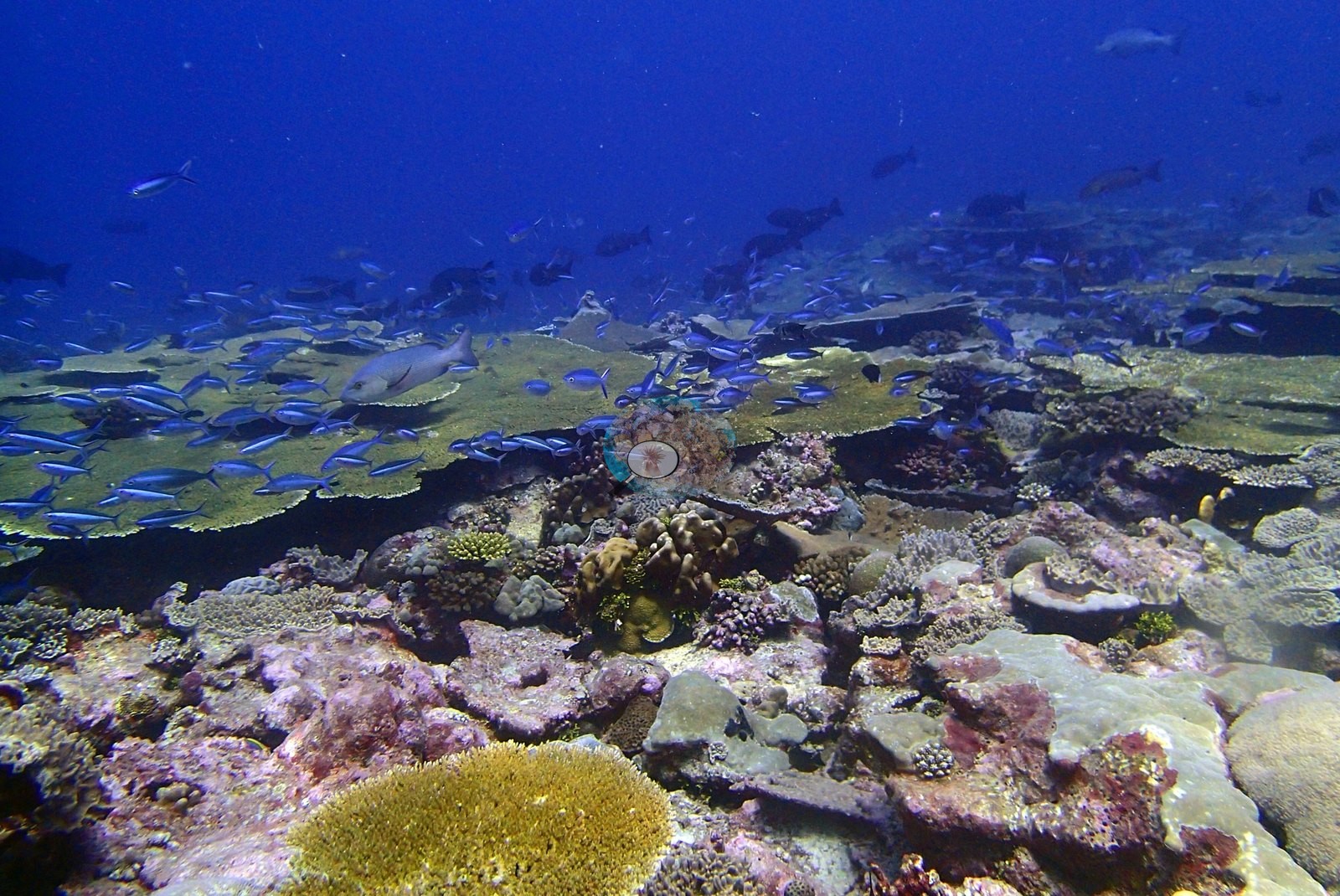
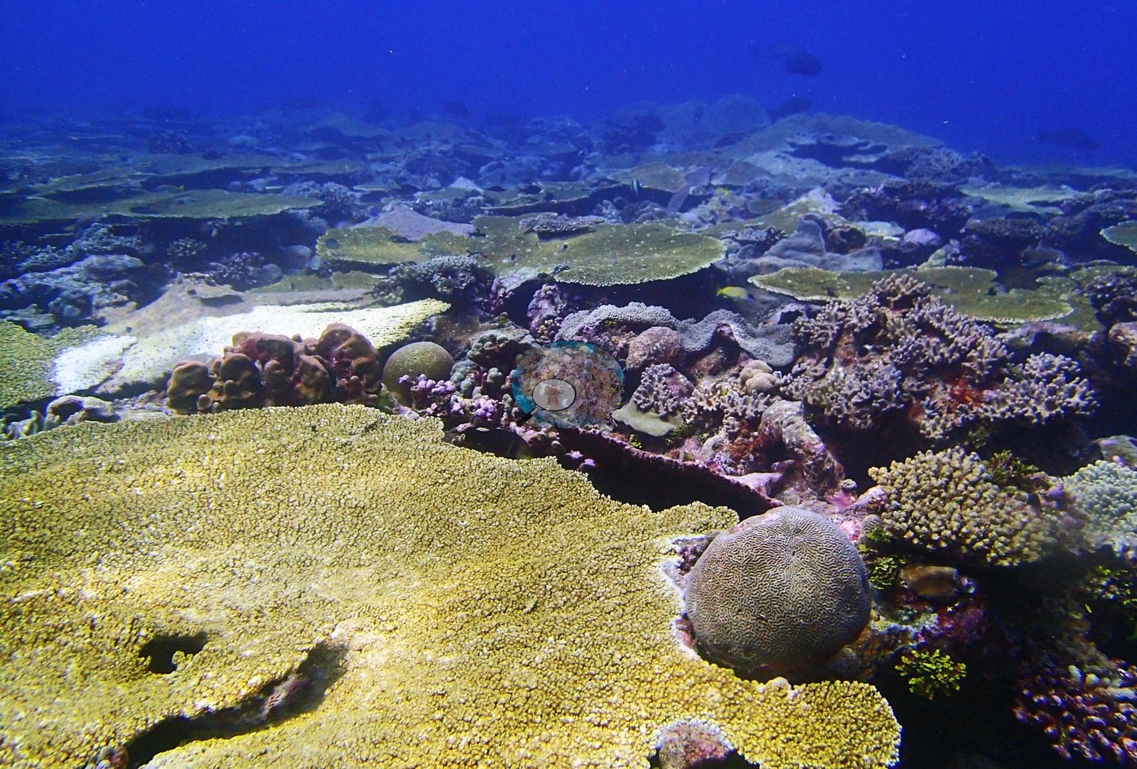
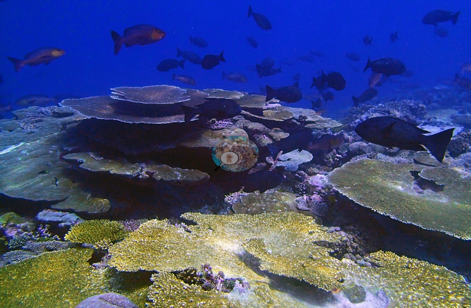
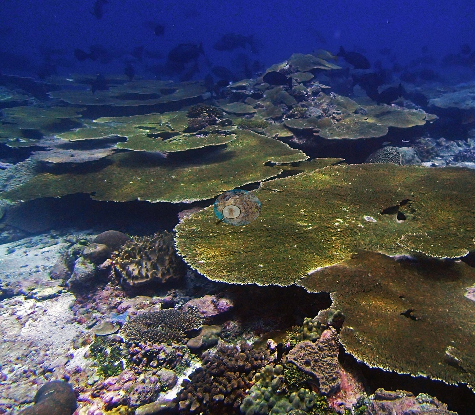
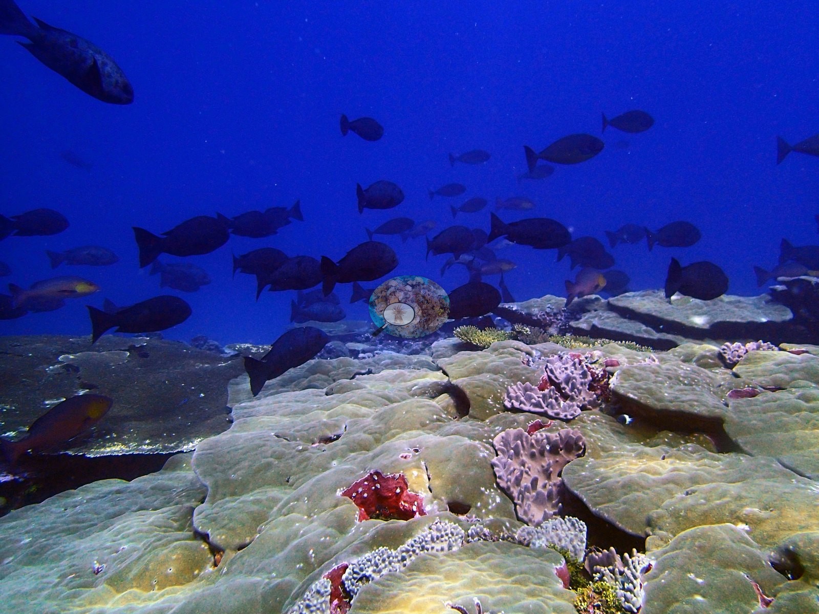
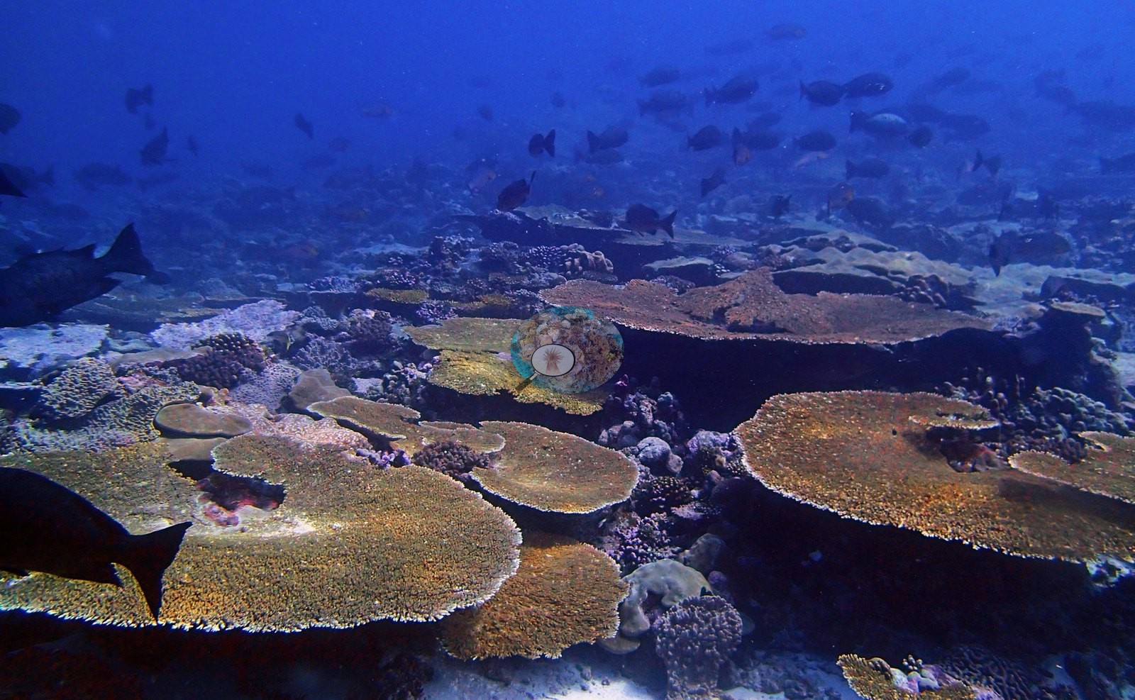
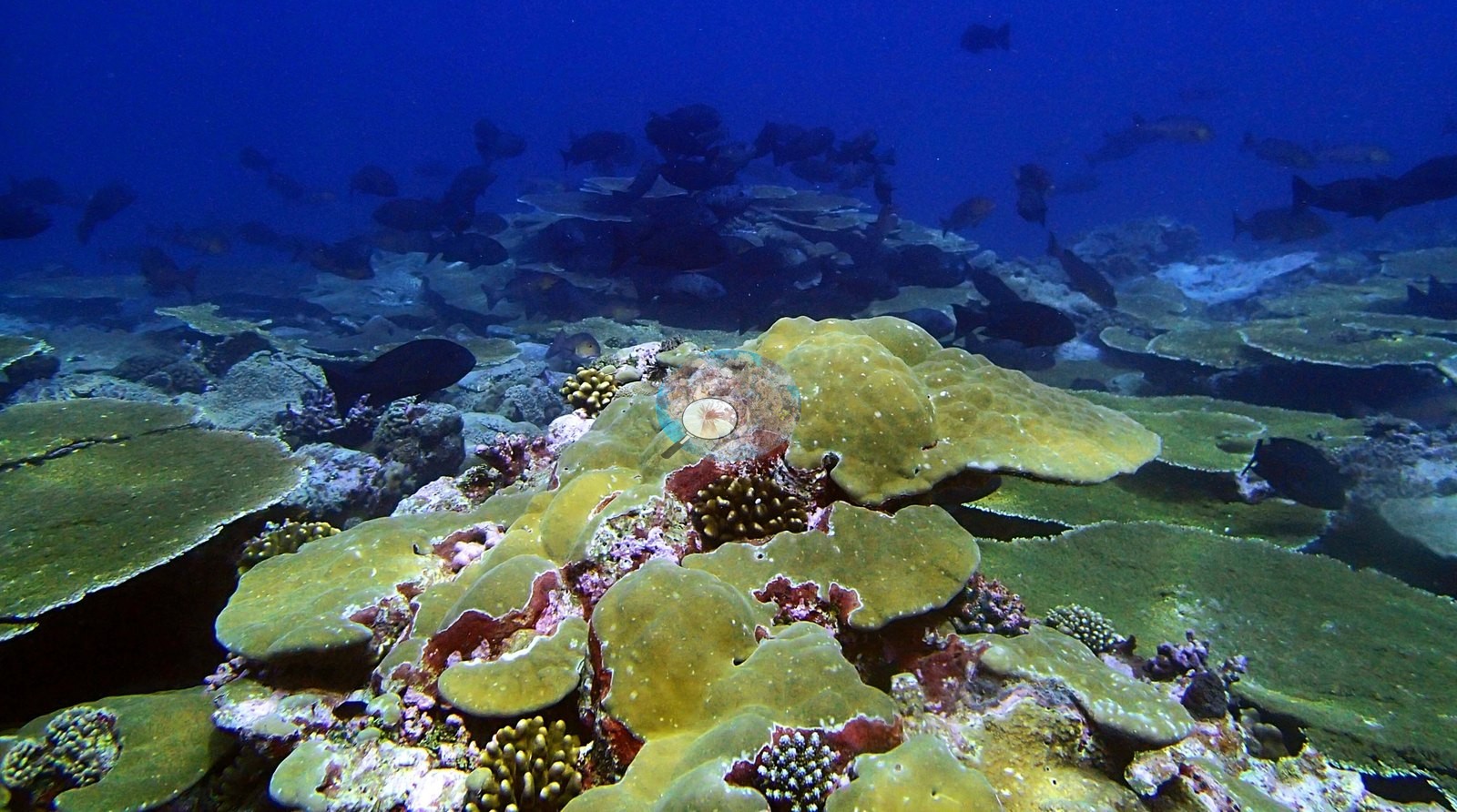
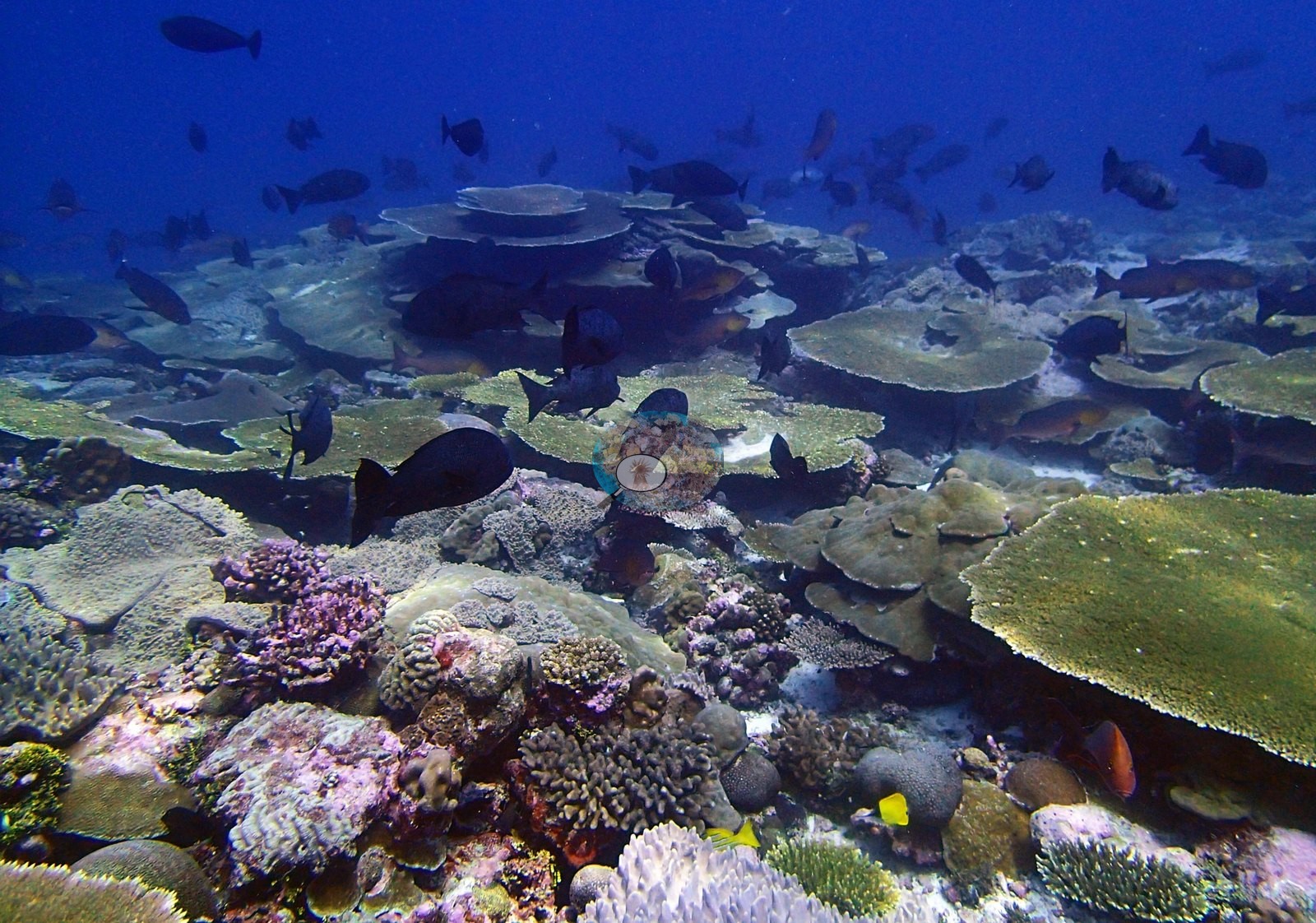
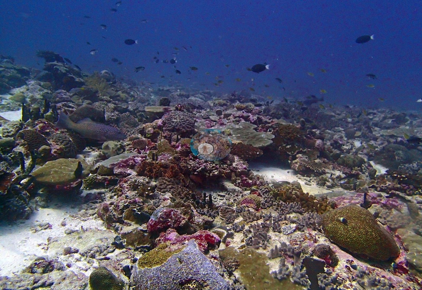
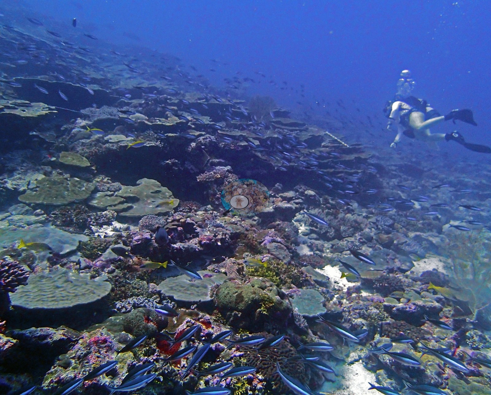
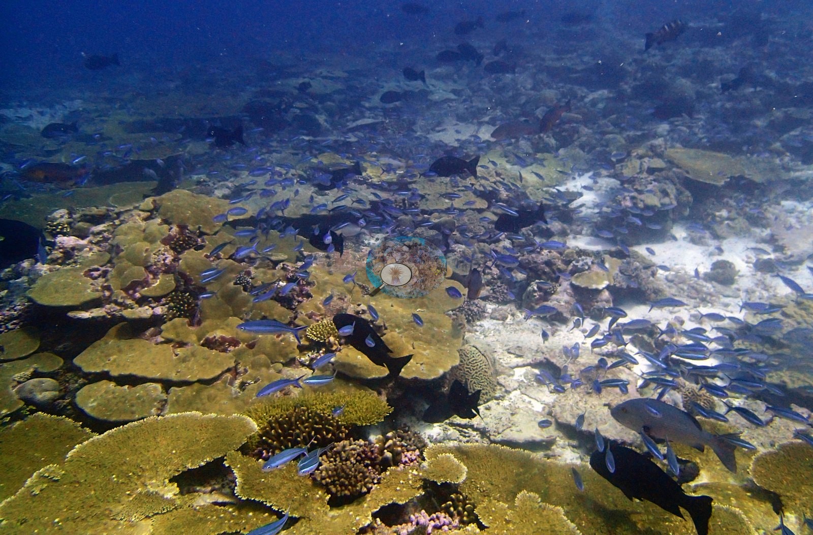
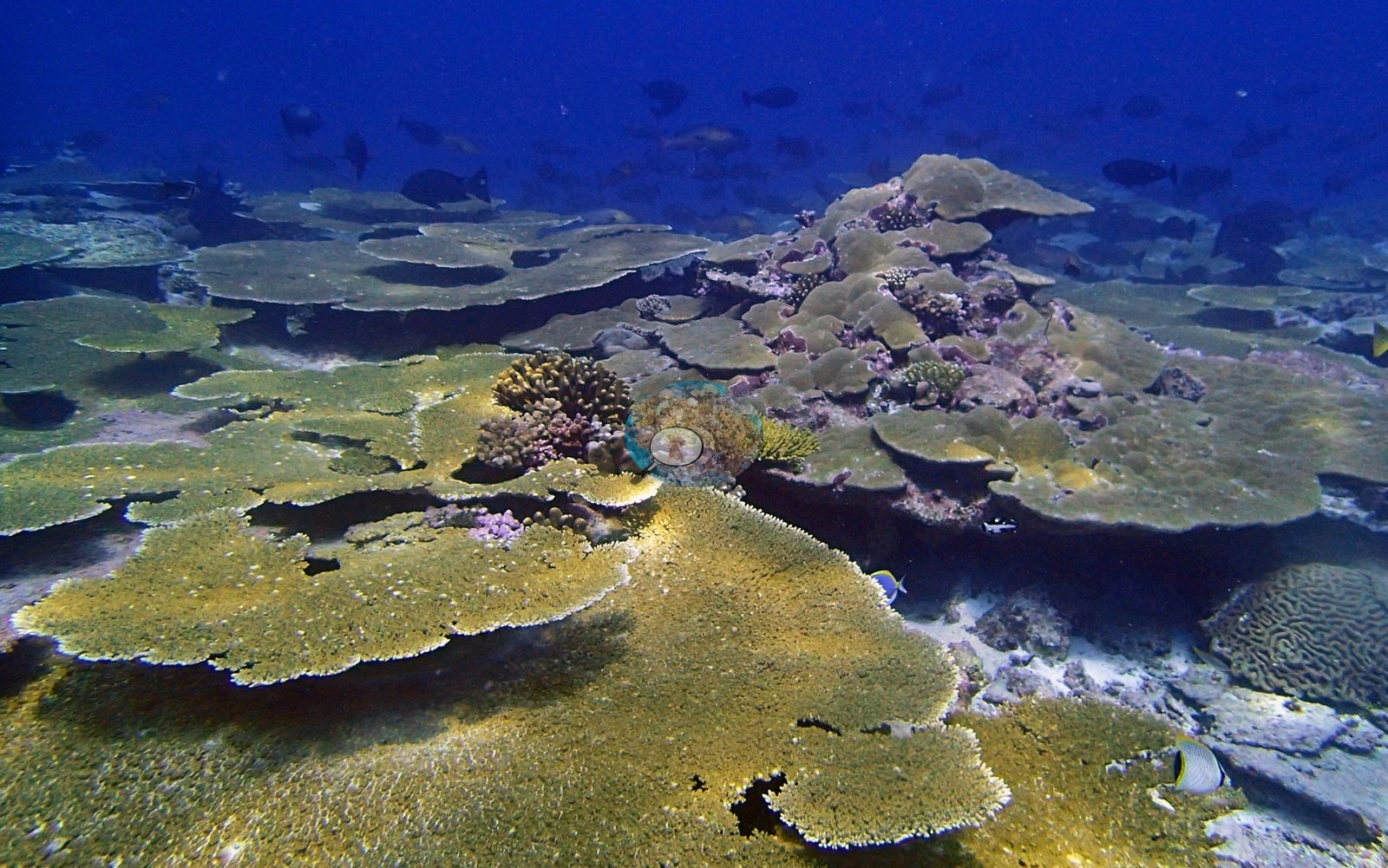
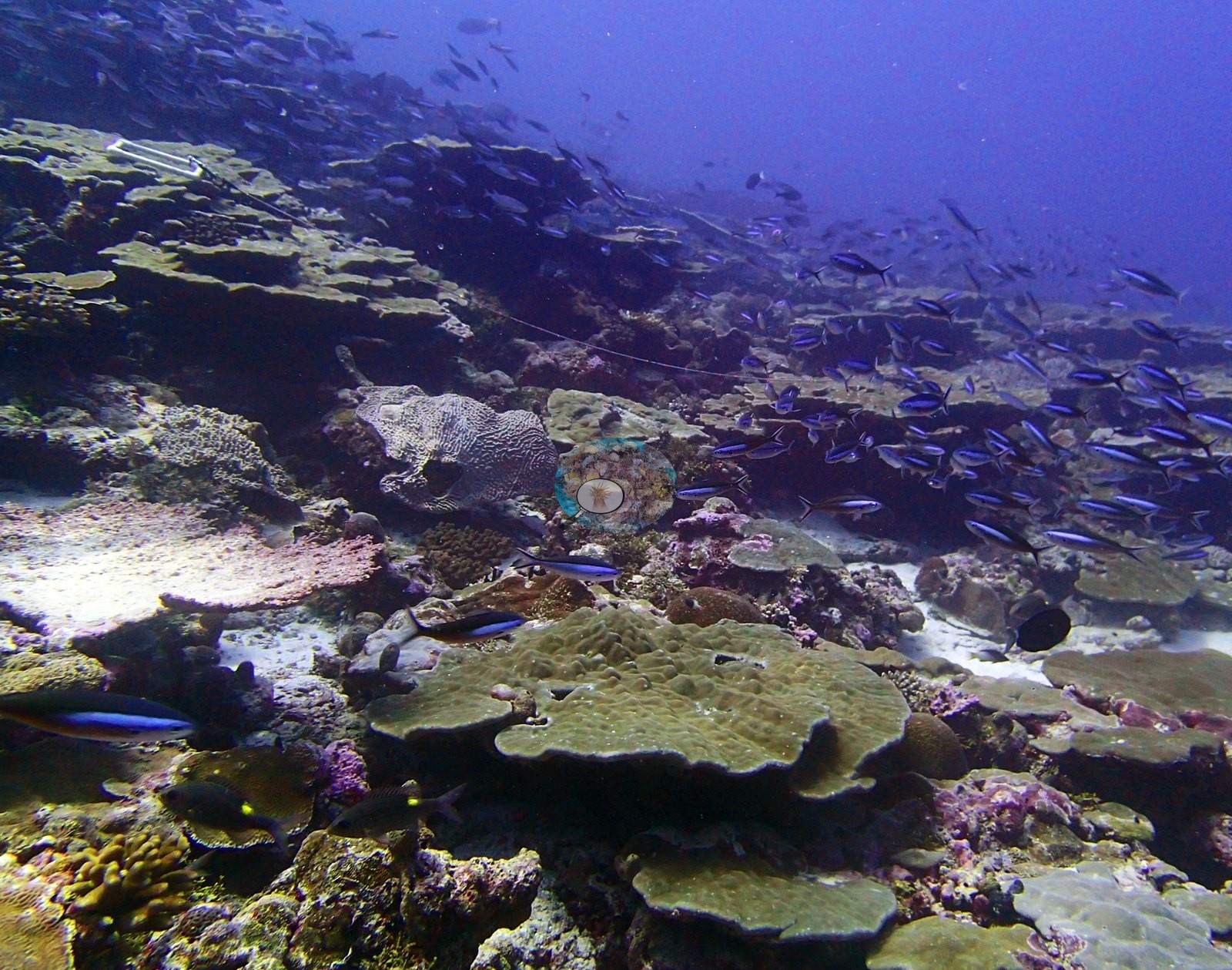
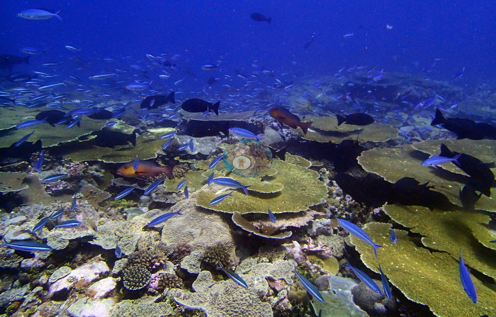
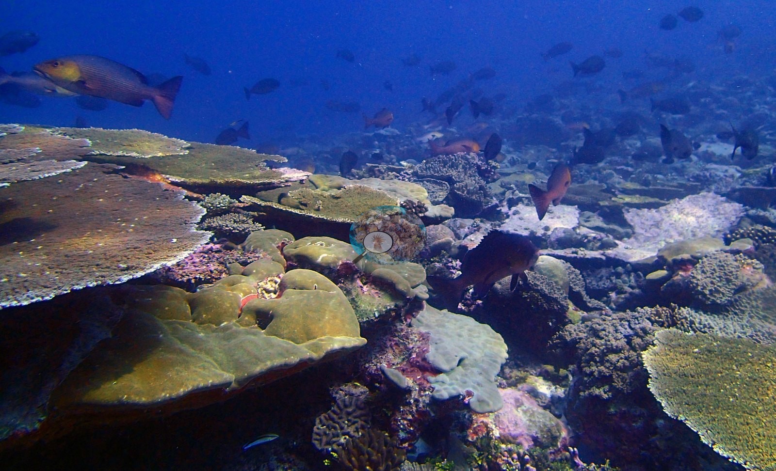
The assemblage is massive-led: Porites 16.02% of the benthos, i.e. 42.5% of all live coral present, more than twice the next genus. Acropora follows at 6.06%, then Montipora 4.38%, Pocillopora 1.75%, Platygyra 1.50%, Favia 1.03%, Montastrea 0.89%, Stylophora 0.81%, Acanthastrea and Pachyseris 0.75% each, Gardineroseris 0.48%, Favites 0.48%, Leptastrea 0.47%, Goniastrea 0.45%, Symphyllia 0.35%, Turbinaria 0.29%, Psammocora 0.28% and Echinopora 0.25%, then a long tail — Galaxea and Pectinia 0.13% each, Pavona 0.12%, Hydnophora and Isopora 0.08%, Astreopora 0.06%, Cyphastrea 0.04%, Millepora 0.03%, Ctenella 0.03% (the Chagos-endemic monotypic genus, not Cynarina), Goniopora 0.02%, Fungia 0.01%, Lobophyllia 0.008% and Leptoseris 0.006%. The non-coral substrate is dominated by non-coral invertebrates at 19.4% — the single largest non-coral category here — then crustose coralline algae 10.68%, bare substrate 9.71%, macroalgae 8.53%, turf-with-sediment 6.45%, erect algae 4.55%, turf 2.96% and cyanobacteria 0.01%. P3120314, P3120315, P3120319, P3120320, and P3120352 show large olive and gold tables overlapping across the whole frame with massive Porites wedged between them, and P3120352 puts a fine green meandroid brain compatible with Platygyra or Leptoria in the foreground. P3120316 and P3120322 are dominated by broad, smooth, pale-green massive Porites plates carrying purple and crimson encrusting sponges — a growth form more prominent here than at any other Danger Island site, and the photographic counterpart of the transect's 16.02% Porites. Massive corals are a real structural component rather than an accent: broad low Porites-type mounds and plate-lobe complexes fill the foreground of P3120316, P3120322 and P3120352, some with maroon-red encrusting patches and mauve sponges set into their surfaces (P3120322), and a rounded meandroid brain sits beside a yellow-green table in P3120352. Smaller structural elements fill the pavement between them — digitate and corymbose Acropora, Pocillopora-type bushes, encrusting, and foliose colonies, brown leather corals in P3120314 and P3120352, thick pink and mauve crustose coralline crusts throughout, and dark blue-gray tubular sponges in P3120328.
P3120328 is the single most diverse benthic frame — a mid-slope pavement packed with meandroid brains, Pocillopora, purple digitate Acropora, faviid domes, pink crustose coralline algae and encrusting sponges, with a peacock grouper compatible with Cephalopholis argus, blue-spotted and unmistakable, resting at frame left.
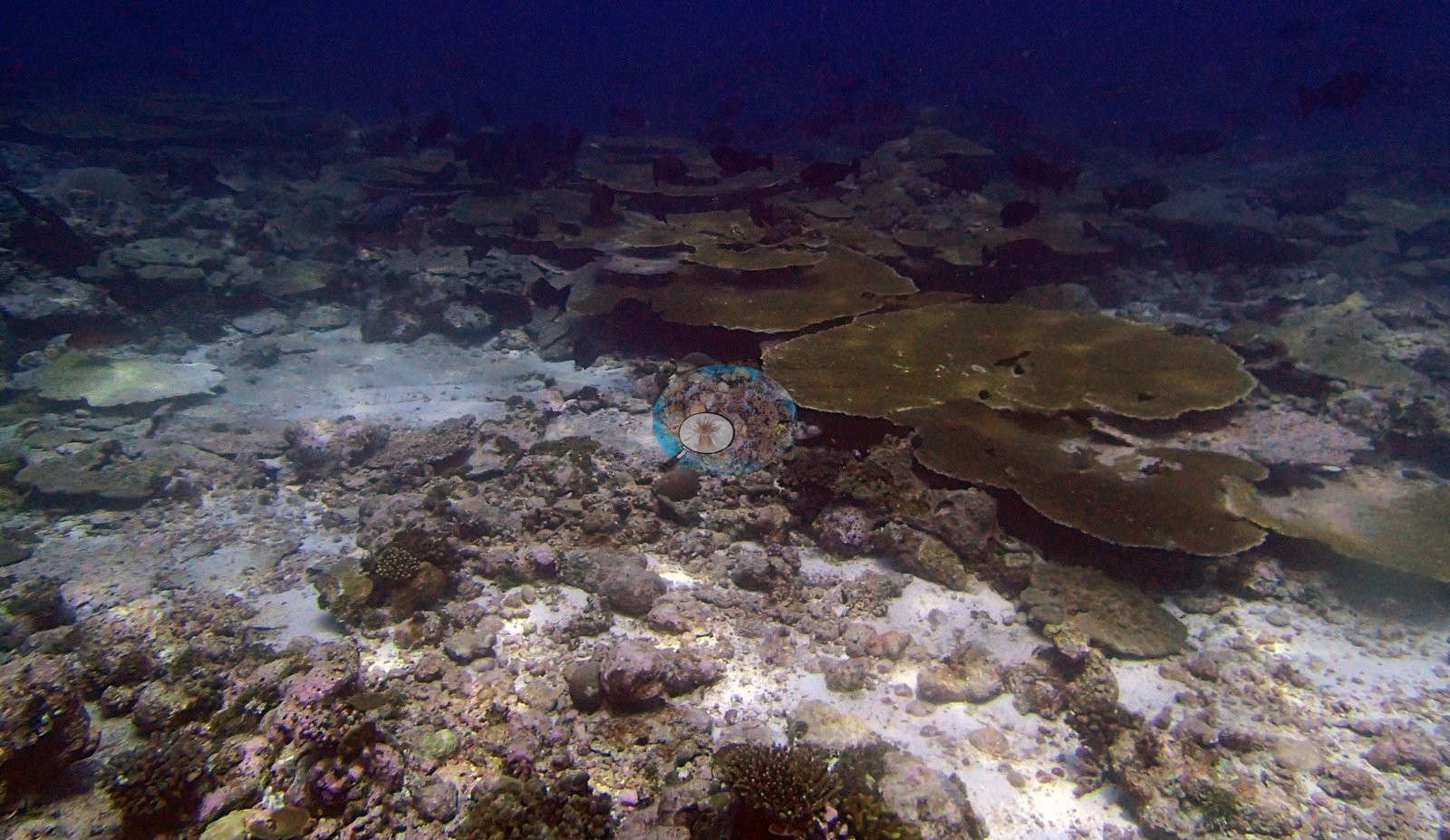
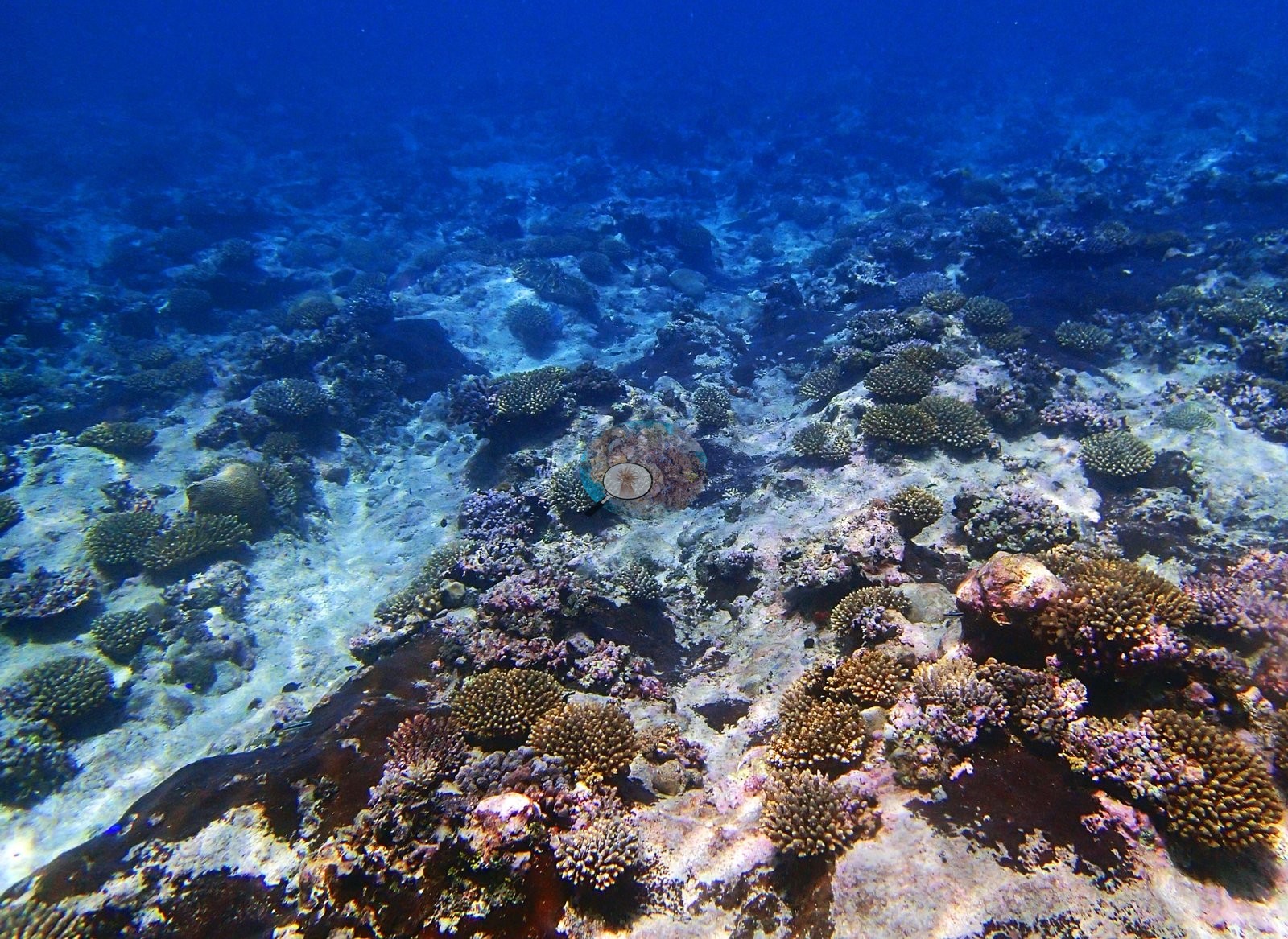
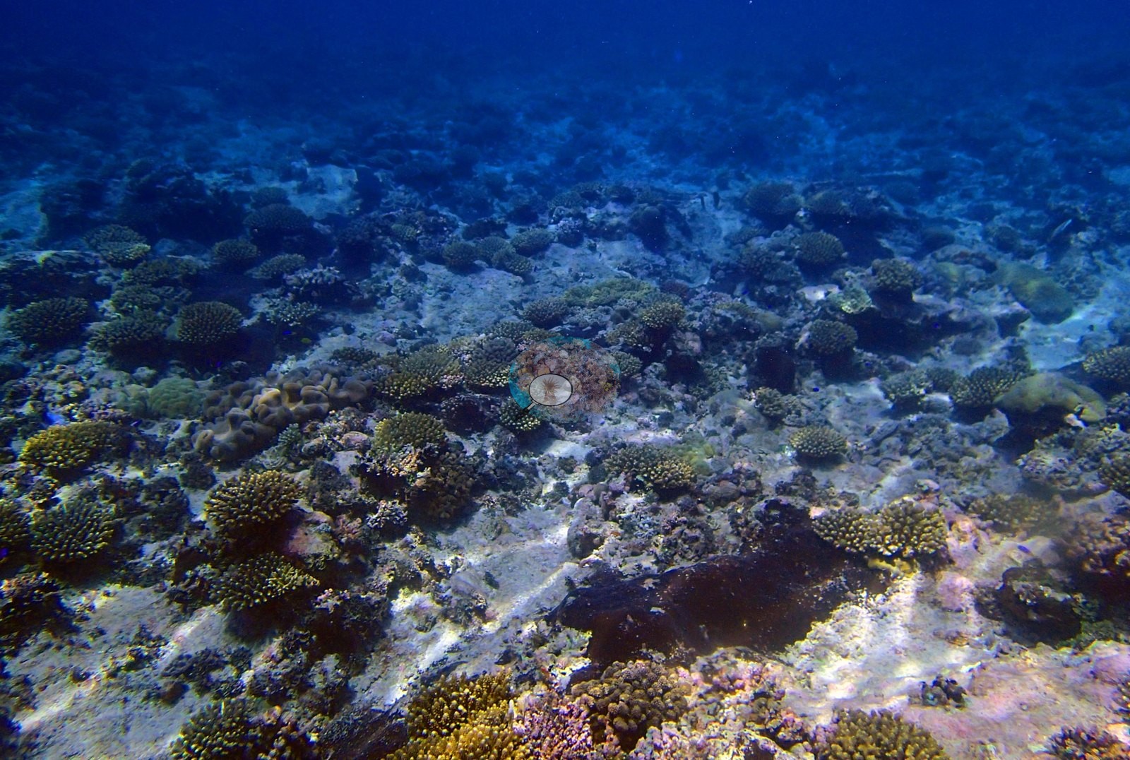
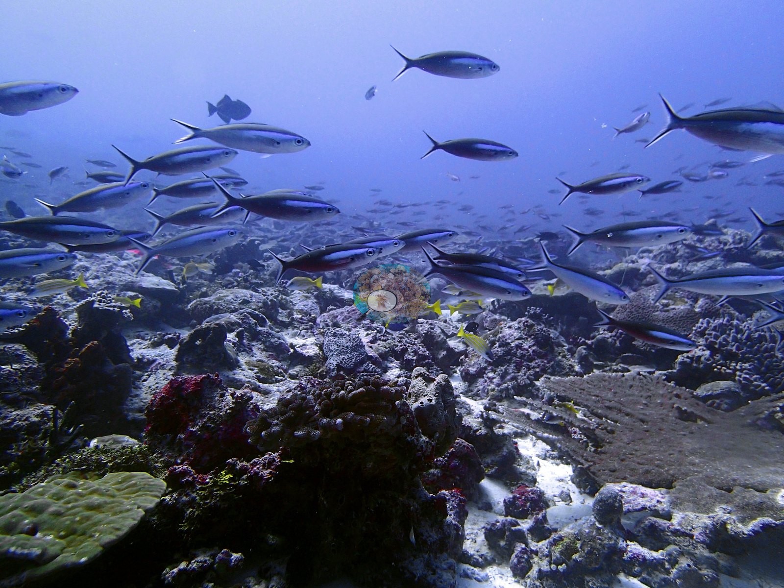
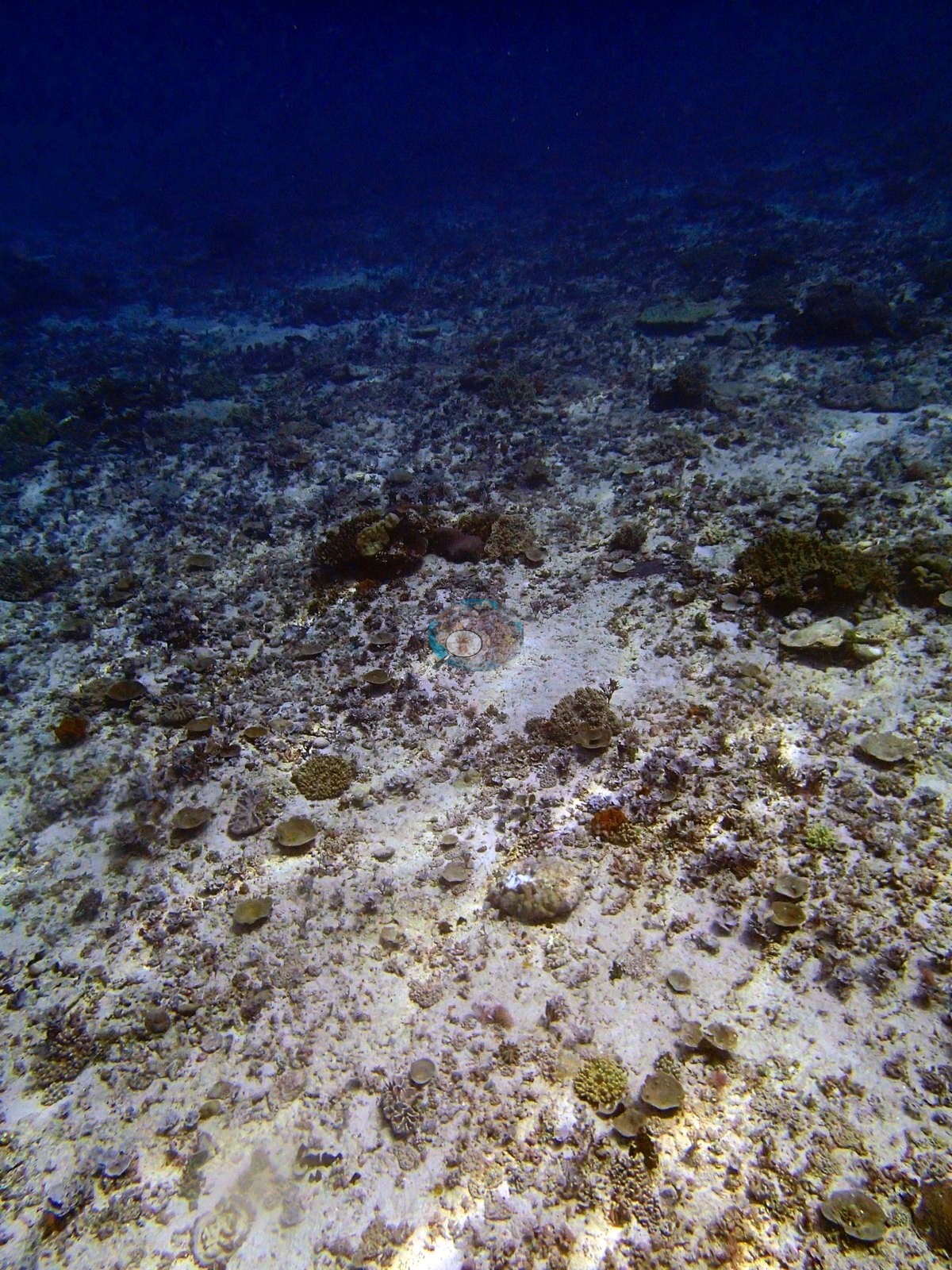
The last three frames are a different reef entirely. P3120365, P3120382 and P3120383 show pale rubble and sand plains carrying only small, widely spaced corymbose and digitate colonies over dominantly bare substrate.
Coral cover
The measurement at BIDI09 is the benthic transect survey. Coral cover 38%, from LOF BIOT-1 in situ transects (Mayfield & Dempsey 2026, Oceans, suppl. That diver transect figure is the authoritative record of cover and community here. Everything photographic below supplements it; nothing below qualifies, softens or revises it, and no cover figure may be read off any frame.
What the transects recorded. Live hard coral 37.7% against algal cover 33.2% of the benthos, across 31 scleractinian genera plus the hydrocoral Millepora — one of the richer generic inventories in the Chagos set. That Porites-over-Acropora ranking is the transect's own account of the site and is the thing the photographs should be read against, not the other way round. Full per-genus and substrate values are in the LOF BIOT-1 benthic file for this site (Mayfield & Dempsey 2026, Oceans, supplemental S1).
Computer-vision comparison — method against method, not against the transect. All 31 frames from the site folder carry both products, so the paired-frame count is n = 31. On those 31 frames CoralNet point annotation returns 24.6% live hard coral and Coralscapes mask segmentation 23.2% of image area, against the transect's 37.7%: a deviation of −13.1 to −14.5 pp, mean of the three methods 28.5% ± 8.0 (that SD reflects systematic method bias between sampling designs, not measurement precision — see CHAGOS_MULTIMETHOD_README.md). The two image methods agree with each other to within 1.4 pp while both read low against the transect, which is the signature of a sampling-frame difference rather than model disagreement: the transect samples the bottom along a line at fixed points, the photographs sample whatever the camera was pointed at, including water column and fish. The instructive comparison is with neighboring BIDI08, where the same two image products sit ~25 pp below the transect. BIDI08's cover is carried almost entirely by large horizontal tables, which foreshorten badly in an oblique photograph; BIDI09 mixes tables with massive Porites and low-relief pavement, which photograph more faithfully, and its offset is about half as large. Neither number corrects the transect — they are different footprints and different denominators and must not be averaged. Quality is good — clear water, mostly well-composed wide reef views — with four exceptions: P3120326 is badly backlit and reads almost black over the substrate, P3120340 carries a strong magenta cast, and P3120323, P3120324, and P3120331 are so densely filled with fish that little benthos shows behind them. That end-of-dive zone — not model error — is a large part of what separates this site's transect mean from its neighbor BIDI08's 59.0%, and it means the frame pool spans more than one habitat state. No bleached percentage is derived here from any photograph. This site's published per-site bleached fraction is a separate, authoritative number from Anderson's own point-annotation record and is not confirmed, contradicted or revised by an image. Coral cover 38%, measured on the in situ benthic transects of the LOF BIOT-1 expedition (Mayfield & Dempsey 2026, Oceans, supplemental S1) — a diver transect measurement, not a photographic or computer-vision estimate.
Also on record for this site: Assemblage composition. The Coralscapes and CoralNet figures are given in the cover line above; at 24.6% and 23.2% they agree closely with each other and sit ~14 pp below the transect, the same systematic offset as the Egmont sites and about half the -25 pp seen at BIDI08. That difference between the two neighboring Danger Island sites is itself informative: BIDI08's cover is carried almost entirely by large horizontal tables (badly foreshortened in photographs), whereas BIDI09 mixes tables with massive Porites and low-relief pavement that photographs capture more faithfully. Coral cover: 38%. Live hard coral measured on the in situ benthic transects of the LOF BIOT-1 expedition (Mayfield & Dempsey 2026, Oceans, supplemental S1), against algal cover of 33.2% of the benthos. The transect figure is this site's authoritative cover value; no image-derived product overrides it. Across methods the same reef reads: transects 37.7% · CoralNet points 24.6% · Coralscapes masks 23.2% (31 frames). These products have different sampling footprints and denominators and should not be averaged.
Stressors
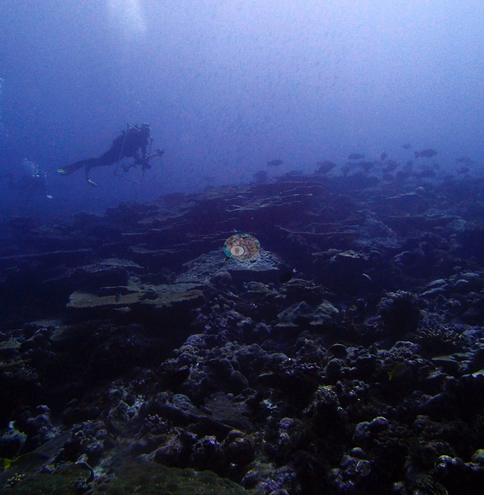
Condition. Bleaching is not a feature of these frames. P3120317 is the one clear case — a bone-white branching colony on the reef below a rudderfish school — and the same low-relief pale colony appears again in P3120338; nothing else in 31 frames reads as bleached tissue. The recurring bright white patches in P3120329, P3120356 and P3120359 are clean carbonate sand and rubble, not bleached coral, and should not be scored as such — flagged explicitly because they are the kind of feature a mask model may misclassify. Some tables carry small dead or pale-dulled sectors, and the sparse pavement in P3120365/P3120382/P3120383 is old, algal-filmed substrate, but there is no storm rubble field, no cyanobacterial mat and no crown-of-thorns scar anywhere in the set.
Fish and other fauna
Roughly 24 of the 31 are usable benthic views.
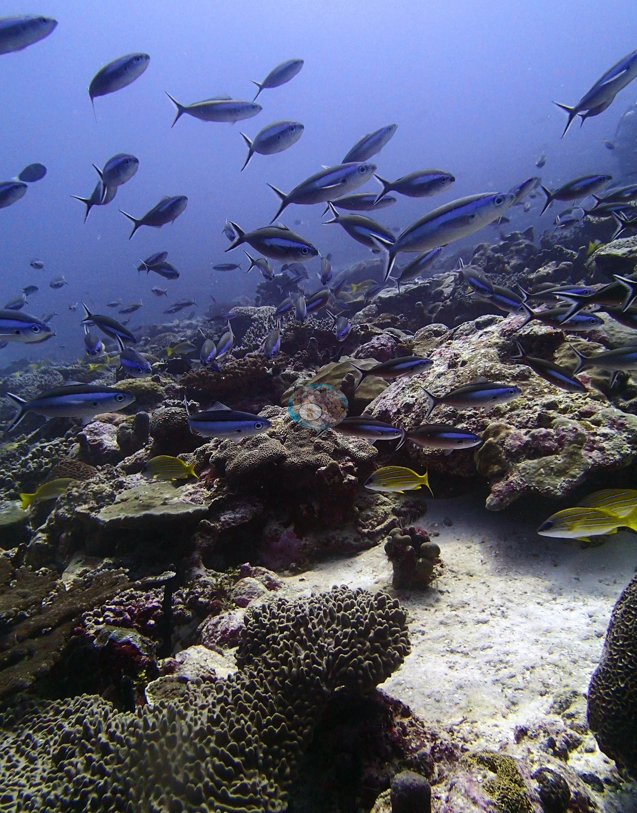
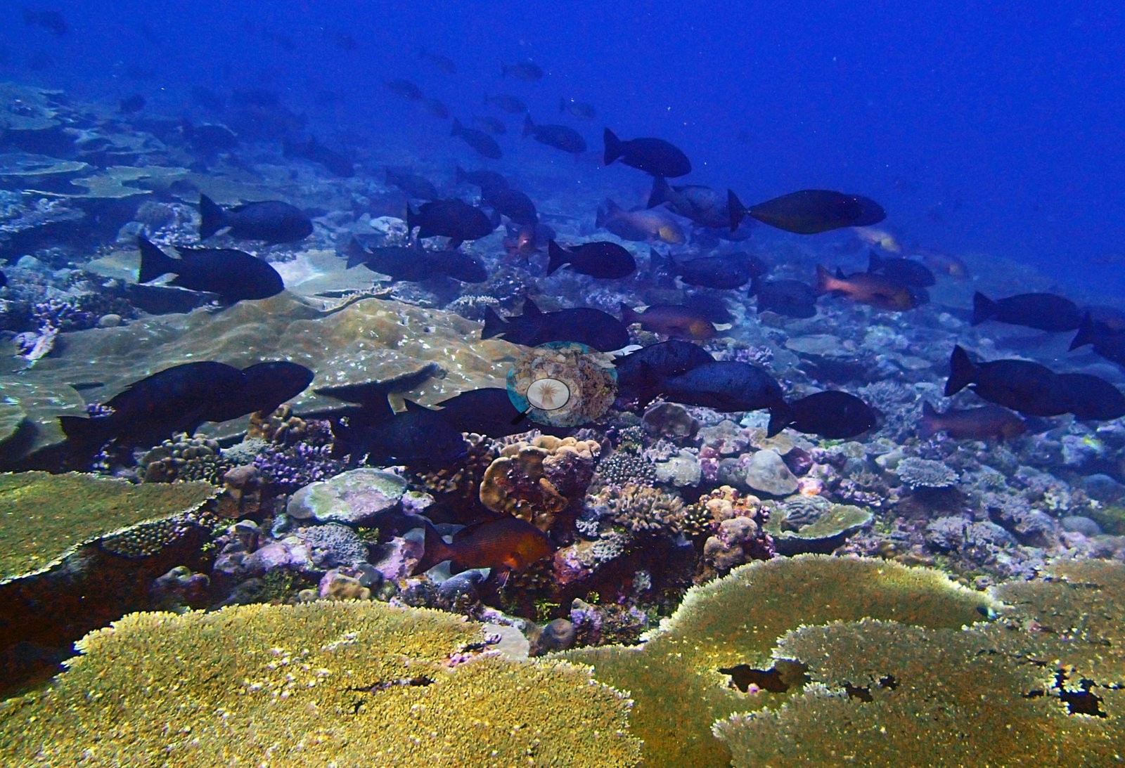
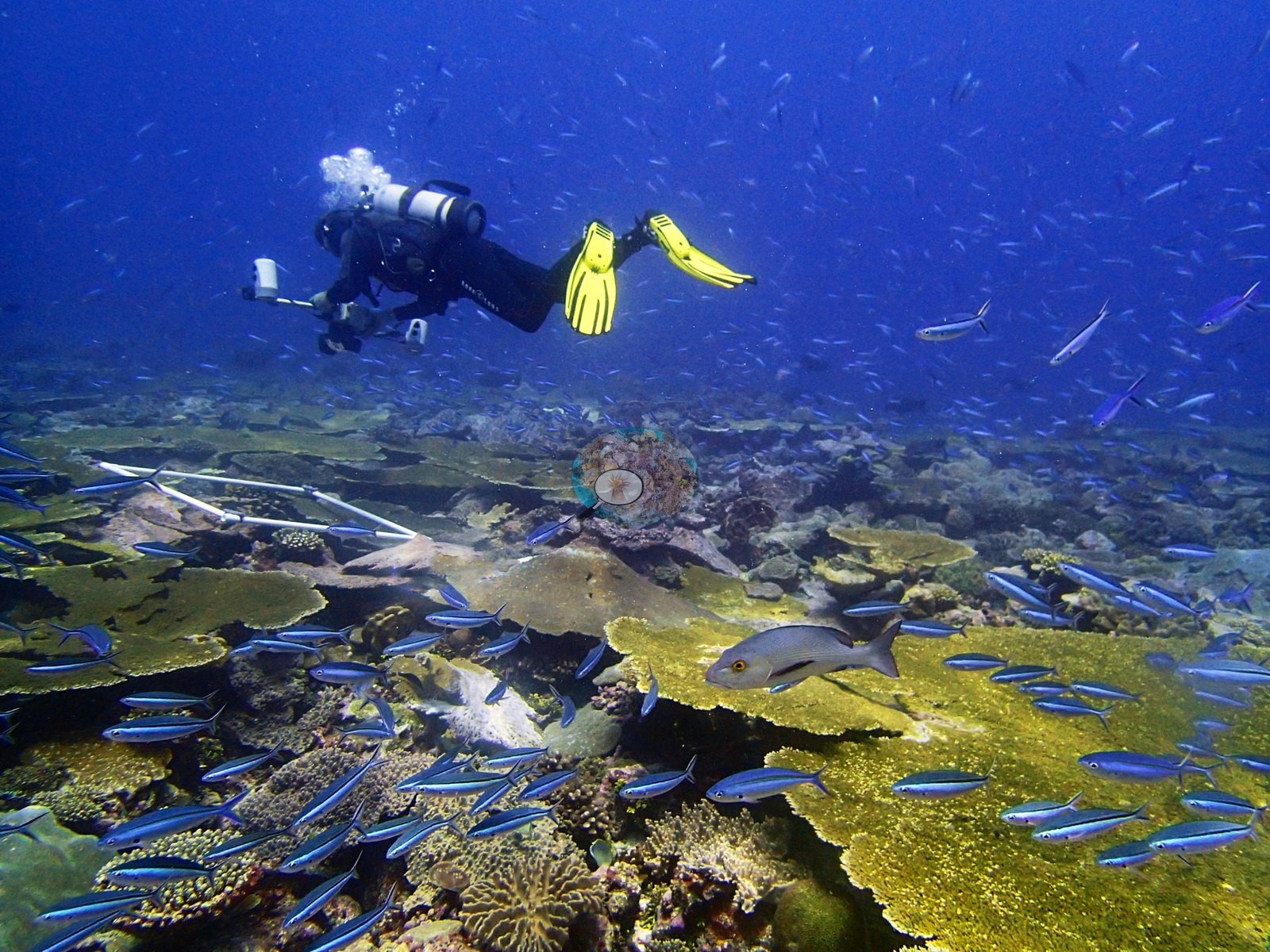
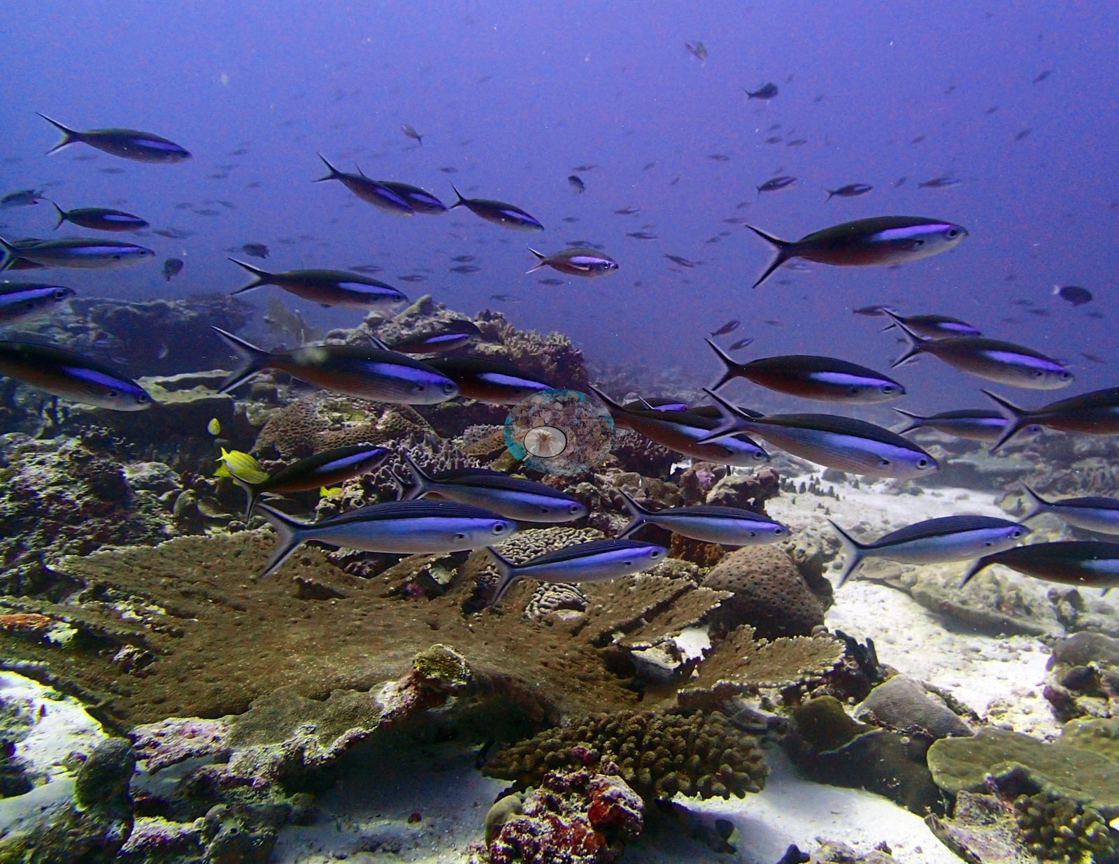
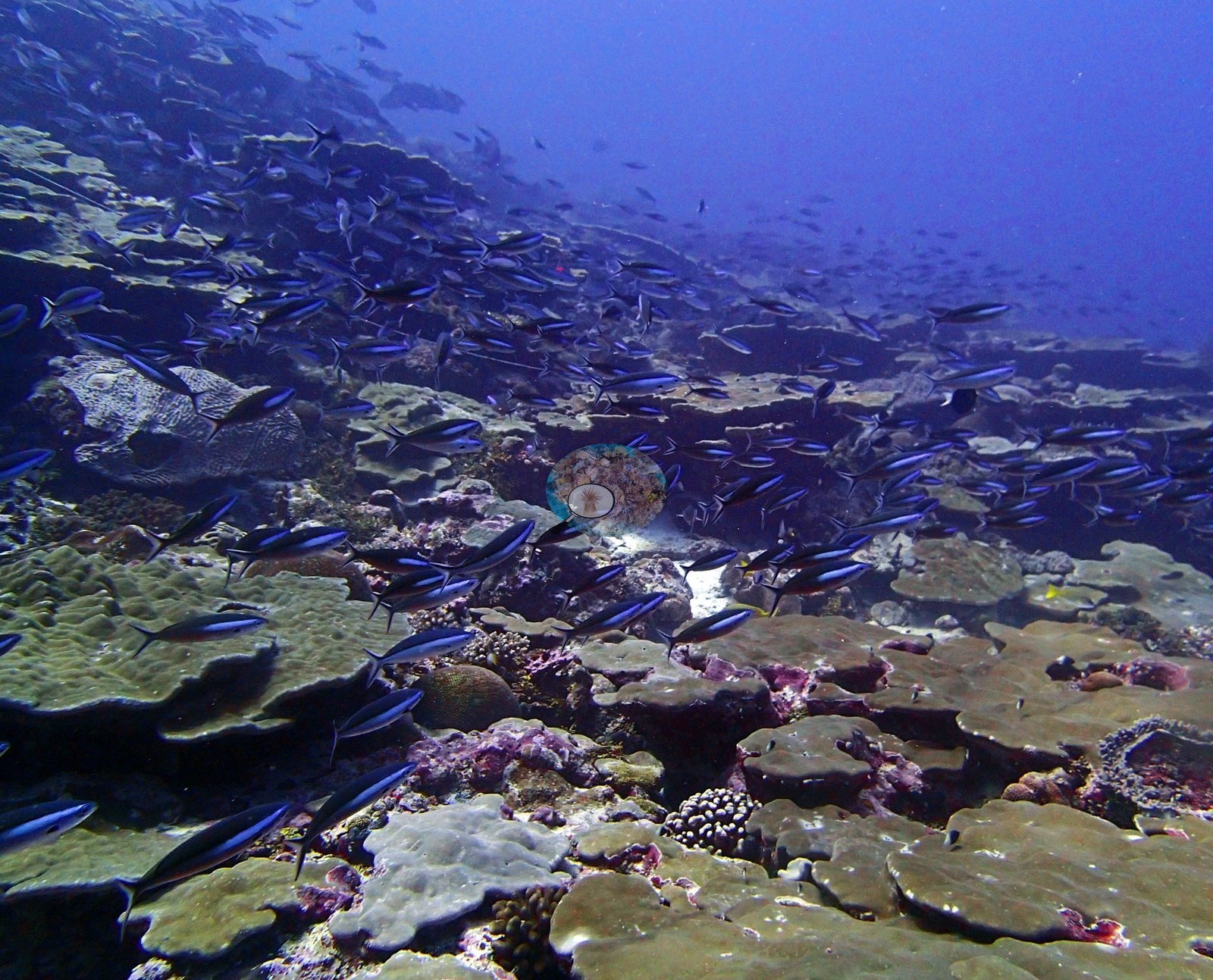
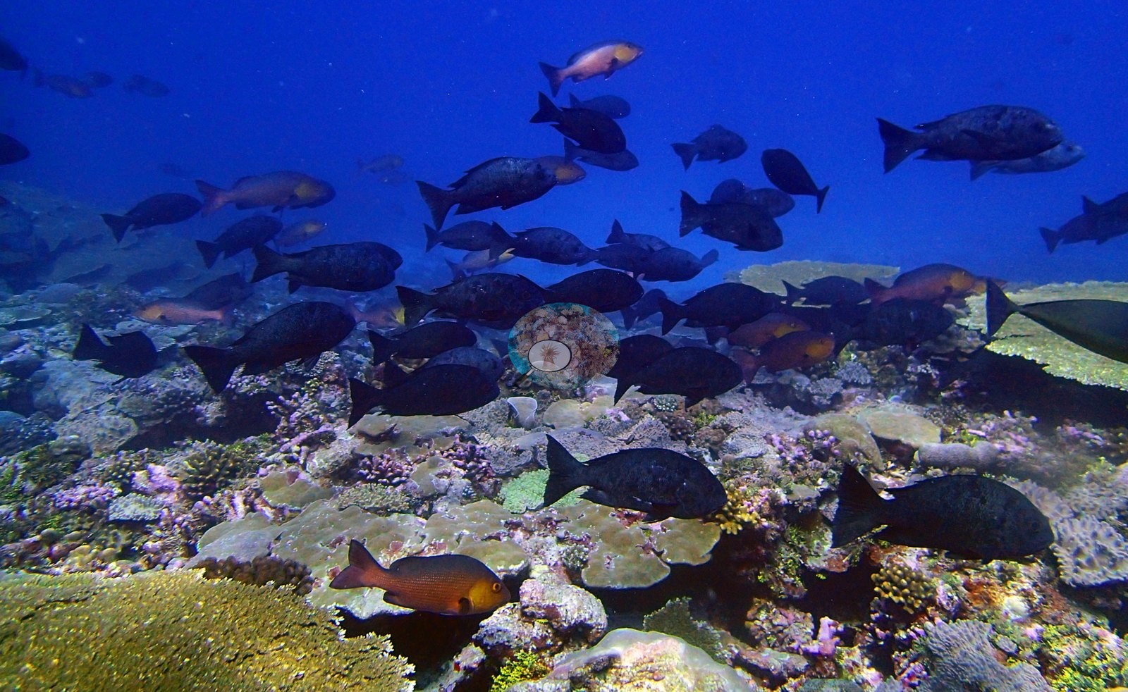
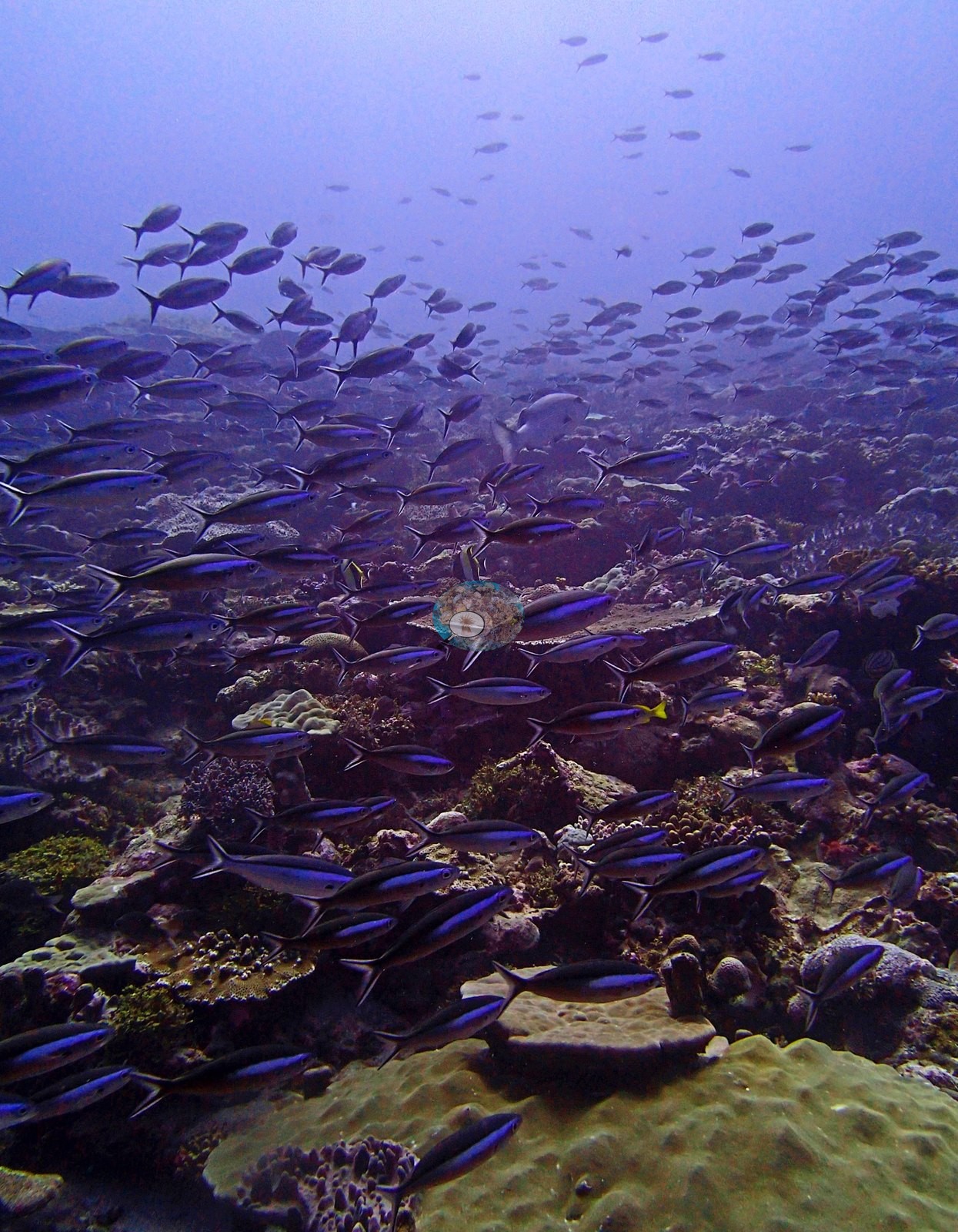
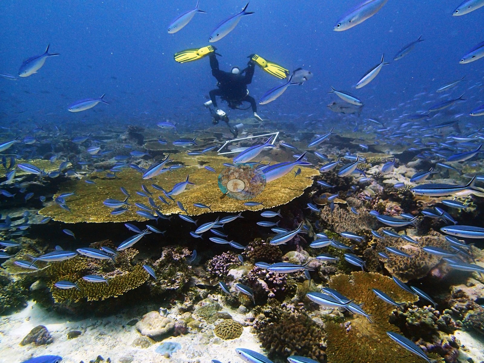
Fauna. What dominates the impression of this site is planktivore biomass. Fusiliers compatible with Caesio and Pterocaesio — brilliant blue with dark dorsal stripes — fill at least fourteen frames (P3120329 through P3120361), in schools of many hundreds that in P3120338 and P3120340 largely obscure the reef behind them. Layered above and among them are large dark-bodied rudderfish or snappers compatible with Kyphosus, Macolor or Lutjanus (P3120317, P3120319, P3120323, P3120324), and blue-striped snapper compatible with Lutjanus kasmira — bright yellow with electric blue lines — in P3120329, P3120337 and P3120343. Larger individuals appear repeatedly: a gray jobfish compatible with Aprion virescens crossing frame in P3120353 and again in P3120361, a red-orange hogfish or wrasse compatible with Bodianus in P3120355, red bigeyes compatible with Priacanthus in P3120317 and P3120355, a large pale-bodied fish over the reef in P3120338, Moorish idols and a powder-blue surgeonfish. A mottled moray shows its head among the pavement corals in P3120328. Thousands of planktivores stacked over the reef, several large-bodied predators in frame, and no fishing gear or damage anywhere — this is what an unfished remote atoll looks like, and it is the most striking thing the photographs record.
Comparisons with other data
No independent survey was made at this exact site; the nearest ones are listed in the table below.
Other notes
Image-by-image. Thirty-one habitat frames from the 12 March dive, all from Anderson's own folder BiDi09-finished; there are no sampled-colony frames, so this is a habitat account throughout. Worth Anderson's eye if these frames are ever used as a single-condition sample.
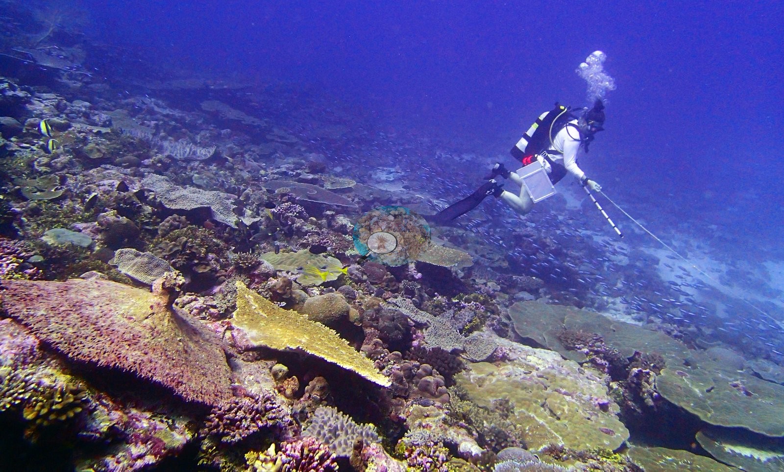
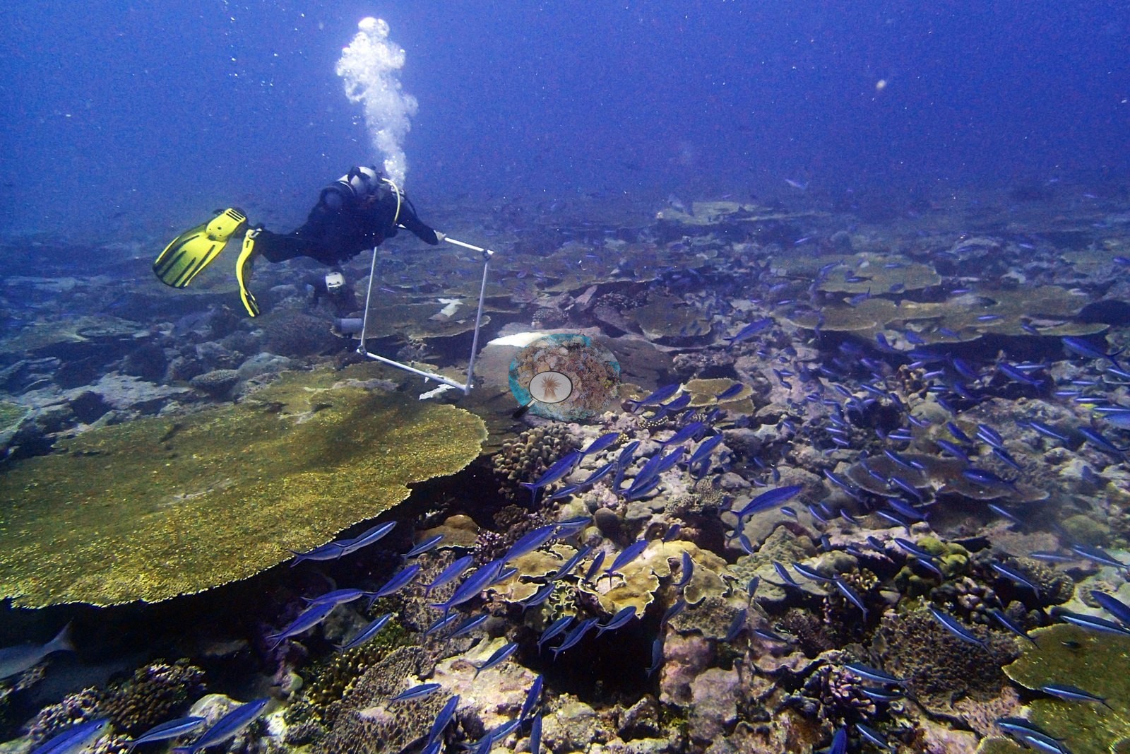
Survey-methodology imagery — the best-documented site in the archipelago set, eight frames. P3120357 and P3120359 show a diver in yellow fins carrying and then placing a large white PVC quadrat frame over the tabular plain with dense fusilier schools filling the water; P3120339 has the quadrat frame at the upper-left edge mid-deployment with line running across the substrate below, and the transect bar visible in-frame beside a large giant clam compatible with Tridacna, its fluted shell wedged among Porites plates. P3120343 catches a diver deploying a transect reel with a slate; P3120361 shows a diver with camera alongside a white transect bar laid across the reef; P3120337 and P3120326 show divers running line at depth, P3120337 placing a diver with line in the middle distance over the fusilier-covered slope. Together with BIDI08's deployed instrument and BIEG05's quadrat series, Danger Island now has a near-complete photographic record of how these numbers were produced.
No frame carries a scale bar or a depth stamp, so colony dimensions, relief and depth zonation cannot be read from this set; the only scale objects are the divers and the PVC quadrat and transect bar in the methodology frames. Fish identifications above are held at body-type or hedged genus level.
CV model comparison
More info
Those are point counts on the photographs; this is a diver swimming a transect. The models and the reference never saw the same thing. ⚠ SITE-LEVEL ONLY. The 2,500 frames were not associated with any transect taken within 200 m of them, so transect-vs-image comparisons are site means, never frames. The transect value is already in the pin `cover` field (109 of 112 pins, sourced to the paper's suppl. S1) and is read from there, never re-imported. The transect is THE coral-cover value for this site and stands alone. The rows below it are a methods comparison only: no computer-vision value is averaged with it, feeds the headline, or carries over to the site's cover figure (Anderson, 2026-09-22).| Method | Hard-coral cover (%) |
|---|---|
| Transect (published) | 37.7 |
| CoralNet | 38.0 |
| In-house DINOv3 | 23.6 |
| CoralSCOP edited | 32.2 |
| Claude | 33.6 |
Independent surveys nearby
Within 5 km, 2 independent survey stations recorded hard coral cover in 2015. The most recent nearby survey is from 2015, so these values predate recent heat stress. This site's own estimate (38%) sits 12.8 points above the range of these surveys (6.3–25%); the methods differ, so the comparison is context, not a like-for-like test.
Collected by other programs using different methods (the XL Catlin Seaview Survey uses photo-transects with automated image annotation), so these are context for the figures above, not a like-for-like comparison. Where a station was surveyed more than once the range is shown. Station names are not dive-site names.
| Agency | Site / location | Date | Hard coral cover (%) | Distance | Link |
|---|---|---|---|---|---|
| XL Catlin Seaview Survey | transect 36002 | 2015 | 25% | 0.26 km | — |
| XL Catlin Seaview Survey | transect 36001 | 2015 | 6.3% | 3.40 km | — |
Data & links
- Read the full site report ↗
- Download benthic survey data (CSV) ↗
- Download all LOF-GRE data (933 sites) ↗
- CoralNet image repository for this region ↗
- HeatCRD database ↗
- (reference) ↗
- Photo portfolio ↗
- Coral Reef Diagnostics page for this area ↗
All images from Coral Reef Diagnostics. Data are from Coral Reef Diagnostics and the organizations named in the data-sources table above.
 © Coral Reef Diagnostics.