
Part of the regional summaries: Chagos Archipelago - Great Chagos Bank West / Brothers / Eagle and Chagos Archipelago

More info
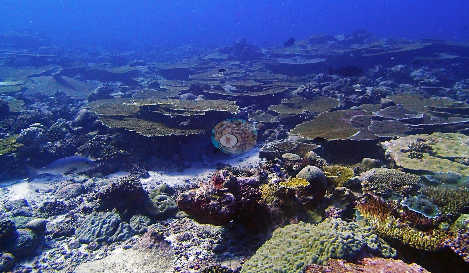
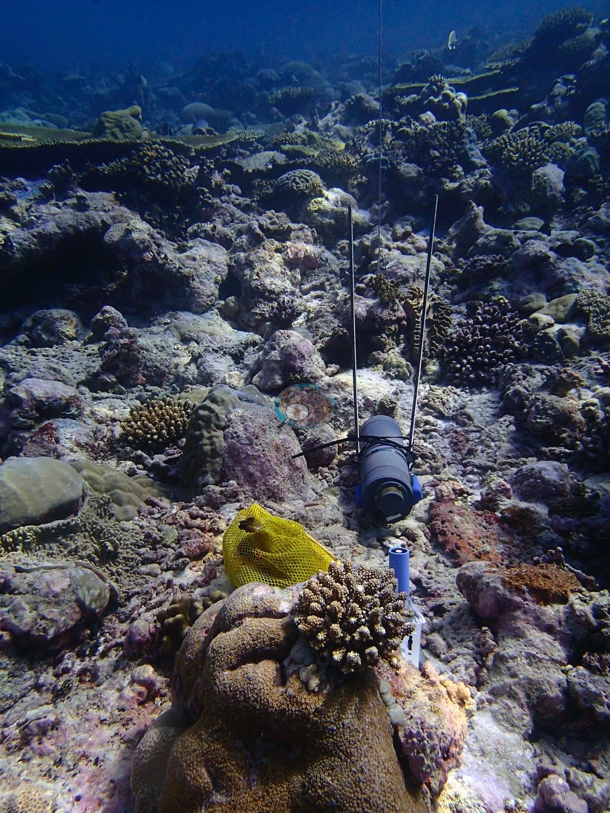
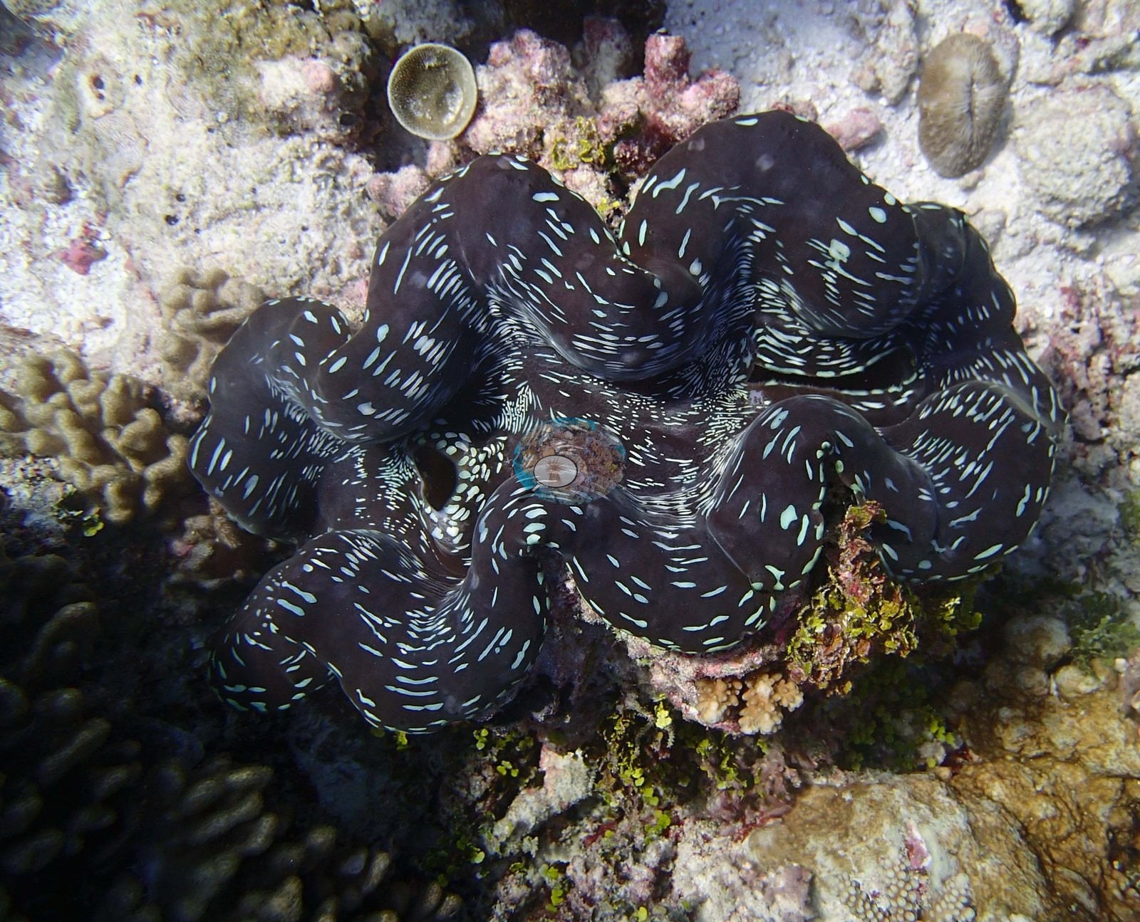
Chagos (NOAA CRW virtual station)BIDI08, at Danger Island, has an unusually high 59% coral cover carried by large tabular plates over well-consolidated crustose coralline pavement, plus a deployed underwater instrument logger left in place on the reef. Bleaching was essentially absent, and the site is known for large fusilier schools, whitetip reef sharks, and a deep purple-black giant clam. Surveyed on the Living Oceans Foundation's Global Reef Expedition.
Two independent survey stations shown with the program’s logo — click one to see how far it is from this site.
Four other CRD dive sites within 5 km shown in orange — click a marker to open its page.
🗺 Detailed map of the Global Reef Expedition dive sites, Danger Island, Chagos (Khaled bin Sultan Living Oceans Foundation; opens in a new window)

Site description
Setting
In-water conditions on 12 March 2015 were 28.4°C at 34.5 salinity.
General benthic features
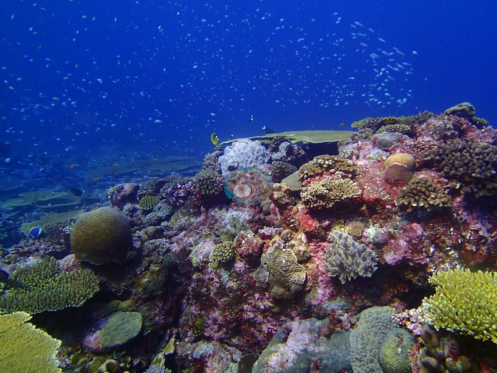
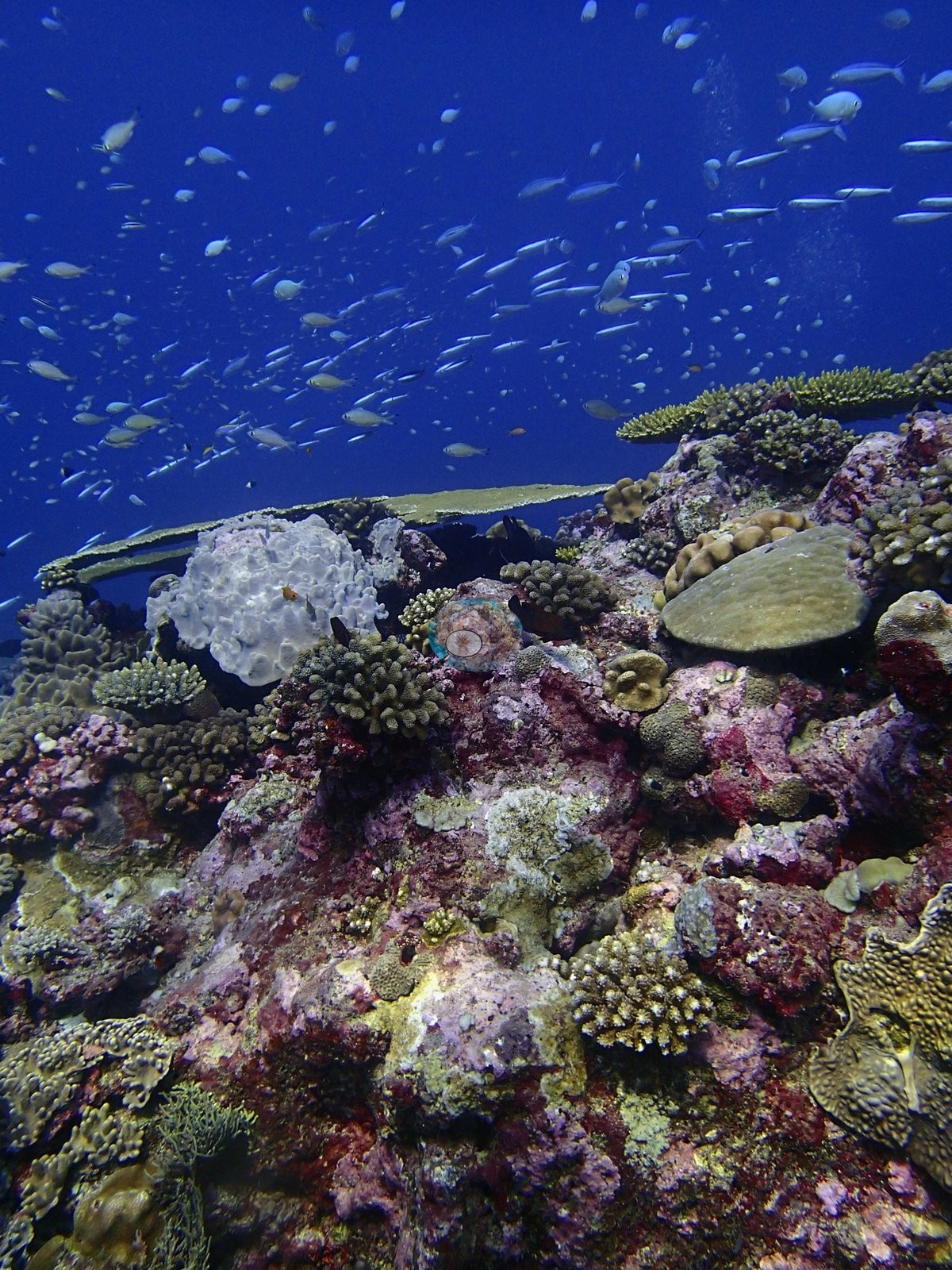
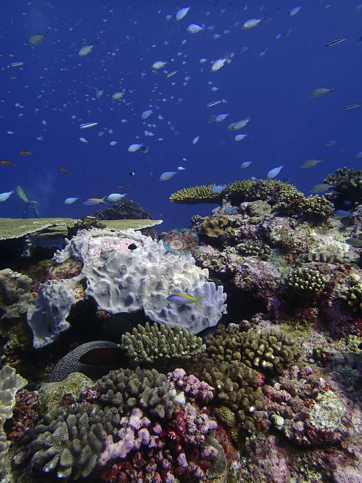
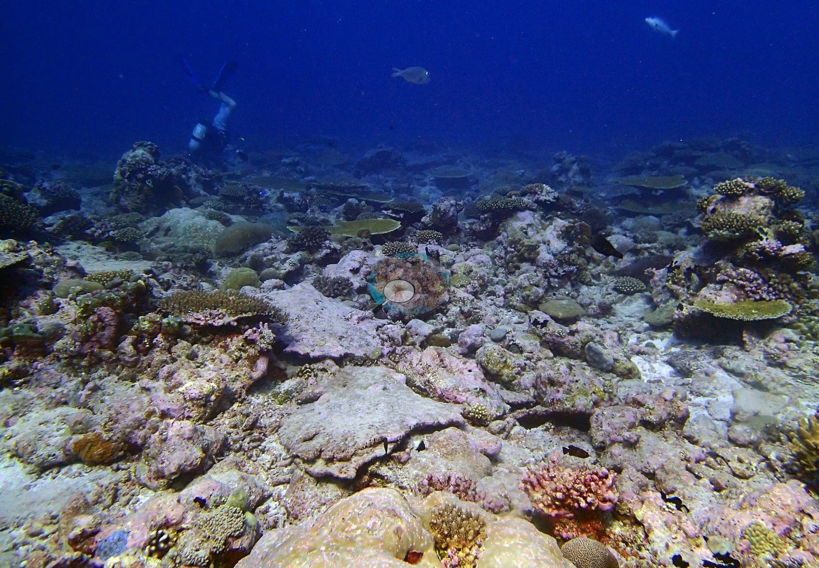
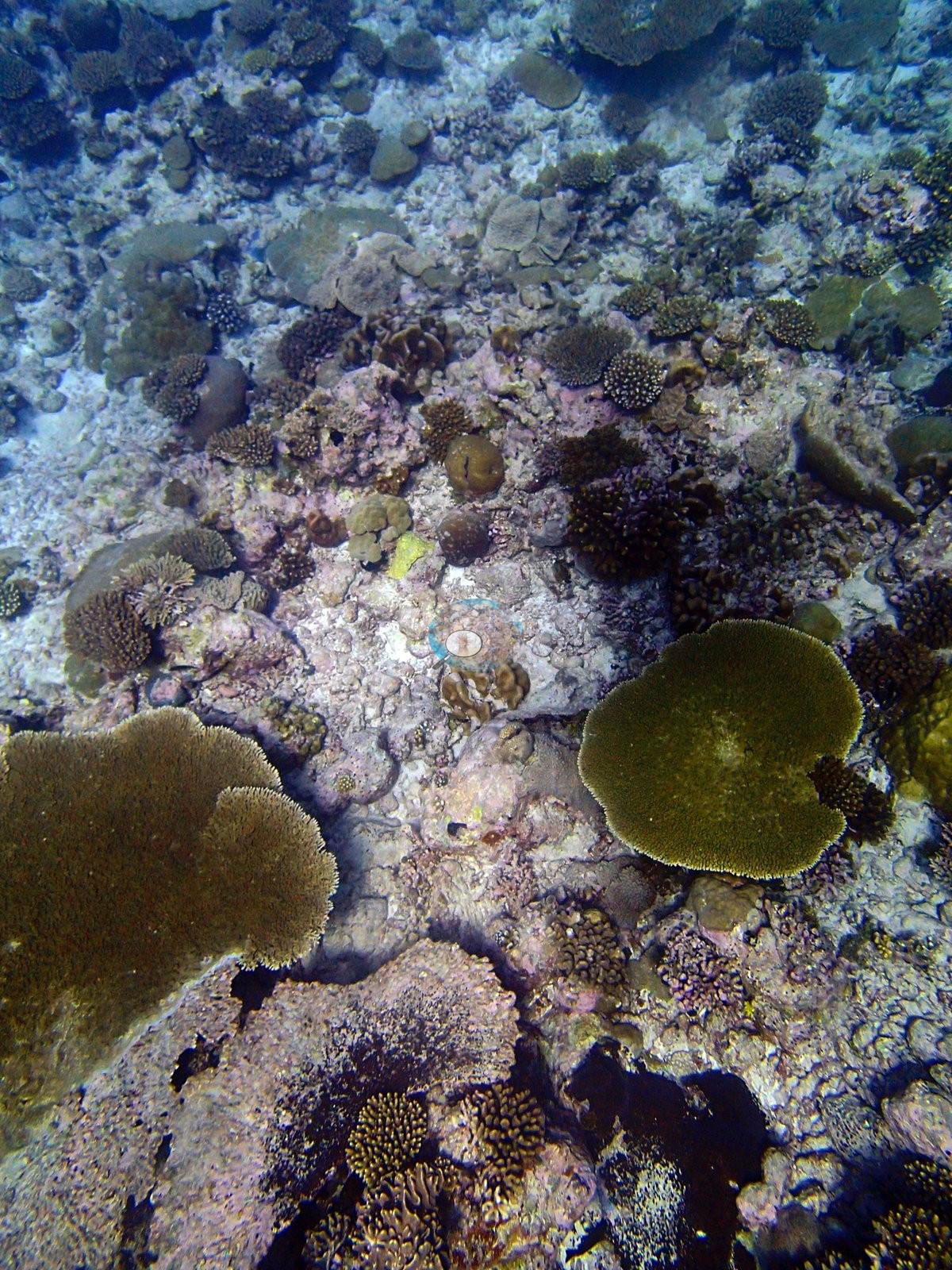
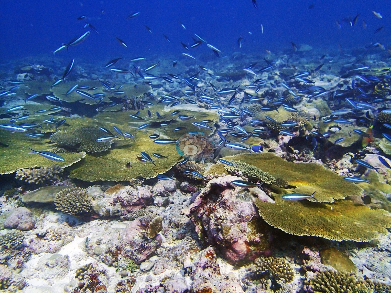
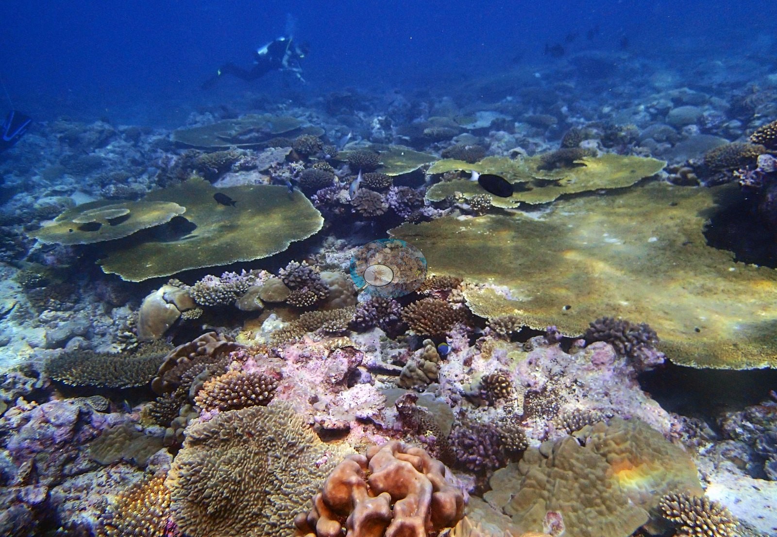
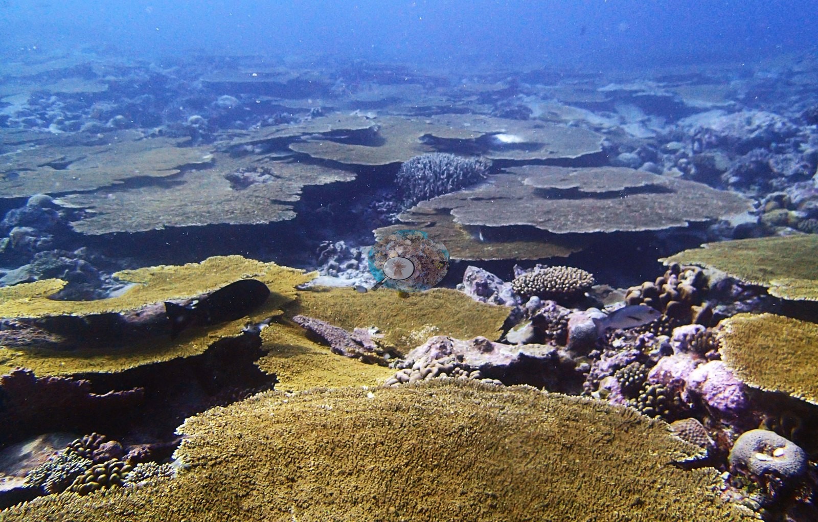
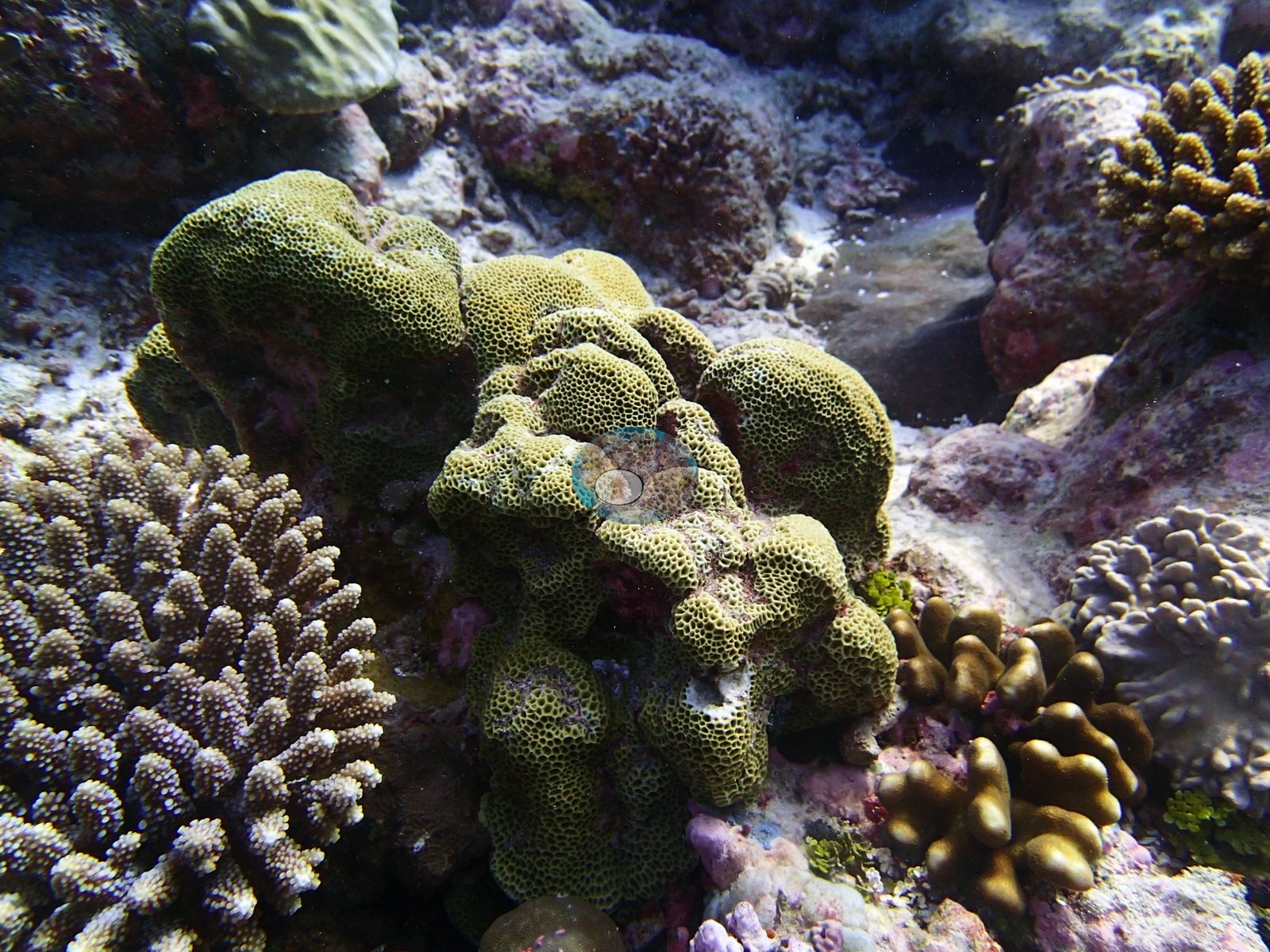
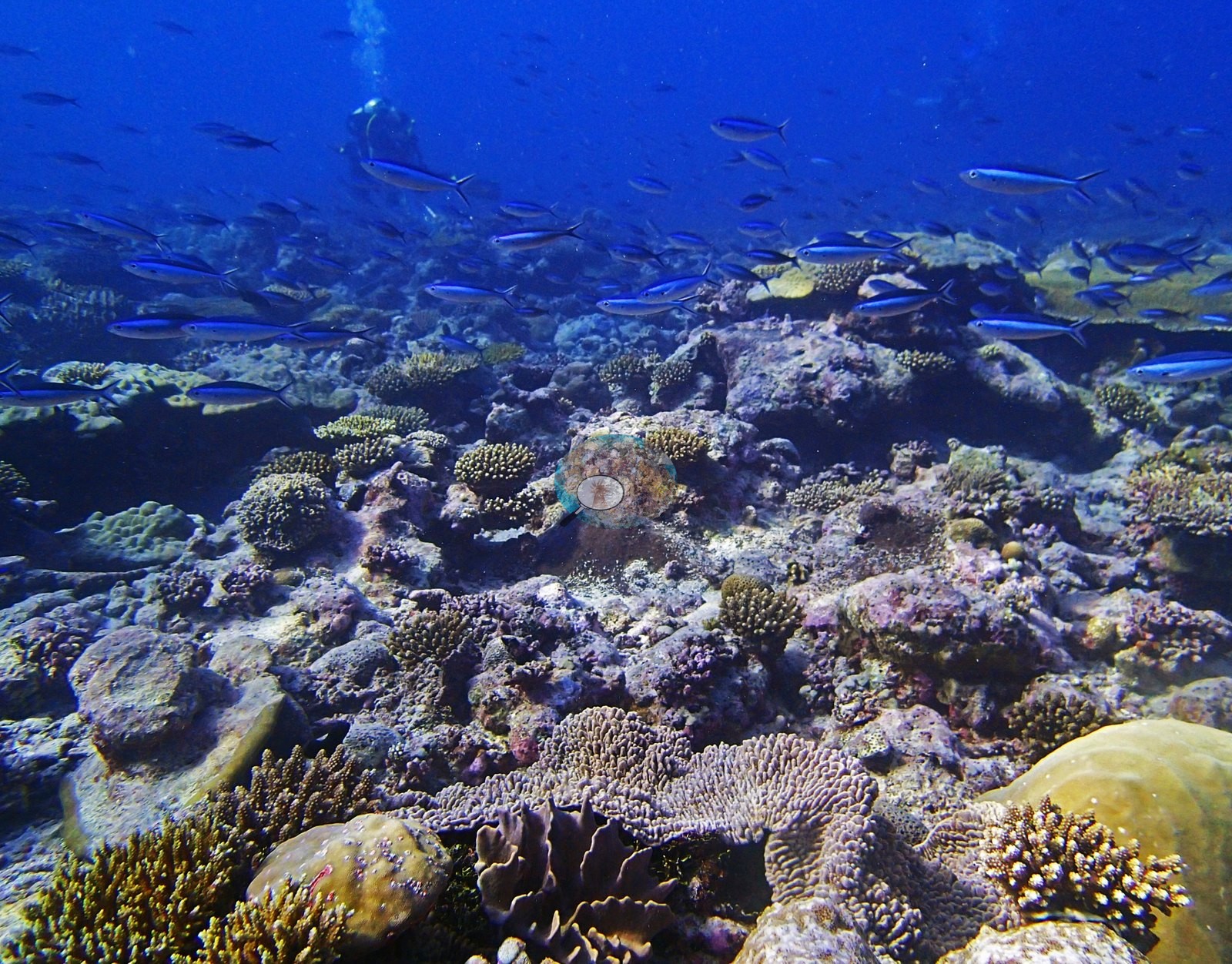
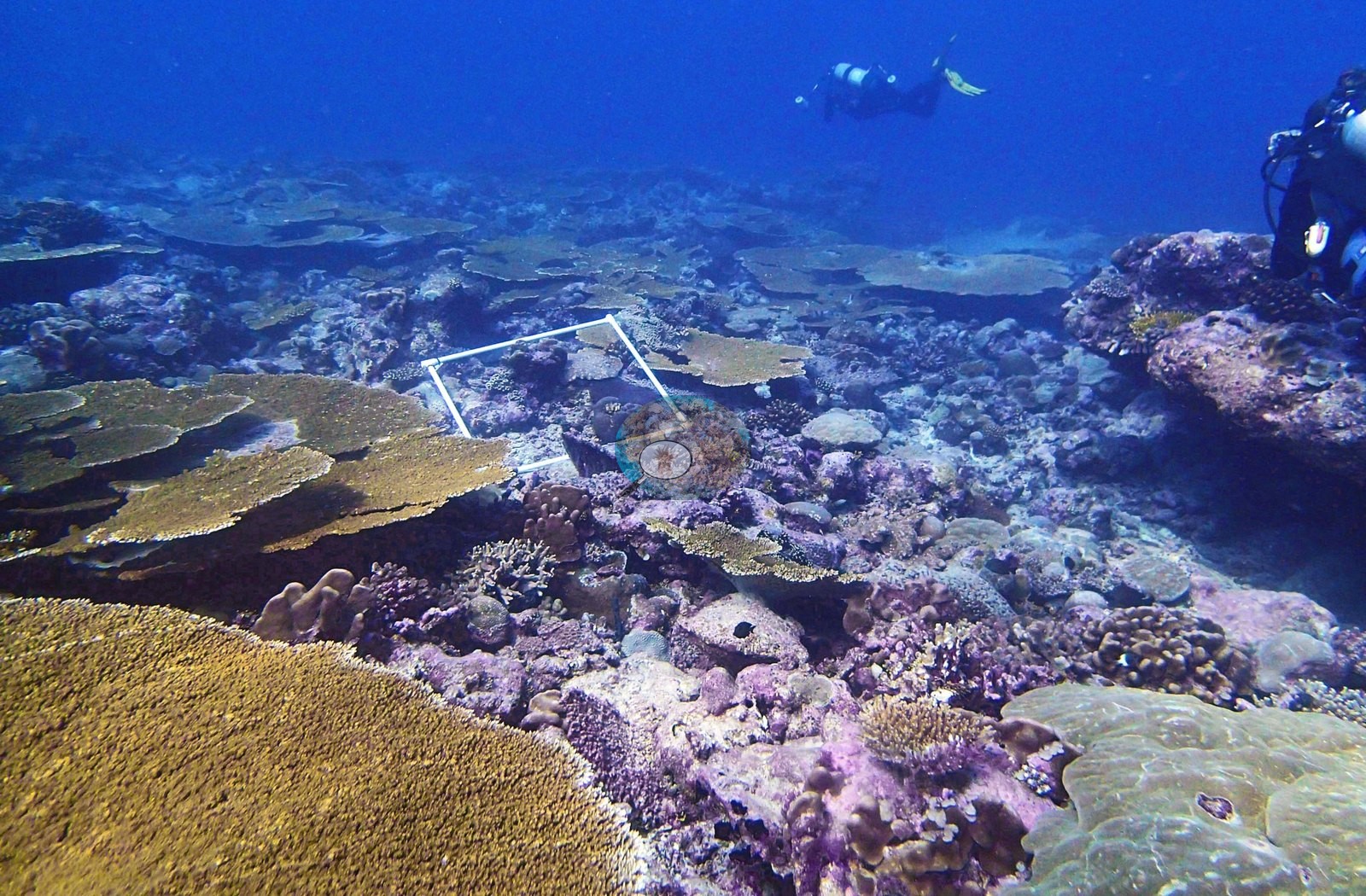
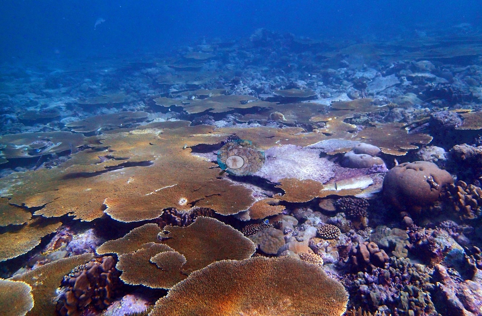
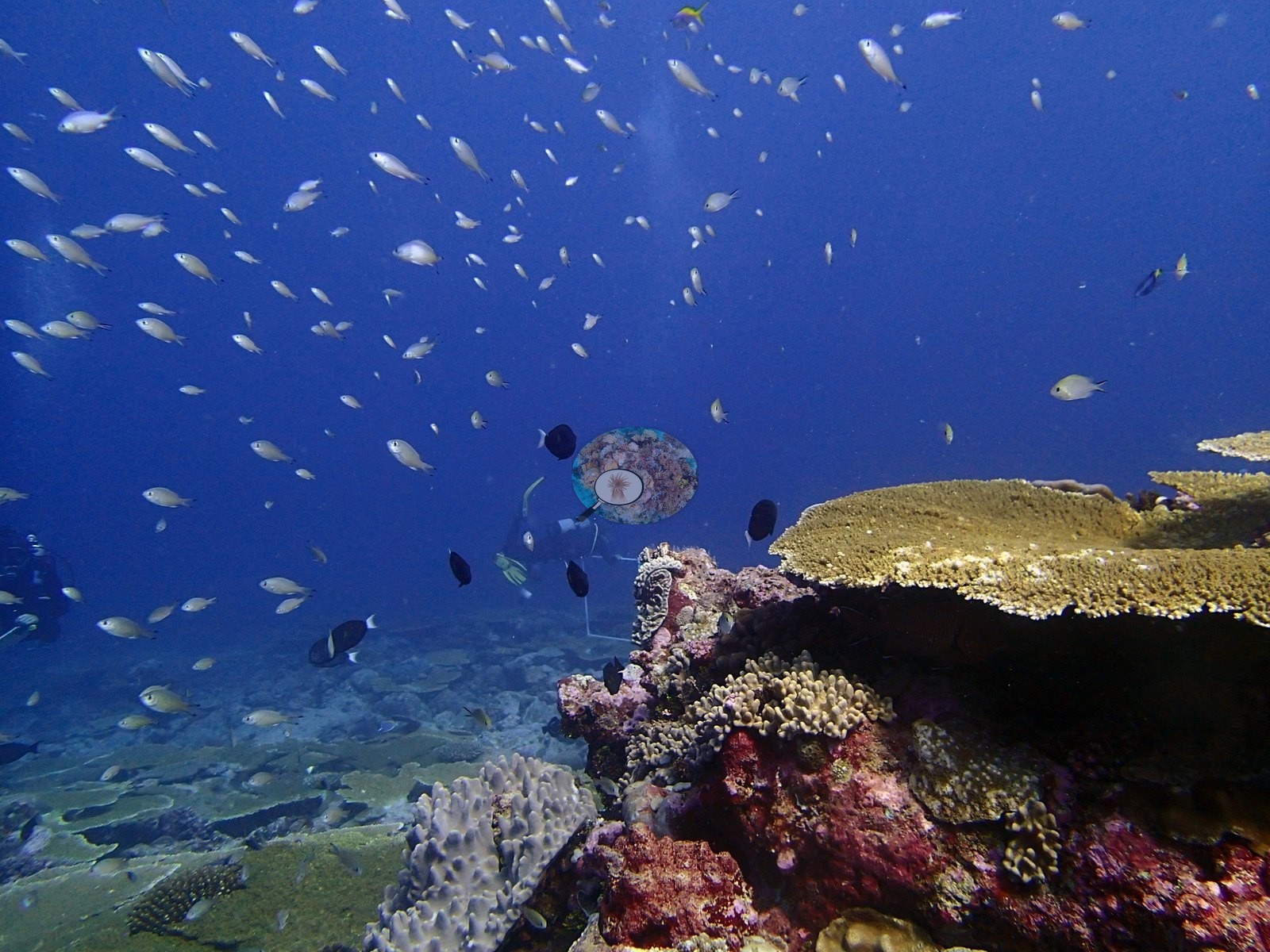
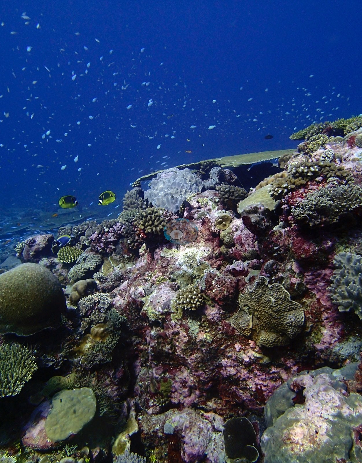
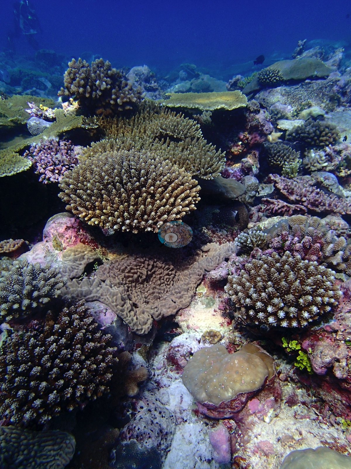
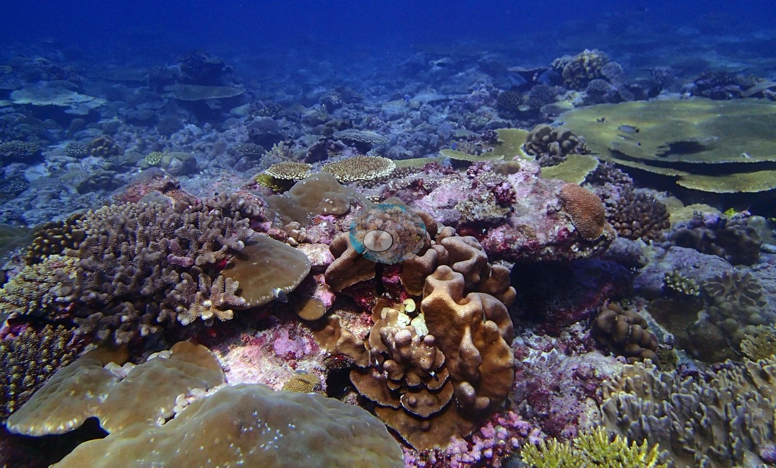
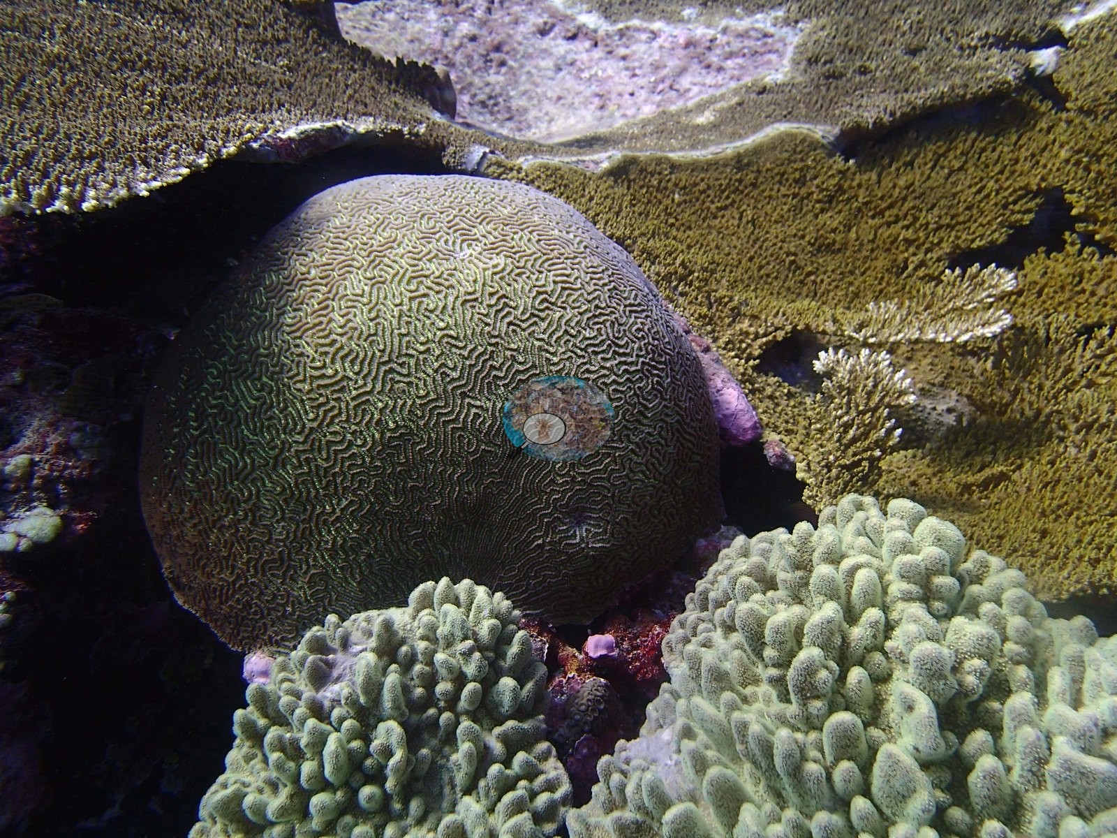
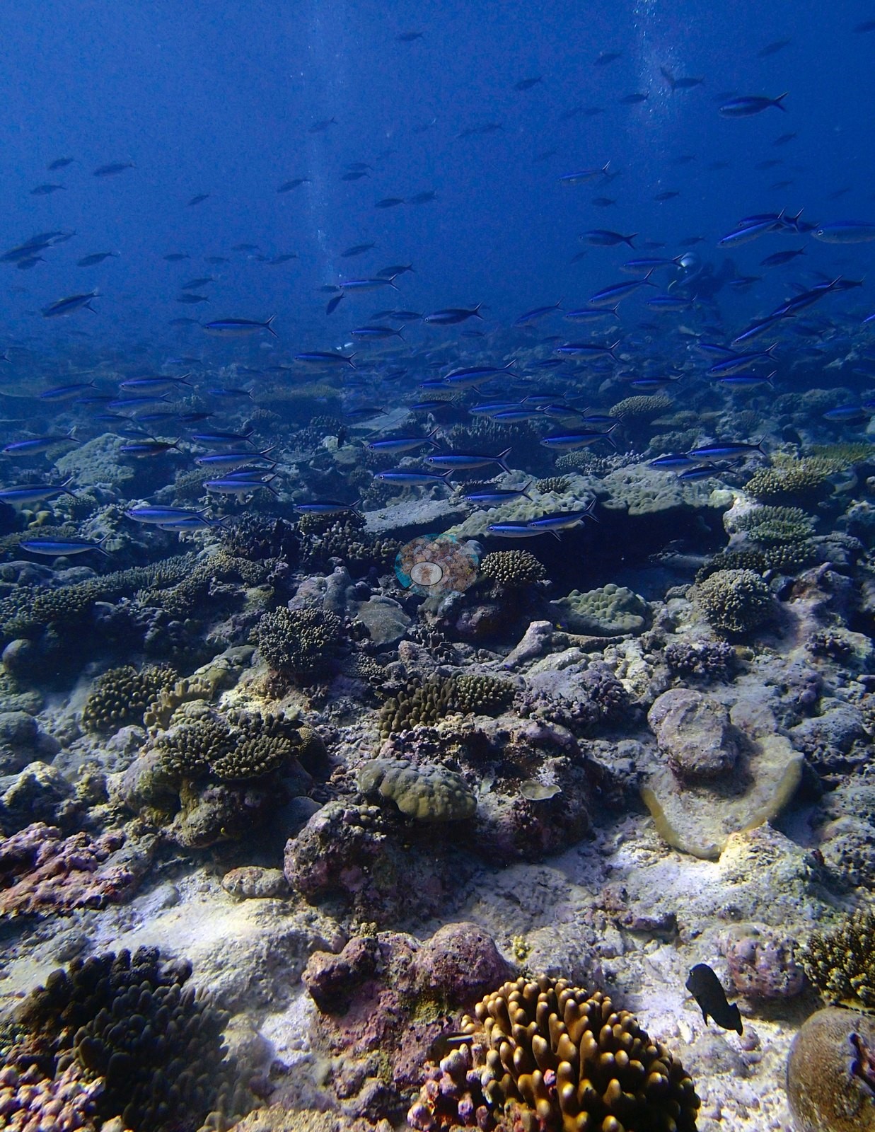
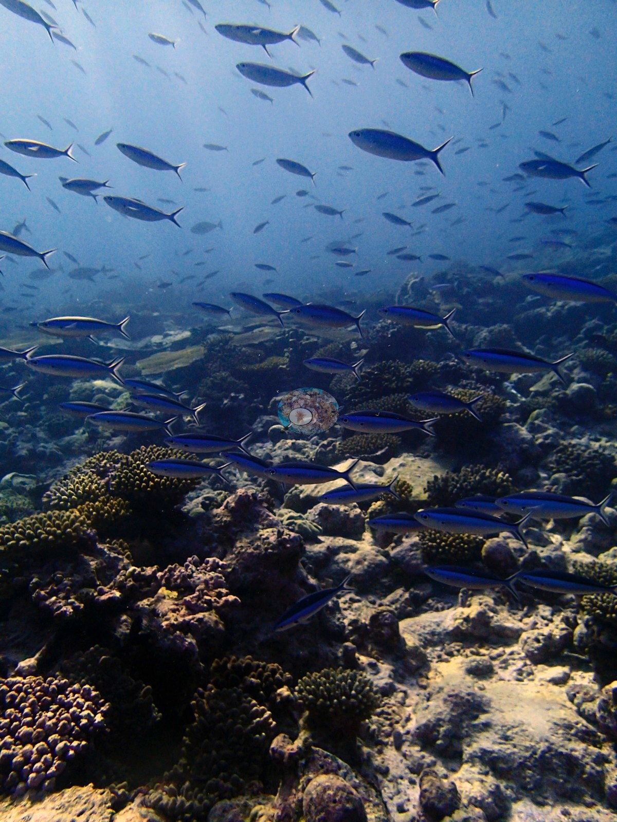
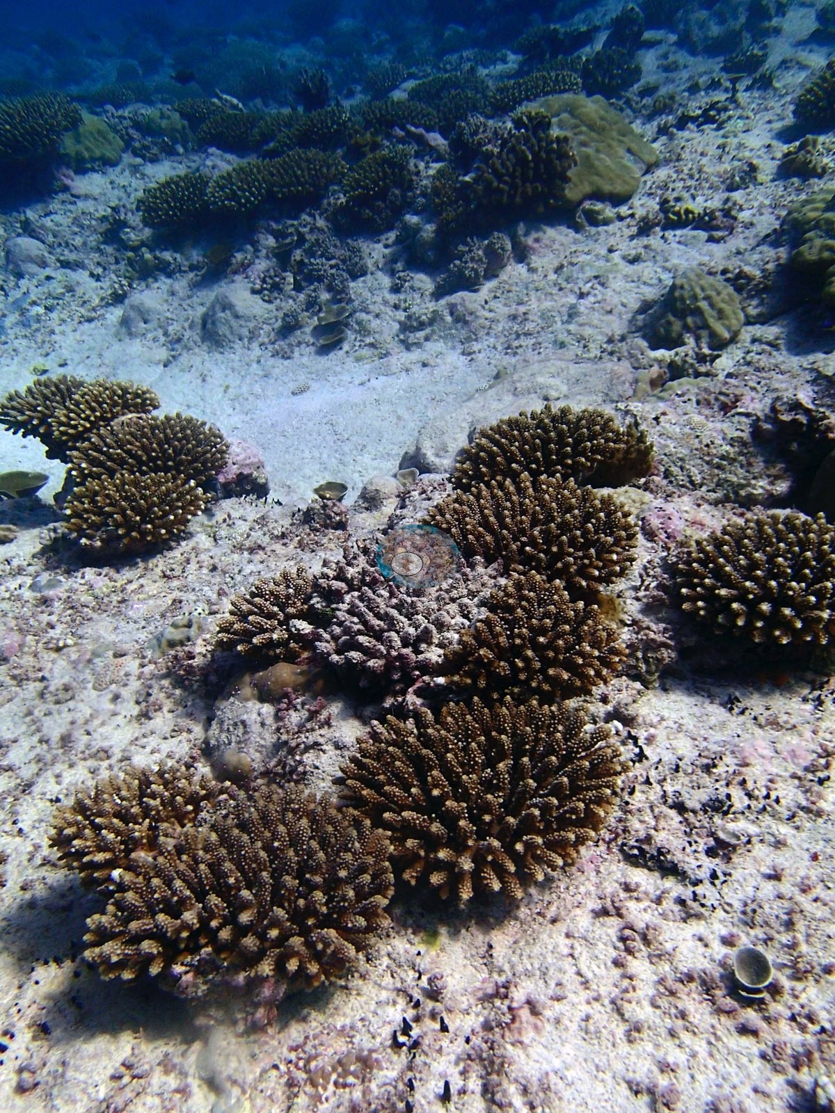
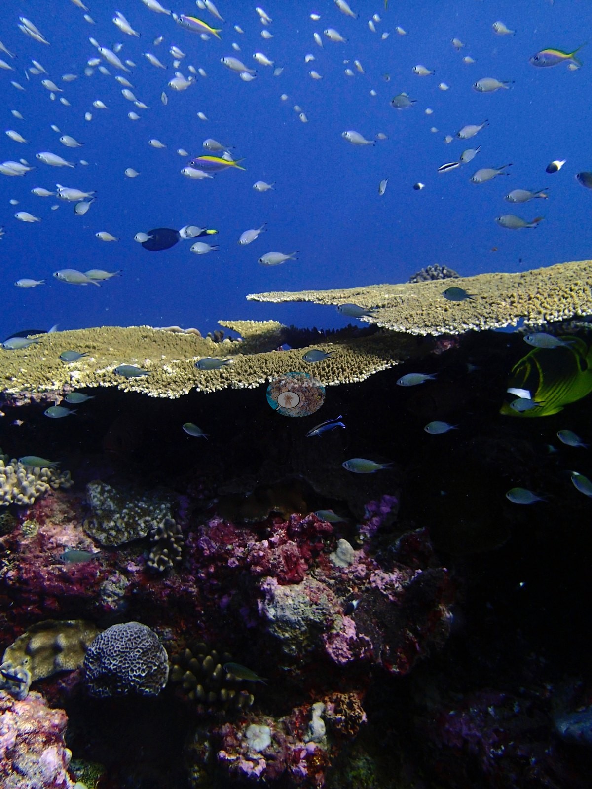
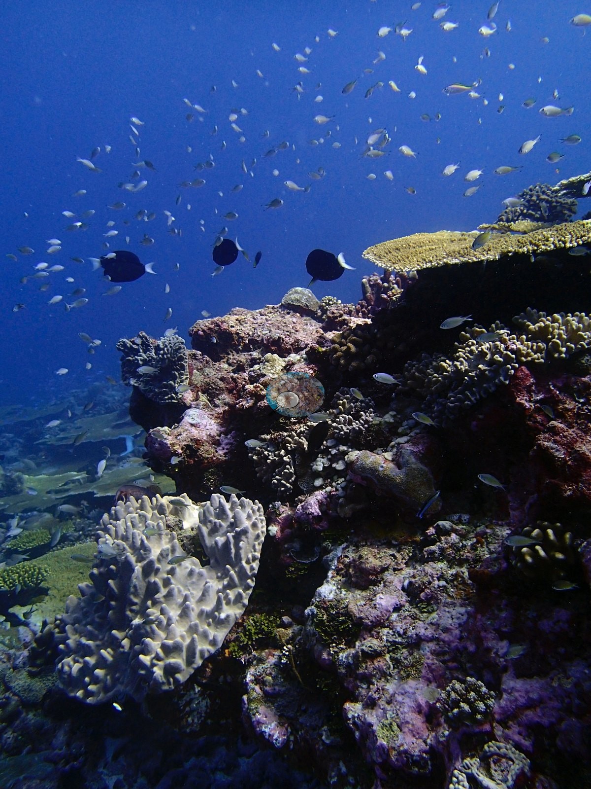
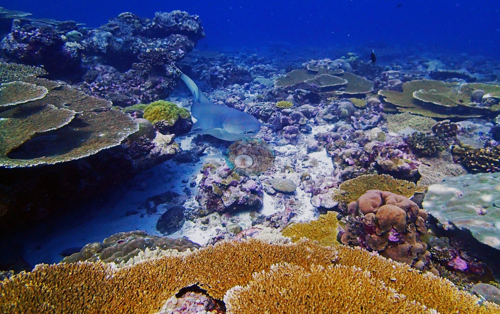
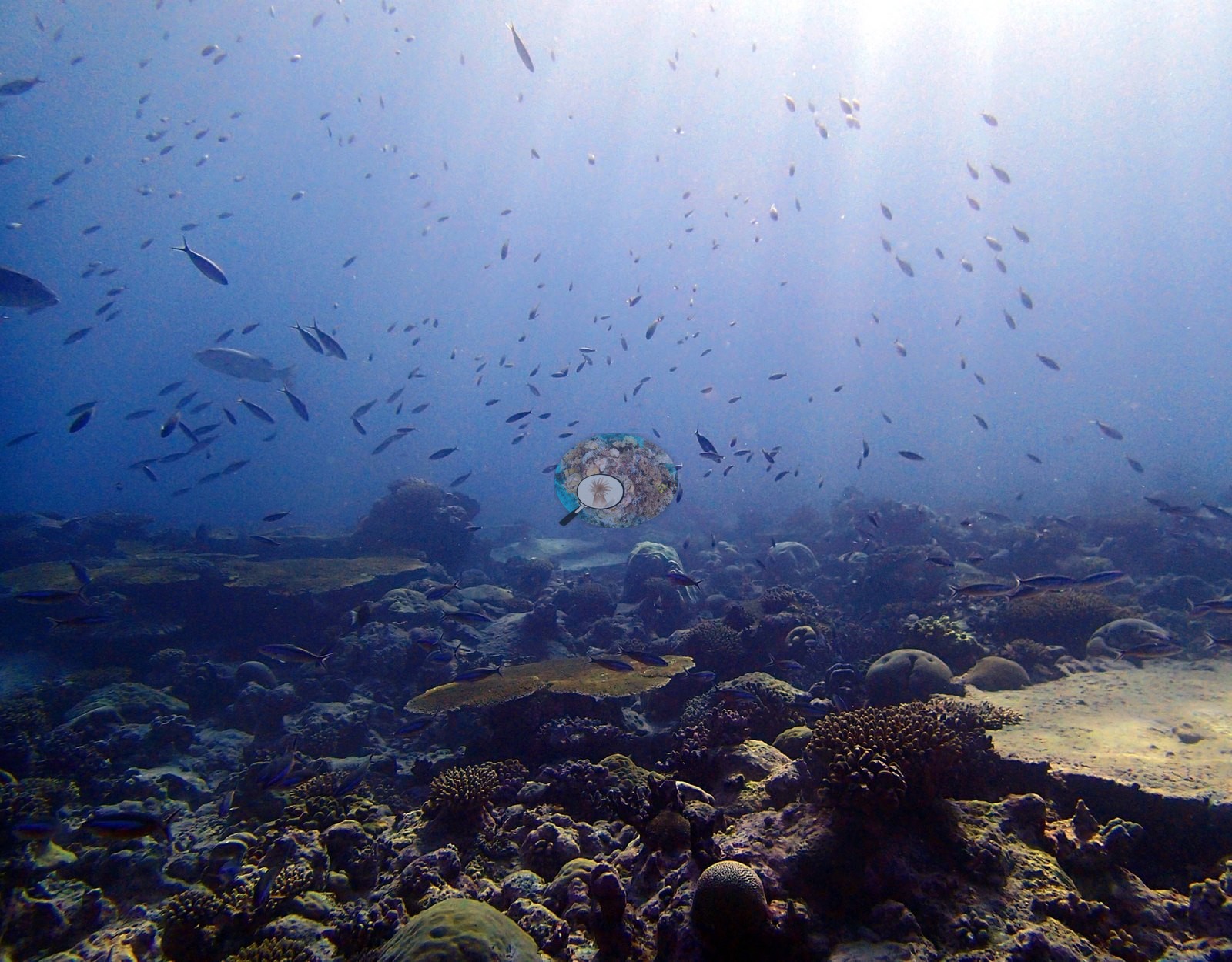
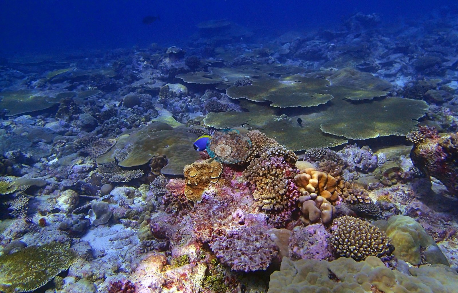
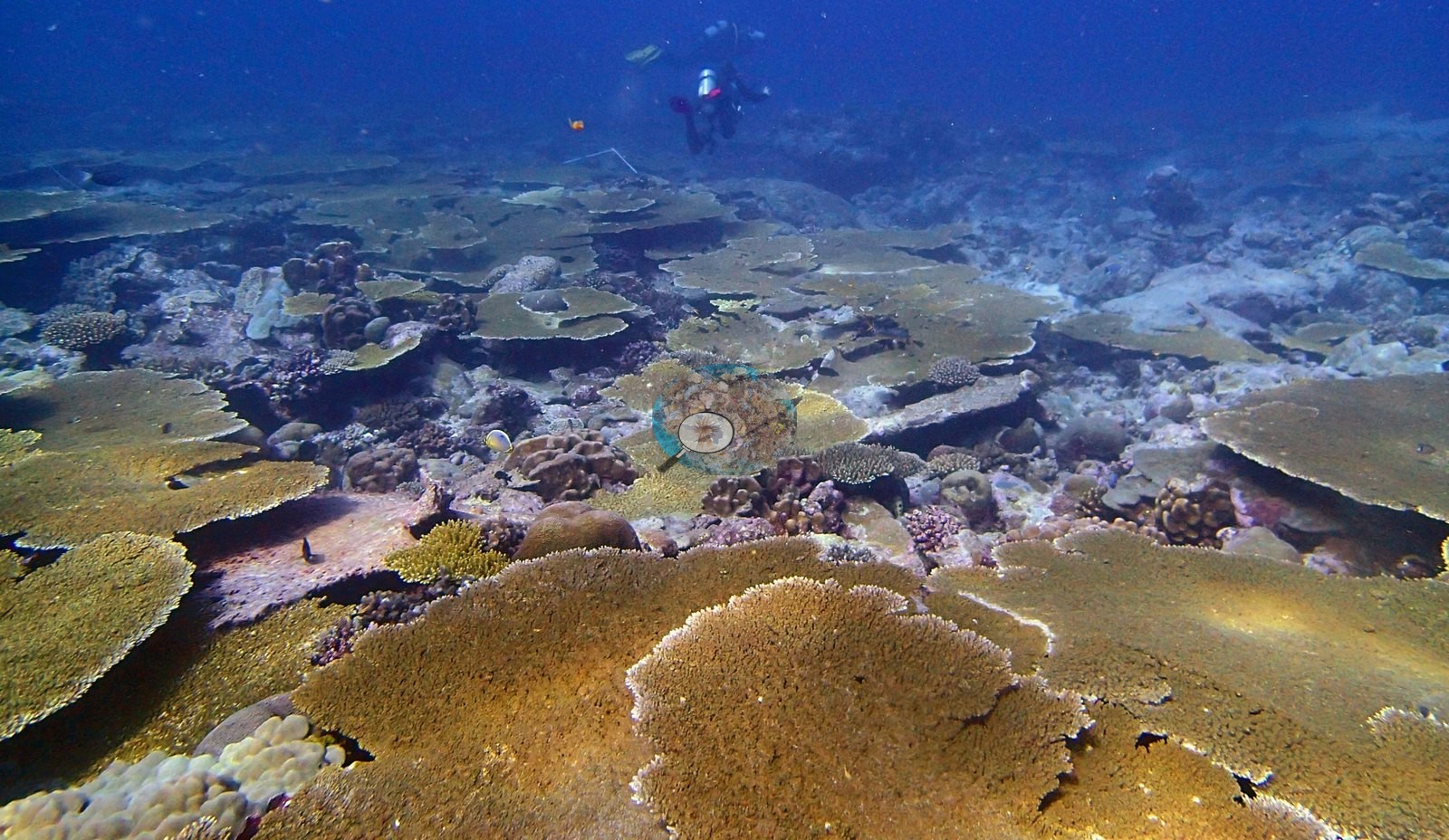
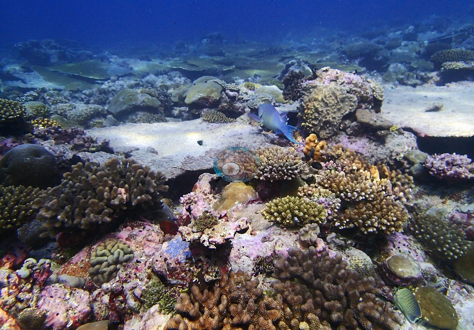
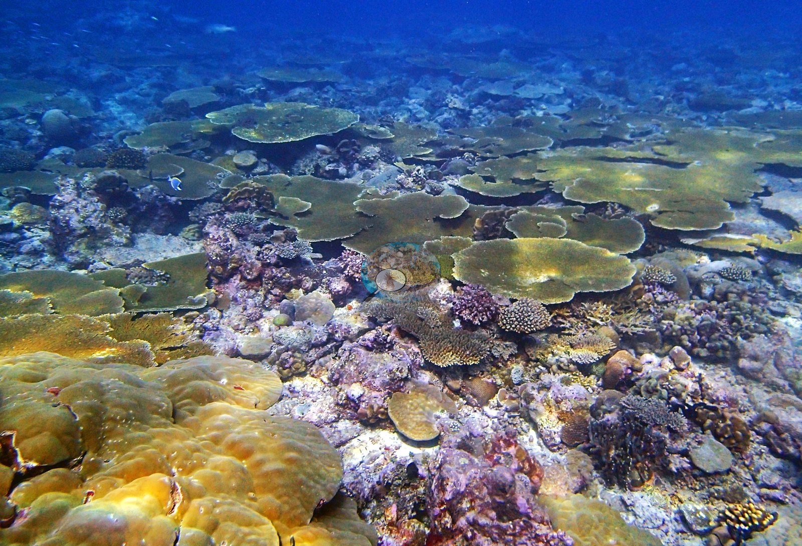
The transect's genus breakdown is the richest description of this reef. Twenty-eight scleractinian genera were recorded. Acropora alone holds 31.55% of the benthos — 53% of all the live coral on the site, and it is the form that builds the reef. Porites follows at 10.41%, then Montipora 3.11%, Favia 2.77% and Pocillopora 2.45%. A well-populated third tier carries Gardineroseris 1.27%, Platygyra 1.06%, Montastrea 0.96%, Stylophora 0.88%, Isopora 0.86%, Favites 0.83% and Goniastrea 0.62%, and a long tail below half a percent adds Pavona (0.45%), Psammocora (0.42%), Leptastrea (0.34%), Symphyllia (0.30%), Cyphastrea (0.20%), Echinopora (0.15%), Hydnophora (0.11%), Mycedium and Turbinaria (0.07% each), Goniopora (0.04%), Pachyseris and Podabacia (0.03% each), Lobophyllia (0.02%), Leptoseris, Oxypora and Astreopora (0.01% each). On the non-coral side the transect gives crustose coralline algae 15.45%, turf 8.96%, invertebrates 5.07%, bare substrate 4.55%, erect algae 3.90%, turf-plus-sediment 1.70% and macroalgae 1.37%. The reef the frames show is a tabular plain of exceptional development. P3120277, P3120278, P3120279, P3120286, and P3120312 show dozens of large olive and gold plates overlapping edge to edge and stepping away to the limit of visibility, with massive Porites bommies wedged between them; in P3120286 the plates step downslope like roof tiles. P3120255 and P3120266 add big yellow-green tables in the shallows. Between the plates the substrate is a pink, mauve and maroon crustose-coralline pavement (P3120253, P3120311) carrying corymbose and digitate Acropora in tan, gold and a distinctive purple-mauve (P3120256, P3120281, P3120311), knobby and lobed Porites, Pocillopora-type clumps, faviids, and encrusting Montipora. That bare-looking pink pavement is well consolidated and reads as ordinary architecture for this reef rather than as loss. The plates shade deep black undercuts (P3120289, P3120290) holding small cryptic colonies and coralline crusts. Two macro frames are outstanding: P3120285, a large green meandroid brain compatible with Platygyra or Leptoria with tight sinuous valleys, flanked by pale-green knobby Porites; and P3120257, a plocoid colony with raised polygonal corallites among golden Porites and white-tipped Acropora. A second meandroid brain sits in P3120291. Brown foliose and encrusting sheets appear in P3120297 and P3120312, and green Halimeda-type calcified algal tufts in P3120254 and P3120256. P3120311 records a distinct habitat — discrete corymbose Acropora colonies scattered like garden plantings across clean white sand.
Coral cover
The LOF benthic transect is this site's measurement. Coral cover at BIDI08 is 59.0%, from the LOF BIOT-1 in situ transects (Mayfield & Dempsey 2026, Oceans, suppl. S1) — the highest transect cover of any site in the reviewed Chagos set, against algal cover of 31.4% of the benthos. That diver transect is the authoritative record of cover and community here; everything photographic below supplements it and none of it qualifies, adjusts or disputes it. No depth-stratified transect means (D1–D4) are carried for this site and no per-frame depth data exist; 59.0% is the site value as published. Coral cover across methods, and why they differ. Presented as a method comparison only — the transect is the measurement. Transect 59.0% · CoralNet points 35.0% · Coralscapes masks 33.6% (n = 16 photos in the multimethod row). Deviation against the transect runs −25.4 to −24.0 pp; mean of three 42.5% ± 14.3, where that spread reflects systematic method bias rather than precision. This is the largest photo-vs-transect gap in the archipelago, and the two image methods agree closely with each other while both sitting roughly 25 points below the diver survey. The frames explain it: this reef's cover is carried by large horizontal tabular Acropora plates, which a downward or oblique photograph foreshortens badly and which mask-based segmentation under-calls wherever a plate edge shadows the substrate beneath it. It is the clearest single illustration in the Chagos set of the archipelago-wide finding that the photo-vs-transect gap grows with cover, and it should be cited as such rather than treated as a model failure. Also on record for this site: Assemblage composition. The Coralscapes and CoralNet figures are given in the cover line above, and this site produces the largest photo-vs-transect gap in the archipelago — around -25 pp. That is worth stating plainly: the two photo methods agree closely with each other (35.0% and 33.6%) and both fall roughly 25 points below the transect. The frames explain why. This reef's cover is carried by large horizontal tabular plates, which a downward or oblique photograph foreshortens badly and which mask-based segmentation tends to under-call where plate edges shadow the substrate beneath. It is the clearest single illustration in the Chagos set of the archipelago-wide finding that the photo-vs-transect gap grows with cover, and it should be cited as such rather than treated as a model failure.
Stressors
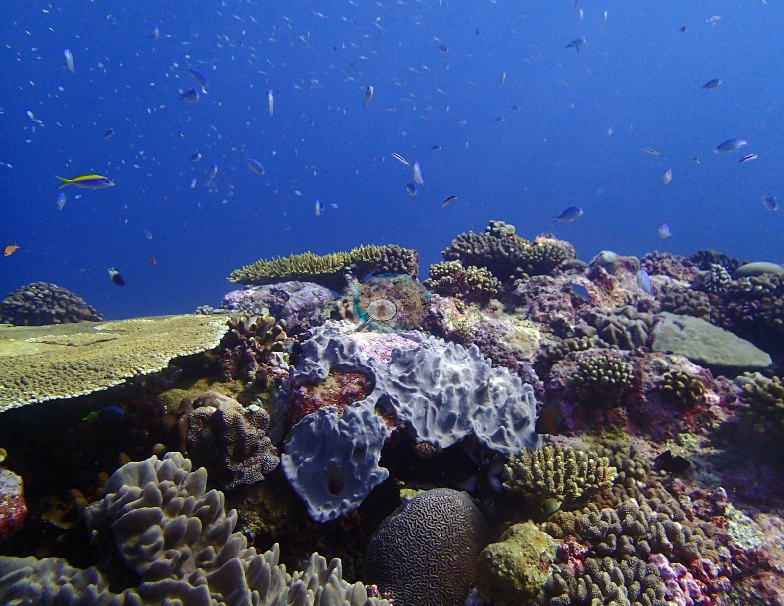
Condition. Anderson's published per-site bleached fraction for BIDI08 is 1.7% (Mayfield & Dempsey 2026), and that figure is the authority on this site's bleaching — nothing below is a measurement of it and no percentage is derived from any photograph. Qualitatively, the frames show a structurally sound reef: no colony in the folder reads as unambiguously bleached, and the three pale features worth logging are each better explained by something else. P3120278 shows a large table whose center has gone pale pink-white across a broad area while its margins remain pigmented, and P3120288 a pale gray-white knobby colony in the foreground; both read as localized mortality or partial paling rather than active thermal bleaching, which on a 12 March dive at a site of this cover is the more plausible interpretation. The chalky gray-white lobed structure prominent in P3120291, and again in P3120294, is a sponge, not a coral — its oscula are visible at full size — and must not be counted toward benthic coral cover or read as whitened tissue. The extensive bare pink CCA pavement between the tables (P3120294, P3120297, P3120312) is likewise normal reef architecture at this site rather than loss: the tables are healthy and the pavement is well consolidated. No crown-of-thorns starfish (COTS) or other corallivores evident.
Fish and other fauna
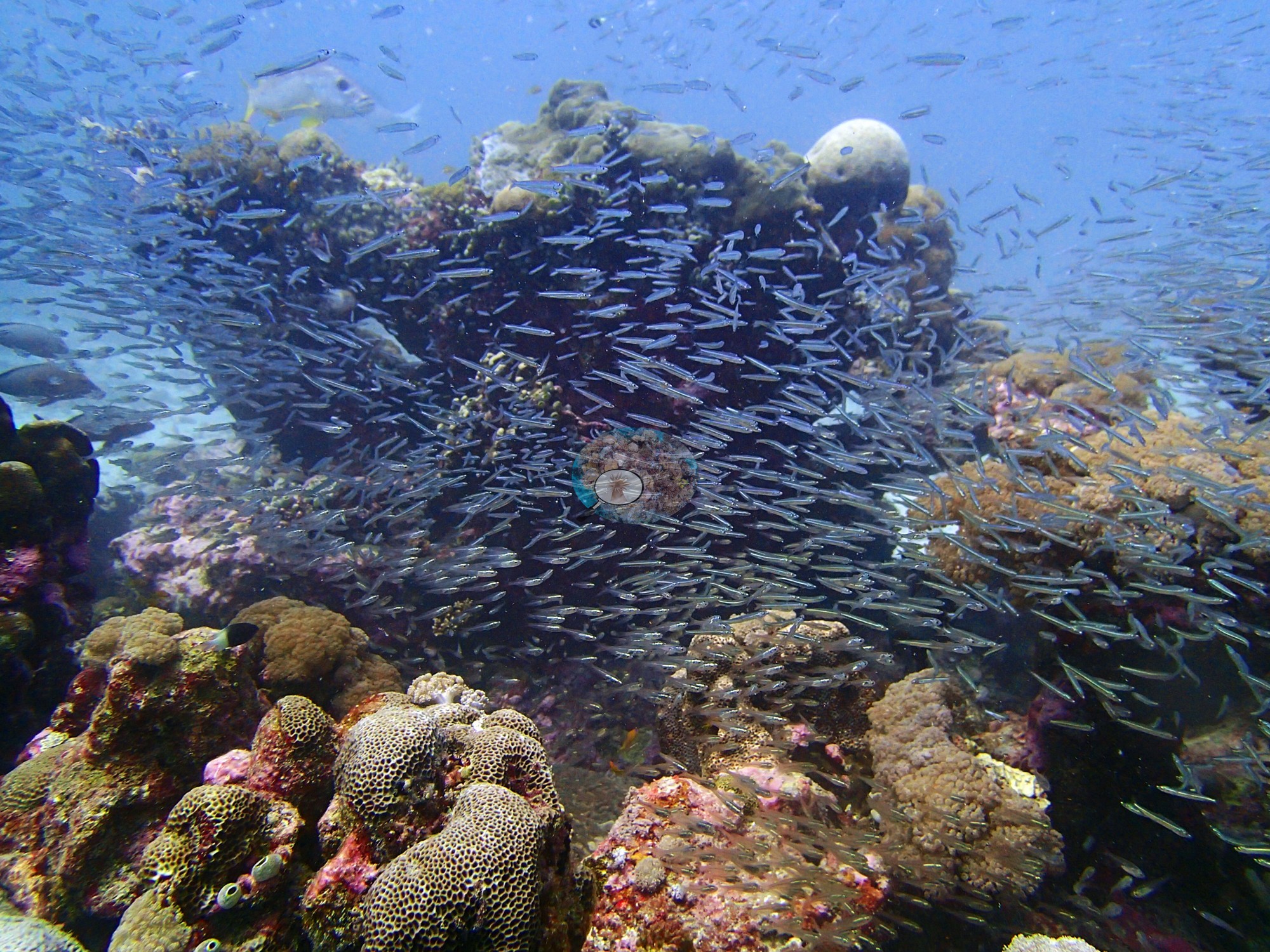
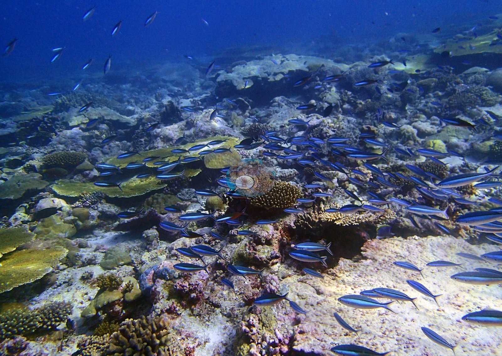
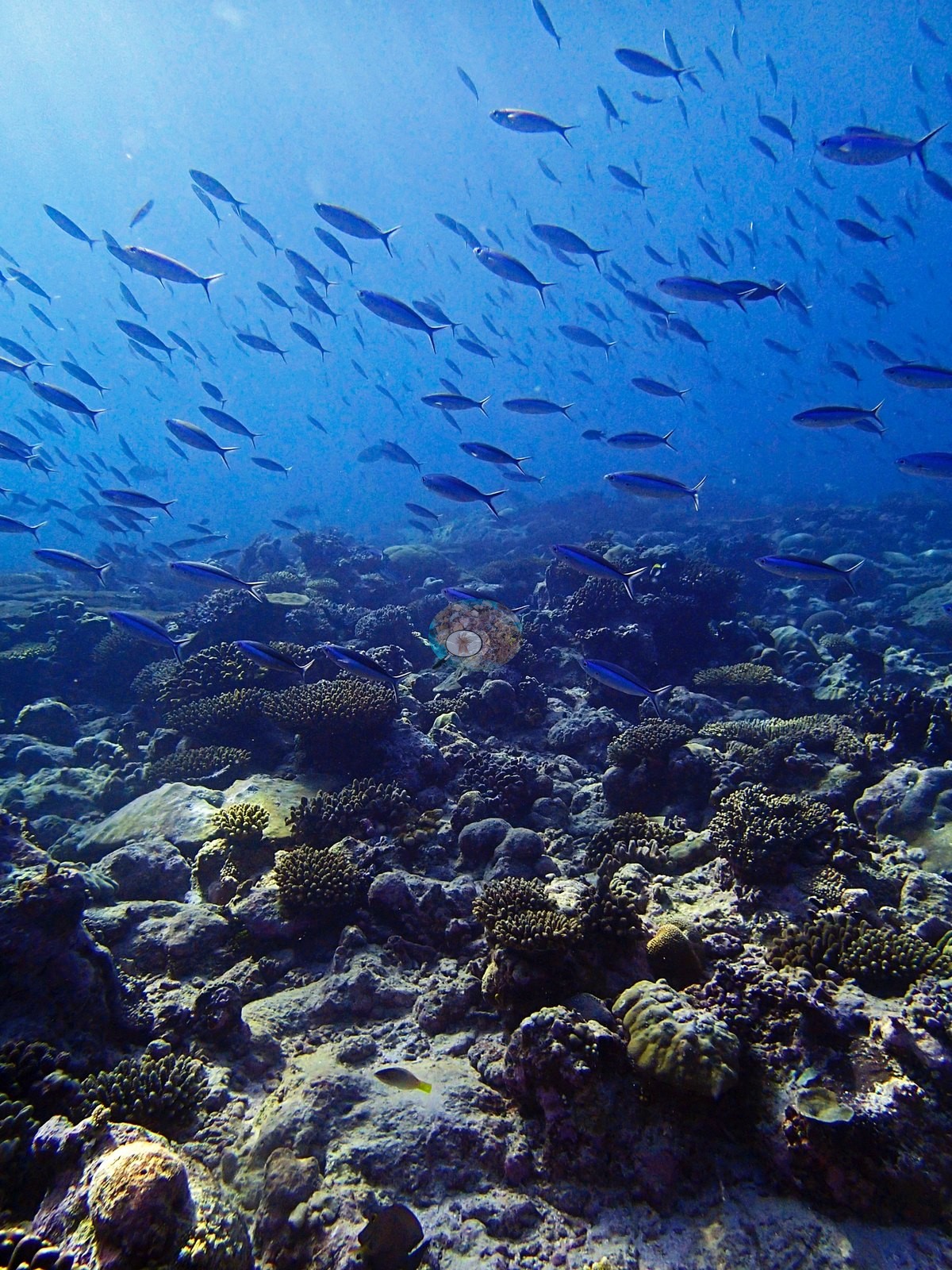
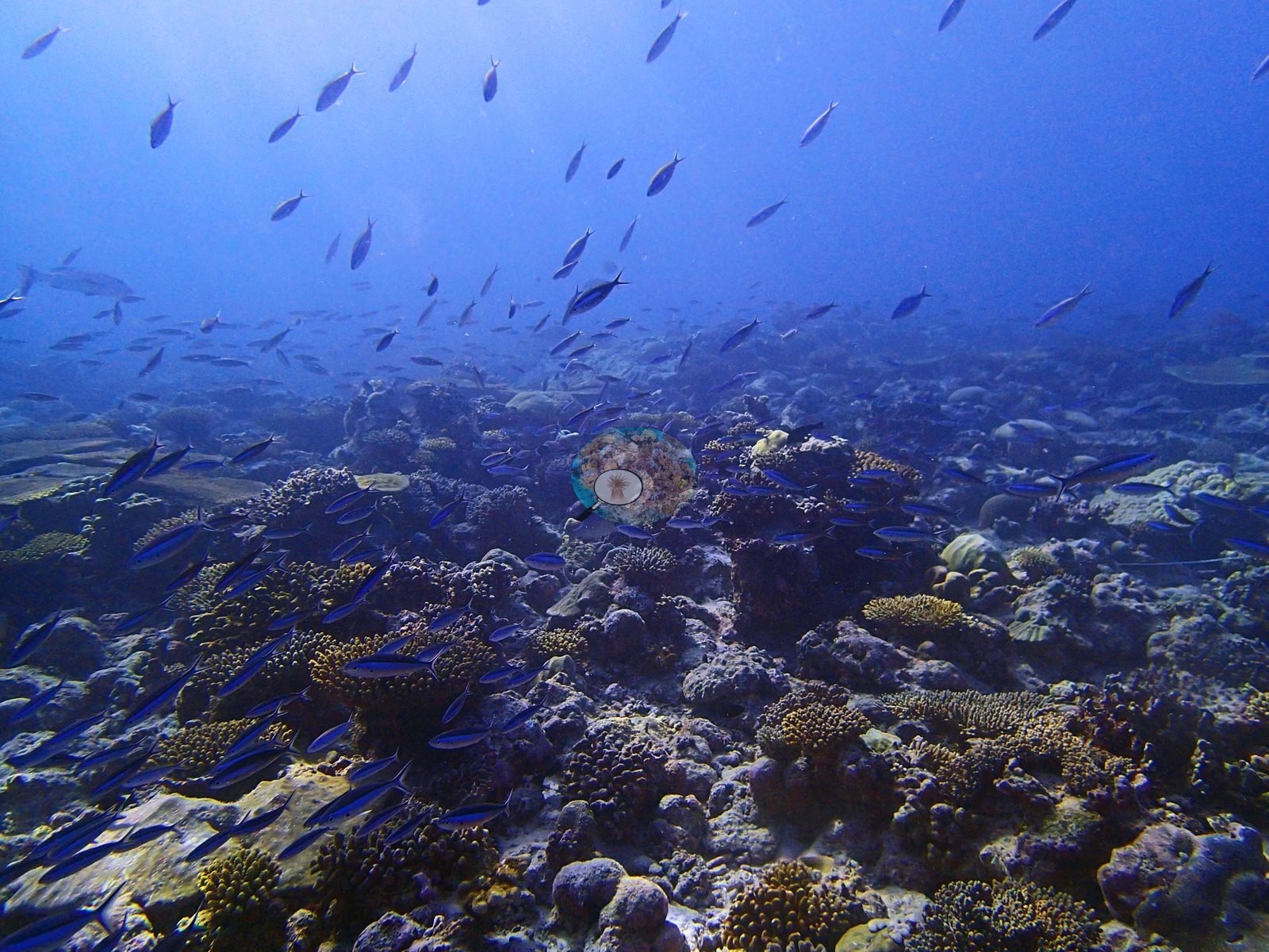
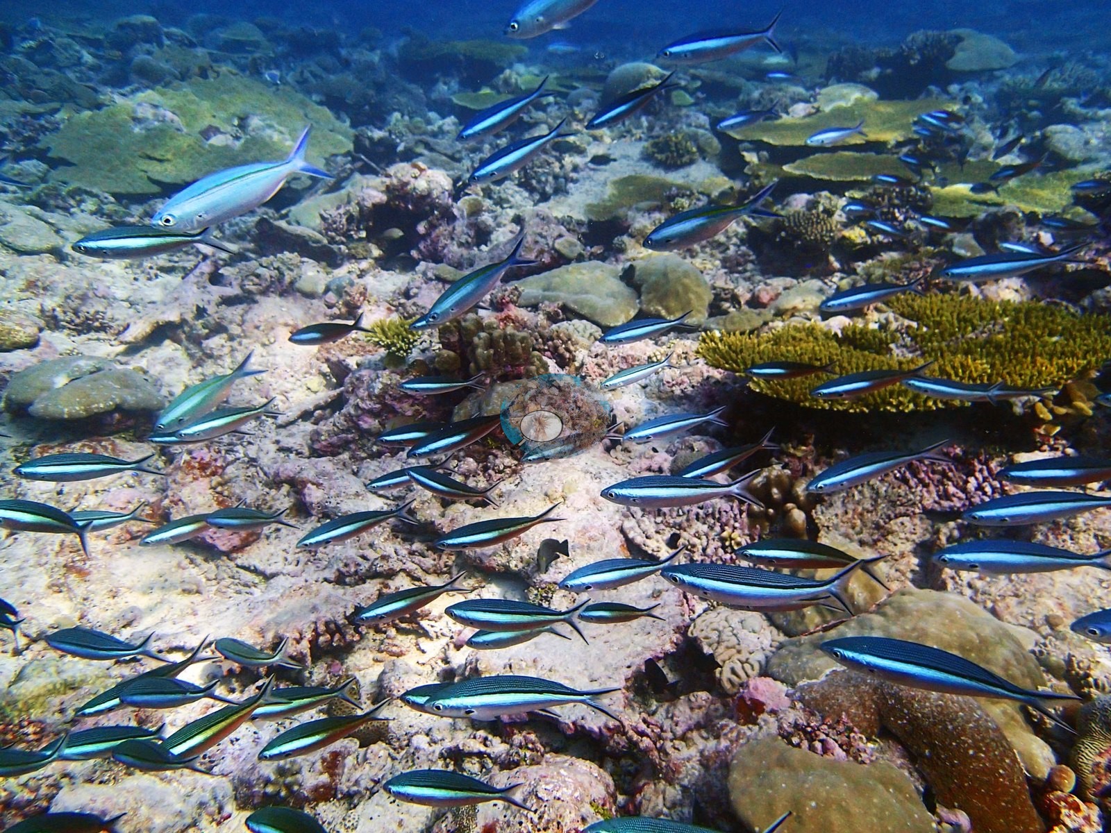
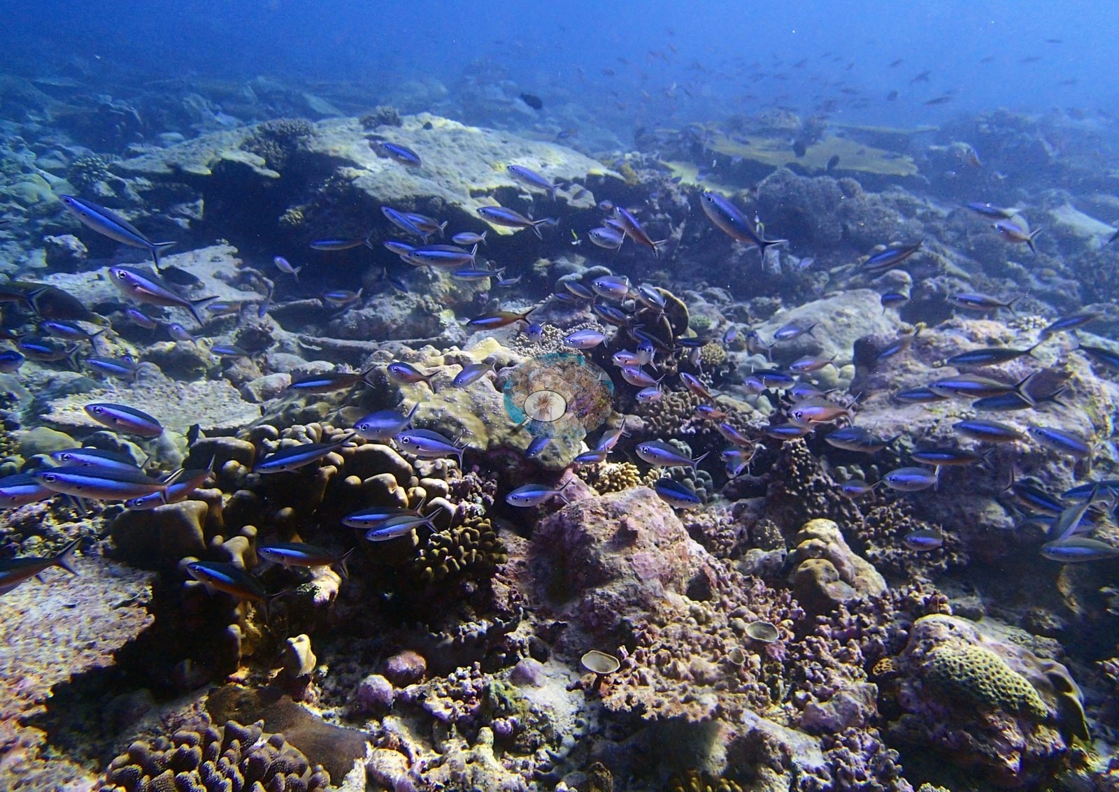
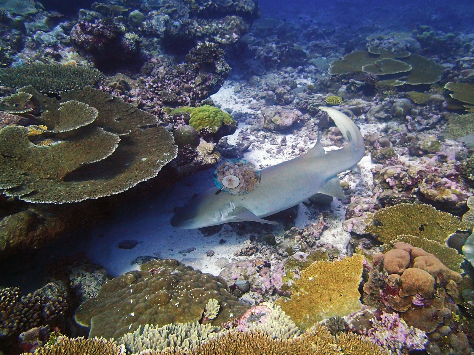
Fauna. The dive is dominated by two things. First, fusiliers: P3120259 through P3120269 are an almost unbroken run of blue-backed and blue-and-yellow Caesio- or Pterocaesio-type schools streaming over the reef, several frames holding well over a hundred fish; P3120263 and P3120267 are essentially water-column frames carrying no benthic information at all. Second, whitetip reef sharks — P3120281 and P3120282 are unambiguous Triaenodon obesus, slender and blunt-headed with white-tipped dorsal and caudal lobes, one photographed at close range resting on sand beneath a tabular Acropora. That is a different animal from the gray reef and silvertip sharks at Egmont, and gives Danger Island a third shark species for the trip. P3120254 is the single best invertebrate image reviewed in the Chagos set: a giant clam compatible with Tridacna, mantle fully extended, deep purple-black shot through with iridescent blue-green flecking, wedged into pink coralline pavement. Reef fish include raccoon butterflyfish compatible with Chaetodon lunula (P3120289, P3120294), powder-blue surgeonfish compatible with Acanthurus leucosternon (P3120277, P3120296), a large jobfish or snapper compatible with Aprion or Lutjanus (P3120284, P3120286), parrotfish, and dense Chromis clouds over the plates (P3120288, P3120289, P3120290, P3120294).
Comparisons with other data
No independent survey was made at this exact site; the nearest ones are listed in the table below.
Other notes
Image-by-image. All 36 frames of Anderson's own edited folder BiDi08-meter site-finished were reviewed; there are no sampled-colony frames, so the photographic account is habitat throughout. The site's methodological content is the strongest in the Chagos set, and it explains the folder's "meter site" tag. Three frames show the survey in progress — P3120280 has a diver holding the white PVC quadrat frame squarely on the reef with a second diver at right; P3120279 and P3120290 put divers and the frame over the tabular plain. But P3120298 is the important one: a gray cylindrical instrument housing, cable-tied to a mount with two upright black rods, sits deployed on the pavement beside a yellow mesh collecting bag and a blue-and-white sampling tube on a Porites bommie, with a vertical line running up out of frame. That is deployed instrumentation, not a hand-held tool — most consistent with a logger or meter left in place, which would account for this being designated the "meter site". Anyone reconstructing where in situ instrument records came from should start with this frame.
CV model comparison
More info
Those are point counts on the photographs; this is a diver swimming a transect. The models and the reference never saw the same thing. ⚠ SITE-LEVEL ONLY. The 2,500 frames were not associated with any transect taken within 200 m of them, so transect-vs-image comparisons are site means, never frames. The transect value is already in the pin `cover` field (109 of 112 pins, sourced to the paper's suppl. S1) and is read from there, never re-imported. The transect is THE coral-cover value for this site and stands alone. The rows below it are a methods comparison only: no computer-vision value is averaged with it, feeds the headline, or carries over to the site's cover figure (Anderson, 2026-09-22).| Method | Hard-coral cover (%) |
|---|---|
| Transect (published) | 59.0 |
| CoralNet | 36.4 |
| In-house DINOv3 | 29.1 |
| CoralSCOP edited | 38.9 |
| Claude | 35.2 |
Independent surveys nearby
Within 5 km, 2 independent survey stations recorded hard coral cover in 2015. The most recent nearby survey is from 2015, so these values predate recent heat stress. This site's own estimate (59%) sits 34.1 points above the range of these surveys (6.3–25%); the methods differ, so the comparison is context, not a like-for-like test.
Collected by other programs using different methods (the XL Catlin Seaview Survey uses photo-transects with automated image annotation), so these are context for the figures above, not a like-for-like comparison. Where a station was surveyed more than once the range is shown. Station names are not dive-site names.
| Agency | Site / location | Date | Hard coral cover (%) | Distance | Link |
|---|---|---|---|---|---|
| XL Catlin Seaview Survey | transect 36002 | 2015 | 25% | 1.53 km | — |
| XL Catlin Seaview Survey | transect 36001 | 2015 | 6.3% | 2.02 km | — |
Data & links
- Read the full site report ↗
- Download benthic survey data (CSV) ↗
- Download all LOF-GRE data (933 sites) ↗
- CoralNet image repository for this region ↗
- Photo portfolio ↗
- Coral Reef Diagnostics page for this area ↗
All images from Coral Reef Diagnostics. Data are from Coral Reef Diagnostics and the organizations named in the data-sources table above.
© Coral Reef Diagnostics.