
Part of the regional summaries: Chagos Archipelago - Salomon / Blenheim / Speakers Bank and Chagos Archipelago
More info
Chagos (NOAA CRW virtual station)This Blenheim forereef carries 38% coral cover, with bleaching limited mostly to branching Acropora and Pocillopora colonies while massive and meandroid corals stayed fully pigmented. Fish life includes Moorish idols, bannerfish, and fusilier schools typical of a healthy, unfished reef. Surveyed on the Living Oceans Foundation's Global Reef Expedition.
One independent survey station shown with the program’s logo — click one to see how far it is from this site.
One other CRD dive site within 5 km shown in orange — click a marker to open its page.
🗺 Detailed map of the Global Reef Expedition dive sites, Blenheim Reef, Chagos (Khaled bin Sultan Living Oceans Foundation; opens in a new window)
Site description
General benthic features
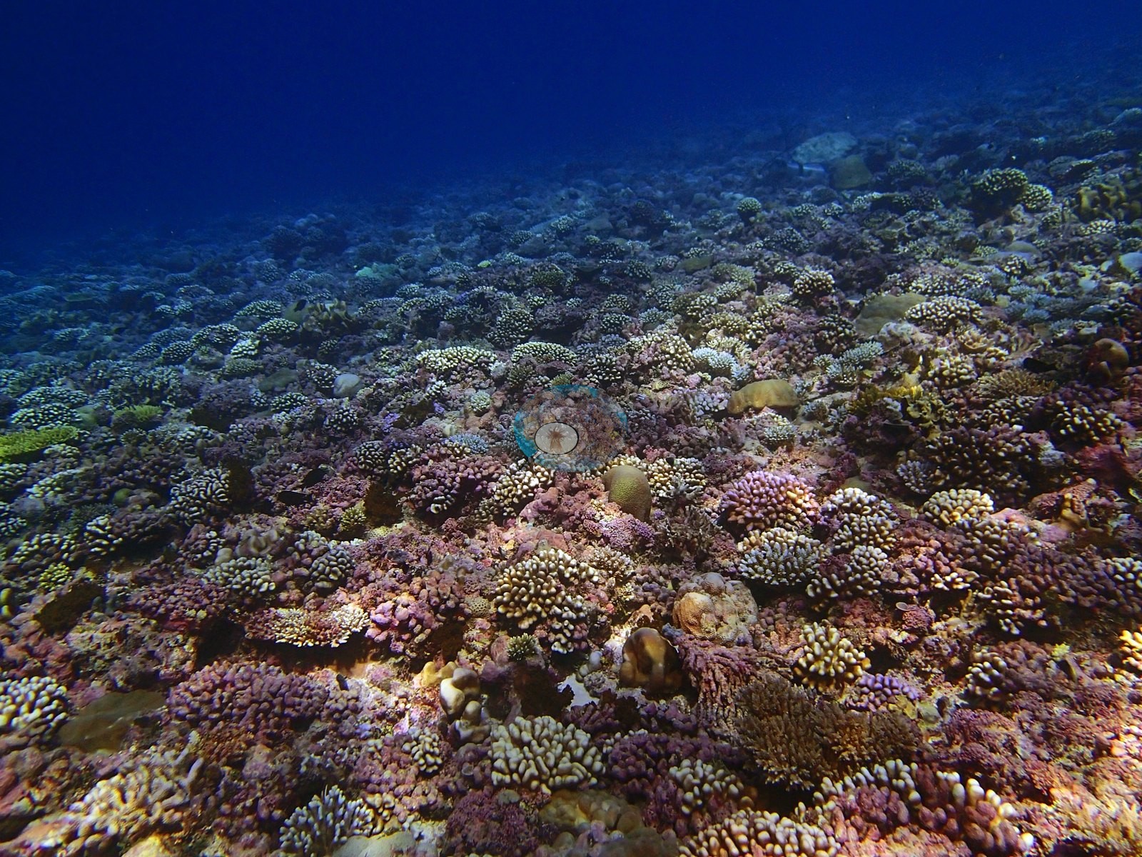
The two image products also disagree with each other on what the coral is, and the reason is their label sets rather than the reef. Coralscapes makes massive and meandroid its largest live component (30.9% of live cover) and then apportions other hard coral 25.2%, Stylophora 13.9%, Acropora (non-tabular) 9.5% and Millepora 7.8%; the point annotation has no Stylophora or Millepora class in play here at all and apportions live coral to other hard coral 39.1%, Acropora 30.4%, Porites 29% and Pocillopora 1.4%. The dense small digitate and corymbose colonies that dominate the wide frames are precisely the material these coarse classes handle worst. Non-coral cover in the point set is dominated by turf (16.5% of all points) and crustose coralline algae (12.8%), and structural loss registers as dead coral 3.6% of image area with rubble at 0.9%.
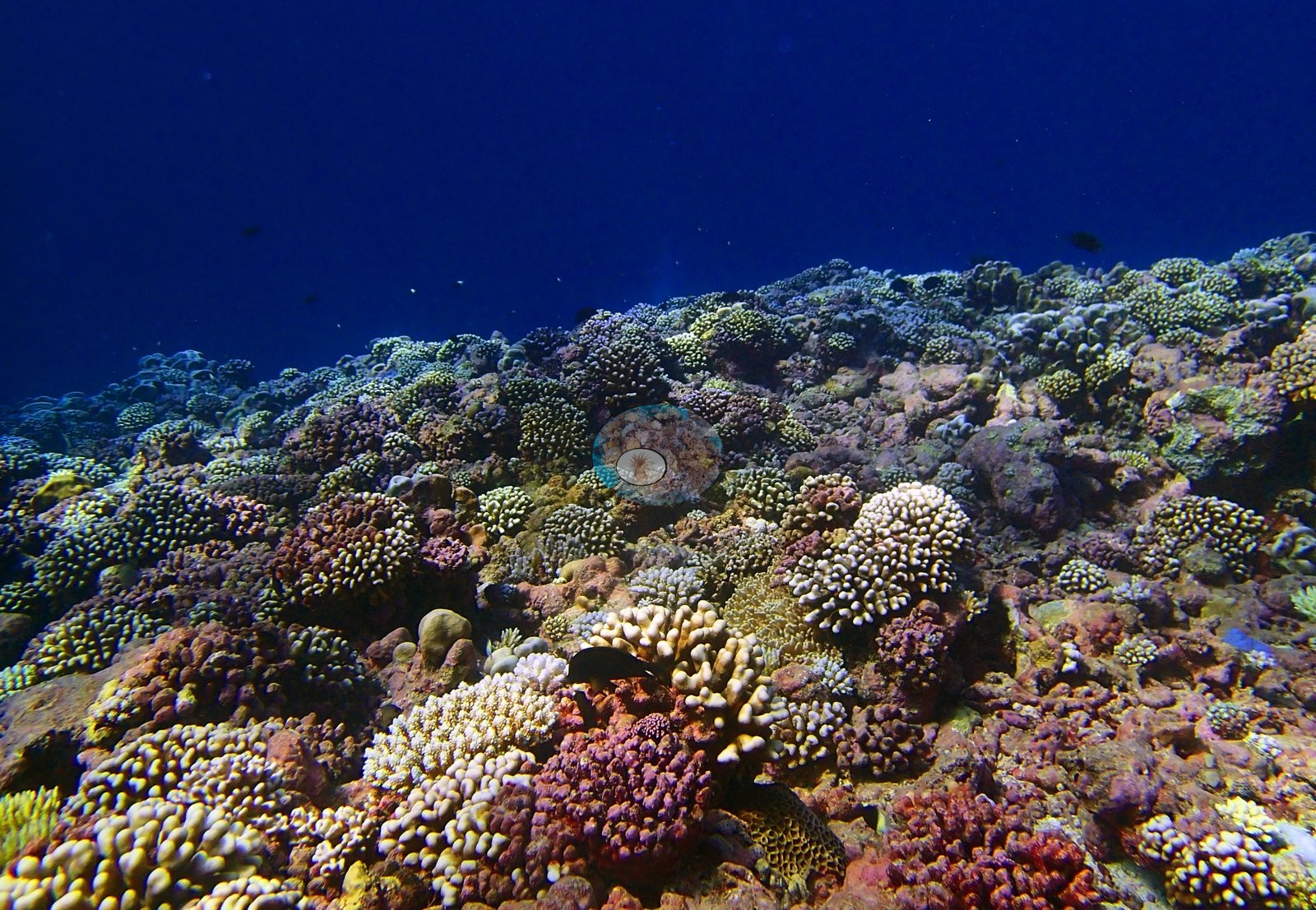
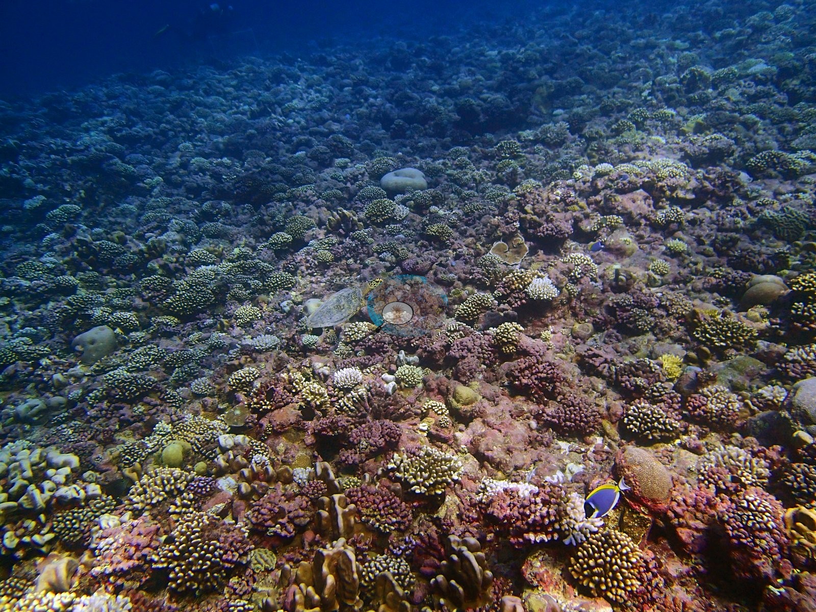
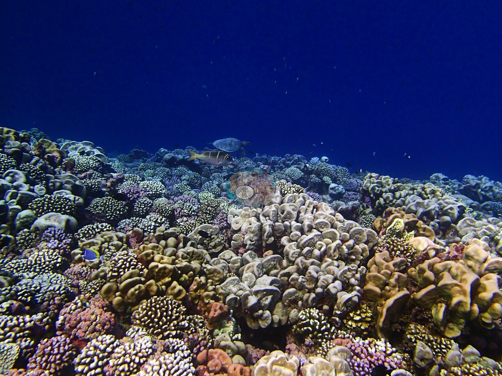
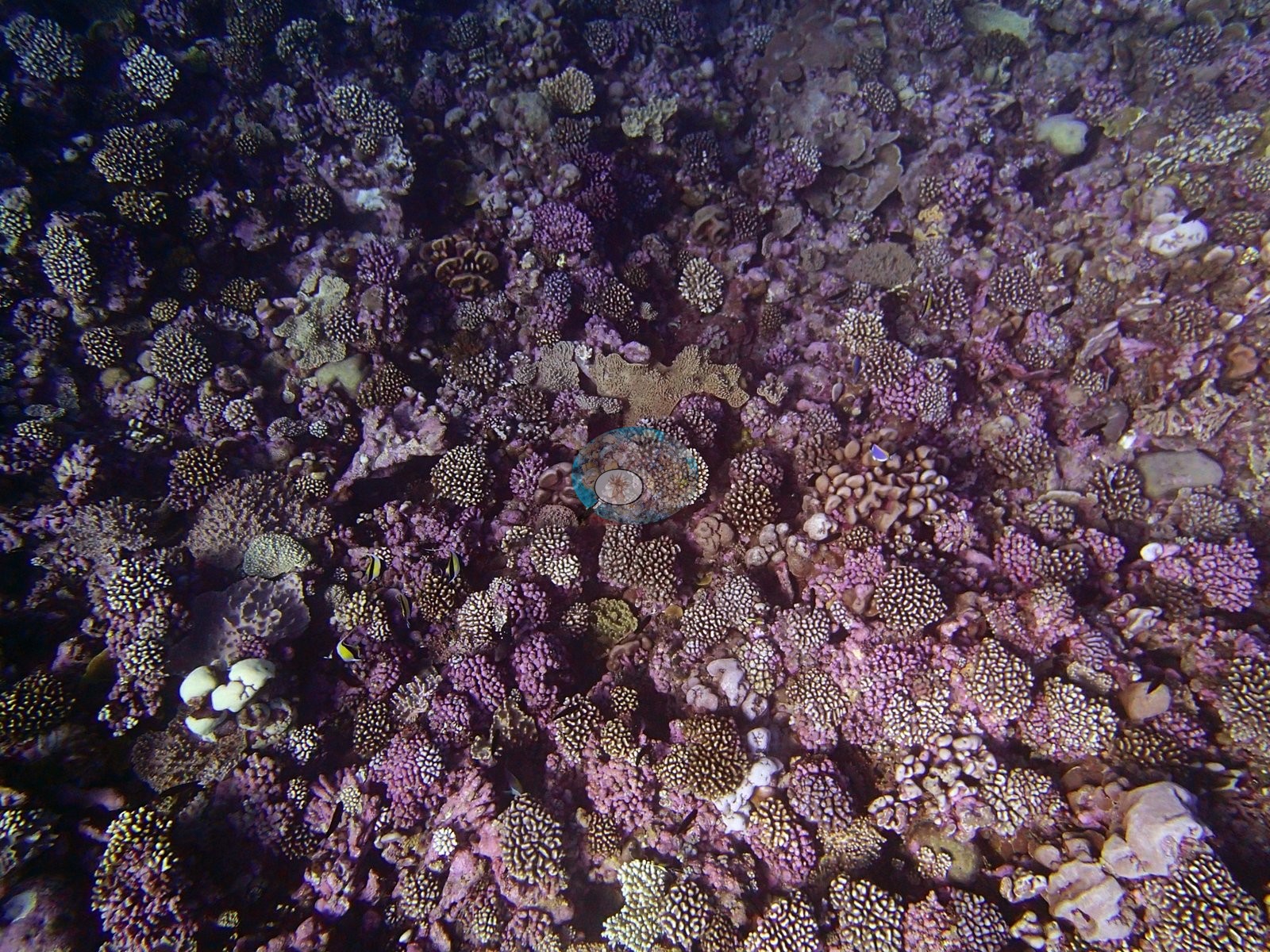
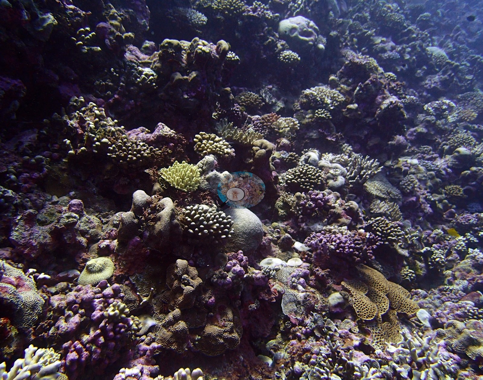
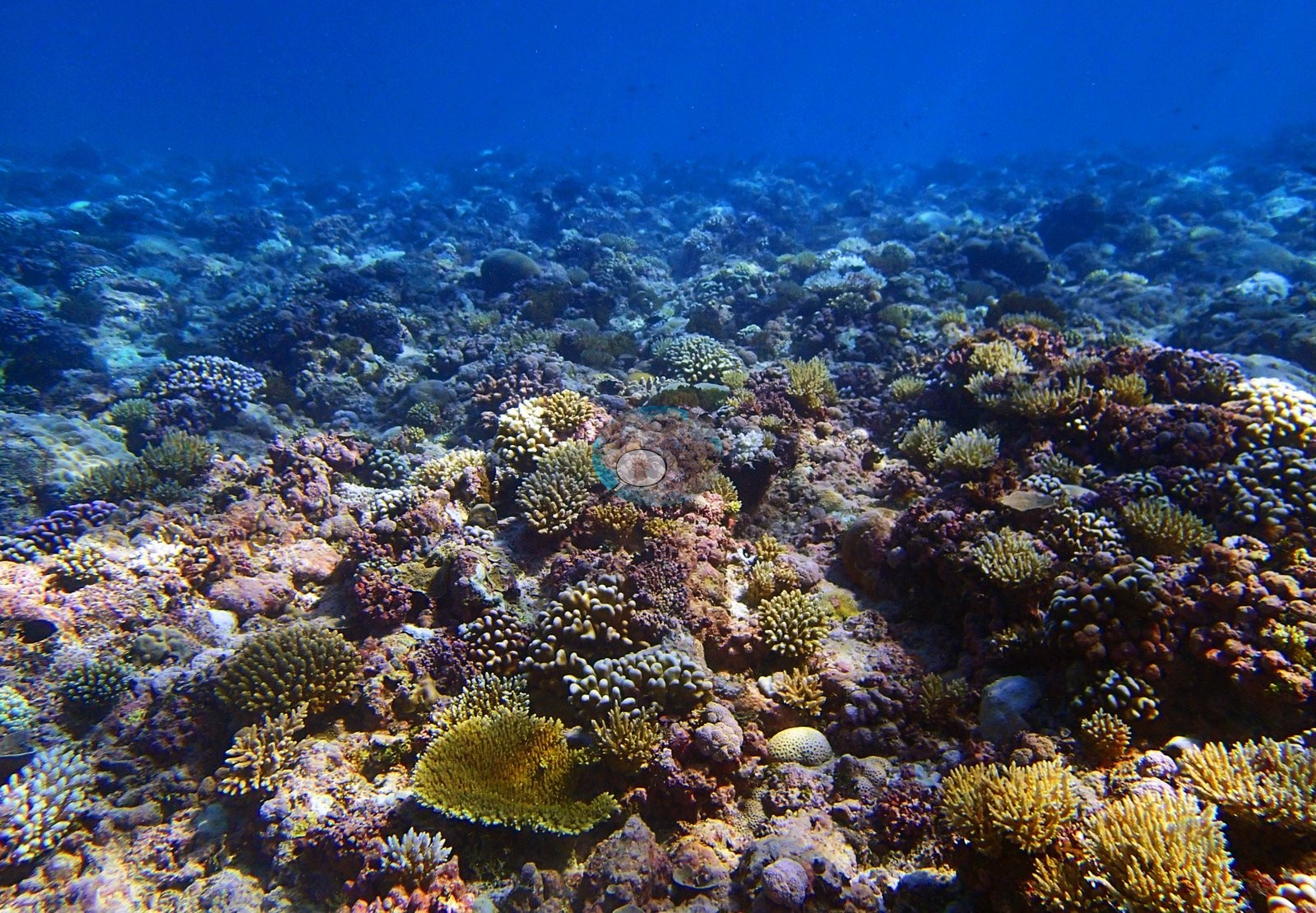
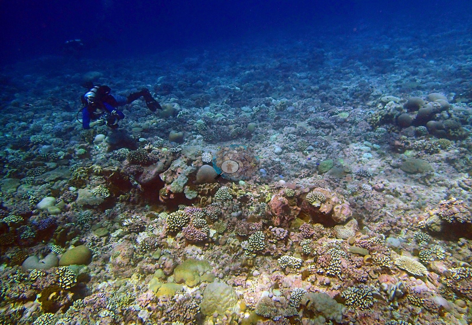
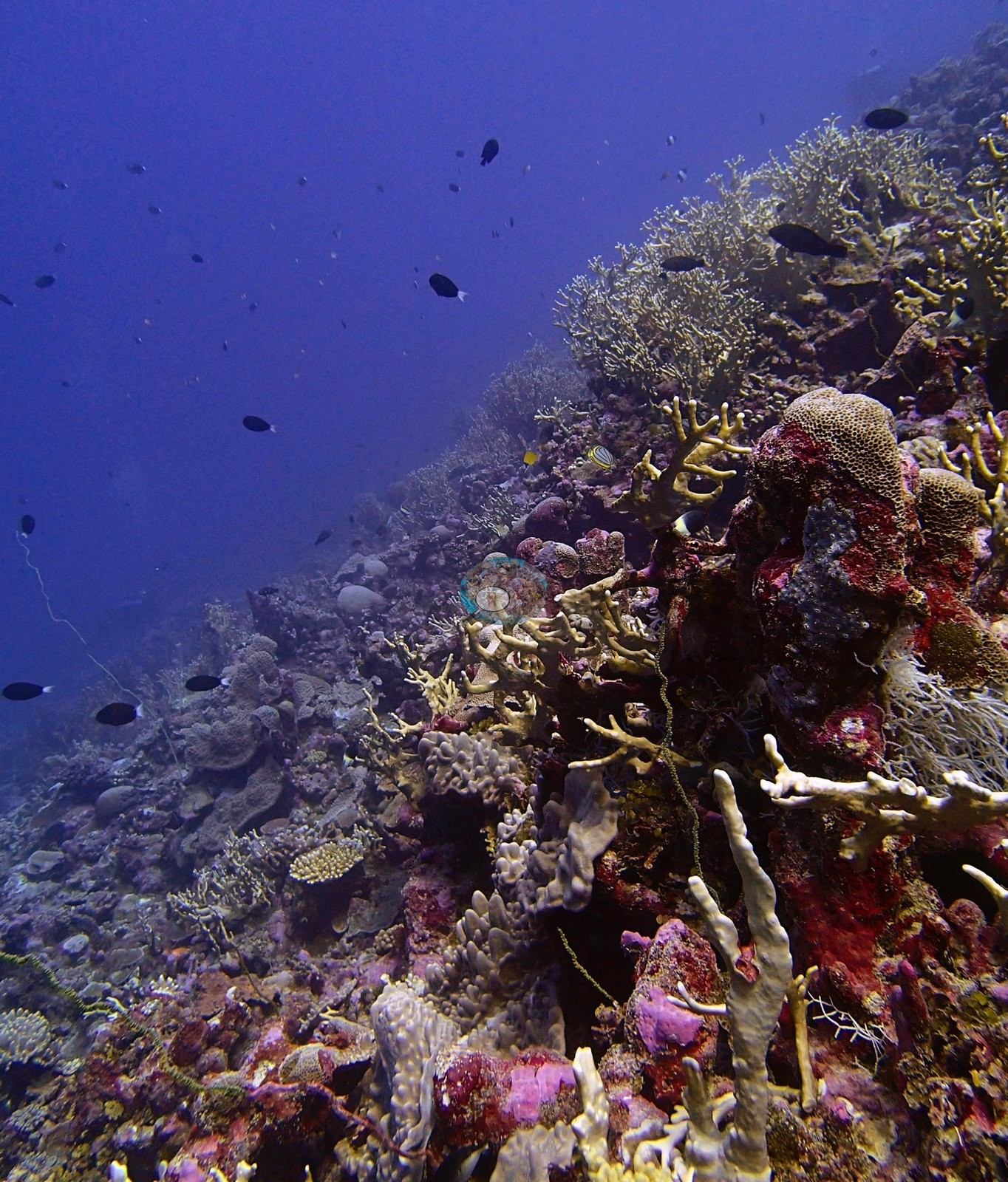
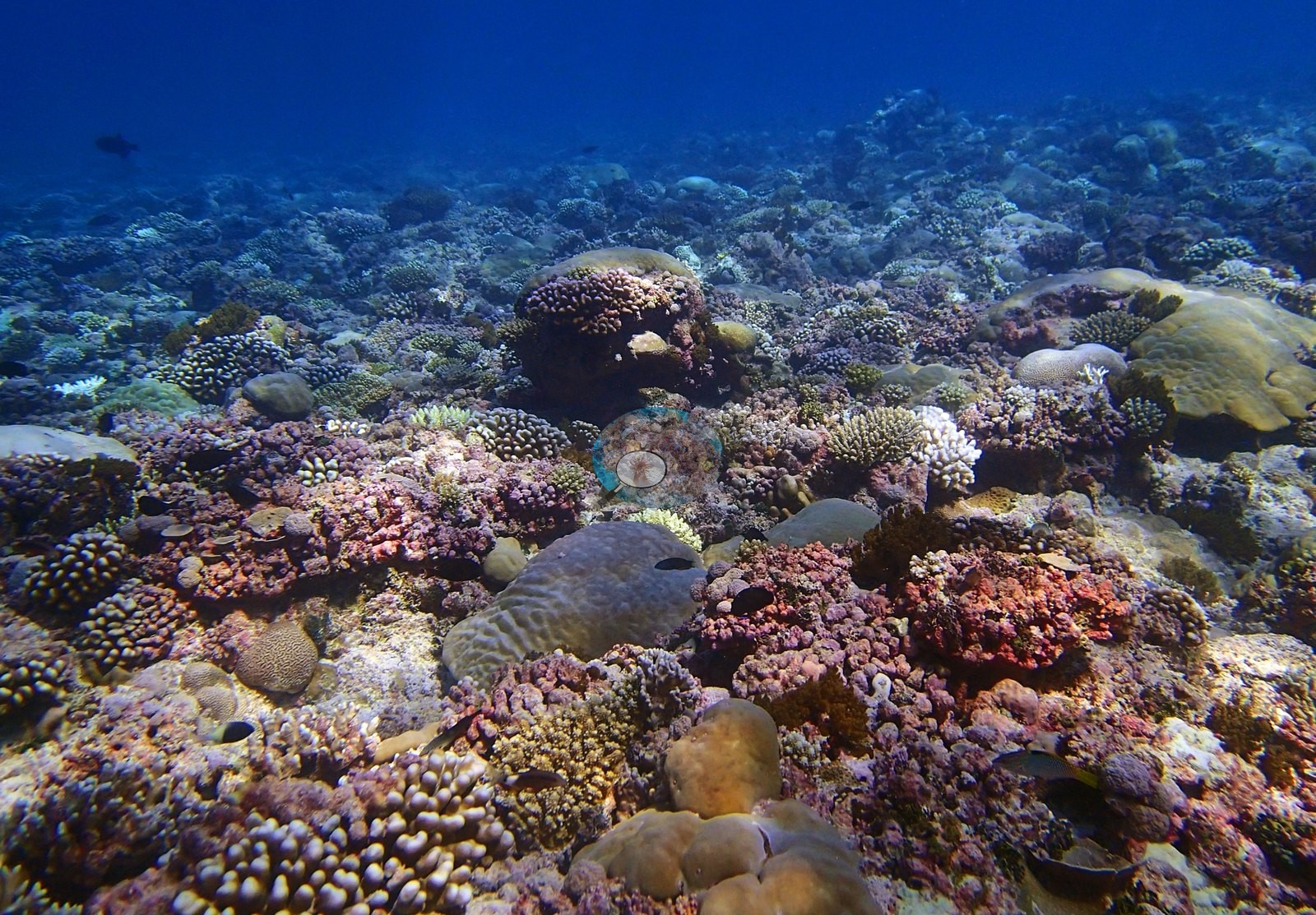
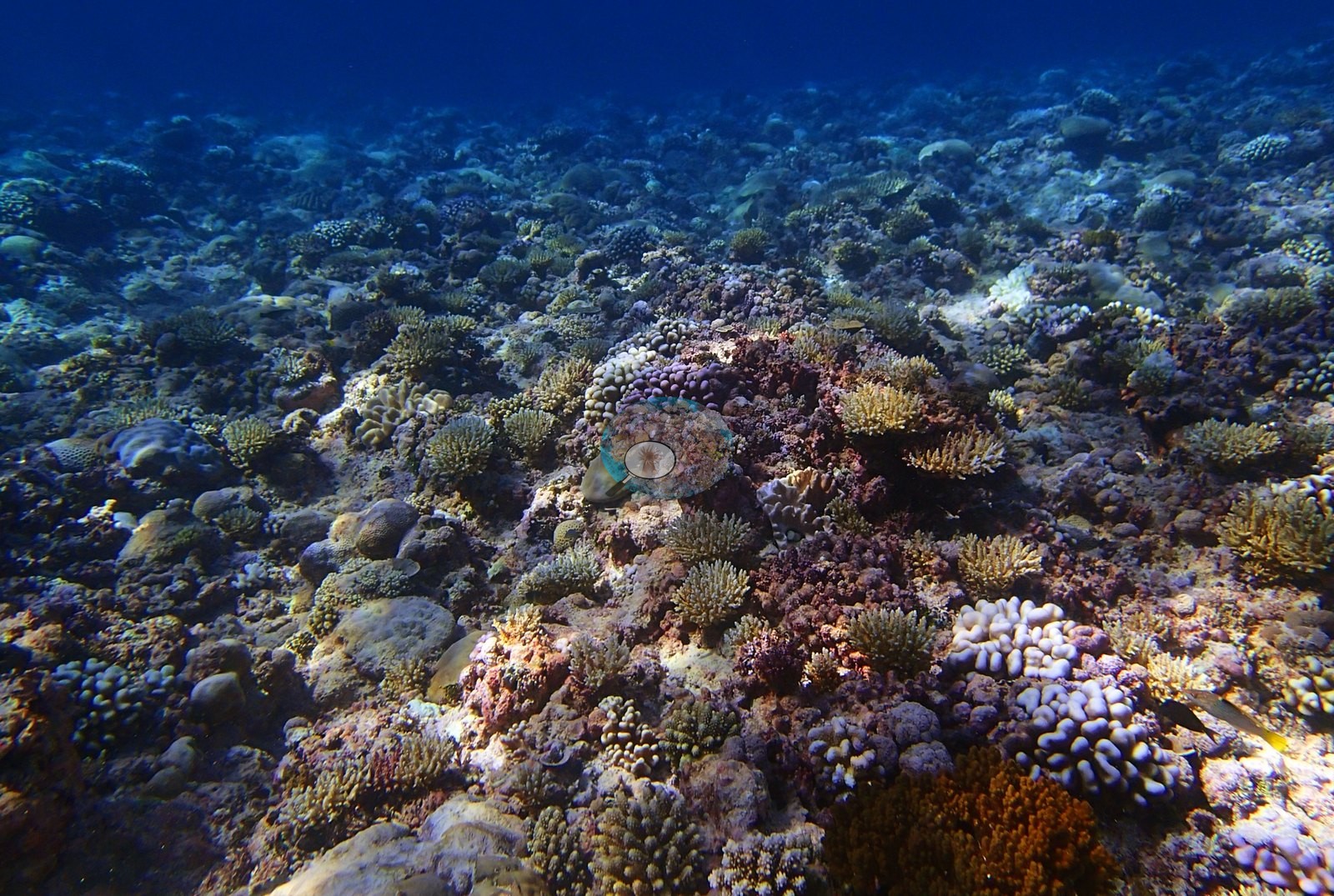
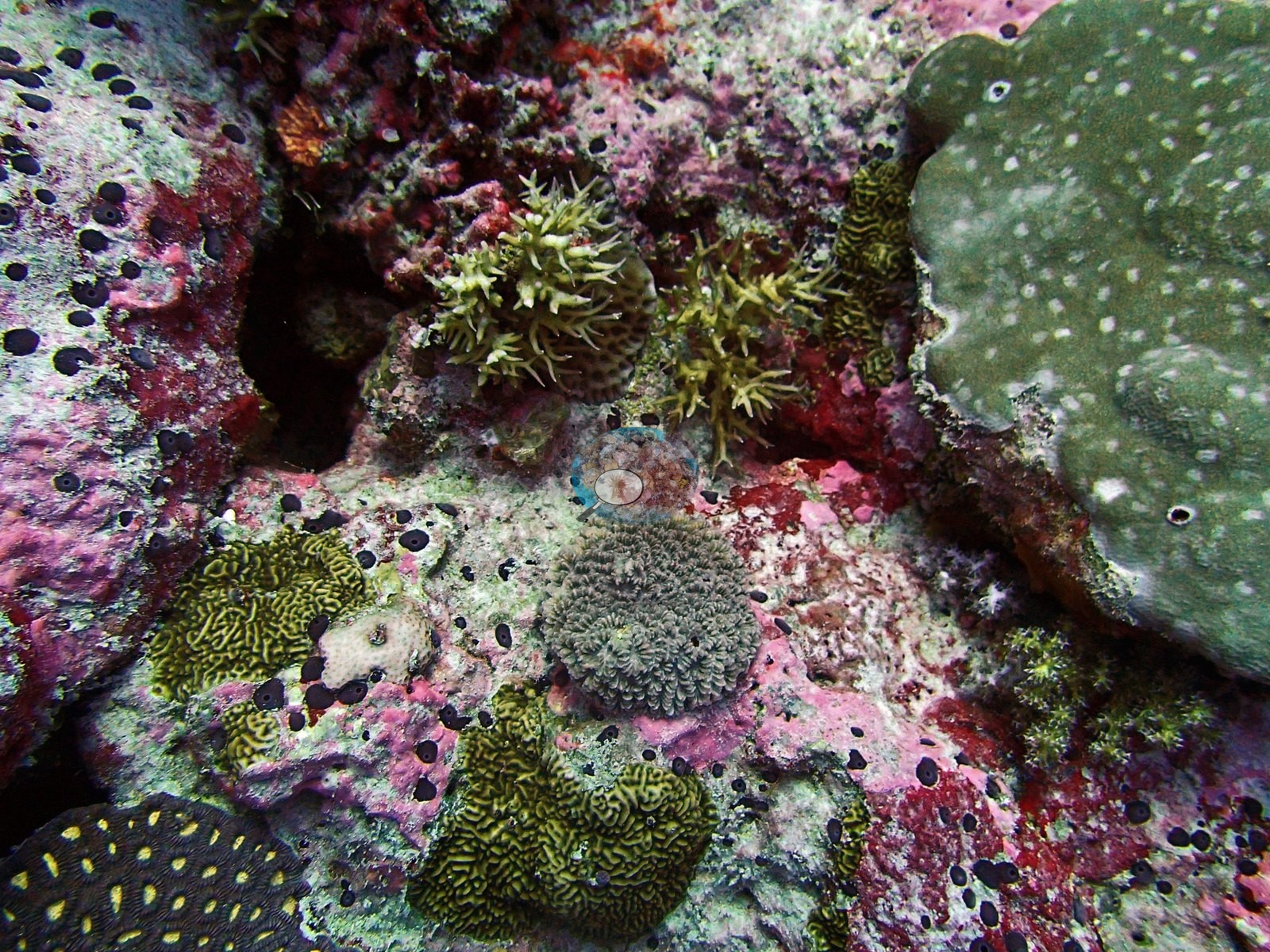
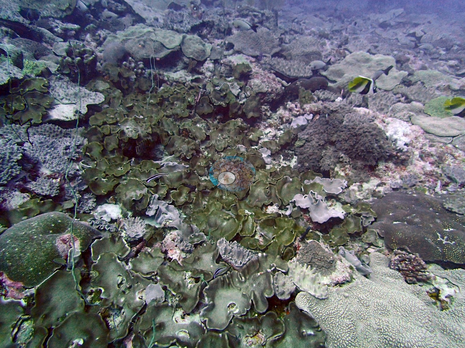
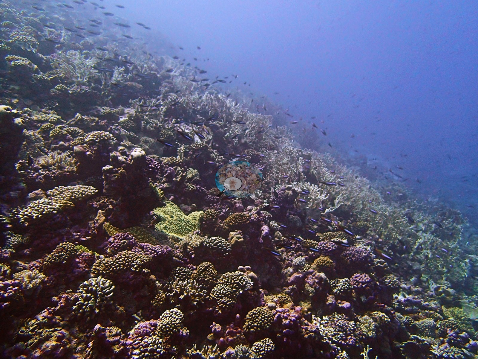
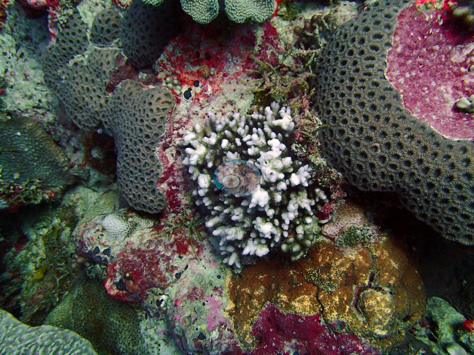
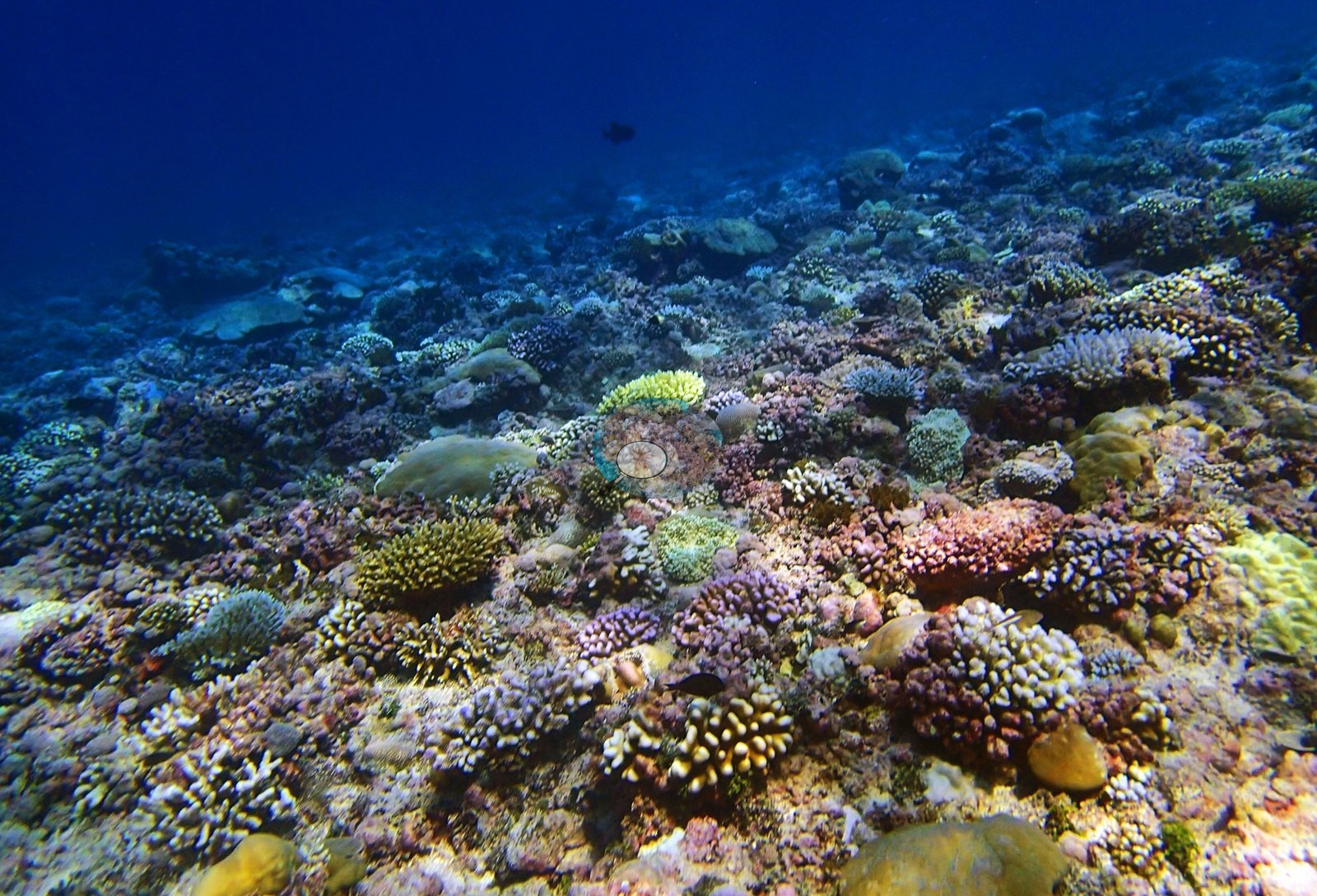
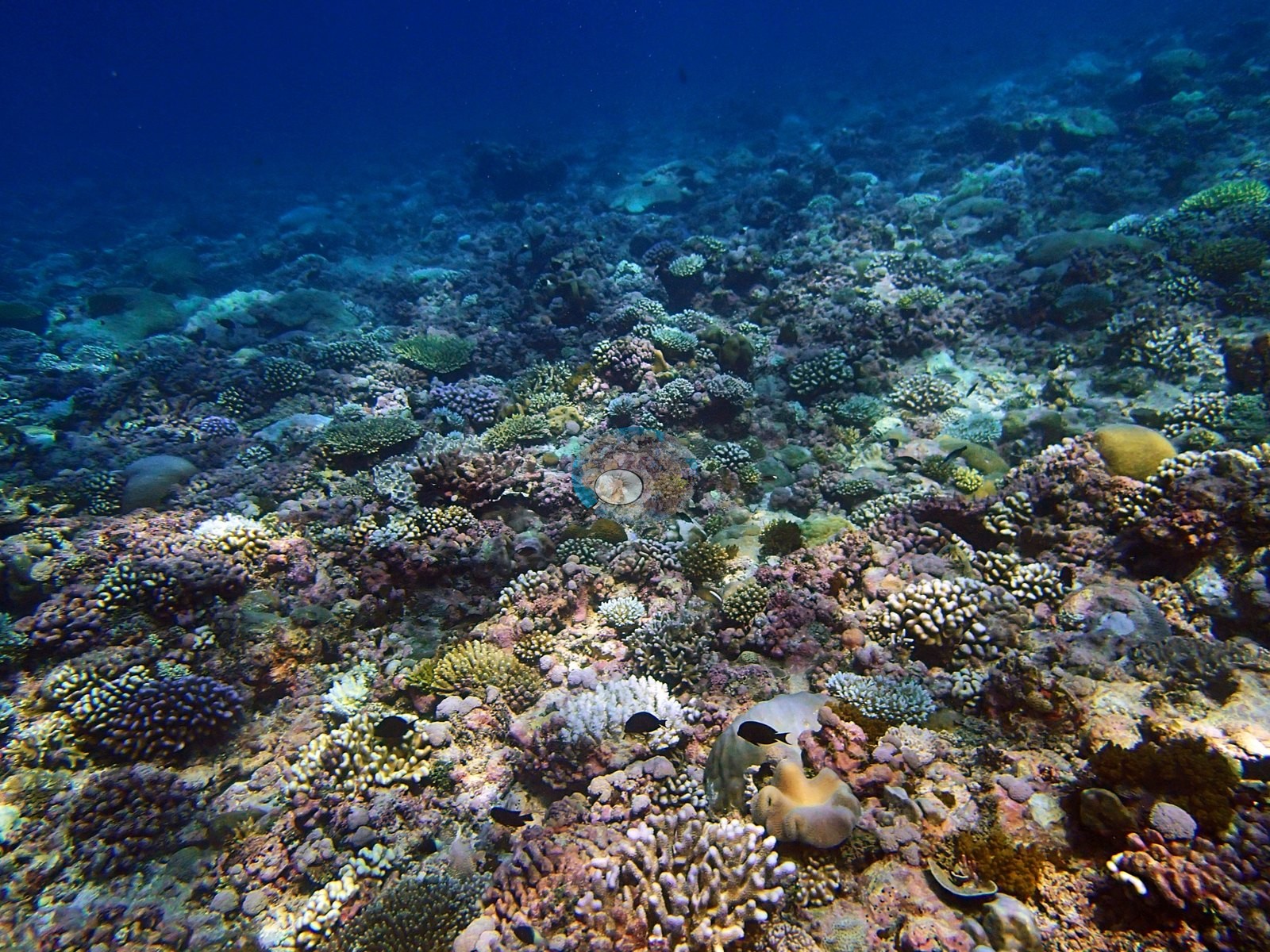
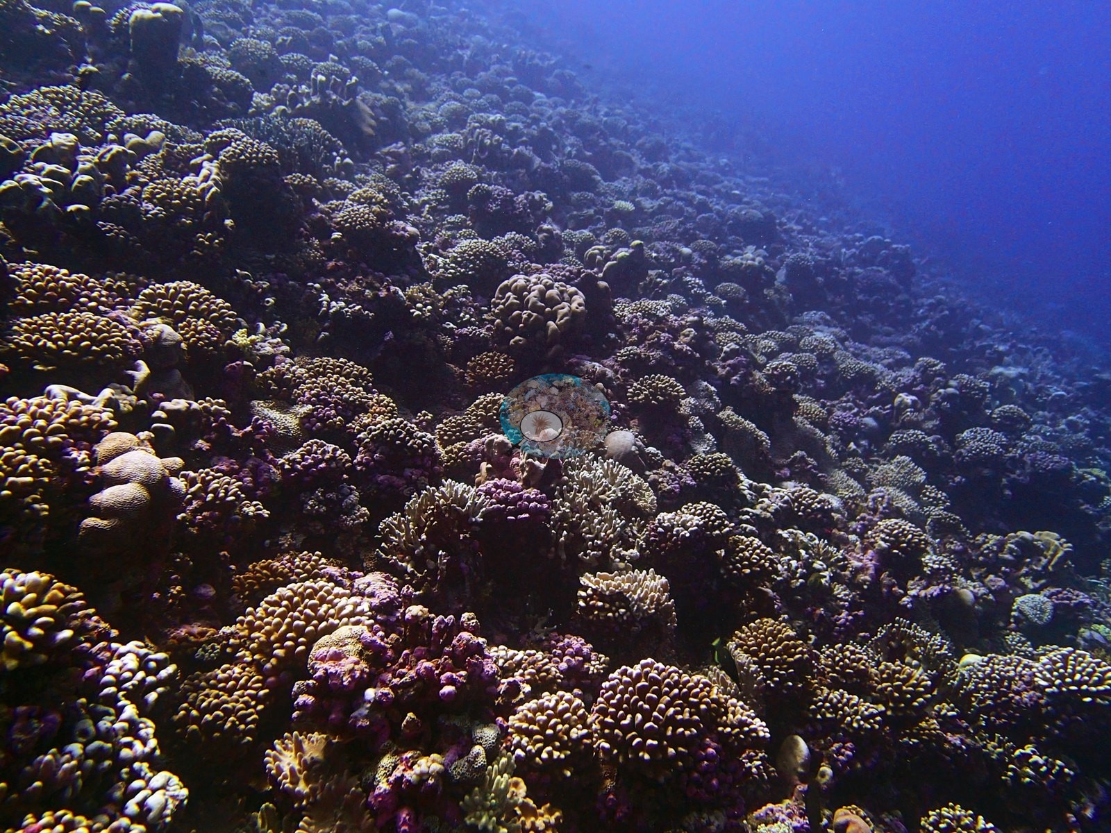
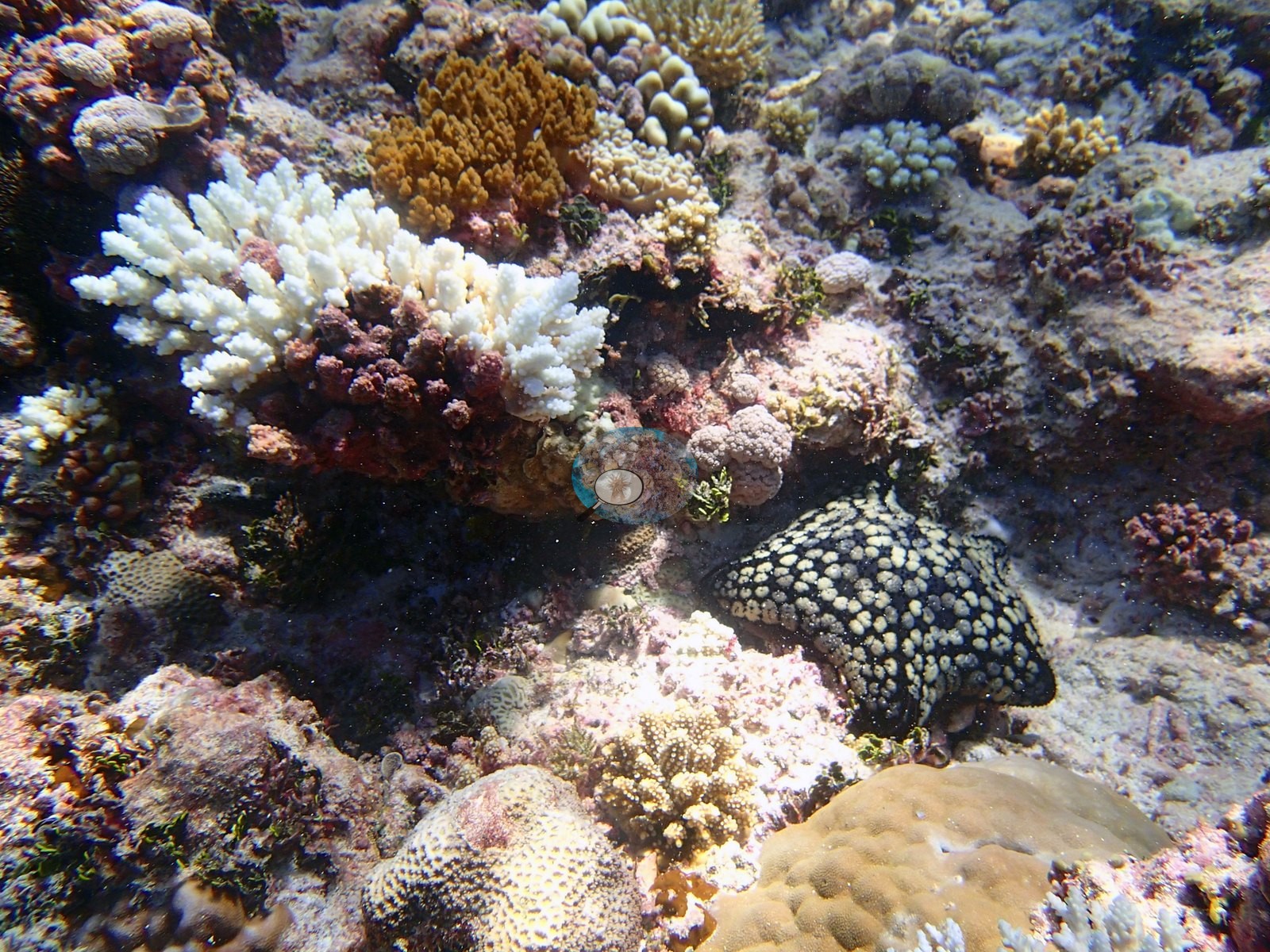
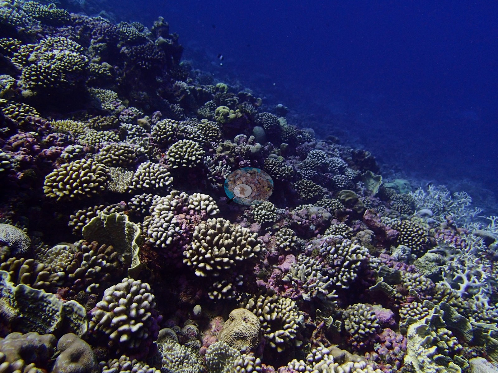
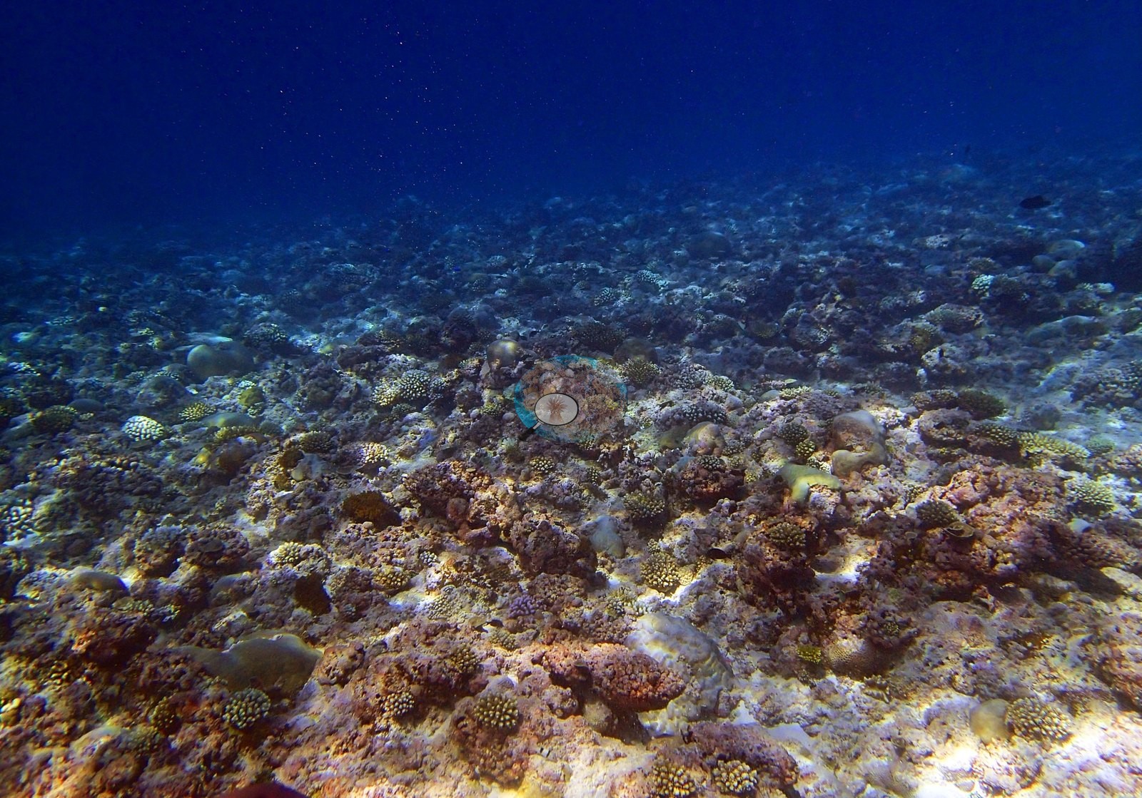
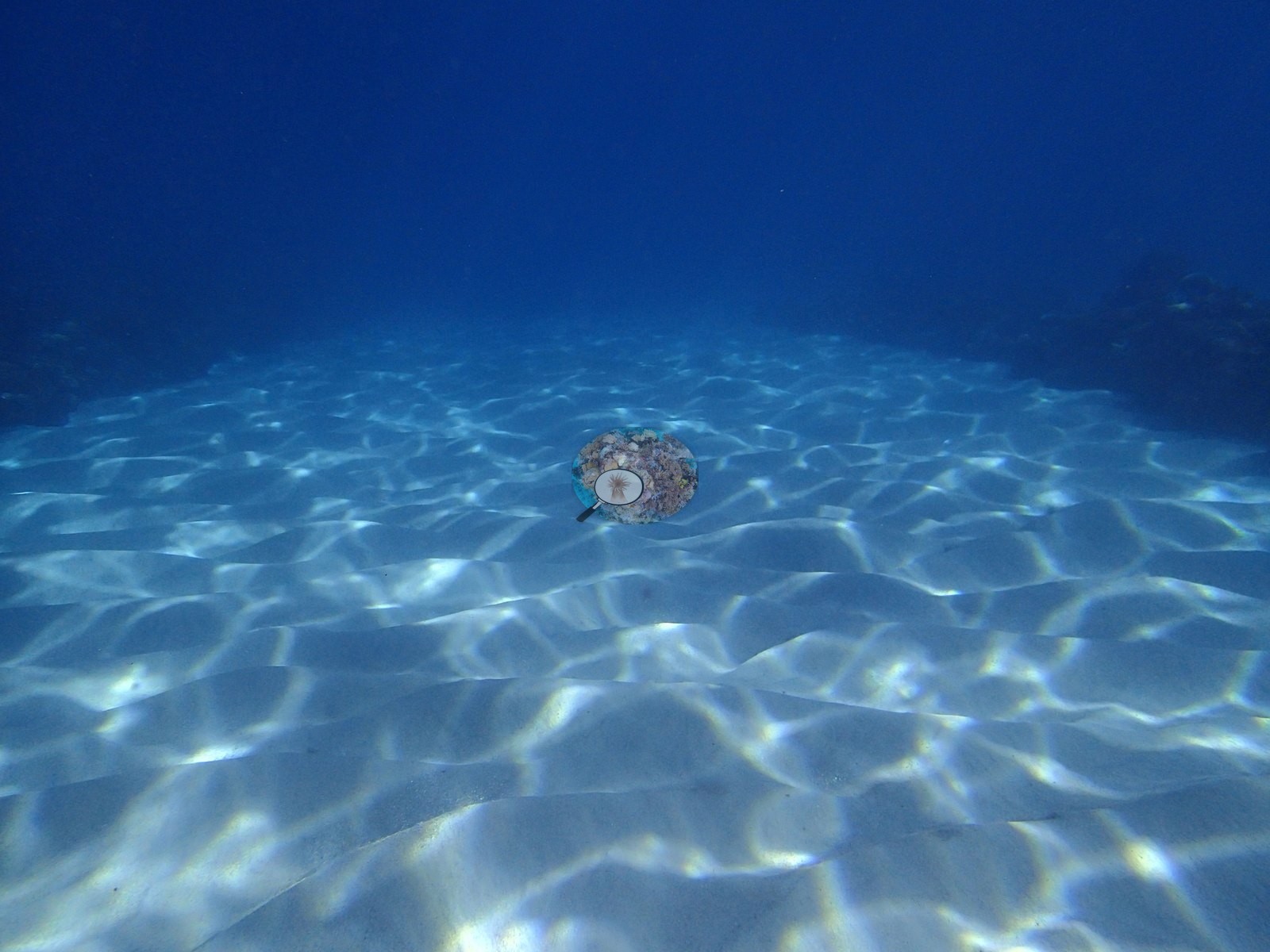
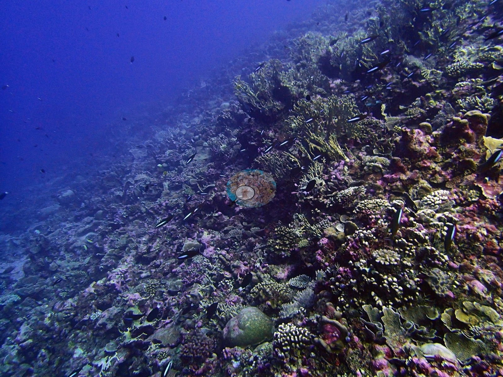
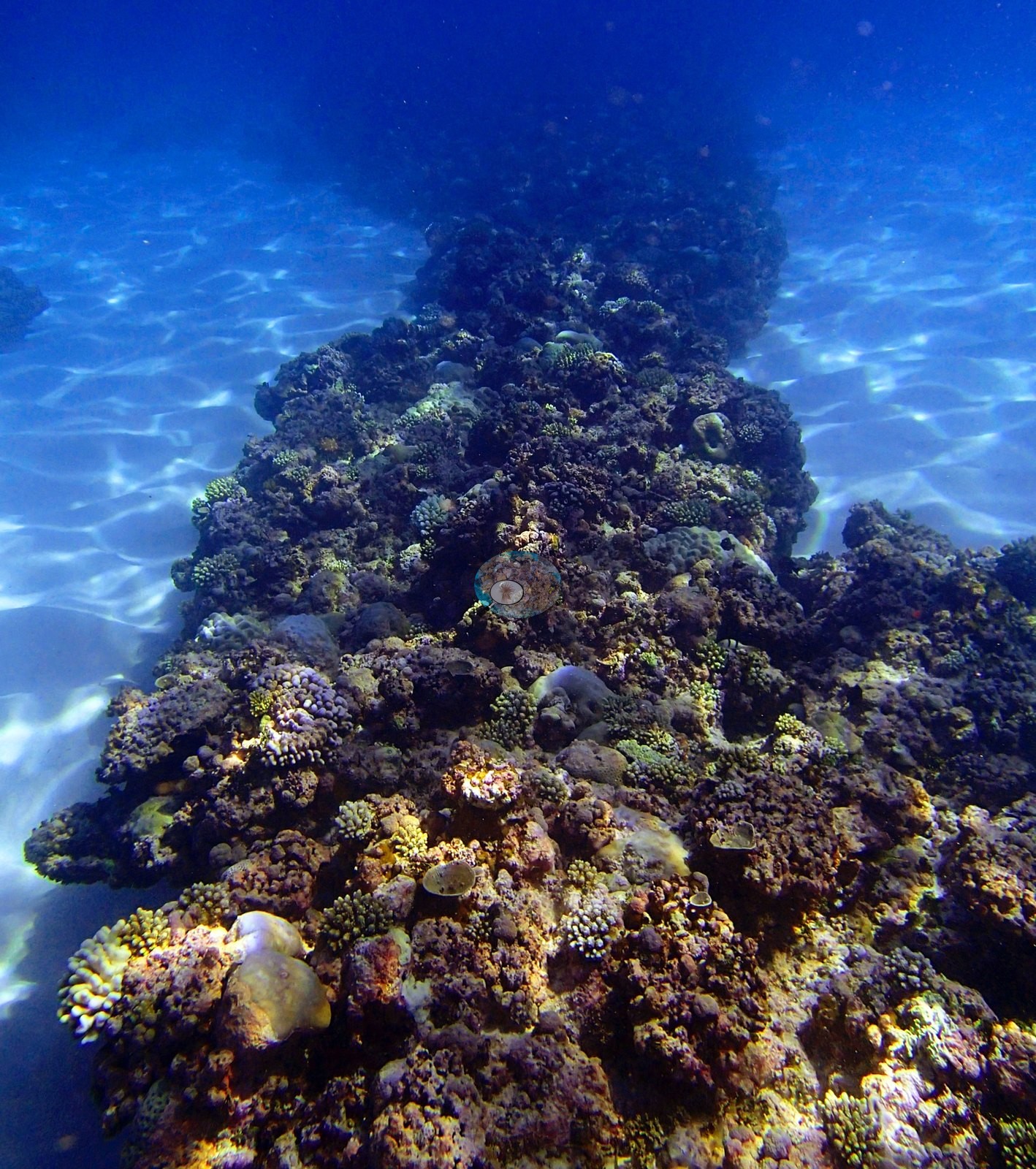
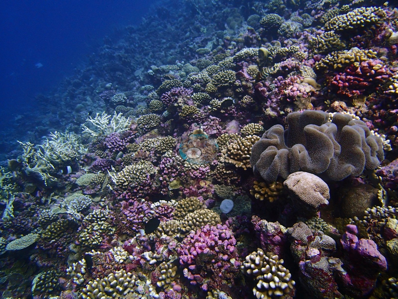
The dominant impression across the wide frames is density and small colony size. P4220837, P4220875, P4220876, P4220900, P4220902, and P4220906 show low-relief pavement carpeted edge to edge with hundreds of small colonies – lilac, rose-pink, mauve, cream, and tan digitate and corymbose forms packed against one another with almost no open rock between them, over a substrate itself crusted pink and magenta with coralline algae. Larger and structurally different colonies punctuate that carpet rather than replace it: yellow-gold massive and lobed mounds in P4220902, P4220904 and P4220905, dark meandroid brains, and a coarse-corallited massive in the two macro frames P4220851 and P4220852 (the only frames in which individual corallites resolve), a yellow-green tabular colony on the upper slope in P4220838, branching yellow stands on the flank in P4220859 and P4220903, and one large brown lobate leather coral in P4220861. P4220845 is a distinct zone – broad gray-green ruffled foliose plates covering most of the frame – and P4220839 shows the reef breaking over an edge into open blue water. The sequence closes the way a real swim does: the reef thins to rubble-and-pavement with smaller, more scattered colonies (P4220907), rises over a shallow surge-lit bommie under bright surface ripple (P4220908), gives way to rippled open sand (P4220909), and ends with a diver working back along the reef edge toward the drop (P4220910). Non-coral cover is dominated by crustose coralline algae 12.8%, turf 16.5% of all points.
Coral cover
The LOF benthic transect is this site's measurement. Coral cover at BIBL82 (Blenheim Reef, Chagos Archipelago, dived 22 April 2015) is 37.9% live hard coral, from the LOF BIOT-1 in situ transects (Mayfield & Dempsey 2026, Oceans, suppl. S1), against algal cover of 51.8% of the benthos. That diver-transect survey is the authoritative record of cover and community at this site. Everything that follows – the computer-vision products and the frame-by-frame photographic account – supplements it. No cover value may be read off a photograph, no image-derived product overrides the transect, and nothing in the imagery below qualifies or revises it.
Method comparison – transects, points and masks. Nineteen of the site's 22 frames were paired between the two image products. Across those 19 frames the Coralscapes masks put live hard coral at 21.2% of image area; the independent 30-point annotation of the same 19 frames (570 points) reads 24.2% of all points. Across methods the same reef therefore reads transects 37.9% · CoralNet points 24.2% · Coralscapes masks 21.2%. Both image products sit well below the transect, which is the expected direction at a structurally complex, high-cover site: a wide oblique frame contains a large fraction of blue water and shaded relief that a downward transect point never samples, and both products score that as non-coral. These three products have different sampling footprints, different denominators and different class vocabularies; they are reported side by side as a method comparison and should not be averaged, and none of them displaces the 37.9% transect value.
Also on record for this site: Assemblage composition. Across 19 analyzed frames the Coralscapes masks put live hard coral at 21.2% of image area, of which massive and meandroid is the largest component at 30.9%; the rest breaks down as other hard coral 25.2%, Stylophora 13.9%, Acropora (non-tabular) 9.5%, Millepora 7.8% of live cover. The independent 30-point human annotation of the same frames (570 points) gives live hard coral as 24.2% of all points and apportions it other hard coral 39.1%, Acropora 30.4%, Porites 29%, Pocillopora 1.4% of live coral. Coral cover: 38%. Live hard coral measured on the in situ benthic transects of the LOF BIOT-1 expedition (Mayfield & Dempsey 2026, Oceans, supplemental S1), against algal cover of 51.8% of the benthos. The transect figure is this site's authoritative cover value; no image-derived product overrides it. Across methods the same reef reads: transects 37.9% · CoralNet points 24.2% · Coralscapes masks 21.2% (19 frames). These products have different sampling footprints and denominators and should not be averaged.
Stressors
The one striking invertebrate is the black, white-tubercled sea star sitting on the pavement in P4220905, immediately beside the bleached branching colonies – a chocolate-chip star compatible with Protoreaster nodosus. This is not a crown-of-thorns and must not be recorded as one, nor counted as benthic cover.
Condition. Bleaching is present at BIBL82 and, in these frames, is unmistakably partitioned by growth form. The overwhelming impression across the 22 frames is of normally pigmented purple, gold, olive, and tan tissue; white appears as scattered individual colonies rather than as any site-wide whitening. The clearest cases are all branching: a stark bone-white cluster tucked among healthy faviids and orange encrusting tissue in the macro frame P4220851; a bright white corymbose Acropora in the middle of an otherwise pigmented flat in P4220901; and P4220905, the most affected frame at the site, where a fully bleached staghorn-type Acropora and an adjacent white Pocillopora sit side by side while brown-orange digitate Acropora and healthy Porites immediately around them keep full color. More diffuse partial-colony pallor – blanched branch tips, whitened plate and colony margins – shows in P4220837, P4220838, P4220845, P4220861, P4220903, and P4220906. The growth-form partitioning is the notable signal: branching and corymbose acroporids and pocilloporids carry essentially all the visible whitening, while massive, meandroid, lobed, and encrusting colonies are unaffected in every frame – the same form-dependent response seen at the 2015 event's other Chagos sites. No bleaching percentage is estimated from these images, and the photographs are not used to test one. Anderson's published per-site percentage bleached is the authoritative figure for this reef; the frames record which colonies and which growth forms were affected, nothing more. (The 1.9% bleached-point figure in the retained block below is a property of the 570-point annotation of 19 frames – a computer-vision output, not a site condition estimate.) Structural loss registers as dead coral 3.6% of image area and rubble 0.9%. Bleaching stands at 1.9% of annotated points, concentrated in other hard coral 1.2%, Acropora 0.3%, Pocillopora 0.3% of points.
Fish and other fauna
Fauna. Fish are present without being conspicuous, and no large-bodied aggregation appears in any frame. Moorish idols compatible with Zanclus cornutus and several butterflyfishes move through the coral in P4220837 and P4220860; bannerfish compatible with Heniochus appear over the foliose stand in P4220845; a loose school of fusiliers compatible with Caesio or Pterocaesio streams across the upper slope in P4220838; damselfishes compatible with Chromis are dense over the wall in P4220839 and P4220859; surgeonfishes compatible with Acanthurus or Ctenochaetus graze the flat in P4220901. Sponges register in 13 of the 19 paired frames, giant clams in 1 and urchins in 1. Conspicuous fauna and sessile invertebrates appear as sponges in 13 frames, giant clams in 1 frame, urchins in 1 frame.
Comparisons with other data
No independent survey was made at this exact site; the nearest ones are listed in the table below.
Other notes
Image-by-image. Twenty-two habitat frames survive, all from one dive and one folder – P4220837 to P4220910, filed by Anderson as BiBl82-great site-finished. The folder name is his own field verdict on the site, and the imagery bears it out. There are no sampled-colony frames, so the account below is from the habitat set alone. Two frames carry little or no benthic information (P4220909 is open rippled sand; P4220908 is a surge-lit bommie shot through heavy surface glitter), leaving 20 usable and about 16 genuinely informative on community composition. No quadrat, scale bar or depth stamp appears anywhere in the set, so no colony dimension quoted here is measured.
CV model comparison
More info
Those are point counts on the photographs; this is a diver swimming a transect. The models and the reference never saw the same thing. ⚠ SITE-LEVEL ONLY. The 2,500 frames were not associated with any transect taken within 200 m of them, so transect-vs-image comparisons are site means, never frames. The transect value is already in the pin `cover` field (109 of 112 pins, sourced to the paper's suppl. S1) and is read from there, never re-imported. The transect is THE coral-cover value for this site and stands alone. The rows below it are a methods comparison only: no computer-vision value is averaged with it, feeds the headline, or carries over to the site's cover figure (Anderson, 2026-09-22).| Method | Hard-coral cover (%) |
|---|---|
| Transect (published) | 37.9 |
| CoralNet | 27.6 |
| In-house DINOv3 | 26.1 |
| CoralSCOP edited | 35.8 |
| Claude | 28.3 |
Independent surveys nearby
Within 5 km, 1 independent survey station recorded hard coral cover in 2015. The most recent nearby survey is from 2015, so these values predate recent heat stress. This site's own estimate (38%) sits 8.7 points above the range of these surveys (29%); the methods differ, so the comparison is context, not a like-for-like test.
Collected by other programs using different methods (the XL Catlin Seaview Survey uses photo-transects with automated image annotation), so these are context for the figures above, not a like-for-like comparison. Where a station was surveyed more than once the range is shown. Station names are not dive-site names.
| Agency | Site / location | Date | Hard coral cover (%) | Distance | Link |
|---|---|---|---|---|---|
| XL Catlin Seaview Survey | transect 36019 | 2015 | 29% | 0.42 km | — |
Data & links
- Read the full site report ↗
- Download benthic survey data (CSV) ↗
- Download all LOF-GRE data (933 sites) ↗
- CoralNet image repository for this region ↗
- HeatCRD database ↗
- (reference) ↗
- Photo portfolio ↗
- Coral Reef Diagnostics page for this area ↗
All images from Coral Reef Diagnostics. Data are from Coral Reef Diagnostics and the organizations named in the data-sources table above.
 © Coral Reef Diagnostics.