
Maldives - Dhigurah Arches (night dive)

Part of the regional summaries: Maldives - Central (Male Atolls / Ari / Vaavu) and Maldives
More info
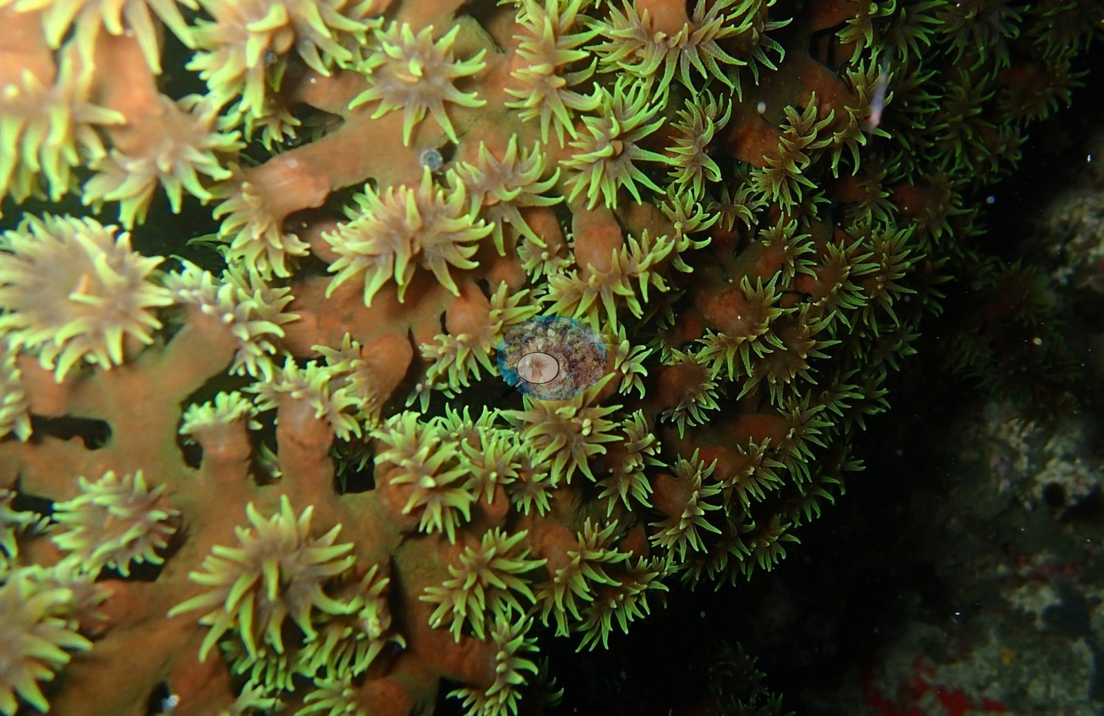
Maldives (NOAA CRW virtual station) · Maldives ecoregion mean=2.9°C-heating weeksA brief torch-lit dive where reef life goes nocturnal: cup corals bloom into luminous green polyp bouquets, a long-armed brittle star drapes a boulder coral, and, per the photographer, an octopus slips across the sand at the edge of the light. No coral-cover figure is published - these are close macro shots, not a wide reefscape.
Three independent survey stations shown with the program’s logo — click one to see how far it is from this site.
Site description
Setting
A short, torch-lit plunge after sunset, and the reef is unrecognizable from its daytime self.
General benthic features
Cup corals that spend daylight as drab knuckles have exploded into bouquets of luminous green polyps, every tentacle out and fishing in the dark (e.g., Image 1).
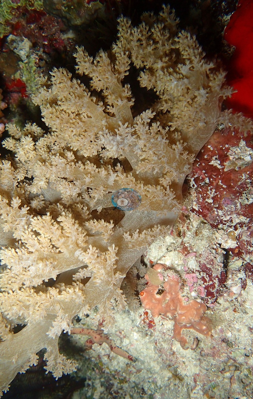
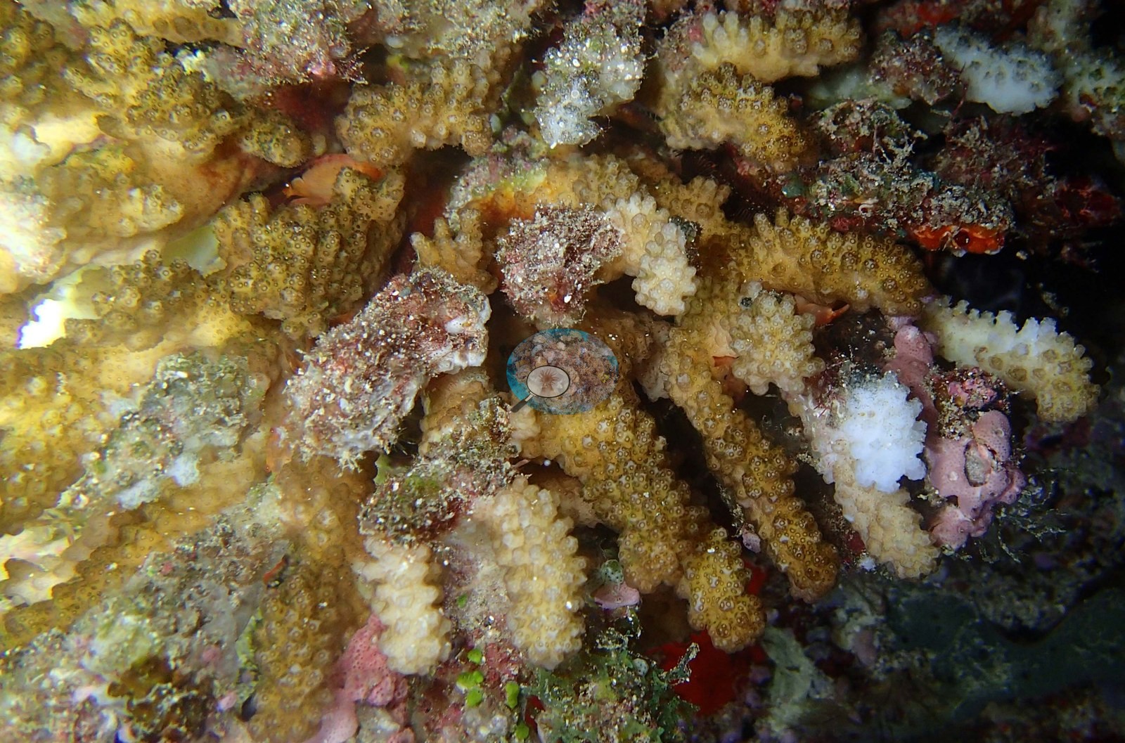
A cauliflower coral wears a fuzz of feeding polyps, a fleshy soft-coral tree stands fully inflated, and the walls glow pink with coralline algae under the beam (e.g., Image 2, Image 3).
Coral cover
Coral cover: not reported. This was a night dive, and its frames are close strobe-lit macro shots rather than wide reefscapes, so a photo-derived index would measure the lit subject and the framing rather than reef cover. The 28.8% figure computed from them was withdrawn on 2026-09-02 and is not published. Two independent computer vision passes were run over Anderson's own frames: a DINOv3 calibrated point classifier reads 31.3% and a CoralSCOP computer vision reads 26.3%, a spread of 5 percentage points. The map publishes a single figure so sites can be sorted against one another, but the honest statement of what is known here is the 26–31% range: the two products have different denominators and should not be treated as one measurement. This CoralSCOP and DINOv3-based number is not final: Anderson is actively scouting better CV models and will regenerate the estimate once one pans out.
Fish and other fauna
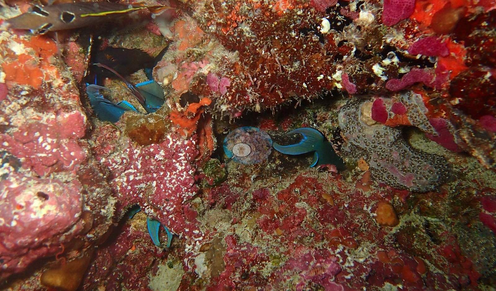
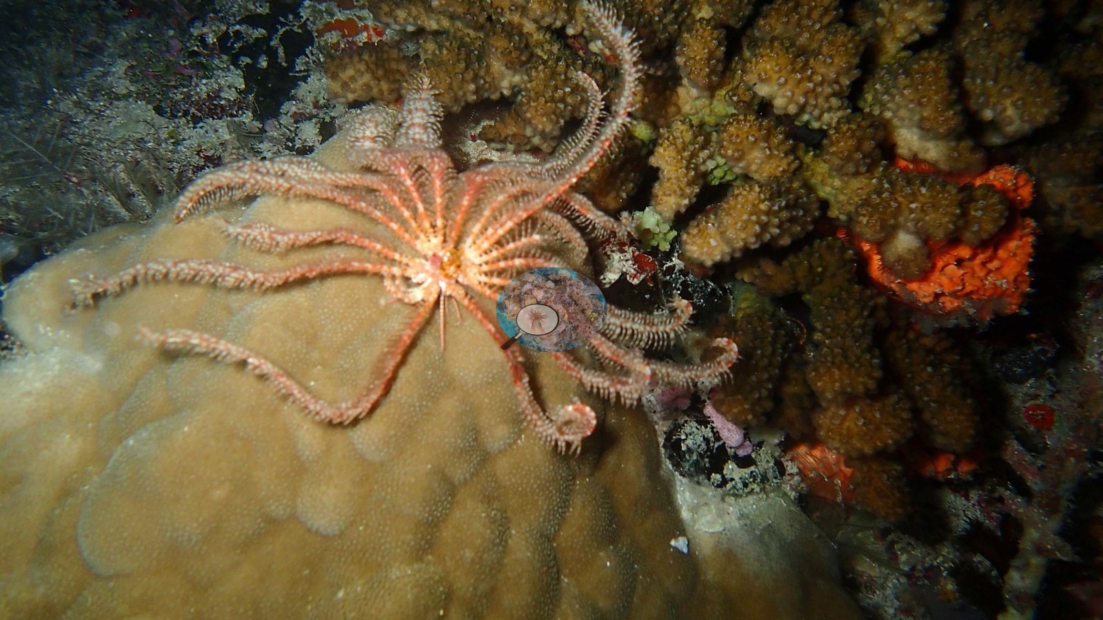
The night shift is out: a long-armed brittle star drapes itself across a boulder coral like a starfish made of whips, small wrasse doze wedged into crevices, and — if the photographer's caption is to be believed — an octopus slinks across the sand at the edge of the light (e.g., Image 4, Image 5).
Comparisons with other data
No independent survey was made at this exact site; the nearest ones are listed in the table below.
Dive record
Thirteen minutes of bottom time, all of it spent nose-to-reef.
Other notes
No coral-cover figure is published for this site: it was withdrawn because the 9 frames reviewed are close strobe macro shots -- not one wide reefscape -- and a photo-derived index over frames like these measures the strobe-lit subject and the framing, not reef cover.
Independent surveys nearby
Within 5 km, 3 independent survey stations recorded hard coral cover in 11 surveys between 2016 and 2023. Of the 2 stations surveyed in more than one year, 2 declined between their first and latest surveys. The longest record, Dhigurah Wall (Reef Check, 2.70 km away), went from 39% in 2016 to 27% in 2023. Surveys since 2021 average 23% (range 19–27%, n=2).
Collected by other programs using different methods (Reef Check uses point-intercept transects), so these are context for the figures above, not a like-for-like comparison. Where a station was surveyed more than once the range is shown. Station names are not dive-site names.
| Agency | Site / location | Date | Hard coral cover (%) | Distance | Link |
|---|---|---|---|---|---|
| Reef Check | Coral Garden | 2016–2022 | 19–63% (3 surveys) | 2.68 km | — |
| Reef Check | Dhigurah Wall | 2016–2023 | 22–39% (5 surveys) | 2.70 km | — |
| Reef Check | Dhigurah Outreef | 2018 | 32% (3 surveys) | 1.83 km | — |
Data & links
All images from Coral Reef Diagnostics. Data are from Coral Reef Diagnostics and the organizations named in the data-sources table above.
© Coral Reef Diagnostics.