
Maldives - Baa Atoll site 10
Part of the regional summaries: Maldives - North (Haa Alif to Baa / Lhaviyani) and Maldives
More info
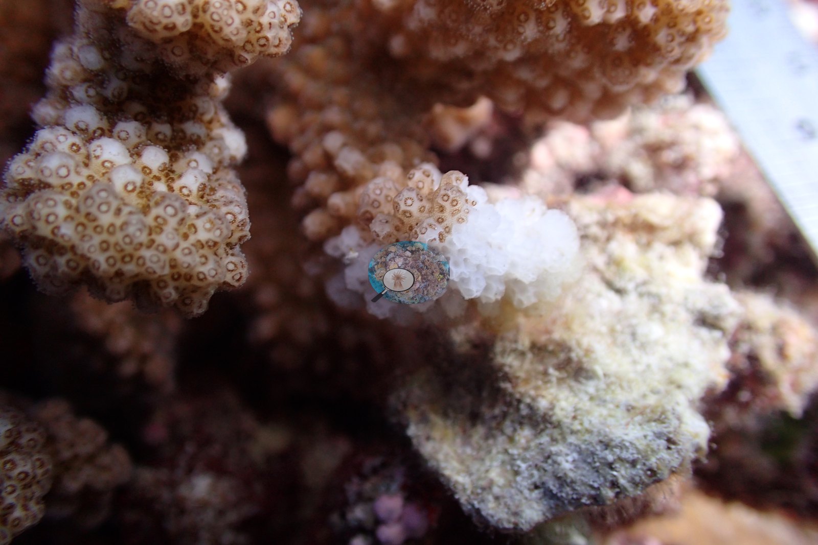
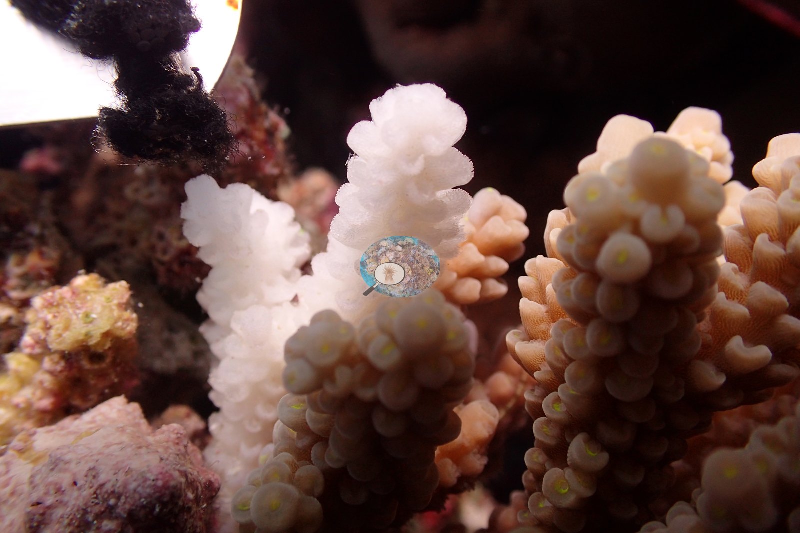
Maldives (NOAA CRW virtual station)A January 2016 Baa Atoll research dive (site 10) on a gently sloping field of Porites domes and leather corals, where Anderson tagged and sampled colonies roughly three months before the 2016 El Niño bleaching event; scattered bone-white branch tips were already visible on some tagged colonies.
2016 ގެ ޖަނަވަރީގައި ބ. އަތޮޅު (Baa Atoll) ގައި ކުރި ދިރާސާގެ ފީނުމެކެވެ (site 10). މި ފީނުނީ ގުނބަޒުގެ ސިފައިގައިވާ Porites އާއި ލެދަރ ކޯރަލް (leather coral) ހުރި، މަޑުމަޑުން ފުންވަމުން ދާ ބިމެއްގައެވެ. 2016 ގެ El Niño ހިރިގާ ހުދުވުމުގެ ހާދިސާއަށް ގާތްގަނޑަކަށް ތިން މަސް ކުރިން، Anderson މިތާގައި ކޮލޯނީތައް ޓެގްކޮށް ސާމްޕަލް ނެގިއެވެ. ޓެގްކުރި ބައެއް ކޮލޯނީތަކުގައި އޭރުވެސް ކަށި ފަދަ ހުދު ކުލައަށް ބަދަލުވެފައިވާ ގޮފިތަކުގެ ކޮޅުތައް ތަންތަނުން ފެނެމުން ދިޔައެވެ.
AI translation of this summary; the English is authoritative. (low confidence)
Two other CRD dive sites with their own pages within 5 km shown in orange — click a marker to open its page.
Site description
Setting
Anderson's sample sheet records 30-35 m visibility and a mild current.
General benthic features
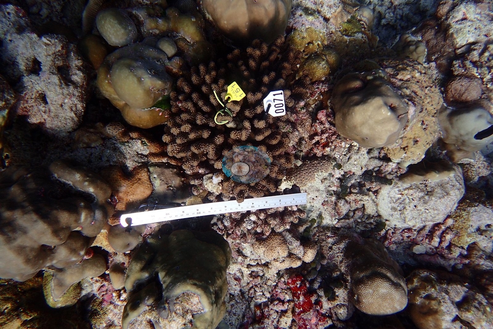
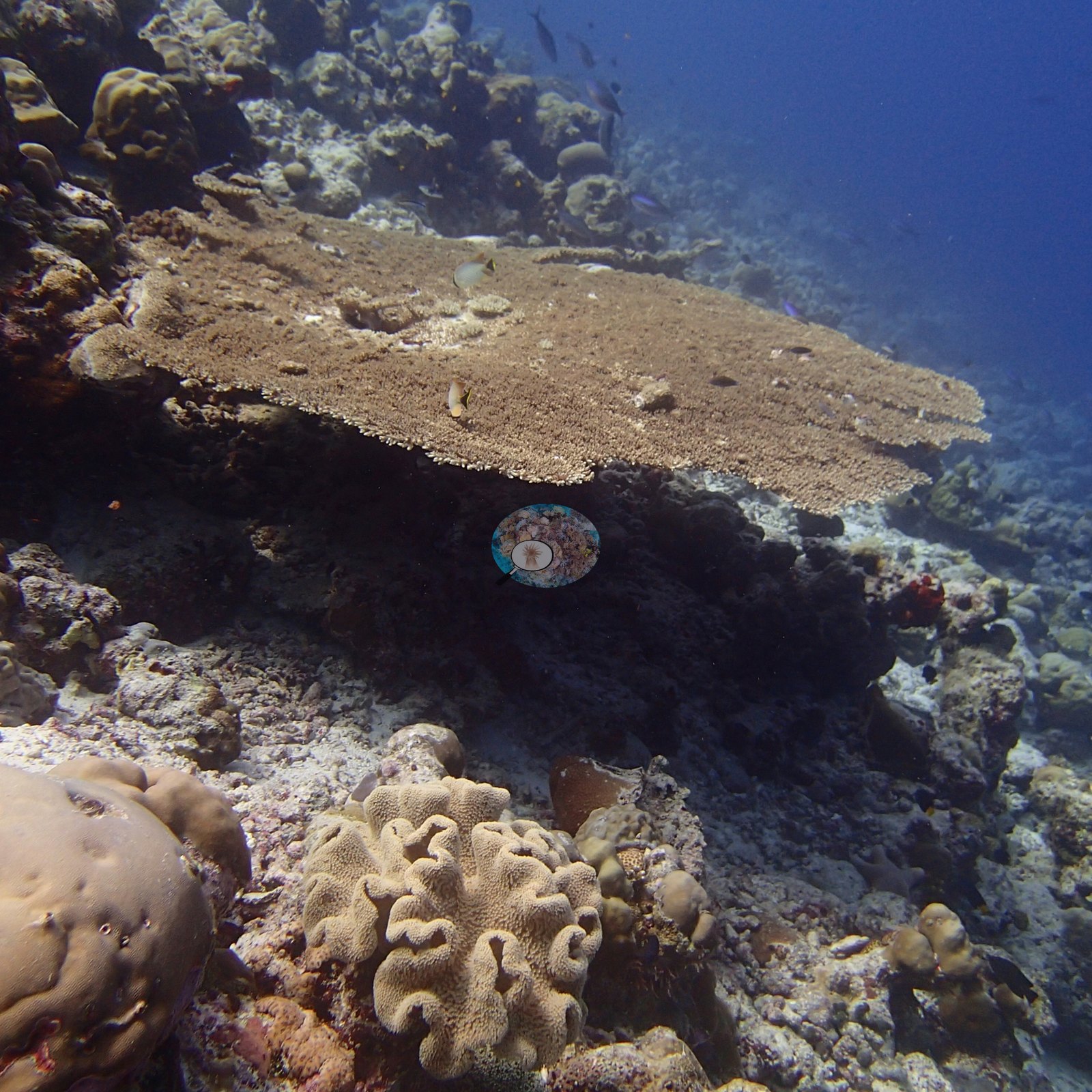
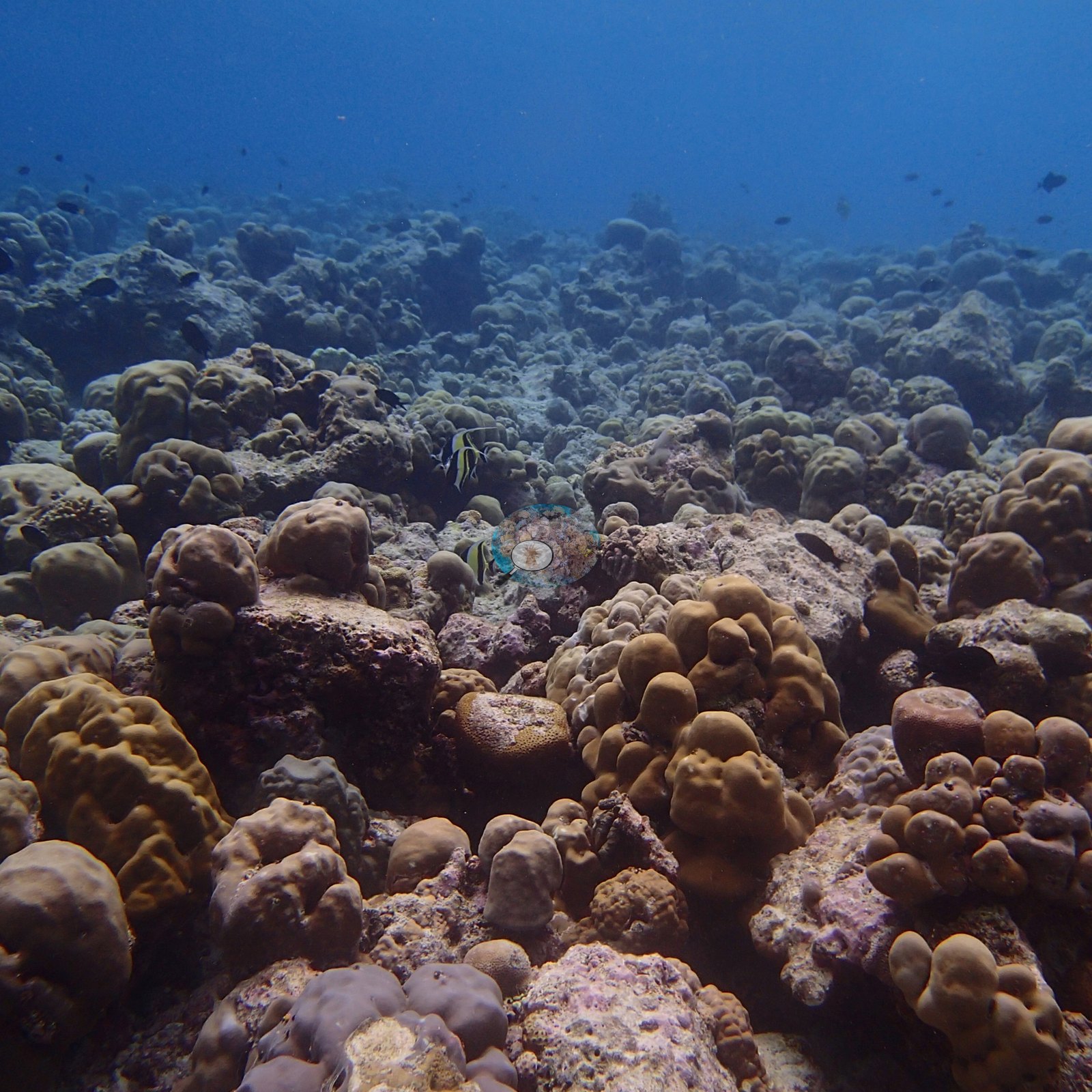
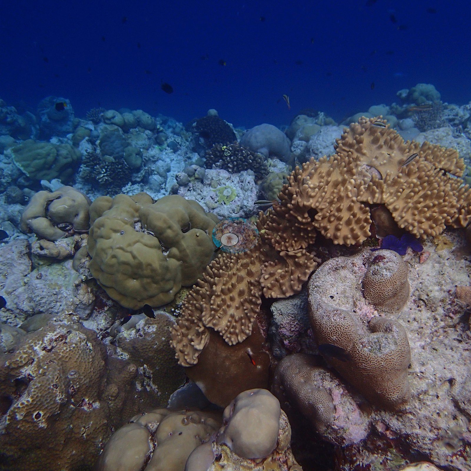
A gently sloping field of Porites domes and bommies some the size of armchairs, leather corals crowning the gaps, and a lone table Acropora (e.g., Image 2, Image 3, Image 4); a tagged colony among the massive corals (e.g., Image 1).
Coral cover
- Reference: Claude CV point count (this site's photos)
- Coral cover: 37%, a photo-based estimate: Claude's visual estimate of live hard coral on 18 of Anderson's January 2016 habitat photographs from research site 10, before the 2016 bleaching (SE 1.4 percentage points; n = 18 photos). Most frames are oblique views, which tend to overstate cover, so treat it as approximate.
- Atoll-wide context, not a survey of this site: Coral Reef CPR point-intercept transects pooled across Baa Atoll read 64% in April 2016, during the bleaching (n=40 transects), and 35% in July 2016, after it (n=50 transects); we were part of the CPR team.
Stressors
This was tagged-and-measured monitoring work, photographed roughly three months before the 2016 El Niño bleaching event across Baa's study reefs. Some colonies already carried stark-white branch sections and tips in January 2016, recent mortality, cause not stated (e.g., Image 5, Image 6).
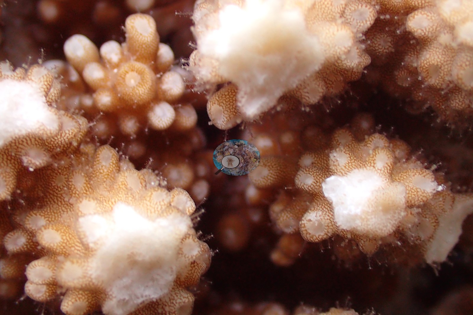
On one tagged colony Anderson's sample sheet notes that many branches had been fragmented; the freshly broken ends are stark white, and the cause is not stated (e.g., Image 7).
No crown-of-thorns starfish (COTS) or other corallivores were evident.
Comparisons with other data
We found no other surveys at this site as of 2026. If you would like to share yours, please email us.
Other notes
Research site 10, the last of the January 2016 Maldives monitoring dives in Baa Atoll (site 9, 1.8 km to the west, has its own pin). The reef is not named in the field records.
CV model comparison
More info
Computer-vision estimates from this site's own photographs are listed in the comparison table below, alongside the headline rather than merged into it.More info
The Coral Reef CPR transects (64% in April and 35% in July 2016) pool every Baa Atoll transect across five or six reef names; they are atoll-wide context, not a survey of this site, and are never averaged with the headline.| Method | Hard coral cover (%) | Photos (n) ± SE |
|---|---|---|
| Transect, July 2016, pooled Baa Atoll (atoll-wide context) | 34.9 | |
| Claude, January 2016 photos (photo-based estimate; headline) | 36.7* | n = 18 · SE 1.4 |
| Transect, April 2016, pooled Baa Atoll (atoll-wide context) | 64.3 |
*Based on only 18 reef-habitat photos; this estimate is less certain.
See a more detailed, stand-alone version of this table.
Data & links
All images from Coral Reef Diagnostics. Data are from Coral Reef Diagnostics and Coral Reef CPR.
© Coral Reef Diagnostics.