
Kenya - Uyombo (Watamu) snorkel
Part of the regional summary: Kenya
More info
Kenya (NOAA CRW virtual station) · East African Coral Coast ecoregion mean=4.1°C-heating weeksUyombo, surveyed across sixteen quadrats on a shallow reef flat, is a genuine mosaic of habitats - dense staghorn thickets, boulder ground, brain-coral beds, and seagrass - with heavy bleaching throughout (82.0% of tissue) that hit massive corals just as hard as the branching Acropora, overturning any idea that boulders were the safe group. A distinctive pink-to-mauve stress coloration recurred across eleven of the sixteen quadrats, always alongside both fully brown and fully white colonies in the same frame. Published cover was 25%, the highest of the four Watamu sites in this study.
Seti kubwa zaidi ya picha katika utafiti wa Kenya: viwanja kumi na sita juu ya sakafu ya mwamba ya Uyombo vinavyoonyesha si mwamba mmoja bali mchanganyiko wa sakafu ya mwani, kichaka cha Acropora, ardhi ya mawe, ardhi ya matumbawe ya ubongo, na nyasi bahari. Matumbawe makubwa na ya ubongo yenye mikunjo yalikuwa miongoni mwa yaliyopauka kwa ukamilifu zaidi, na rangi ya msongo ya waridi hadi zambarau inajitokeza…
Tafsiri ya muhtasari huu kwa AI; Kiingereza ndicho kinachotumika rasmi. Translated from the site’s shorter map summary.
Five independent survey stations shown with the program’s logo — click one to see how far it is from this site.
Two other CRD dive sites within 5 km shown in orange — click a marker to open its page.
4 of these 50 photographs are shown beside the text that discusses them under "Site description" below.
Site description
General benthic features
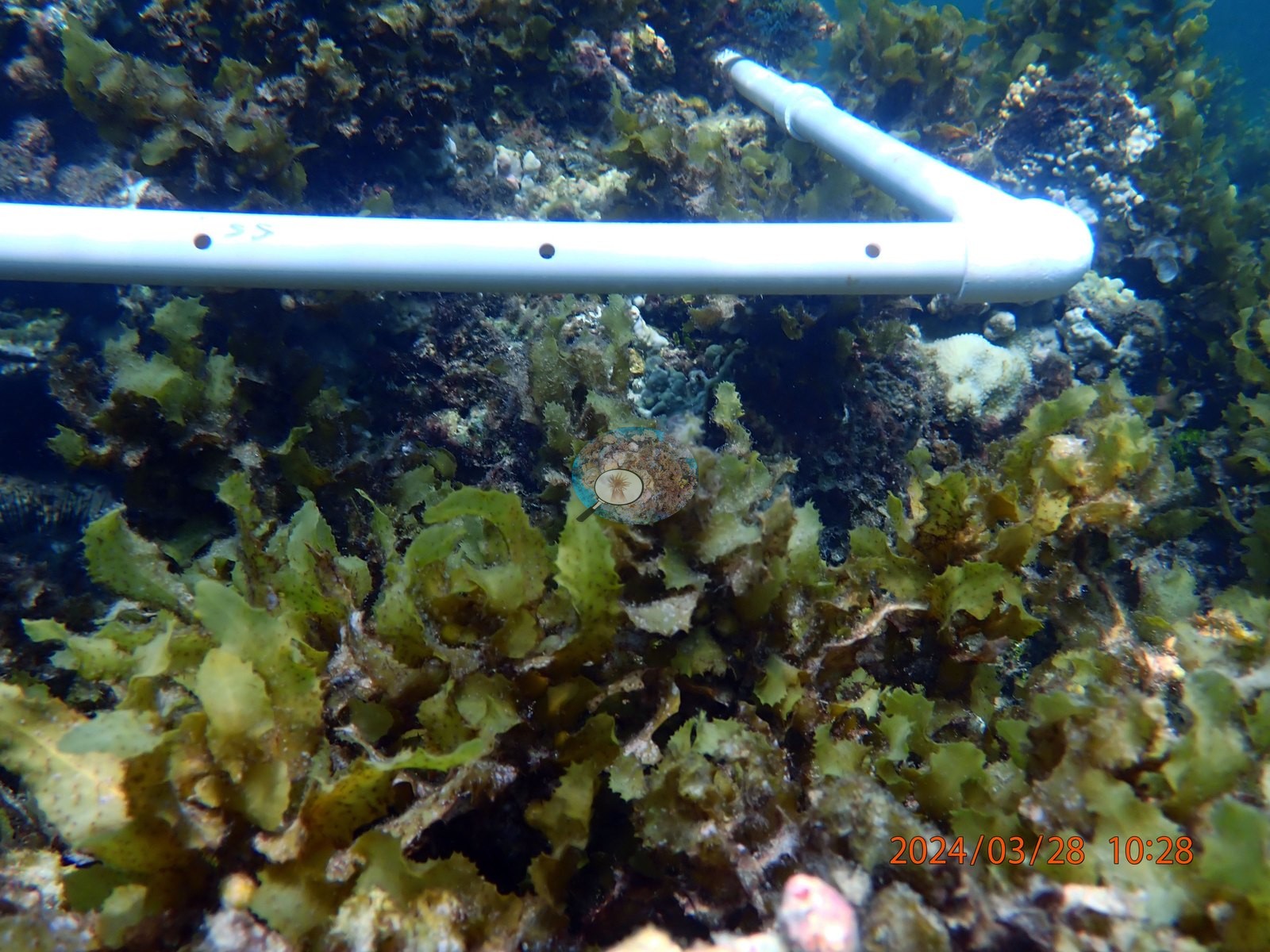
The quadrats that open and close the survey are the thinnest. UYQ1 (10:22-10:28) is low-relief rubble and pavement carpeted in red-brown turf and green Halimeda-type clumps, with coral present only as scattered colonies against the transect pipe: a bone-white branching Acropora (UYQ1-1, UYQ1-2, UYQ1-3), a meter-scale knobby Porites-type dome bleached uniformly porcelain-white (UYQ1-12), a white encrusting sheet against the pipe (UYQ1-7), and against those a handful of colonies still carrying pigment -- a tan meandroid brain (UYQ1-14), a mustard-brown faviid (UYQ1-4), a salmon-cream massive Porites (UYQ1-13). UYQ15 (12:27-12:30) is the poorest ground in the set, only nine frames, and every one of them is dominated by a brown fleshy macroalgal canopy over rock with seagrass behind; the corals in it are isolated pale lobes swamped by algae (UYQ15-5, UYQ15-6, UYQ15-7, UYQ15-9), and the two quadrat-frame shots (UYQ15-1, UYQ15-2) enclose almost no coral at all. UYQ16 (12:18-12:23) is similar back-reef algal ground, but with small Pocillopora and Stylophora-type colonies scattered through it, several of them a striking pink-to-mauve (UYQ16-4, UYQ16-5, UYQ16-7, UYQ16-8, UYQ16-9), one mustard-yellow encrusting colony holding full pigment (UYQ16-13), and one white meandroid brain beside a still-tan Porites (UYQ16-19). Three quadrats carry most of the site's structure and most of its survivors. UYQ6 (10:58-11:05) is the richest ground photographed, large corymbose and tabular Acropora in salmon, tan, and pink with blue-green chromis streaming through them (UYQ6-4, UYQ6-5, UYQ6-6, UYQ6-8, UYQ6-12), and it is also where partial mortality is clearest: a massive Porites bleached white with brown tissue remnants and open excavated lesions (UYQ6-15), a large white columnar colony (UYQ6-23), and a white Acropora sitting directly against a dark-brown meandroid brain that has held its pigment completely (UYQ6-22). UYQ10 (11:33-11:37) is plate-and-boulder ground: broad foliose plates dominate, most of them white (UYQ10-13, UYQ10-14, UYQ10-17), but the single largest plate in the set is olive-tan and fully pigmented (UYQ10-3). UYQ14 (11:56-12:15, 49 frames) is the transition zone and the most varied quadrat of all. It runs from reef onto seagrass, and the seagrass frames are unambiguous (UYQ14-33, UYQ14-35, UYQ14-36, UYQ14-47), including one lilac-pink Acropora sitting alone in a seagrass bed (UYQ14-47).
Coral cover
Coral cover 25% -- and 82.0% of hard coral tissue bleached (March-April 2024). Measured from 375 white-balanced photographs taken at this site during the 2024 Western Indian Ocean mass bleaching event and point-annotated in CoralNet, published in Mayfield, A.B. (2025) A Citizen Science Approach for Documenting Mass Coral Bleaching in the Western Indian Ocean. Environments 12(8):276. doi:10.3390/environments12080276, Supplemental File S1 (May 2025 analysis). This is a published diver-photograph point-annotation value, not a computer vision estimate, and it is the highest coral cover of the four Watamu sites.
Stressors
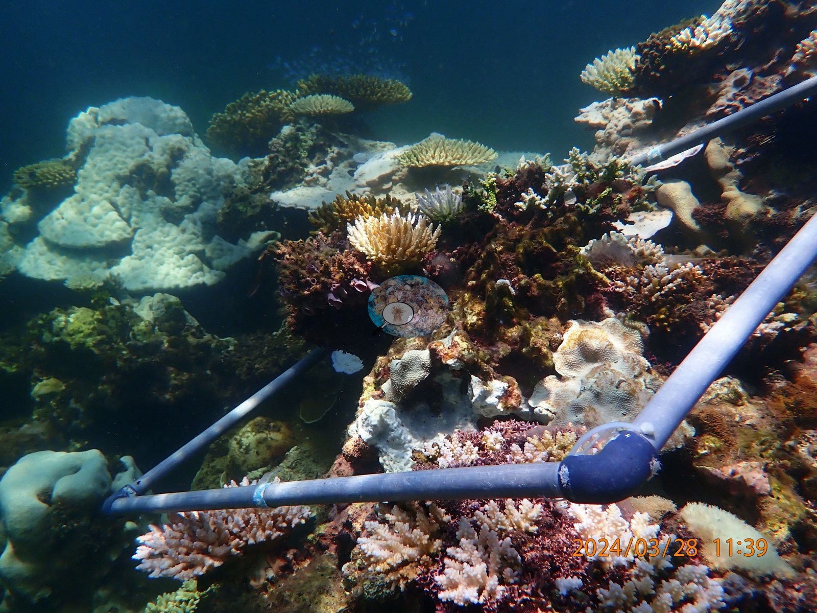
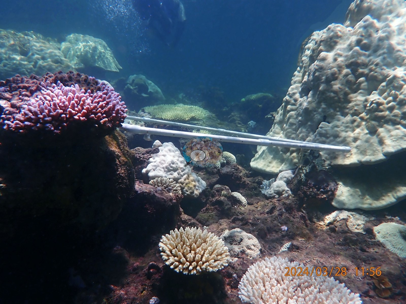
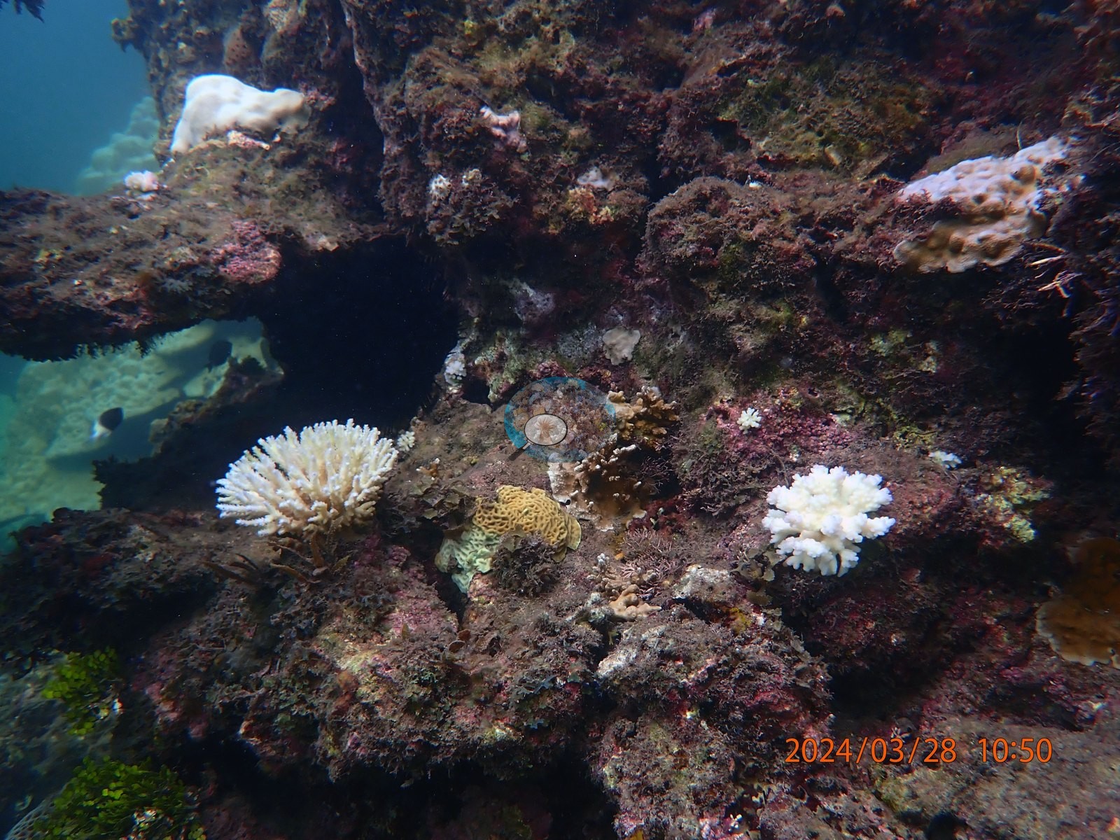
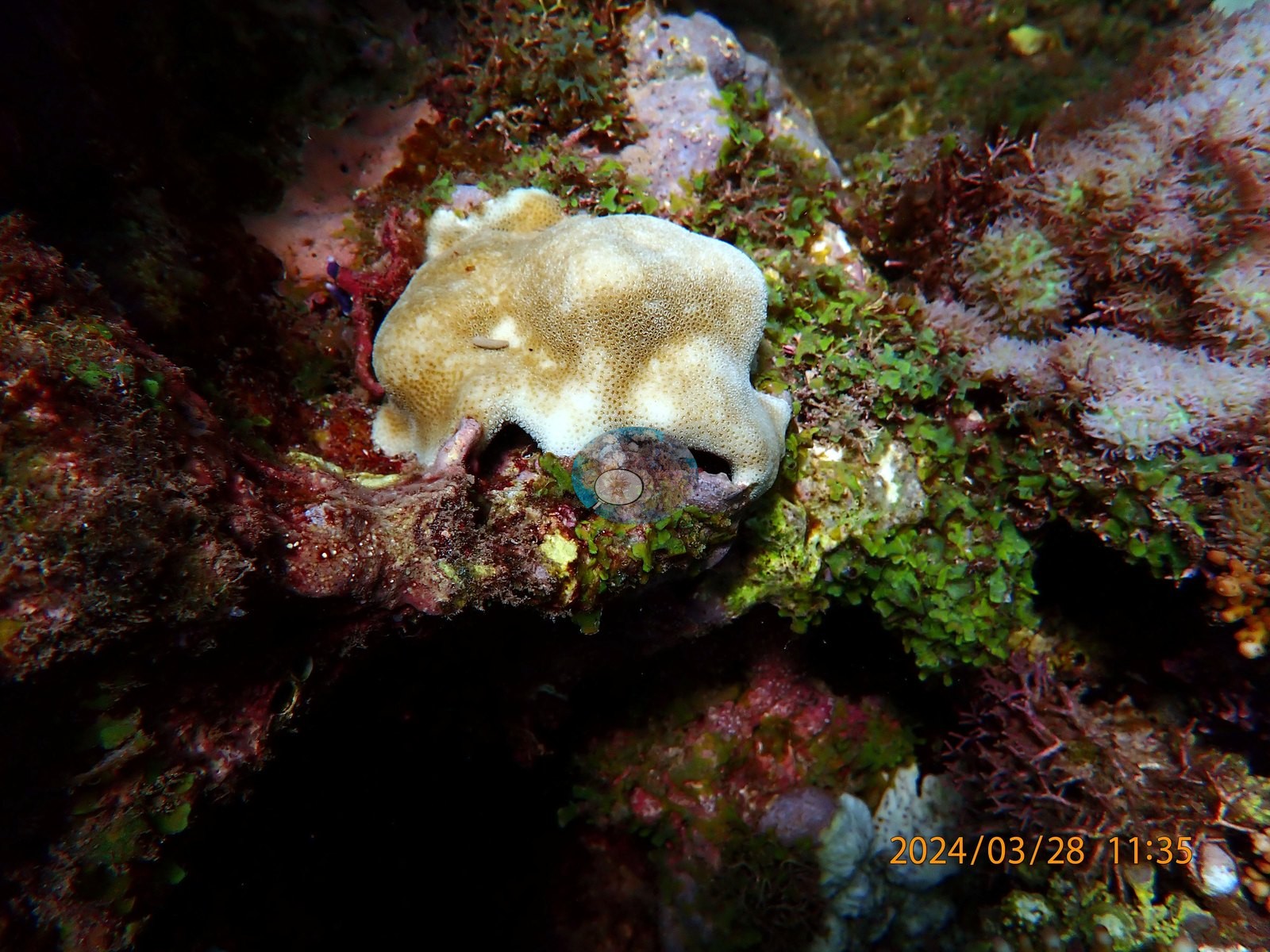
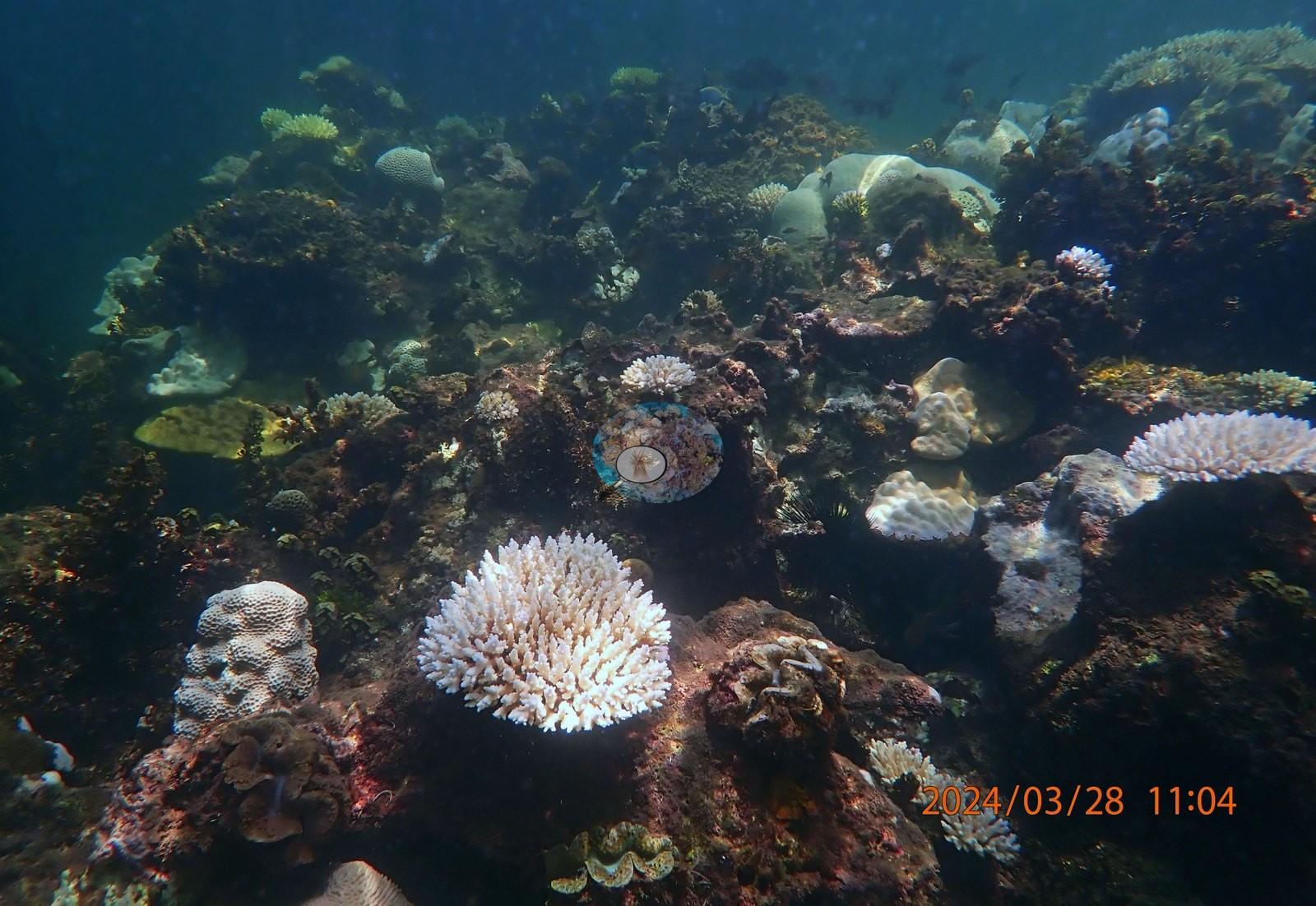
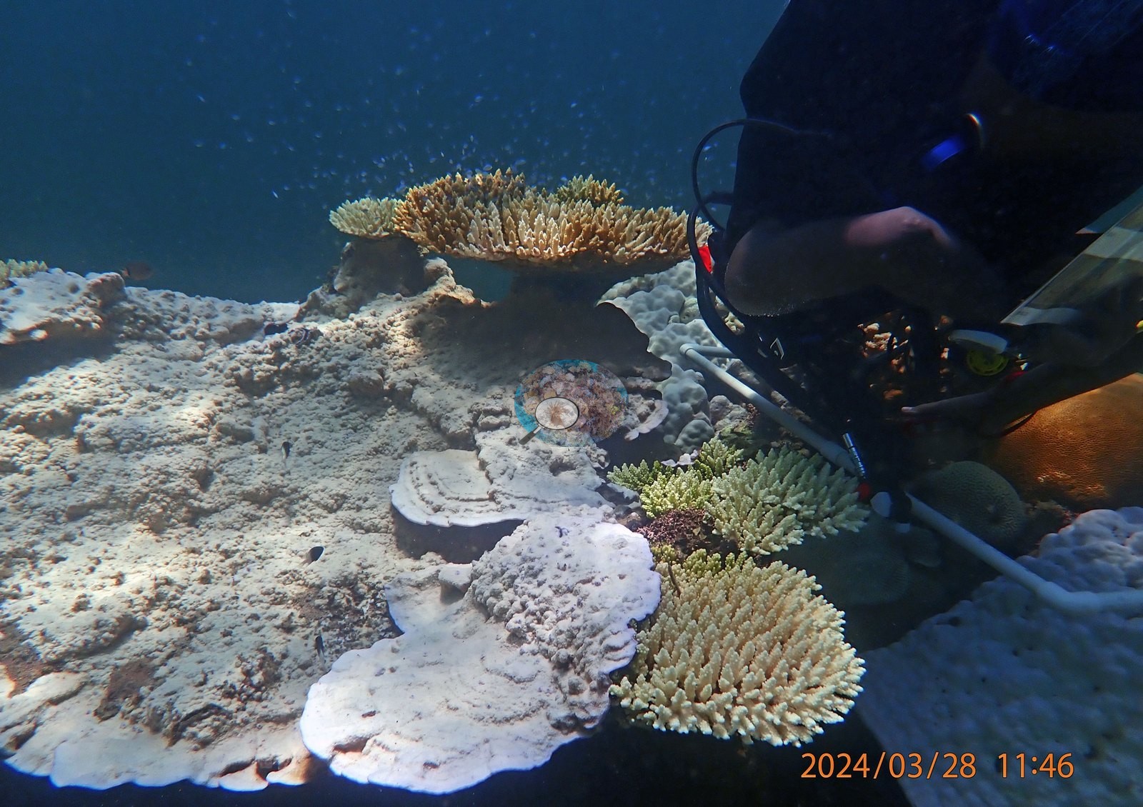
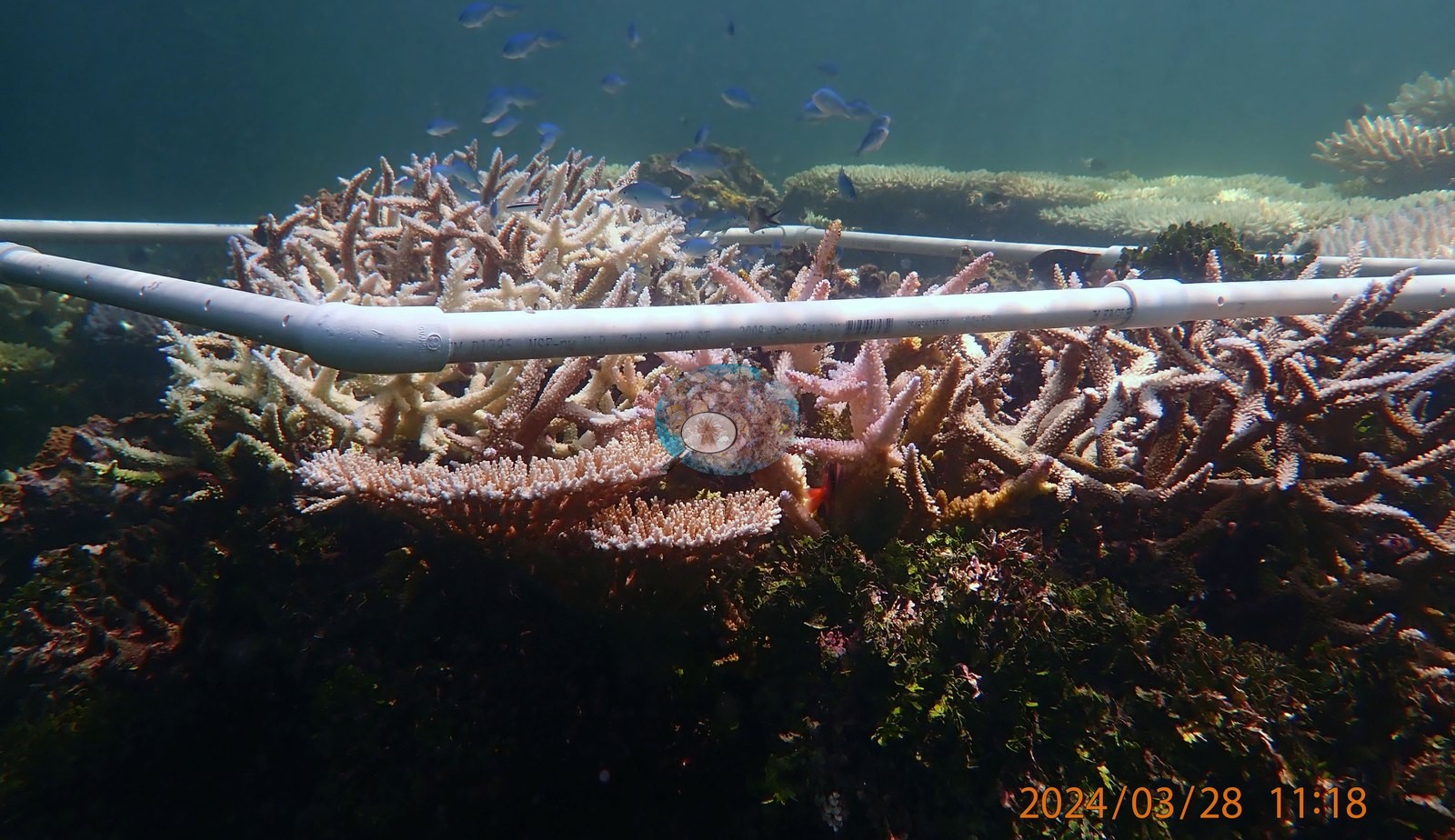
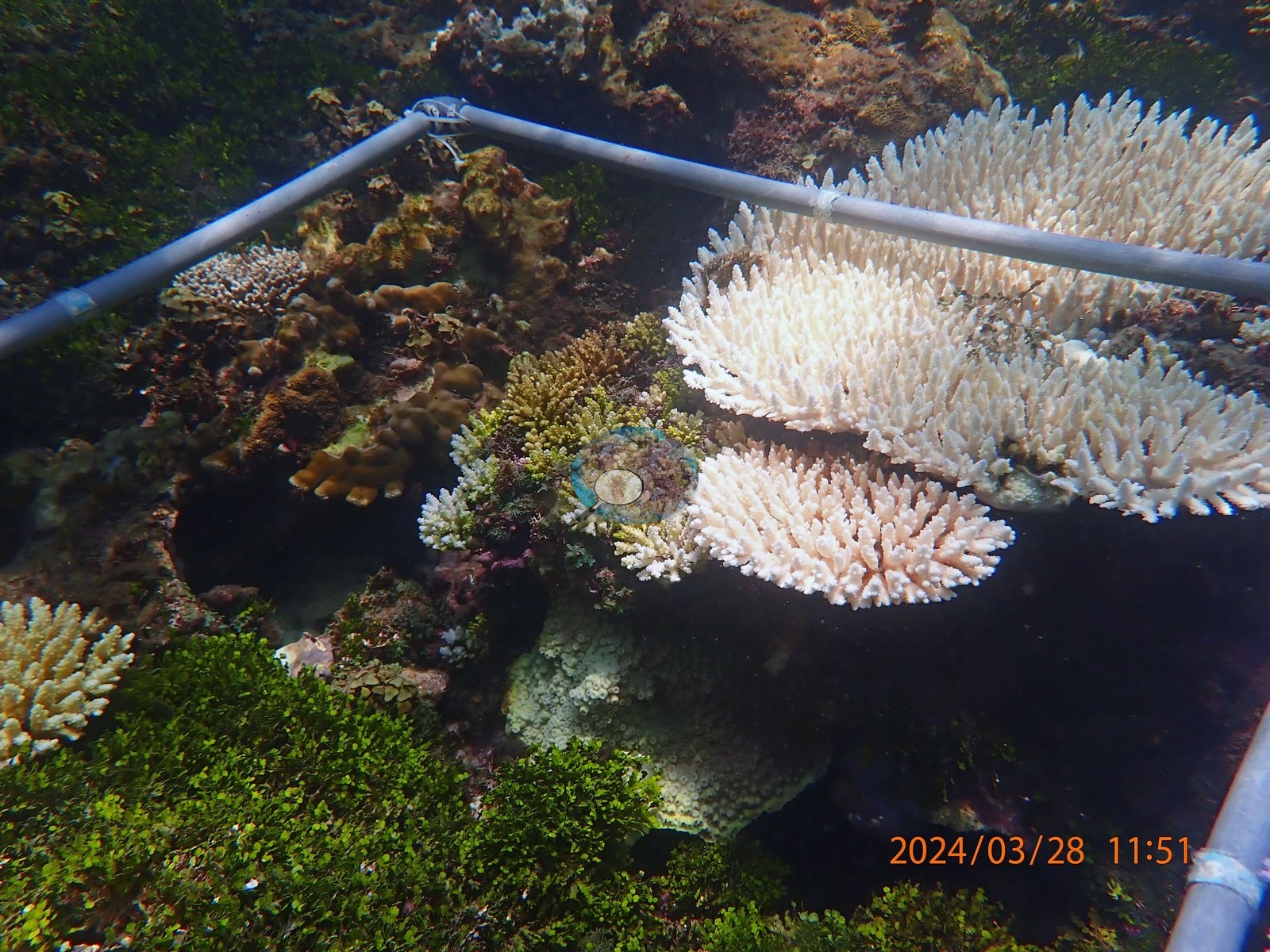
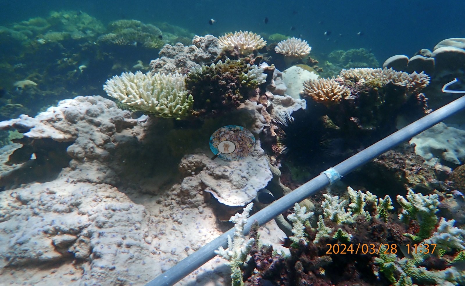
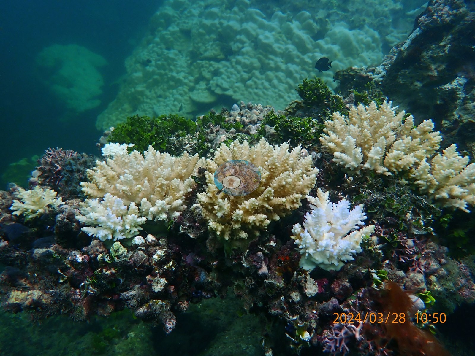
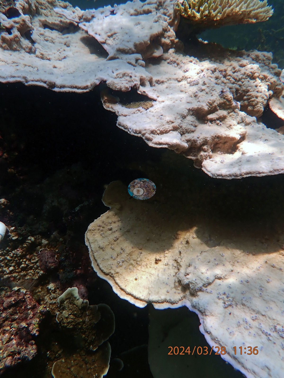
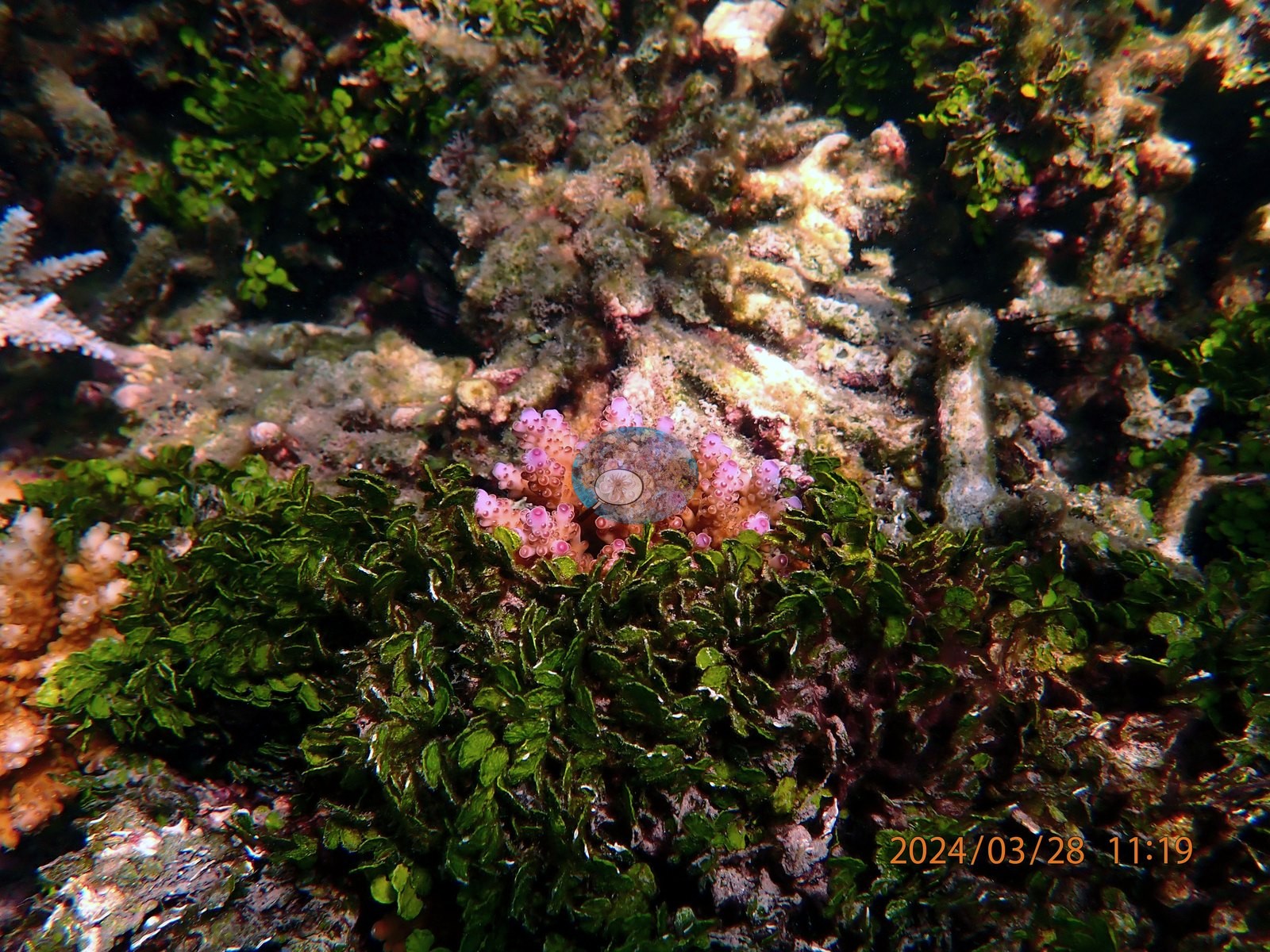
The branching-coral quadrats are where the bleaching is most complete. UYQ8 (11:18-11:25) is a dense staghorn and corymbose Acropora thicket, and it is essentially uniformly bleached: frame after frame of white-to-palest-pink branch stands filling the quadrat (UYQ8-3, UYQ8-4, UYQ8-13, UYQ8-14, UYQ8-22, UYQ8-23, UYQ8-24, UYQ8-25, UYQ8-26, UYQ8-27, UYQ8-28, UYQ8-29). UYQ13 (11:47-11:55) is the same story in tabular form -- white tables and corymbose heads standing over a green algal carpet (UYQ13-2, UYQ13-3, UYQ13-4, UYQ13-7, UYQ13-10, UYQ13-12, UYQ13-14) -- with only one clearly pigmented tan Acropora table left in it (UYQ13-8), blue damselfish hanging over it. UYQ5 (10:52-10:57) holds two large tables, one pale cream throughout (UYQ5-1) and one split tan-and-white across a single colony (UYQ5-15), plus corymbose heads in pink and mauve-white (UYQ5-4, UYQ5-5, UYQ5-8, UYQ5-9, UYQ5-11). UYQ12 (11:43-11:47) is tabular ground too, but with more survivors: two large tables gone white with lilac rims (UYQ12-10, UYQ12-13) sit beside gold-brown corymbose Acropora and chocolate-brown faviid domes still fully pigmented (UYQ12-3, UYQ12-4, UYQ12-5, UYQ12-6). The boulder and brain quadrats overturn the idea that the massive corals were the safe group here. UYQ2 (10:26-10:36) is macroalgae-heavy ground -- brown Sargassum and Padina-type canopy through UYQ2-2, UYQ2-10, UYQ2-14, UYQ2-19 -- studded with large massive colonies, and the massives in it are the most completely bleached corals in the entire set: two meter-scale porcelain-white Porites-type domes (UYQ2-17, UYQ2-25), a third white dome with black tissue-loss channels running across it (UYQ2-13), and white meandroid and faviid colonies at UYQ2-5, UYQ2-7, and UYQ2-8. UYQ3 (10:36-10:43) adds a textbook fully white meandroid brain (UYQ3-20) and a white massive bommie (UYQ3-18) alongside long pale digitate Acropora ridges (UYQ3-21, UYQ3-22), but also the survivors: gold-brown corymbose Acropora immediately beside white ones (UYQ3-4, UYQ3-5, UYQ3-7) and tan faviids and Astreopora-type colonies (UYQ3-8, UYQ3-9, UYQ3-13) (e.g., Image 3).
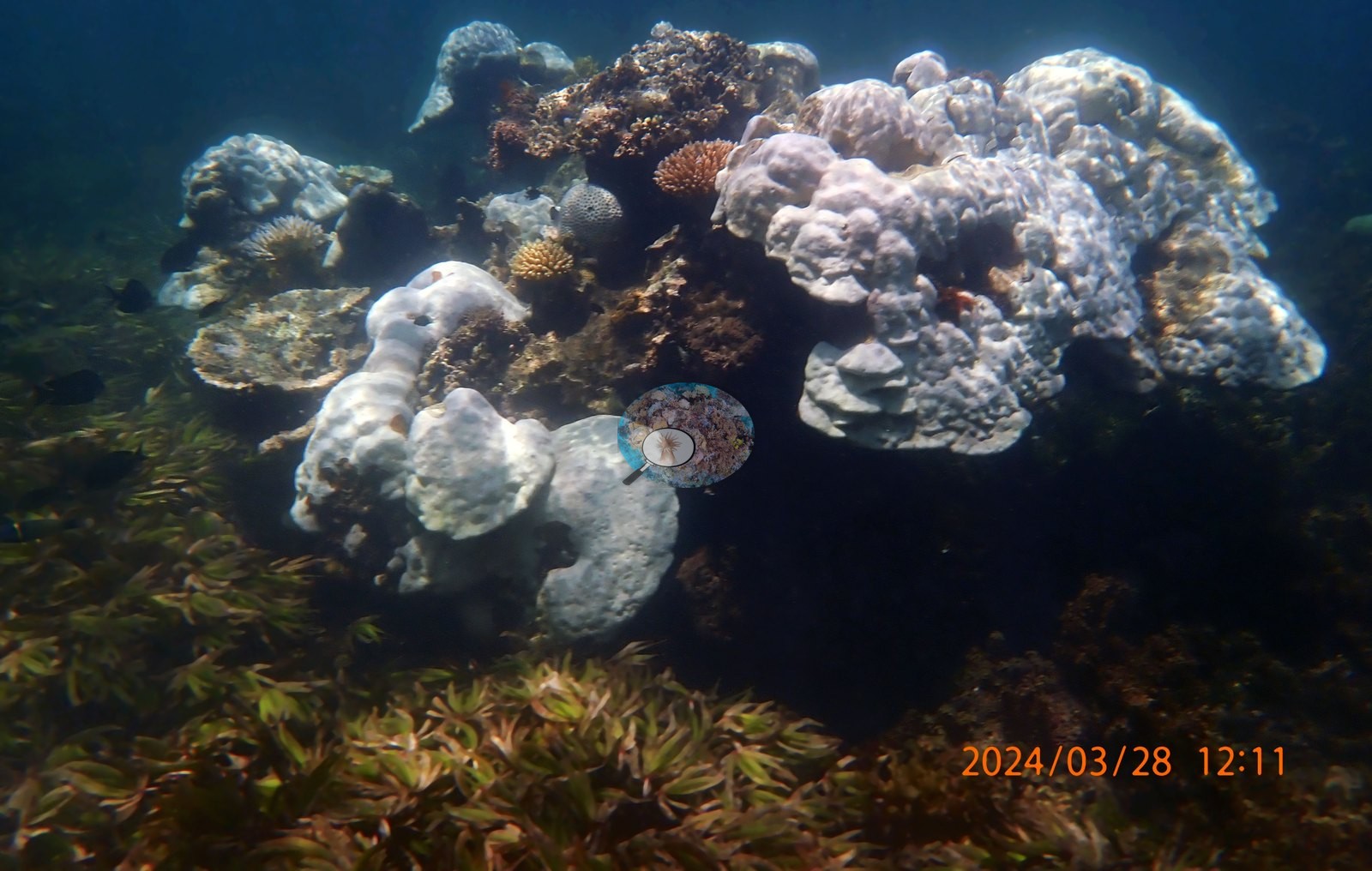
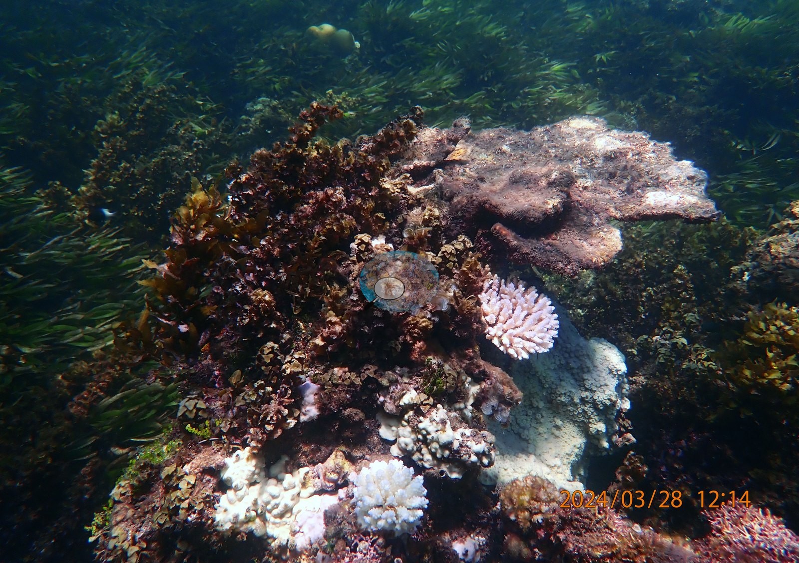
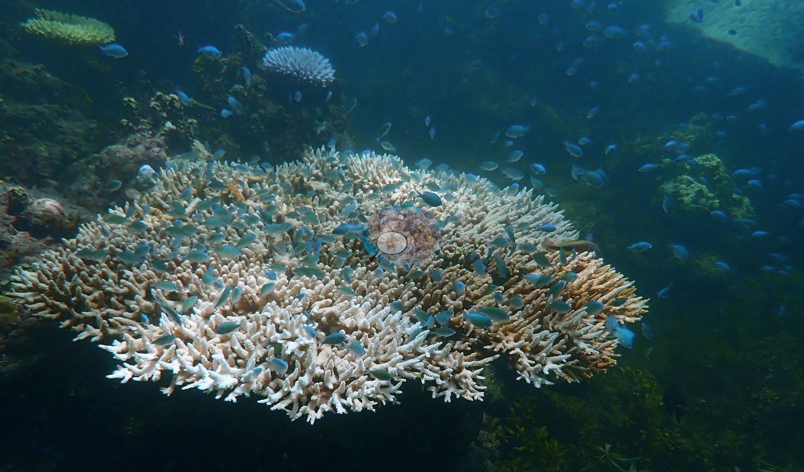
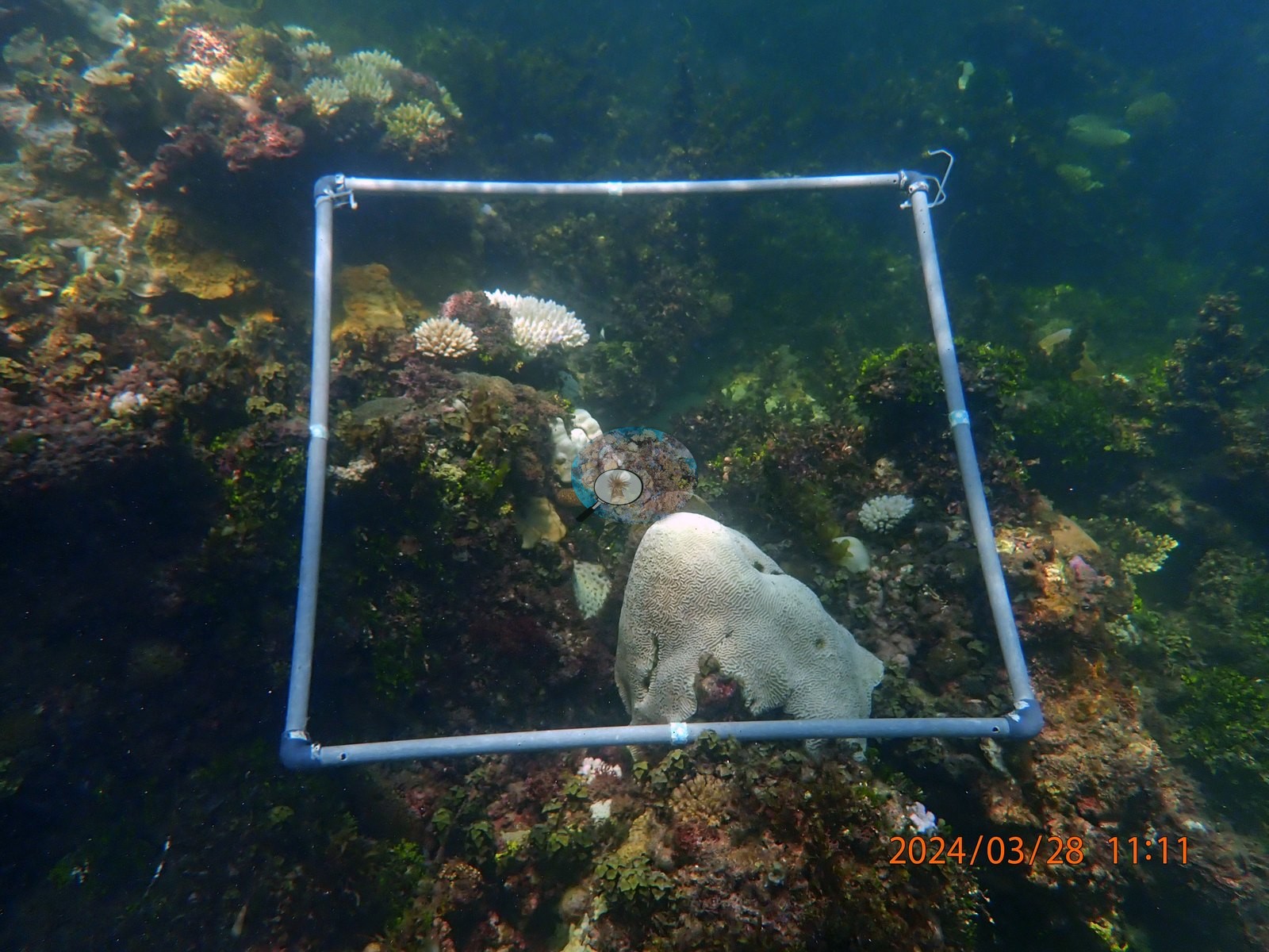
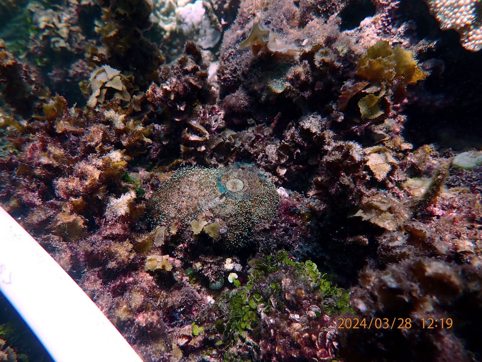
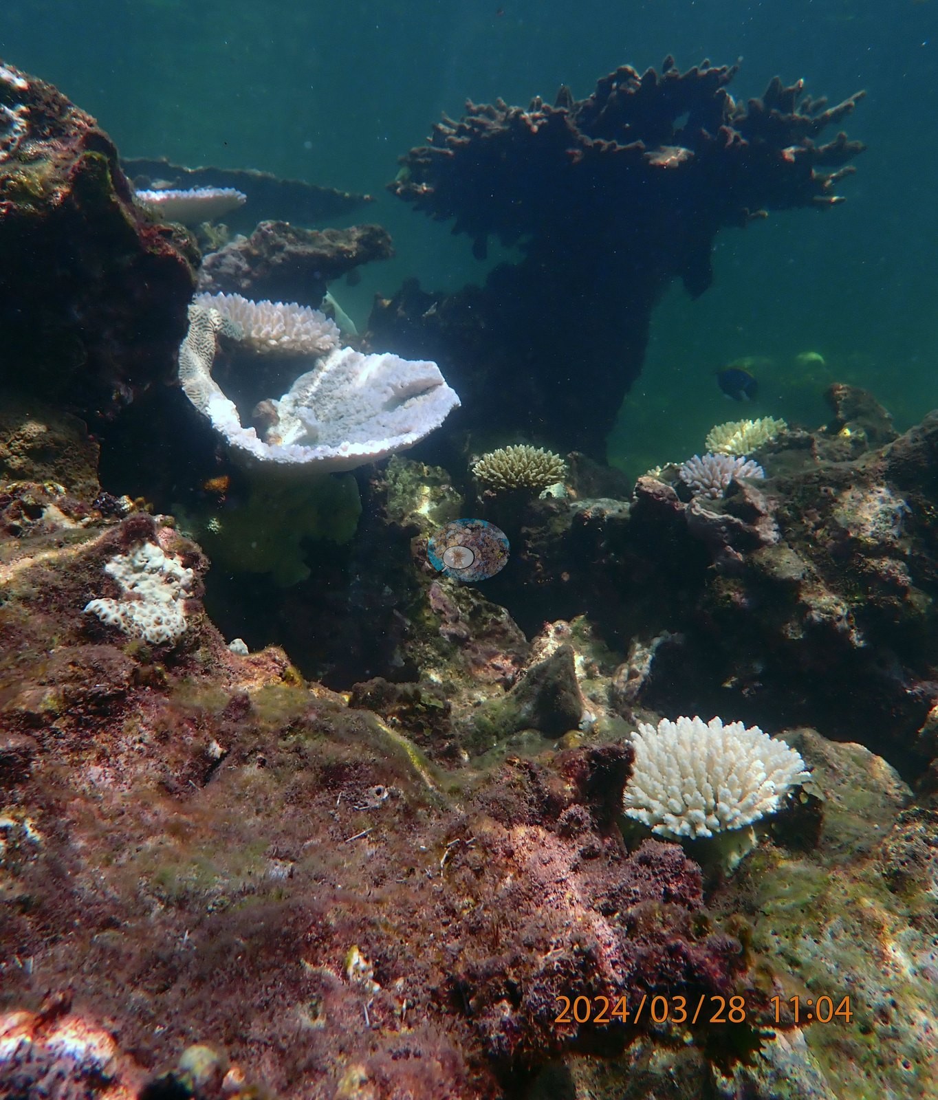
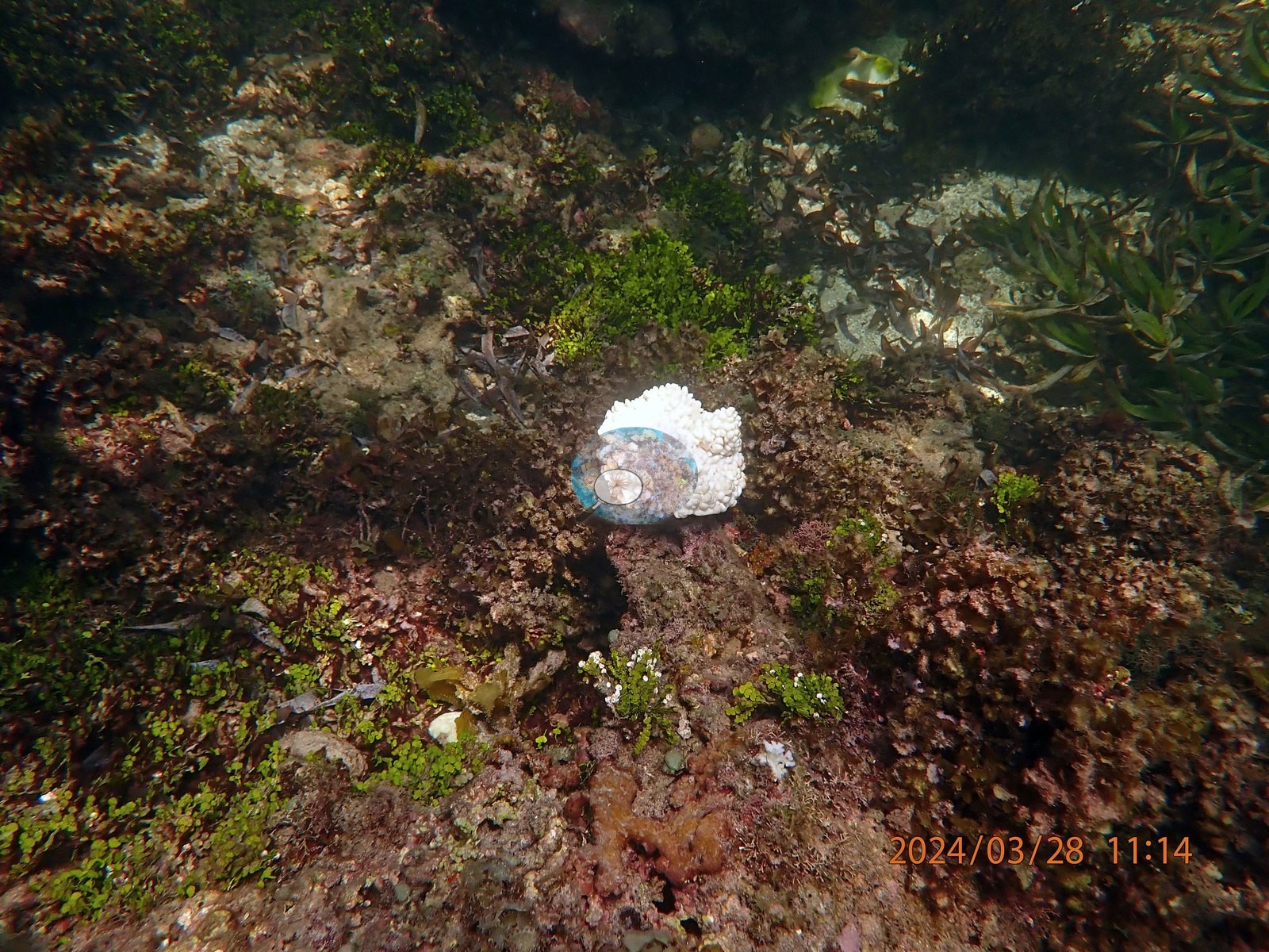
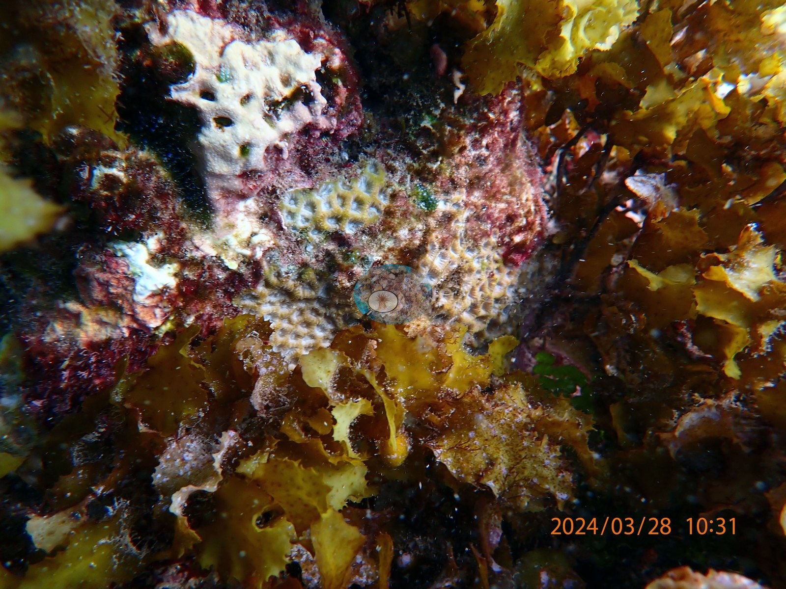
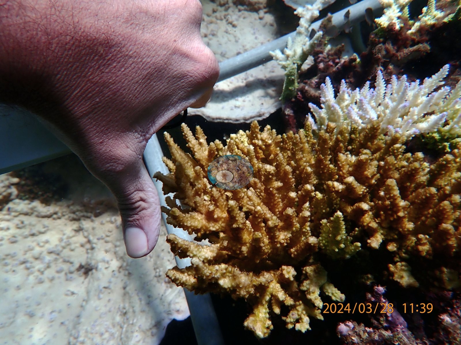
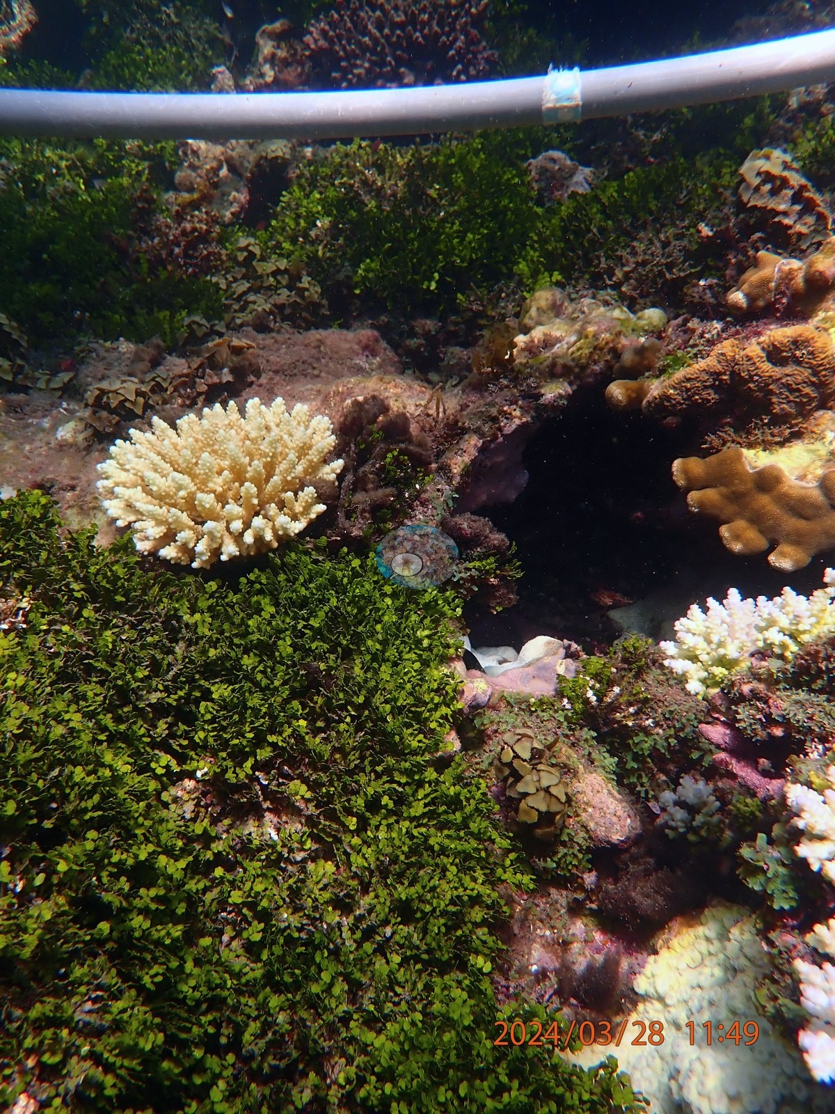
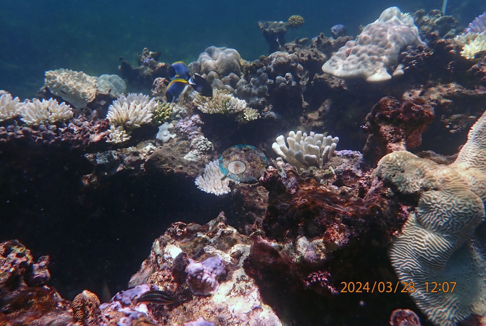
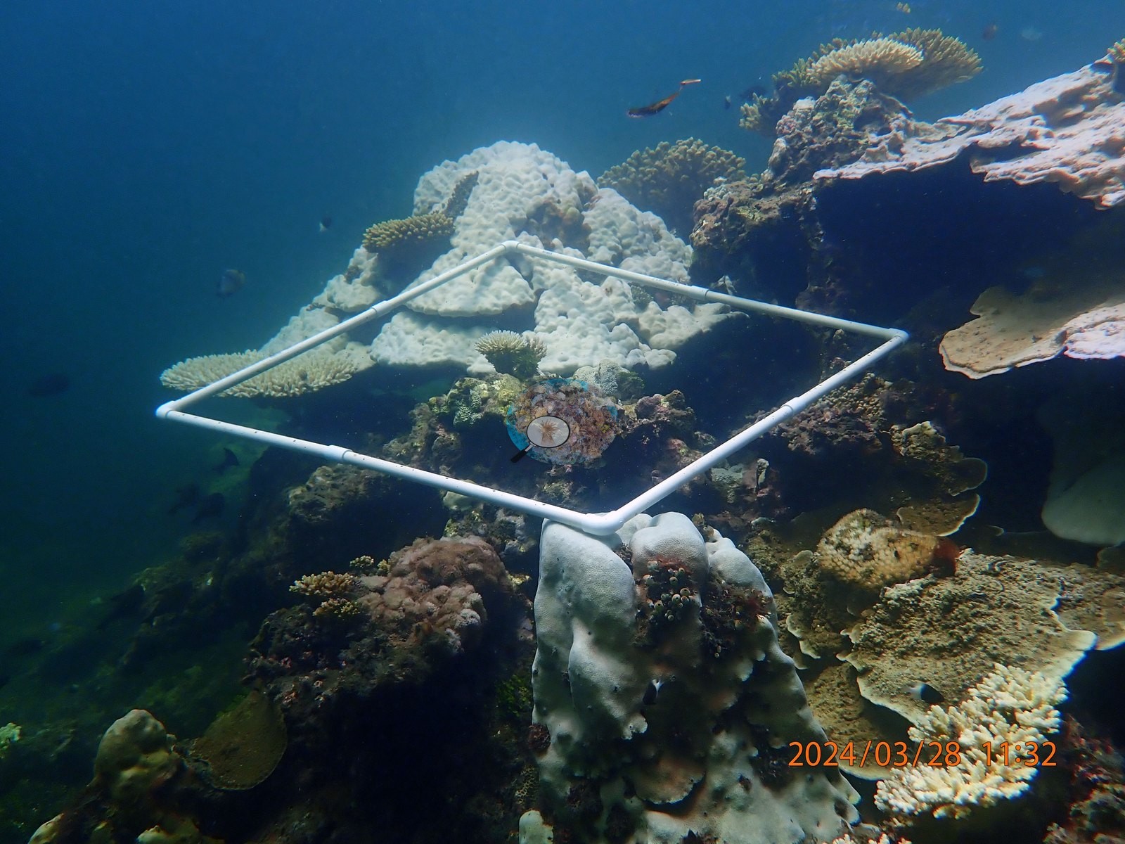
UYQ4 (10:44-10:51) is a Porites boulder field where the boulders have gone pale and chalky rather than staying brown (UYQ4-1, UYQ4-2, UYQ4-3, UYQ4-27, UYQ4-28), including one large white lobate colony with a single dark red remnant patch (UYQ4-29); its pigmented holdouts are branching, not massive -- two close-ups of gold-orange Acropora with normal color (UYQ4-25, UYQ4-26) and a mustard-yellow encrusting plate (UYQ4-14) (e.g., Image 2).
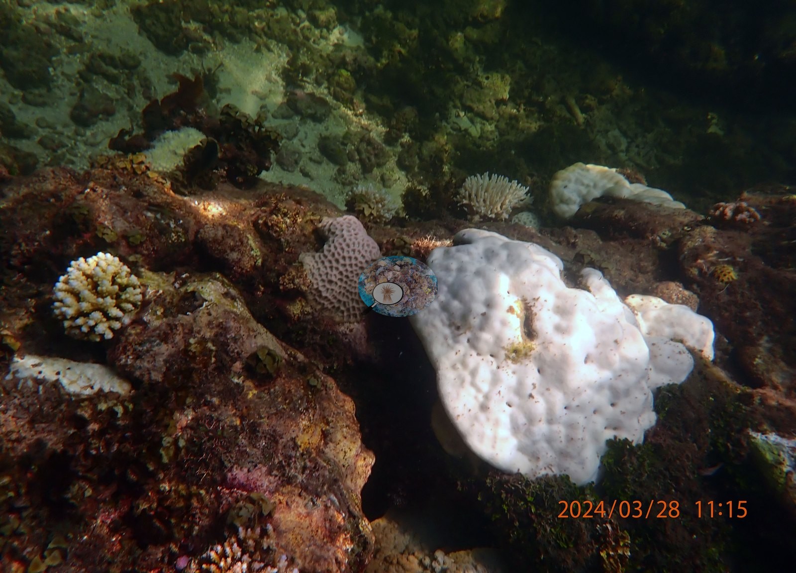
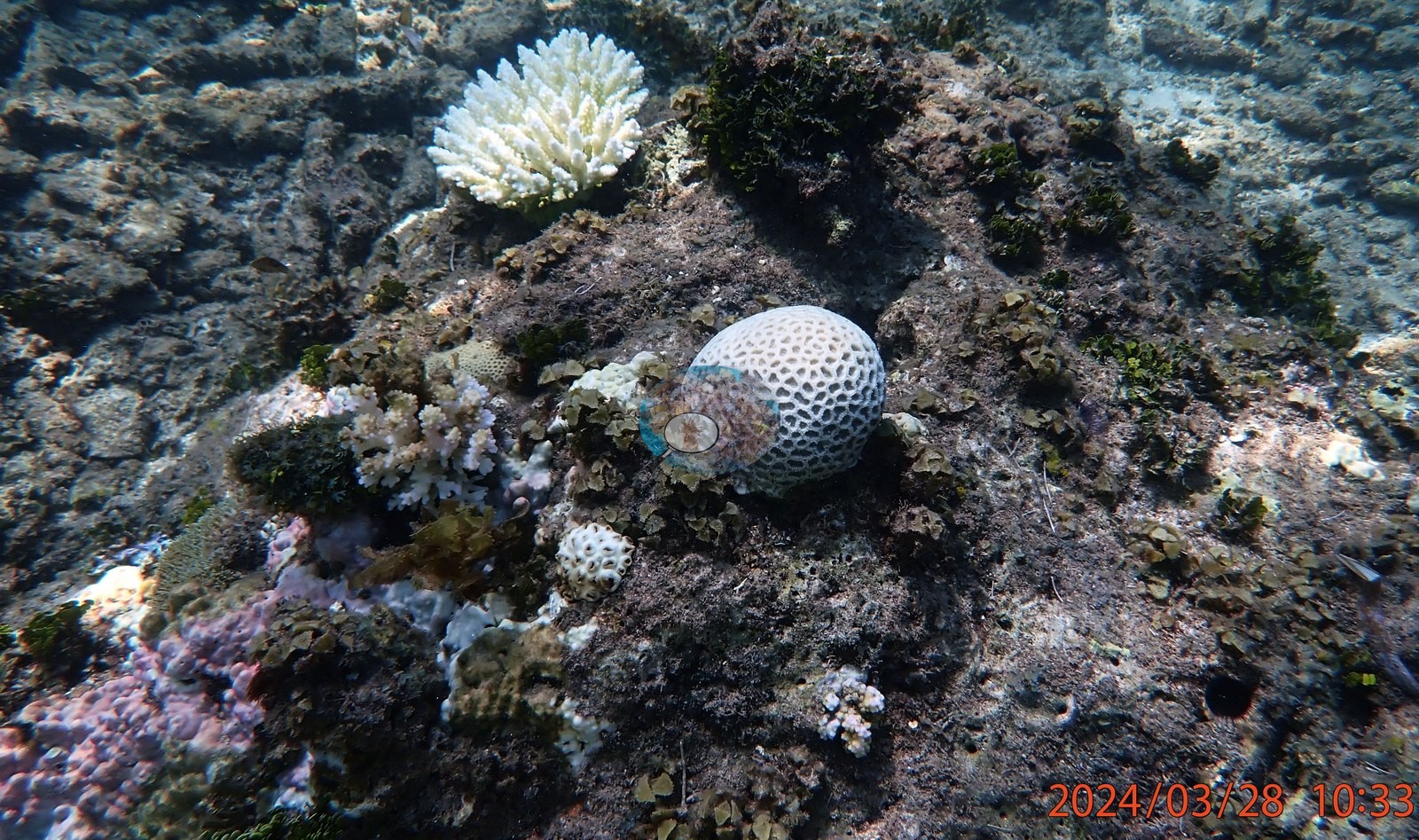
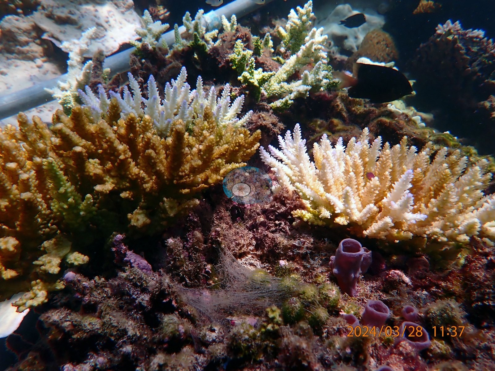
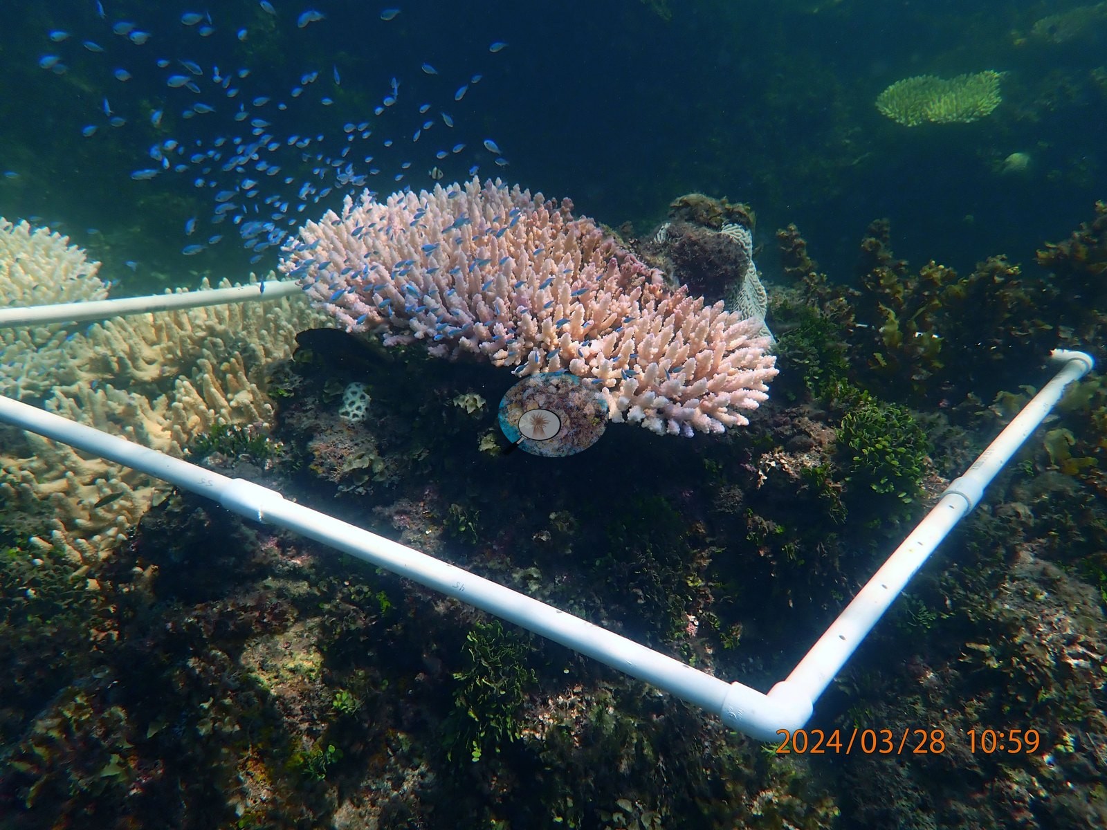
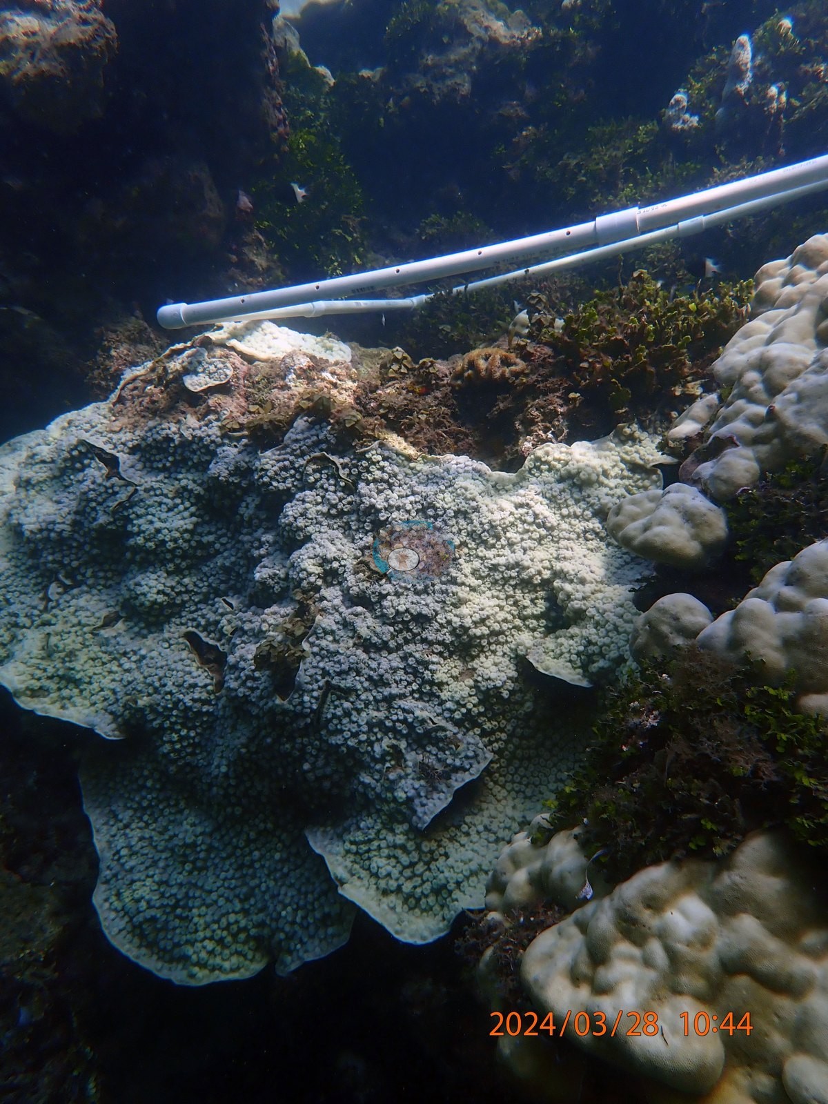
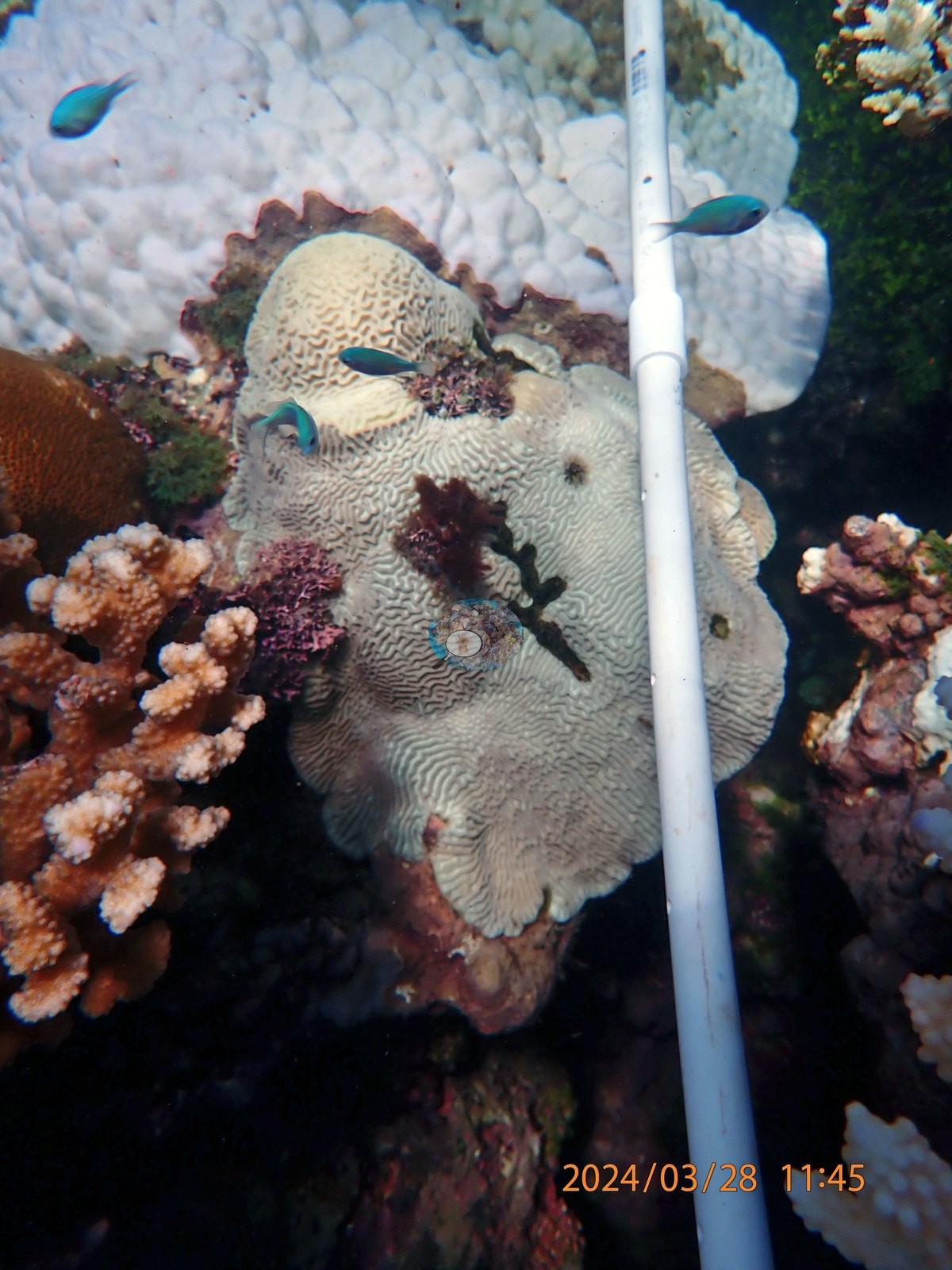
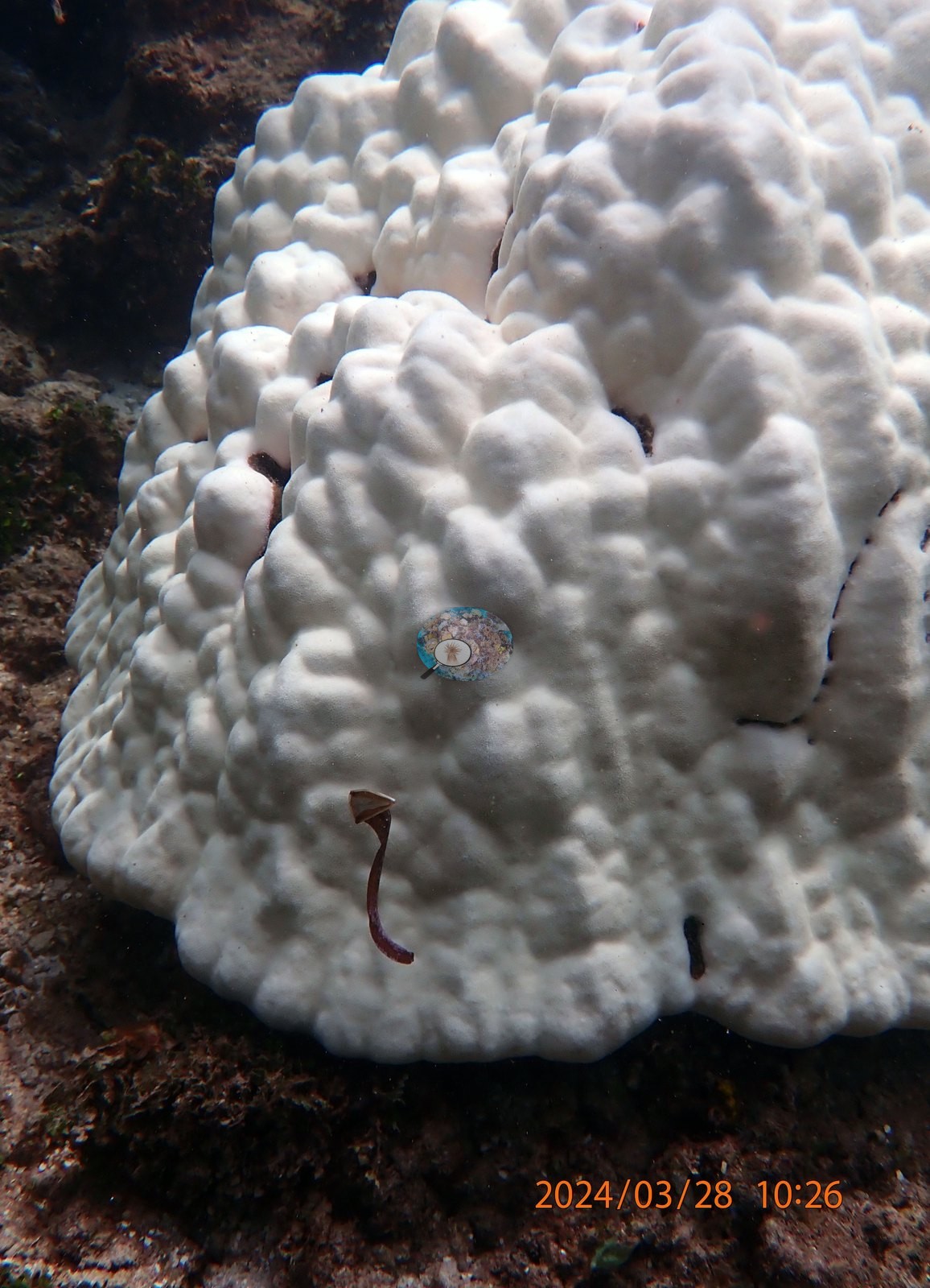
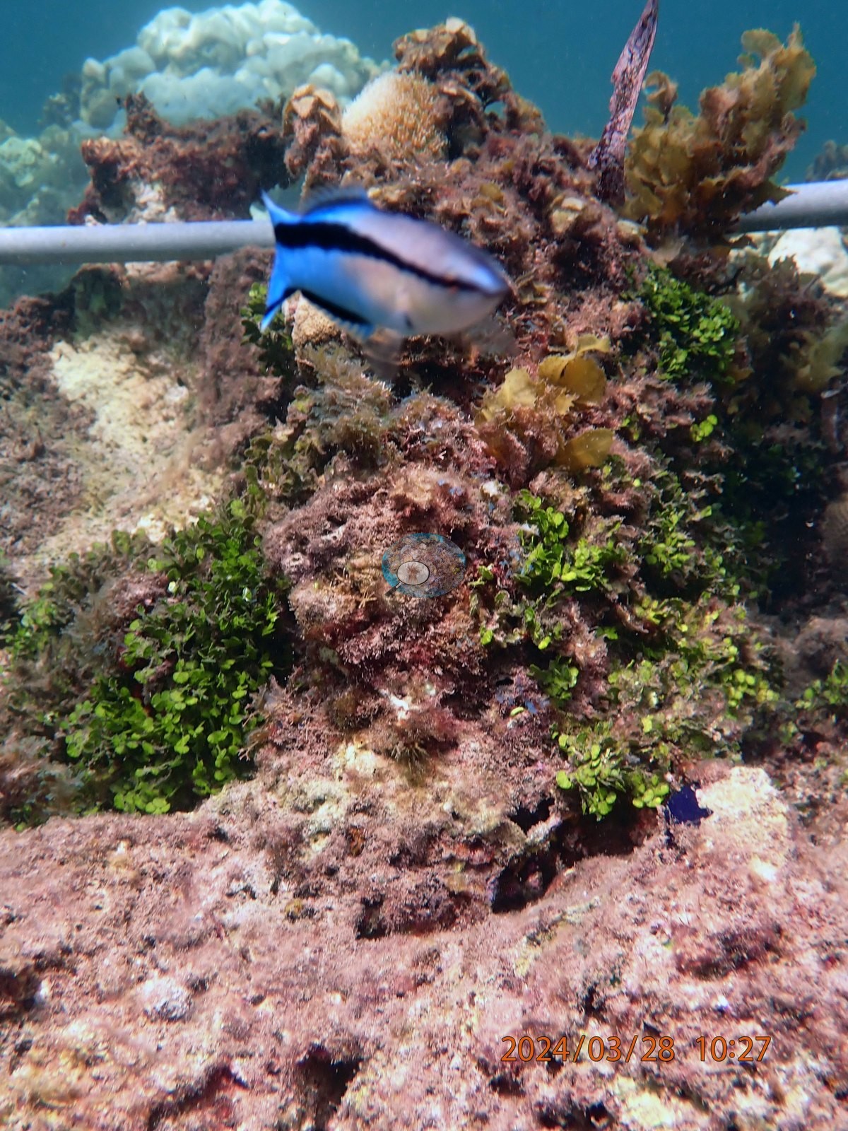
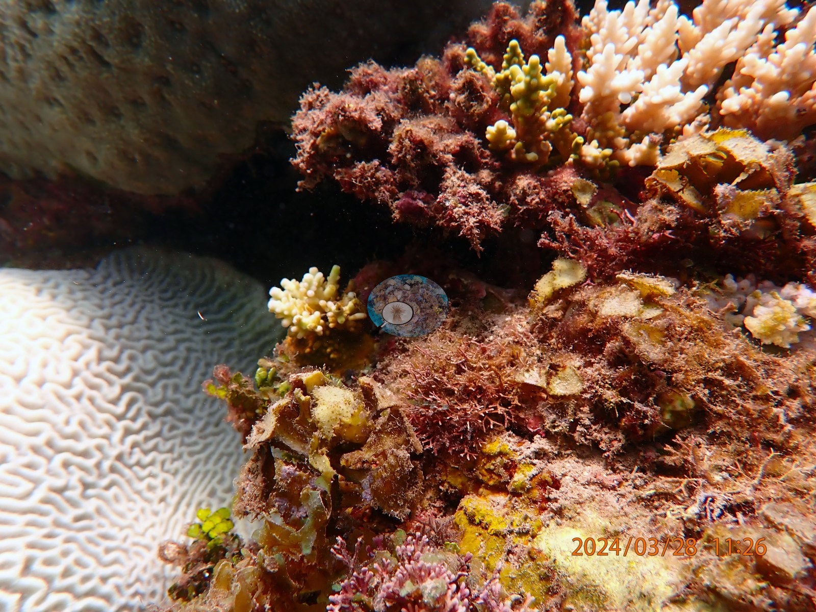
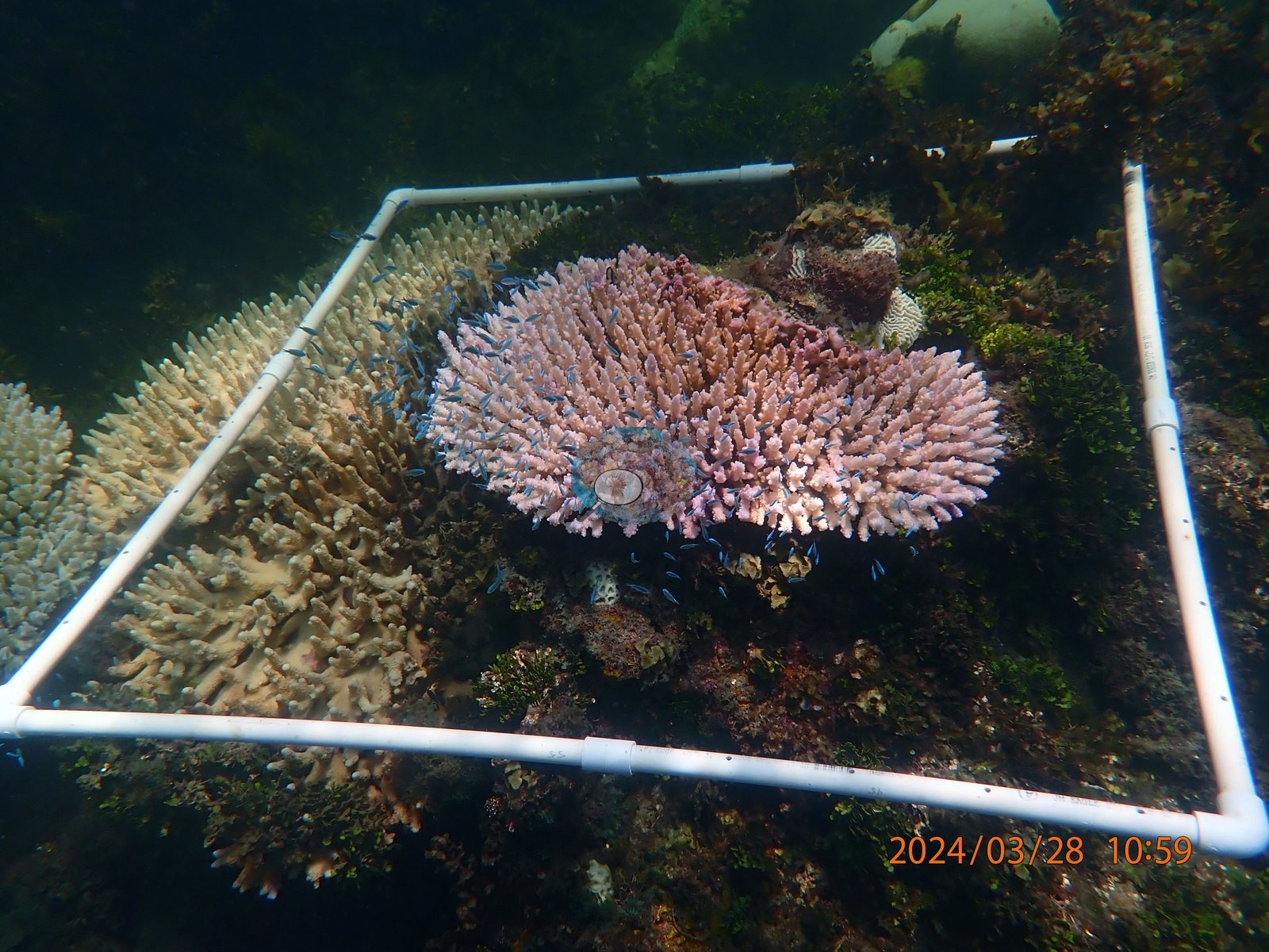
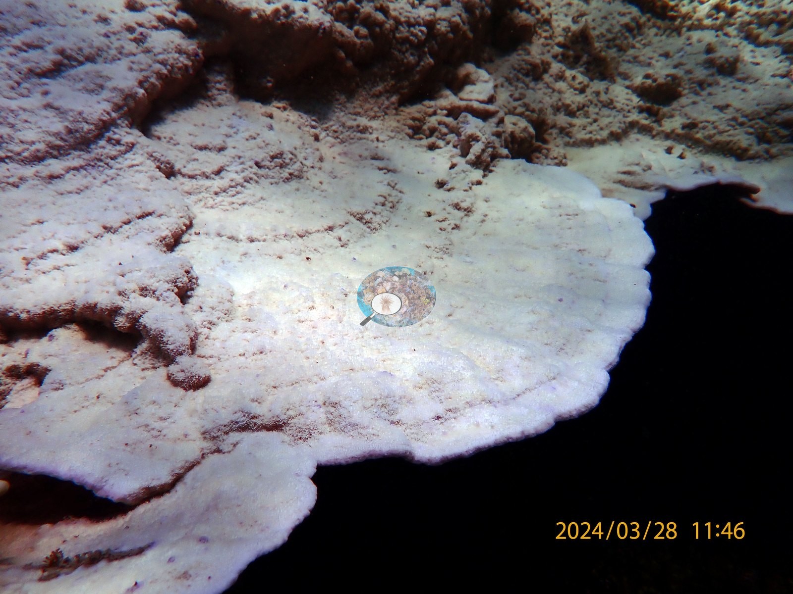
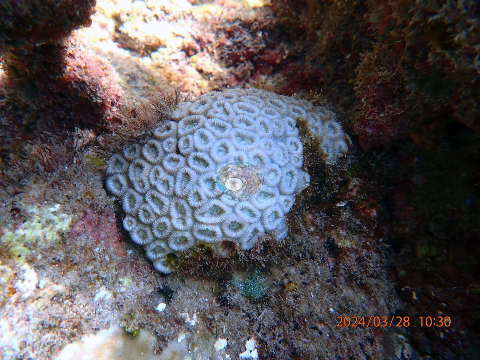
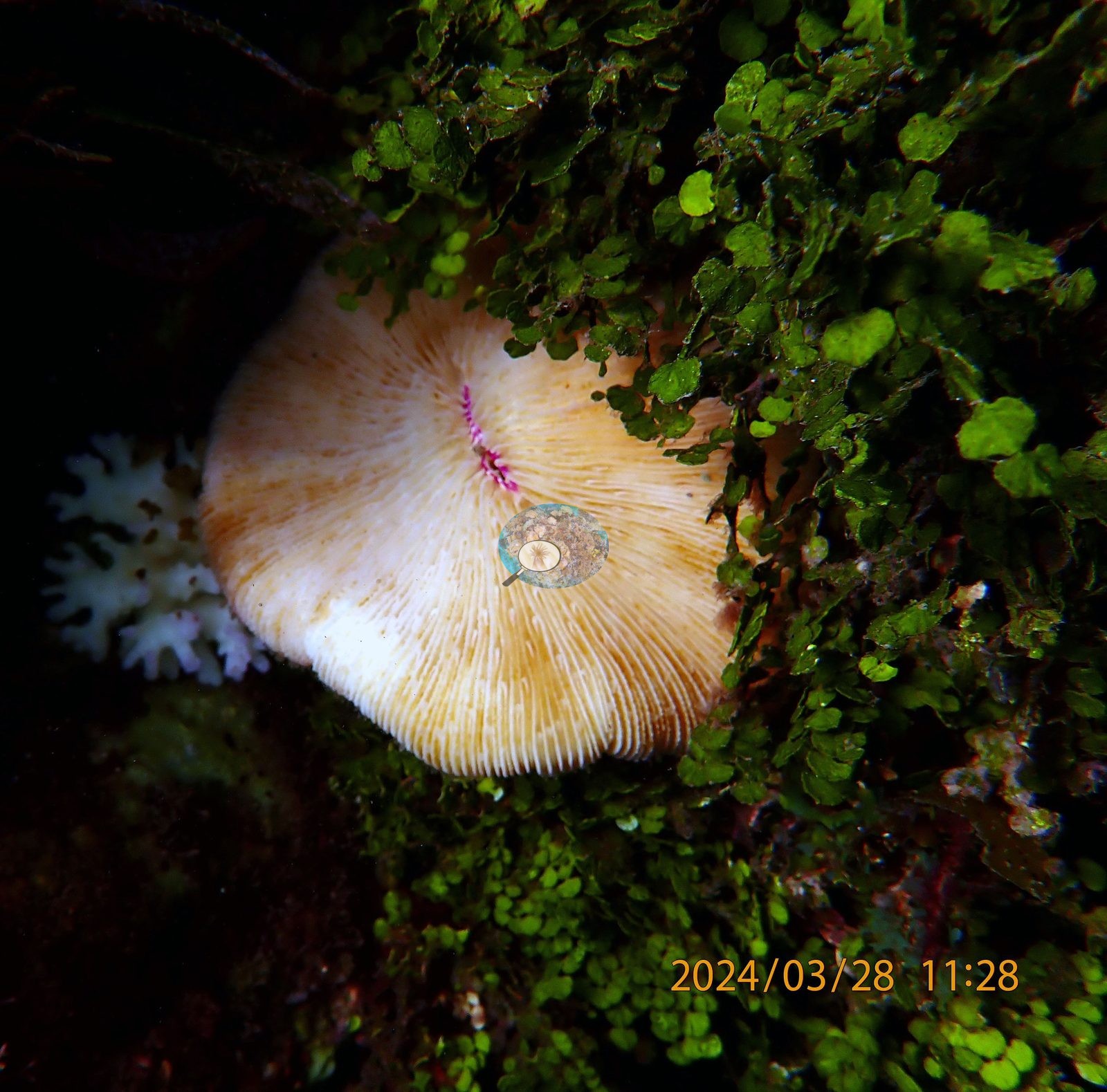
UYQ9 (11:25-11:32) is brain coral ground, and every large meandroid colony in it is pale gray-white (UYQ9-6, UYQ9-9, UYQ9-19, UYQ9-21, UYQ9-22); free-living Fungia mushroom corals in the same quadrat are white too (UYQ9-18, UYQ9-20), with a single tan one retaining a pink mouth (UYQ9-17) (e.g., Image 4).
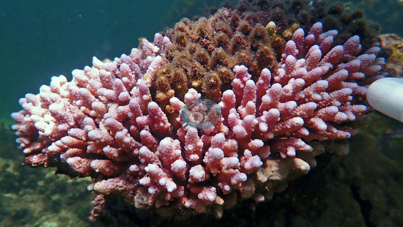
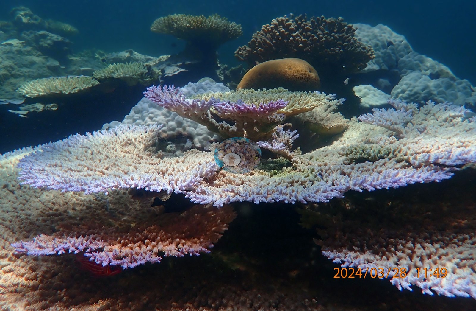
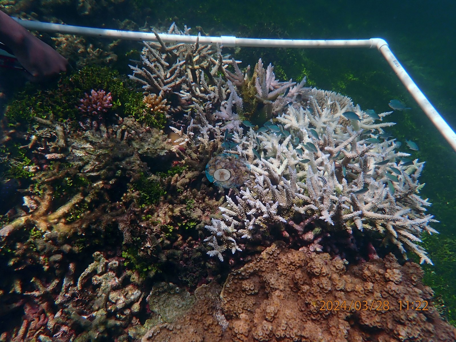
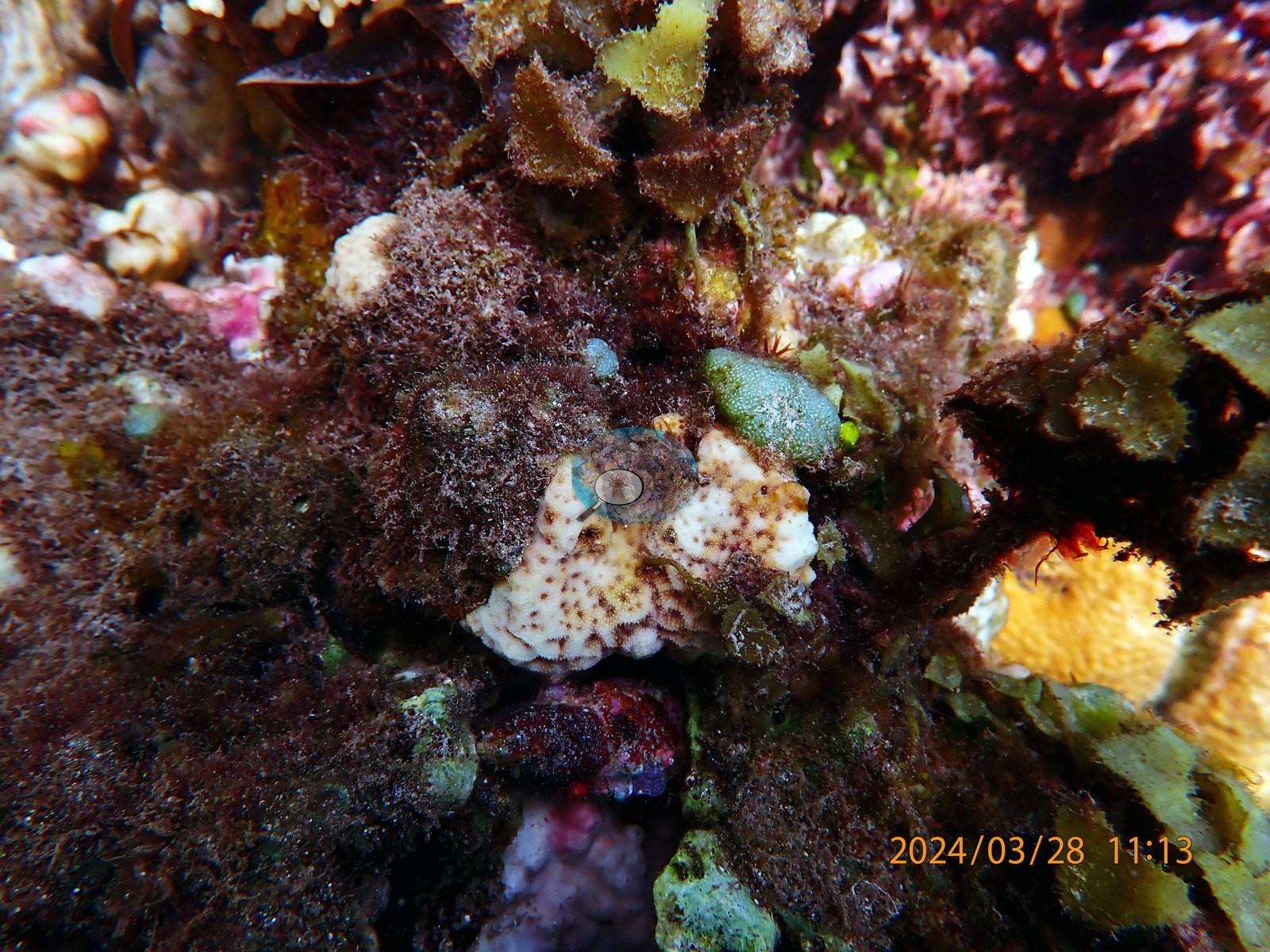
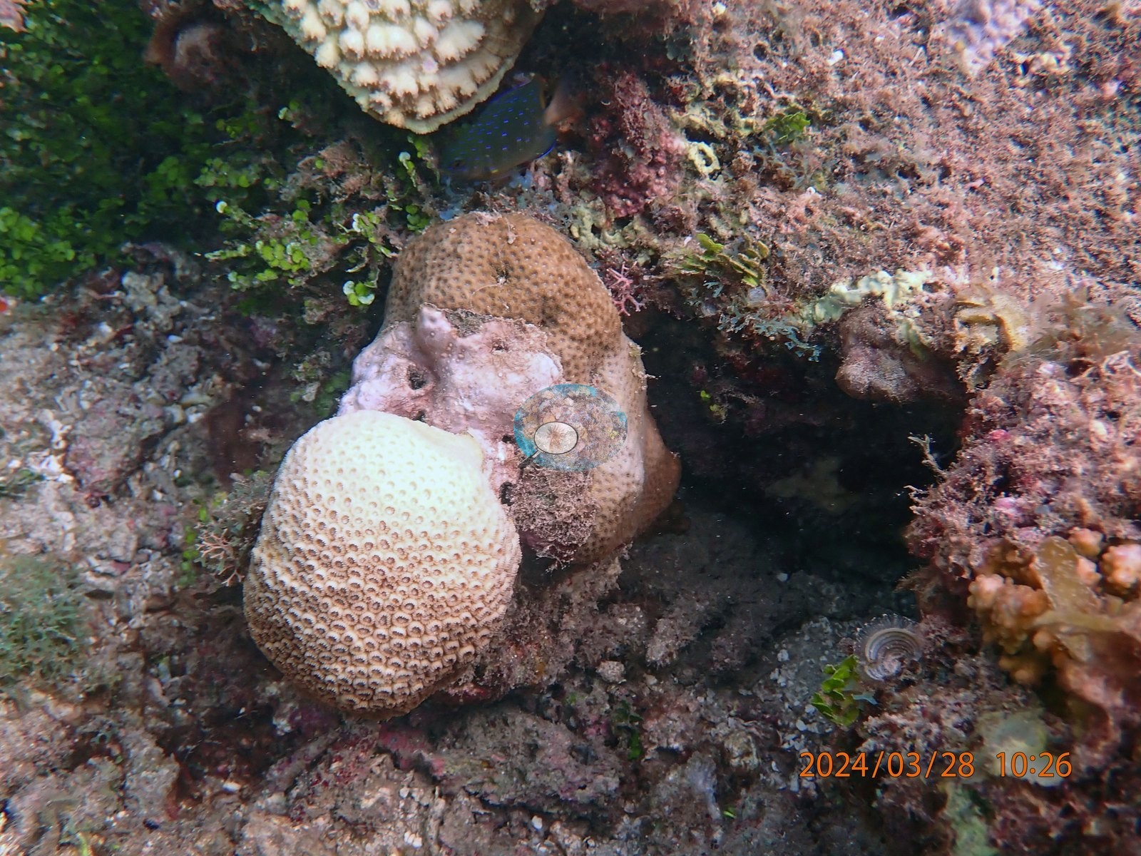
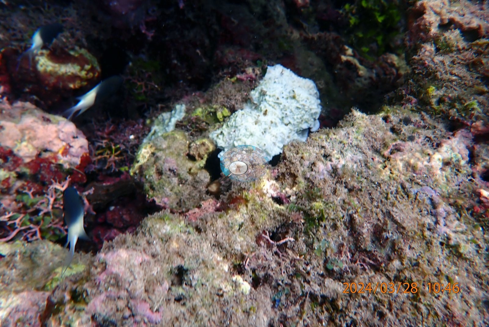
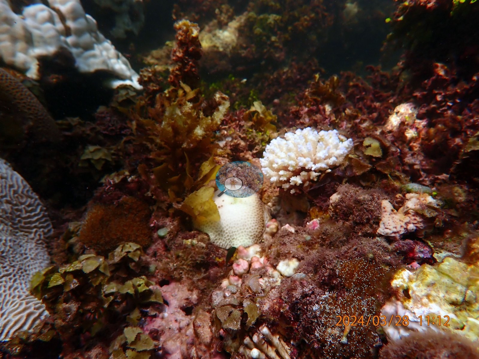
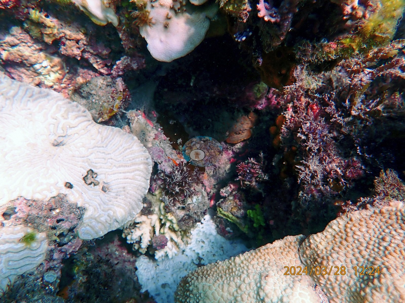
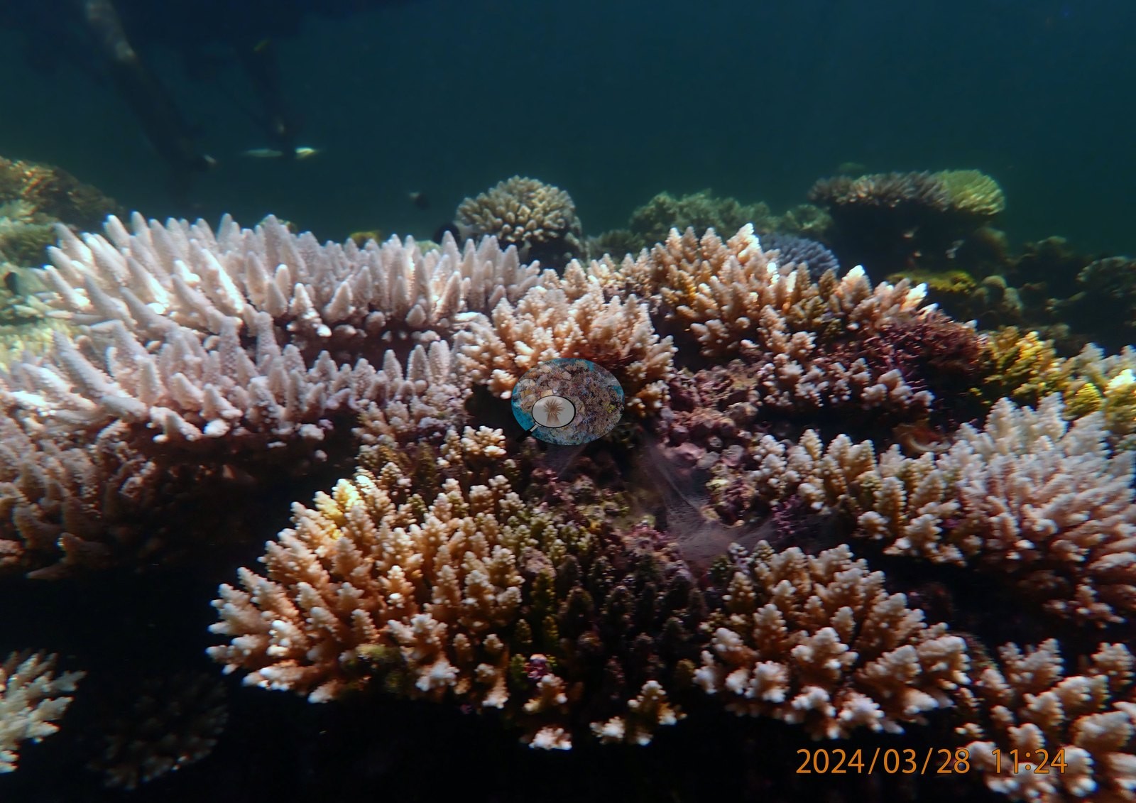
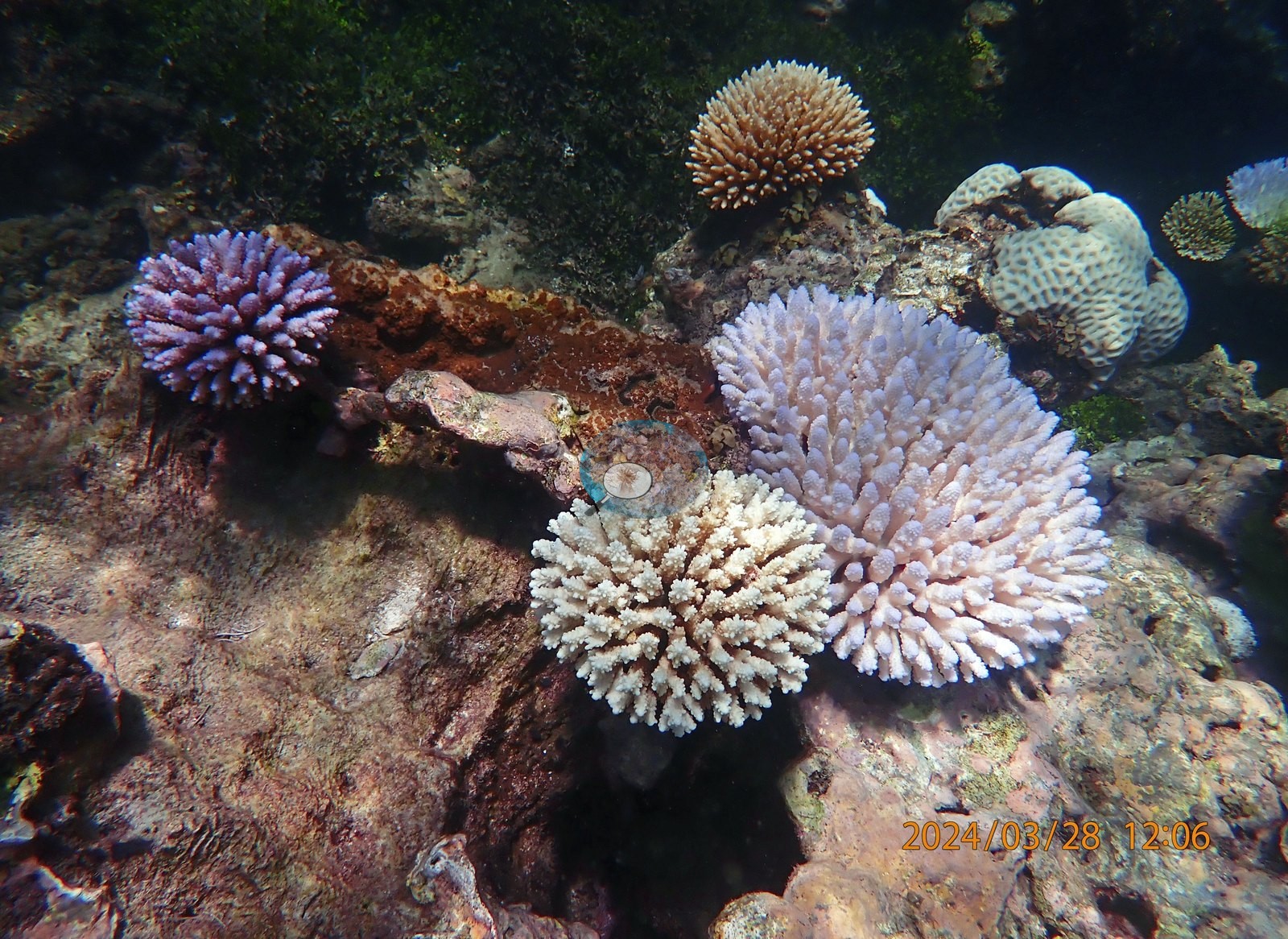
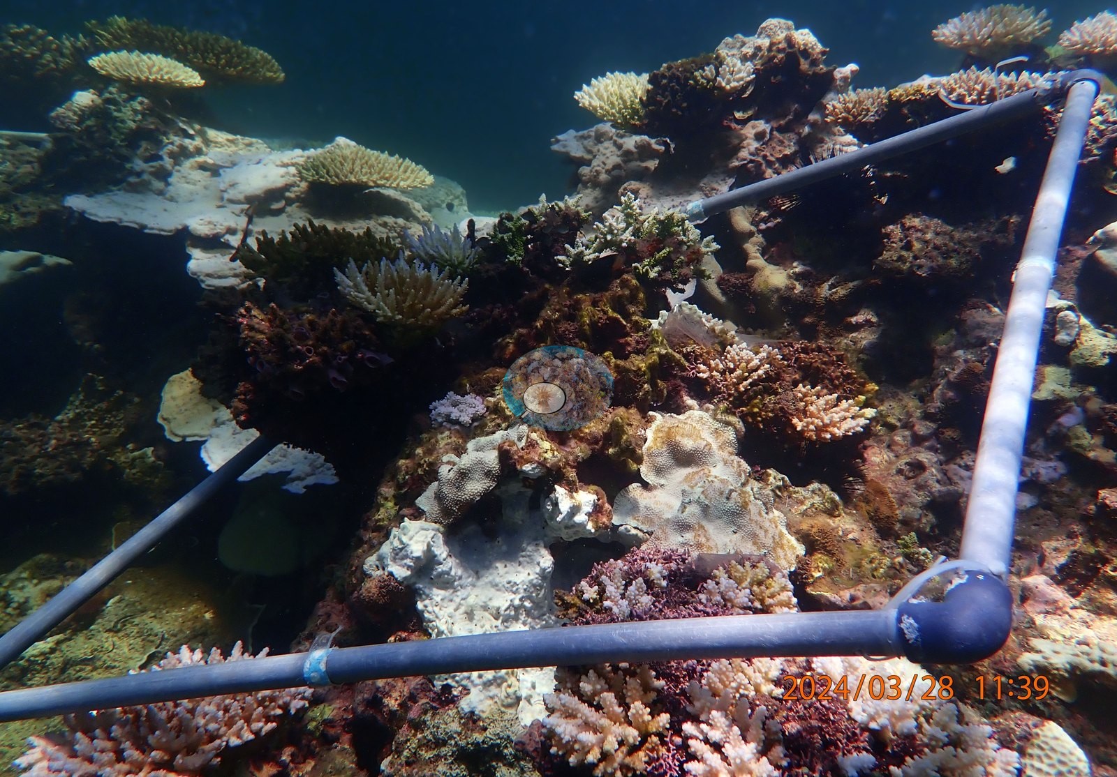
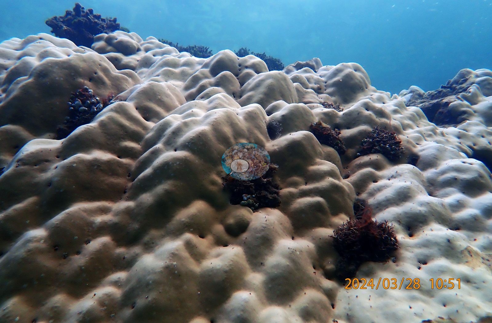
The exceptions in UYQ9 are again branching: a fully gold-green Acropora (UYQ9-12) and a strongly orange-brown corymbose colony (UYQ9-24). UYQ11 (11:38-11:43) is the healthy-versus-bleached quadrat -- four hand-in-frame close-ups deliberately place a gold or tan Acropora against a snow-white one on the same patch of reef (UYQ11-4, UYQ11-5, UYQ11-6, UYQ11-8), and UYQ11-15 catches the split within a single corymbose colony, half brown and half white. Its massive Porites bommies are pale to white almost without exception (UYQ14-10, UYQ14-28, UYQ14-34, UYQ14-37, UYQ14-38, UYQ14-40, UYQ14-41, UYQ14-42, UYQ14-44, UYQ14-48), one broad stretch is flattened algal-covered pavement with no live coral left on it (UYQ14-23), and one wide frame holds a dozen separate white colonies in a single view (UYQ14-26). Set against that, UYQ14-17 is a fully tan-gold massive Porites in perfect condition, and the quadrat holds the strongest color signal in the survey: vivid pink-red corymbose Acropora with brown remaining at the top (UYQ14-11), magenta-pink Pocillopora (UYQ14-2), and a mauve-pink corymbose head immediately beside a white one (UYQ14-30). That pink-to-mauve stress coloration is real and it is the site's signature, seen in eleven of the sixteen quadrats -- but note that these are color-adjusted exports, so the intensity of the pinks should be treated as indicative rather than measured (e.g., Image 1).
What supports it as a genuine observation, rather than processing, is that in every case the pink colonies sit in the same frame as both fully brown and fully white colonies, so the contrast is internal to the image. No crown-of-thorns seastar appears in any of the 358 frames reviewed. Typical recent thermal stress: mean annual maximum of 4.1 degree heating weeks (2021-2025, NOAA CRW; East African Coral Coast ecoregion). Seawater here measured 32.3°C during the survey (the Kenya survey-wide mean of 32.0°C matched the 1998 event), and NOAA recorded a peak of 13.5 degree-heating weeks on 18 April 2024, the highest for Kenya since records began in 1985. In situ temperatures ran 1.3 degrees C above NOAA's estimates, so the true heat stress was likely nearer 22 DHWs.
Fish and other fauna
Other fauna across the set: schooling blue-green chromis over the Acropora stands (UYQ4-30, UYQ6-6, UYQ6-8, UYQ13-13), a sergeant-major over the reef flat (UYQ14-49), damselfish over bleached tables (UYQ12-7), black long-spined urchins (UYQ1-16, UYQ2-9, UYQ11-16), an orange mushroom coral tucked among bleached Acropora branches (UYQ8-12), and extensive fleshy red and brown macroalgae across UYQ2, UYQ7, UYQ9, UYQ15, and UYQ16.
Comparisons with other data
No independent survey was made at this exact site; the nearest ones are listed in the table below.
Dive record
Snorkeled 28 Mar 2024 at about 2 m over the Uyombo reef flat south of Watamu, during the 2024 Western Indian Ocean mass bleaching event. The survey was run as sixteen quadrats (UYQ1-UYQ16) worked between 10:22 and 12:30, and the full 358-frame set shows that Uyombo is not one reef but a mosaic: algal-turfed pavement, dense Acropora thicket, boulder ground, brain coral ground, and seagrass all sit within the same shallow survey, and the bleaching signal reads differently in each. Surveys were run with A Rocha.
CV model comparison
More info
The like-for-like row is the recomputed manual, not the published one. ⚠ The CV columns are on the OLD all-30 denominator while the published manual is on the settled rule; on these frames that understates cover by ~3.0 pp. The 50-frame batch is 6.3 pp poorer in cover than the survey average, so the CV columns are subset-distorted as well as denominator-shifted. Round Reef and Uyombo roll up 15 and 16 quadrat codes respectively. CoralSCOP (SAM-based mask-sum), edited photos: n/a — CoralSCOP was never run on Kenya edited copies; owner's ruling 2026-09-17: 'for kenya, it's only on unedited'| Method | Hard-coral cover (%) |
|---|---|
| Manual (published) | 24.8 |
| CoralNet | 24.5 |
| In-house DINOv3 | 36.7 |
| CoralSCOP unedited | 29.1 |
| Claude | 17.5 |
Independent surveys nearby
| Agency / program | Year(s) | Stations / distance | Link |
|---|---|---|---|
| McClanahan et al. 2016 | 2016 | 3 stations, 2.75–2.88 km | Records ↓ |
| WCS Kenya via MERMAID | 2014–2022 | 2 stations, 3.16–4.56 km | Records ↓ |
 Dr. Coral (CRD)
Within 5 km, 5 independent survey stations recorded hard coral cover in 7 records between 2014 and 2022. One survey since 2021 recorded 8.8%. This site's own estimate (25%) sits 16.0 points above the recent value (8.8%); the methods differ, so the comparison is context, not a like-for-like test.
Collected by other programs using different methods (MERMAID is a data platform: each MERMAID row names the organization that did the survey, and its method is in the row's hover text), so these are context for the figures above, not a like-for-like comparison. Where a station was surveyed more than once the range is shown. Station names are not dive-site names.
| Agency | Site / location | Date | Hard coral cover (%) | Distance | Link |
|---|---|---|---|---|---|
| WCS Kenya via MERMAID | Watamu Tewa | 2014 | 20% (2 images) | 4.56 km | Darling E. 2018. Kenya CRCP legacy. MERMAID |
| McClanahan et al. 2016 | Watamu South (Kenya) | 2016 | 23% | 2.75 km | — |
| McClanahan et al. 2016 | Watamu south (Kenya) | 2016 | 28% | 2.75 km | — |
| McClanahan et al. 2016 | Watamu north (Kenya) | 2016 | 24% (2 surveys) | 2.88 km | — |
| WCS Kenya via MERMAID | Watamu | 2022 | 8.8% | 3.16 km | Darling E, Kosgei J, McClanahan T, Muthiga N, Oddenyo R. 2022. Kenya-Marine Monitoring_2022. MERMAID |
Data & links
- CoralNet image repository for this region ↗
- Photo portfolio ↗ Email for access.
- Coral Reef Diagnostics page for this area ↗
All images from Coral Reef Diagnostics. Data are from Coral Reef Diagnostics and the organizations named in the data-sources table above.
© Coral Reef Diagnostics.