
Indonesia - Komodo NP: Police Corner

Part of the regional summary: Indonesia - Komodo
More info
East Nusa Tenggara (NOAA CRW virtual station) · Lesser Sunda ecoregion mean=6.9°C-heating weeksOne of the best dives of Anderson's Komodo trip: a near-vertical wall to 30 m with overhangs and coral-encrusted boulders, rising through a low-relief terrace of 10-15 encrusting coral species to a very diverse, high-cover shallow zone. Visibility was among the best of the trip, and snapper, batfish, and angelfish were seen.
Salah satu penyelaman terbaik dalam perjalanan Anderson di Komodo: dinding nyaris tegak lurus hingga 30 m dengan ceruk-ceruk menggantung dan bongkahan batu berselimut karang, naik melalui teras berelief rendah dengan 10-15 jenis karang mengerak menuju zona dangkal yang sangat beragam dan bertutupan tinggi. Jarak pandang termasuk yang terbaik sepanjang perjalanan, dan terlihat ikan kakap, ikan kelelawar, serta ikan angelfish.
Terjemahan ringkasan ini oleh AI; versi bahasa Inggris yang berlaku.
Seven independent survey stations shown with the program’s logo — click one to see how far it is from this site.
Seven other CRD dive sites within 5 km shown in orange — click a marker to open its page.
5 of these 50 photographs are shown beside the text that discusses them under "Site description" below.
Site description
Setting
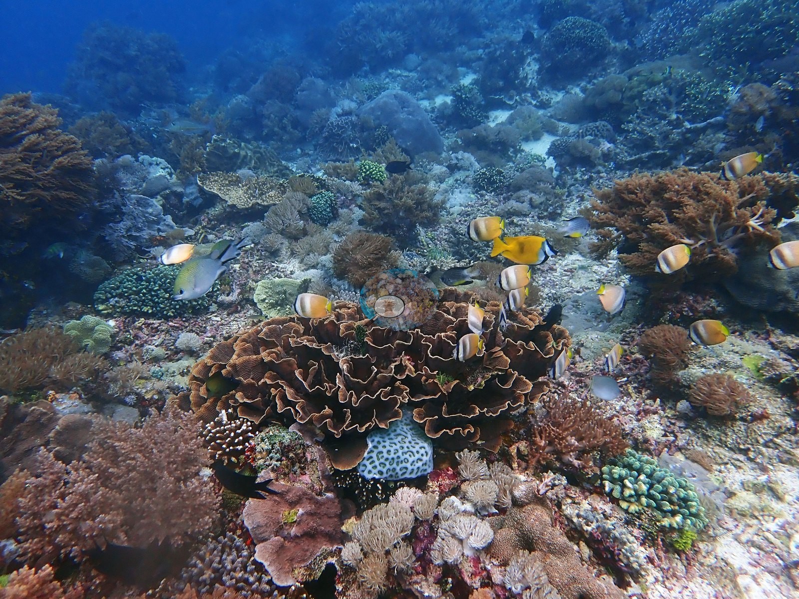
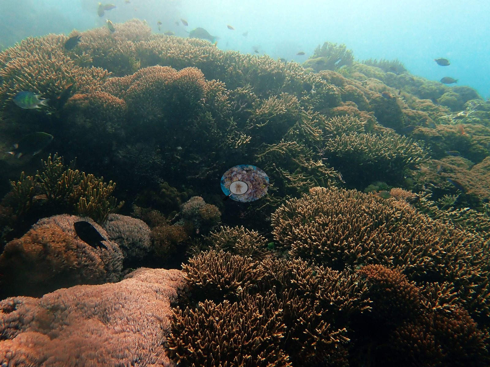
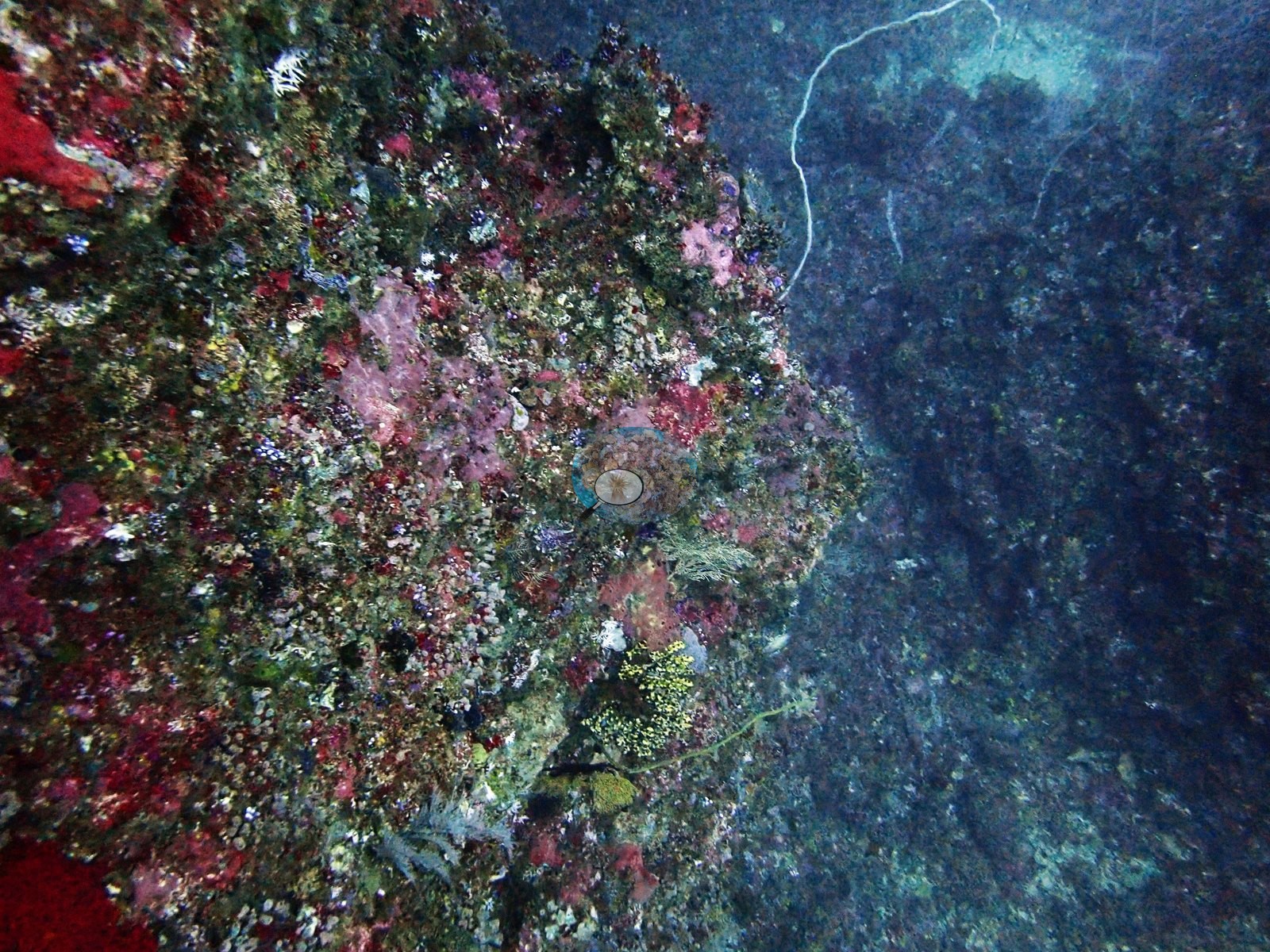
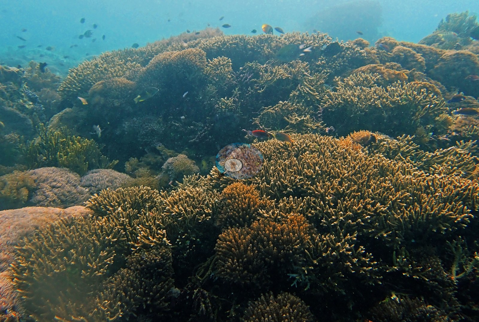
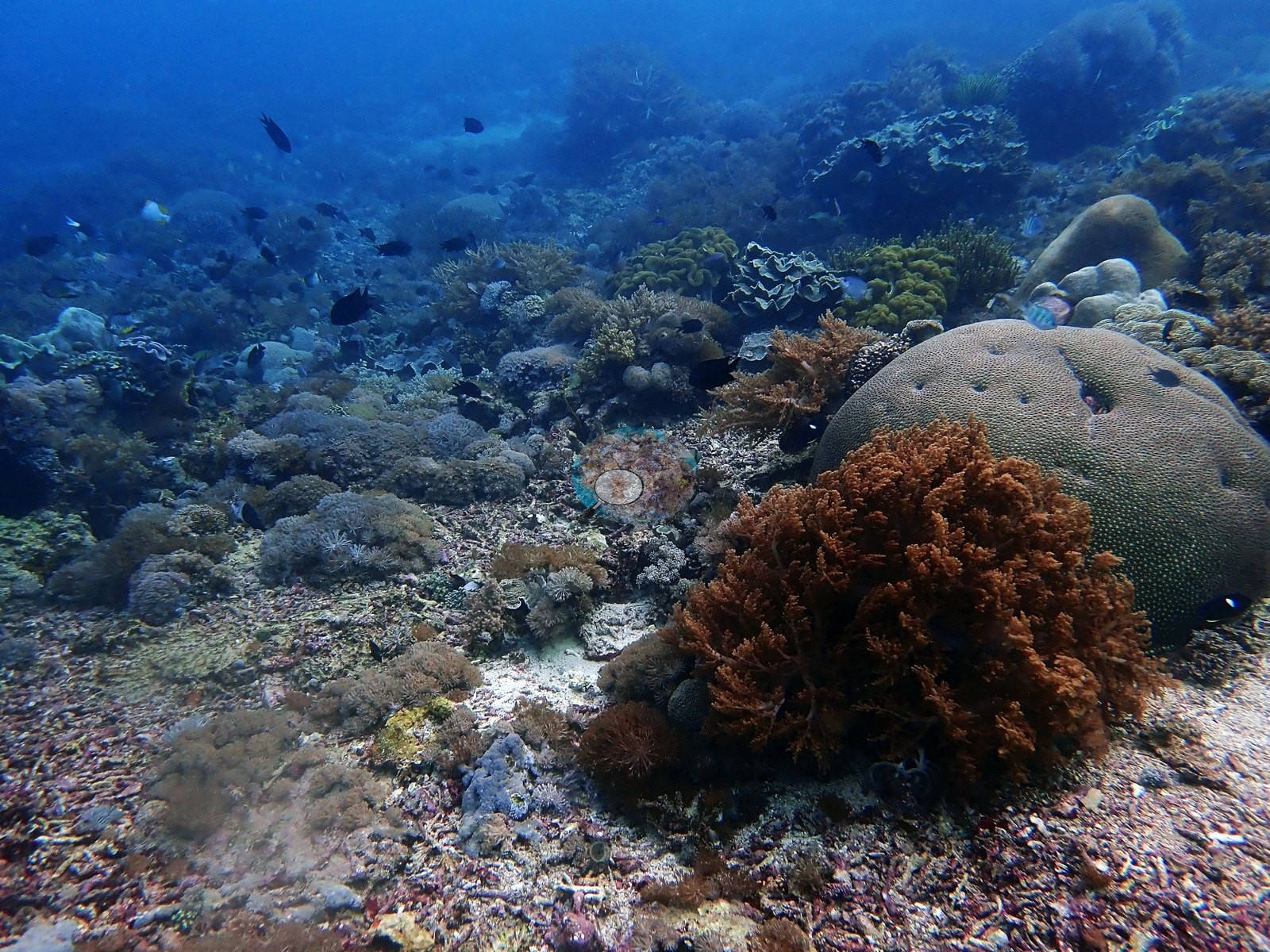
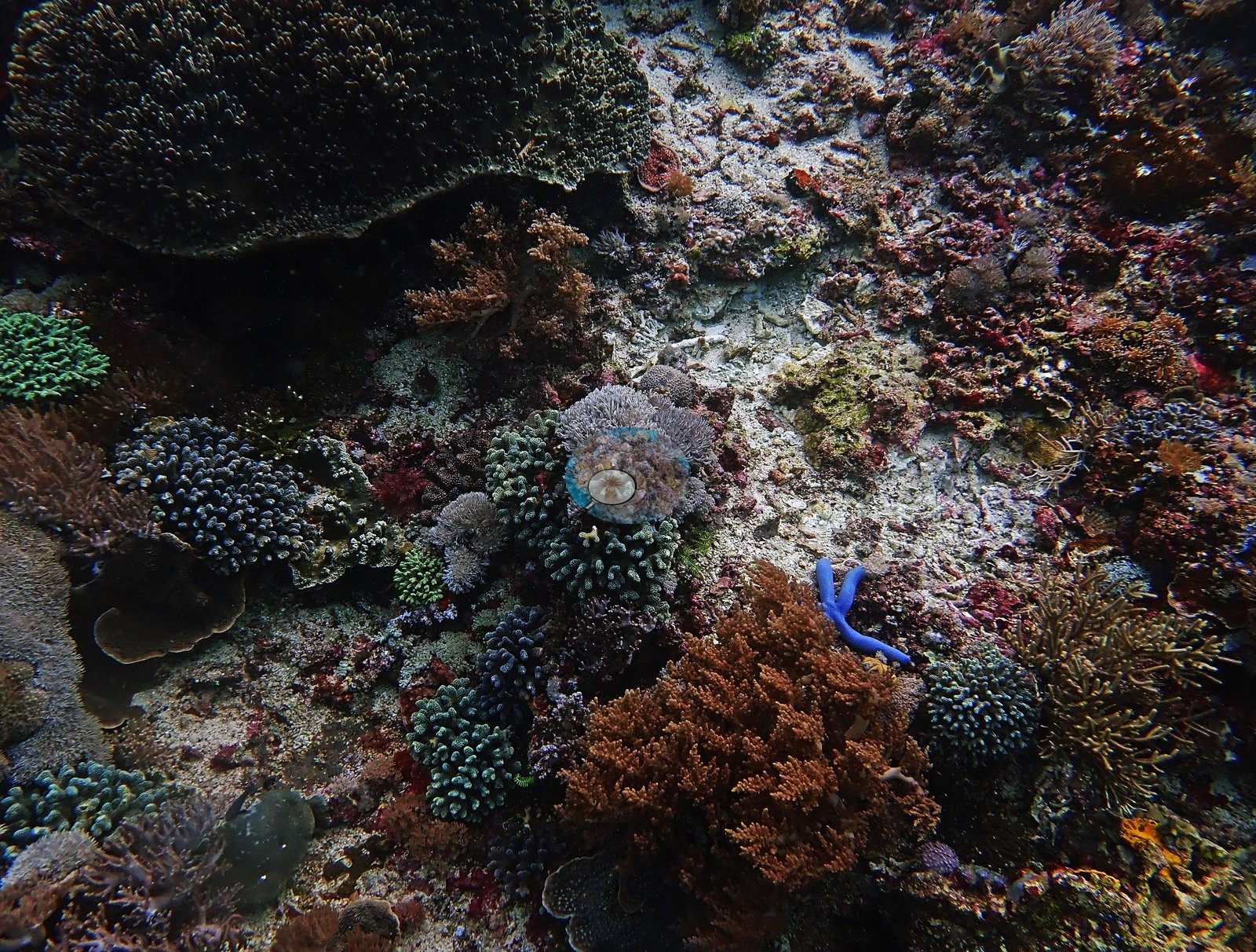
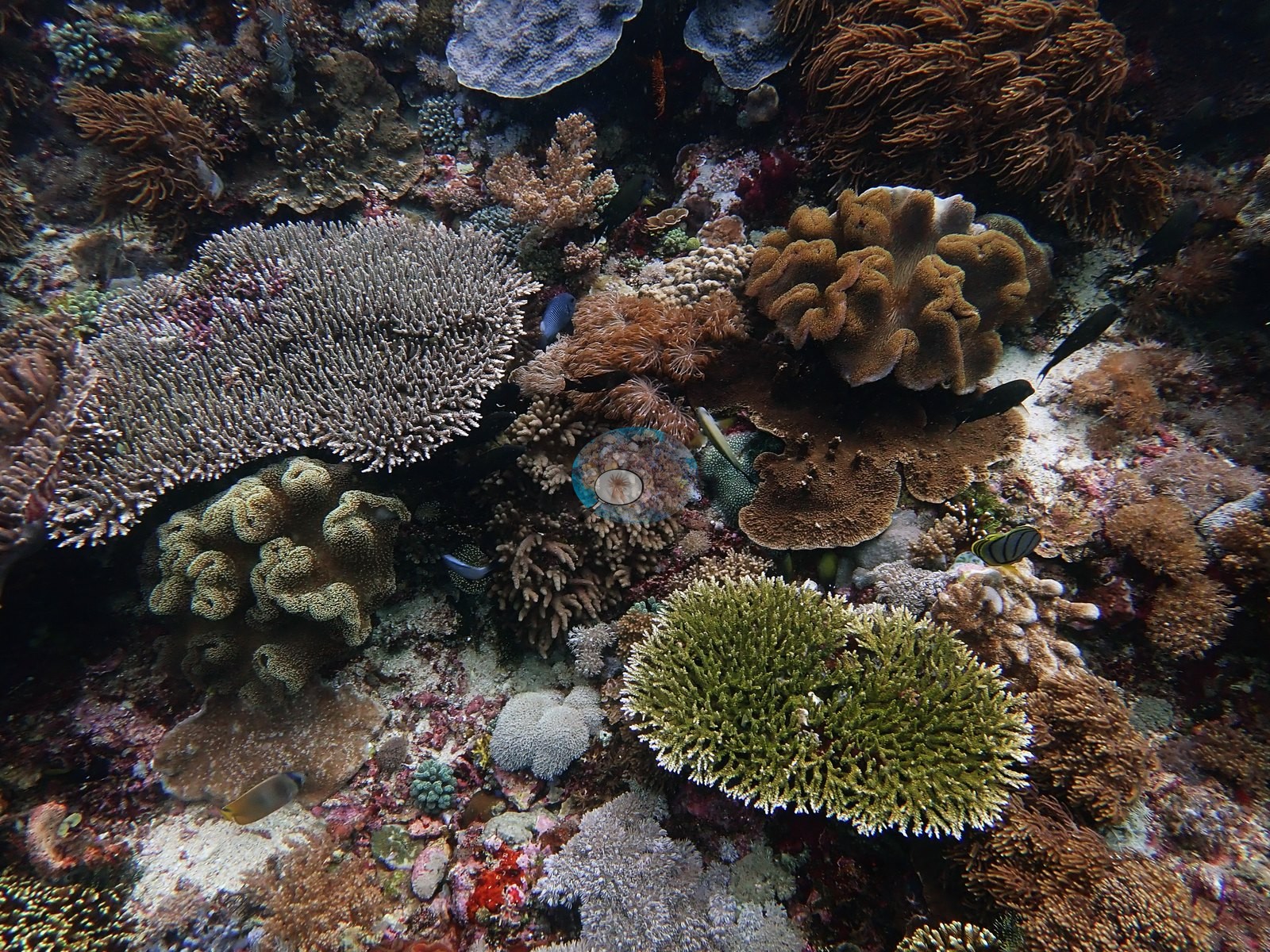
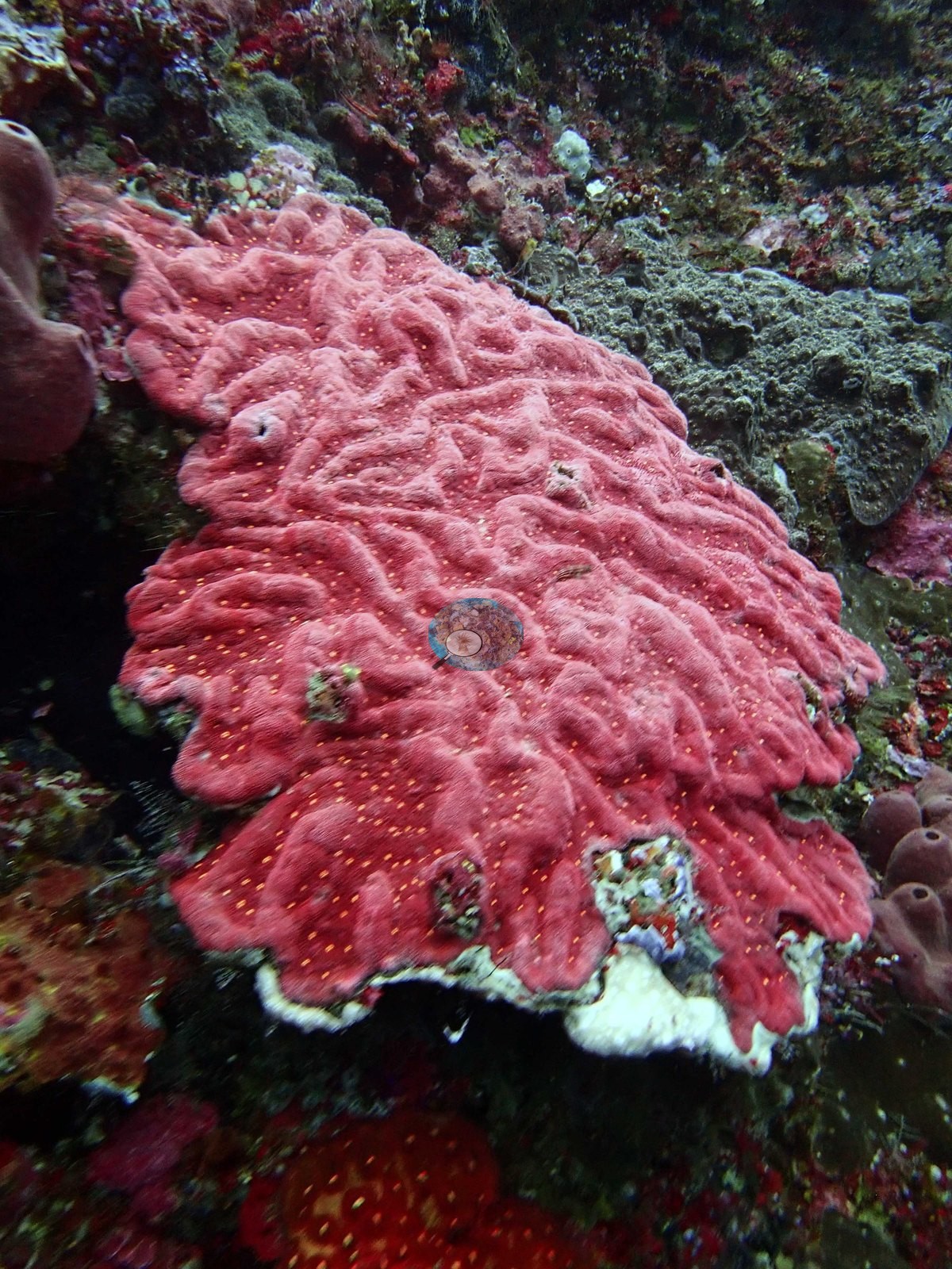
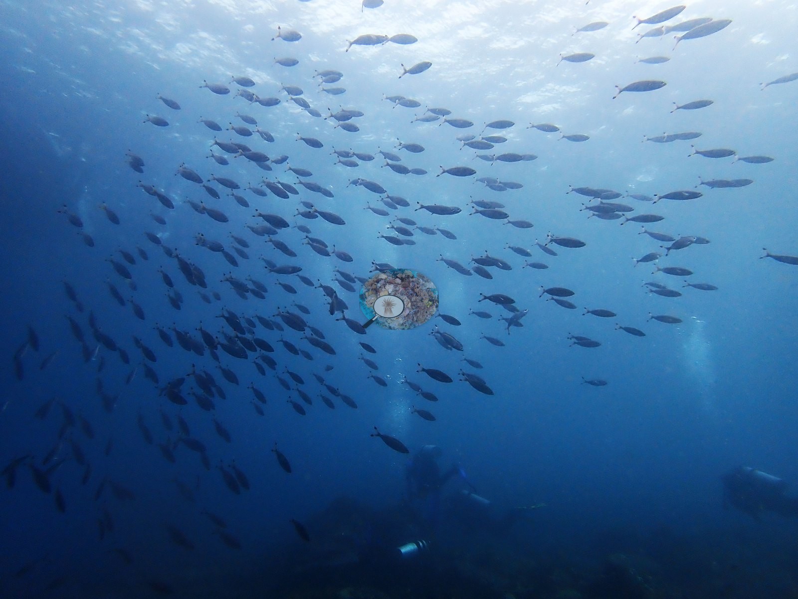
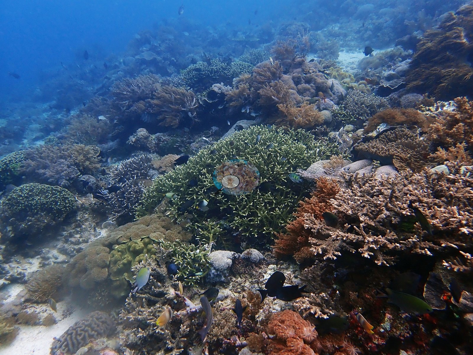
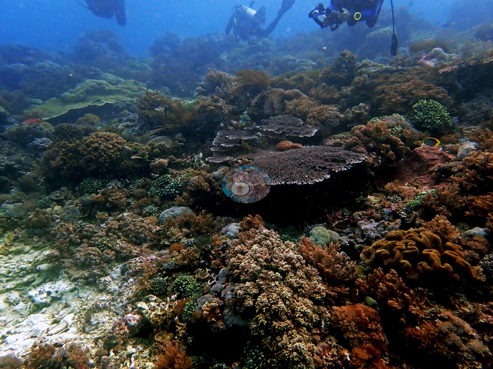
Then went on to 30 m along near-vertical wall. 20 m viz at beginning of dive (among best of trip), 25ºC, cold, and dark. Swam through a series of cool overhangs. Very little relief, likely due to high currents most of the time (e.g., Image 3).
Went with current back into coral-dominated area.
General benthic features
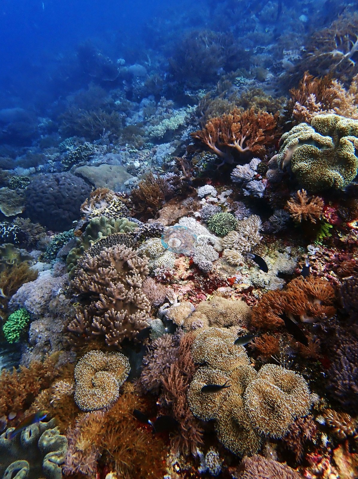
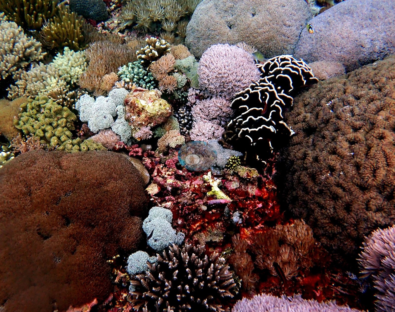
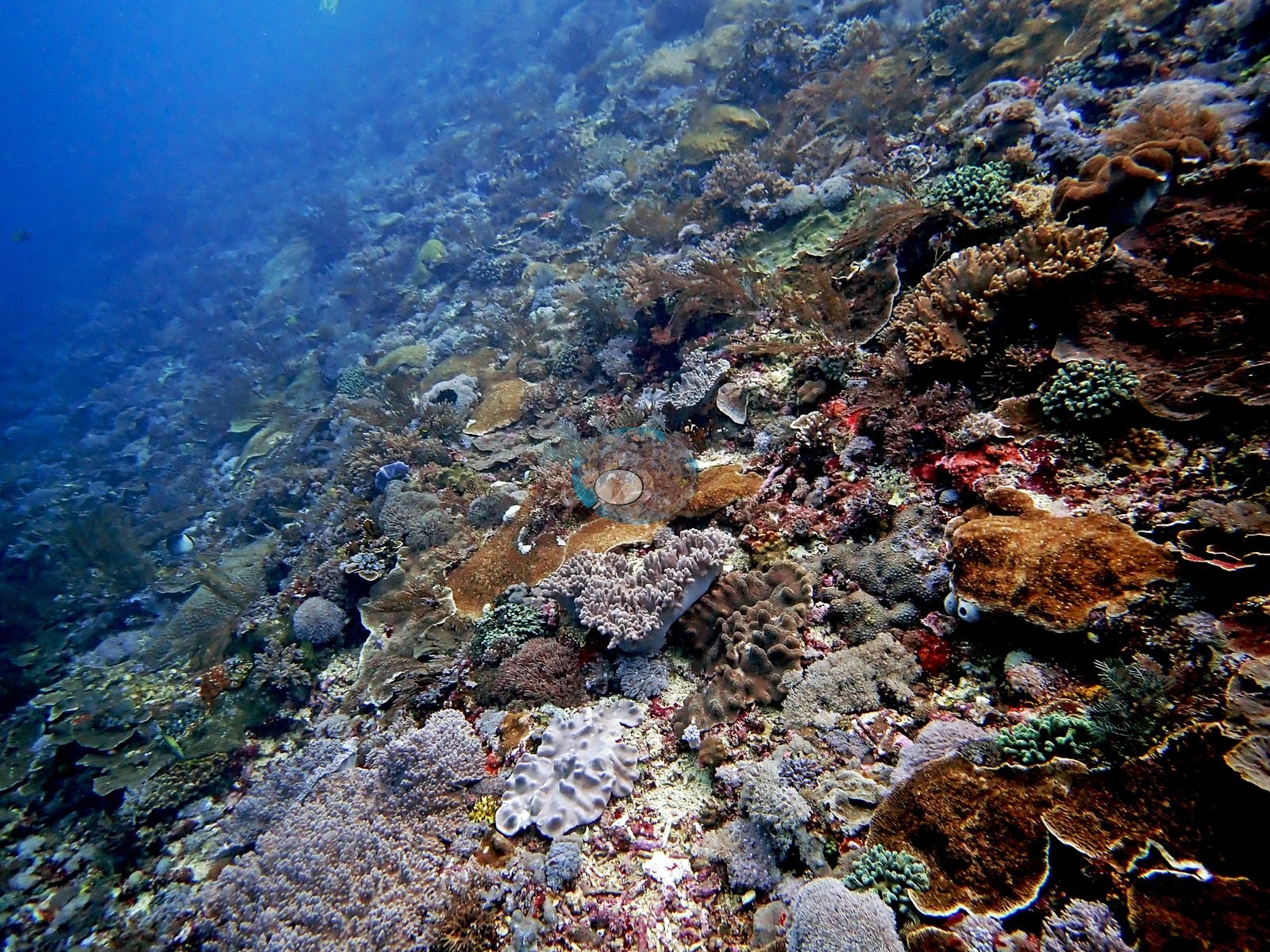
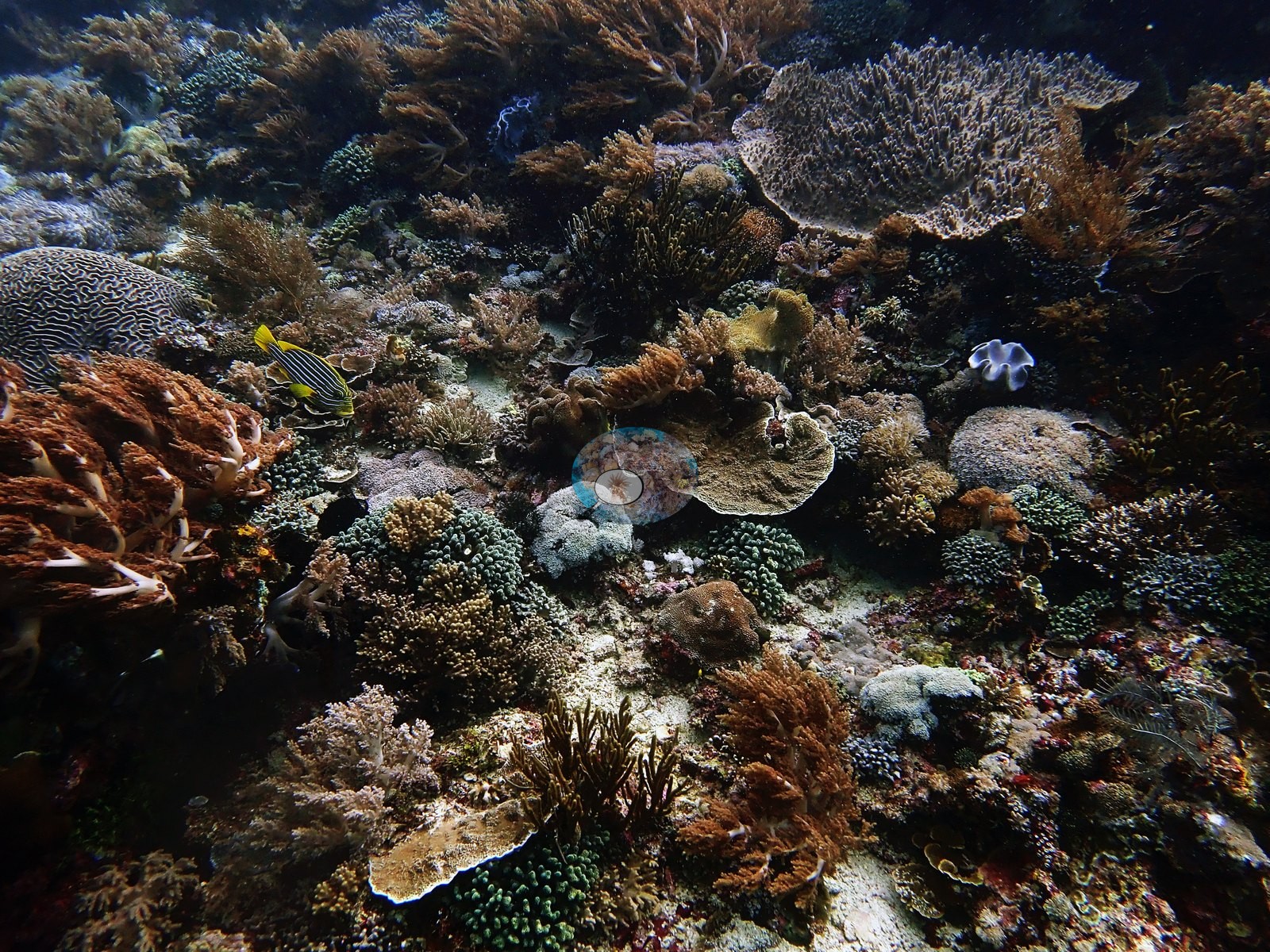
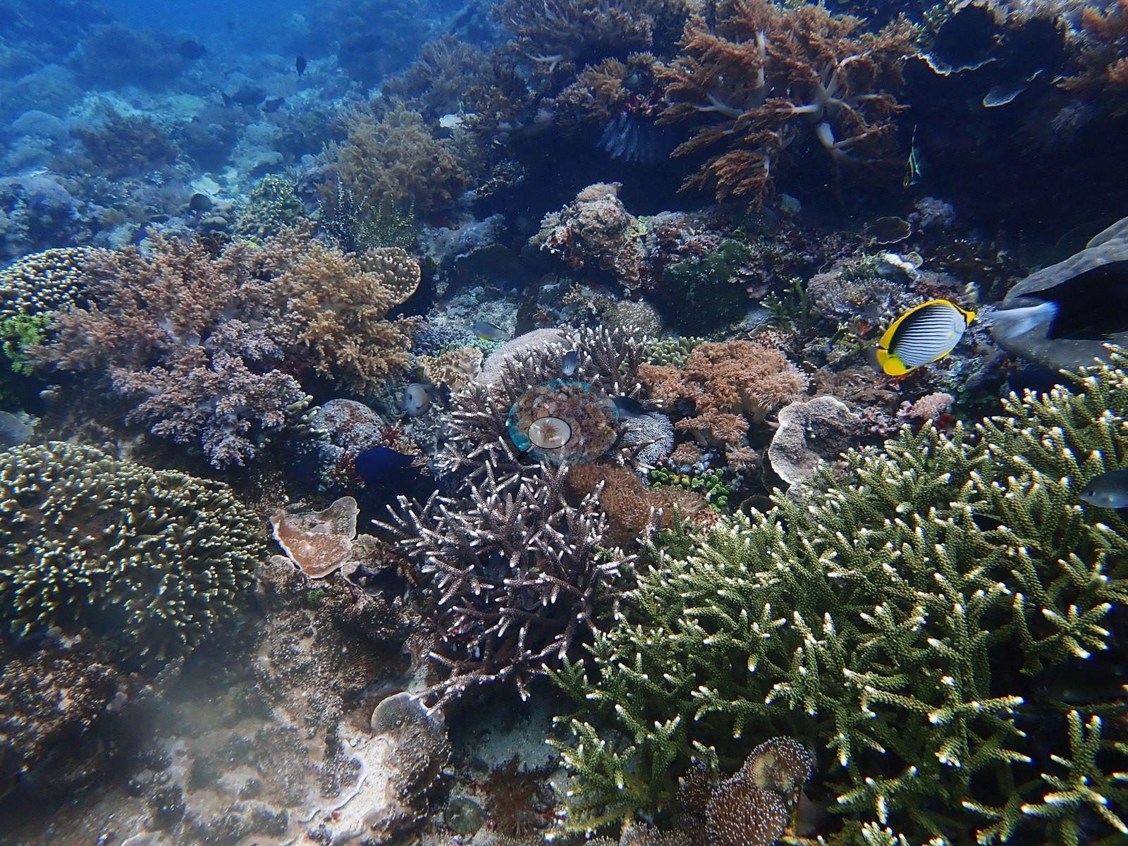
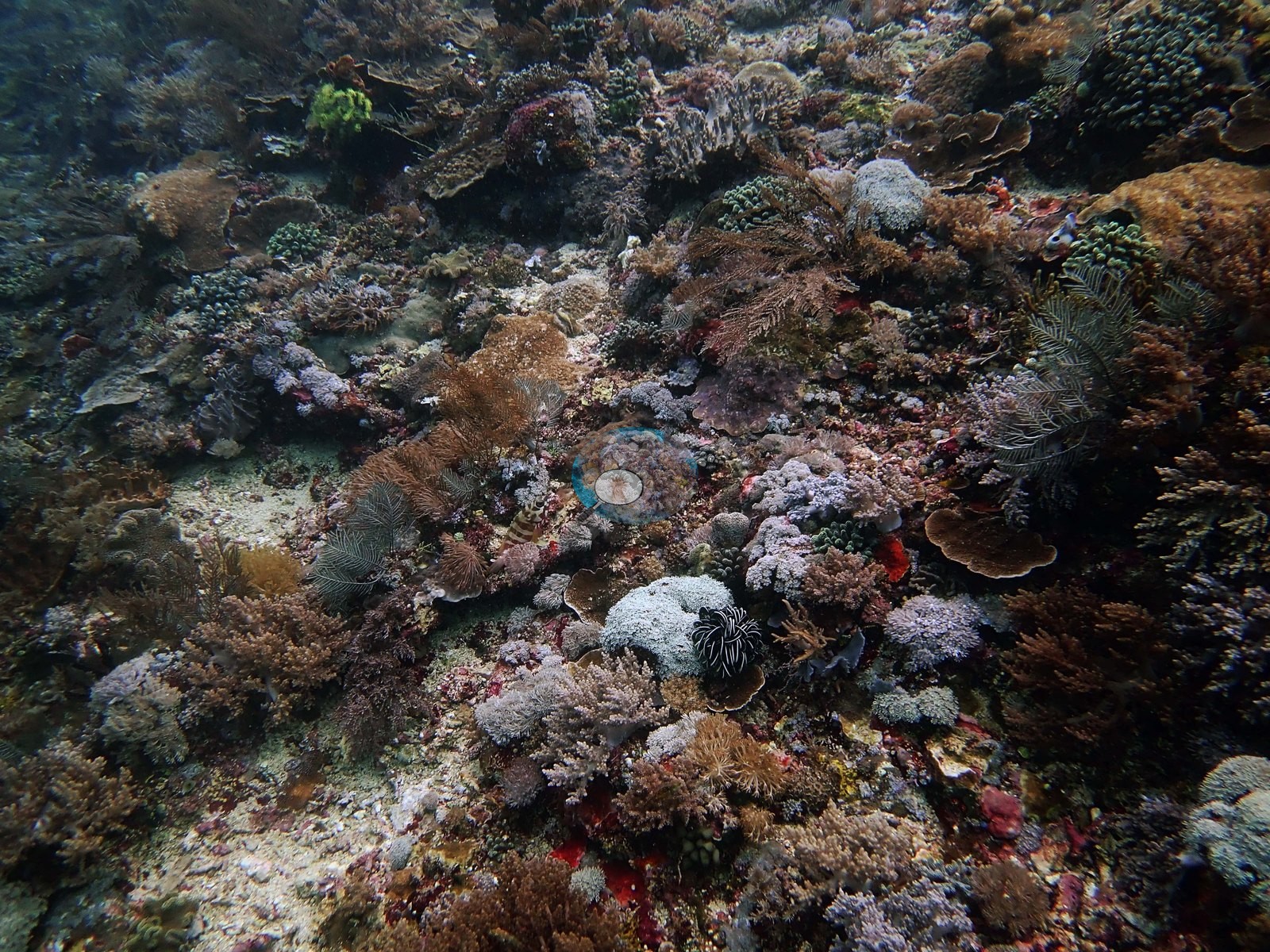
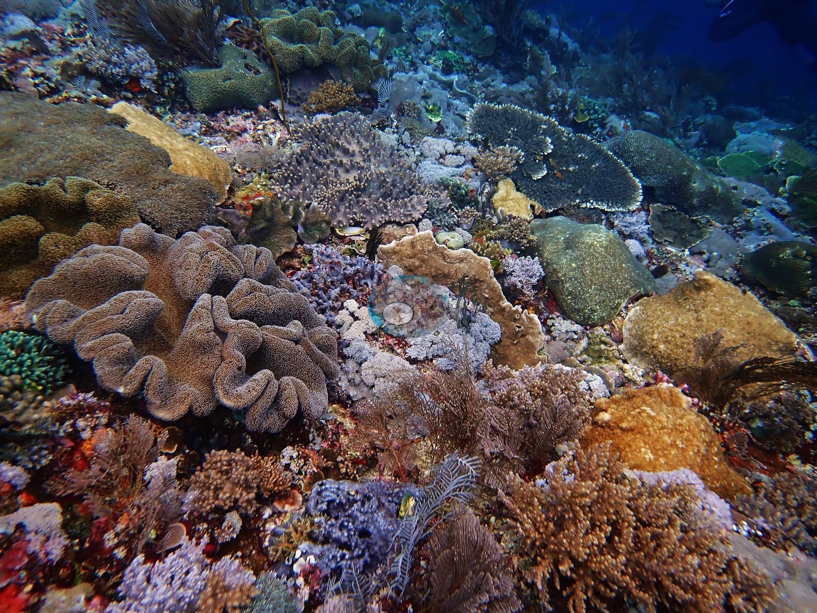
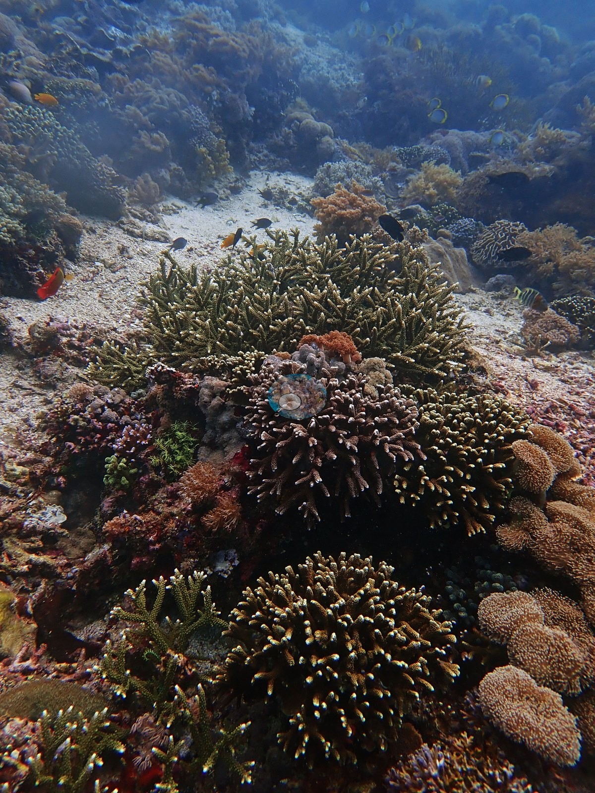
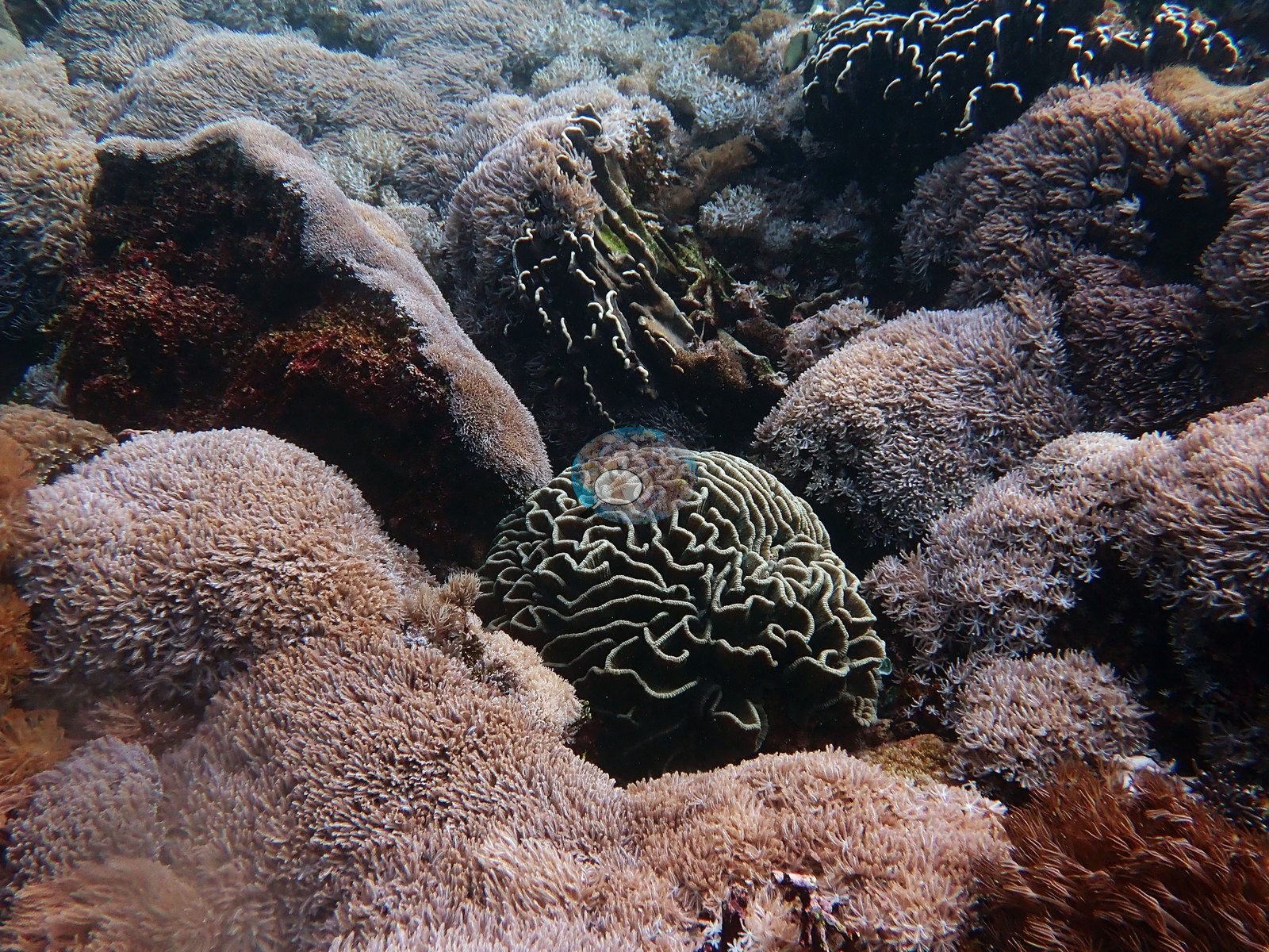
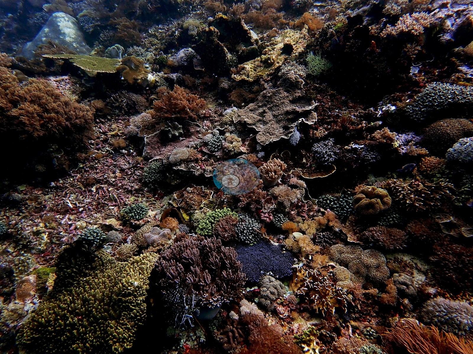
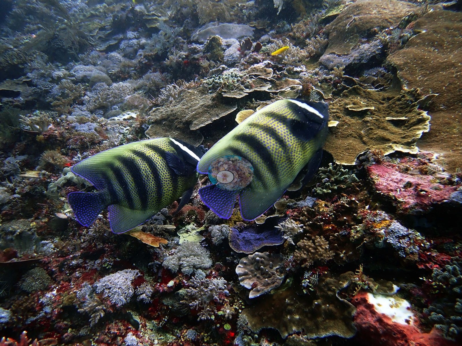
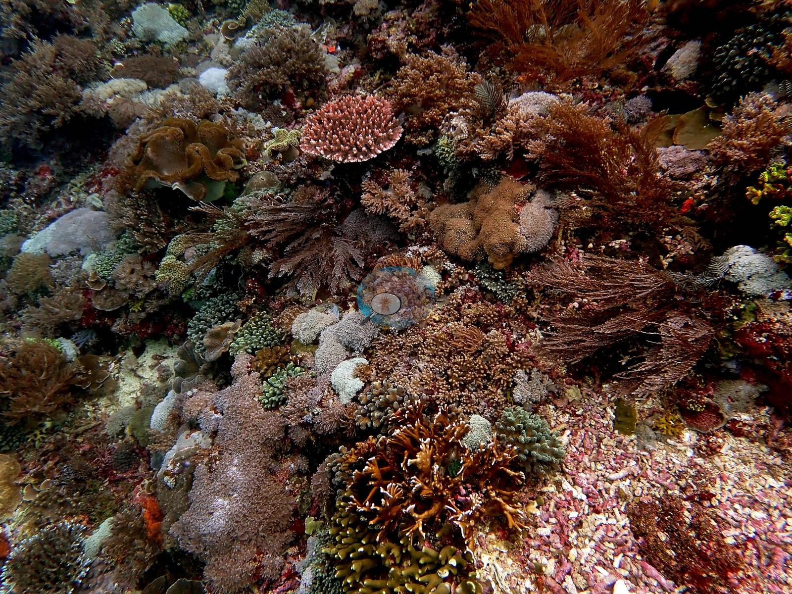
Descended onto some of the nicest corals of the trip. Fluorescent green Seriatopora caliendrum. Less hard corals at depth. Some large, coral-encrusted boulders at 30 m. Some Seriatopora hystrix and Pocillopora verrucosa @ 30 m. Tubastrea. Many unknown plating species. Some Acropora. Plentiful CCA at depth. Stylophora pistillata. Nearly all encrusting species. One species of encrusting sponge also very common. At 15 m, more soft corals and hydroids, many unknown encrusting species, one of which looked like Isopora (are there encrusting isoporids?). At least 10-15 encrusting species @ 15 m (e.g., Image 2).
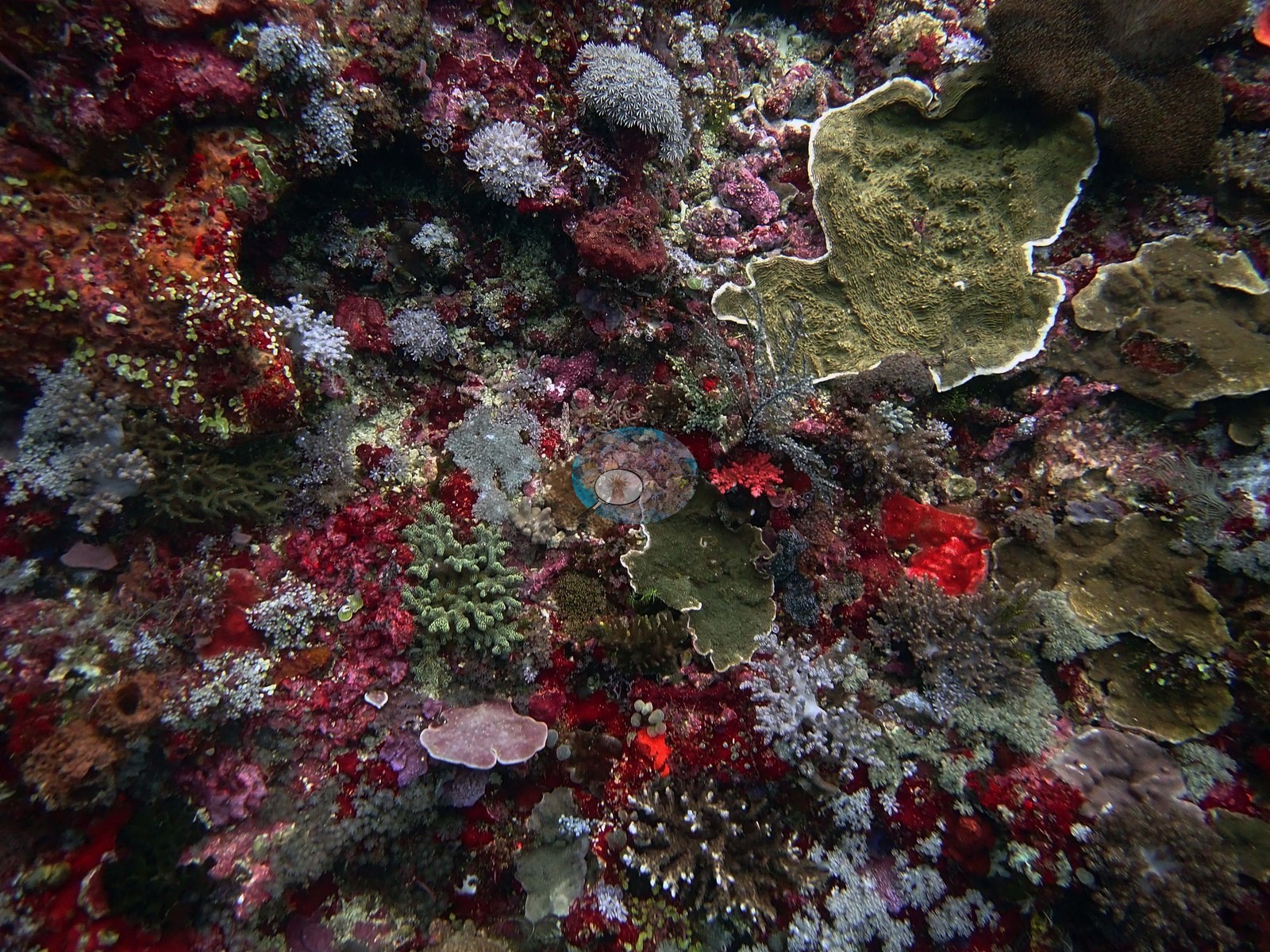
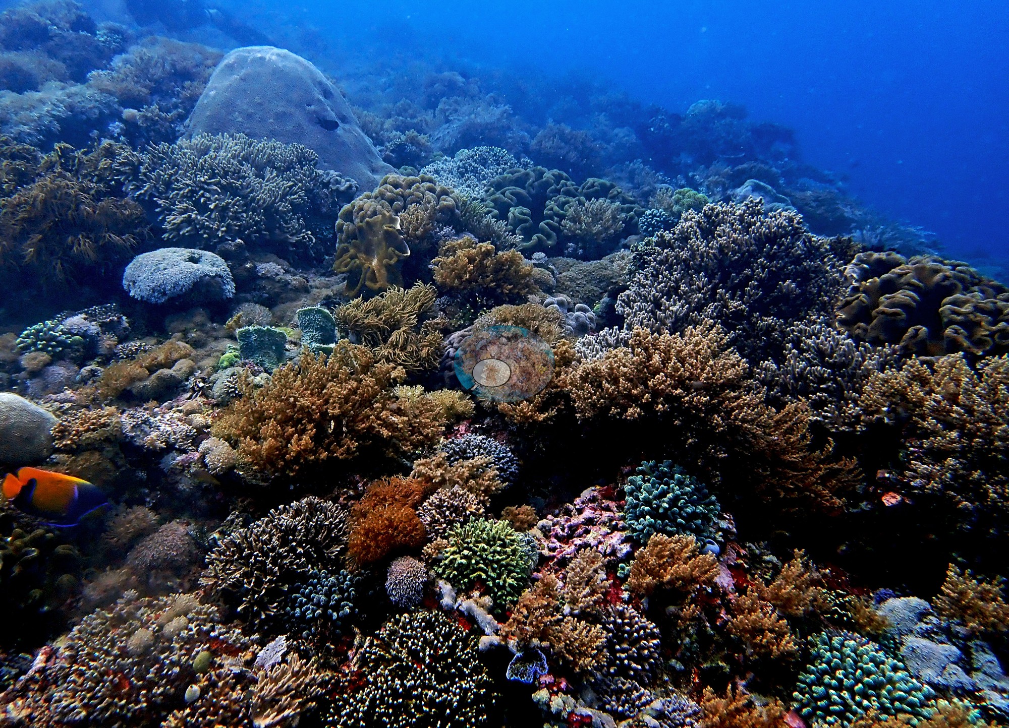
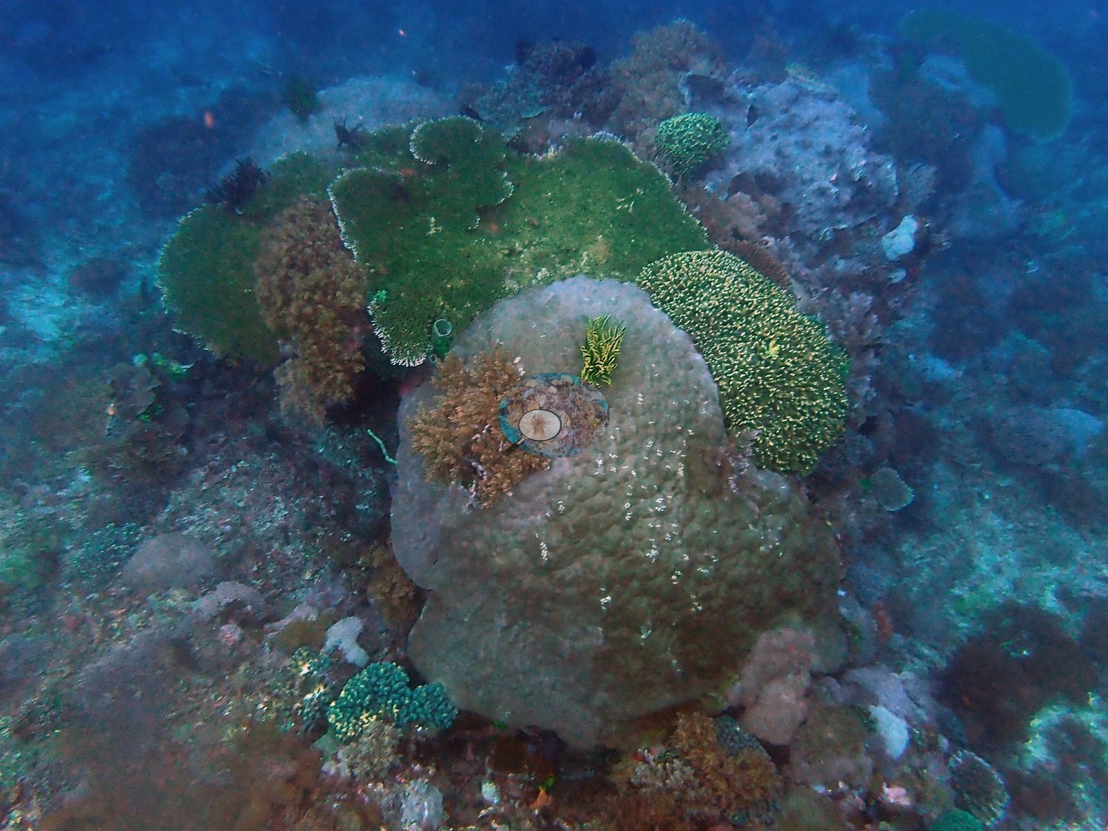
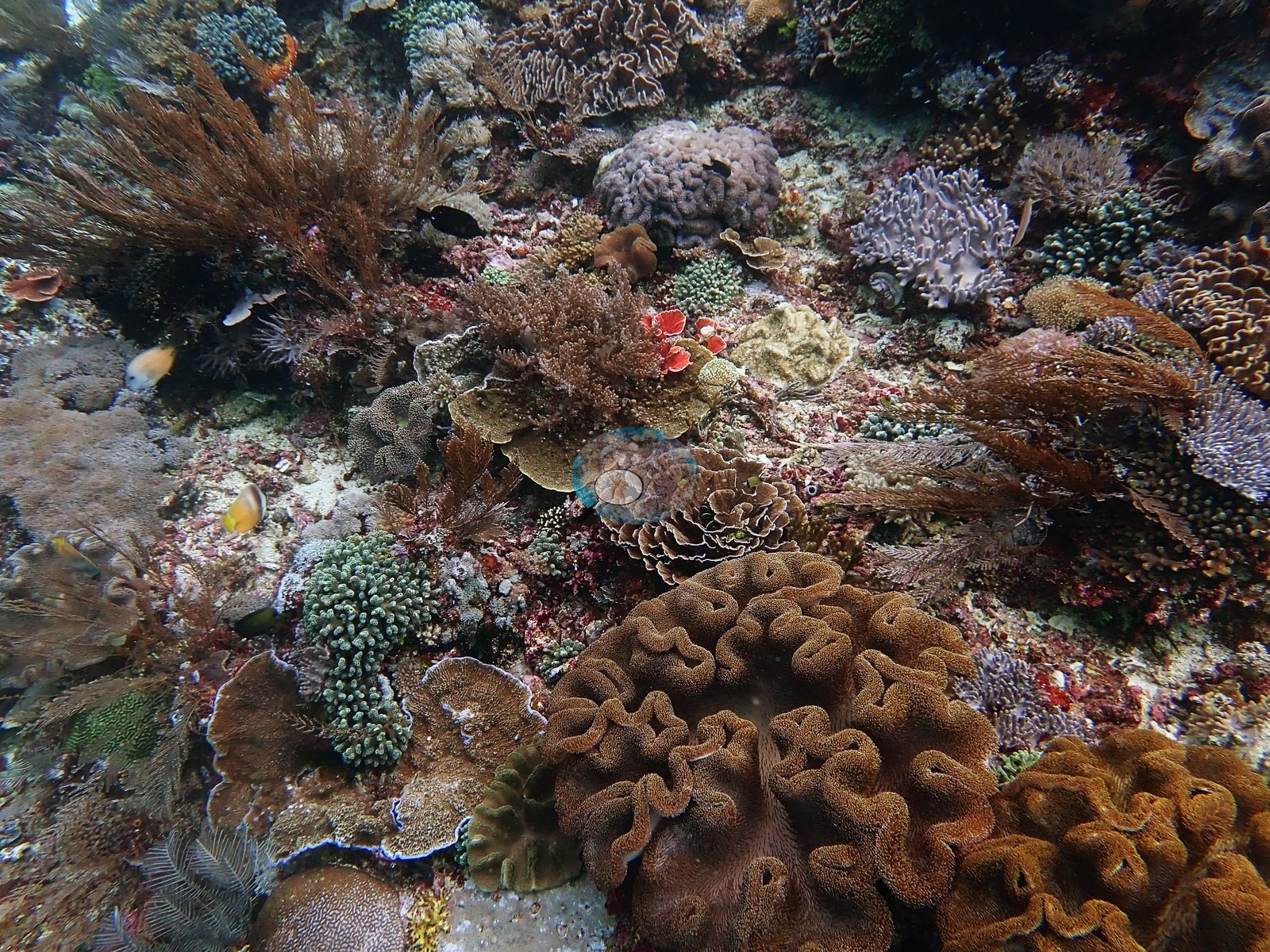
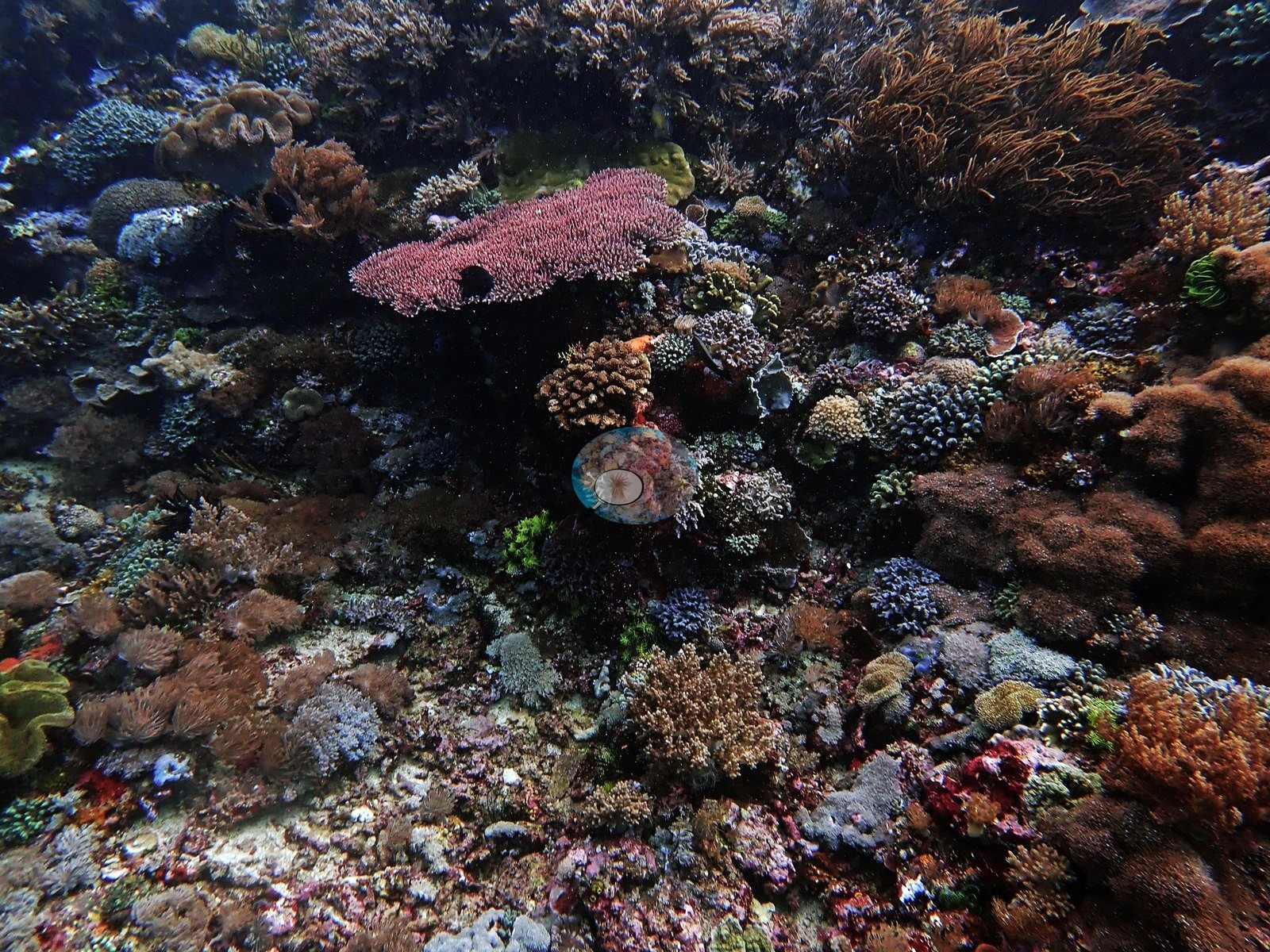
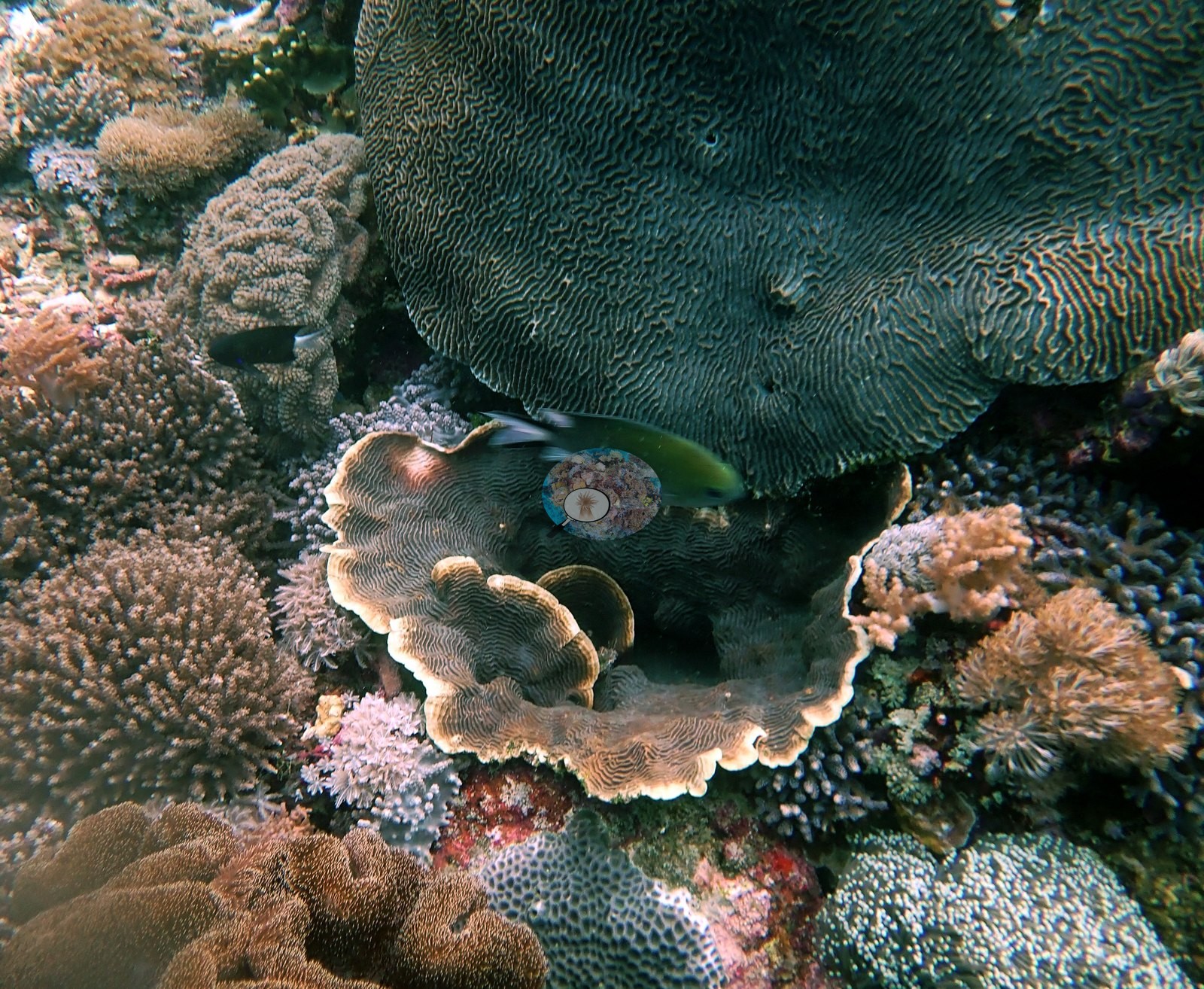
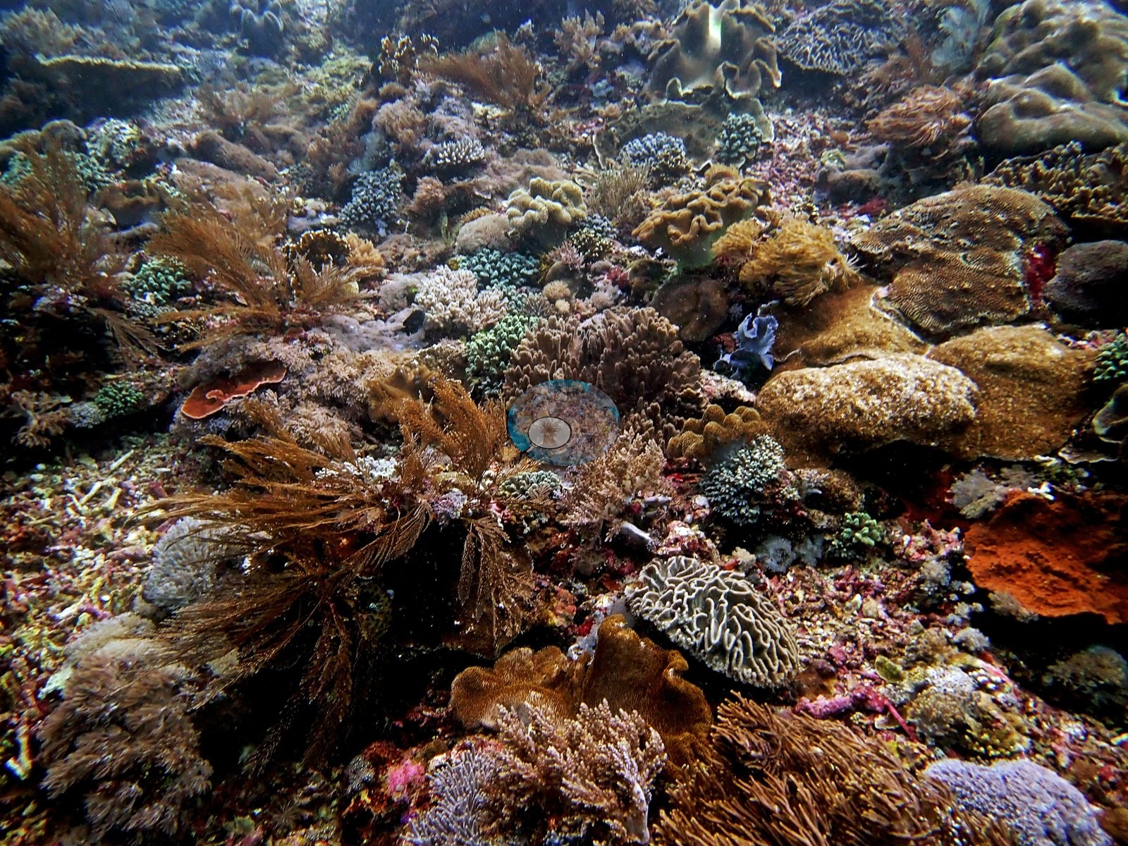
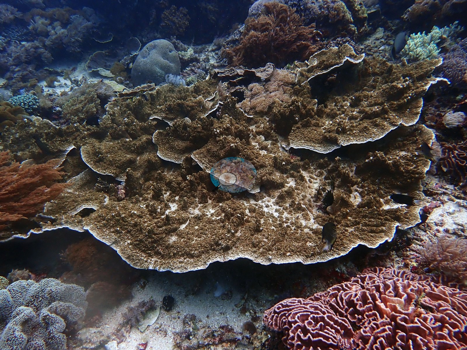
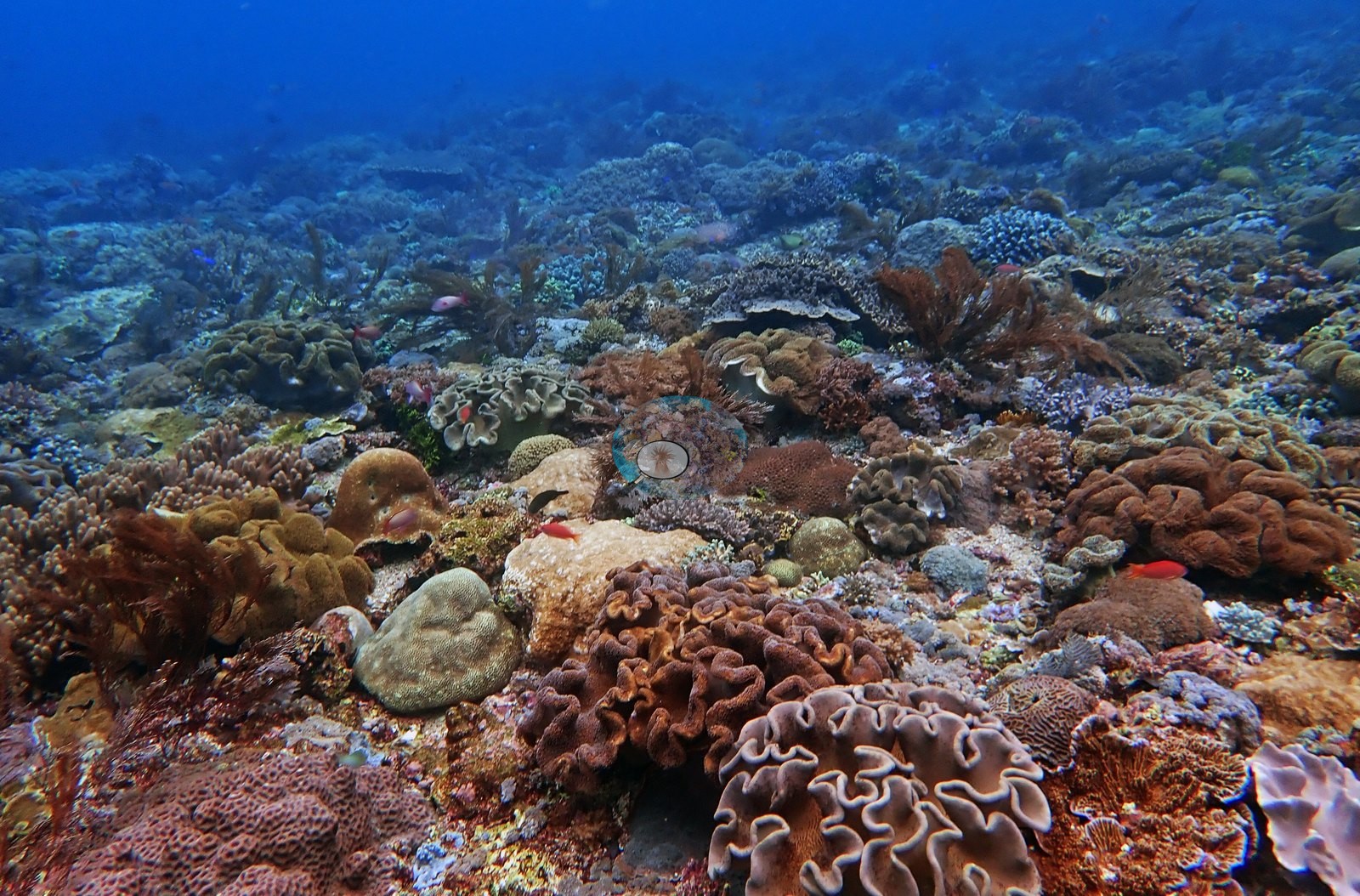
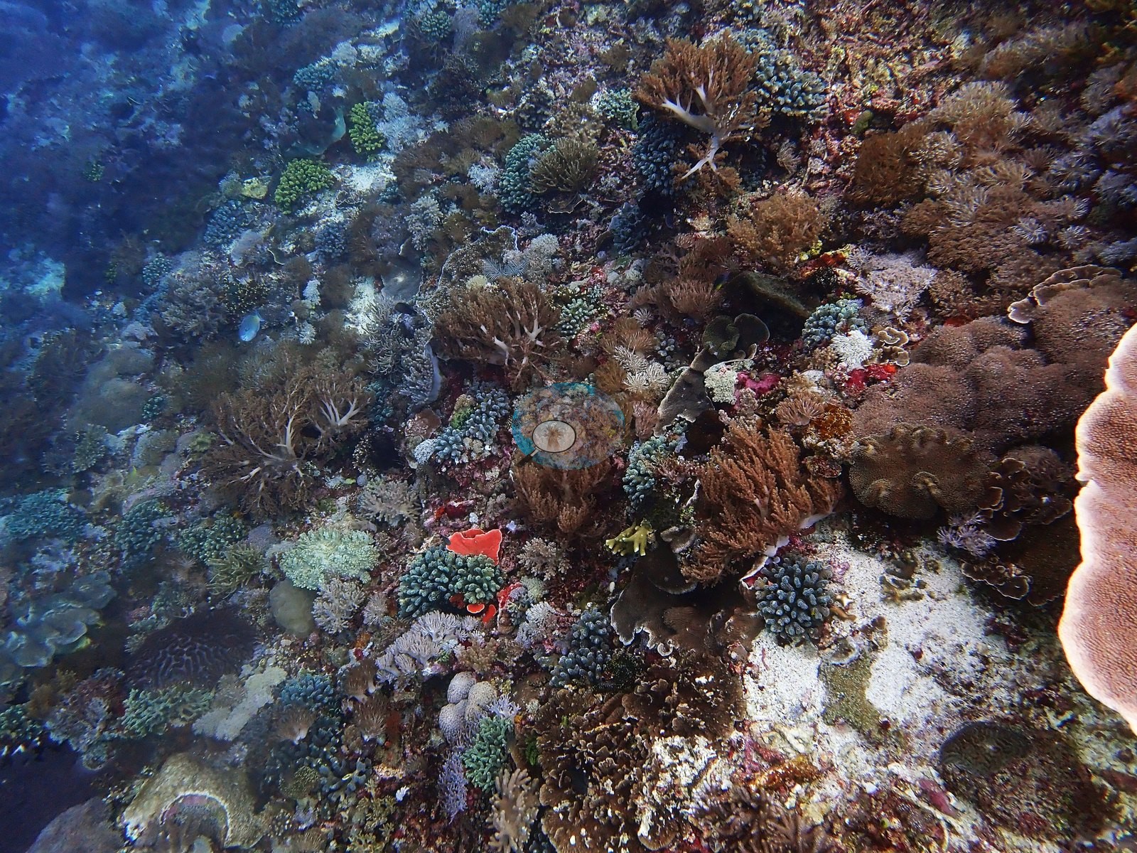
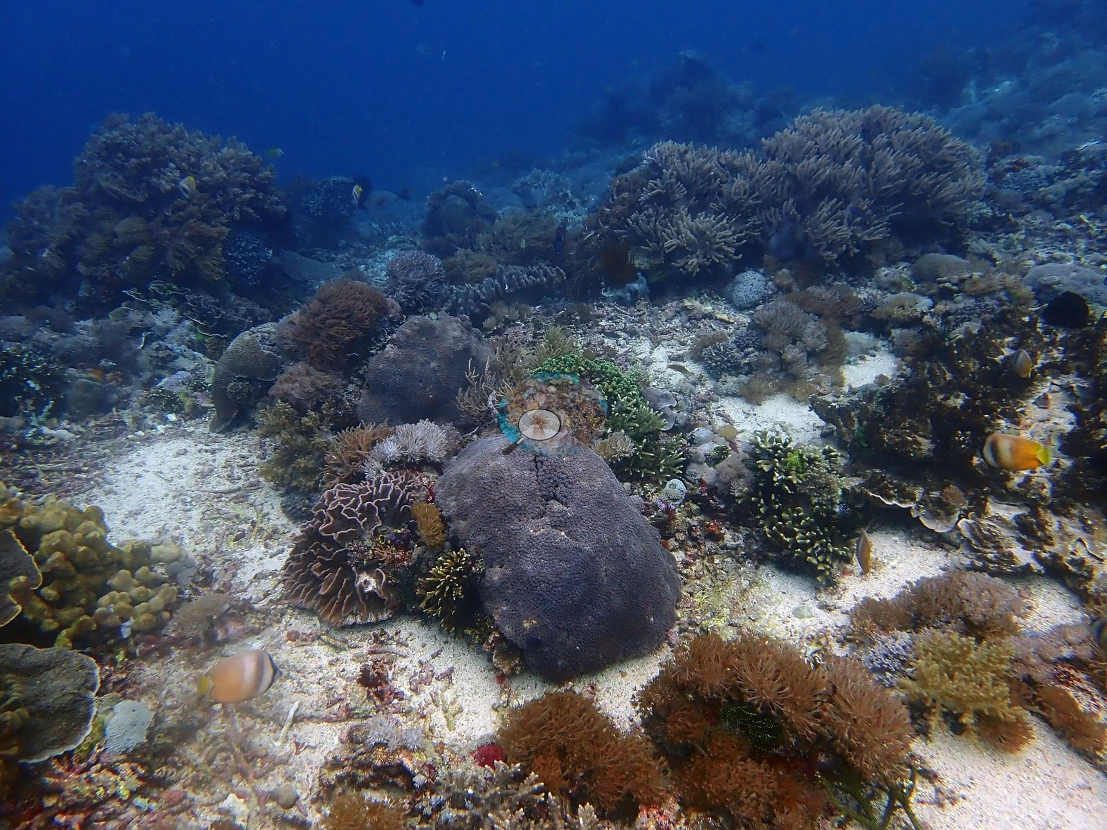
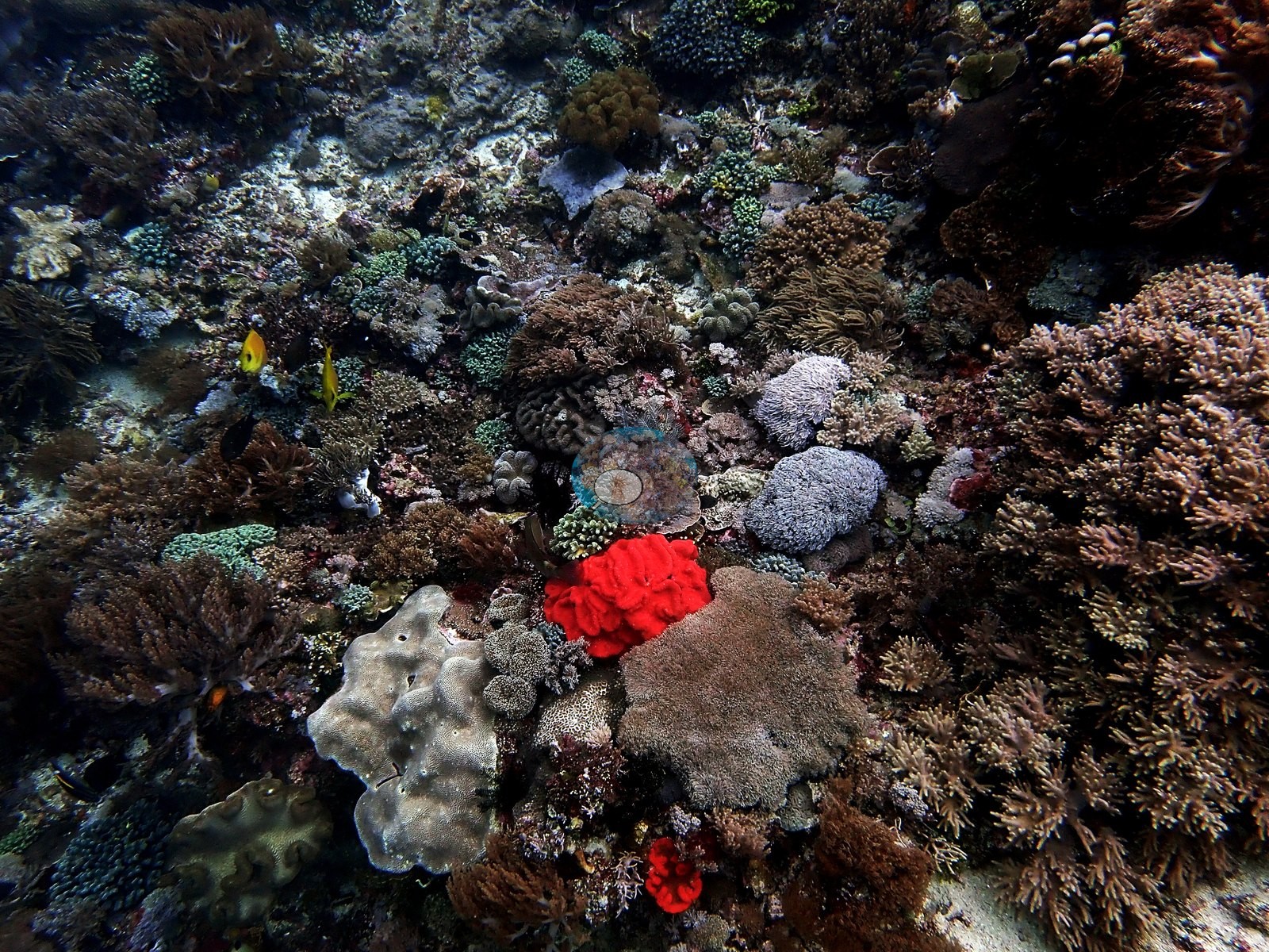
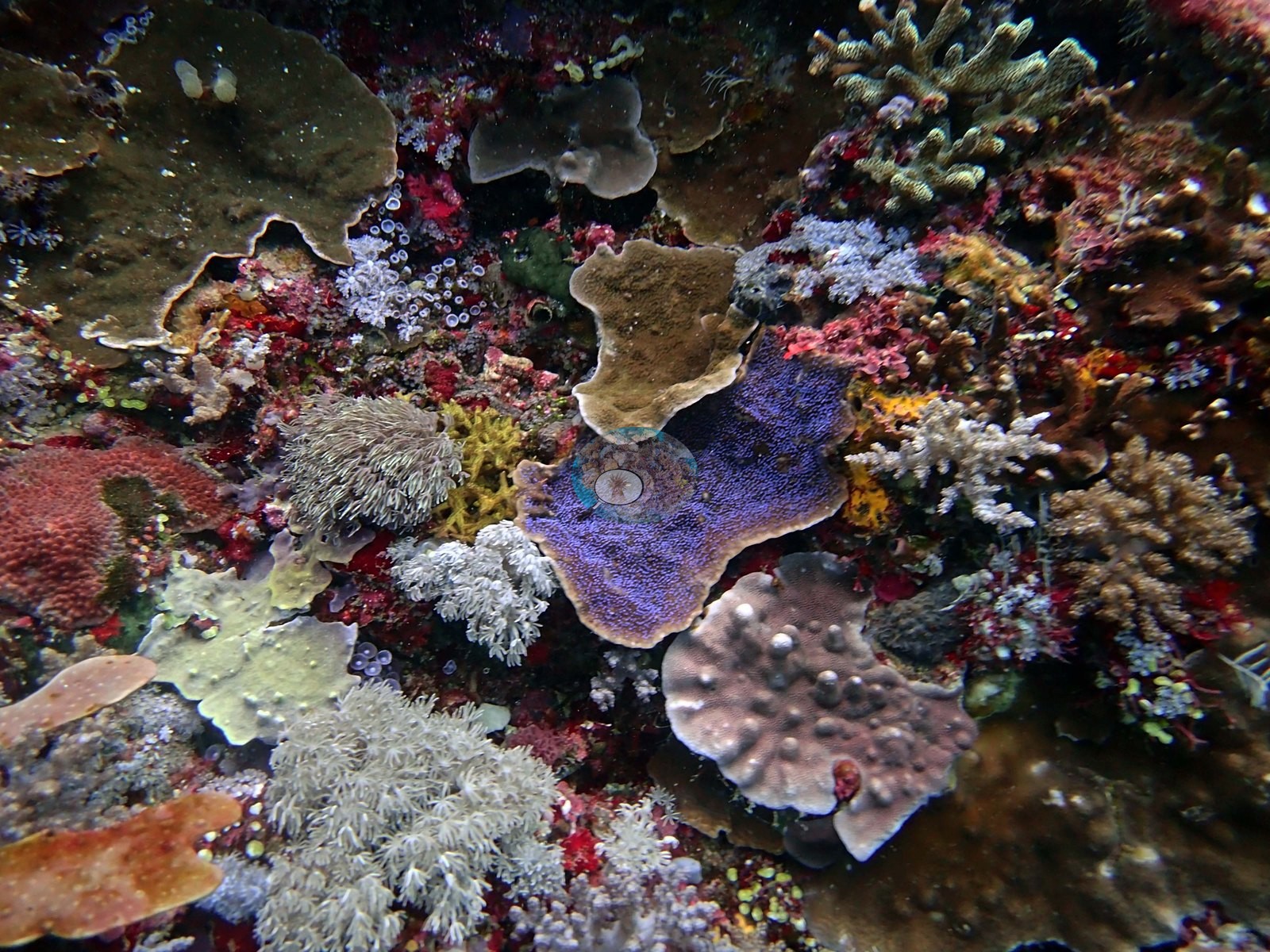
Seriatopora caliendrum, brain corals, Stylophora pistillata, 40-50% coral cover at 11-13 m. Very high coral diversity @ 10 m (e.g., Image 1).
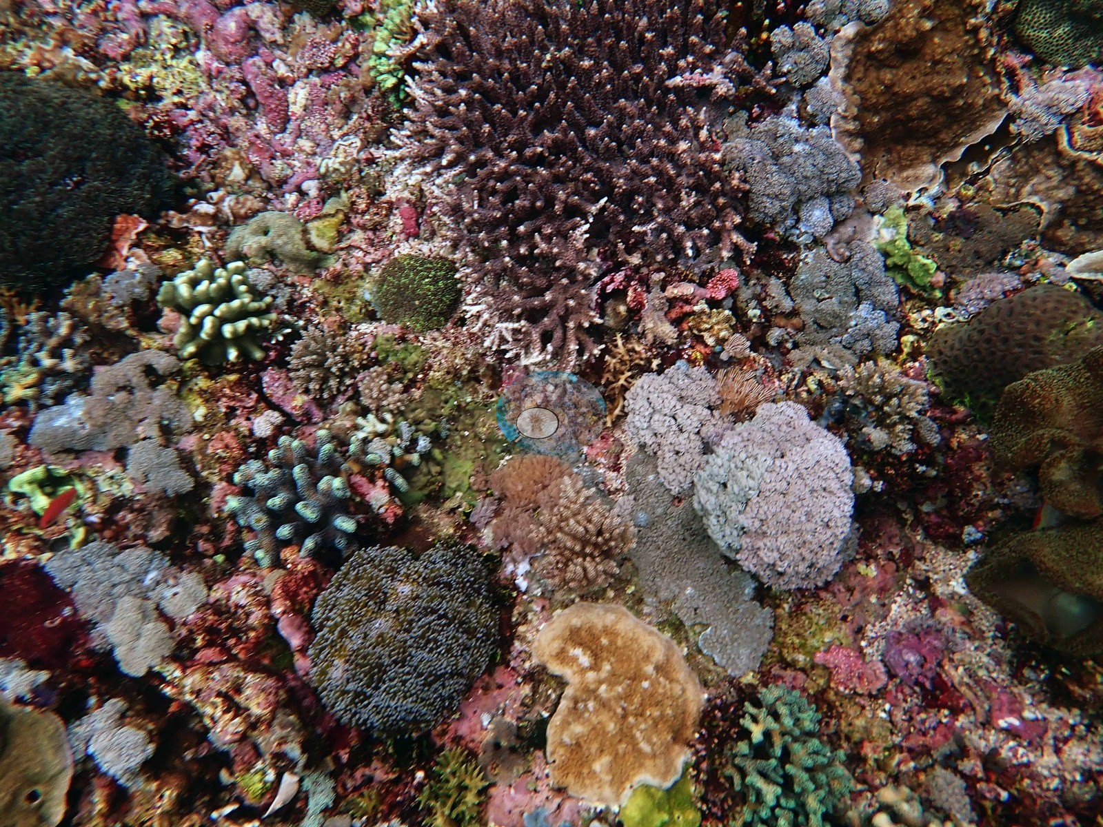
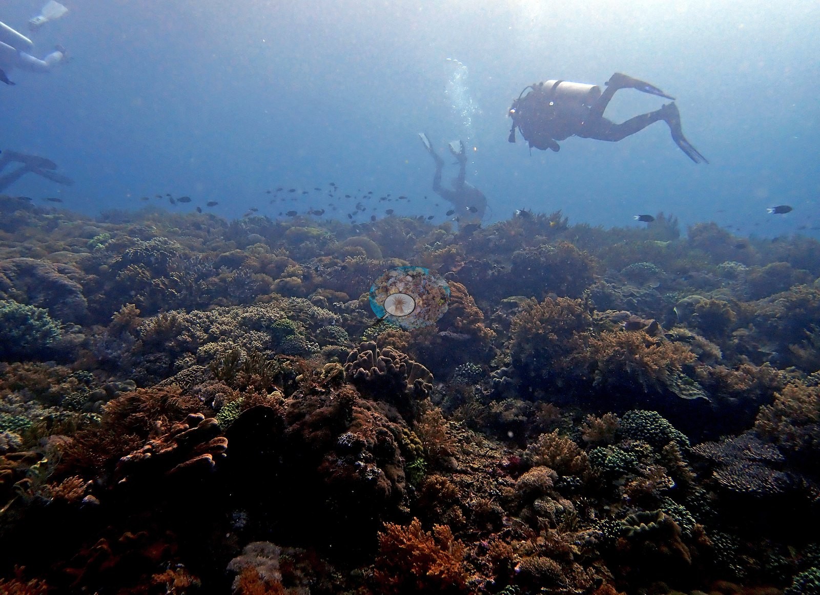
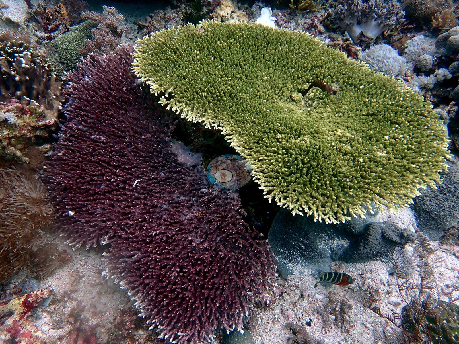
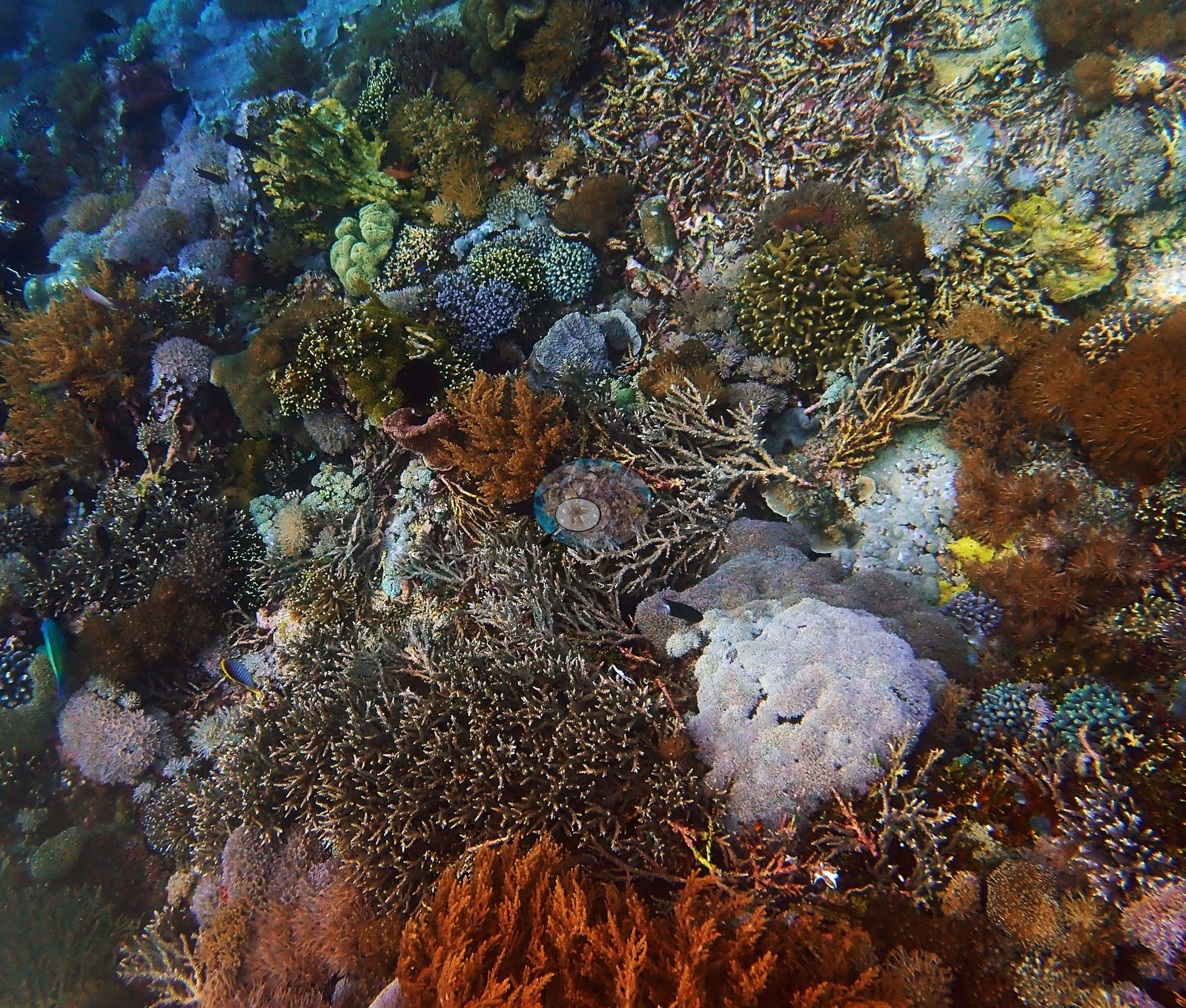
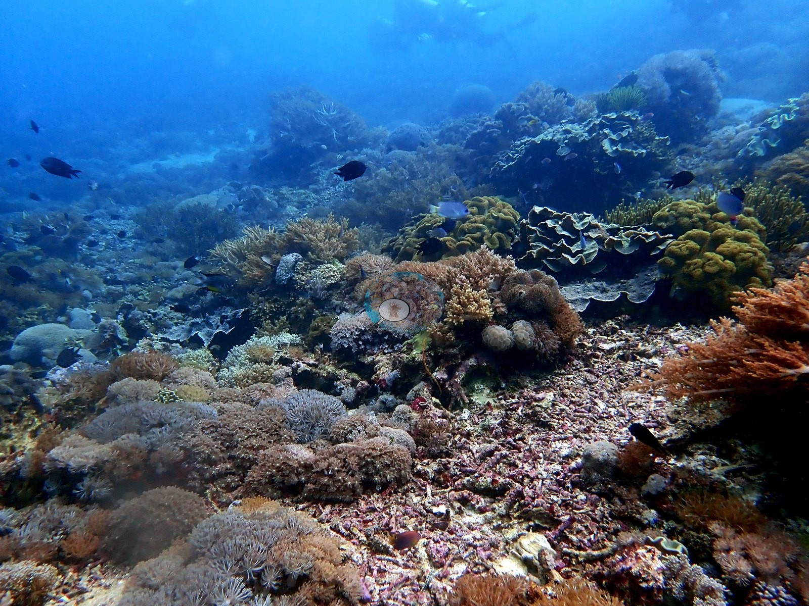
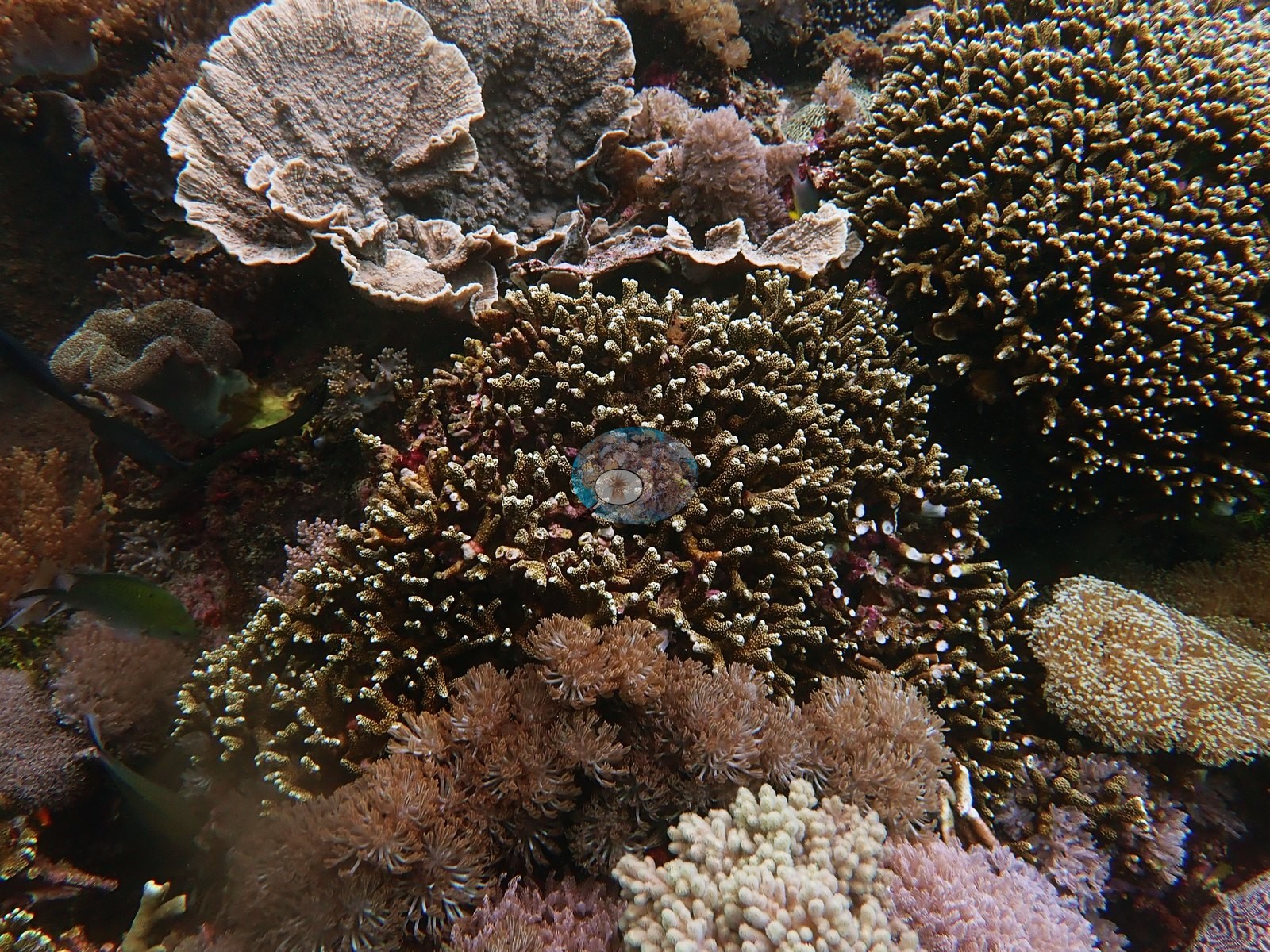
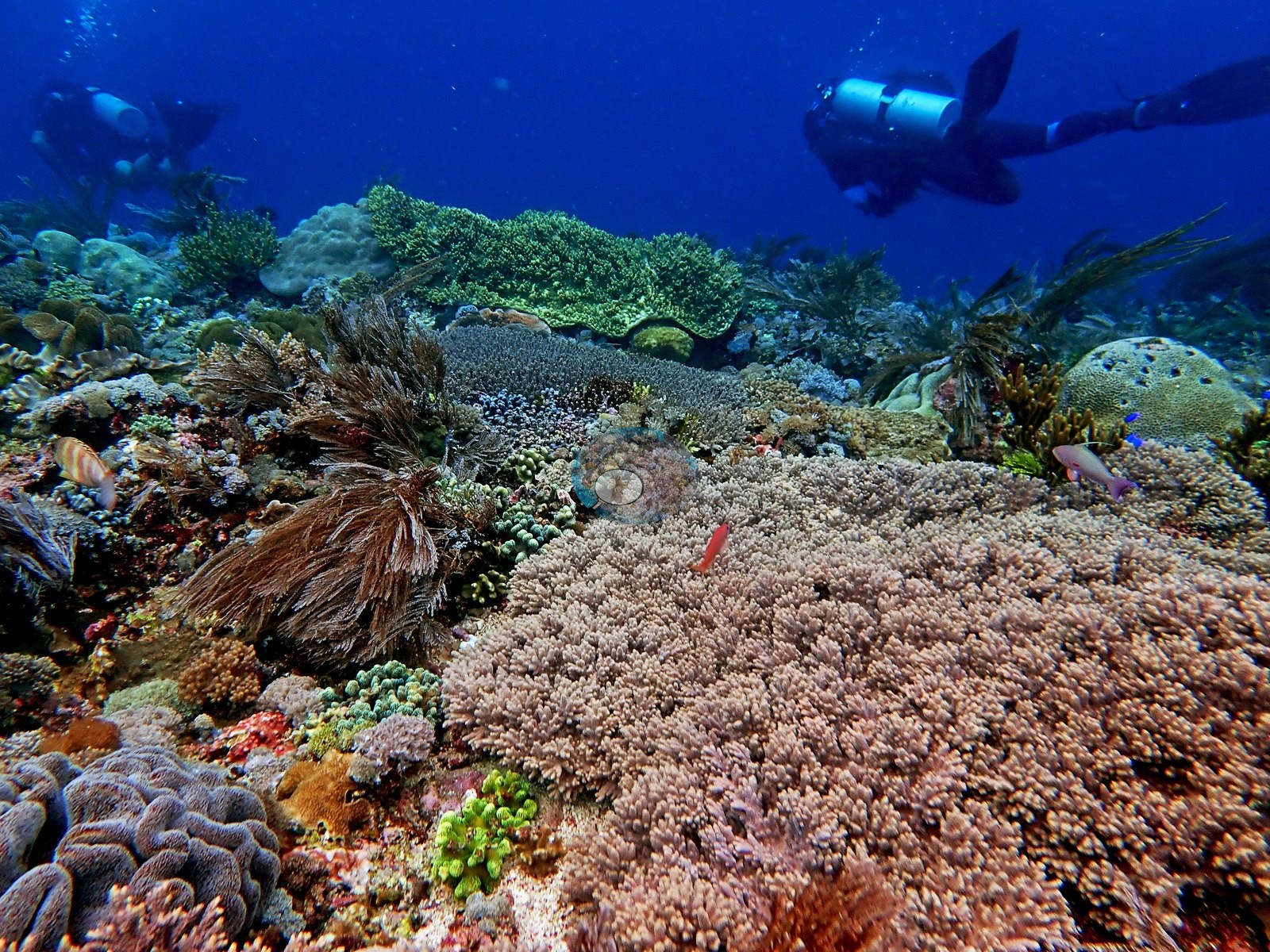
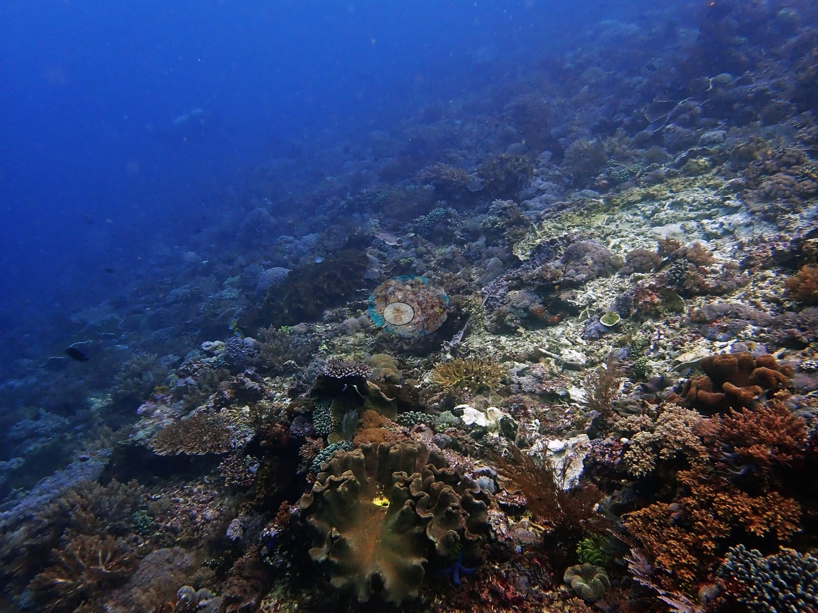
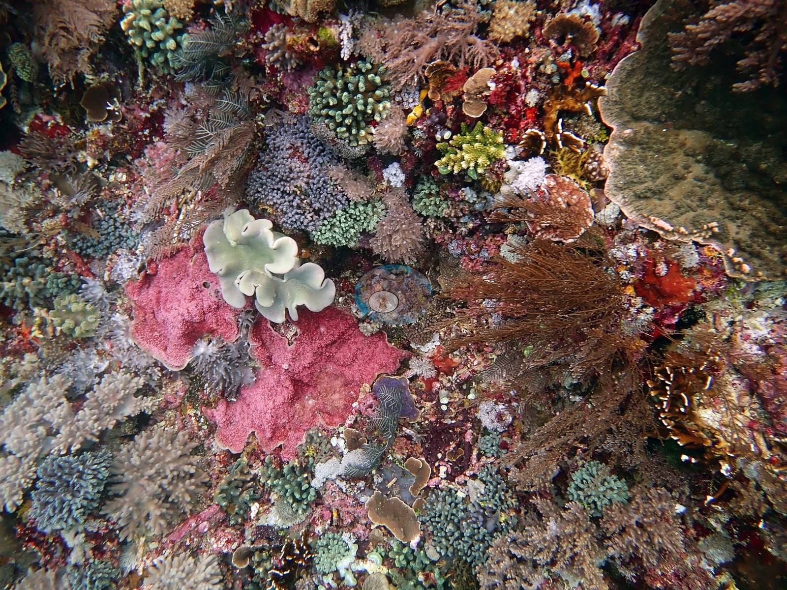
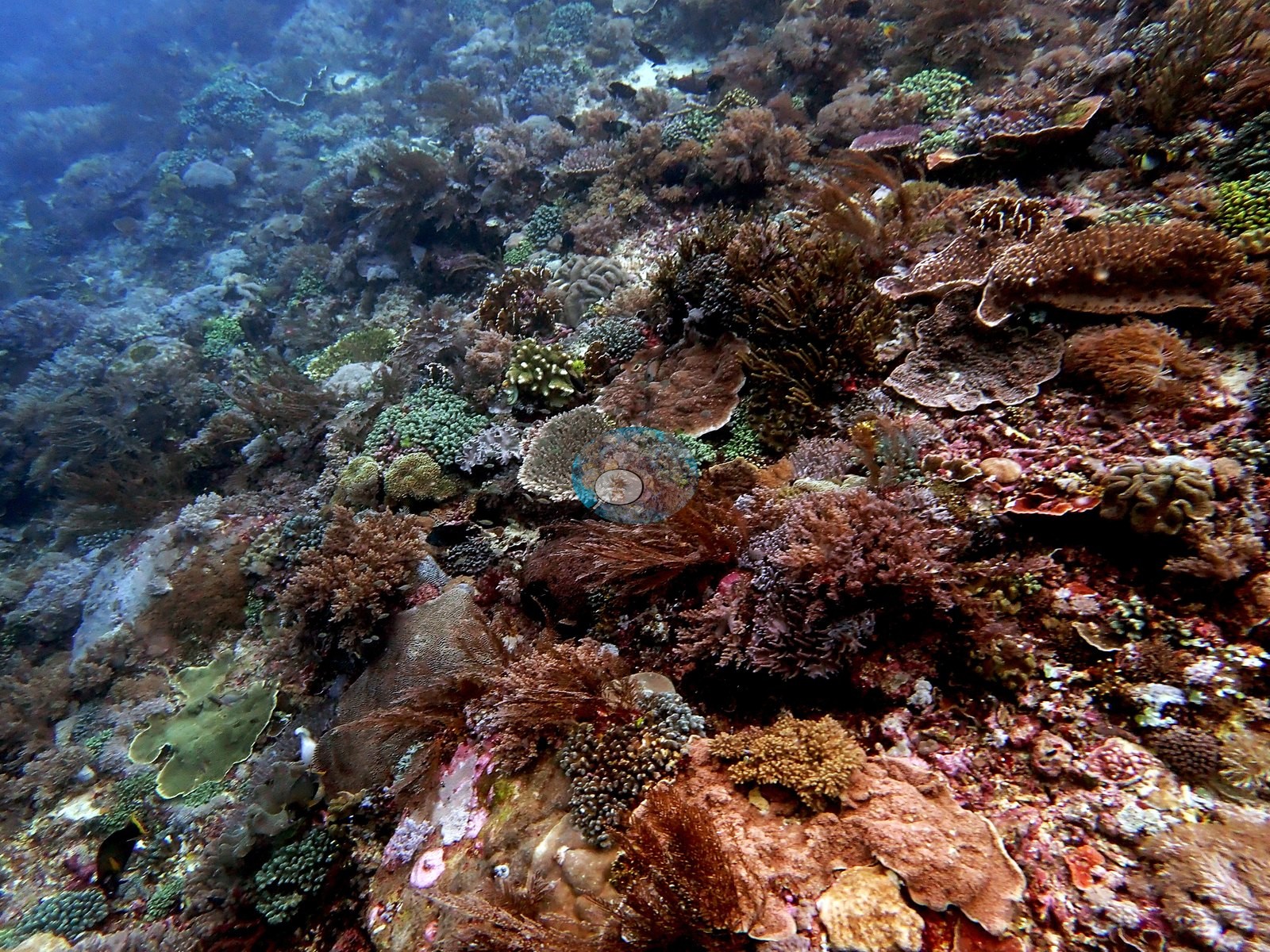
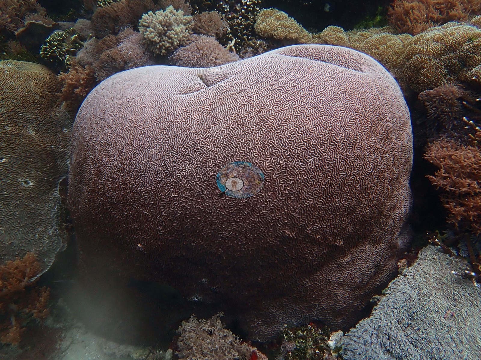
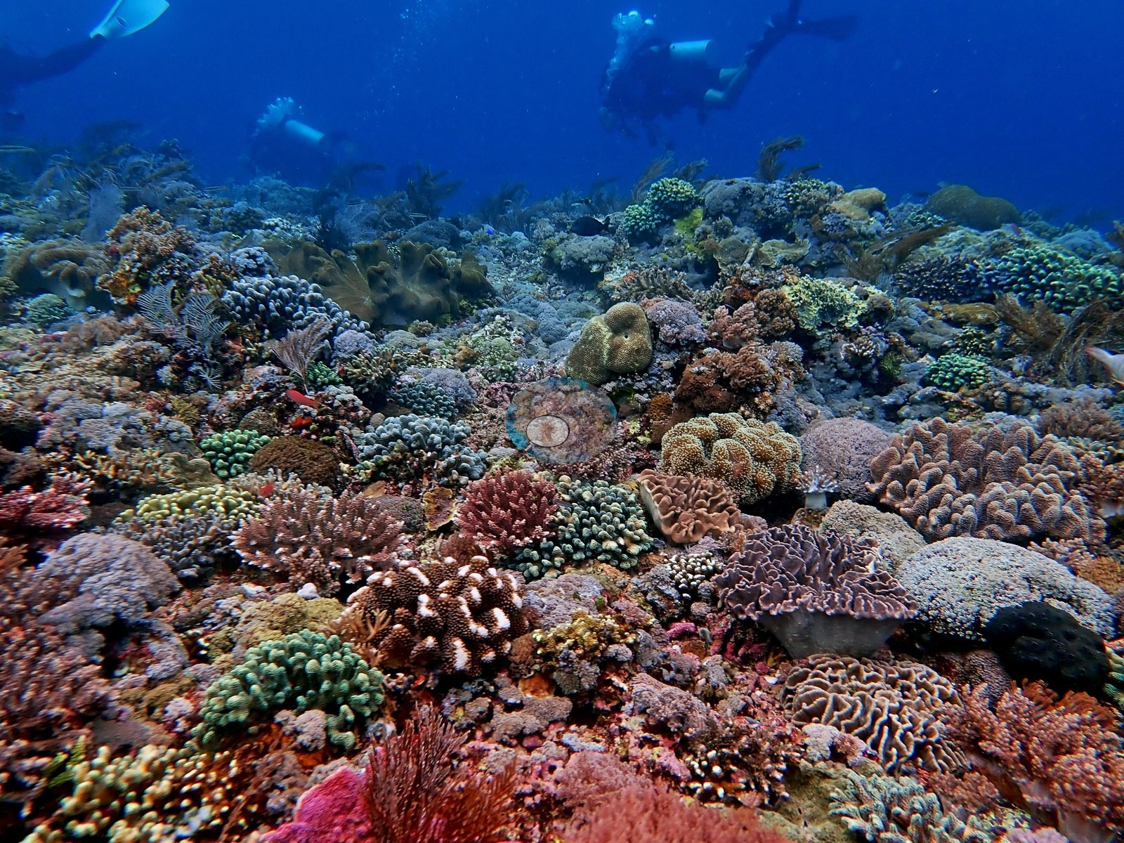
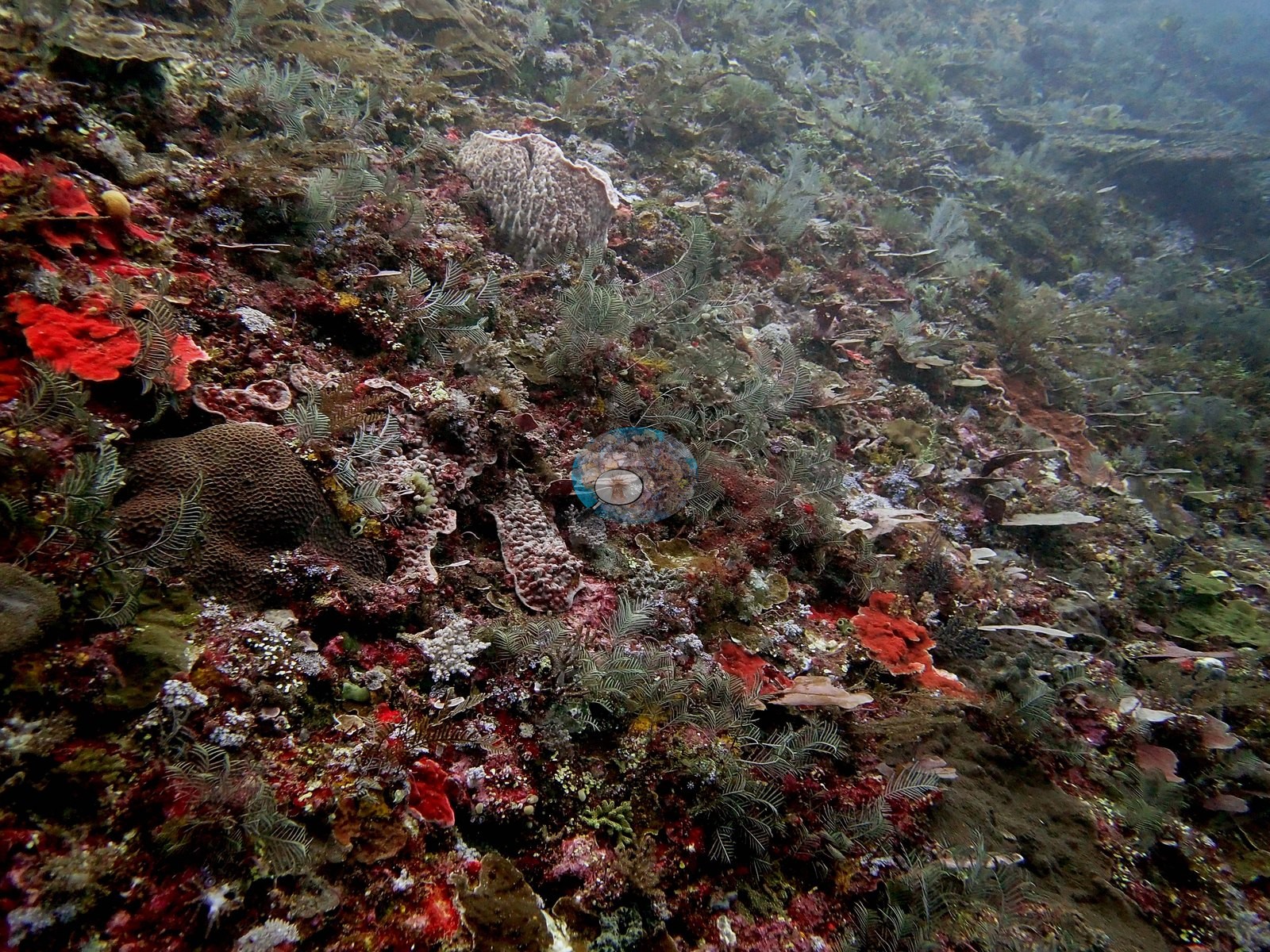
Fire coral, Hydnophora, some Acropora. Slightly more relief at 9 m, at which point Acropora became more common. Nearly all Stylophora pistillata were green fluorescent. Galaxea relatively common at all depths (small colonies). Mix of hard and soft corals in shallows (very beautiful; got some great photos) (e.g., Image 4, Image 5).
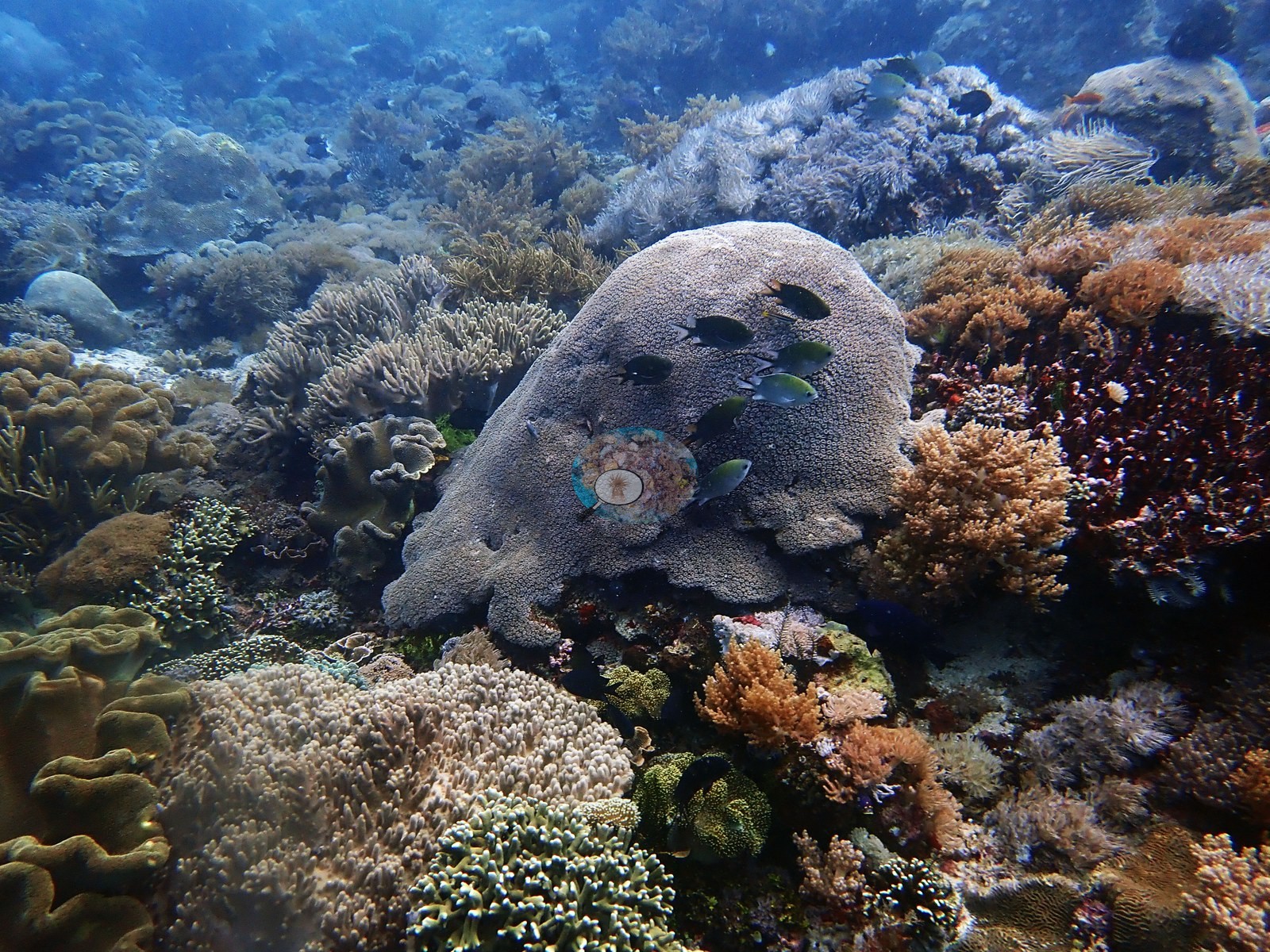
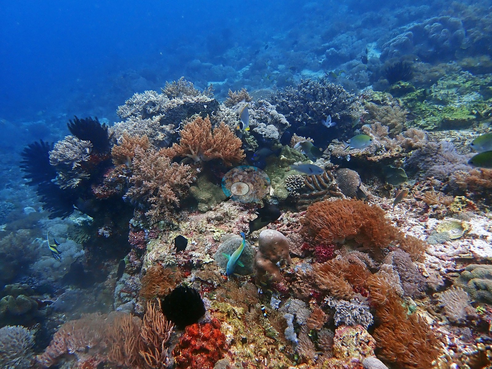
Some small massive poritids in shallows, Montipora, some finger Porites. Amazing corals at 5-9 m. Platygyra, Plerogyra, P. rus, leaf scorpionfish.
Coral cover
Coral cover: 22% — a blind Claude computer-vision point count of 78 of Anderson's edited photographs (20 points per photo; water, fish, and obstructions excluded). Other computer-vision methods are listed in the method table. Coral cover=5.0-10% at 25 m. Coral cover @ 20 m was much more impressive. Coral cover @ 20 m: 30-40%. 50-60% cover, high diversity, reef fish community eventually became more impressive but still signs of overfishing. Anderson is still comparing computer-vision models, and these figures will be updated as the methods improve.
Stressors
No crown-of-thorns starfish (COTS) or other corallivores evident.
Fish and other fauna
Fish life unimpressive, though several nice angelfish. Finally began to see schooling fish. Snapper, batfish, encrusting Porites, Pachyseris, stinging hydroids (all over the place), Pocillopora acuta (uncommon). Few big fish with the exception of a small barracuda and some batfish.
Comparisons with other data
No independent survey was made at this exact site; the nearest ones are listed in the table below.
Dive record
2019-1-25 dive 1: Police corner (#24). 7:33-8:35 (62 min). Max. depth=32.6 m. Temp=25.6ºC. 30% oxygen.
Other notes
This was one of the best dives of the trip. 20 m viz at beginning of dive (among best of trip), 25ºC, cold, and dark.
CV model comparison
More info
DINOv3 and CoralSCOP were run on the same photos and are listed for comparison. Coralscapes v2 and v1 were also run but are not shown: Anderson does not consider Coralscapes reliable for these photos. No diver transect exists for this trip, so agreement between the rows is not accuracy, and as of September 2026 no computer-vision method estimates coral cover accurately on new images; treat every row as indicative.| Method | Hard-coral cover (%) |
|---|---|
| In-house DINOv3 | 30.0 |
| CoralSCOP edited | 51.8 |
| Claude (edited photos) | 21.6 |
Independent surveys nearby
| Agency / program | Year(s) | Stations / distance | Link |
|---|---|---|---|
| Reef Check | 2014–2020 | 5 stations, 2.72–4.27 km | Records ↓ |
| WWF-US / WWF-Indonesia | 2016 | 2 stations, 2.38–4.37 km | Records ↓ |
 Dr. Coral (CRD)
Within 5 km, 7 independent survey stations recorded hard coral cover in 12 surveys between 2014 and 2020. The most recent nearby survey is from 2020, so these values predate recent heat stress. This site's own estimate (22%) sits within the range of these surveys (8.8–55%); the methods differ, so the comparison is context, not a like-for-like test.
Collected by other programs using different methods (Reef Check uses point-intercept transects), so these are context for the figures above, not a like-for-like comparison. Where a station was surveyed more than once the range is shown. Station names are not dive-site names.
| Agency | Site / location | Date | Hard coral cover (%) | Distance | Link |
|---|---|---|---|---|---|
| Reef Check | Sebayor Kecil | 2014 | 53% (2 surveys) | 4.27 km | — |
| WWF-US / WWF-Indonesia | TNK06 | 2016 | 40% (2 surveys) | 2.38 km | Amkieltiela, Abdillah T, Amkieltiela A, Andradi-Brown D, Lazuardi E. 2016. Komodo MPA. MERMAID |
| WWF-US / WWF-Indonesia | TNK04 | 2016 | 55% | 4.37 km | Amkieltiela, Abdillah T, Amkieltiela A, Andradi-Brown D, Lazuardi E. 2016. Komodo MPA. MERMAID |
| Reef Check | Siaba Besar (Sector 1) | 2020 | 51% (2 surveys) | 2.72 km | — |
| Reef Check | Siaba Besar (Sector 2) | 2020 | 47% (2 surveys) | 2.72 km | — |
| Reef Check | Mawan (Sector 1) | 2020 | 10% (2 surveys) | 3.41 km | — |
| Reef Check | Mawan (Sector 2) | 2020 | 8.8% | 3.41 km | — |
Data & links
All images from Coral Reef Diagnostics. Data are from Coral Reef Diagnostics and the organizations named in the data-sources table above.
© Coral Reef Diagnostics.