
Part of the regional summaries: Tonga - Vava'u and Tonga

More info
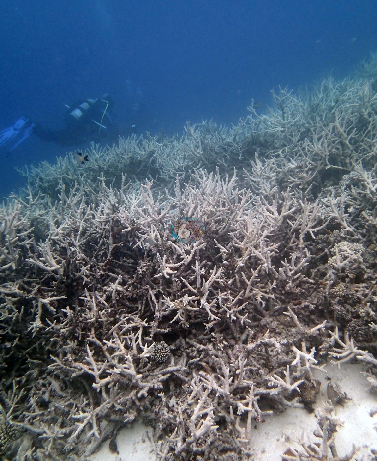
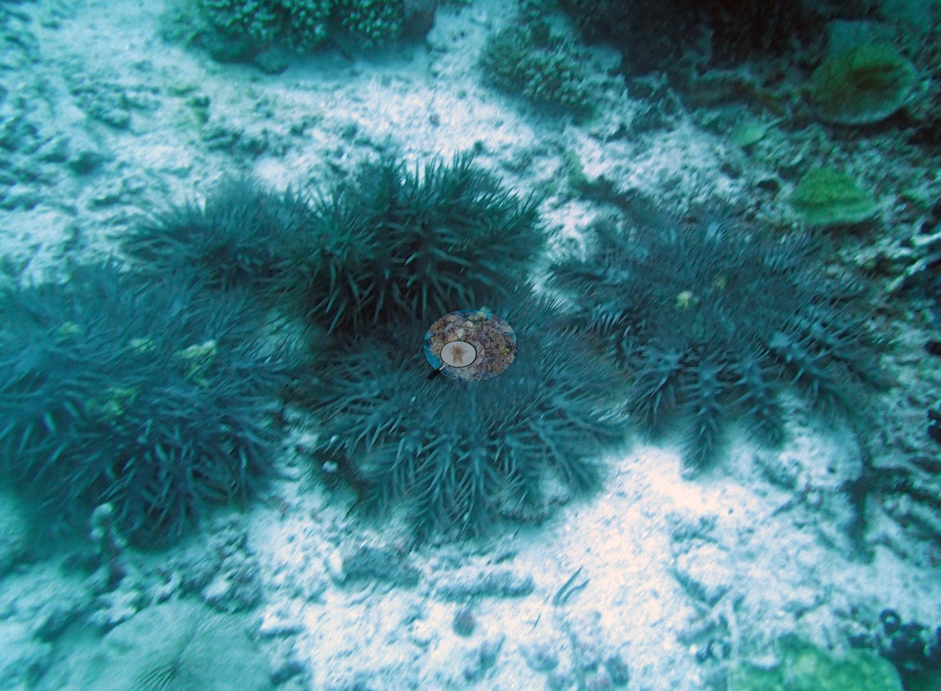
Southern Tonga (NOAA CRW virtual station)On a dive to 24.4 m off Vava'u, a staghorn Acropora thicket so extensive it dwarfs a passing diver, its branches pale gray-white along most of their length: bleached, but still alive. Several crown-of-thorns starfish were massed together on the reef, and Anderson's sampling sheet records two of the eight Pocillopora colonies sampled here as 50% and 80% bleached. Surveyed on the Living Oceans Foundation's Global Reef Expedition.
ʻI ha uku ki he 24.4 m ʻi Vavaʻu, ko ha vao Acropora staghorn ʻoku fuʻu lahi ʻo siʻisiʻi ai ha tokotaha uku ʻoku ʻalu atu, ʻoku vaivai hono lanu efuefu-hinehina ʻi he lahi taha ʻo hono loloa ʻo hono ngaahi vaʻa: kuo hinehina (bleached), ka ʻoku kei moʻui. Naʻe fakatahataha ha ʻalamea (crown-of-thorns starfish) ʻe niʻihi ʻi he hakau, pea ʻoku lēkooti ʻe he pepa sampling ʻa Anderson ko e kulupu ʻe ua ʻi he kulupu Pocillopora ʻe valu naʻe toʻo sīpinga mei ai heni naʻe hinehina ʻaki ʻa e 50% mo e 80%.
AI translation of this summary; the English is authoritative. (low confidence)
CTD-cast midpoint of 26.1–26.7°C
Four other CRD dive sites with their own pages within 5 km shown in orange — click a marker to open its page.
🗺 Detailed map of the Global Reef Expedition dive sites, Vava'u, Tonga (Khaled bin Sultan Living Oceans Foundation; opens in a new window)
Site description
Setting
Northwest end of Treasure Island, Vava'u: a leeward, lagoonal fringing reef (Anderson's sample sheet).
General benthic features
Two of the three habitat frames are views of the same thing: an extensive field of branching, staghorn-form Acropora, growing as an open interlocking thicket over a gently sloping bottom, with pale sand or rubble visible in the gaps between clumps and a few small knobby and encrusting colonies among the branches (e.g., Image 1, Image 2).
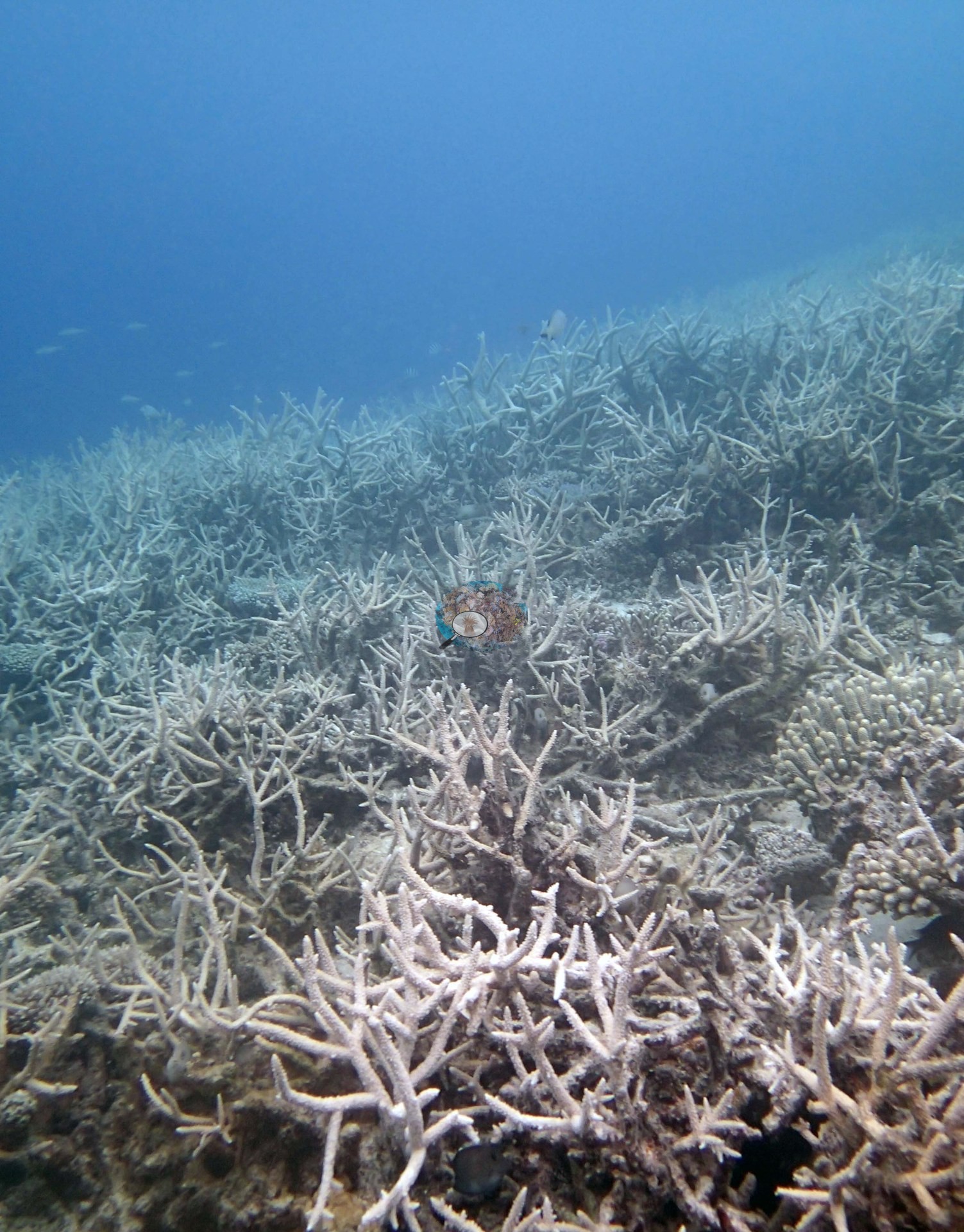
In one the thicket runs continuously away into the haze with a diver working in the blue water above it; in the other it fills the foreground and continues past the edge of the frame. That is the whole of what the imagery establishes about this site's habitat — it does not show the reef's profile, its depth zonation, its shallower or deeper communities, or how much of the site the thicket occupies. The third frame records the key observation at this site: a tight aggregation of crown-of-thorns starfish, several individuals massed shoulder to shoulder with their arms fanned across a pale, bare patch of substratum, with green encrusting and foliose colonies around the edges of the frame (e.g., Image 3).
Coral cover
- Reference: Khaled bin Sultan Living Oceans Foundation, Global Reef Expedition (in situ transect)
- 35%, from the Khaled bin Sultan Living Oceans Foundation's in situ transect survey (Global Reef Expedition site data); the photographs illustrate the site. Algal cover is 37% of the benthos.
- Transect mean 35 ± 3.8% SE (n = 4 transects; Living Oceans Foundation per-transect benthic data); the headline above is this all-transect mean.
Stressors
Anderson recorded the frame as crown-of-thorns starfish (COTS). The aggregation itself is unambiguous; the frame cannot establish how far the outbreak extended or how much of the site had been grazed. The staghorn thicket in both wide frames is pale gray-white along most of its branches, with the corallites intact rather than bare skeleton: bleached, but still alive (e.g., Image 1, Image 2). Anderson's sampling sheet also records bleaching in the colonies sampled: two of the eight were 80% and 50% bleached, three more 5–10%, and one cream-pale and possibly unhealthy. The Living Oceans Foundation transects here recorded 0.5% cyanobacteria and no recently dead coral.
Comparisons with other data
James Cook University and the Ministry of Fisheries Tonga surveyed a nearby station (Euiki West side), 0.26 km from the pin; we could not confirm that it is the same reef. If you have survey data from this site to share, please email us.
Other notes
Photo review of 3 habitat frames plus 42 sampled-colony close-ups (Vava'u, 27 Sep 2013). The account on this page is written from the three habitat frames only; the colony images are treated purely as a record of what was sampled. Three frames is very little to describe a reef with, and all three are ambient-light shots at survey depth with heavy blue-green casts and no scale reference, so what follows is deliberately limited to what they actually show. Eight Pocillopora colonies were sampled here (colonies 98-105), six of them identified as P. acuta in Anderson's own field records; two (colonies 103 and 105), from which no RNA or DNA was extracted, are identified as P. damicornis on the sample sheet (not genotyped). The 42 close-ups are repeat polyp-scale macro, tag, and setting shots of only those eight colonies — numbered tags appear in frame, several held by a gloved hand — and describe the colonies, not the reef.
Data & links
- Download benthic survey data (CSV) ↗
- Download all LOF-GRE data (933 sites) ↗
- Photo portfolio ↗
- Coral Reef Diagnostics region page ↗
All images from Coral Reef Diagnostics. Data are from the Khaled bin Sultan Living Oceans Foundation Global Reef Expedition and Coral Reef Diagnostics.
© Coral Reef Diagnostics.