

Part of the regional summaries: Tonga - Vava'u and Tonga
More info
Southern Tonga (NOAA CRW virtual station)A gently sloping leeward barrier reef in Vava'u of wide spurs and clean sand channels, with a flat middle band dominated by soft corals. Deeper spurs carry large staghorn patches, most partly dead under turf and damselfish lawns, along with big table corals and a 3 m Porites at the sand edge. Surveyed on the Living Oceans Foundation's Global Reef Expedition.
Ko ha hakau fakaā (barrier reef) ʻoku hifo māmālie ʻi he tafaʻaki maluʻi mei he matangi (leeward) ʻi Vavaʻu ʻo e ngaahi spurs fālahi mo e ngaahi hala vai ʻoneʻone maʻa, mo ha konga lafalafa ʻi he lotomālie ʻoku puleʻi ʻe he feo molū (soft corals). ʻOku ʻi he ngaahi spurs loloto ange ʻa e ngaahi konga staghorn lalahi, ko e lahi taha kuo mate ha konga ʻi lalo ʻi he limu nounou (turf) mo e ngaahi ngoue limu ʻa e damselfish, fakataha mo e ngaahi feo fakatēpile (table corals) lalahi mo ha Porites ʻo e 3 m ʻi he tafaʻaki ʻo e ʻoneʻone.
AI translation of this summary; the English is authoritative. (low confidence)
CTD-cast midpoint of 26.3–26.5°C
One independent survey station shown with the program’s logo — click one to see how far it is from this site.
Two other CRD dive sites with their own pages within 5 km shown in orange — click a marker to open its page.
🗺 Detailed map of the Global Reef Expedition dive sites, Vava'u, Tonga (Khaled bin Sultan Living Oceans Foundation; opens in a new window)
Site description
Setting
Barrier reef on the leeward side at the southwestern end of the reef system. This is a very gently sloping system of wide spurs and wide sand patches and channels with little rubble.
General benthic features
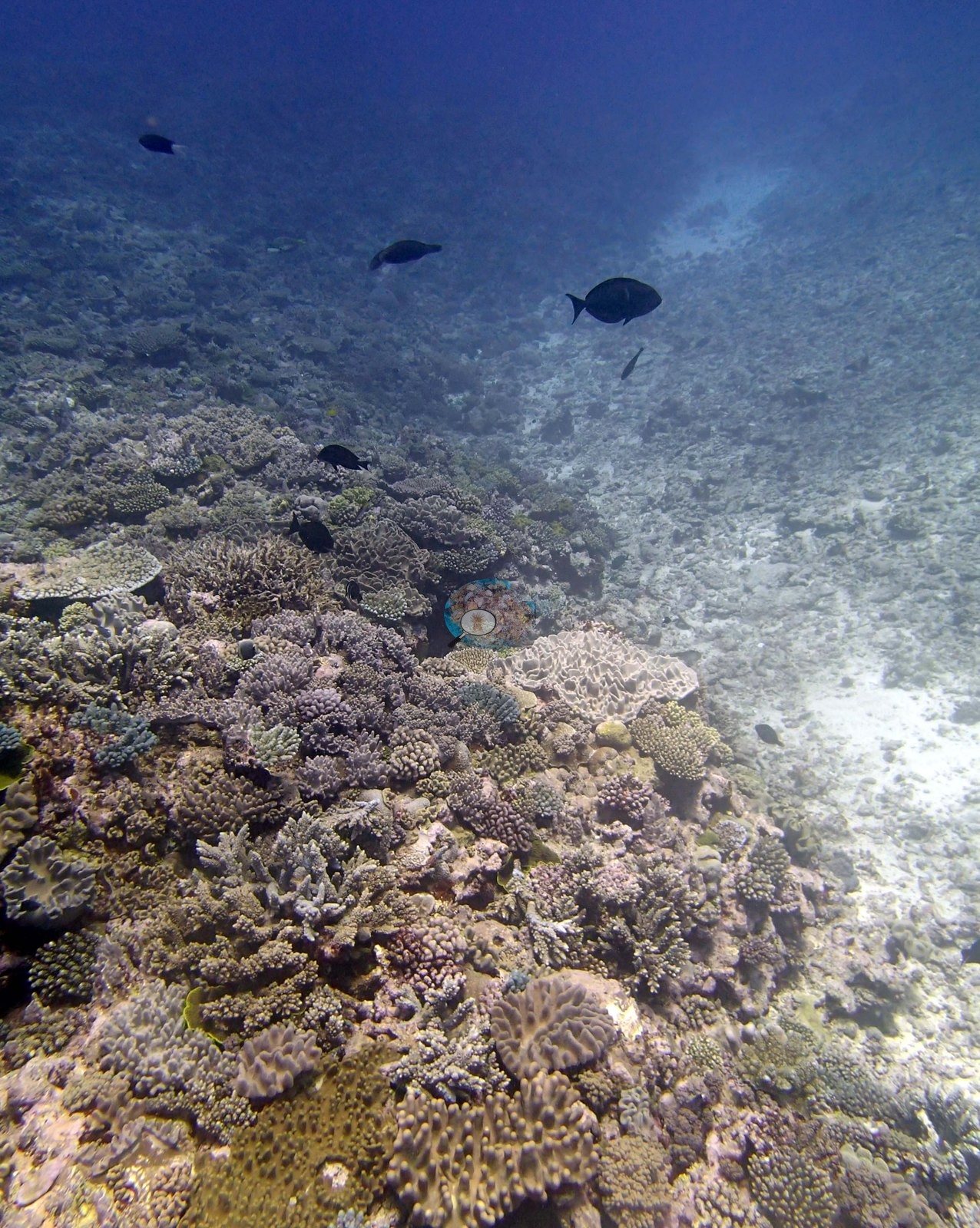
The frames show the crest and flank of a wide, gently sloping spur, with open white sand immediately alongside it. Image 1 and Image 6 both catch the boundary directly: a coral-covered ridge running diagonally across the frame and falling away to a broad, clean sand channel with no coral on it at all.
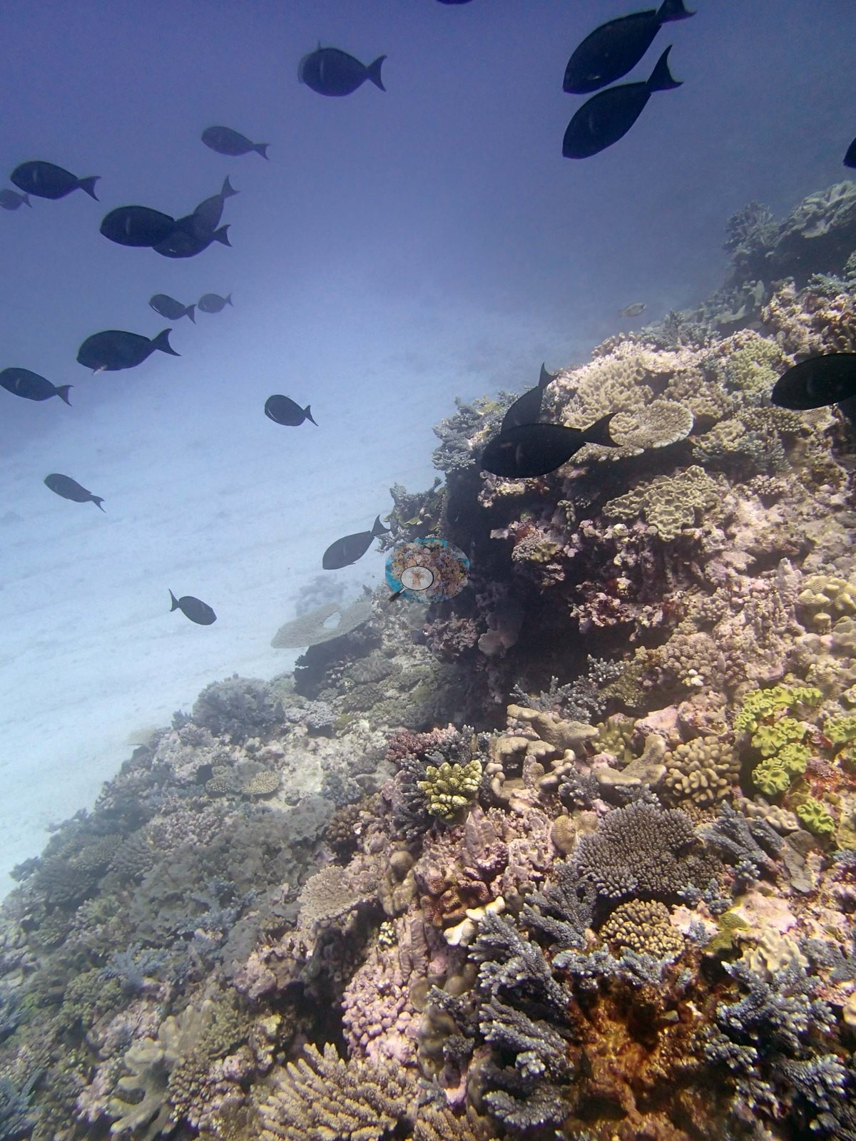
This wide-spur-and-sand-channel arrangement is consistent with the surveyors' account of a gently sloping system of wide spurs and wide sand patches, but relief and depth zonation are not readable from these frames and no such claim is made from them. Image 8, Image 2, Image 3, and Image 4 look along and over the crest under open blue water, with sand visible beyond the reef in Image 4. Image 3 is the only frame with real vertical structure in it — a dark undercut running beneath the crest.
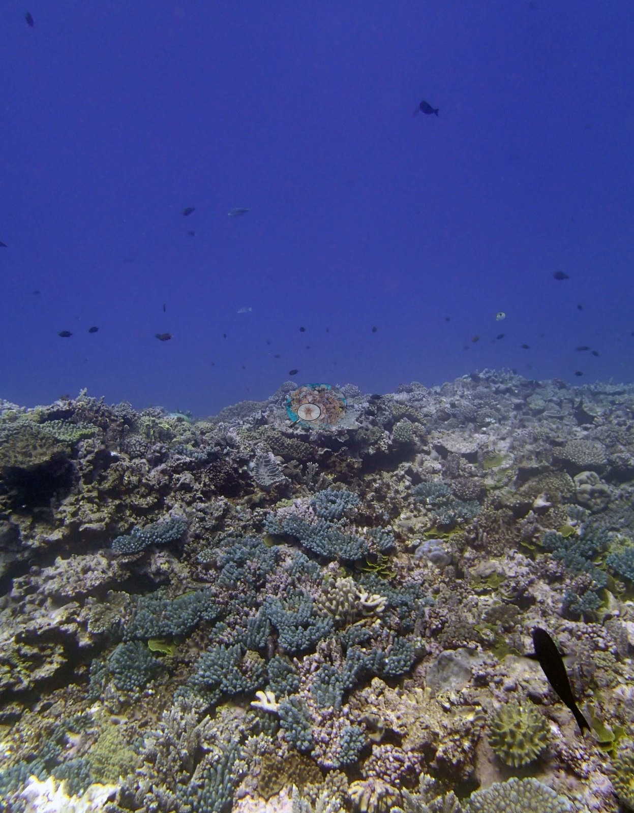
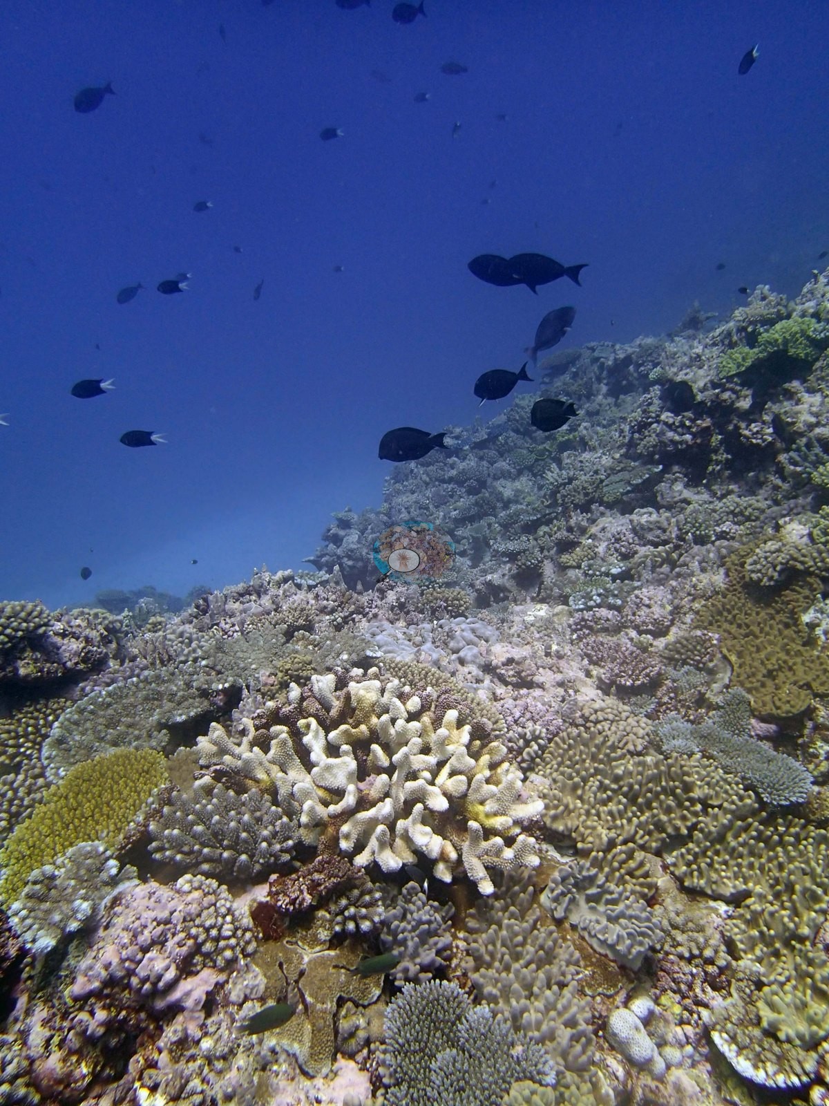
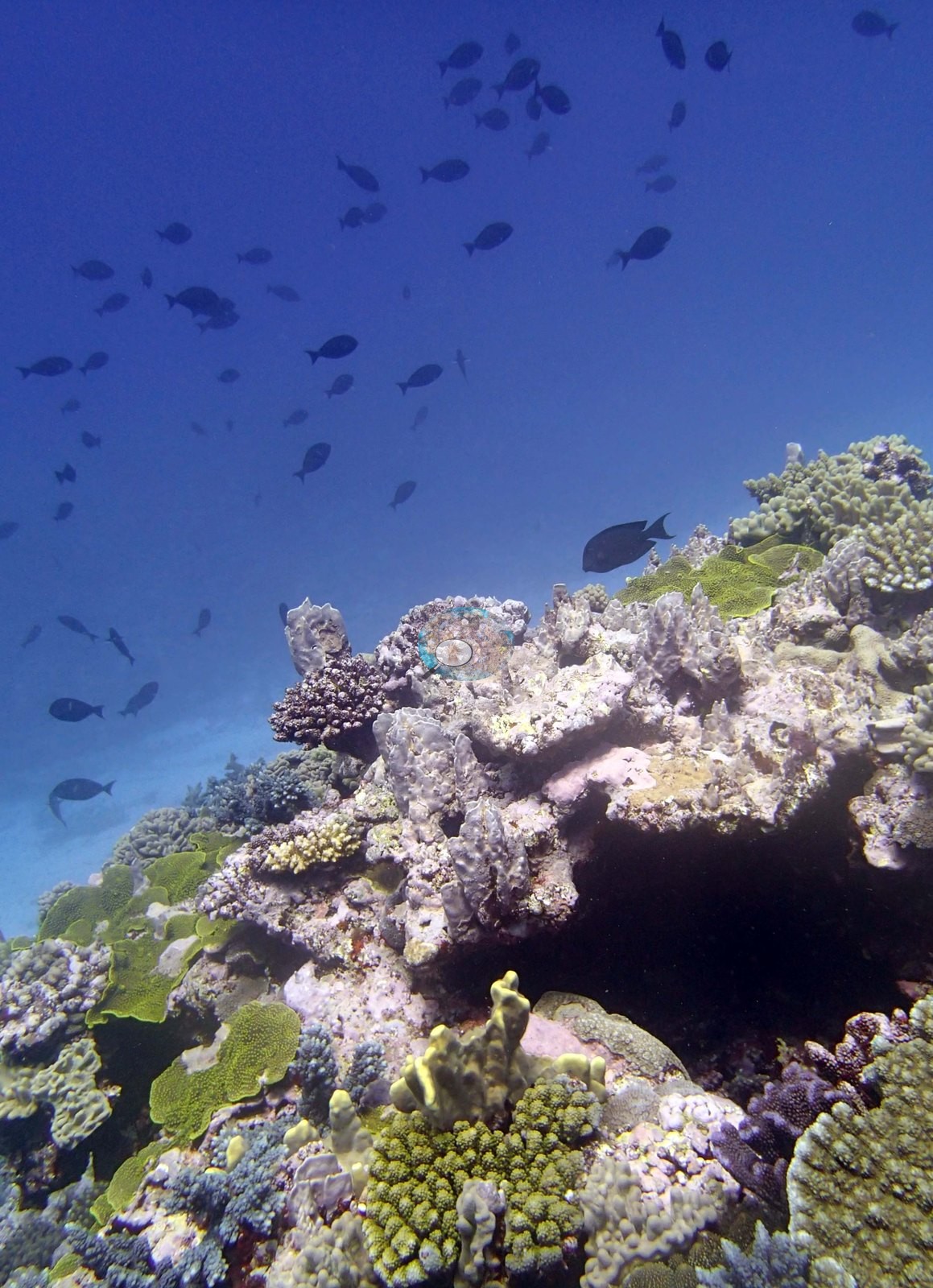
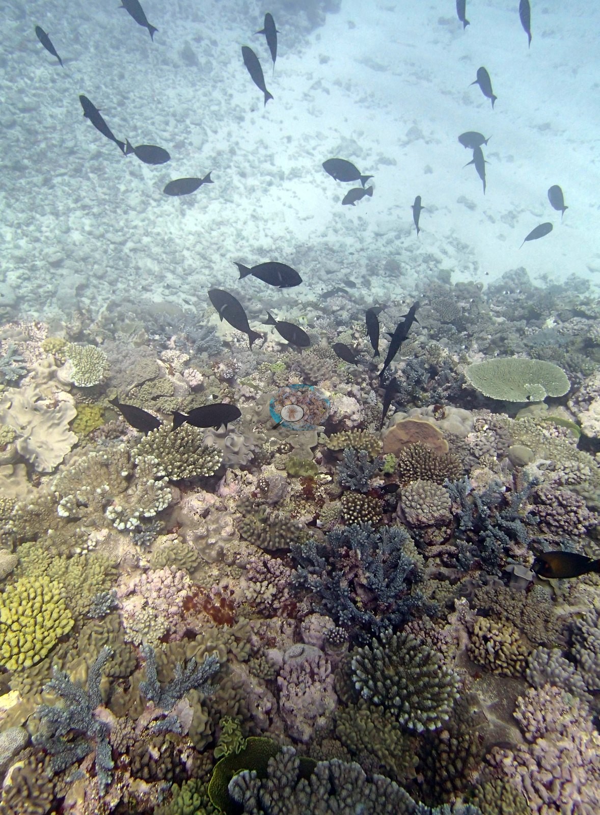
Where the camera is over the reef the community is branching- and plating-dominated. The recurring elements across all eight frames are corymbose and digitate Acropora in tan, mauve, and lavender; tabular and plating Acropora, several of them broad and low; olive- and yellow-green foliose and encrusting colonies; small tan knobby and digitate heads; and pale gray-cream colonies of several growth forms scattered through. Image 5 is the densest benthic frame — a close mosaic of green tabular plates, olive-green foliose colonies, mauve branching thickets and, filling the lower frame, a large pale gray-white convoluted foliose colony.
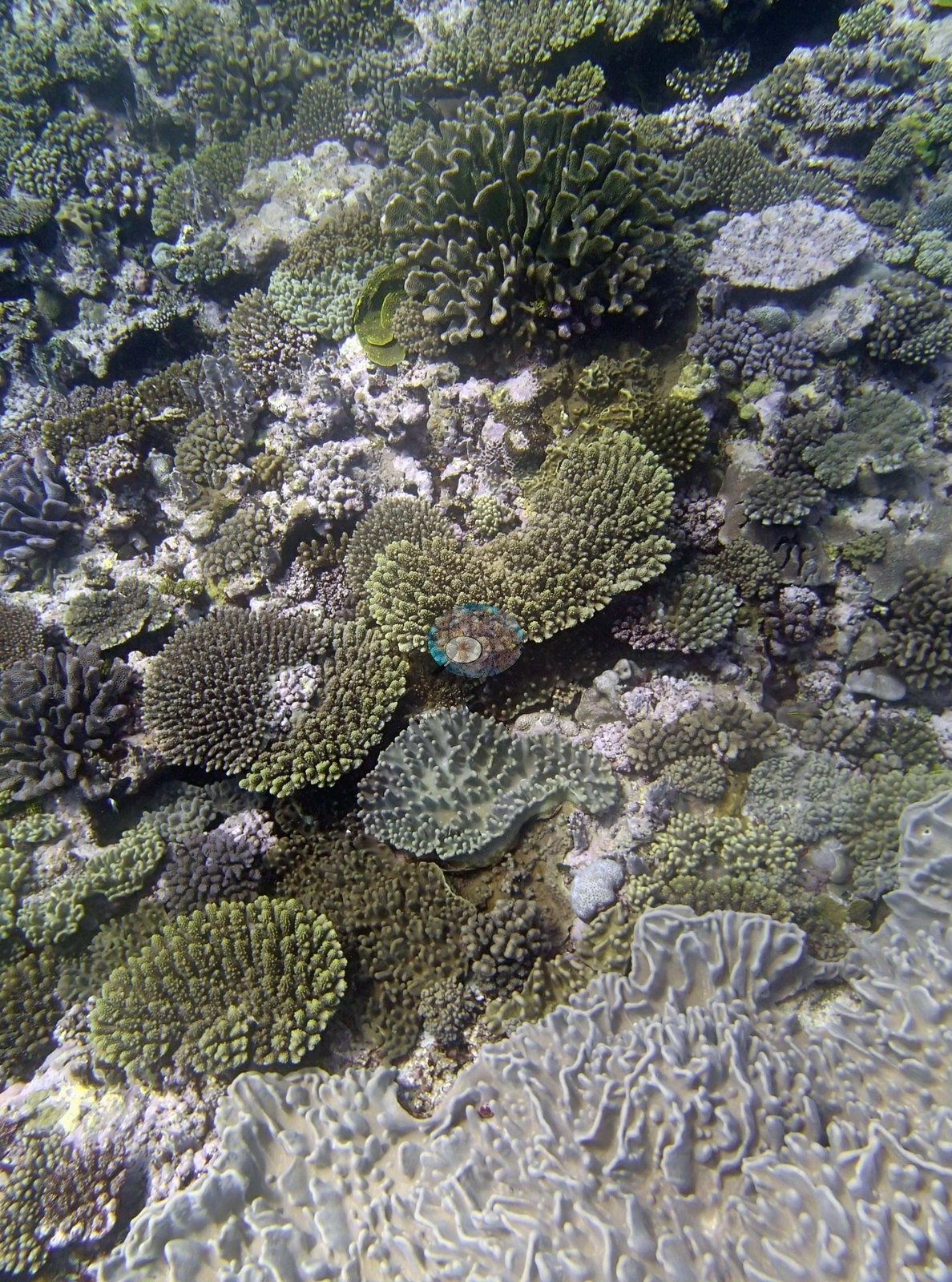
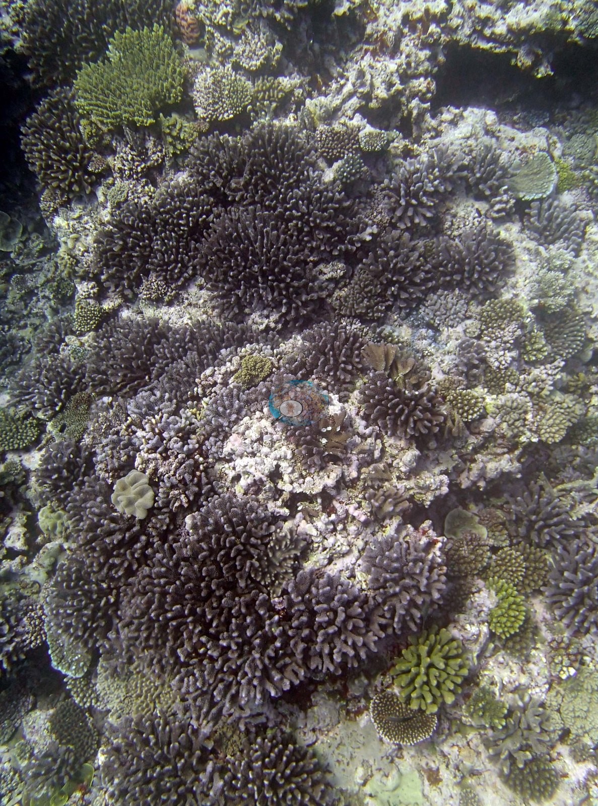
Image 7 is a bushy mauve-brown Acropora stand filling the frame with green tabular plates above it and pale rubble showing in the gaps between colonies. Image 4 carries a distinctly blue-lavender branching Acropora that is the most conspicuous single colony in the set.
The sand channels beside the spur, plainly visible in Image 1 and Image 6, carry no coral. The shallow areas (8-12 m) have up to 1.5 m relief, but relatively low cover dominated by faviids, small acroporids, Pocillopora, and Stylophora. At 12-15 m there is very little relief – largely a flat-topped reef with little coral and 40-50% soft corals. At 15-25 m the spurs are 2-3 m above the surrounding sand with large patches of staghorn corals (most partially dead with dense turf algae and damselfish), soft corals, scattered large table acroporids (up to 2 m, 10% dead), Isopora, Goniastrea, Montipora plates, Stylophora colonies (most with partial mortality and snails), Favia stelligera, Coscinaraea, and Porites 1-2 m in diameter. Found one very large Porites (3 m × 2 m) at the edge of the spur in the sand (15 m) and one very large (2 m) Montipora plate. The reef has 10-15% cover Halimeda, good CCA (30%) throughout all depths and 20% turf (except in damselfish algal lawns).
Coral cover
- Reference: Khaled bin Sultan Living Oceans Foundation, Global Reef Expedition (in situ transect)
- 19%, from the Khaled bin Sultan Living Oceans Foundation's in situ transect survey (Global Reef Expedition site data); the photographs illustrate the site.
- Transect mean 19 ± 1.8% SE (n = 5 transects; Living Oceans Foundation per-transect benthic data); the headline above is this all-transect mean.
Stressors
On condition the frames say less than they appear to. Pale gray-cream colonies appear in Image 2, Image 3, Image 6, and Image 5, and pale rubble and bare patches show between colonies in Image 7 and along the crest in Image 1 and Image 4. At this range those cannot be separated from one another — pale but normally pigmented tissue, older dead skeleton crusted with coralline algae, and recent whitening all read much the same in a wide frame lit by ambient light. They are reported as seen and diagnosed no further, and no bleaching or mortality percentage should be read off this set. Equally, the surveyors' specific observations — partial mortality with turf algae on the staghorn stands, snails on Stylophora, the very large Porites and Montipora plate, the three Culcita — are neither confirmed nor contradicted by these eight frames. The 2013 survey notes for this site record snails on most of the Stylophora colonies and three Culcita cushion stars (Khaled bin Sultan Living Oceans Foundation expedition site notes, 2013; regional summary in Bruckner 2014). Typical recent thermal stress: mean annual maximum of 8.1°C-weeks (Degree Heating Weeks, 2021-2025, NOAA CRW; Southern Tonga virtual station). The Living Oceans Foundation transects here recorded 2.9% cyanobacteria and no recently dead coral.
Fish and other fauna
Faunally the set is quiet and consistent: loose schools of dark surgeonfishes and unicornfishes over the crest and the adjacent sand in Image 1, Image 2, Image 3, Image 6, and Image 4, with scattered damselfishes among the corals. Low numbers of sea cucumbers found.
Comparisons with other data
TOVA46 (Vava'u) was surveyed on 26 September 2013 during the Khaled bin Sultan Living Oceans Foundation Global Reef Expedition.
Other notes
Eight habitat frames survive from TOVA46 (Vava'u, 26 Sep 2013), all of them genuine wide or mid-range reef views, with no apparatus, tag, or dive-computer frames among them. There are no sampled-colony frames.
Anderson recorded none of the target Pocillopora ('no Pdam') here. That is Anderson's field determination and it stands as recorded; it is also why this site produced habitat photography and no colony sampling. No quadrat, transect line, or scale reference appears anywhere, so no colony dimension in this set is measured.
Independent surveys nearby
Within 5 km, 1 independent survey station recorded hard coral cover in 2013. The most recent nearby survey is from 2013, so these values predate recent heat stress. This site's own estimate (19%) is not compared with these surveys: none lies within 2 km.
Collected by other programs using different methods (Reef Check uses point-intercept transects), so these are context for the figures above, not a like-for-like comparison. Where a station was surveyed more than once, the cell shows either the range of its values or, as a single value, the mean of surveys made in one year. Station names are not dive-site names.
| Agency | Site / location | Date | Hard coral cover (%) | Distance |
|---|---|---|---|---|
| Reef Check | The Coral Gardens | 2013 | 59% | 4.58 km |
Data & links
- Download benthic survey data (CSV) ↗
- Download all LOF-GRE data (933 sites) ↗
- Photo portfolio ↗
- Coral Reef Diagnostics region page ↗
All images from Coral Reef Diagnostics. Data are from the Khaled bin Sultan Living Oceans Foundation Global Reef Expedition, Coral Reef Diagnostics, and the organizations named in the data sources above.
 © Coral Reef Diagnostics.