

Part of the regional summaries: Tonga - Vava'u and Tonga

More info
Southern Tonga (NOAA CRW virtual station)A lagoon fringing reef in Vava'u with a shallow platform of very dense, multi-layered table and staghorn Acropora that drops vertically onto overlapping plating corals. At the base lie piles of broken, dead plates and rubble, and 20-30% of the table corals were dead in place, with some showing large white lesions. Surveyed on the Living Oceans Foundation's Global Reef Expedition.
Ko ha hakau matafonua ʻi he namo (lagoon fringing reef) ʻi Vavaʻu mo ha tuʻunga mamaha (shallow platform) ʻo e Acropora fakatēpile (table) mo e staghorn fefuʻifuʻi ʻaupito mo fakalaulau (multi-layered) ʻoku tō hifo hangatonu ki he ngaahi feo fakapaleti (plating corals) ʻoku fetaulaki. ʻI he takele ʻoku ʻi ai ʻa e ngaahi fokotuʻunga ʻo e ngaahi papa mate kuo fasifasi mo e maka momoa (rubble), pea ko e 20-30% ʻo e ngaahi feo fakatēpile naʻe mate ʻi hono tuʻuʻanga, mo ha niʻihi naʻe ʻi ai ʻa e ngaahi lavea hinehina lalahi (white lesions).
AI translation of this summary; the English is authoritative. (low confidence)
CTD-cast midpoint of 26.7–26.8°C
One independent survey station shown with the program’s logo — click one to see how far it is from this site.
Four other CRD dive sites with their own pages within 5 km shown in orange — click a marker to open its page.
🗺 Detailed map of the Global Reef Expedition dive sites, Vava'u, Tonga (Khaled bin Sultan Living Oceans Foundation; opens in a new window)
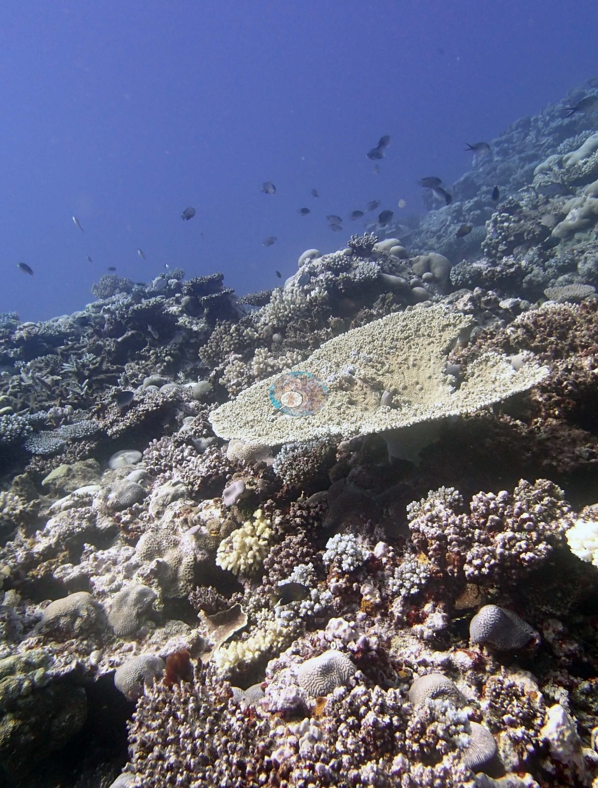
2 of the 15 photographs on this page are shown beside the text that discusses them under "Site description" below.
Site description
Setting
Lagoonal fringing reef.
General benthic features
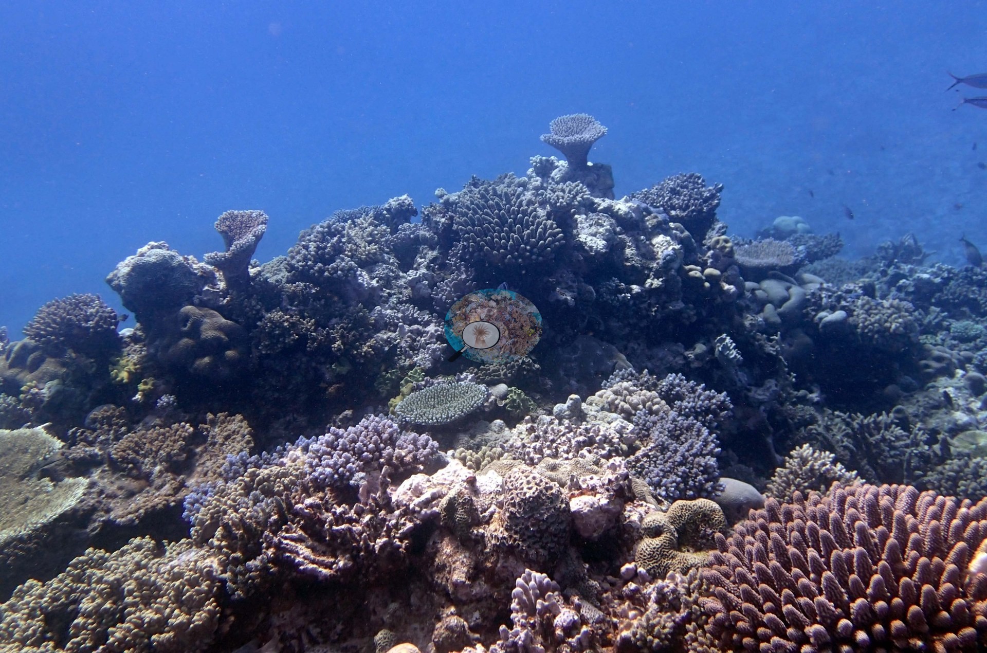
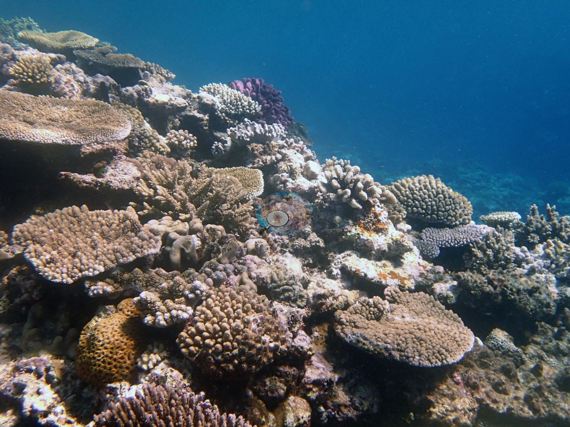
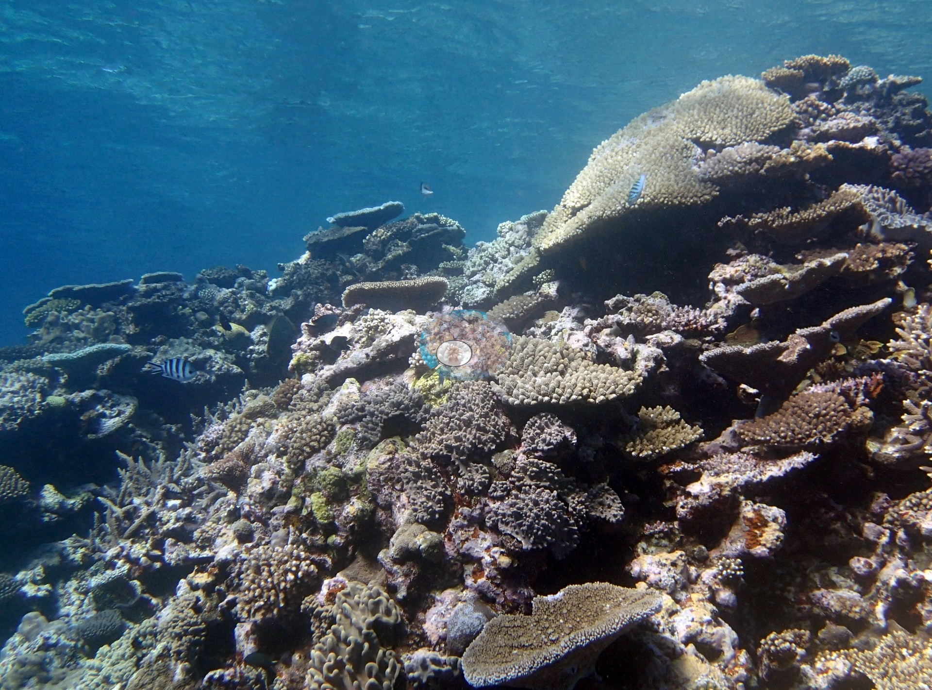
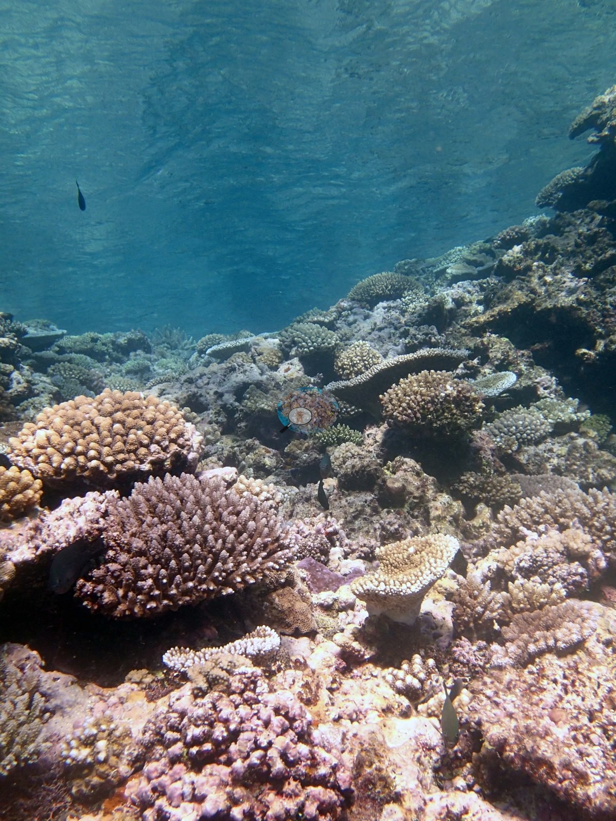
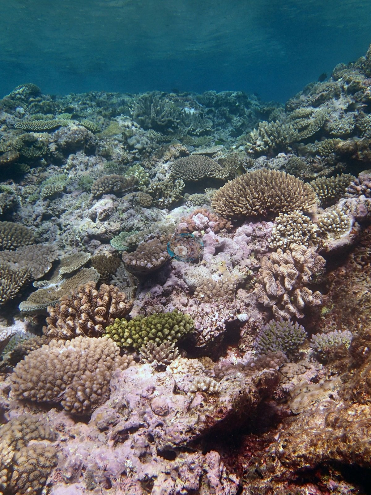
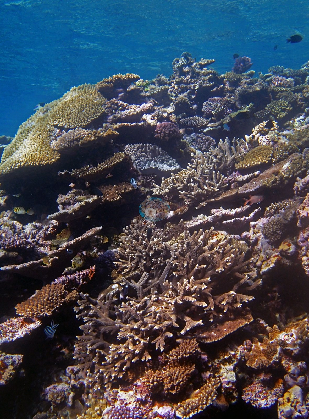
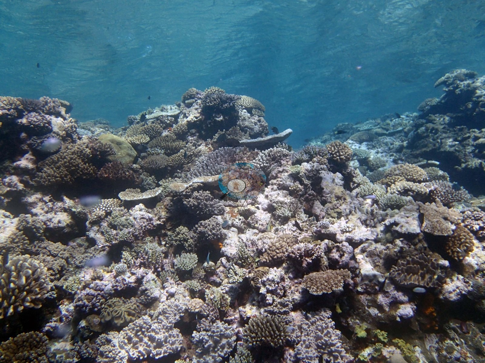
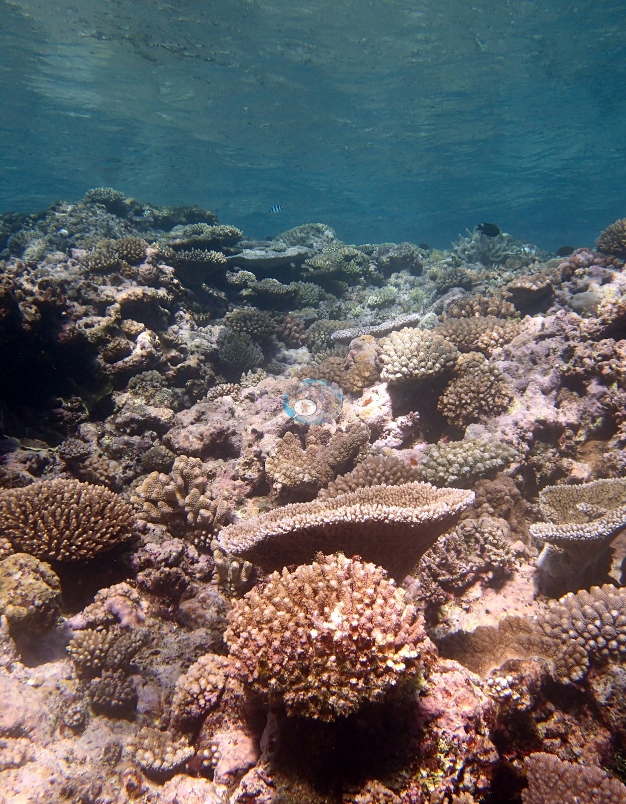
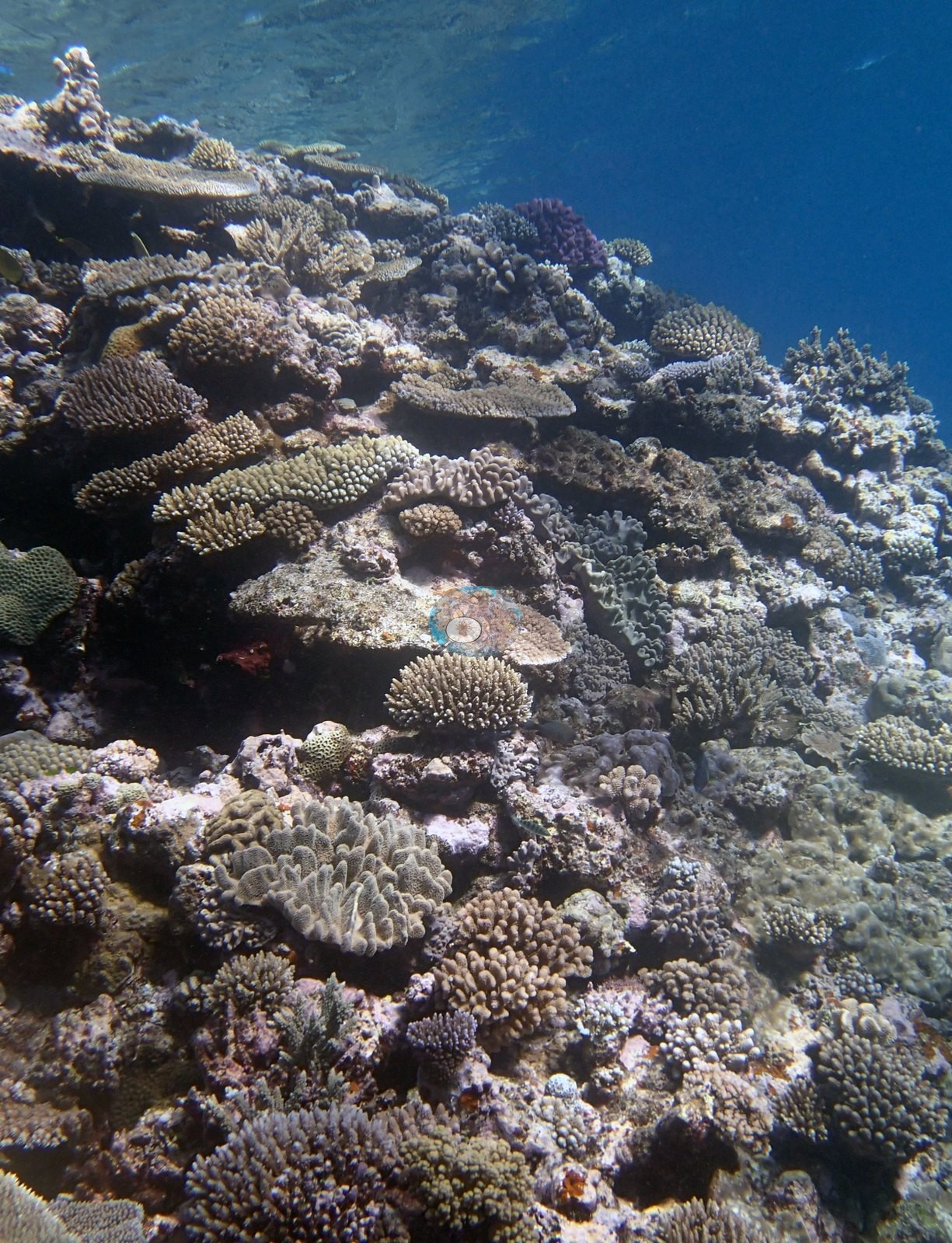
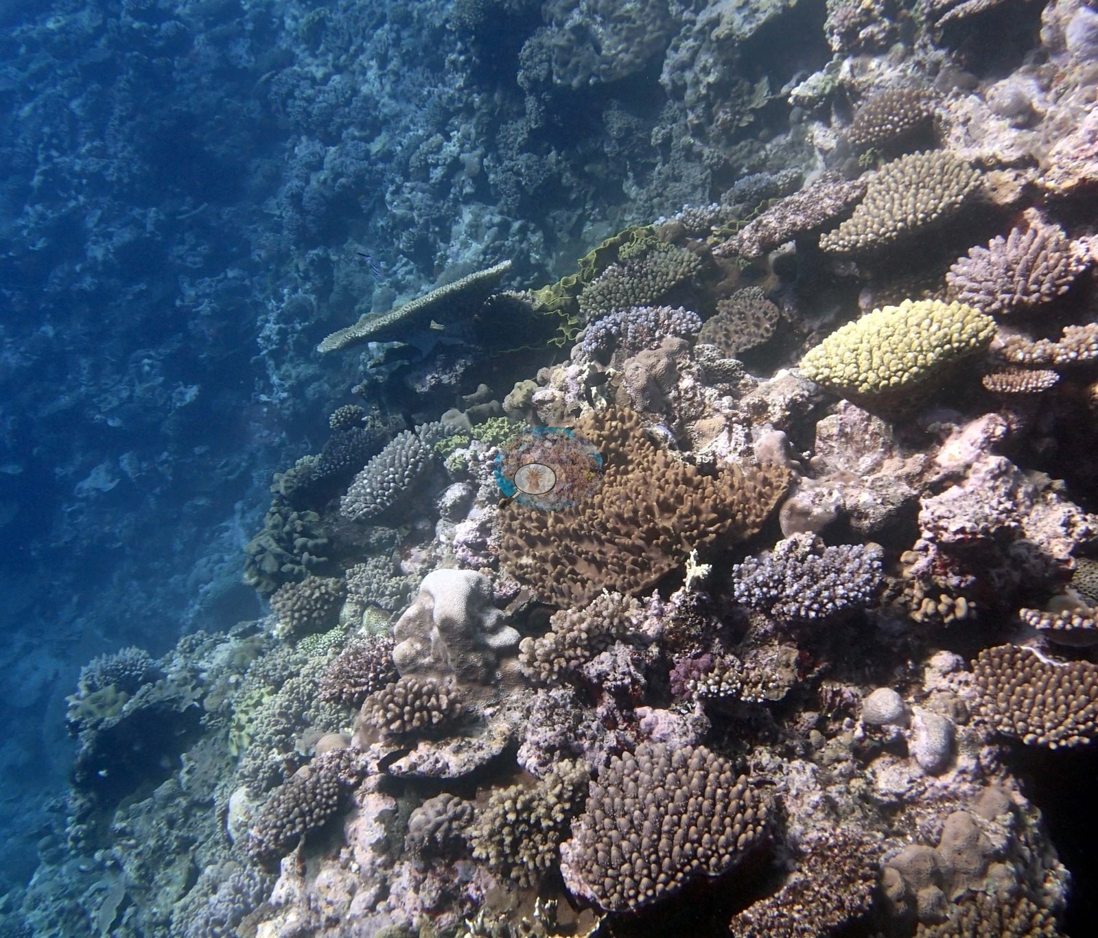
Twelve of the fifteen wide frames are shallow reef-top and platform-edge views, and they are consistent with one another: a close-packed, structurally crowded shallow terrace in which digitate and corymbose Acropora, staghorn clumps, thick tabular Acropora, and knobby Pocillopora-type colonies grow shoulder to shoulder, with encrusting and small massive heads and pink-mauve coralline crusts filling the gaps between them. Anderson's field impression, recorded on these frames, was of a coral garden at full cover in a bright, shallow, high-light setting (one view from 3 m), and the frames match it: in the shallowest views the water surface is visible directly overhead and bare substratum is hard to find between colonies. Two frames record the reef's vertical dimension rather than the reef top: one shows a steep-sided coral mound or spur rising into open blue water with its flank continuously covered, and a deeper frame shows two very large table Acropora plates side by side above knobby encrusting and submassive colonies, with blue fusiliers streaming past in the background (e.g., Image 15, Image 3).
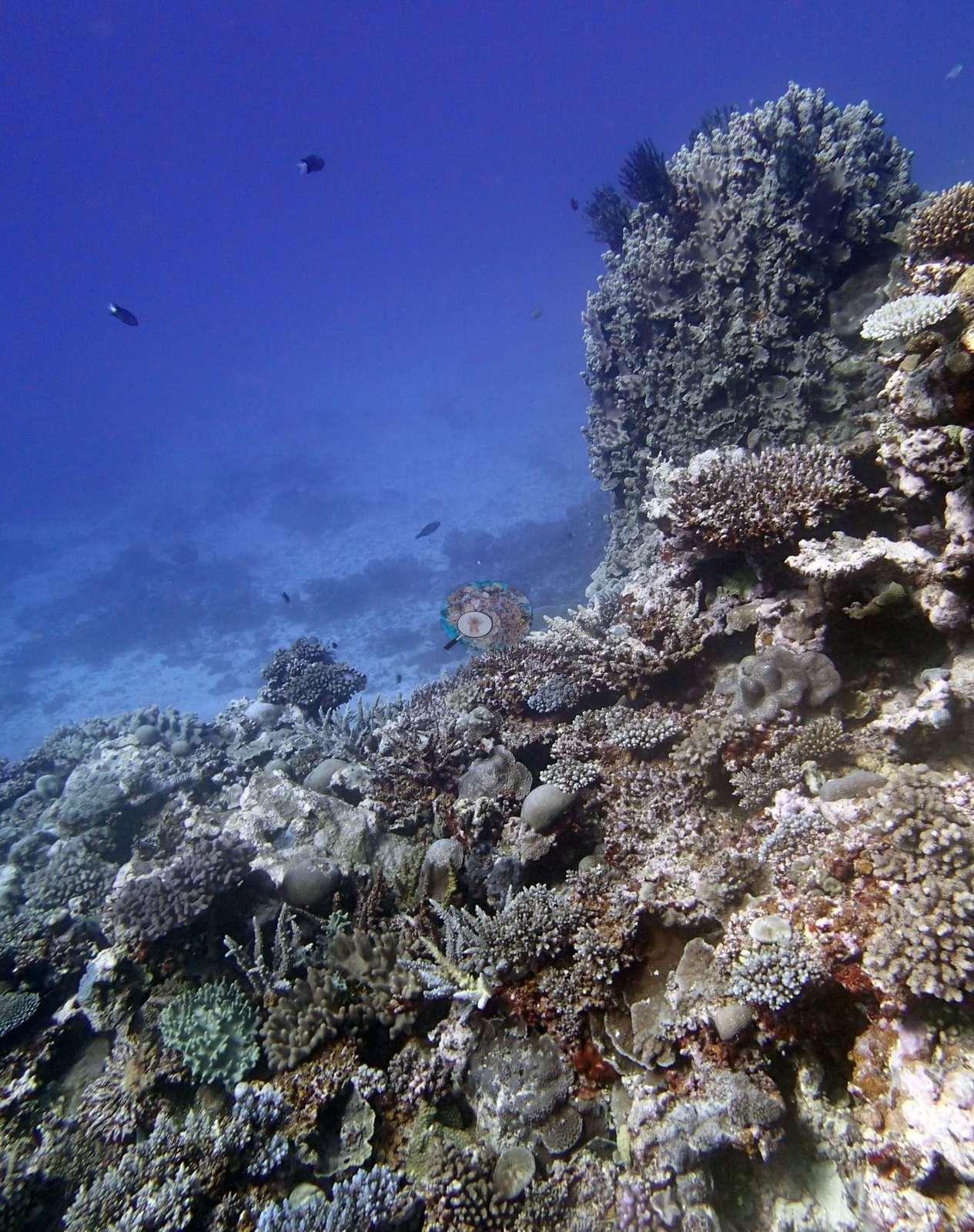
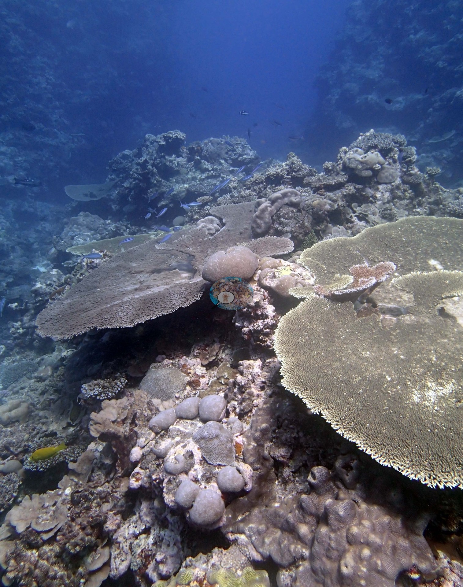
Sand flat close to shore then a shallow reef platform that extends out up to 100 m. This is 2-5 m deep with a scoured hardground near the shore and very high cover digitate, staghorn, thick tabular Acropora (often with multiple canopy layers), branching Hydnophora, Pocillopora, Isopora, Goniastrea, Favia stelligera, and other species near the edge of the drop. The platform drops vertically to 8-12 m, then slopes steeply to 23-28 m, ending in sand. The vertical surfaces have large overlapping plates, Pachyseris, Leptoseris, Goniastrea, Echinophyllia, Oxypora, Echinopora, Mycedium, and other species, encrusting Leptastrea, and Coscinaraea and other species. At the base of this and running down the slope are large piles of broken, dead plates, dead branches, and rubble. The slope has 20-30% live coral consisting of table acroporids, high numbers of Goniastrea retiformis, Stylophora, Favia stelligera, Echinopora, Merulina, P. rus, Turbinaria often growing as a series of overlapping shingles, and other species at lower abundances. High cover of CCA was apparent at all depths. Soft corals were mostly in the shallows.
Coral cover
- Reference: Khaled bin Sultan Living Oceans Foundation, Global Reef Expedition (in situ transect)
- Coral cover 53%, from an LOF-GRE in situ transect — a diver transect measurement, not a photographic or computer-vision estimate; the photographs here are qualitative only, and the photo set is biased toward the shallow terrace.
- Coral Health Index 3.46/5 (Mayfield & Dempsey 2025, Discover Oceans formula).
- Transect mean 53 ± 8.7% SE (n = 6 transects; Living Oceans Foundation per-transect benthic data); the headline above is this all-transect mean.
Stressors
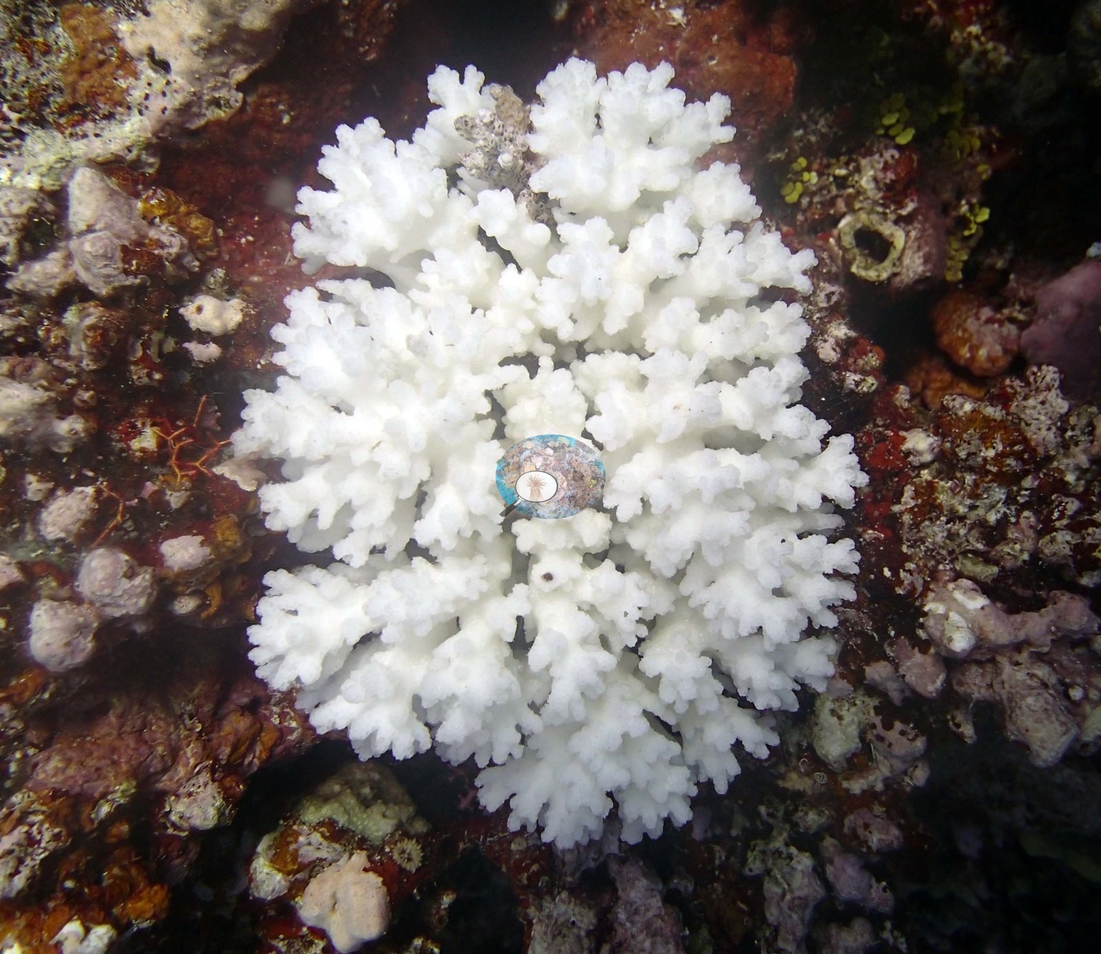
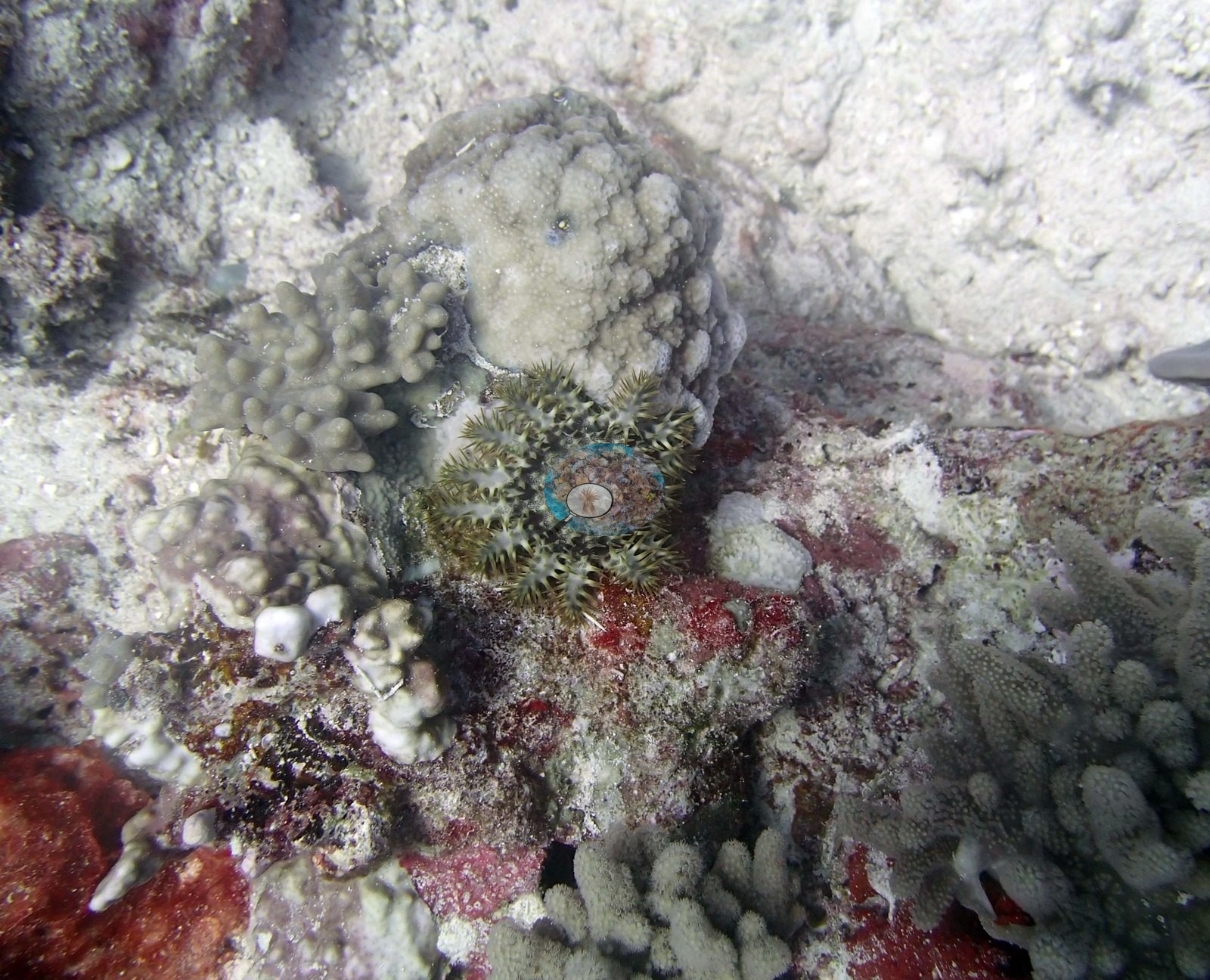
Two frames bear directly on condition, and both rest on Anderson's own field calls rather than a photo interpretation. One is a close view of a small crown-of-thorns starfish sitting on pale, recently exposed substratum among red coralline crusts and small pocilloporid and massive colonies — a juvenile predator on the reef, consistent with the surveyors' record of one COTS at this site. The other shows a single Pocillopora colony, which Anderson recorded as eaten, stripped completely white against dark red-brown substratum; Anderson attributed that whiteness to predation, not to bleaching. The sampling sheet for this dive does record bleaching on four of the six colonies sampled: colony 87 half dead with most of the remaining tissue bleached (unhealthy), and colonies 84, 85, and 86 10-30% bleached. Elsewhere in the shallow frames several tabular colonies look dull and matte rather than crisply pigmented, but at these ranges, and with the strong blue-green casts these frames carry, the photographs cannot distinguish a turf-covered dead table from a live one, and they cannot settle the site's condition, its zonation, or the rubble and dead-plate piles the surveyors logged at the base of the wall — none of which appear in any frame. Some 20-30% of the table acroporids were dead in growth position, and 5% had large white lesions. A lot of small acroporids and Pocillopora were dead. Typical recent thermal stress: mean annual maximum of 8.1°C-weeks (Degree Heating Weeks, 2021-2025, NOAA CRW; Southern Tonga virtual station). The 2013 survey notes for this site record one crown-of-thorns starfish, one Culcita cushion star, and few snails (Khaled bin Sultan Living Oceans Foundation expedition site notes, 2013; regional summary in Bruckner 2014). The Living Oceans Foundation transects here recorded no cyanobacteria and no recently dead coral.
Fish and other fauna
Fish are present without being abundant in frame: sergeant-major damselfish over the platform edge, butterflyfish and small planktivores among the shallow colonies, and the fusilier school over the deeper tables. High numbers of sea cucumbers.
Comparisons with other data
TOVA44 (Vava'u) was surveyed on 25 September 2013 during the Khaled bin Sultan Living Oceans Foundation Global Reef Expedition.
Other notes
Photo review of 15 habitat frames plus 35 sampled-colony close-ups (Vava'u, 25 Sep 2013). The account on this page is written from the habitat frames only; the colony images are treated purely as a record of what was sampled. None of the frames carries a scale bar, quadrat, or transect line, so colony dimensions and cover cannot be read off any of them; the only scale objects in the whole set are the cattle tags and bone clippers in the colony close-ups. Six Pocillopora colonies were sampled at this site (colonies 84-89): four labeled P. acuta (colonies 84, 85, 86, and 87) and two labeled P. damicornis (colonies 88 and 89) in Anderson's own field records. The 35 close-ups are repeat polyp-scale macro, tag and setting shots of only those six colonies — tagged 0598, 0590, 0592, 0595, 0599, and 0589, several with a gloved hand or bone clippers in shot — and describe the colonies, not the reef.
CV model comparison
More info
The photo row below is a methods comparison only: it is never averaged with the transect and never used as the headline. It compares site means only: the photos come from the same survey dive as the transect but not from the same points.| Method | Hard coral cover (%) | Photos (n) ± SE |
|---|---|---|
| Transect mean (all transects) | 53.5 | |
| CoralSCOP unedited | 40.0* | n = 15 · SE 3.0 |
| Claude (edited photos) | 31.8* | n = 15 · SE 3.4 |
The two computer-vision methods differ by 8.2 pp (31.8–40.0%) and read 13.5–21.7 pp below the in-water transect (53.5%); the headline is the in-water transect because a diver transect is independent of the photographs.
*Based on only 15 reef-habitat photos; this estimate is less certain.
See a more detailed, stand-alone version of this table.
Independent surveys nearby
Within 5 km, 1 independent survey station recorded hard coral cover in 2013. The most recent nearby survey is from 2013, so these values predate recent heat stress. This site's own estimate (53%) is not compared with these surveys: none lies within 2 km.
Collected by other programs using different methods (Reef Check uses point-intercept transects), so these are context for the figures above, not a like-for-like comparison. Where a station was surveyed more than once, the cell shows either the range of its values or, as a single value, the mean of surveys made in one year. Station names are not dive-site names.
| Agency | Site / location | Date | Hard coral cover (%) | Distance |
|---|---|---|---|---|
| Reef Check | The Coral Gardens | 2013 | 59% | 3.46 km |
Data & links
- Download benthic survey data (CSV) ↗
- Download all LOF-GRE data (933 sites) ↗
- Photo portfolio ↗
- Coral Reef Diagnostics region page ↗
All images from Coral Reef Diagnostics. Data are from the Khaled bin Sultan Living Oceans Foundation Global Reef Expedition, Coral Reef Diagnostics, and the organizations named in the data sources above.
© Coral Reef Diagnostics.
References
- Mayfield AB, Dempsey AC (2025). Machine-learning algorithms for identifying climate-resilient corals in the Republic of Palau. Discover Oceans 2:45. PDF
- Bruckner AW (2014). Global Reef Expedition: Kingdom of Tonga. Field Report. Khaled bin Sultan Living Oceans Foundation, Landover, MD. 28 pp. PDF