
Part of the regional summaries: Tonga - Vava'u and Tonga
More info
Southern Tonga (NOAA CRW virtual station)Split Rock, at a channel entrance in Vava'u, where wide spurs are dominated by big mounding Porites lobata colonies at 60-90% cover, some up to 4 m across. Damselfish algal lawns were widespread, including on many of the Porites, and Turbinaria stands at depth showed extensive recent mortality. Surveyed on the Living Oceans Foundation's Global Reef Expedition.
Ko Split Rock, ʻi he hūʻanga ʻo ha hala vai (channel) ʻi Vavaʻu, ʻa ia ʻoku puleʻi ai ʻa e ngaahi spurs fālahi ʻe he ngaahi kulupu Porites lobata fakapuke lalahi ʻi he ʻufiʻufi ʻo e 60-90%, ko e niʻihi ʻoku aʻu ki he 4 m hono fālahi. Naʻe mafola ʻa e ngaahi ngoue limu ʻa e damselfish, kau ai ʻi he Porites lahi, pea naʻe hā ʻi he ngaahi vao Turbinaria ʻi he loloto ʻa e mate foʻou lahi.
AI translation of this summary; the English is authoritative. (low confidence)
CTD-cast midpoint of 26.0–26.1°C
Three other CRD dive sites with their own pages within 5 km shown in orange — click a marker to open its page.
🗺 Detailed map of the Global Reef Expedition dive sites, Vava'u, Tonga (Khaled bin Sultan Living Oceans Foundation; opens in a new window)
Site description
Setting
Split rock. Fringing reef on the seaward edge of a small island at the entrance to the channel. The island has a vertical face that drops to 4-8 m.
General benthic features
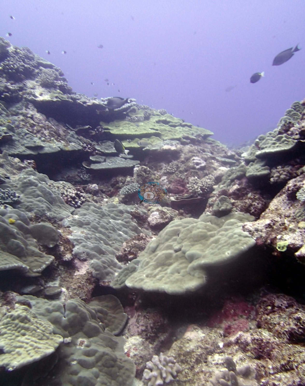
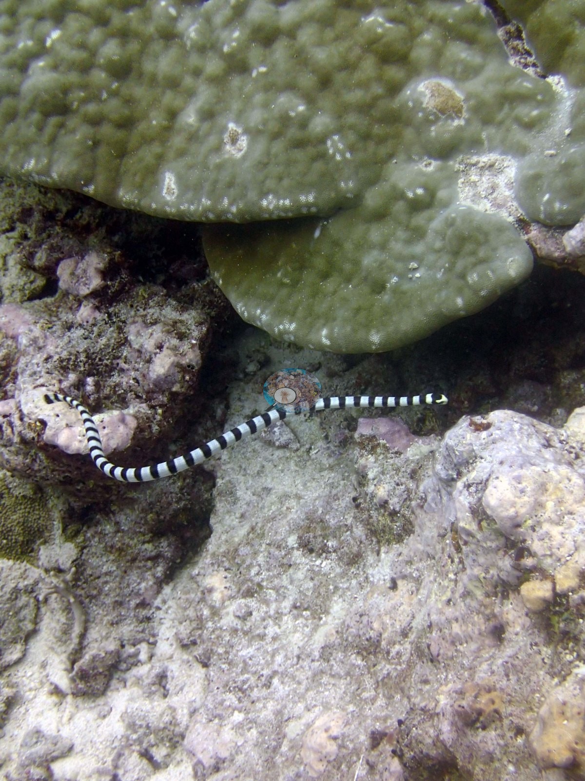
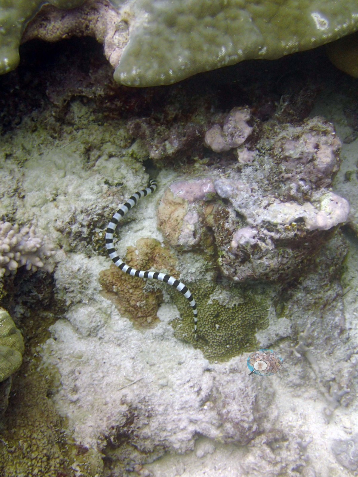
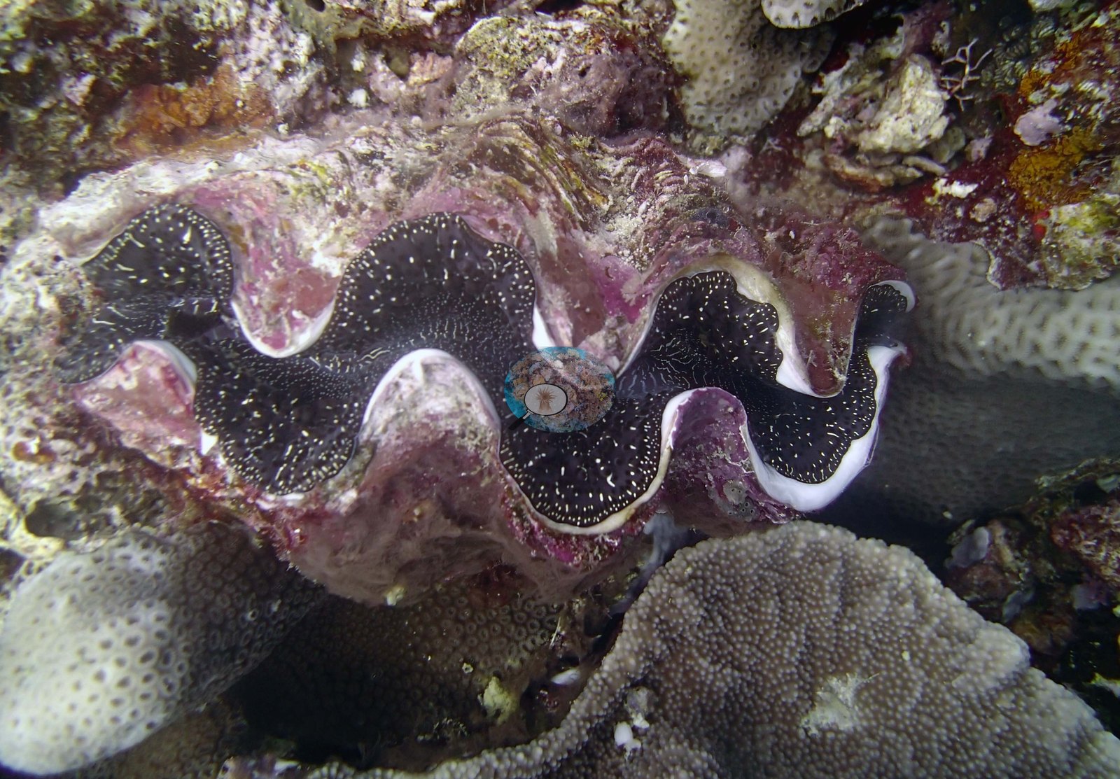
Five frames are reef views (e.g., Image 1, Image 2, Image 3, Image 4, and Image 7) and three are close-ups of particular subjects — a giant clam and two frames of a sea snake (e.g., Image 5 and Image 8).
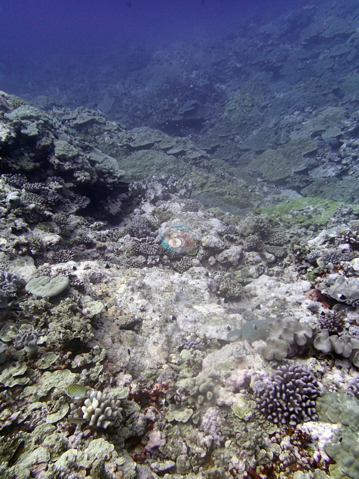
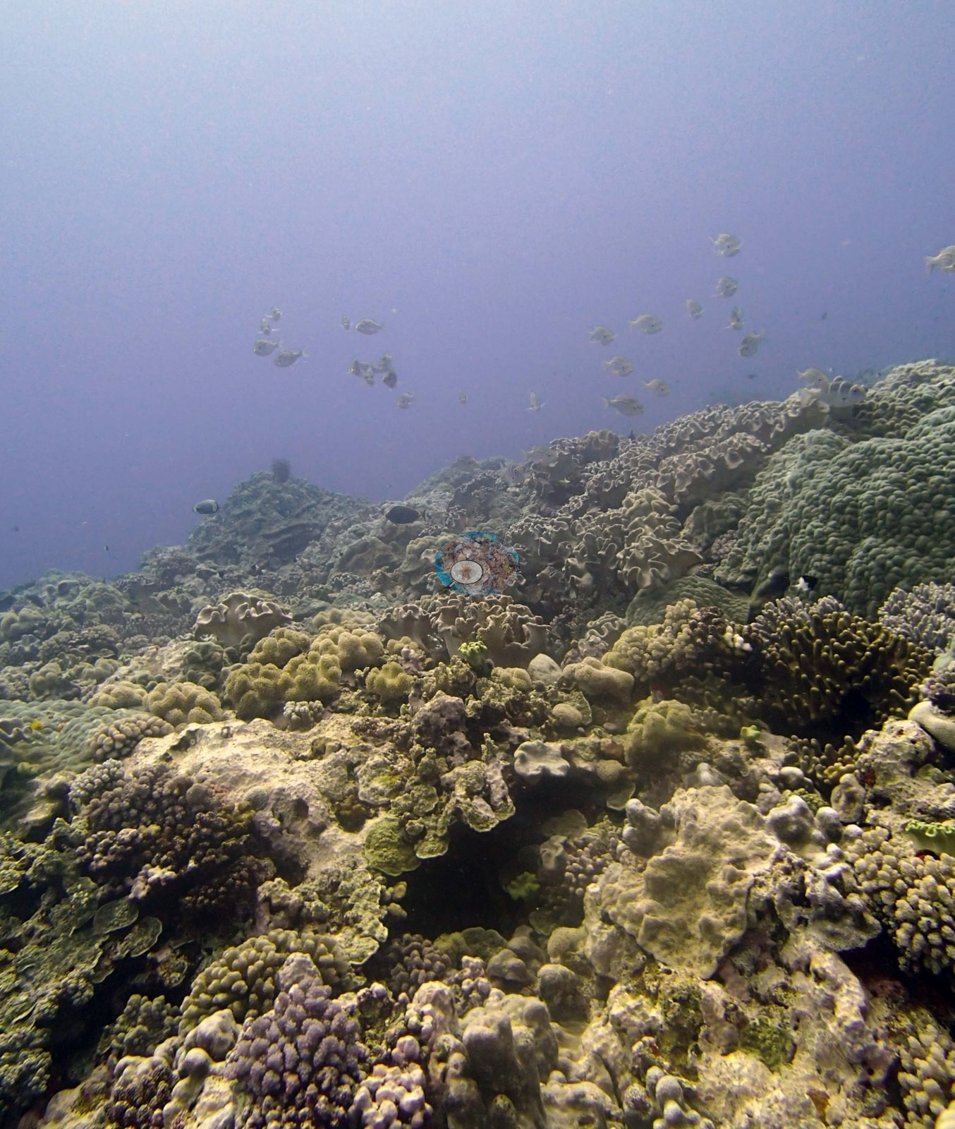
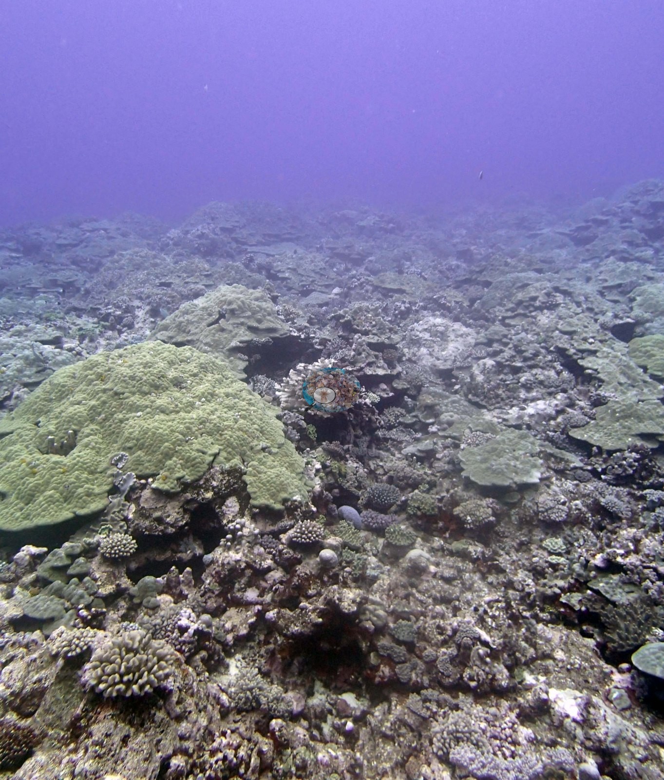
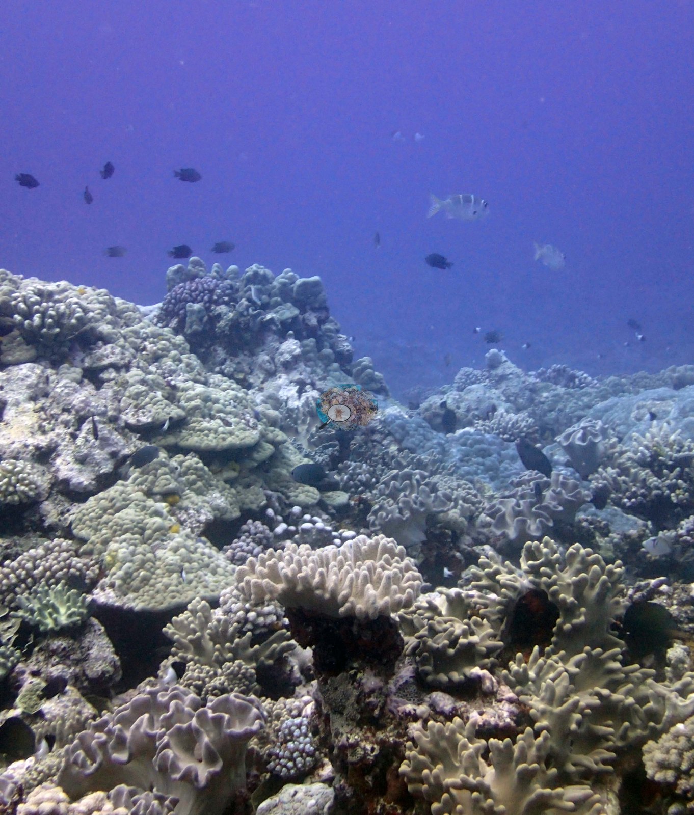
The reef views show a low-relief, coral-built surface with a laminar and mounding community rather than a branching one. Image 1 is the most informative: large olive-green plating and laminar colonies stacked in overlapping tiers across the framework, with pink coralline crusts and shaded recesses beneath their margins — the same growth form recurs in Image 4 and in the two sea-snake frames. Image 2 and Image 4 look across broader, lower surfaces where the mounding and encrusting colonies are more scattered and pale rubble and turf-filmed pavement take up much of the frame. Image 3 and Image 7 are the more crowded views, a densely occupied surface rising toward the upper left with mixed mounding, encrusting, and small branching colonies. The one thing the photographs add that the survey narrative barely touches is the abundance of leathery soft corals: pale gray-lilac alcyonacean colonies with lobed and folded surfaces are conspicuous in the foreground of Image 7, appear again in the lower right of Image 2, and are common enough in those frames to be a real feature of the reef surface here rather than an incidental. The surveyors noted gorgonians and soft corals on the scattered boulders; these frames show leathery soft corals well out on the reef itself. Image 6 shows a giant clam with its speckled dark mantle and white-lipped, fluted shell margins wide open, set into the surface of a large fine-textured massive colony — the clam is embedded in living coral, which is worth noting for a site whose survey account is dominated by large mounding Porites lobata.
Seaward of the island's vertical face are numerous large scattered boulders, 3-5 m across and up to 4 m tall (at 8-10 m depth) with sand and rubble surrounding these. These have some gorgonians and soft corals along with a few acroporids and Pocillopora but very low cover.
Coral cover
- Reference: Khaled bin Sultan Living Oceans Foundation, Global Reef Expedition (in situ transect)
- 30%, from the Khaled bin Sultan Living Oceans Foundation's in situ transect survey (Global Reef Expedition site data); the photographs illustrate the site.
- Transect mean 30 ± 7.6% SE (n = 5 transects; Living Oceans Foundation per-transect benthic data); the headline above is this all-transect mean.
Stressors
Image 3 and Image 4 are hazy with a strong violet-blue cast and low contrast. The features the surveyors singled out are outside what this set can confirm: the vertical island face, the field of 3-5 m boulders, the deeper Turbinaria retiformis stands with their extensive recent mortality, and the 2 to 5% of acroporids and pocilloporids with recent Drupella feeding scars. No bleaching is claimed from any frame; the pale colors in these shallow views are not separable from natural pigmentation, glare, and attenuation. The Turbinaria had extensive patches of recent mortality. There were also many locations with damselfish algal lawns, including on many of the Porites lobata colonies. In these areas entire colonies and parts of colonies had white lesions from damselfish bites and portions colonized by thick turf algae. Typical recent thermal stress: mean annual maximum of 8.1°C-weeks (Degree Heating Weeks, 2021-2025, NOAA CRW; Southern Tonga virtual station). The 2013 survey notes for this site record Drupella snail feeding scars on 2 to 5% of the Acropora and Pocillopora (Khaled bin Sultan Living Oceans Foundation expedition site notes, 2013; regional summary in Bruckner 2014). Anderson's sea-snake frame does show the damselfish damage: the large olive plating colony carries a dozen small white bite lesions along its margin and surface, plus two turf-filled patches (e.g., Image 5). The Living Oceans Foundation transects here recorded 3.9% cyanobacteria and no recently dead coral on the transect lines.
Fish and other fauna
Anderson's three subject frames are good ones. Image 5 and Image 8 show a boldly black-and-white banded sea snake working along the pavement beneath the overhanging margin of a large olive plating colony, shot at two ranges.
Comparisons with other data
TOVA36 (Vava'u) was surveyed on 23 September 2013 during the Khaled bin Sultan Living Oceans Foundation Global Reef Expedition. Seaward of the boulder field are wide spurs with channels. Both the tops of the spurs and the sides are dominated by large mounding Porites lobata colonies 60-90% cover in most locations. The colonies are largest and most abundant from 10-15 m, declining slightly in size and intermixed with other corals in deeper water. Most colonies are 50-400 cm diameter and up to 1.5 m tall. Dead areas and the substrate surrounding the colonies were colonized by scattered table acroporids, digitate Acropora, Pocillopora, Coscinaraea, Favia stelligera, and large Porites rus colonies. At the deeper end of the reef, there are also large stands of Turbinaria retiformis, Stylophora, and other species intermixed with the Porites.
Other notes
Eight habitat frames survive from the Vava'u dive of 23 Sep 2013 — the site the surveyors called Split Rock — and no sampled-colony frames. Anderson noted that none of the Pocillopora the colony-sampling program targeted ('no Pdam') was found here to sample; that is why the site has habitat photography and no colony photography. There is no scale object, quadrat, or transect tape in any image and no depth cue, so no colony dimension can be read and the survey's account of 50-400 cm Porites lobata colonies up to 1.5 m tall cannot be checked here.
Data & links
- Download benthic survey data (CSV) ↗
- Download all LOF-GRE data (933 sites) ↗
- Photo portfolio ↗
- Coral Reef Diagnostics region page ↗
All images from Coral Reef Diagnostics. Data are from the Khaled bin Sultan Living Oceans Foundation Global Reef Expedition and Coral Reef Diagnostics.
 © Coral Reef Diagnostics.