

Part of the regional summaries: Tonga - Vava'u and Tonga

More info
Southern Tonga (NOAA CRW virtual station)Nicknamed Pete's Paradise, this sheltered lagoonal fringing reef in Vava'u has wide spurs of built-up Acropora and deeper mounds up to 5 m tall covered in huge staghorn and bottlebrush stands. All seven Pocillopora colonies Anderson sampled were 20–80% bleached, although the station's Coral Health Index is 4.24 out of 5. The survey notes also record dead, turf-covered staghorn branches up to a meter wide, where damselfish farm their algal gardens. Surveyed on the Living Oceans Foundation's Global Reef Expedition.
ʻOku ui ko Pete's Paradise, ko e hakau matafonua ʻi he namo (lagoonal fringing reef) ko ʻeni ʻi Vavaʻu ʻoku maluʻi, ʻoku ʻi ai hono ngaahi spurs fālahi ʻo e Acropora kuo langa hake pea mo e ngaahi puke loloto ange ʻoku aʻu ki he 5 m hono māʻolunga kuo ʻufiʻufi ʻe he ngaahi vao staghorn mo e fakapulumu (bottlebrush) lalahi ʻaupito. Ko e kulupu Pocillopora kotoa ʻe fitu naʻe toʻo sīpinga mei ai ʻe Anderson naʻe hinehina ʻaki ʻa e 20–80%, neongo ʻoku 4.24 mei he 5 ʻa e Coral Health Index ʻo e siteisoni. ʻOku lēkooti foki ʻe he ngaahi nouti ʻo e savea ʻa e ngaahi vaʻa staghorn mate kuo ʻufiʻufi ʻe he limu nounou (turf) ʻo aʻu ki he mita ʻe taha hono fālahi, ʻa ia ʻoku tauhi ai ʻe he damselfish ʻenau ngaahi ngoue limu.
AI translation of this summary; the English is authoritative. (low confidence)
CTD-cast midpoint of 26.1–26.7°C
One independent survey station shown with the program’s logo — click one to see how far it is from this site.
Four other CRD dive sites with their own pages within 5 km shown in orange — click a marker to open its page.
🗺 Detailed map of the Global Reef Expedition dive sites, Vava'u, Tonga (Khaled bin Sultan Living Oceans Foundation; opens in a new window)
Site description
General benthic features
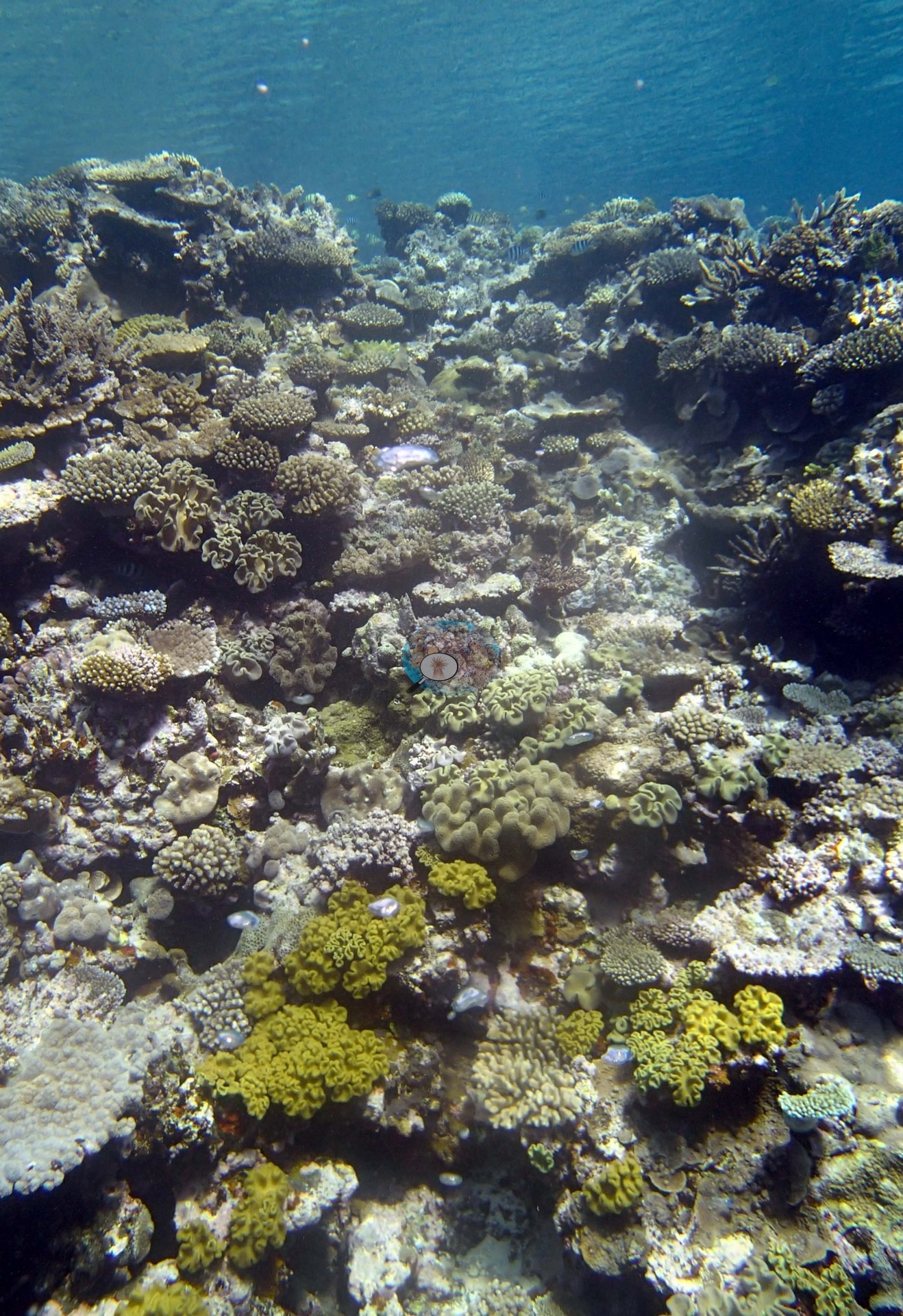
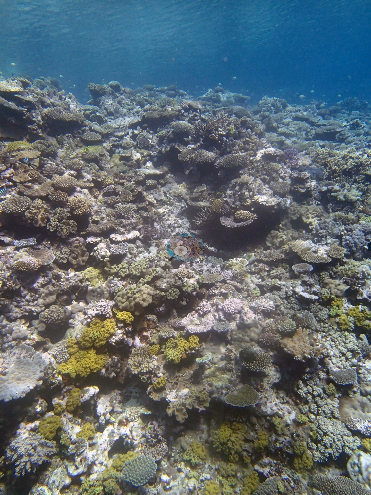
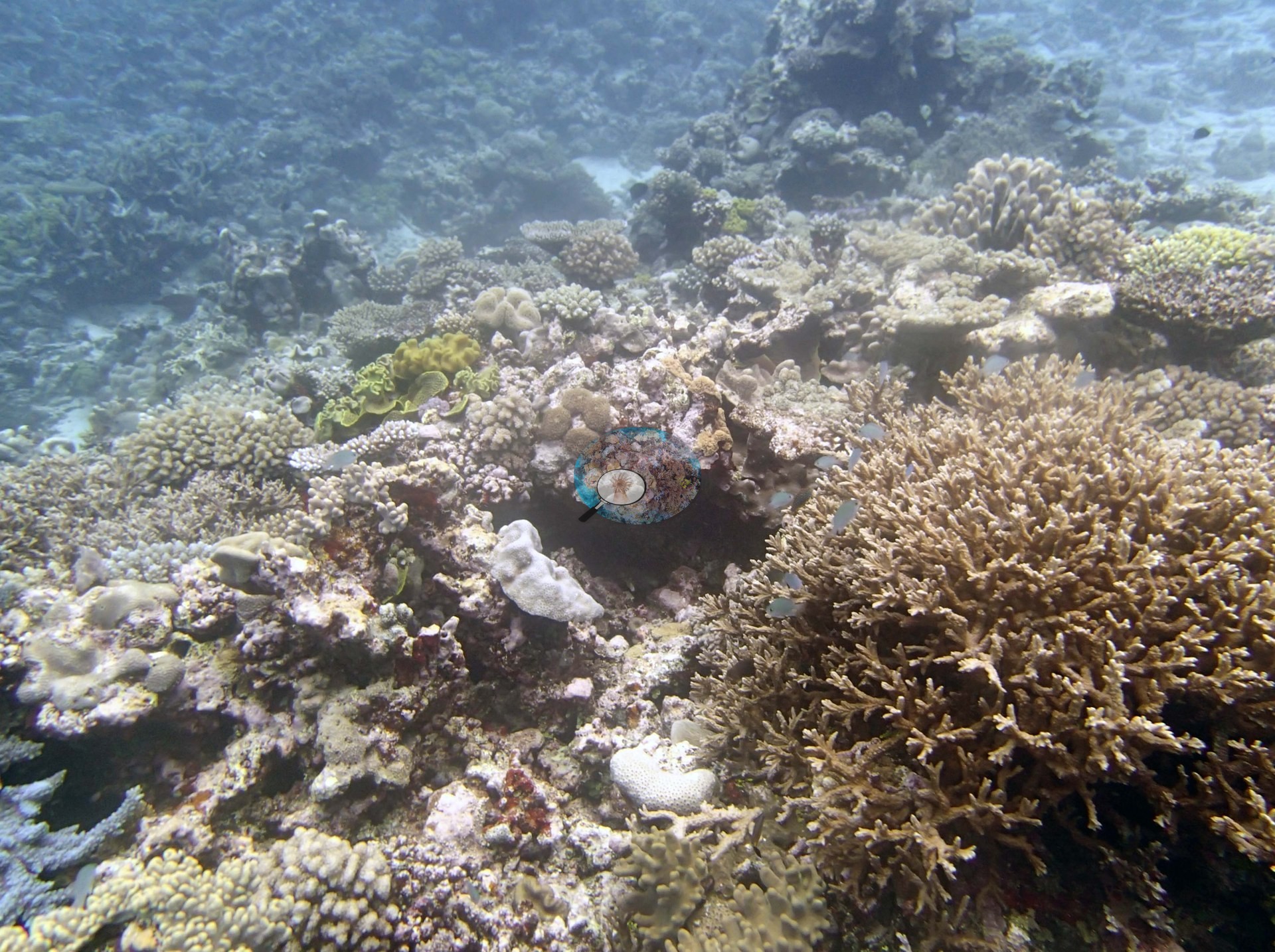
The three shallow habitat frames show a densely occupied reef surface with little exposed sand or open pavement — a close-packed mosaic of small corymbose and digitate Acropora, encrusting and low massive corals, and plating forms, with abundant soft corals (bright yellow-green fleshy colonies) scattered through it; the third frame is dominated by a single large staghorn Acropora thicket growing beside older turf-covered dead substrate (e.g., Image 1, Image 2, Image 3).
Coral cover
- Reference: Khaled bin Sultan Living Oceans Foundation, Global Reef Expedition (in situ transect)
- Coral cover 50% (LOF-GRE in situ transects; mean of all of this station's own transects).
- Cover is not estimated from any photograph — the 50% figure above is the transect value.
- Transect mean 50 ± 2.5% SE (n = 5 transects; Living Oceans Foundation per-transect benthic data); the headline above is this all-transect mean.
Stressors
Anderson's sampling sheet records all seven Pocillopora colonies sampled here (colonies 56-62) as 20-80% bleached, and the close-ups (e.g., Image 4, Image 5, Image 6) show them white to cream-white with polyps extended.
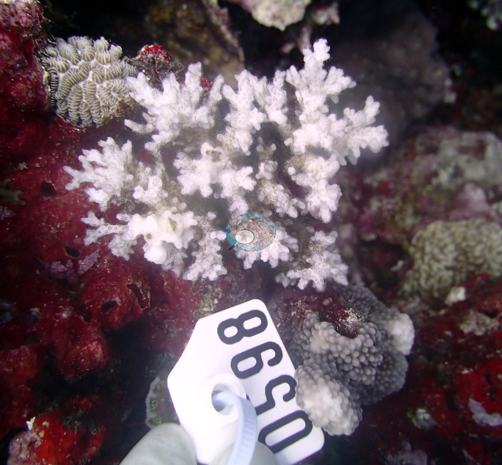
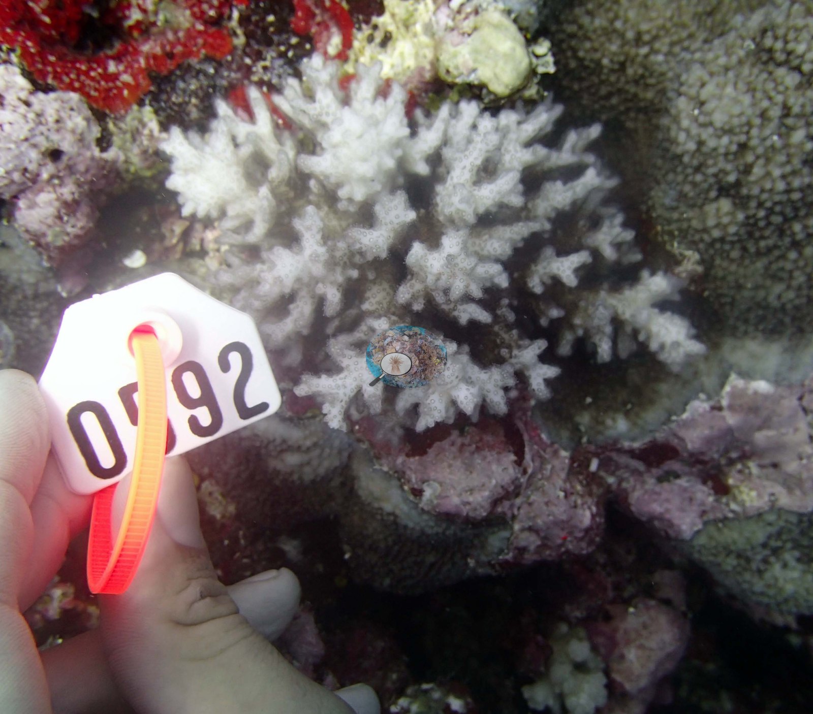
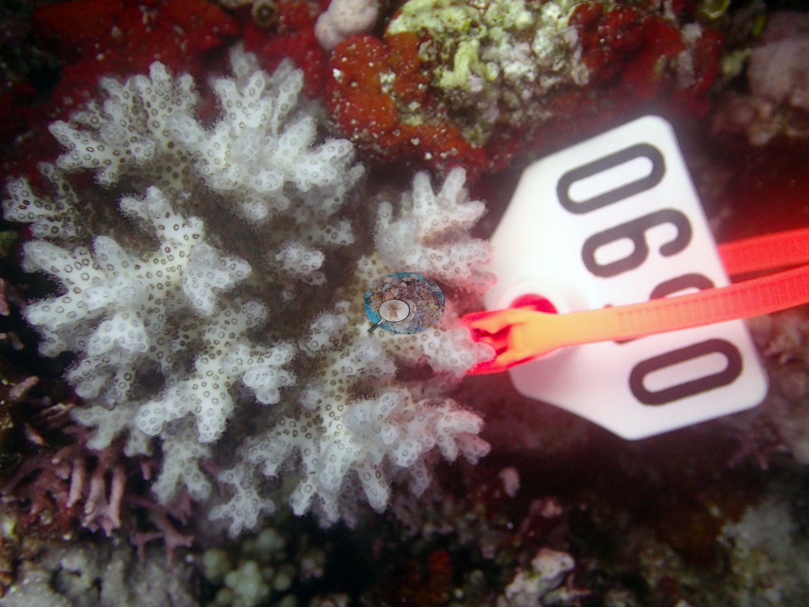
The survey notes record many staghorn colonies with wide, turf-encrusted dead branches beneath damselfish algal lawns. The Living Oceans Foundation transects here recorded no cyanobacteria and no recently dead coral.
Comparisons with other data
Coral Health Index 4.24/5 (Mayfield & Dempsey 2025 formula; Mayfield et al. 2021, Platax, Tonga data). "Pete's paradise" — a sheltered lagoonal fringing reef in the Vava'u lagoon, about 50 m from shore. The in-water survey narrative records a shallow reef-flat community running parallel to the land and broken by narrow, deep channels; its edge lies at 4-8 m and slopes at about 45 degrees to 15-25 m. Very wide spurs carry 80-100 cm microrelief with extensive Acropora build-ups and end on a flat sand bottom holding large mounds of staghorn coral, bottlebrush acroporids, scattered tabular acroporids, and large foliose plates. From 20-40 m are further mounds up to 5 m tall dominated by bottlebrush and staghorn acroporids mixed with Echinophyllia, Echinopora, Merulina, Leptoseris, and Pachyseris plates. Cover across the site ranged from 20-80%, high on the sides and in the deep, except that many staghorn colonies carried wide turf-encrusted dead branches beneath damselfish algal lawns. Sampling: 7 Pocillopora colonies were collected at this site (colonies 56-62), all seven labeled Pocillopora acuta by Anderson; each was tagged, photographed whole and then photographed in macro, which is why the site's photo set is dominated by close-ups of those seven animals. Typical recent thermal stress: mean annual maximum of 8.1°C-weeks (Degree Heating Weeks, 2021-2025, NOAA CRW; Southern Tonga virtual station). Coral cover — external cross-reference (Reef Check): two independent measurements, reported side by side and deliberately not averaged. Living Oceans Foundation diver transect (Global Reef Expedition): 50% hard coral (2013). Reef Check: 59% at The Coral Gardens, 1.34 km away (2013, 1 survey). Both were surveyed in the same year; methods differ (Living Oceans Foundation diver transect vs Reef Check point-intercept transect). Reef Check site positions are approximate, and at 1.34 km apart the two surveys may have sampled different patches of the same reef, which is the main caveat on this comparison.
Dive record
TOVA34 (Vava'u): surveyed 22 Sep 2013 during the Khaled bin Sultan Living Oceans Foundation Global Reef Expedition.
Other notes
Photographic record: only three habitat frames exist for this site, all shallow, and they are of modest quality. These frames cover the shallows alone: they cannot settle the slope, the deeper mounds, the zonation, or the site's overall condition, all of which come from the survey narrative and the transect, not from photographs.
Independent surveys nearby
Within 5 km, 1 independent survey station recorded hard coral cover in 2013. The most recent nearby survey is from 2013, so these values predate recent heat stress. This site's own estimate (50%) sits 9 points below the one nearby survey station (59%); the methods differ, so the comparison is context, not a like-for-like test.
Collected by other programs using different methods (Reef Check uses point-intercept transects), so these are context for the figures above, not a like-for-like comparison. Where a station was surveyed more than once, the cell shows either the range of its values or, as a single value, the mean of surveys made in one year. Station names are not dive-site names.
| Agency | Site / location | Date | Hard coral cover (%) | Distance |
|---|---|---|---|---|
| Reef Check | The Coral Gardens | 2013 | 59% | 1.34 km |
Data & links
- Download benthic survey data (CSV) ↗
- Download all LOF-GRE data (933 sites) ↗
- Photo portfolio ↗
- Coral Reef Diagnostics region page ↗
All images from Coral Reef Diagnostics. Data are from the Khaled bin Sultan Living Oceans Foundation Global Reef Expedition, Coral Reef Diagnostics, and the organizations named in the data sources above.
© Coral Reef Diagnostics.