
Part of the regional summaries: Chagos Archipelago - Egmont / Danger Island / Cauvin Bank and Chagos Archipelago
More info
Chagos (NOAA CRW virtual station)The warmest site on the Egmont transect (30.0°C) and the most bleached in the Chagos set at 18.3%, with bleaching or paling on branching Acropora and Pocillopora in three of eight frames. Where coral survives it is richly mixed at small scale, including a huge, fully pigmented brain-coral boulder, and transects put live cover at 48%. Surveyed on the Living Oceans Foundation's Global Reef Expedition.
Five independent survey stations shown with the program’s logo — click one to see how far it is from this site.
Four other CRD dive sites within 5 km shown in orange — click a marker to open its page.
🗺 Detailed map of the Global Reef Expedition dive sites, Egmont Atoll, Chagos (Khaled bin Sultan Living Oceans Foundation; opens in a new window)
Site description
General benthic features
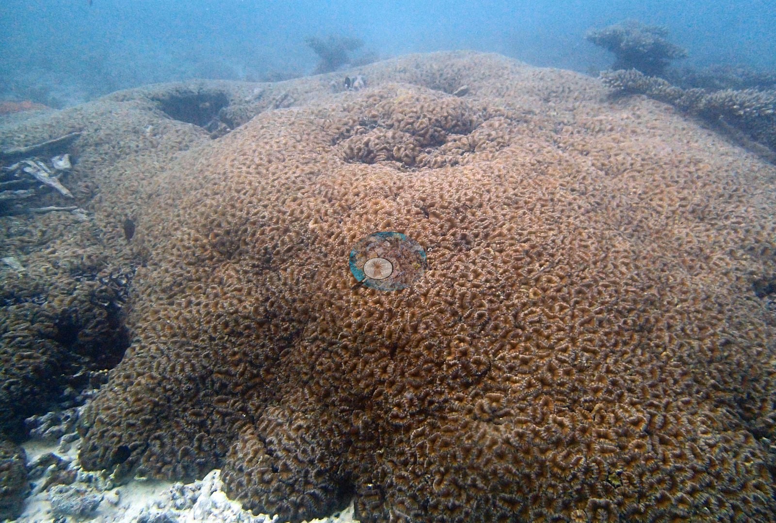
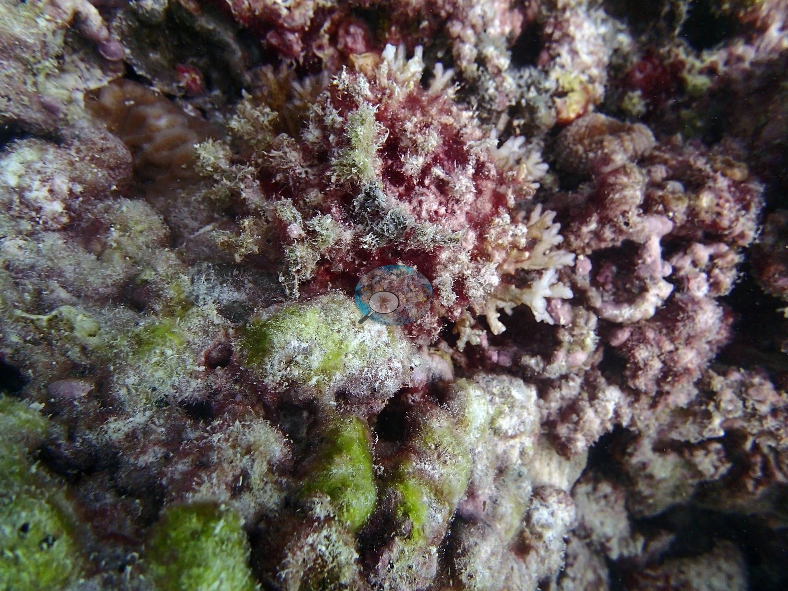
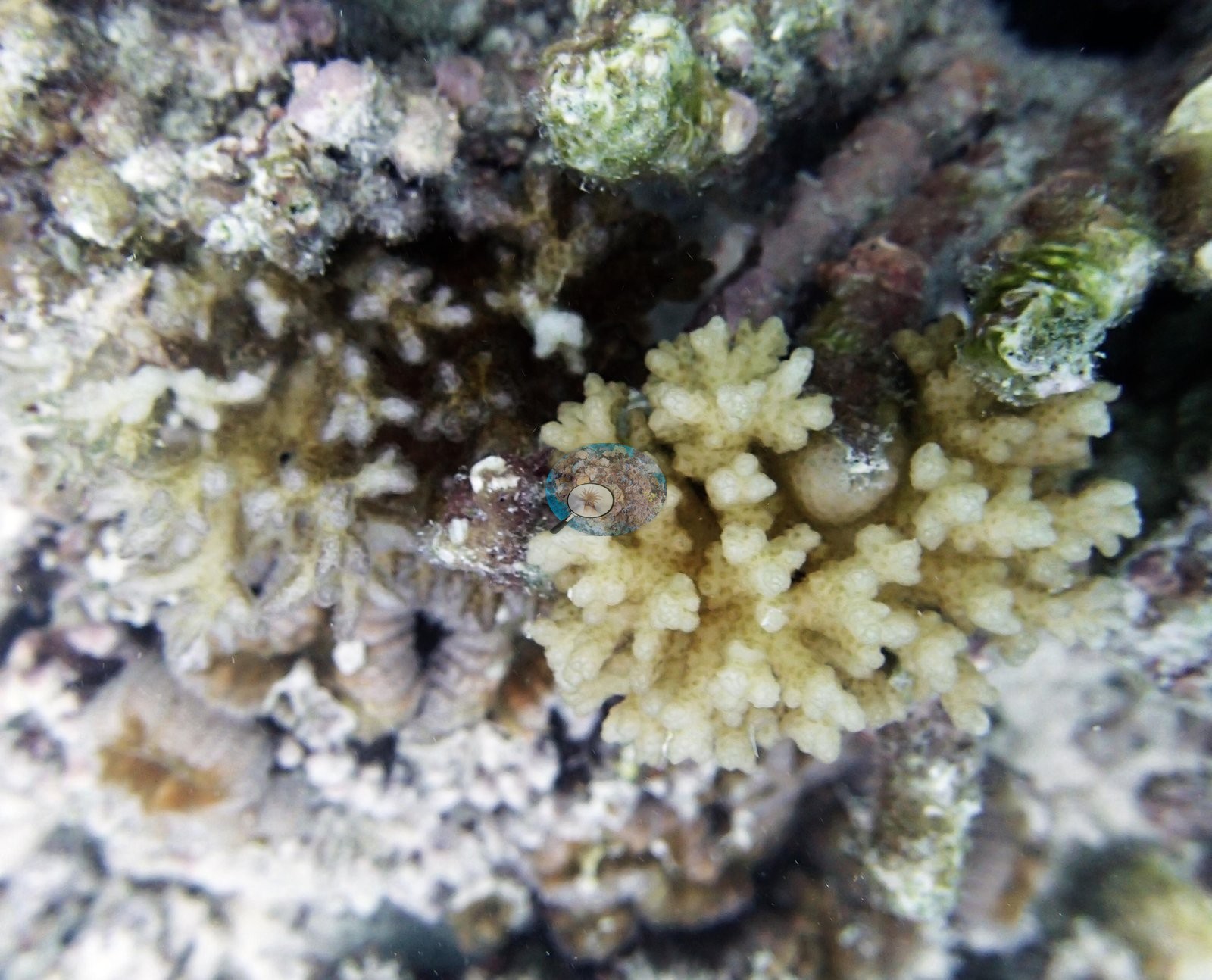
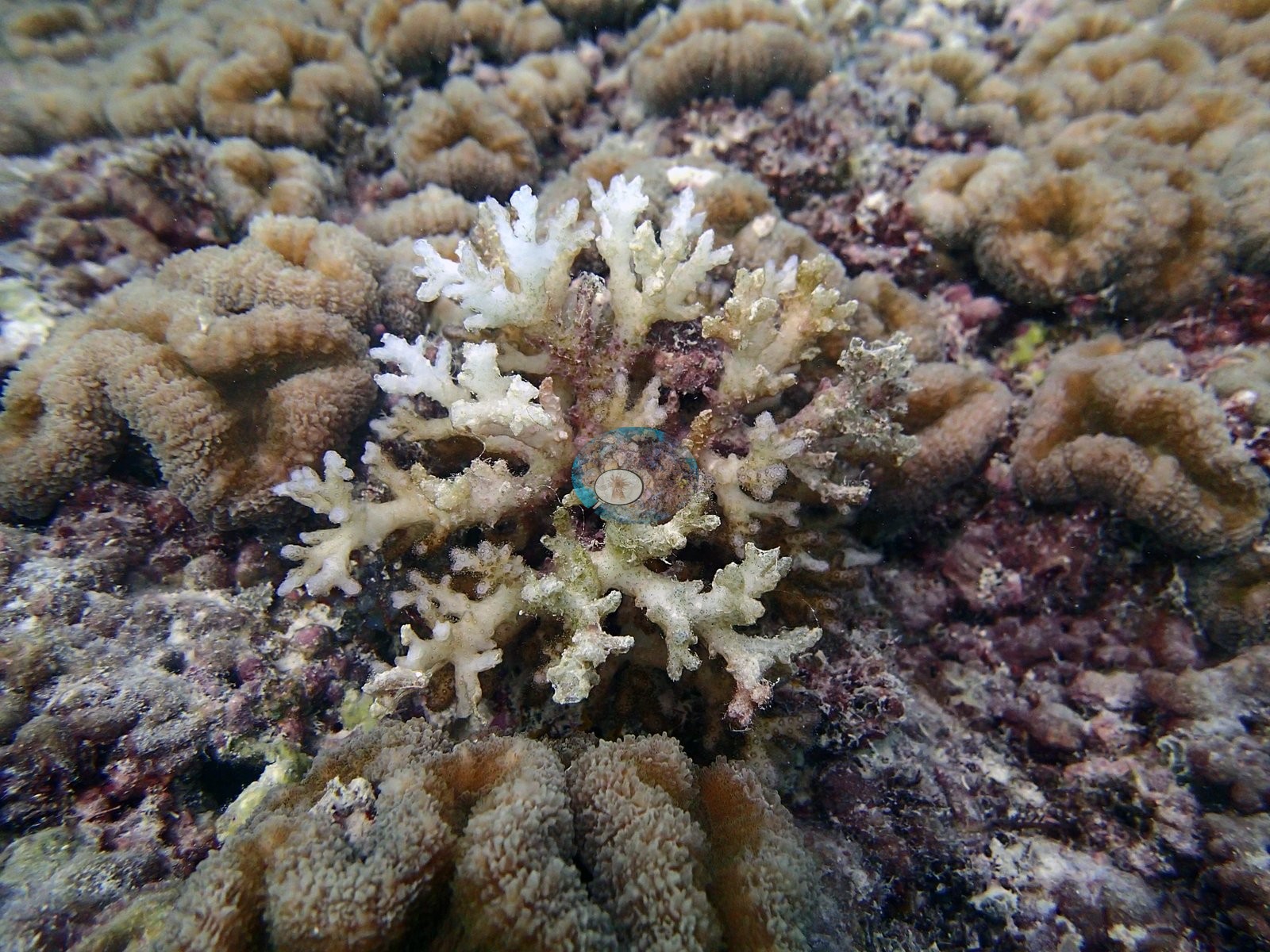
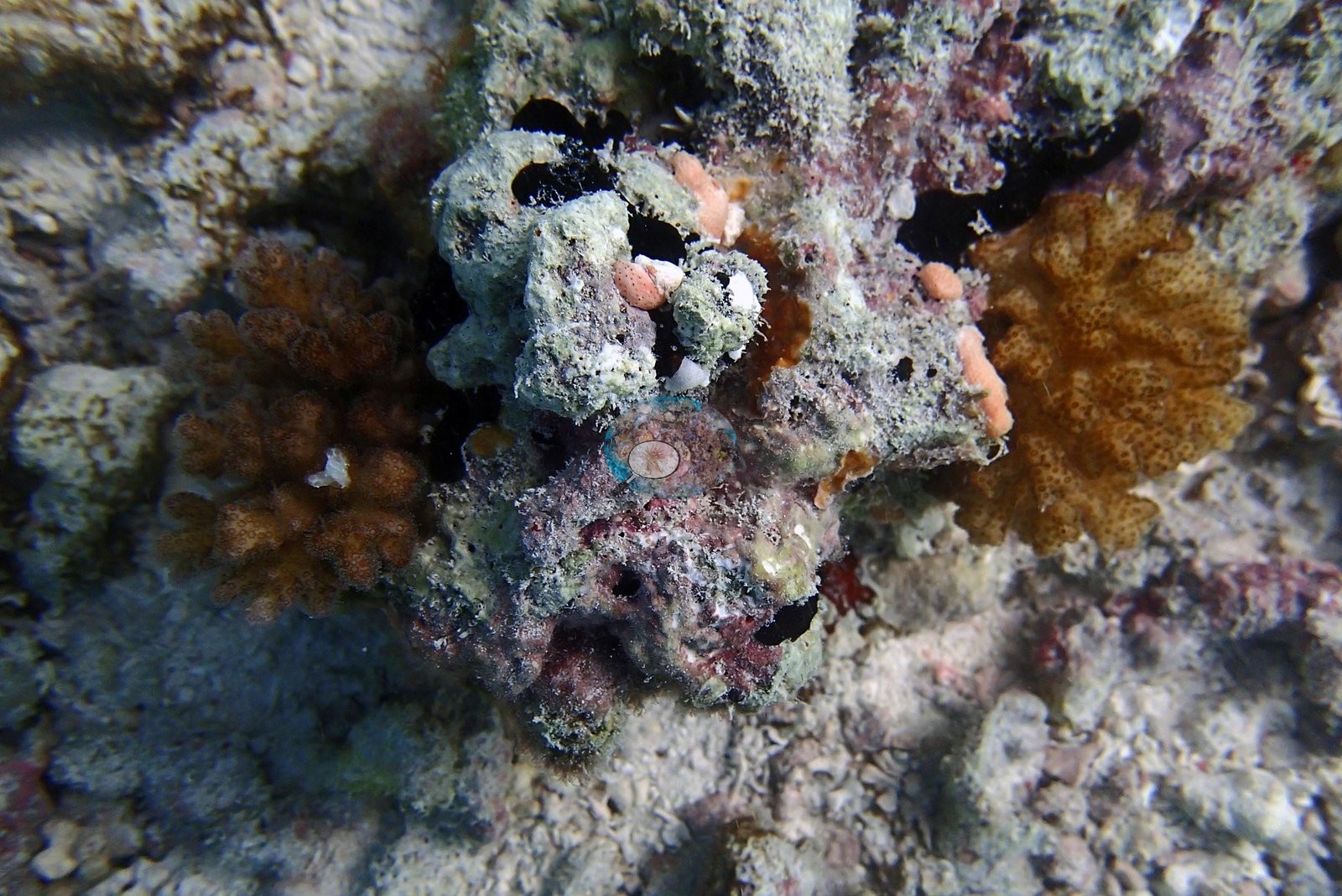
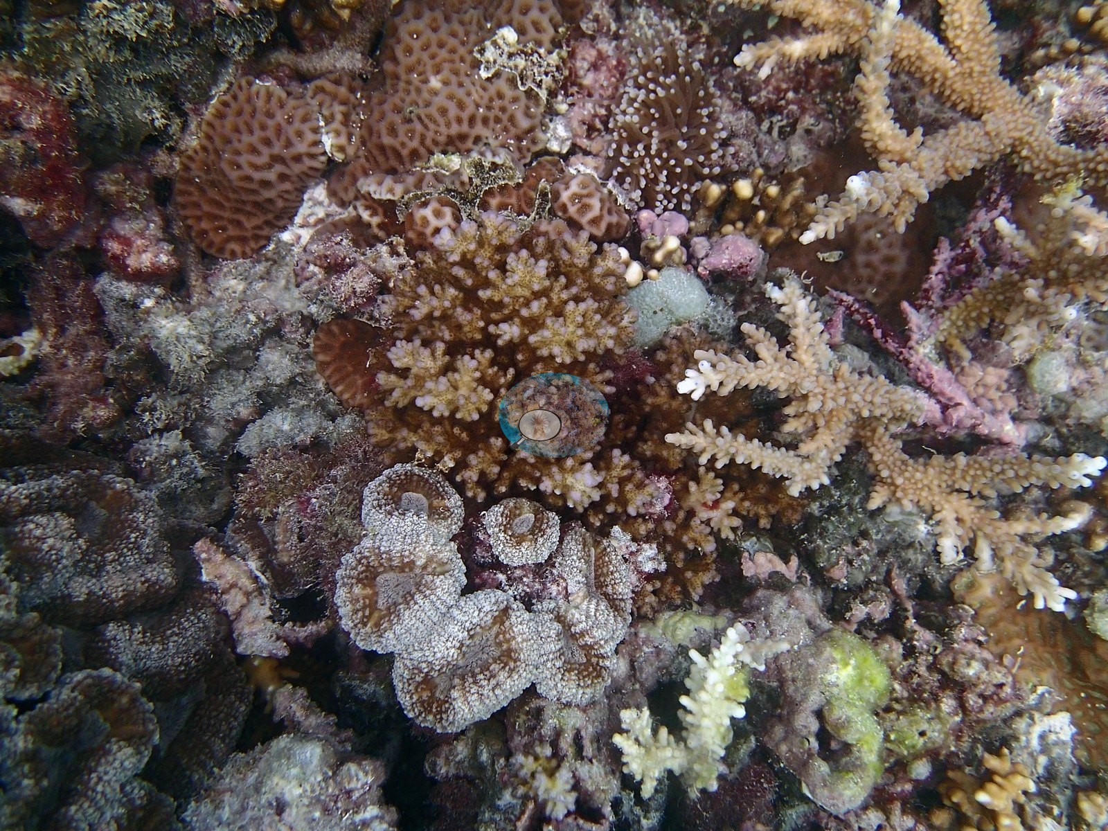
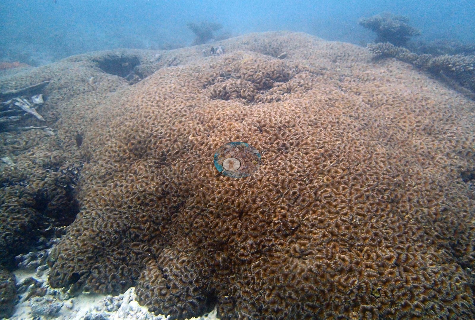
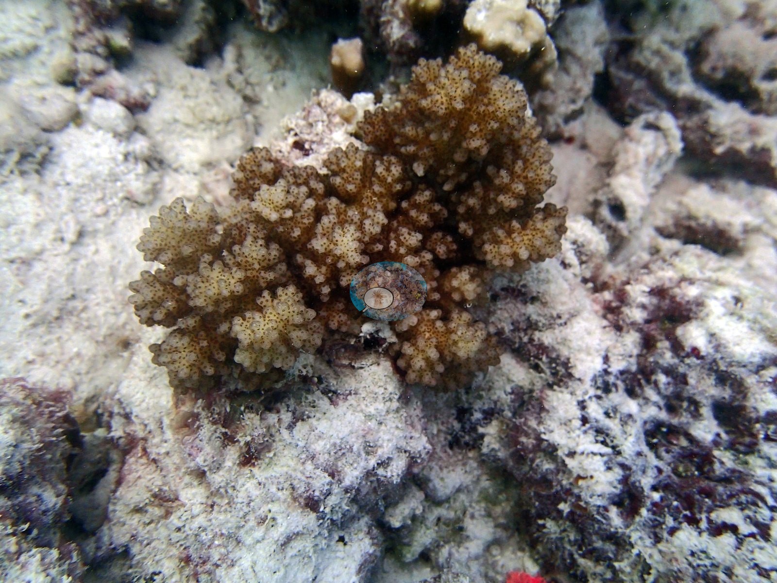
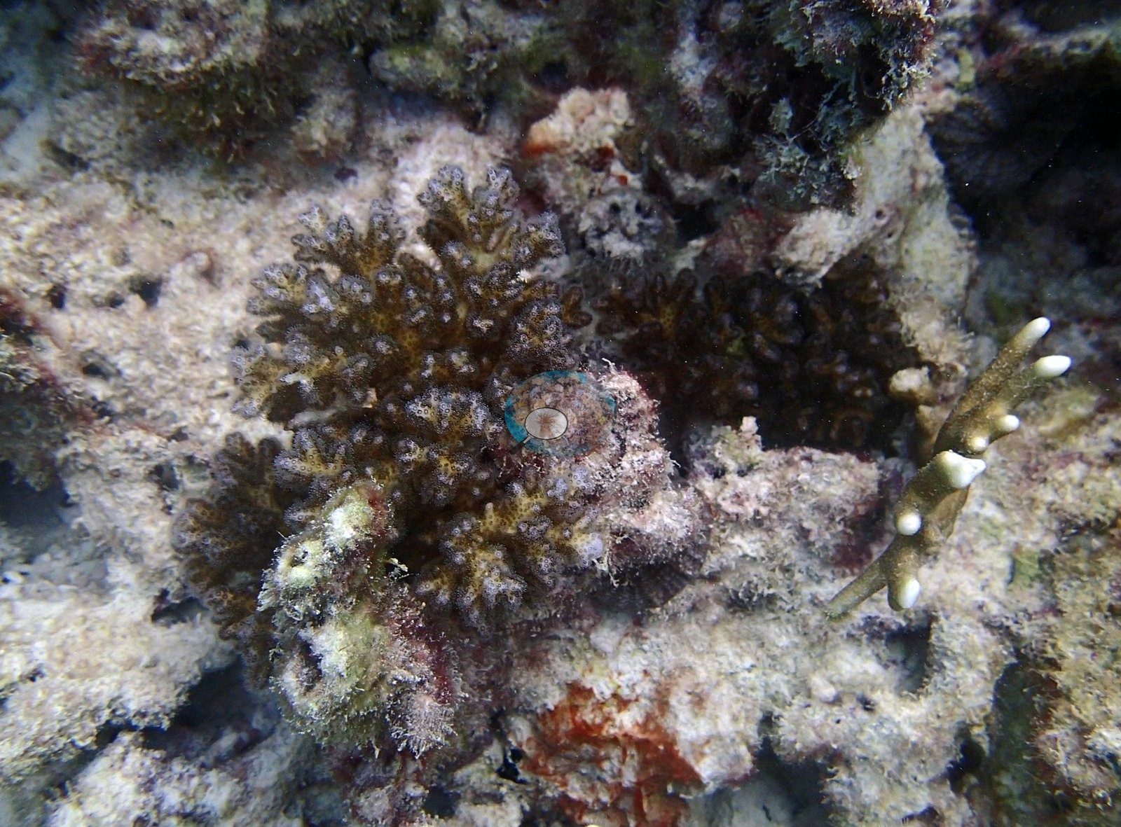
The transect genus list is the community record (LOF BIOT-1 survey, supplemental file S1) and it is dominated by two genera: Acropora 26.25% and Lobophyllia 14.17%, which together carry the great majority of the site's coral, then Millepora 2.48%, Favia 1.23%, Euphyllia 0.77%, Goniastrea 0.66%, Montastrea 0.62%, Stylophora 0.40%, Pocillopora 0.28%, Favites 0.18%, Porites 0.12%, Platygyra 0.11%, Cyphastrea 0.08%, Leptoseris 0.08%, Fungia 0.06%, and Montipora and Pavona at 0.03% each — 17 genera. The substrate and algal categories run turf 18.72%, sediment-laden turf 16.77%, bare substrate 9.40%, crustose coralline algae 5.89%, non-coral invertebrates 0.63%, macroalgae 0.62% and cyanobacteria 0.43%. Seven of the eight are within about a meter of the substrate and only P3110282 pulls back far enough to show the reef and a water column; the frames are sharp, evenly strobe-lit and naturally colored, with P3110282 the only hazy one. This set cannot characterize habitat, relief or zonation at BIEG07, and nothing below should be read as though it could. What the close frames show well is small-scale diversity and the state of the pavement. The substrate in P3110272 and P3110309 is largely dead: crimson and pink crustose coralline algae over gray eroded rock, olive-green algal turf and filamentous growth, black boring holes, loose white Acropora branch fragments and orange-pink encrusting sponges, with live coral reduced to a few small tan colonies and pale Acropora branchlets in the gaps. P3110309 sets a brown knobby colony beside a pale gray-green eroded mass riddled with dark cavities and carrying salmon-pink stubs and encrustation, with a brown fleshy lobed colony at the right — old framework and living tissue side by side, though the pink material cannot be resolved as coral, sponge or coralline from the image. P3110273 is the most diverse single macro frame at Egmont: honeycomb- and cerioid-corallite colonies compatible with Favites or Goniastrea, a verrucose brown colony compatible with Pocillopora, tan corymbose and digitate Acropora branchlets, a gray-white convoluted leathery octocoral compatible with Sarcophyton or Lobophytum, a small green encrusting colony, purple and mauve encrusting sheets, pink CCA, and a cluster of long extended polyps compatible with Goniopora or Alveopora (the two are separated by tentacle count, which this frame does not show) — six or seven taxa inside one field of view. P3110282 is the one frame that shows the reef, and it is the standout image at the site: an enormous massive boulder filling the frame, healthy and fully pigmented tan-brown, with further coral heads and a hazy blue water column behind it. A genus correction on that boulder, independently confirmed. P3110282 was recorded in an earlier description as 'a large, healthy massive/lobed colony compatible with Porites'. It is not Porites: the surface carries large meandroid and cerioid corallites with distinct walls and sinuous valleys at centimeter scale, which makes it a merulinid brain coral, compatible with Platygyra, Favites or Goniastrea. Porites corallites are minute and would give a smooth, finely pitted surface at this magnification.
Coral cover
The measurement at BIEG07 is the LOF BIOT-1 benthic transect survey. Coral cover 48%, from LOF BIOT-1 in situ transects (Mayfield & Dempsey 2026, Oceans, suppl. S1) — Anderson's own published value, the highest of this Chagos batch, and the authoritative record of cover and community at this site. Against it the transects put algal cover at 42.4% of the benthos. Anderson's published percentage bleached for this site is 18.3% (CoralNet analysis of informal survey images; Mayfield & Dempsey 2026, Oceans), the highest figure in the reviewed archipelago set. Everything below supplements that transect; no cover value may be read off any photograph, and where imagery and transect appear to differ, the transect governs. The computer-vision comparison, and why neither image number is a cover estimate here. Across the eight photographs the 30-point CoralNet annotation reads 38.8% live hard coral and the Coralscapes masks 26.8%, against the transect's 47.5% — deviations of −8.7 and −20.7 pp, mean of three methods 37.7% ± 10.4. That SD reflects systematic method bias rather than precision: image methods read low at high cover across this archipelago. This site has the widest human-versus-model split of any Egmont site, a 12 pp gap, and it is a framing artifact rather than a method disagreement worth interpreting. With eight close-range macro frames, human point-counts land repeatedly on the coral head that fills the frame, while the model still scores the extensive dead pavement and algal turf around it. Neither figure should be read as a site-level cover estimate: the frame set is not a survey, and the 47.5% transect figure is the only defensible cover value for BIEG07.
Image-by-image. All eight habitat frames from Anderson's folder BiEg07-finished were reviewed — the smallest photo set at Egmont, and the only one shot almost entirely as close-in macro rather than wide reef scenes. Two independent reads of the frame agree on this, and the transect community it sits in records Porites at only 0.12% of the benthos here.
Also on record for this site: Assemblage composition. The Coralscapes and CoralNet figures are given in the cover line above, and this site has the widest split between them of any Egmont site (38.8% human points vs 26.8% model area, a 12 pp gap). That is an expected artifact of the frame set: with eight close-range macro frames, human point-counts land repeatedly on the coral head that fills the frame, while the model still scores the extensive dead pavement and algal turf around it. Neither number should be read as a site-level cover estimate here — the frame set is not a survey, and the 47.5% transect figure is the only defensible cover value for BIEG07.
Stressors
Survey conditions on 11 Mar 2015 at 6.66732°S, 71.36813°E: in situ temperature 30.0°C — the warmest reading of the Egmont series — and salinity 34.1. P3110283 shows a branching colony with algal-fuzzed dead patches interleaved with live tissue. Condition and bleaching. Whitening is visible in this set and is worth recording frame by frame. P3110300 is unambiguous: a bone-white to cream branching Acropora colony, its skeleton bare enough in places to be taking on a greenish algal film, sitting among fully pigmented brown and tan lobed massives that show no whitening at all — the contrast inside the frame is the point. P3110274 is a cream-yellow verrucose branching colony compatible with Pocillopora that has lost most of its pigment, on turf- and coralline-covered rubble. P3110301 is a second branching colony of the same kind, brown over its upper branches and pale cream-tan across its lower and left portions — partial paling rather than whole-colony whitening. Whitened branch ends also appear at the right edge and lower right of P3110273, though at that range they cannot be separated from dead branches crusted with coralline. These are descriptions of what is visible in individual frames. No bleaching percentage is estimated from them and none should be: eight opportunistically composed macro frames are not a sample of a site's bleached fraction, and Anderson's published per-site percentage bleached — 18.3% for BIEG07, the highest in the archipelago set — is the authoritative number. The site's place among its neighbors rests on the published record rather than on the photographs: the six Egmont sites span in situ temperatures of 28.9–30.0°C and published bleached percentages of 0.5–18.3%, and BIEG07 sits at the top of both ranges — the thermal end-member of the Egmont series. The extensive dead pavement in P3110272 and P3110309 is logged as mortality of unresolved age and cause; this is a macro set with no wide context, so it cannot be scaled to the site. No disease lesion or predation scar resolves with confidence in any of the eight frames.
Comparisons with other data
No independent survey was made at this exact site; the nearest ones are listed in the table below.
Other notes
No depth-stratified (D1–D4) breakdown is carried for this site in the pin material. There are no sampled-colony frames, no quadrat, transect line or scale object anywhere in the set. No scale object is in frame, so its size is not measured here.
CV model comparison
More info
Those are point counts on the photographs; this is a diver swimming a transect. The models and the reference never saw the same thing. ⚠ SITE-LEVEL ONLY. The 2,500 frames were not associated with any transect taken within 200 m of them, so transect-vs-image comparisons are site means, never frames. The transect value is already in the pin `cover` field (109 of 112 pins, sourced to the paper's suppl. S1) and is read from there, never re-imported. The transect is THE coral-cover value for this site and stands alone. The rows below it are a methods comparison only: no computer-vision value is averaged with it, feeds the headline, or carries over to the site's cover figure (Anderson, 2026-09-22).| Method | Hard-coral cover (%) |
|---|---|
| Transect (published) | 47.5 |
| In-house DINOv3 | 56.7 |
| CoralSCOP edited | 26.8 |
| Claude | 28.5 |
Independent surveys nearby
| Agency / program | Year(s) | Stations / distance | Link |
|---|---|---|---|
| Spalding et al. 2025 (Chagos 2024 bleaching report) | 2024 | 3 stations, 2.06 km | Records ↓ |
| XL Catlin Seaview Survey | 2015 | 2 stations, 1.94–4.56 km | Records ↓ |
Within 5 km, 5 independent survey stations recorded hard coral cover in 5 records between 2015 and 2024. One survey since 2021 recorded 5.0%; 2 best-patch values above 70% are left out, as they are not site means. This site's own estimate (48%) sits 42.5 points above the recent value (5.0%); the methods differ, so the comparison is context, not a like-for-like test.
Collected by other programs using different methods (the XL Catlin Seaview Survey uses photo-transects with automated image annotation), so these are context for the figures above, not a like-for-like comparison. Where a station was surveyed more than once the range is shown. Station names are not dive-site names. Values marked best patch exceed 70%: surveyors usually chose the richest area, so they are not site means.
| Agency | Site / location | Date | Hard coral cover (%) | Distance | Link |
|---|---|---|---|---|---|
| XL Catlin Seaview Survey | transect 36029 | 2015 | 29% | 1.94 km | — |
| XL Catlin Seaview Survey | transect 36028 | 2015 | 11% | 4.56 km | — |
| Spalding et al. 2025 (Chagos 2024 bleaching report) | Egmont Manta Alley (ocean, NE aspect, 2-5 m) | 2024 | 5.0% | 2.06 km | — |
| Spalding et al. 2025 (Chagos 2024 bleaching report) | Egmont Manta Alley (ocean, NE aspect, 5-8 m) | 2024 | 80% best patch | 2.06 km | — |
| Spalding et al. 2025 (Chagos 2024 bleaching report) | Egmont Manta Alley (ocean, NE aspect, 8-10 m) | 2024 | 80% best patch | 2.06 km | — |
Data & links
- Read the full site report ↗
- Download benthic survey data (CSV) ↗
- Download all LOF-GRE data (933 sites) ↗
- CoralNet image repository for this region ↗
- HeatCRD database ↗
- (reference) ↗
- Photo portfolio ↗
- Coral Reef Diagnostics page for this area ↗
All images from Coral Reef Diagnostics. Data are from Coral Reef Diagnostics and the organizations named in the data-sources table above.
 © Coral Reef Diagnostics.
References
- Mayfield AB, Dempsey AC (2026). Using tourist diver images to estimate coral cover and bleaching prevalence in a remote Indian Ocean coral reef system. Oceans 7(1):1. PDF
- Spalding M, Bourasseau M, et al. (2025). Coral bleaching and mortality in the Chagos Archipelago, 2024. British Indian Ocean Territory Administration report (gray literature). PDF