
Part of the regional summaries: Chagos Archipelago - Egmont / Danger Island / Cauvin Bank and Chagos Archipelago
More info
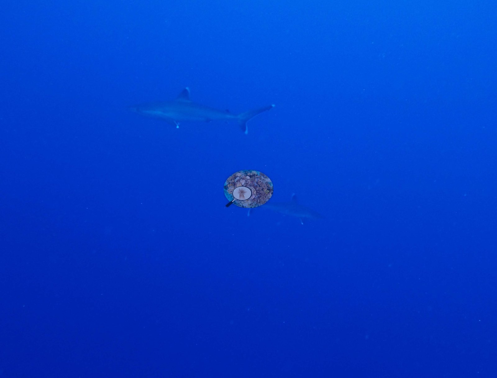
Chagos (NOAA CRW virtual station)BIEG04, at Egmont, is an early-March 2015 dive with bleaching effectively absent (0.5%), serving as a clean pre-event baseline for this atoll - where the reef is alive, it is almost entirely Acropora. Silvertip sharks (previously misidentified as whitetips) and a spectacular bait ball of thousands of small silver fish were the fauna highlights, and cover measured 29%. Surveyed on the Living Oceans Foundation's Global Reef Expedition.
Seven independent survey stations shown with the program’s logo — click one to see how far it is from this site.
Three other CRD dive sites within 5 km shown in orange — click a marker to open its page.
🗺 Detailed map of the Global Reef Expedition dive sites, Egmont Atoll, Chagos (Khaled bin Sultan Living Oceans Foundation; opens in a new window)
Site description
Setting
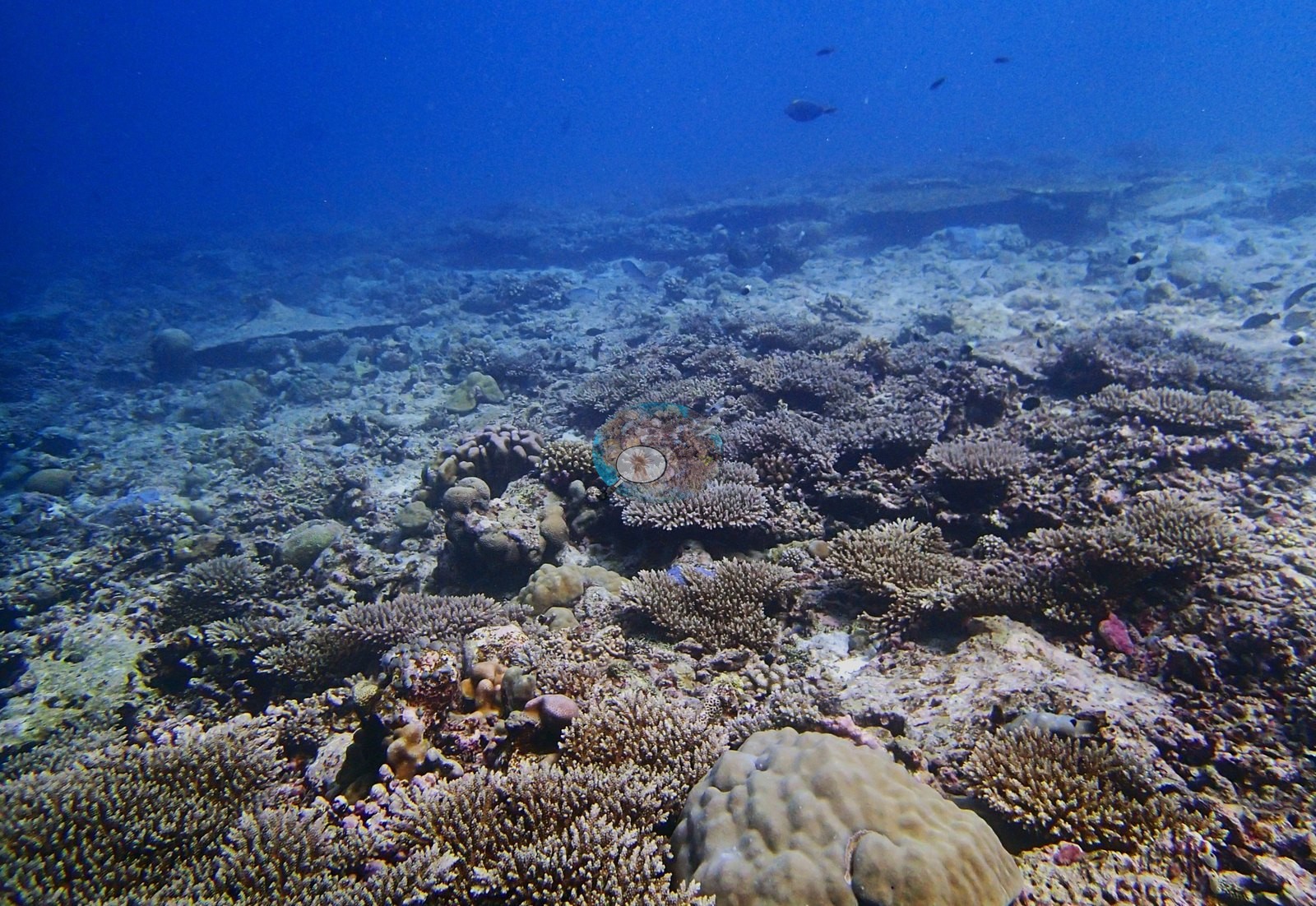
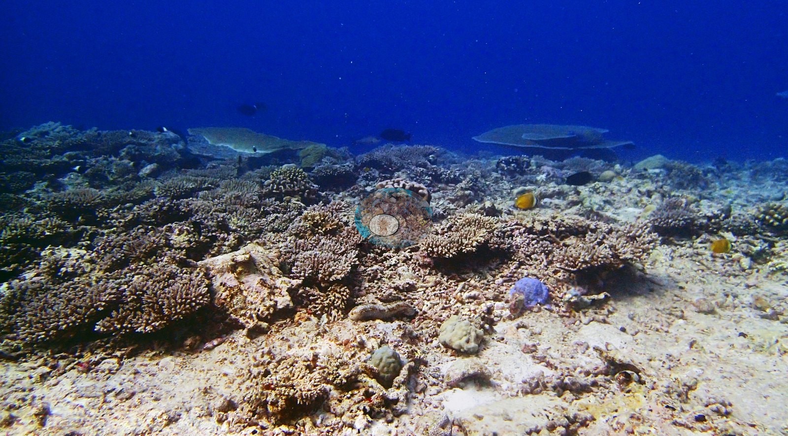
In-water conditions were 29.3°C at 34.0 salinity. Nothing in the set resolves as high-relief spur or wall; the impression across the wide frames is of an open, low-relief acroporid reef top.
General benthic features
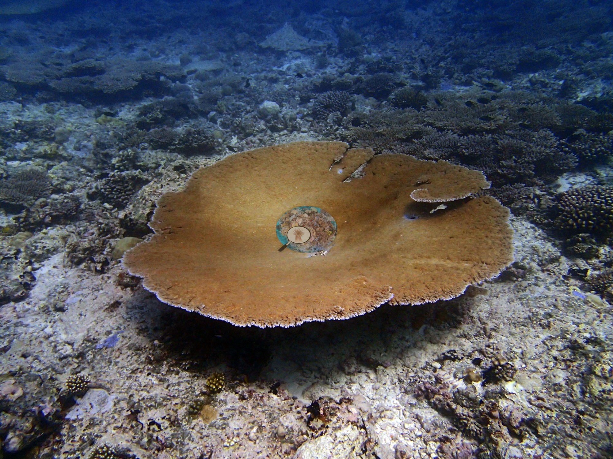
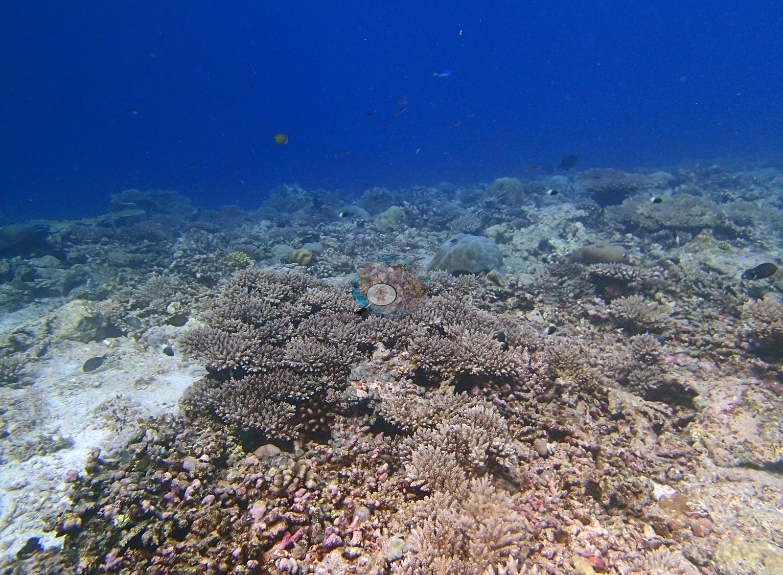
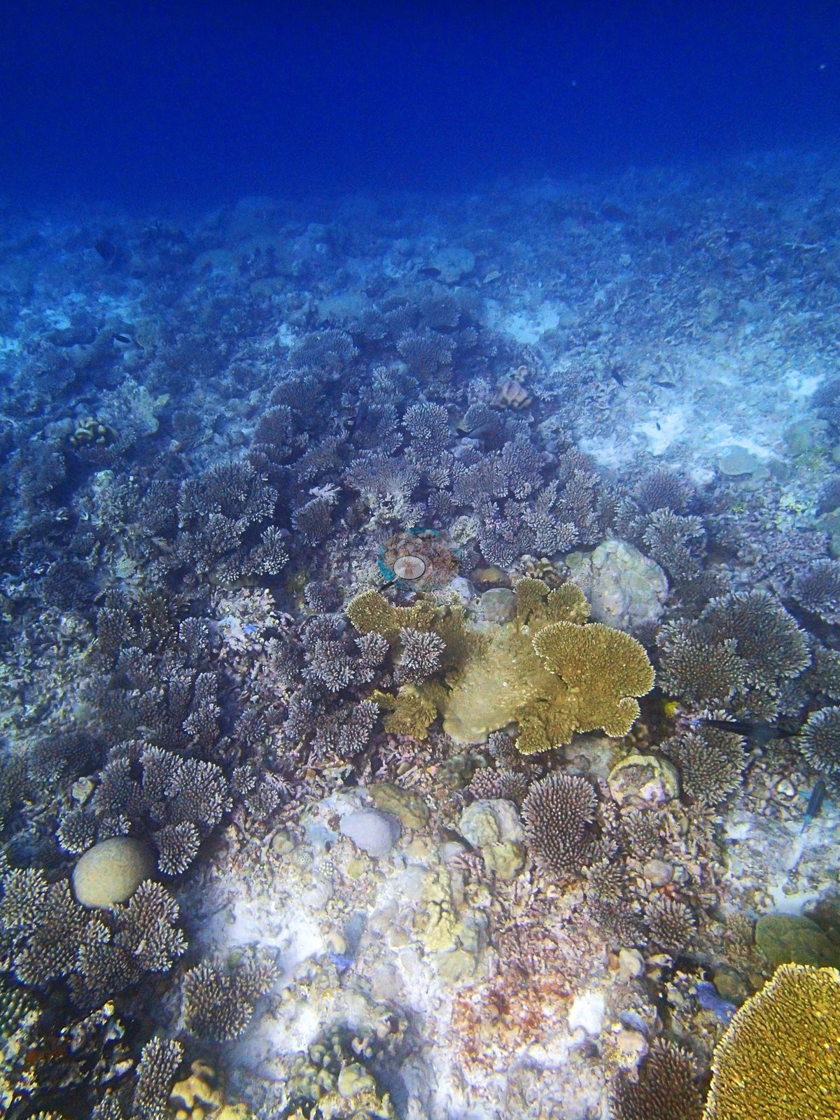
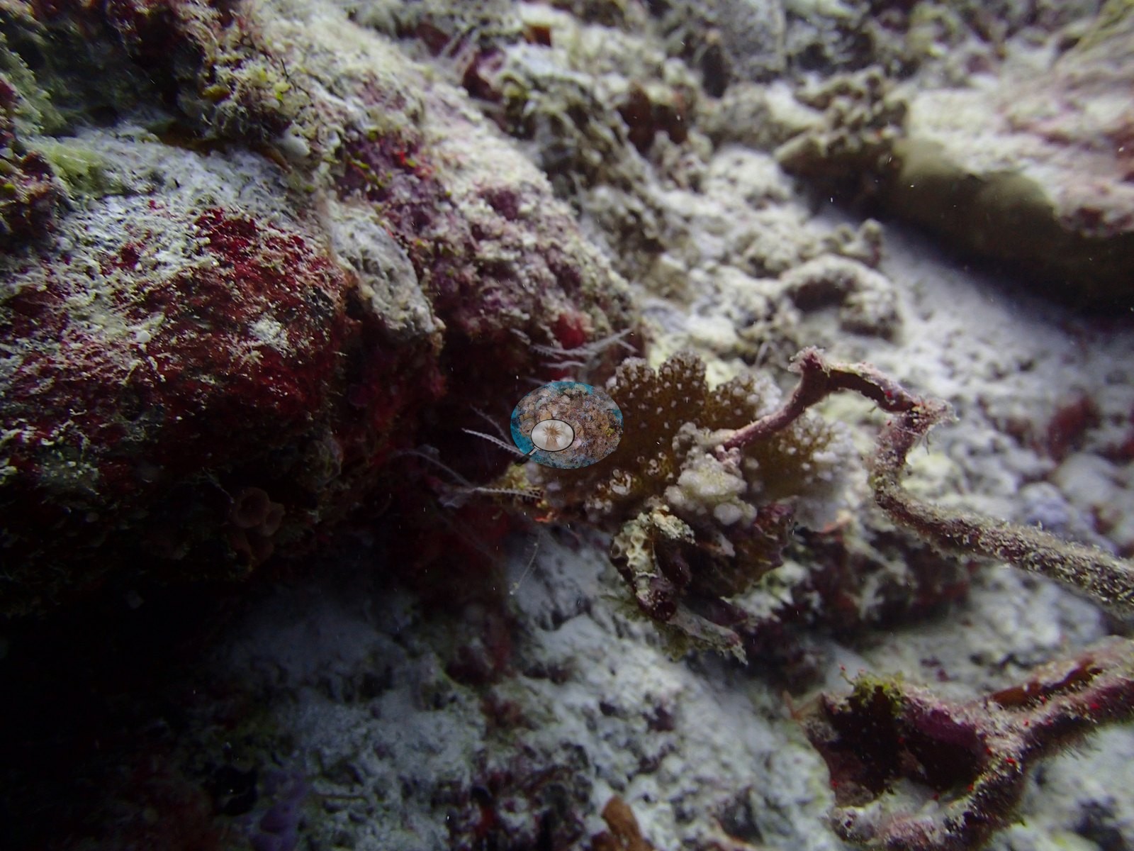
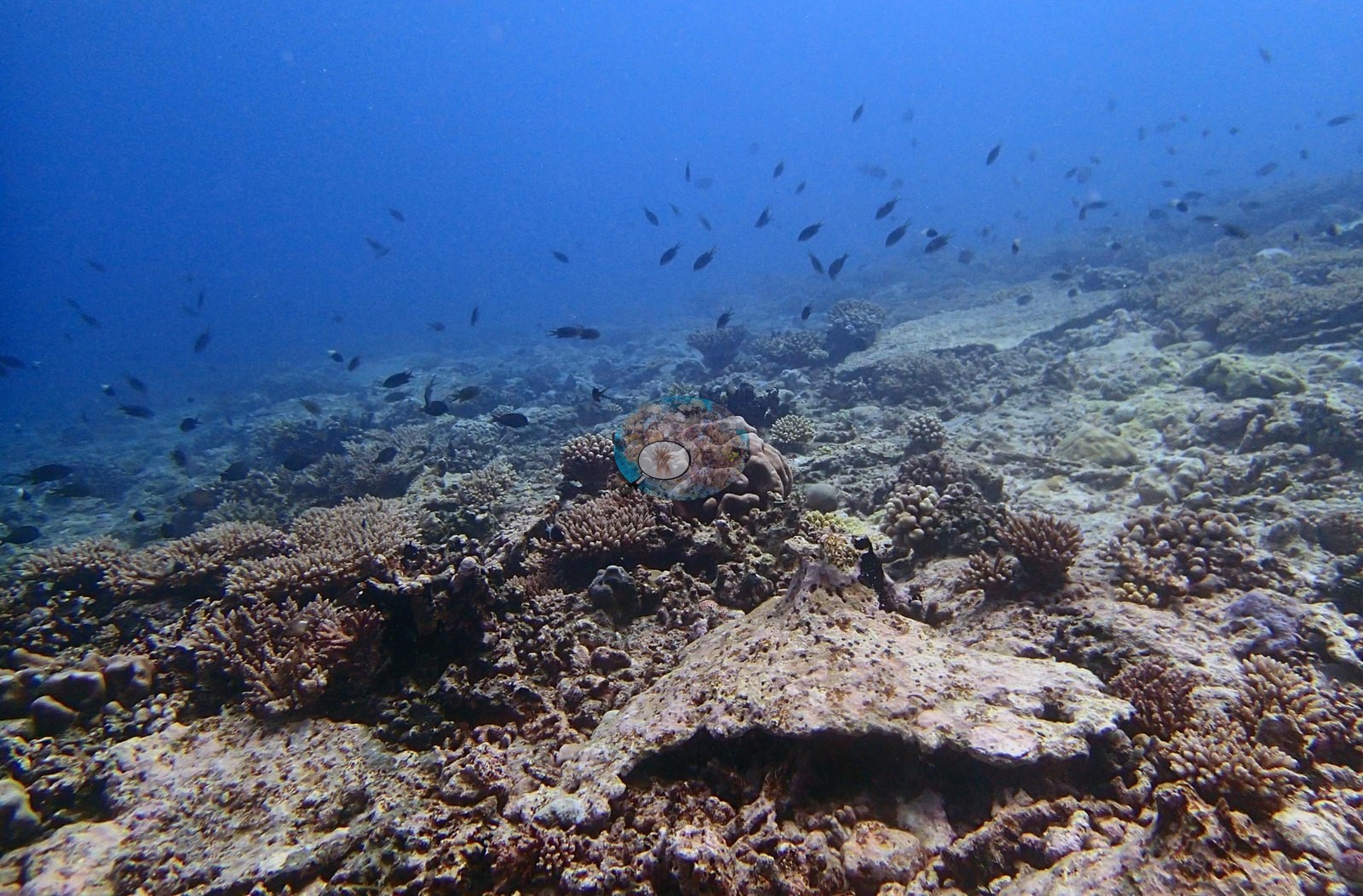
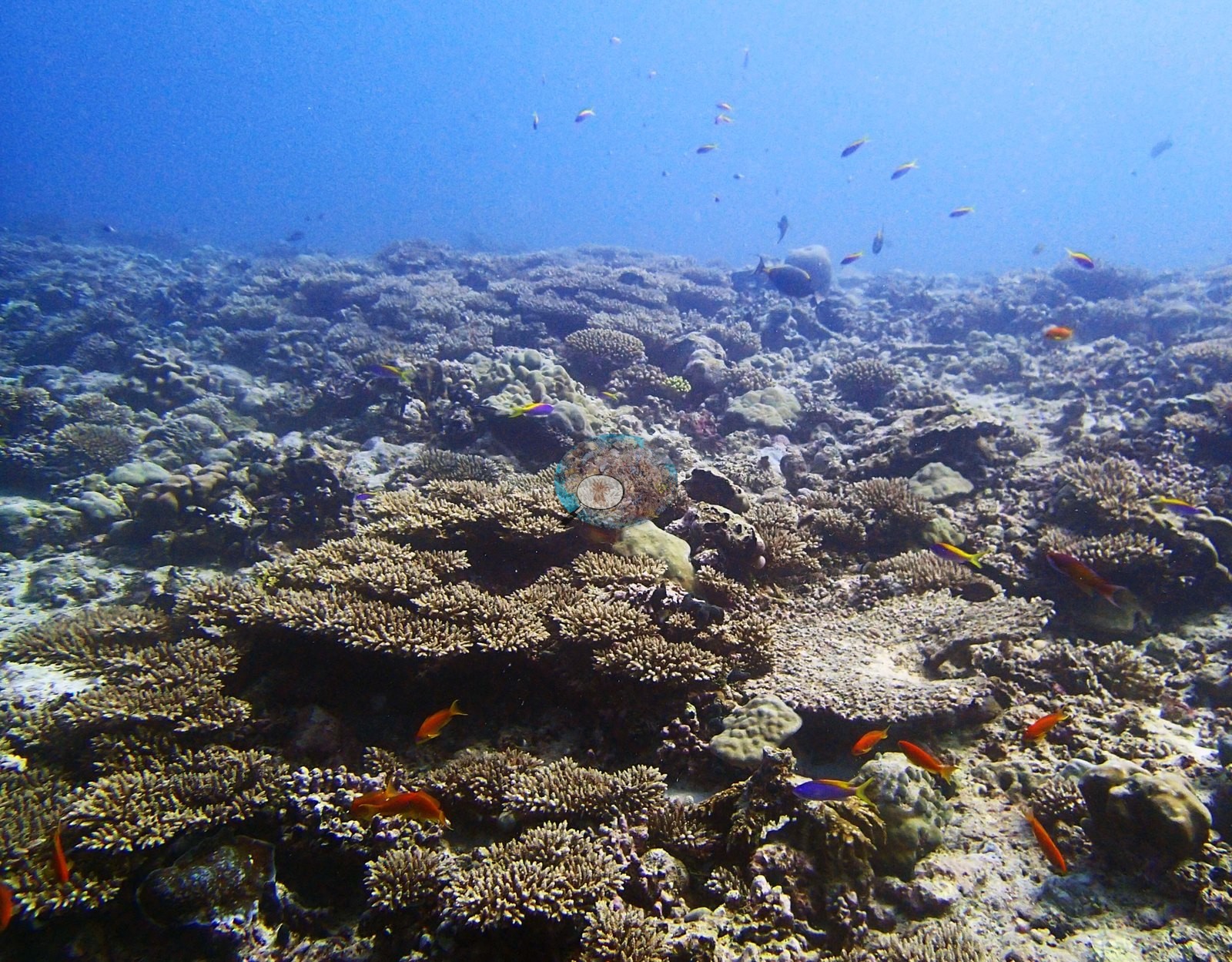
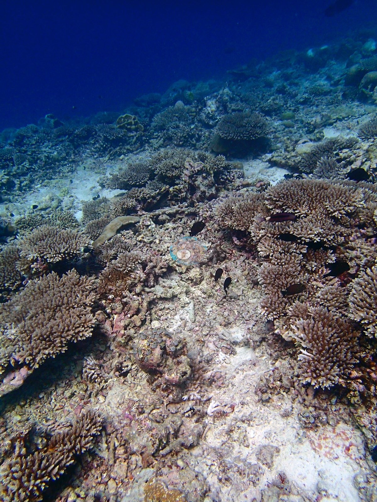
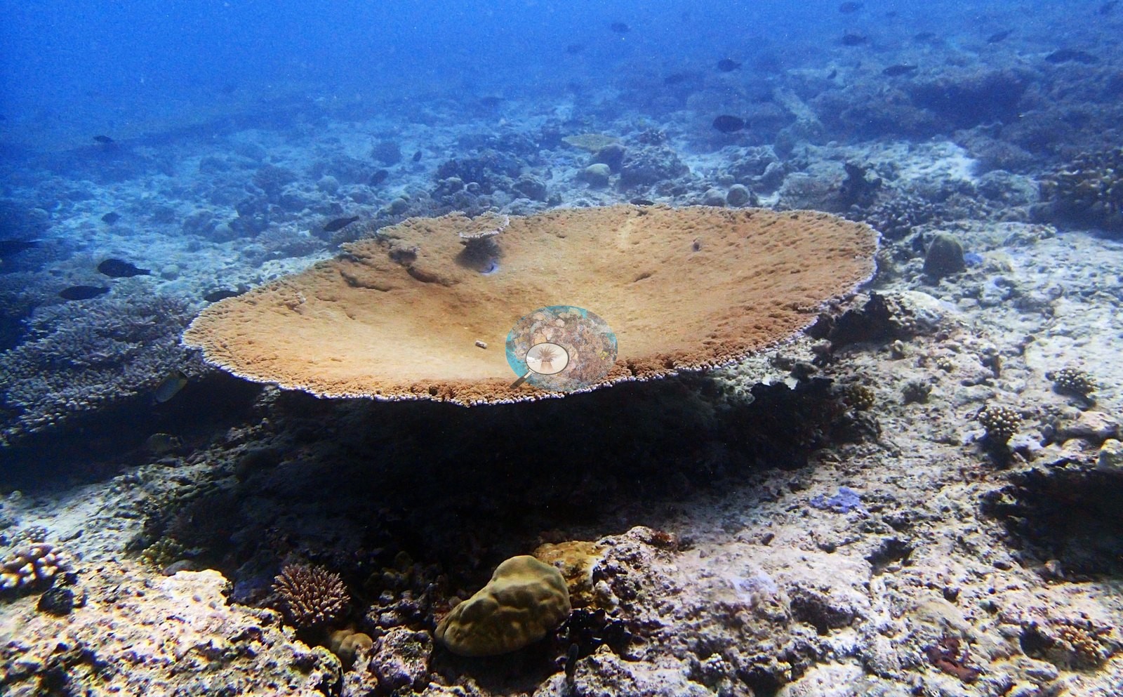
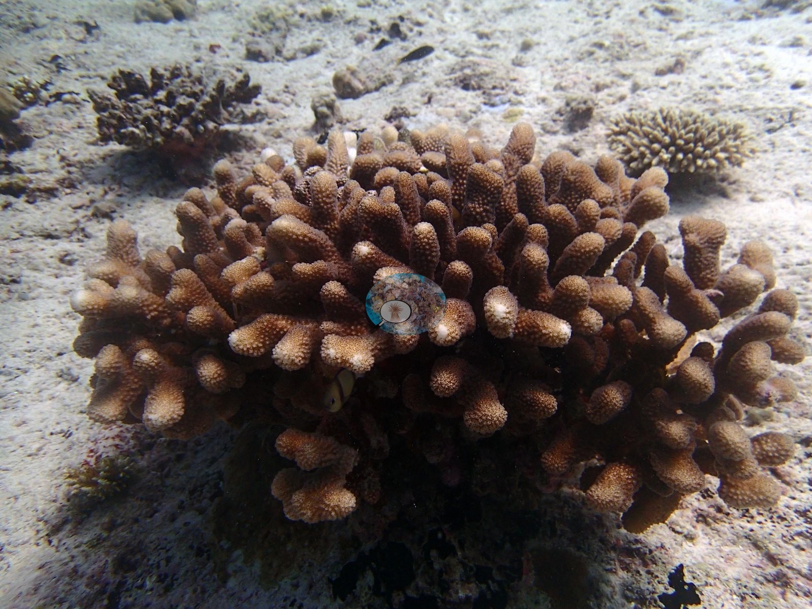
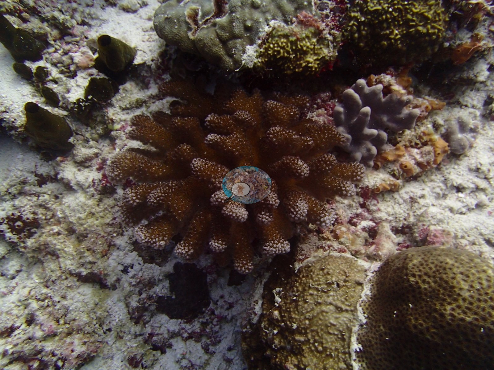
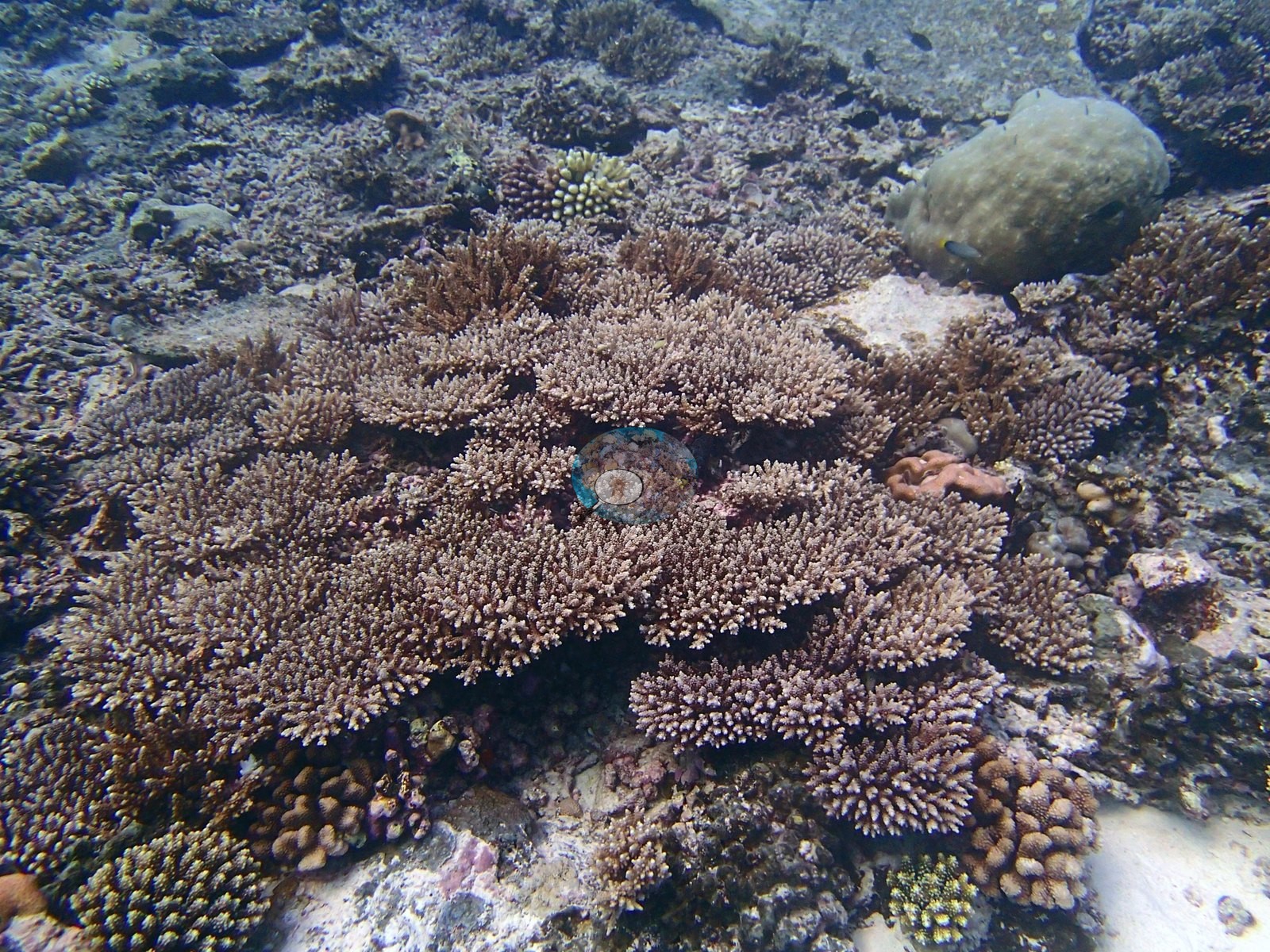
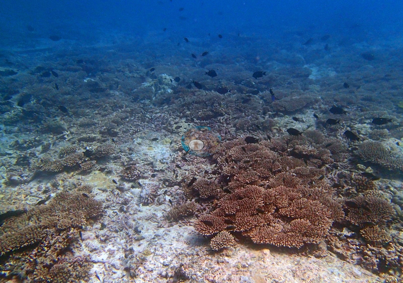
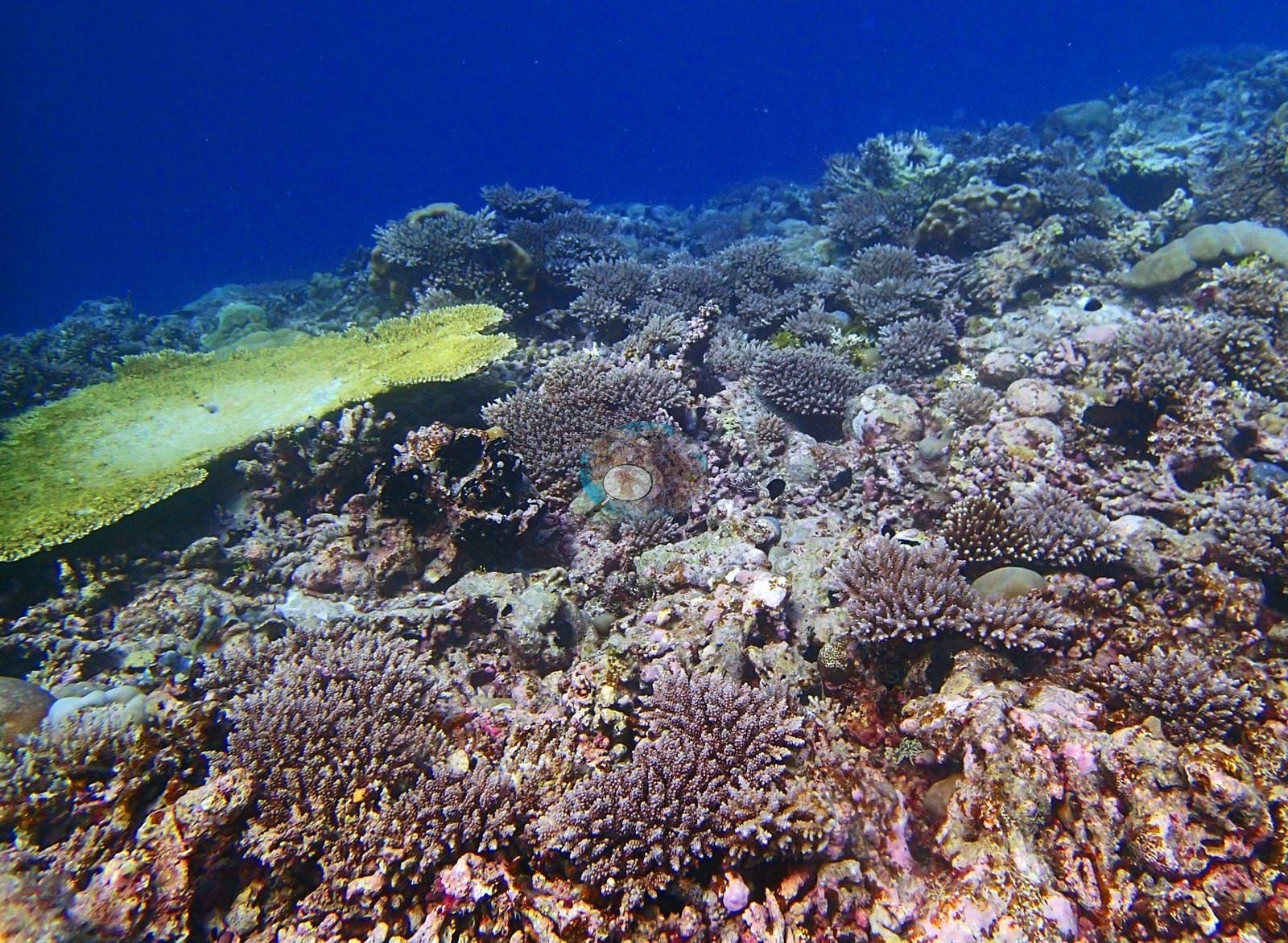
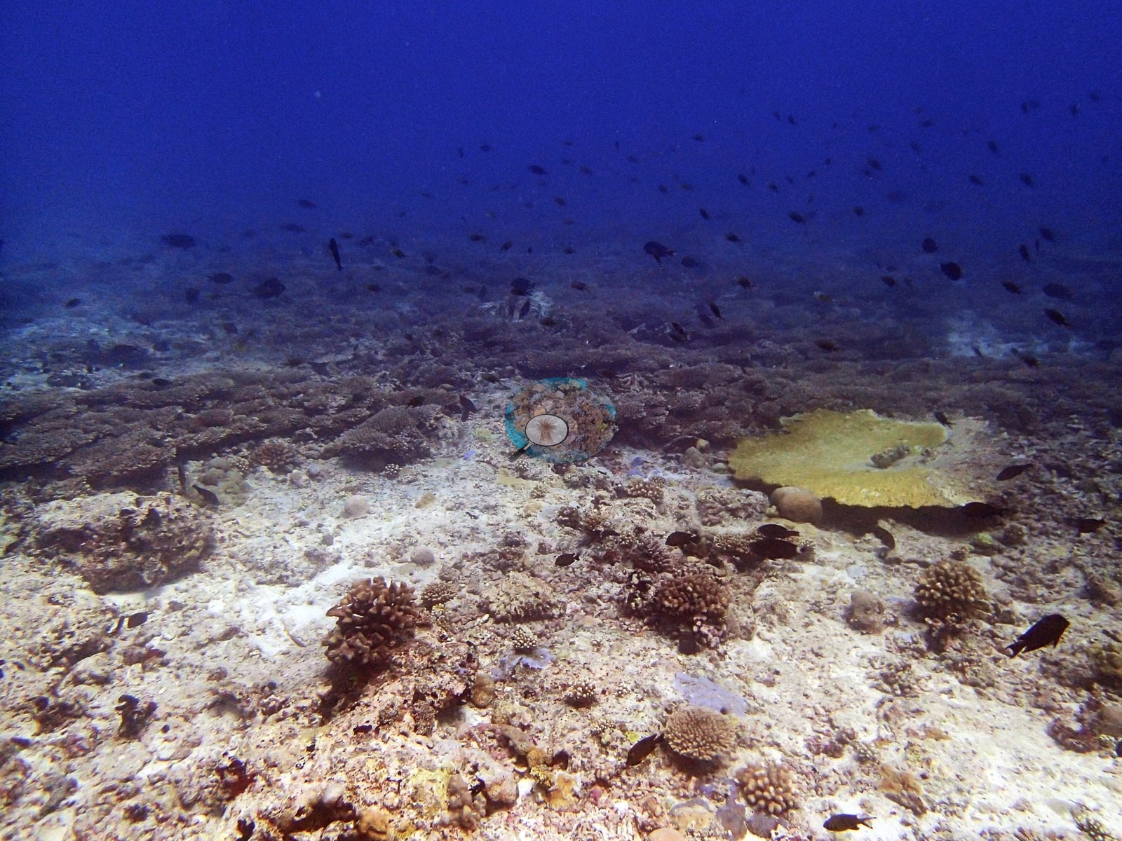
The transect's genus breakdown. Twenty-five scleractinian and hydrocoral genera were recorded, and this is unambiguously an Acropora reef: Acropora holds 11.40% of the benthos — 39% of all the live coral at the site. Porites follows at 6.22% and Montipora at 3.55%, then Pocillopora 1.37%, Favia 1.12%, Cyphastrea 0.86%, Goniastrea and Leptastrea 0.70% each, Favites 0.56%, Platygyra 0.50%, Pavona 0.42%, Fungia 0.33%, Psammocora 0.32% and Astreopora 0.30%. The tail runs Montastrea and Gardineroseris 0.18%, Galaxea 0.16%, Turbinaria 0.07%, Pachyseris 0.06%, Stylocoeniella and Symphyllia 0.04%, Heliopora 0.03%, Millepora 0.025%, and Goniopora and Echinopora 0.01% each. The Heliopora record carries a correction of Anderson's own: the HELI code is listed as Heliofungia in the LOF codebook, but the field data are Heliopora (blue coral) — determined by A. Mayfield, expedition coral-physiology lead, 2026-08-25, on the evidence that HELI reaches 93% cover on one transect elsewhere in the dataset, impossible for a solitary free-living mushroom coral, while HEFU, the Heliopora code, has only three records across all 3,067 GRE transects. The non-coral benthos is led by crustose coralline algae at 24.24%, then bare substrate 15.56%, turf 11.37%, turf-plus-sediment 8.16%, macroalgae 5.23%, invertebrates 3.81%, erect algae 2.37% and cyanobacteria 0.11%. Both image products therefore over-weight Acropora relative to the transect while all three agree on which genus builds this reef. The rest of the mask breakdown is tabular Acropora 15%, other hard coral 13.8%, massive and meandroid 13.1% and Pocillopora 6.5% of live cover; the rest of the point breakdown is Porites 11.4%, Pocillopora 9.6% and other hard coral 7.8% of live coral. Non-coral point cover is dominated by turf at 18.1% of all points with crustose coralline algae at 2.9% — far below the transect's 24.2% CCA, a straightforward class-assignment difference rather than a disagreement about the reef. Five frames (P3100382–P3100386 and P3100417) are open blue water with a shark or a jack and carry no benthic information, and P3100382 is hazy and very dim; P3100388 and P3100389 are close pavement macros. That leaves about sixteen usable benthic frames, most of them clear, well-lit mid-range reef-top views, several hazy with a strong blue cast at range. BIEG04 is an exposed Egmont forereef whose frames divide almost evenly between two states, and the division matters more than the site mean. Roughly half the set — P3100401, P3100402, P3100405, P3100418, P3100420 — shows genuinely dense Acropora development: overlapping lilac, mauve, fawn, and brown corymbose and branching colonies packed edge to edge over a low-relief pavement, with orange anthias compatible with Pseudanthias and purple-and-yellow fairy basslets compatible with Cirrhilabrus clouding above them. The other half — P3100403, P3100412, P3100413, P3100414, P3100419 — crosses broad pale carbonate pavement where turf-dusted hardground carries only isolated colonies and coral cover by eye is well under 10%. The two most striking benthic frames are both isolated structures standing on that pavement rather than parts of a continuous framework: P3100415, a large, perfectly formed tabular Acropora of A. cytherea/hyacinthus type with a clean white growth margin, and P3100404, a broad yellow-green table on the upper slope. Further tables sit on a dark undercut pedestal in P3100414, range along the reef edge in P3100412 and front the frame as a bright yellow plate in P3100420. Massive domes compatible with Porites recur throughout as isolated bommies (P3100404, P3100414, P3100418, P3100420), joined by polygonal-corallite faviids compatible with Favites or Dipsastraea, fine-pored domes compatible with Astreopora, a lobed fleshy colony compatible with Lobophyllia in P3100419 (the least secure call in the set), and a large yellow encrusting-to-plating sheet in P3100414. Two macro frames, P3100388 and P3100389, add the octocorals — brown finger-lobed colonies with white polyps compatible with Sinularia and Lobophytum, growing beside gray digitate and orange tube sponges on rubble crusted with red coralline algae; a conspicuous blue sponge appears in P3100412. Non-coral cover is dominated by crustose coralline algae 2.9%, turf 18.1% of all points.
Coral cover
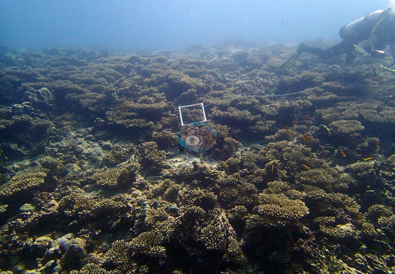
The LOF benthic transect is this site's measurement. Coral cover at BIEG04 (Egmont Atoll, 10 March 2015) is 29.2%, from the LOF BIOT-1 in situ transects (Mayfield & Dempsey 2026, Oceans, suppl. S1), against algal cover of 51.5% of the benthos. That diver transect is the authoritative record of cover and community at this site; the photographs and computer-vision products below supplement it and never qualify it. Coral cover across methods, and why they differ. Method comparison only. Transect 29.2% · CoralNet points 22.1% · Coralscapes masks 15.4% (25 frames). Deviation against the transect runs −13.7 to −7.0 pp; mean of three 22.2% ± 6.9, where that spread reflects systematic method bias rather than precision — the photo methods read low at high cover. Unusually for the Chagos set, the two image methods do not agree closely with each other here: the mask product sits nearly seven points below the point product, which is the signature of a reef whose cover is carried by small branching and corymbose colonies with a great deal of shadowed interstitial pavement between the branches, exactly the geometry a mask under-calls. Where the two do agree completely is on composition: the Coralscapes masks make Acropora (non-tabular) 49.1% of masked live cover, and the 30-point human annotation of the same frames (750 points) makes Acropora 71.1% of live points — against the transect's 39% of live cover. Two frames document the survey methodology directly, and are worth keeping for that reason alone. P3100401 shows a white PVC photoquadrat frame resting on a dense Acropora stand with the transect line running through it and a diver working in the upper right — this is the point-count method that produced the site's cover figures, photographed in the act. Nothing photographic here is a measurement of it and no percentage is derived from any frame. Also on record for this site: Assemblage composition. Across 25 analyzed frames the Coralscapes masks put live hard coral at 15.4% of image area, of which Acropora (non-tabular) is the largest component at 49.1%; the rest breaks down as tabular Acropora 15%, other hard coral 13.8%, massive and meandroid 13.1%, Pocillopora 6.5% of live cover. The independent 30-point human annotation of the same frames (750 points) gives live hard coral as 22.1% of all points and apportions it Acropora 71.1%, Porites 11.4%, Pocillopora 9.6%, other hard coral 7.8% of live coral. The dominance of Acropora in both methods (49.1% of masked live cover, 71.1% of live points) matches the visual impression exactly — where this reef is alive, it is almost entirely acroporid. Coral cover: 29%. Live hard coral measured on the in situ benthic transects of the LOF BIOT-1 expedition (Mayfield & Dempsey 2026, Oceans, supplemental S1), against algal cover of 51.5% of the benthos. The transect figure is this site's authoritative cover value; no image-derived product overrides it. Across methods the same reef reads: transects 29.1% · CoralNet points 22.1% · Coralscapes masks 15.4% (25 frames). These products have different sampling footprints and denominators and should not be averaged.
Stressors
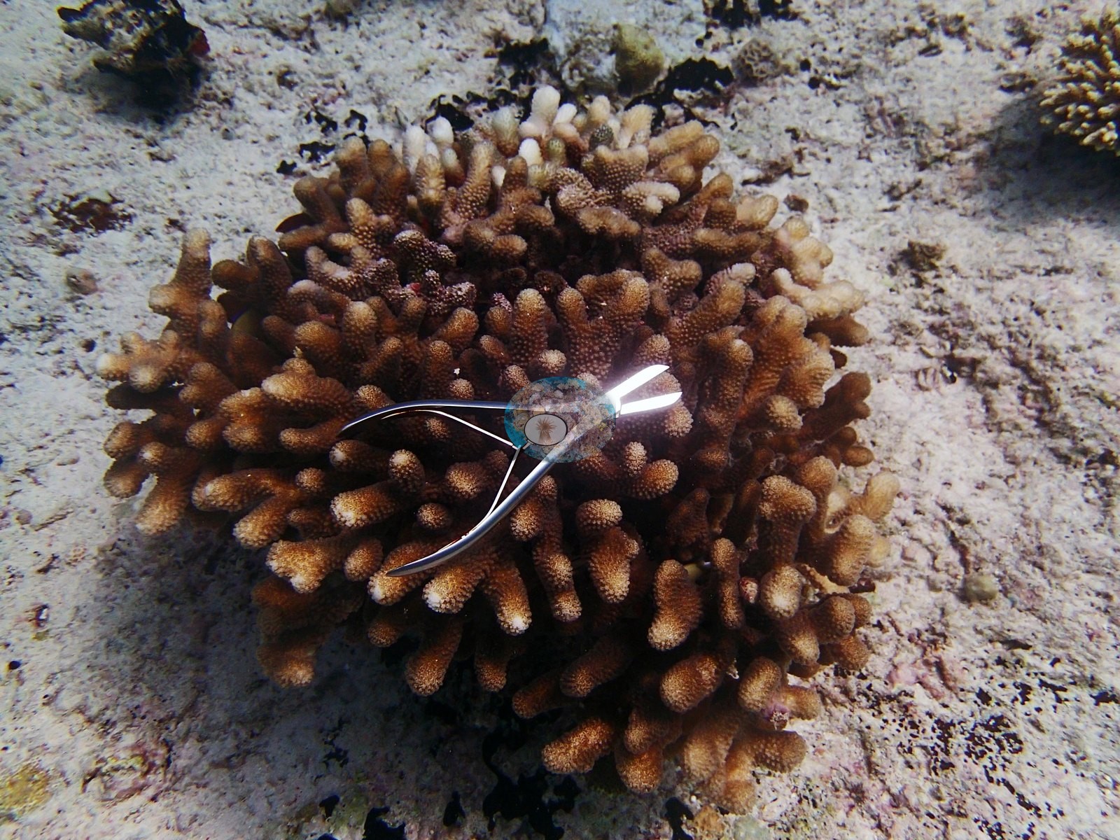
Structural loss registers as dead coral 1.9% of image area and rubble 8.2%. Bleached points make up 0.9% of the annotated set, in Acropora 0.8% and other hard coral 0.1%; that is a CV output on an opportunistic frame set and is not an estimate of the site's bleached fraction. P3100407 shows a stainless steel bone-rongeur laid across a digitate Acropora colony, plainly a fragment-collection or measurement shot; the identical tool appears at BIEG02 beside the crown-of-thorns. Condition. Anderson's published per-site bleached fraction for BIEG04 is 0.5% (CoralNet analysis of the informal survey images; Mayfield & Dempsey 2026), and that published figure is the authority on this site's bleaching. Qualitatively, no colony in any of the 25 frames is bleached white. The only pallor worth recording is in P3100406, a club-branched Pocillopora whose branch tips are cream-white — but the pattern is confined to the apical few millimeters of each branch with fully pigmented tissue immediately behind, which reads as normal actively growing tips rather than thermal stress, and it is recorded here as such and deliberately excluded from the bleaching log. This is a 10 March dive, the earliest leg of the expedition and well ahead of the 2015 event's development at Egmont; the value of BIEG04 in the bleaching record is as a clean pre-event photographic baseline for this atoll rather than as an impact site. Structural loss registers as dead coral 1.9% of image area and rubble 8.2%. Bleaching stands at 0.9% of annotated points, concentrated in Acropora 0.8%, other hard coral 0.1% of points.
Fish and other fauna
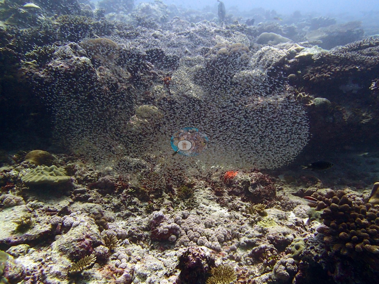
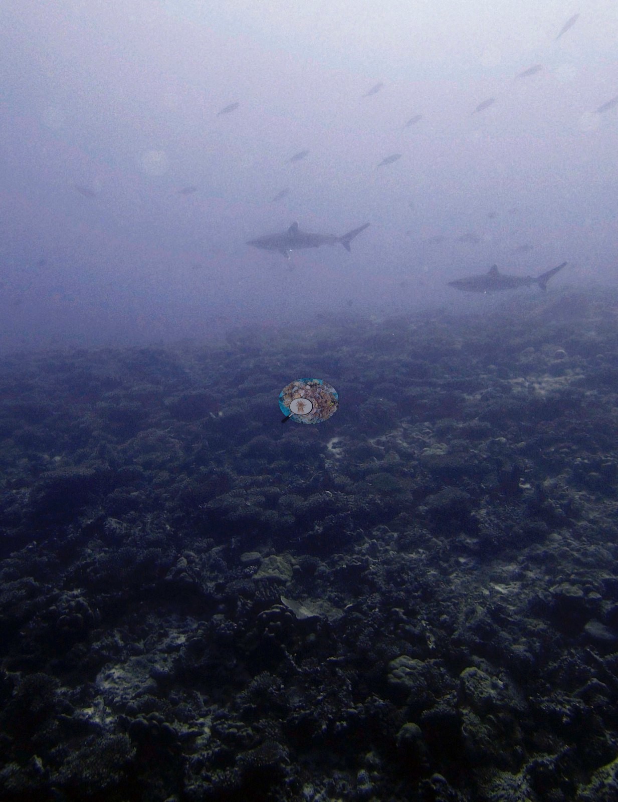
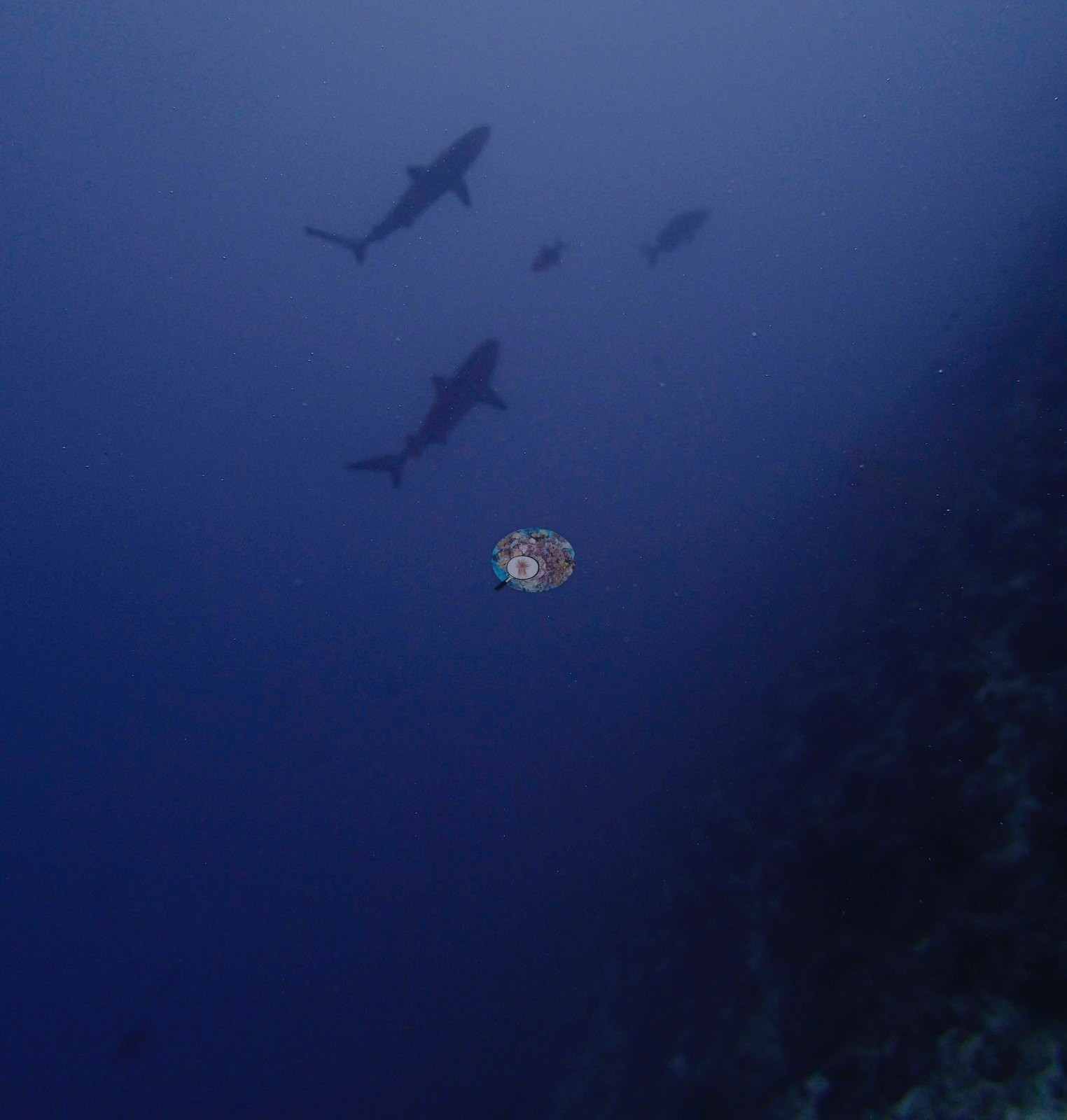
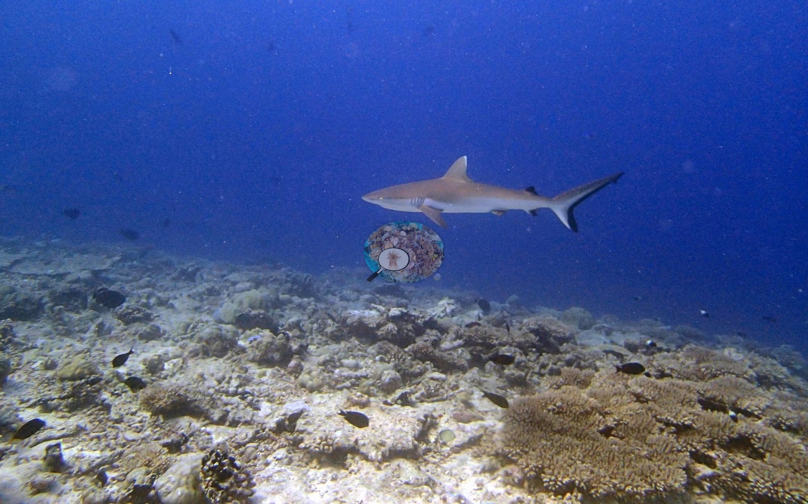
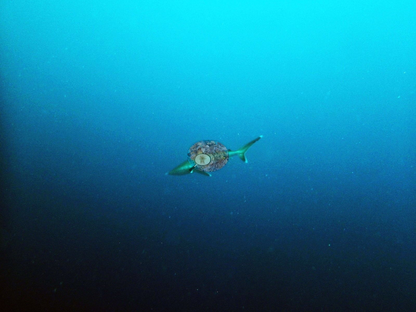
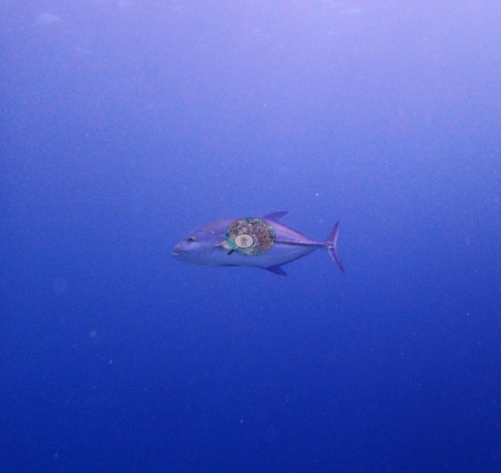
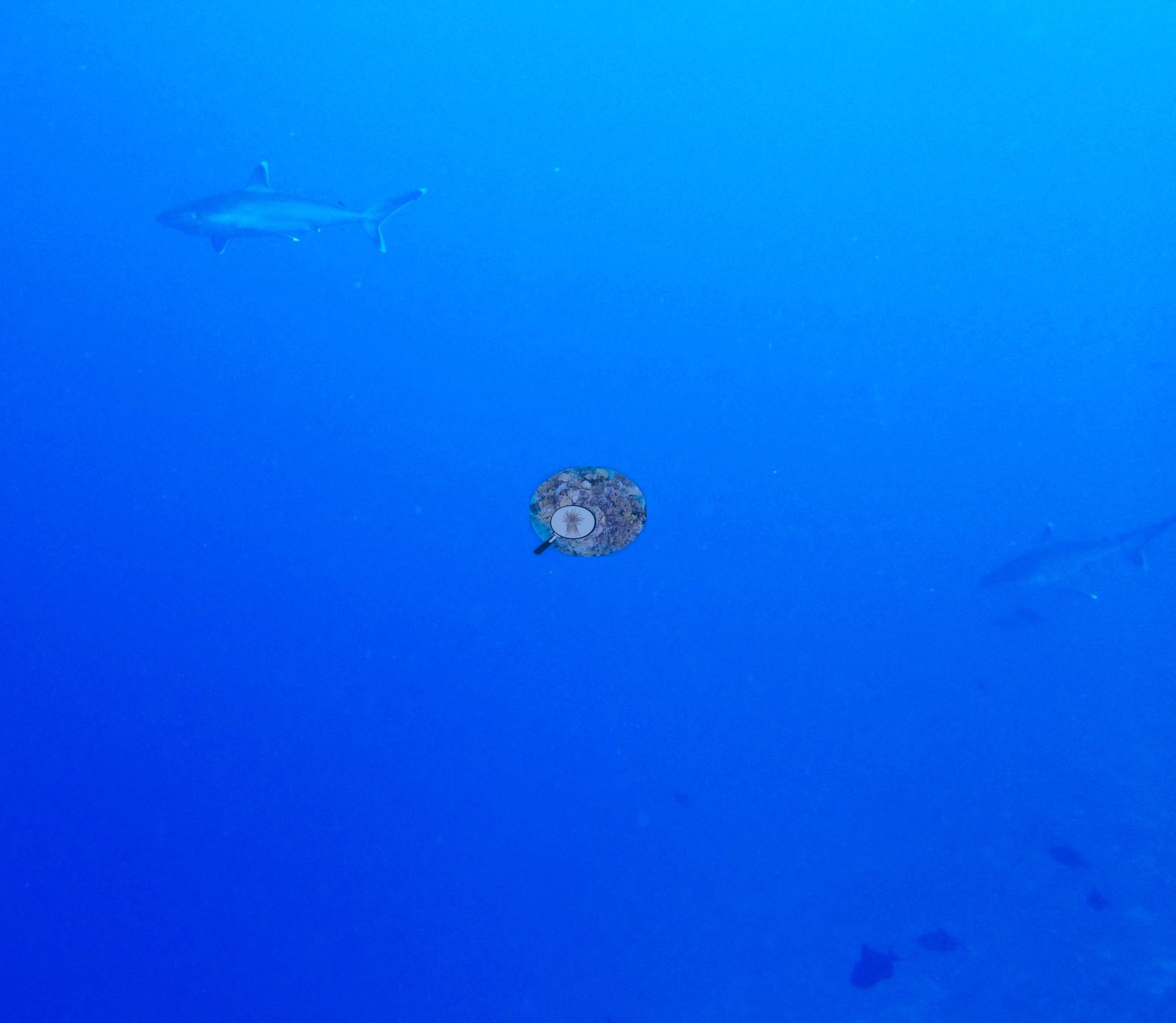
Conspicuous fauna and sessile invertebrates appear as sponges in 6 frames, sea cucumbers in 4, urchins in 1 and anemones in 1. Fauna. The dive is dominated by sharks, present in six frames — P3100382, P3100383, P3100384, P3100385, P3100386, and P3100409 — singly, in pairs and in a loose group of three over the drop-off in P3100386. Most are gray reef sharks compatible with Carcharhinus amblyrhynchos; P3100409 is an unambiguous close pass over the reef, showing the broadly dark-margined caudal fin. But the animals in P3100384 and P3100385 carry conspicuous white tips on the first dorsal, pectorals and caudal lobe, which is the signature of the silvertip shark, Carcharhinus albimarginatus — not the "whitetip/blacktip-type" recorded in an earlier entry. Whitetip reef shark (Triaenodon obesus) is a slender, blunt-headed, bottom-resting animal, and is not what these frames show; the remaining shark frames are hazy, distant and blue-shifted and should not be pushed past the genus. P3100311 is the dive's most spectacular frame: a bait ball of many thousands of small silver fish, compatible with cardinalfishes or sweepers, packed into a reef hollow and filling the entire field of view. A single jack compatible with Caranx or Seriola patrols the blue in P3100417, and butterflyfishes, damselfishes, and dense Chromis clouds populate the reef frames throughout. Conspicuous fauna and sessile invertebrates appear as sponges in 6 frames, sea cucumbers in 4 frames, urchins in 1 frame, anemones in 1 frame.
Comparisons with other data
No independent survey was made at this exact site; the nearest ones are listed in the table below.
Other notes
No depth-stratified means (D1–D4) and no per-frame depth data are carried for this site; the two-zone structure described below is inferred from framing and light, not measured. Image-by-image. All 25 habitat frames of Anderson's own folder BiEg04-finished were reviewed; there are no sampled-colony frames. These frames tie the photographic record to the physical sample and transect archive and should not be dismissed as incidental gear shots.
CV model comparison
More info
Those are point counts on the photographs; this is a diver swimming a transect. The models and the reference never saw the same thing. ⚠ SITE-LEVEL ONLY. The 2,500 frames were not associated with any transect taken within 200 m of them, so transect-vs-image comparisons are site means, never frames. The transect value is already in the pin `cover` field (109 of 112 pins, sourced to the paper's suppl. S1) and is read from there, never re-imported. The transect is THE coral-cover value for this site and stands alone. The rows below it are a methods comparison only: no computer-vision value is averaged with it, feeds the headline, or carries over to the site's cover figure (Anderson, 2026-09-22).| Method | Hard-coral cover (%) |
|---|---|
| Transect (published) | 29.2 |
| In-house DINOv3 | 35.1 |
| CoralSCOP edited | 28.2 |
| Claude | 25.9 |
Independent surveys nearby
| Agency / program | Year(s) | Stations / distance | Link |
|---|---|---|---|
| Spalding et al. (2024) | 2024 | 3 stations, 0.34 km | Records ↓ |
| Spalding et al. 2025 (Chagos 2024 bleaching report) | 2024 | 6 stations, 0.34–4.78 km | Records ↓ |
| XL Catlin Seaview Survey | 2015 | 1 station, 4.06 km | Records ↓ |
Within 5 km, 10 independent survey stations recorded hard coral cover in 10 records between 2015 and 2024. Surveys since 2021 average 27% (range 5.0–70%, n=3); 6 best-patch values above 70% are left out, as they are not site means. This site's own estimate (29%) sits within the recent range (5.0–70%); the methods differ, so the comparison is context, not a like-for-like test.
Collected by other programs using different methods (the XL Catlin Seaview Survey uses photo-transects with automated image annotation), so these are context for the figures above, not a like-for-like comparison. Where a station was surveyed more than once the range is shown. Station names are not dive-site names. Values marked best patch exceed 70%: surveyors usually chose the richest area, so they are not site means.
| Agency | Site / location | Date | Hard coral cover (%) | Distance | Link |
|---|---|---|---|---|---|
| XL Catlin Seaview Survey | transect 36029 | 2015 | 29% | 4.06 km | — |
| Spalding et al. 2025 (Chagos 2024 bleaching report) | Egmont Manta Alley (ocean, NE aspect, 2-5 m) | 2024 | 5.0% | 0.34 km | — |
| Spalding et al. 2025 (Chagos 2024 bleaching report) | Egmont Manta Alley (ocean, NE aspect, 5-8 m) | 2024 | 80% best patch | 0.34 km | — |
| Spalding et al. 2025 (Chagos 2024 bleaching report) | Egmont Manta Alley (ocean, NE aspect, 8-10 m) | 2024 | 80% best patch | 0.34 km | — |
| Spalding et al. 2025 (Chagos 2024 bleaching report) | Egmont, NW Lagoon (lagoon, S aspect, 2-3 m) | 2024 | 70% | 4.43 km | — |
| Spalding et al. 2025 (Chagos 2024 bleaching report) | Egmont Outer reef North (ocean, N aspect, 5-8 m) | 2024 | 80% best patch | 4.78 km | — |
| Spalding et al. 2025 (Chagos 2024 bleaching report) | Egmont Outer reef North (ocean, N aspect, 8-10 m) | 2024 | 80% best patch | 4.78 km | — |
| Spalding et al. (2024) | Egmont Manta Alley (ocean, NE aspect, 2-5 m) | 2024 | 5.0% | 0.34 km | — |
| Spalding et al. (2024) | Egmont Manta Alley (ocean, NE aspect, 5-8 m) | 2024 | 80% best patch | 0.34 km | — |
| Spalding et al. (2024) | Egmont Manta Alley (ocean, NE aspect, 8-10 m) | 2024 | 80% best patch | 0.34 km | — |
Data & links
- Read the full site report ↗
- Download benthic survey data (CSV) ↗
- Download all LOF-GRE data (933 sites) ↗
- CoralNet image repository for this region ↗
- Photo portfolio ↗
- Coral Reef Diagnostics page for this area ↗
All images from Coral Reef Diagnostics. Data are from Coral Reef Diagnostics and the organizations named in the data-sources table above.
 © Coral Reef Diagnostics.
References
- Mayfield AB, Dempsey AC (2026). Using tourist diver images to estimate coral cover and bleaching prevalence in a remote Indian Ocean coral reef system. Oceans 7(1):1. PDF
- Spalding M, Bourasseau M, et al. (2025). Coral bleaching and mortality in the Chagos Archipelago, 2024. British Indian Ocean Territory Administration report (gray literature). PDF