
Dominica - Toucari Bay

Part of the regional summary: Dominica
More info
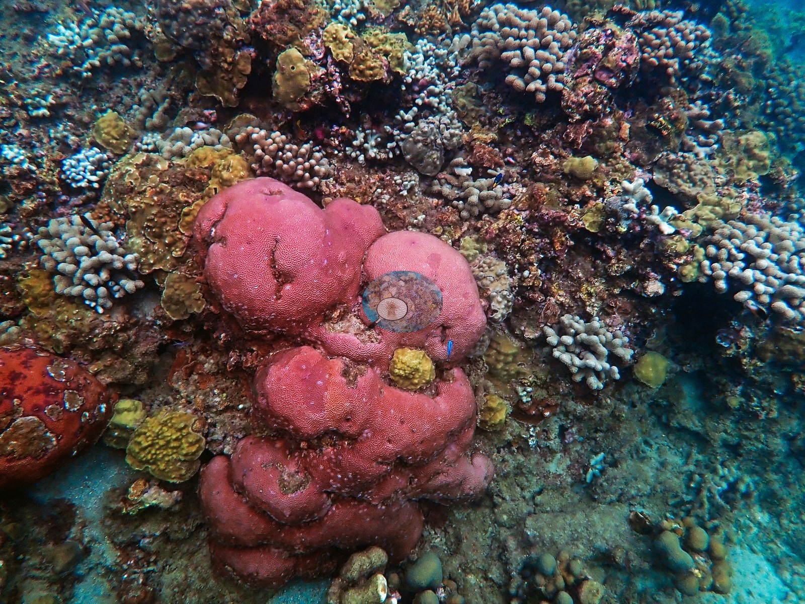
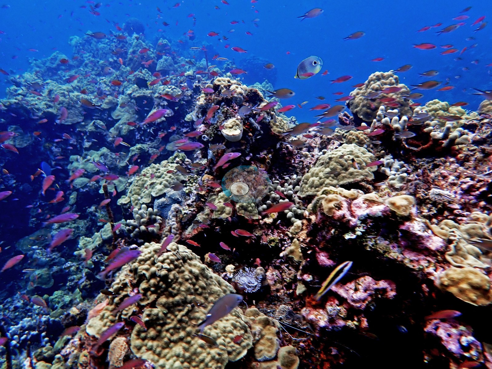
Leeward Caribbean Islands (NOAA CRW virtual station) · Eastern Caribbean ecoregion mean: 13.1 degree heating weeksA shallow snorkeling reef on Dominica's northwest coast packed with boulder star and brain corals and finger-coral thickets, showing few signs of the disease seen at the deeper Soufriere Bay sites. Bright red and orange encrusting sponges dot the coral heads, though one boulder star stand carries patches of recent partial die-off.
Three independent survey stations shown with the program’s logo — click one to see how far it is from this site.
Site description
Setting
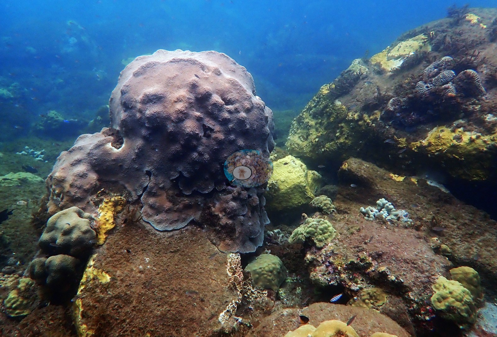
Toucari Bay reef, northern Dominica. A shallow, healthy fringing reef used for snorkeling on Dominica's northwest coast, with dense stands of boulder star and brain corals and few visible signs of disease, unlike the deeper Soufriere Bay dive sites (e.g., Image 1, Image 4, Image 5).
General benthic features
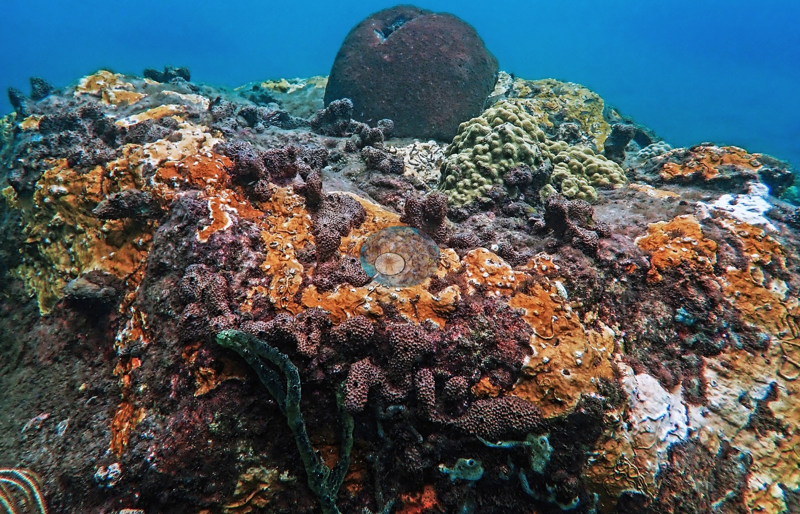
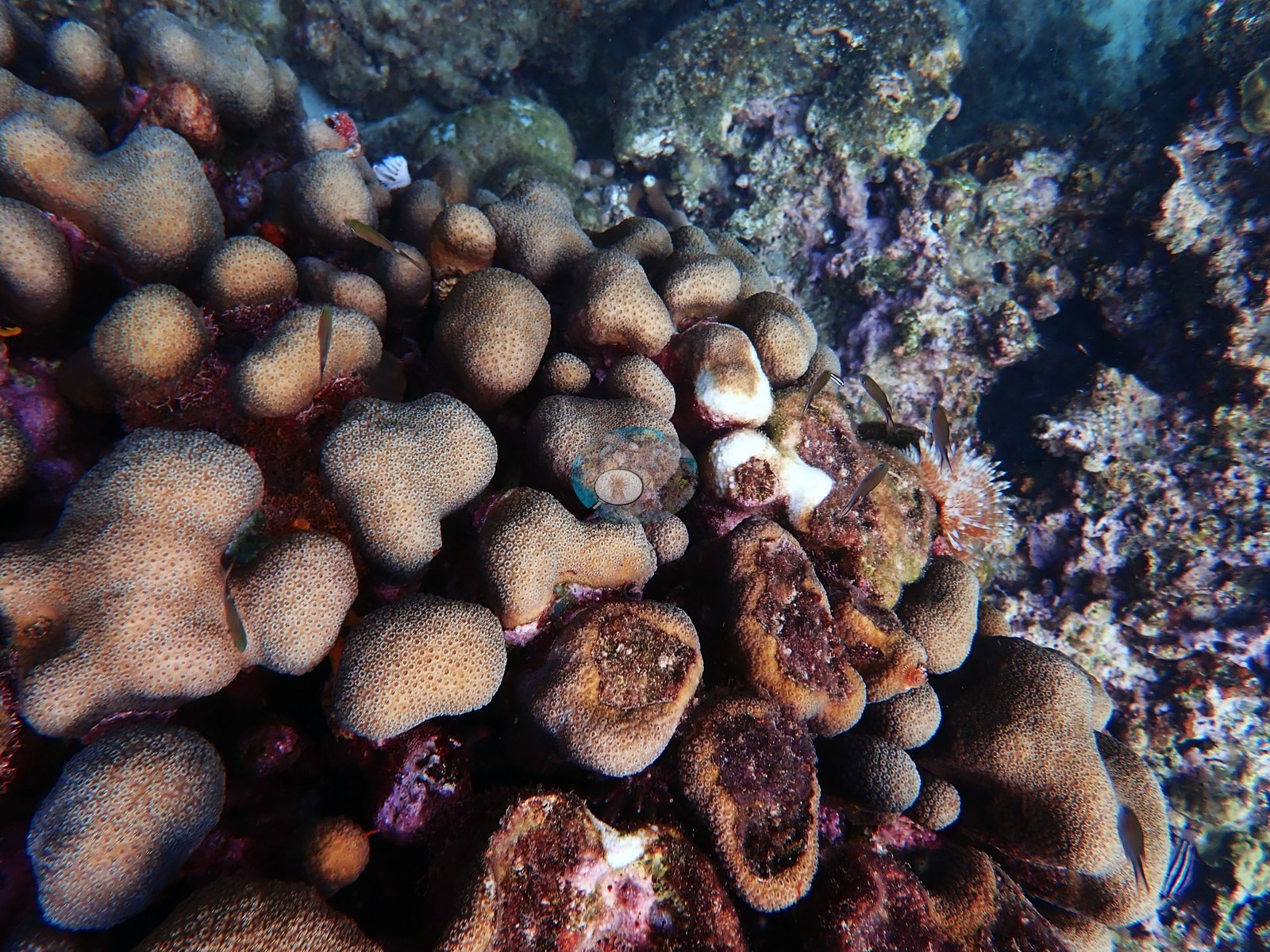
Bright red and salmon-pink encrusting sponges dot the coral heads, with sea urchins tucked into crevices and small reef fish schooling over the shallows (e.g., Image 2, Image 3).
Coral cover
- Reference: Claude CV point count (this site's photos)
- Coral cover: 28% — a blind Claude computer-vision point count of 42 of Anderson's edited photographs (20 points per photo; water, fish, and obstructions excluded). Other computer-vision methods are listed in the method table.
Stressors
No corallivores evident.
Comparisons with other data
No other surveys have been conducted at this site to date. Within 5 km, three Reef Check stations recorded 4.4–17% hard coral cover between 2006 and 2018; the nearest, Reef Check at Rose Garden, 2.88 km away, read 8.4% in 2006.
Other notes
Position approximate.
CV model comparison
More info
A few colony-focused photos raise the mean; the median is the typical photo. No computer-vision method yet estimates coral cover accurately on new images, so treat this as indicative rather than a measurement; it is revised as the methods improve.More info
Other rows are for comparison only and are never averaged. No diver transect exists for this trip, so agreement between rows is not accuracy.| Method | Hard-coral cover (%) |
|---|---|
| CoralSCOP edited | 33.5 |
| Claude (edited photos) | 28.0 |
See a more detailed, stand-alone version of this table.
Independent surveys nearby
 Coral Reef Diagnostics
Within 5 km, 3 independent survey stations recorded hard coral cover in 6 surveys between 2006 and 2018. Of the 1 station surveyed in more than one year, 1 declined between their first and latest surveys. The longest record, Sunshine Reef (Reef Check, 3.98 km away), went from 14% in 2006 to 4.4% in 2018. The most recent nearby survey is from 2018, so these values predate recent heat stress. This site's own estimate (28%) sits 11.0 points above the range of these surveys (4.4–17%); the methods differ, so the comparison is context, not a like-for-like test.
Collected by other programs using different methods (Reef Check uses point-intercept transects), so these are context for the figures above, not a like-for-like comparison. Where a station was surveyed more than once the range is shown. Station names are not dive-site names.
| Agency | Site / location | Date | Hard coral cover (%) | Distance |
|---|---|---|---|---|
| Reef Check | Rose Garden | 2006 | 8.4% (2 surveys) | 2.88 km |
| Reef Check | Sunshine Reef | 2006–2018 | 4.4–14% (3 surveys) | 3.98 km |
| Reef Check | Canon Site | 2018 | 17% | 2.99 km |
Data & links
All images from Coral Reef Diagnostics. Data are from Coral Reef Diagnostics and the organizations named in the data sources above.
© Coral Reef Diagnostics.