

Atauro - Haruine

Part of the regional summary: Timor-Leste
2024-01-31
More info
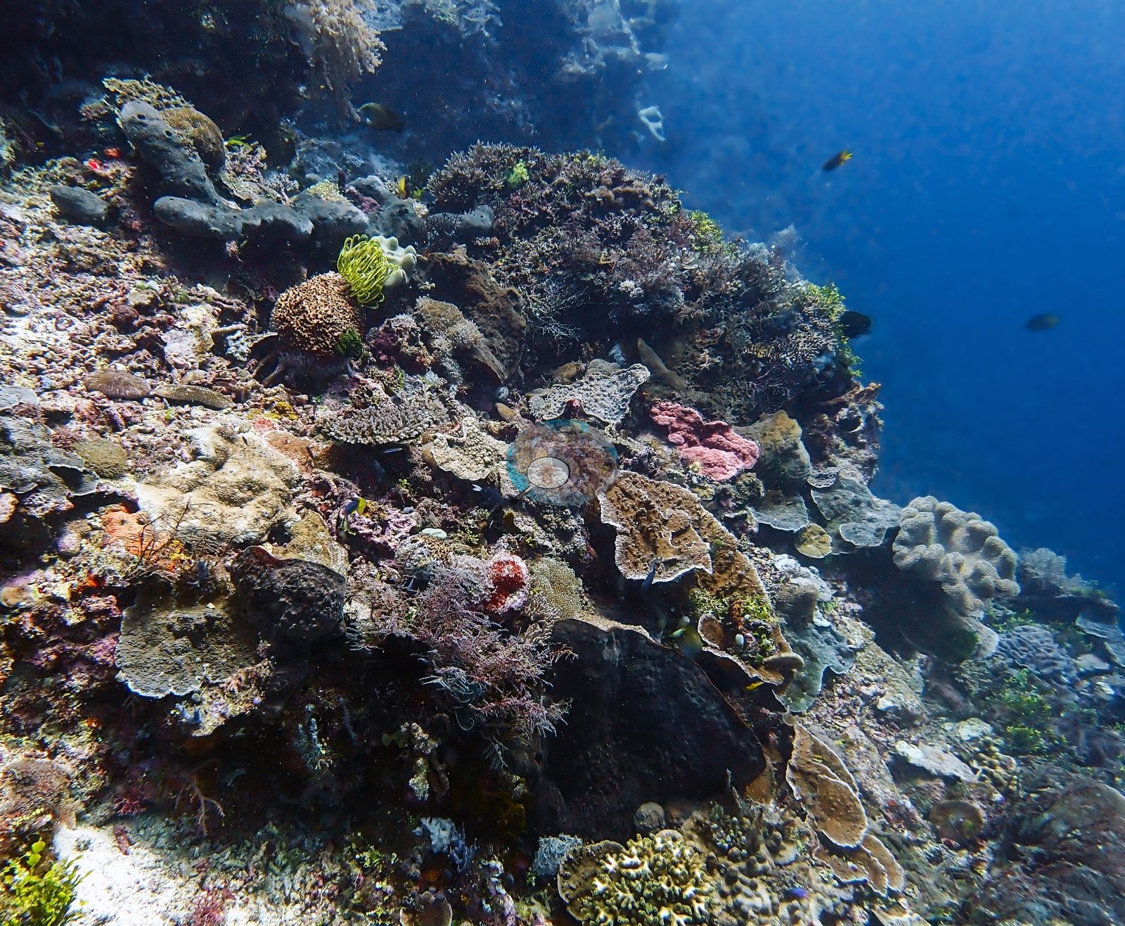
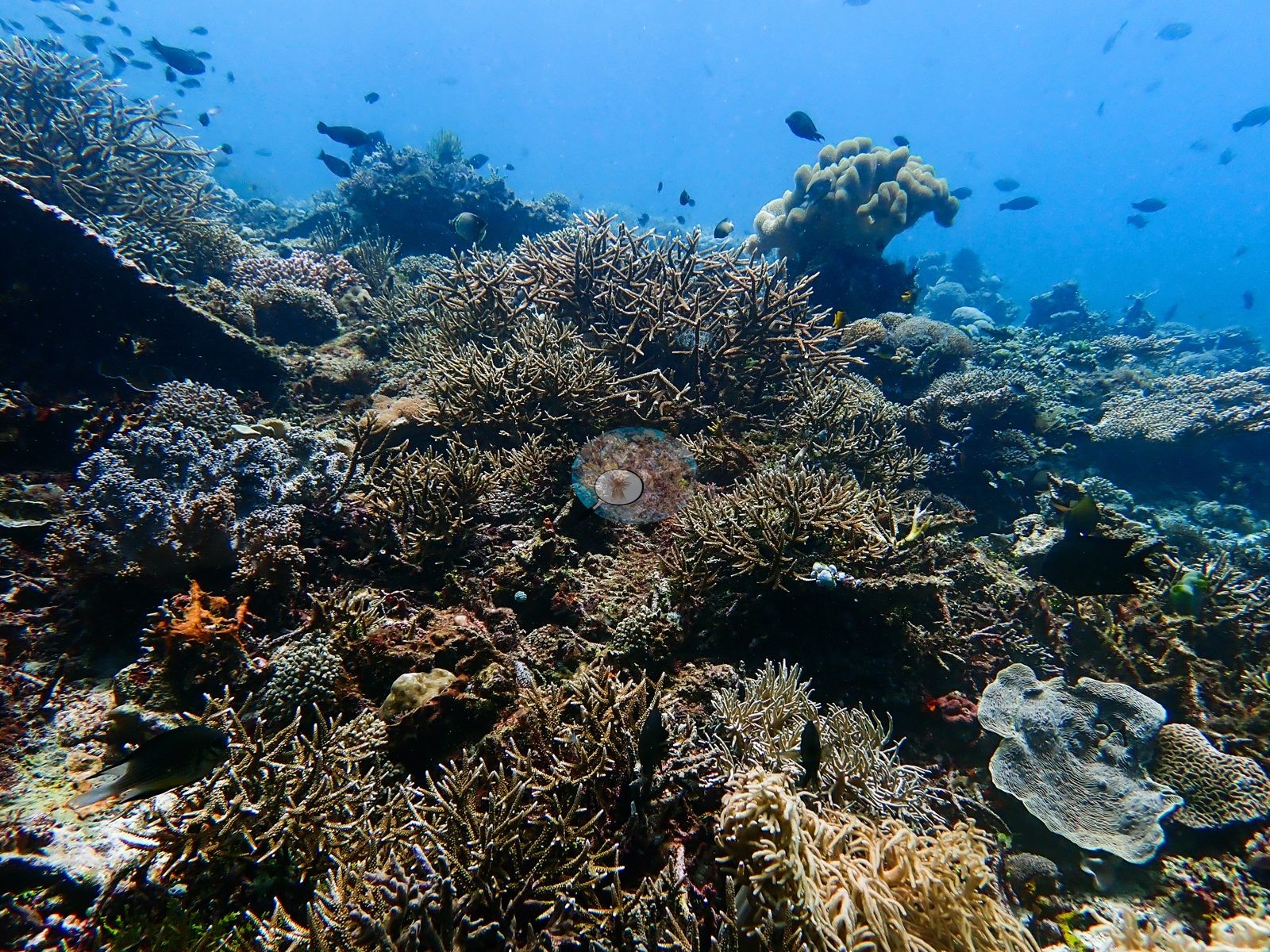
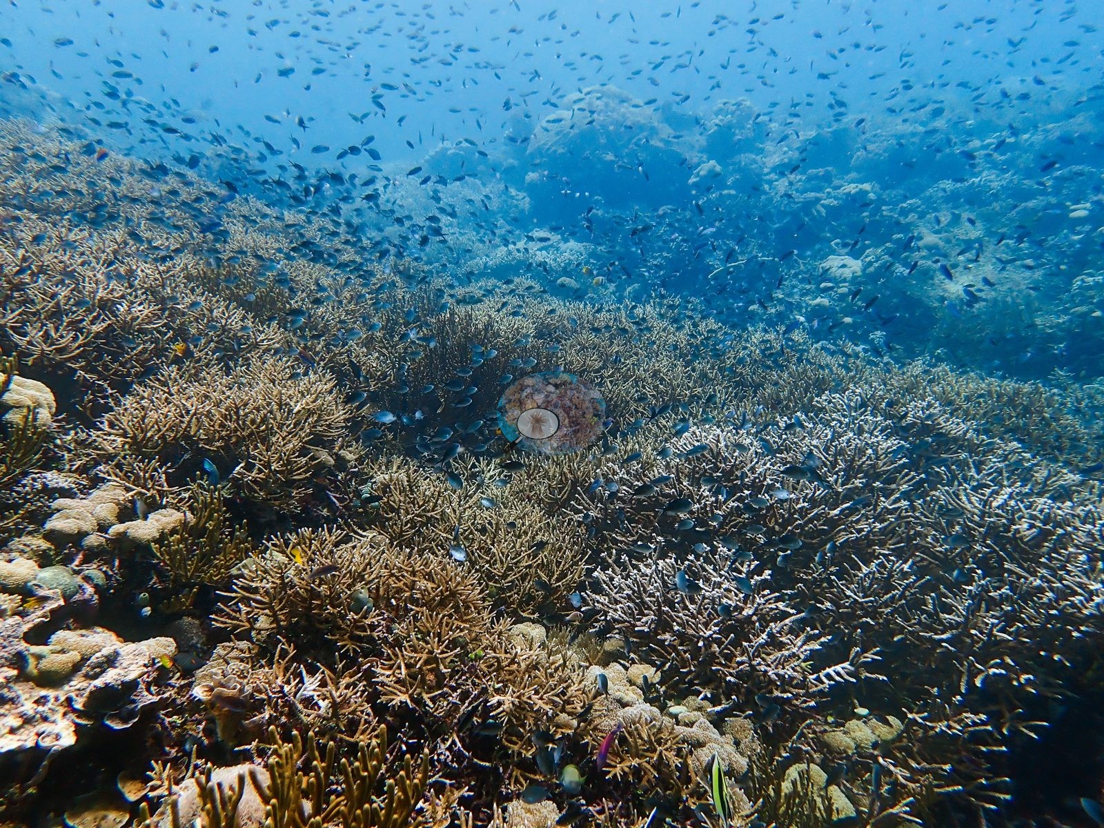
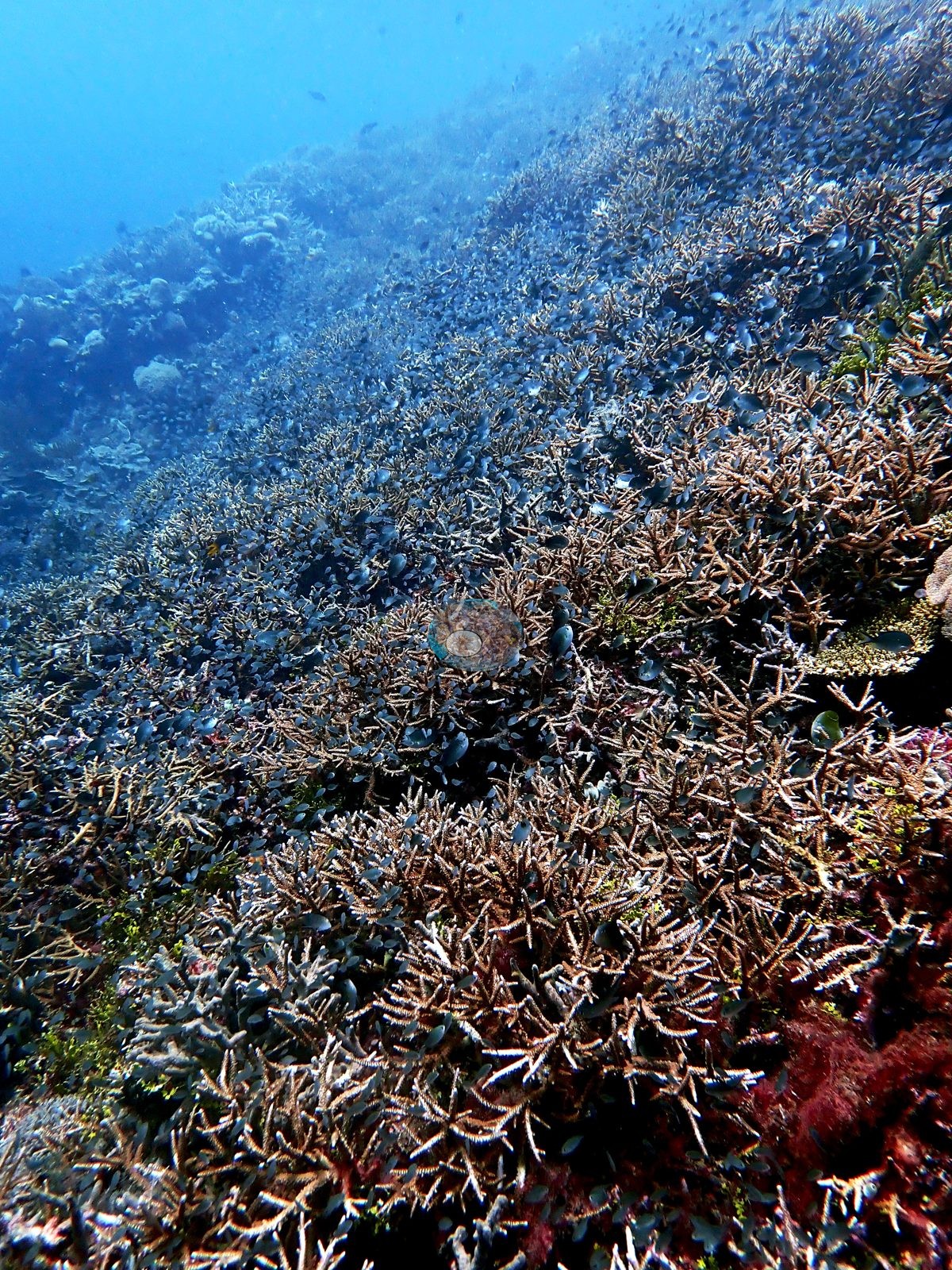
Timor-Leste (NOAA CRW virtual station) · Lesser Sunda ecoregion mean=6.9°C-heating weeksAn Atauro site dived by day and after dark, with two faces: a steep shoulder of plating corals, leather soft corals, and a yellow feather star, and broad slopes carpeted edge to edge in staghorn Acropora. The standout is the fish density, with thousands of small blue damselfish hovering over the thickets.
Twelve independent survey stations shown with the program’s logo — click one to see how far it is from this site.
Seven other CRD dive sites within 5 km shown in orange — click a marker to open its page.
Site description
General benthic features
The daylight frames show two distinct faces of the site. One is a steep reef shoulder falling into deep blue, and it is dominated not by branching coral but by foliose and plating growth: overlapping gray-tan scrolling plates, a pink-mauve encrusting colony, dark massive lobed heads, a large gray lobed leather soft coral on the right edge, an orange sponge, red encrusting sponges, a yellow-armed feather star perched on a mound, and appreciable maroon and green algal turf between colonies (e.g., Image 1).
The other three are the coral-rich face: broad slopes carpeted edge-to-edge in tan staghorn and corymbose Acropora, with a pale scrolling foliose colony and cream soft corals in the foreground, a tan lobed leather soft coral on the skyline, and thousands of small dark-blue damselfishes hovering over the thickets and out into the water column — the fish density is the single most striking feature of the day set (e.g., Image 2, Image 3, Image 4).
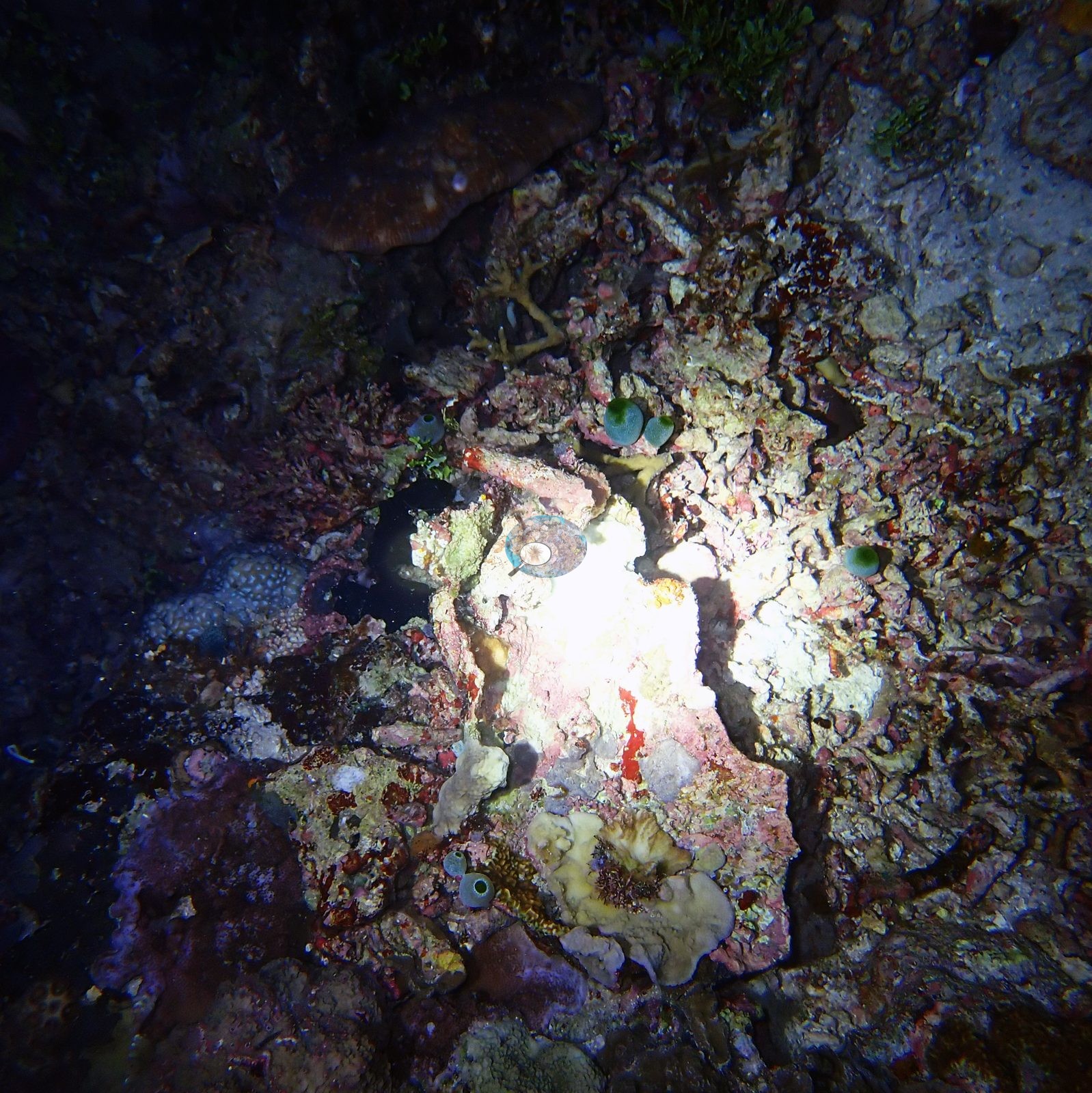
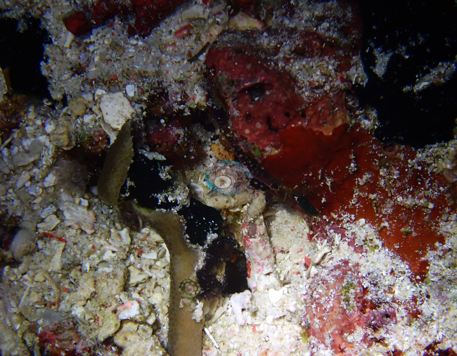
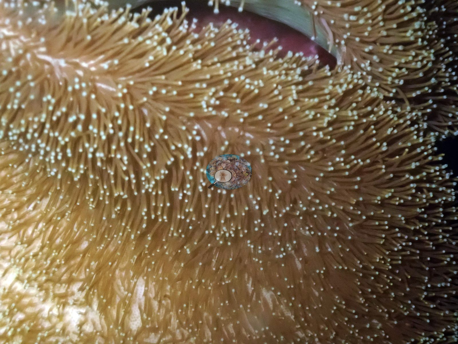
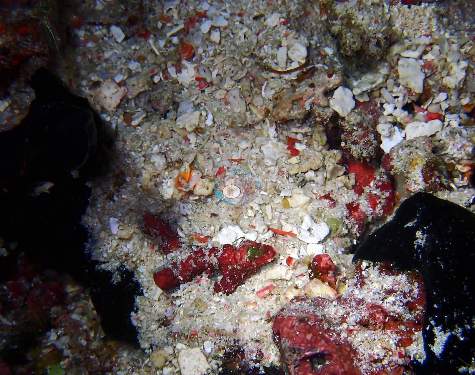
The night frames document the interstitial reef instead: a coralline-crusted rubble pavement with several teal colonial tunicates, small blue-gray coral heads, a brown plating coral, and a cream lobed leather soft coral; a coarse rubble-and-shell-hash floor with vivid red encrusting sponges and a shrimp; and one macro of a leather soft coral with its golden, white-tipped polyps fully expanded in night feeding posture (e.g., Image 5, Image 6, Image 7, Image 8).
Coral cover
Coral cover: 41% — a blind Claude computer-vision point count of 183 of Anderson's edited photographs (20 points per photo; water, fish, and obstructions excluded). Other computer-vision methods are listed in the method table.
Stressors
No bleaching, disease lesion, predation scar, transect tape, or man-made object appears in any of the eight frames — one strobe-blown white patch in a night frame is camera overexposure, not bleached tissue, and should not be read as one.
Fish and other fauna
Butterflyfish, anthias, and small wrasses appear at the margins; red crustose coralline crusts the flanks.
Comparisons with other data
Also on record for this site: The two accounts are on the separate day and night markers below. Large sections of the gallery show coral-rich framework with relatively little open sand, although lower-cover ledges and shaded crevices interrupt the gardens. The fauna visible in the selections includes small reef fishes and a distinctive black dorid nudibranch with pale, lavender-tinged tubercles. Coral form and color vary strongly over short distances, giving the photographed reef a layered appearance. The images support a high-complexity mixed-coral characterization consistent with the model estimate. These are a real, photographer-flagged pattern at Haruine, not an isolated frame.
Dive record
Haruine was dived by day and again after dark, on 30-31 January 2024 — the logged daylight dive was 66 minutes to 20.4 m maximum and 11.0 m average, minimum water temperature 27.2°C (lifetime dive 253).
CV model comparison
More info
DINOv3 and CoralSCOP were run on the same photos and are listed for comparison. Coralscapes v2 and v1 were also run but are not shown: Anderson does not consider Coralscapes reliable for these photos. No diver transect exists for this trip, so agreement between the rows is not accuracy, and as of September 2026 no computer-vision method estimates coral cover accurately on new images; treat every row as indicative.| Method | Hard-coral cover (%) |
|---|---|
| In-house DINOv3 | 35.6 |
| CoralSCOP edited | 38.7 |
| Claude (edited photos) | 41.1 |
Dive history
| Date | Time in | Max depth (m) | Bottom time (min) |
|---|---|---|---|
| 2024-01-30 | 10:46 | 20.4 | — |
| 2024-01-31 | — | 19.5 | — |
Independent surveys nearby
| Agency / program | Year(s) | Stations / distance | Link |
|---|---|---|---|
| Coral Triangle Center (CTC) | 2017 | 3 stations, 0.58–3.44 km | Records ↓ |
| Reef Check | 2004–2017 | 6 stations, 0.67–4.72 km | Records ↓ |
| XL Catlin Seaview Survey | 2014 | 3 stations, 0.61–4.98 km | Records ↓ |
 Dr. Coral (CRD)Year-average (no detectable trend)
Within 5 km, 12 independent survey stations recorded hard coral cover in 29 records between 2004 and 2017. The most recent nearby survey is from 2017, so these values predate recent heat stress. This site's own estimate (41%) sits within the range of these surveys (13–65%); the methods differ, so the comparison is context, not a like-for-like test.
Collected by other programs using different methods (Reef Check uses point-intercept transects; the XL Catlin Seaview Survey uses photo-transects with automated image annotation), so these are context for the figures above, not a like-for-like comparison. Where a station was surveyed more than once the range is shown. Station names are not dive-site names.
Show all 12 independent survey records
| Agency | Site / location | Date | Hard coral cover (%) | Distance | Link |
|---|---|---|---|---|---|
| Reef Check | South of Tanjung Reta | 2004 | 33% (2 surveys) | 2.93 km | — |
| Reef Check | North of Tanjung Reta | 2004 | 44% (2 surveys) | 4.72 km | — |
| XL Catlin Seaview Survey | transect 30015 | 2014 | 21% | 0.61 km | — |
| XL Catlin Seaview Survey | transect 30014 | 2014 | 17% | 1.40 km | — |
| XL Catlin Seaview Survey | transect 30013 | 2014 | 13% | 4.98 km | — |
| Coral Triangle Center (CTC) | Beloi (10) | 2017 | 49% (8 surveys) | 0.58 km | Currier K, Marine P, Welly M. 2017. Atauro Island MPA. MERMAID |
| Reef Check | Haru ina | 2017 | 53% (2 surveys) | 0.67 km | — |
| Coral Triangle Center (CTC) | Outer Reef (09) | 2017 | 41% (7 surveys) | 0.75 km | Currier K, Marine P, Welly M. 2017. Atauro Island MPA. MERMAID |
| Reef Check | Rai keta tungu | 2017 | 65% | 1.27 km | — |
| Reef Check | Rai keta rala | 2017 | 39% | 1.95 km | — |
| Reef Check | Watu ai | 2017 | 49% | 1.96 km | — |
| Coral Triangle Center (CTC) | Vila (11) | 2017 | 36% (2 surveys) | 3.44 km | Currier K, Marine P, Welly M. 2017. Atauro Island MPA. MERMAID |
Data & links
All images from Coral Reef Diagnostics. Data are from Coral Reef Diagnostics and the organizations named in the data-sources table above.
© Coral Reef Diagnostics.