

Atauro - Haruine night dive

Part of the regional summary: Timor-Leste
More info
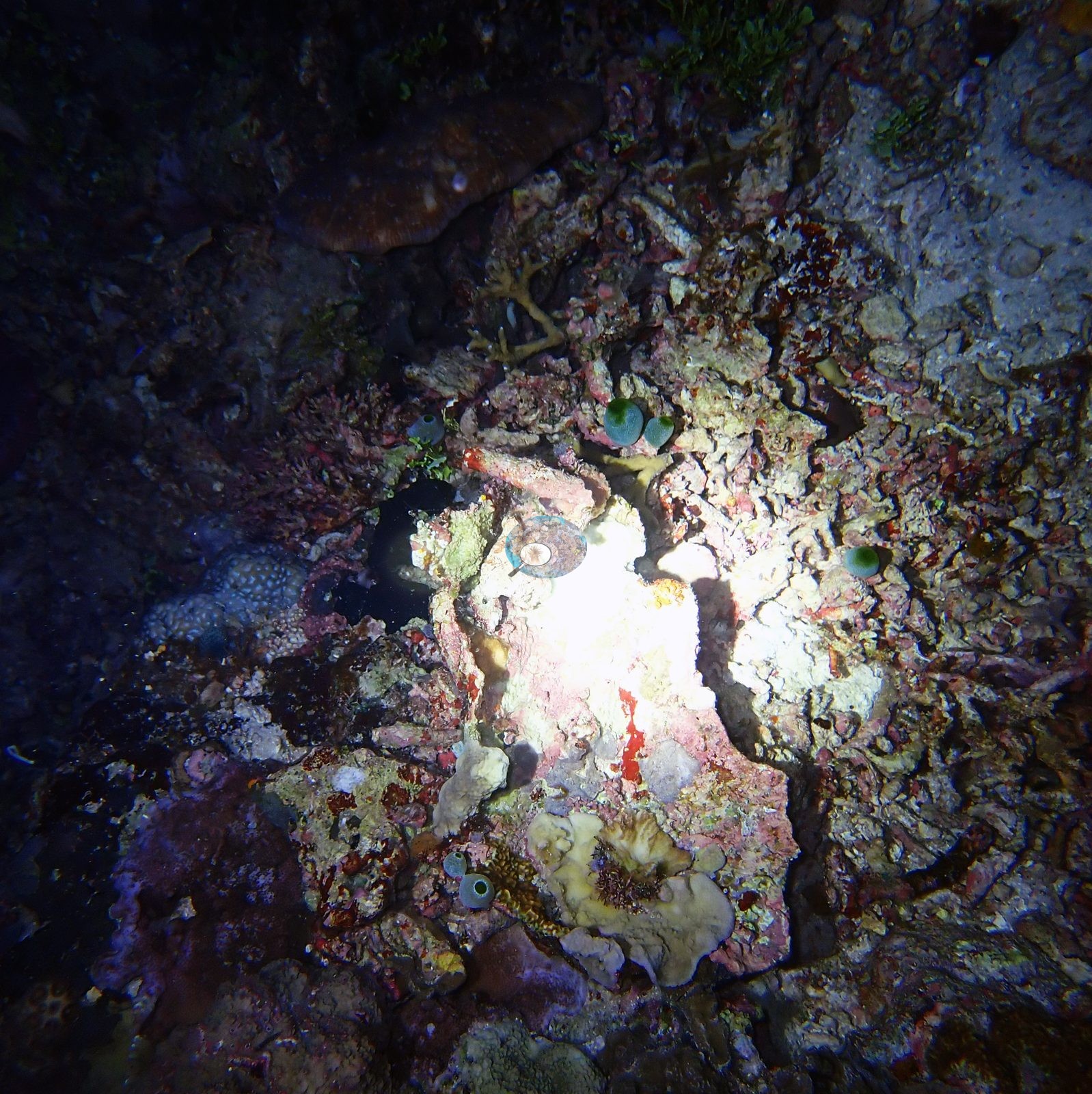
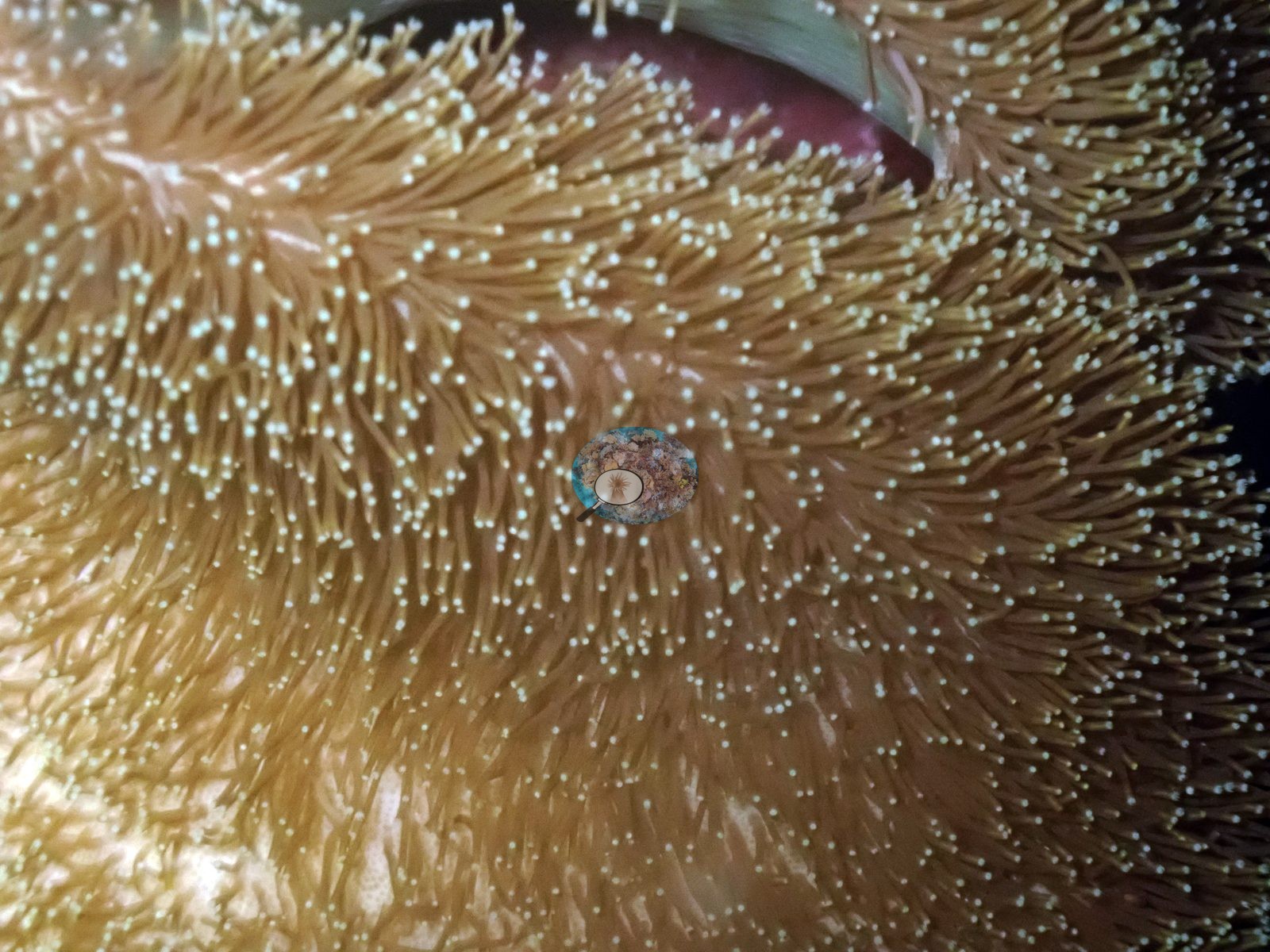
Timor-Leste (NOAA CRW virtual station)A night dive at Haruine, Atauro, on 31 January 2024, over a coralline-crusted rubble pavement with teal colonial tunicates, small coral heads, and leather soft corals with their polyps fully expanded to feed. One ridged foliose colony looked possibly bleached across about half its surface.
Mergullu kalan iha Haruine, Atauro, iha 31 Janeiru 2024, iha pavimentu rahun ne'ebé taka ho alga koralina, ho tunikadu kolonial kór-azul-matak (teal), ulun ahu-ruin ki'ik sira, no ahu-ruin mamar tipu kouru (leather soft corals) ne'ebé loke sira-nia pólipu tomak atu han. Kolónia folioza (foliose) ida ho rida sira (ridged) hatudu katak karik sai mutin (bleached) iha besik metade husi ninia superfísie.
AI translation of this summary; the English is authoritative. (low confidence)
Twelve independent survey stations shown with the program’s logo — click one to see how far it is from this site.
Eight other CRD dive sites with their own pages within 5 km shown in orange — click a marker to open its page.
Site description
General benthic features
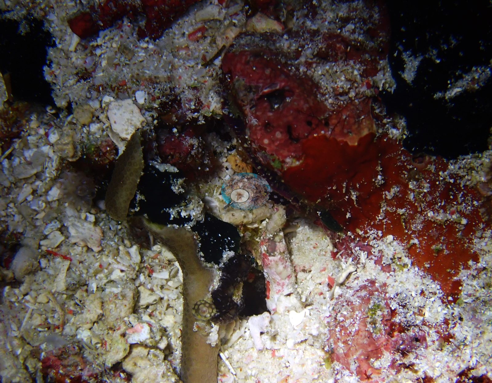
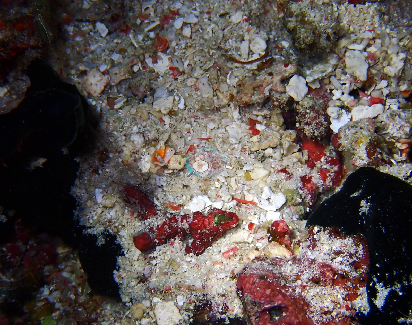
The night frames document the interstitial reef: a coralline-crusted rubble pavement with several teal colonial tunicates, small blue-gray coral heads, a brown plating coral, and a cream lobed leather soft coral; a coarse rubble-and-shell-hash floor with vivid red encrusting sponges and a shrimp; and one macro of a leather soft coral with its golden, white-tipped polyps fully expanded in night feeding posture (e.g., Image 1, Image 2, Image 3, Image 4).
Coral cover
- Coral cover: not reported. This was a night dive, and its strobe-lit frames of rubble pavement, small coral heads, and feeding polyps would measure the lit subject and the framing rather than reef cover; the daytime cover is on the Atauro - Haruine pin.
Stressors
On the night dive, one ridged foliose colony shows possible bleaching across about half its surface (one frame, Image 5): cream-white tissue with its ridges intact grades into brown pigmented tissue.
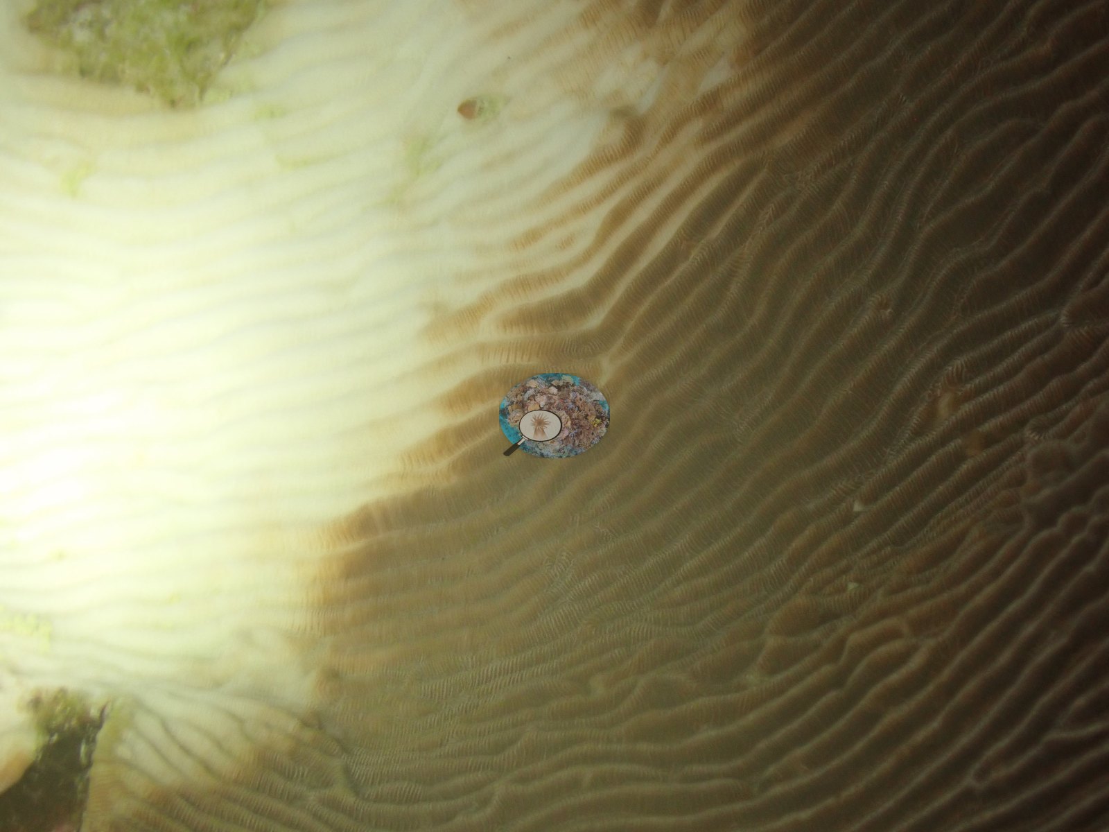
The pale rim on a neighboring foliose colony is a normal growth edge. In the gallery, one strobe-blown white patch in a night frame is camera overexposure, not bleached tissue (e.g., Image 1). No crown-of-thorns starfish (COTS) or other corallivores were evident.
Comparisons with other data
Reef Check surveyed this site (Haru ina) in 2017, 0.00 km from the pin. Within 5 km, twelve independent stations recorded station-year means of 13–65% hard coral cover between 2004 and 2017; the nearest, Reef Check at Haru ina, 0.00 km away, read 53% in 2017.
Dive record
The night dive was logged on 31 January 2024, in at 19:18 for 53 minutes, 19.5 m maximum and 9.5 m average depth, average water temperature 27.9°C (dive-computer minimum 26.7°C); the log row carries no site name.
Other notes
The daytime dive at the same site (30 January 2024) is on the Atauro - Haruine pin; a night dive and its daytime counterpart are kept on separate pins.
Independent surveys nearby
| Agency / program | Year(s) | Stations / distance | Link |
|---|---|---|---|
| Coral Triangle Center (CTC) | 2017 | 3 stations, 0.09–3.48 km | Records ↓ |
| Reef Check | 2004–2017 | 6 stations, 0.00–4.42 km | Records ↓ |
| XL Catlin Seaview Survey | 2014 | 3 stations, 0.89–4.71 km | Records ↓ |
Within 5 km, 12 independent survey stations recorded hard coral cover in 15 surveys between 2004 and 2017. The most recent nearby survey is from 2017, so these values predate recent heat stress.
Collected by other programs using different methods (Reef Check uses point-intercept transects; the XL Catlin Seaview Survey uses photo-transects with automated image annotation), so these are context for the figures above, not a like-for-like comparison. Where a station was surveyed more than once, the cell shows either the range of its values or, as a single value, the mean of surveys made in one year. Station names are not dive-site names.
Show all 15 independent surveys
| Agency | Site / location | Date | Hard coral cover (%) | Distance | Link |
|---|---|---|---|---|---|
| Reef Check | South of Tanjung Reta | 2004 | 33%, mean of 2 surveys (5.8 m and 12 m) | 2.63 km | — |
| Reef Check | North of Tanjung Reta | 2004 | 44%, mean of 2 surveys (7.1 m and 13 m) | 4.42 km | — |
| XL Catlin Seaview Survey | transect 30015 | 2014 | 21% | 0.89 km | doi:10.14264/uql.2019.930 |
| XL Catlin Seaview Survey | transect 30014 | 2014 | 17% | 1.13 km | doi:10.14264/uql.2019.930 |
| XL Catlin Seaview Survey | transect 30013 | 2014 | 13% | 4.71 km | doi:10.14264/uql.2019.930 |
| Reef Check | Haru ina | 2017 | 53%, mean of 2 surveys (9 m and 16 m) | 0.00 km | — |
| Coral Triangle Center (CTC) | Outer Reef (09) | 2017 | 41% | 0.09 km | Currier K, Marine P, Welly M. 2017. Atauro Island MPA. MERMAID |
| Coral Triangle Center (CTC) | Beloi (10) | 2017 | 49% | 0.81 km | Currier K, Marine P, Welly M. 2017. Atauro Island MPA. MERMAID |
| Reef Check | Rai keta tungu | 2017 | 65% | 1.40 km | — |
| Reef Check | Rai keta rala | 2017 | 39% | 2.05 km | — |
| Reef Check | Watu ai | 2017 | 49% | 2.08 km | — |
| Coral Triangle Center (CTC) | Vila (11) | 2017 | 36% | 3.48 km | Currier K, Marine P, Welly M. 2017. Atauro Island MPA. MERMAID |
Data & links
All images from Coral Reef Diagnostics. Data on this page are from Coral Reef Diagnostics (the dive record) and the organizations named in the data sources above; Coral Reef Diagnostics has no coral cover estimate of its own at this site.
© Coral Reef Diagnostics.