

Atauro - Cabbage Patch

Part of the regional summary: Timor-Leste
More info
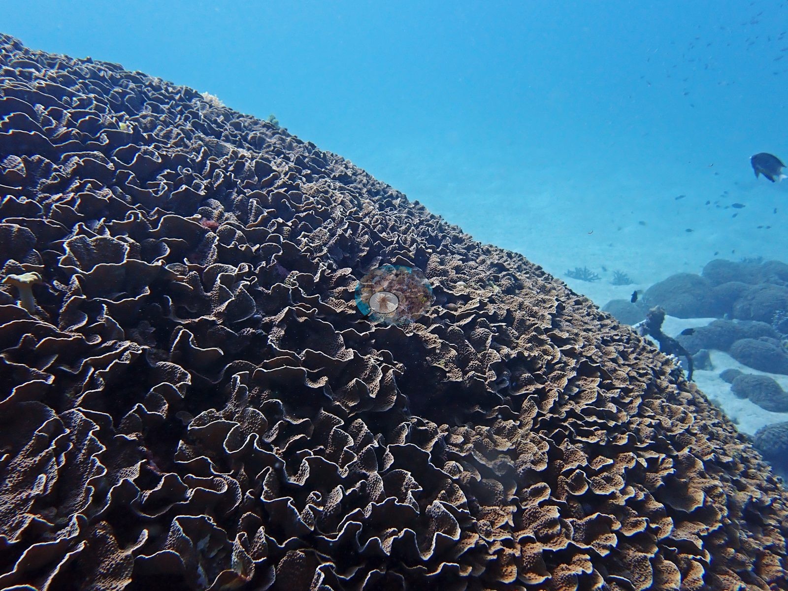
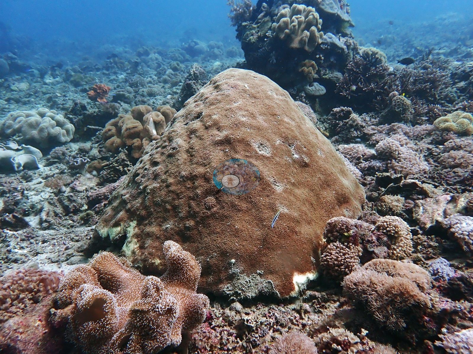
Timor-Leste (NOAA CRW virtual station) · Lesser Sunda ecoregion mean=6.9°C-heating weeksA shallow Atauro site named for its colossal foliose coral, a dome of tightly folded brown-and-tan plates, set on a sand slope with scattered Porites heads and a mixed garden of pink Pocillopora, brain corals, and leather soft corals. One large Porites dome shows recent tissue loss around its base.
Eleven independent survey stations shown with the program’s logo — click one to see how far it is from this site.
Six other CRD dive sites within 5 km shown in orange — click a marker to open its page.
Site description
Setting
Water is bright blue and visibility excellent; a surgeonfish and several chromis pass above.
General benthic features
The first is a single colossal foliose colony filling three-quarters of the frame — a dome of tightly folded, whorled, beaded plates in dark brown and tan, the classic "cabbage" growth form — with a black feather star on its flank, a small pale soft coral at the base, and beyond it a pale sand slope carrying scattered gray-brown massive lobate Porites heads and one broken Acropora branch lying on the sand (e.g., Image 1).
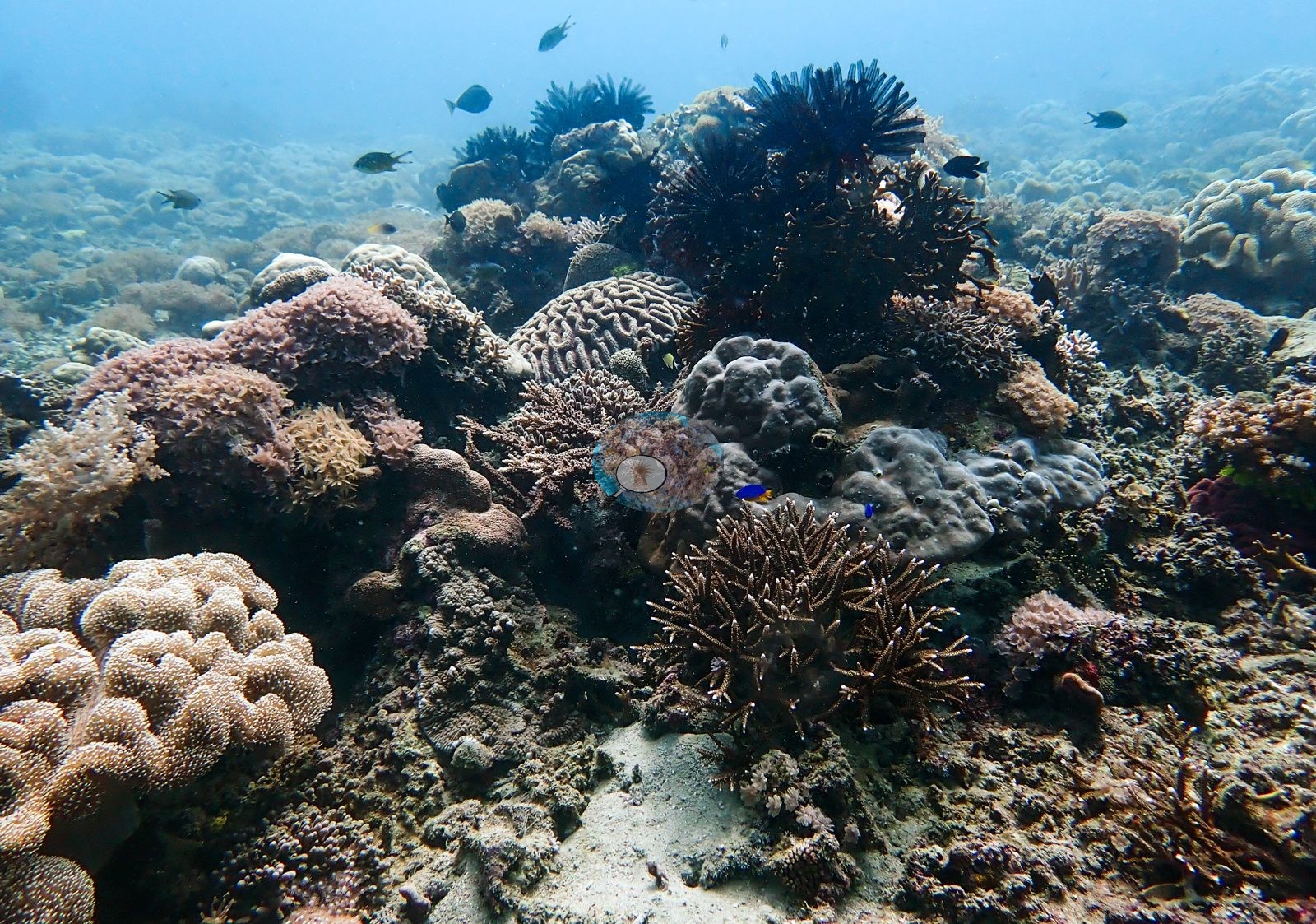
The second frame is a mixed shallow garden on rubble and sand: pale pink corymbose Pocillopora-like colonies, cream lobed leather soft corals, a gray-brown maze-patterned Platygyra, gray lumpy encrusting masses, tan fine-branching colonies, several large dark blue-black feather stars perched high on the framework, a vivid blue-and-yellow damselfish, and a smaller blue damsel, with open sand between the coral clumps (e.g., Image 2).
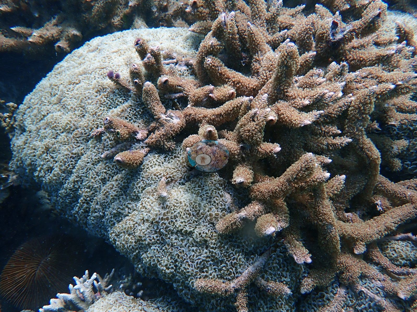
The fourth is a close view of a dome of pale cream, tightly curled fleshy polyps (a euphylliid, bubble- or anchor-coral type) pressed against a tan branching Acropora with its polyps fully extended, a brown mushroom coral (fungiid) at the lower edge (e.g., Image 4).
Growth-form variety across four frames is high — foliose, massive, corymbose, branching, fleshy euphylliid, and soft coral — but so is open sand and rubble; this is a heterogeneous garden, not a continuous carpet.
Coral cover
Coral cover: 37% — a blind Claude computer-vision point count of 115 of Anderson's edited photographs (20 points per photo; water, fish, and obstructions excluded). Other computer-vision methods are listed in the method table.
Stressors
The third is the most informative on condition: a large dome of massive Porites, fine-corallite and tan, with pale abraded patches on its upper surface and a strip of exposed white skeleton around part of its base — recent basal tissue loss, not bleaching of the whole colony — attended by a small blue-and-white cleaner-wrasse-type fish, and flanked by a big pink-mauve lobed leather soft coral with polyps expanded, mauve corymbose colonies, an orange sponge, and pale gray lobed soft corals on sediment-dusted rubble behind (e.g., Image 3).
No crown-of-thorns starfish (COTS) or other corallivores evident.
Comparisons with other data
Also on record for this site: In the strongest wide-angle views, a single mound occupies most of the frame and supports small reef fishes above and around its rim. The photographs support the descriptive name without requiring a species-level identification of the dominant foliose coral.
Dive record
Cabbage Patch was dived on 31 January 2024, a shallow profile to 14.6 m maximum and 7.6 m average, and the frames justify the name.
CV model comparison
More info
DINOv3 and CoralSCOP were run on the same photos and are listed for comparison. Coralscapes v2 and v1 were also run but are not shown: Anderson does not consider Coralscapes reliable for these photos. No diver transect exists for this trip, so agreement between the rows is not accuracy, and as of September 2026 no computer-vision method estimates coral cover accurately on new images; treat every row as indicative.| Method | Hard-coral cover (%) |
|---|---|
| In-house DINOv3 | 30.7 |
| CoralSCOP edited | 37.6 |
| Claude (edited photos) | 37.2 |
Independent surveys nearby
| Agency / program | Year(s) | Stations / distance | Link |
|---|---|---|---|
| Coral Triangle Center (CTC) | 2017 | 3 stations, 0.29–2.71 km | Records ↓ |
| Reef Check | 2004–2017 | 6 stations, 0.56–4.57 km | Records ↓ |
| XL Catlin Seaview Survey | 2014 | 2 stations, 0.21–2.11 km | Records ↓ |
 Dr. Coral (CRD)Year-average (no detectable trend)
Within 5 km, 11 independent survey stations recorded hard coral cover in 29 records between 2004 and 2017. The most recent nearby survey is from 2017, so these values predate recent heat stress. This site's own estimate (37%) sits within the range of these surveys (17–65%); the methods differ, so the comparison is context, not a like-for-like test.
Collected by other programs using different methods (Reef Check uses point-intercept transects; the XL Catlin Seaview Survey uses photo-transects with automated image annotation), so these are context for the figures above, not a like-for-like comparison. Where a station was surveyed more than once the range is shown. Station names are not dive-site names.
Show all 11 independent survey records
| Agency | Site / location | Date | Hard coral cover (%) | Distance | Link |
|---|---|---|---|---|---|
| Reef Check | South of Tanjung Reta | 2004 | 33% (2 surveys) | 3.65 km | — |
| XL Catlin Seaview Survey | transect 30015 | 2014 | 21% | 0.21 km | — |
| XL Catlin Seaview Survey | transect 30014 | 2014 | 17% | 2.11 km | — |
| Coral Triangle Center (CTC) | Beloi (10) | 2017 | 49% (8 surveys) | 0.29 km | Currier K, Marine P, Welly M. 2017. Atauro Island MPA. MERMAID |
| Reef Check | Rai keta tungu | 2017 | 65% | 0.56 km | — |
| Reef Check | Haru ina | 2017 | 53% (2 surveys) | 1.10 km | — |
| Coral Triangle Center (CTC) | Outer Reef (09) | 2017 | 41% (7 surveys) | 1.18 km | Currier K, Marine P, Welly M. 2017. Atauro Island MPA. MERMAID |
| Reef Check | Watu ai | 2017 | 49% | 1.21 km | — |
| Reef Check | Rai keta rala | 2017 | 39% | 1.21 km | — |
| Coral Triangle Center (CTC) | Vila (11) | 2017 | 36% (2 surveys) | 2.71 km | Currier K, Marine P, Welly M. 2017. Atauro Island MPA. MERMAID |
| Reef Check | Vila South | 2017 | 25% (3 surveys) | 4.57 km | — |
Data & links
All images from Coral Reef Diagnostics. Data are from Coral Reef Diagnostics and the organizations named in the data-sources table above.
© Coral Reef Diagnostics.