
NOAA - East Flower Garden Bank, Buoy 3
2019-06-04
More info
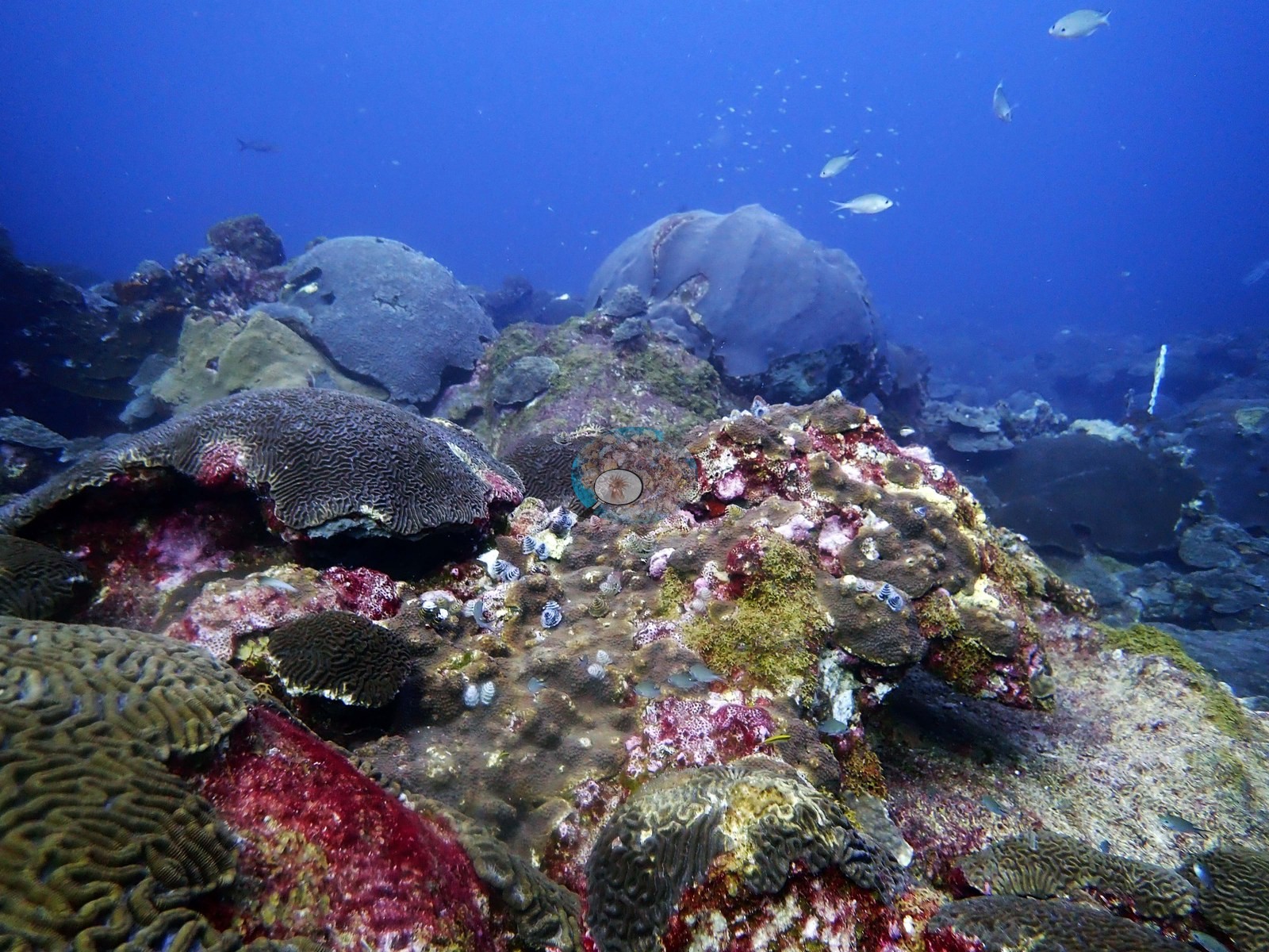
Flower Garden Banks, Texas (NOAA CRW virtual station)A coral-capped salt-dome bank 180 km off Galveston where mounding Montastraea/Orbicella heads and brain corals cover roughly half the bottom; in June 2019 Anderson photographed fresh tissue loss on several brain colonies, parrotfish bite scars, and a lionfish. NOAA's 2024 survey puts coral cover at 50%, compared with 59% on the NOAA NCRMP chain-intercept transects of June 2019.
151 independent survey stations shown with the program’s logo — click one to see how far it is from this site.
Site description
Setting
This is the highlight reel from two days of diving (3-4 June 2019) on the East Flower Garden Bank, a coral-capped salt dome roughly 180 km off Galveston; the NOAA NCRMP carbonate-budget chain-intercept transects run on 3 June 2019 (by Anderson and A. Kirkland) averaged 59% living stony coral.
General benthic features
The published frames show the survey work and the top of the bank: a diver laying a transect tape (e.g., Image 1), the tape running over mounding Montastraea/Orbicella heads and finely ridged brain corals (e.g., Image 2, Image 3), and wide views of the top of the bank crowded with mounding colonies (e.g., Image 4, Image 5).
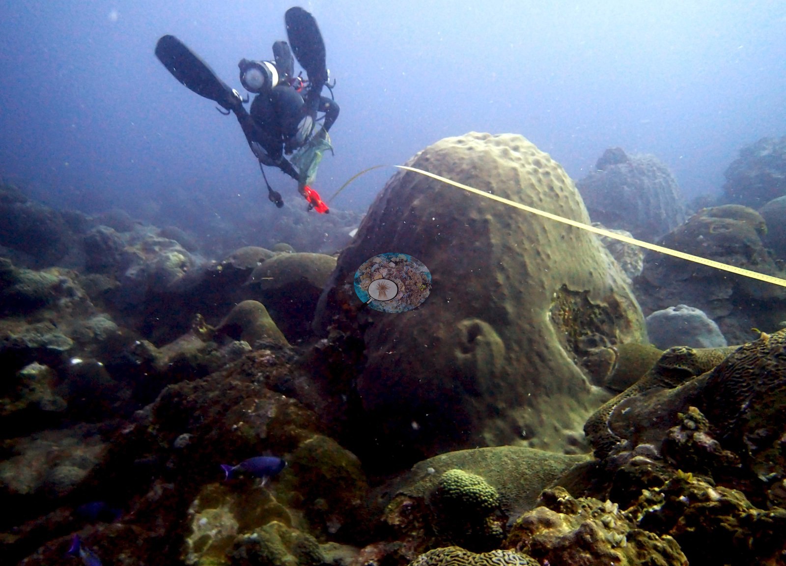
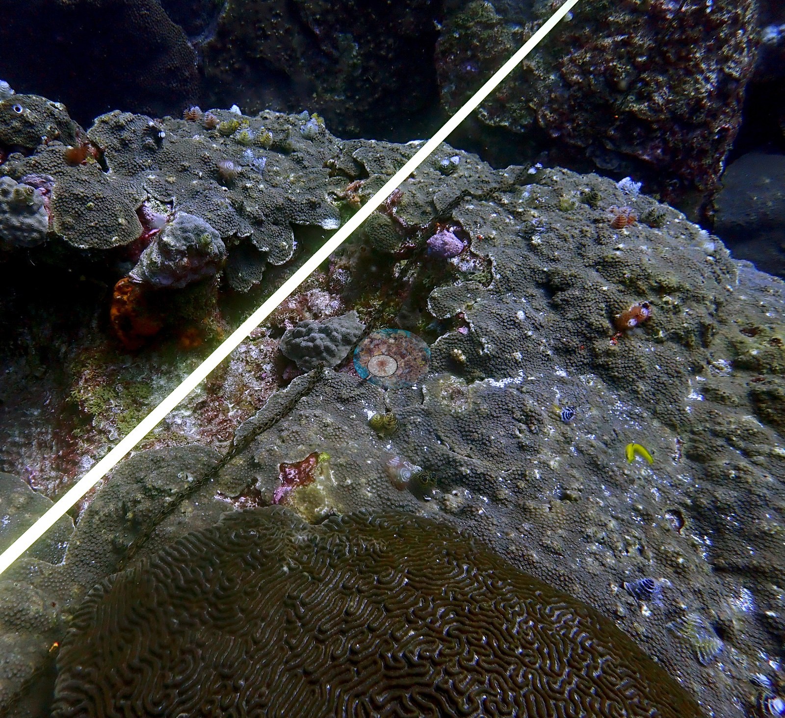
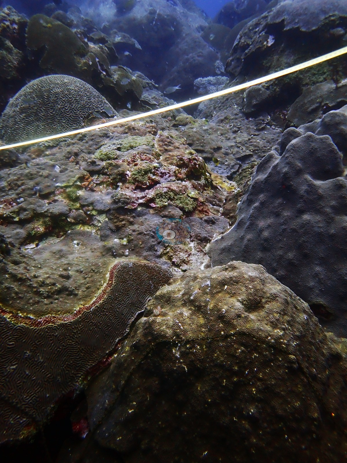
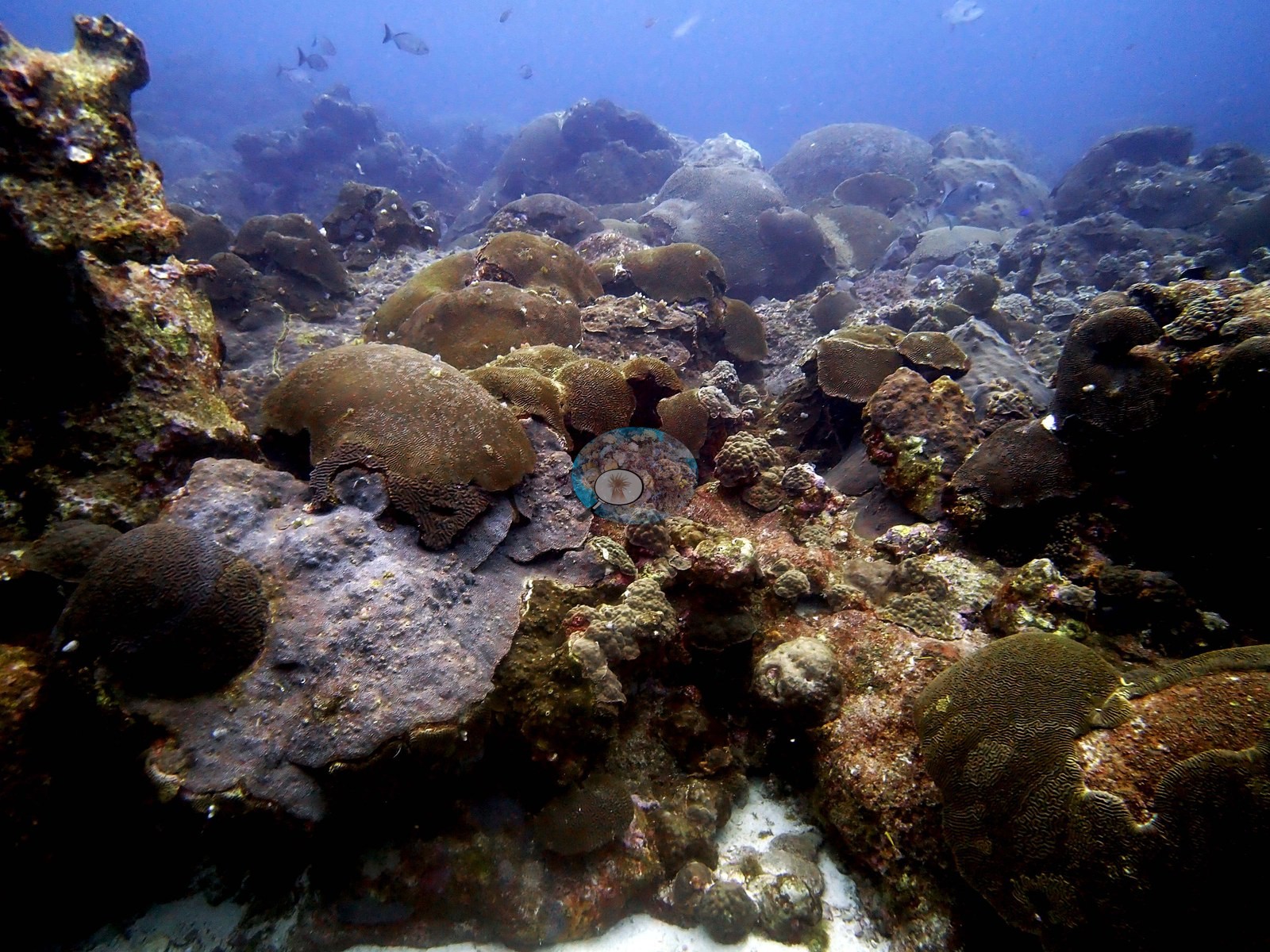
A large Orbicella faveolata dome carries two small, rounded excavations compatible with boring or predation scars.
Coral cover
- Coral cover: 50% ± 14% SD (median 52%) in July 2024 on NOAA's 16 random photo transects at the East Flower Garden Bank long-term monitoring study site, 0.3 km from this pin (O'Connell et al. 2026).
- The NOAA NCRMP carbonate-budget chain-intercept survey on 3 June 2019 (6 transects, run by Anderson and A. Kirkland) read 59% ± 14% SD. 2023 and 2024 were the first consecutive years of coral bleaching recorded at the sanctuary (O'Connell et al. 2026).
- For comparison only, a blind Claude computer-vision point count of 148 of Anderson's 2019 photographs reads 51%.
- NOAA FGBNMS long-term monitoring reports: 2024, 2023, 2022.
Stressors
On the 4 June 2019 dives Anderson photographed fresh white tissue loss (bare white skeleton within dark live tissue) on several brain colonies, recorded as disease and an unidentified ailment. Fresh white bite scars on brain and massive colonies appear in frames where Anderson recorded corallivory, including parrotfish bites. A lionfish, an invasive Indo-Pacific species, was seen on the reef.
Fish and other fauna
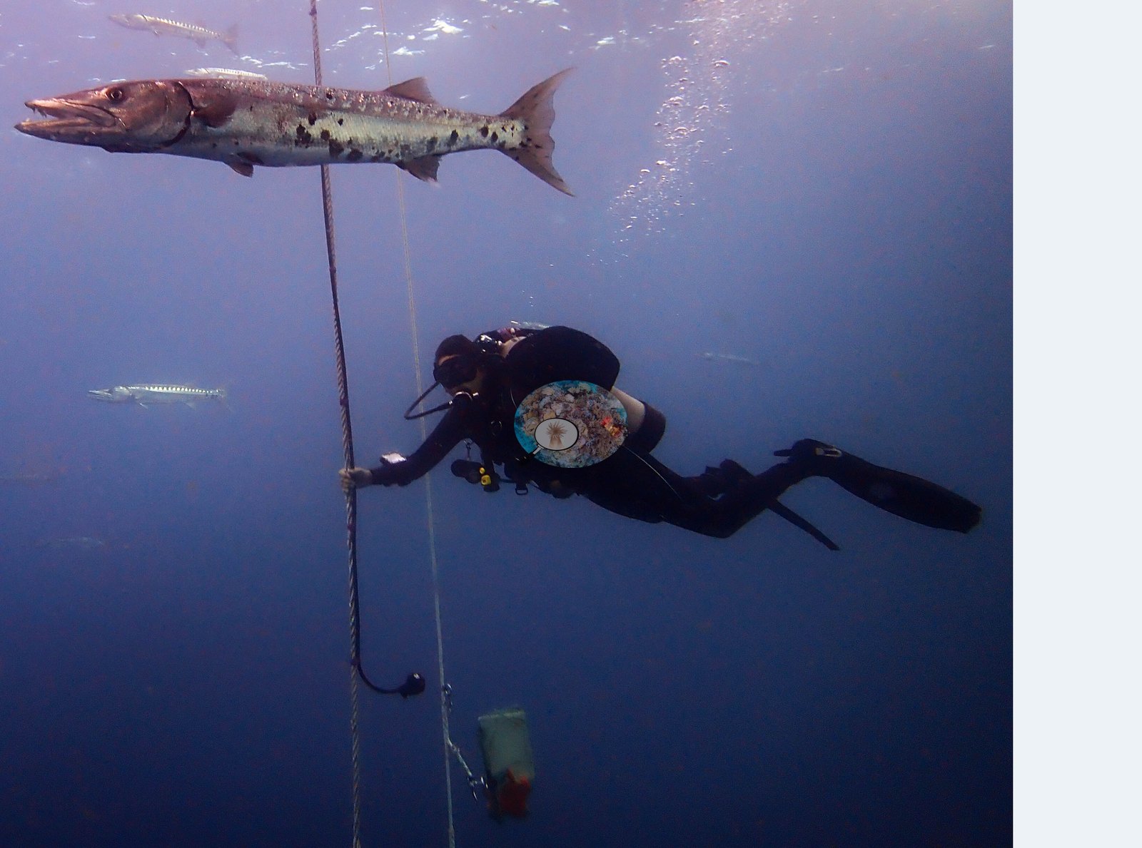
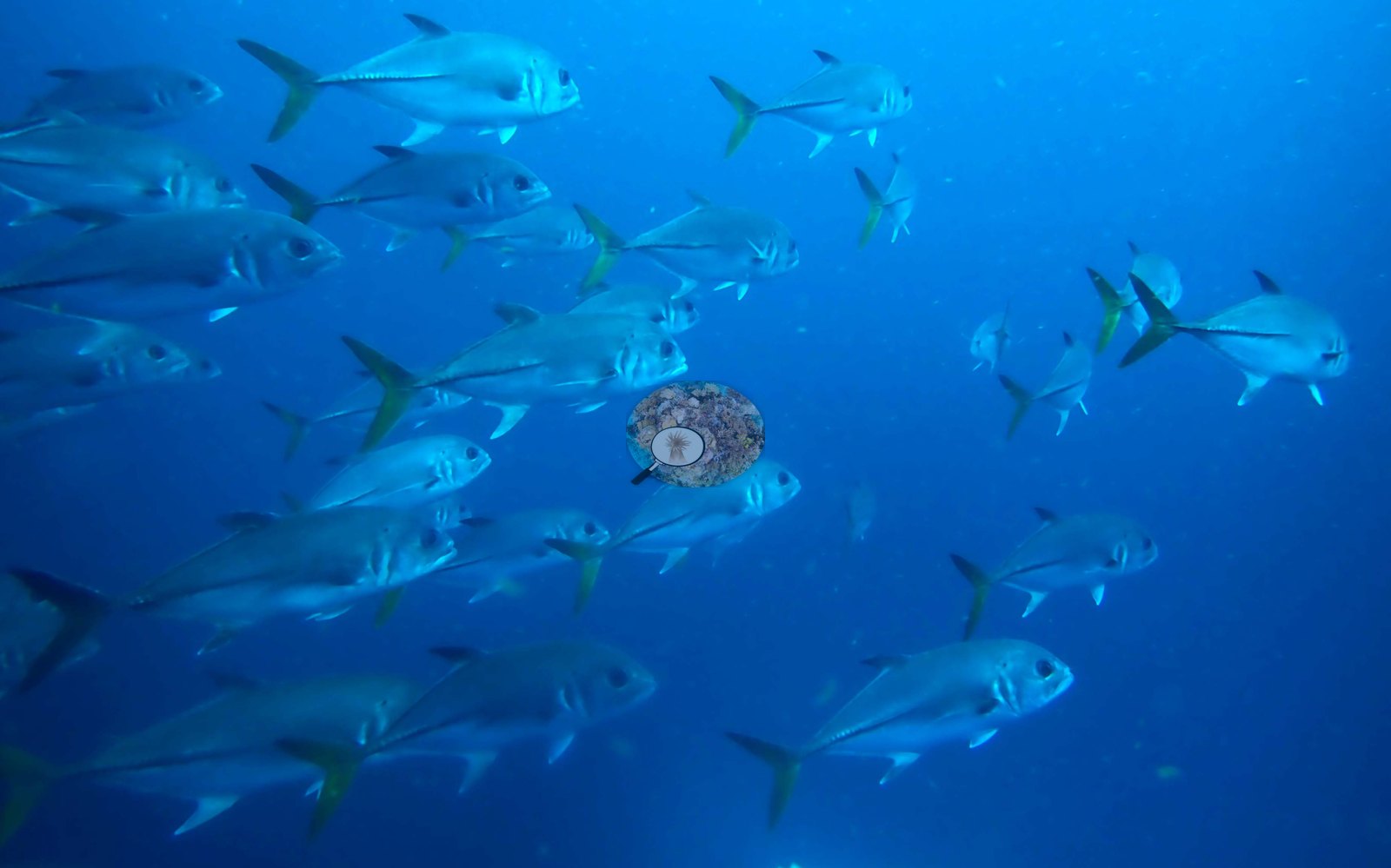
Anderson's log for the second dive on 3 June notes 'tons of large barracuda and giant trevally', and the other frames from the two days show a barracuda beside a teammate (e.g., Image 6) and a school of jacks over the bank top (e.g., Image 7).
Comparisons with other data
NOAA NCRMP Flower Garden Banks surveyed this site (GOM PSU 7404-1) in 2018, 0.02 km from the pin. Within 5 km, 151 independent stations recorded station-year means of 1.7–94% hard coral cover between 2006 and 2024; the nearest, NOAA NCRMP Flower Garden Banks at GOM PSU 7404-1, 0.02 km away, read 61% in 2018.
CV model comparison
More info
Same site, June 2019 → July 2024: 59% → 50% (Same bank, different surveys: NOAA NCRMP 2019 carbonate-budget chain-intercept transects → NOAA FGBNMS 2024 random photo transects). 2019: 6 NOAA NCRMP carbonate-budget chain-intercept transects (June 2019; run by Anderson and A. Kirkland); 2024: 16 random photo transects at the NOAA study site. 2023 and 2024 were the first consecutive bleaching years recorded at the sanctuary (2024: 1.4% of coral cover bleached, 12.9% pale at the EFGB study site).More info
Anderson's 2019 chain-intercept survey is the earlier point; Claude and CoralSCOP on the 2019 photos are comparisons only, never averaged.| Method | Hard coral cover (%) | Photos (n) ± SE |
|---|---|---|
| NOAA FGBNMS transects, July 2024 (headline) | 50.4 | |
| Chain-intercept survey, June 2019 (earlier point) | 58.8 | |
| CoralSCOP edited | 57.7 | n = 148 · SE 2.1 |
| Claude (edited photos) | 50.9 | n = 148 · SE 1.8 |
The two computer-vision methods agree within 6.8 pp (50.9–57.7%) and read 0.5–7.3 pp above the in-water transect (50.4%); the headline is the in-water transect because a diver transect is independent of the photographs.
See a more detailed, stand-alone version of this table.
Dive history
| Date | Time in | Max depth (m) | Bottom time (min) |
|---|---|---|---|
| 2019-06-03 | 07:24 | 21.9 | 48 |
| 2019-06-03 | 10:22 | 21.9 | 52 |
| 2019-06-03 | 13:28 | 21.3 | 52 |
| 2019-06-04 | 07:11 | 21.3 | 61 |
| 2019-06-04 | 10:24 | 21.9 | 47 |
Independent surveys nearby
| Agency / program | Year(s) | Stations / distance | Link |
|---|---|---|---|
| NOAA NCCOS Caribbean & Gulf of Mexico surveys (pre-NCRMP) | 2006–2007 | 81 stations, 0.05–1.37 km | Records ↓ |
| NOAA NCRMP | 2013–2015 | 28 stations, 0.30–1.40 km | Records ↓ |
| NOAA NCRMP Flower Garden Banks | 2018–2024 | 42 stations, 0.02–1.25 km | Records ↓ |
Within 5 km, 151 independent survey stations recorded hard coral cover in 175 records between 2006 and 2024. Of the 19 stations surveyed in more than one year, 4 declined (by 6.0–31 points), 14 increased (by 2.0–41 points), and 1 changed by less than 1 point between their first and latest surveys. 19 stations share the longest span (2013–2015); one, FGBNMS-37 (NOAA NCRMP, 0.30 km away), went from 25% in 2013 to 37% in 2015. Since 2021, station-year means average 61% (range 47–69%; n = 15 station-years from 15 records); 10 best-patch values above 70% are left out, as they are not site means. This site's headline survey value (50%) sits within the recent range of station-year means (47–69%); the methods differ, so the comparison is context, not a like-for-like test.
Collected by other programs using different methods (NOAA rows come from NOAA monitoring programs (NCRMP, PIFSC, NCCOS), and each row's method is in its hover text), so these are context for the figures above, not a like-for-like comparison. Where a station was surveyed more than once, the cell shows either the range of its values or, as a single value, the mean of surveys made in one year. Station names are not dive-site names. Values above 70% are marked “best patch”: surveys often target the densest coral on a reef, so these may overstate the site as a whole.
Show all 175 independent survey records
| Agency | Site / location | Date | Hard coral cover (%) | Distance | Link |
|---|---|---|---|---|---|
| NOAA NCCOS Caribbean & Gulf of Mexico surveys (pre-NCRMP) | FGBCAP EB EBF89 (27.90831,-93.5991) | 2006 | 50% | 0.10 km | NCEI 0206670 |
| NOAA NCCOS Caribbean & Gulf of Mexico surveys (pre-NCRMP) | FGBCAP EB EBF81 (27.90835,-93.6002) | 2006 | 57% | 0.14 km | NCEI 0206670 |
| NOAA NCCOS Caribbean & Gulf of Mexico surveys (pre-NCRMP) | FGBCAP EB EBF67 (27.90602,-93.59996) | 2006 | 62% | 0.17 km | NCEI 0206670 |
| NOAA NCCOS Caribbean & Gulf of Mexico surveys (pre-NCRMP) | FGBCAP EB EBF57 (27.90639,-93.60068) | 2006 | 94% best patch | 0.18 km | NCEI 0206670 |
| NOAA NCCOS Caribbean & Gulf of Mexico surveys (pre-NCRMP) | FGBCAP EB EBF71 (27.90606,-93.59824) | 2006 | 77% best patch | 0.18 km | NCEI 0206670 |
| NOAA NCCOS Caribbean & Gulf of Mexico surveys (pre-NCRMP) | FGBCAP EB EBF51 (27.906,-93.6009) | 2006 | 47% | 0.22 km | NCEI 0206670 |
| NOAA NCCOS Caribbean & Gulf of Mexico surveys (pre-NCRMP) | FGBCAP EB EBF60 (27.90587,-93.60113) | 2006 | 45% | 0.25 km | NCEI 0206670 |
| NOAA NCCOS Caribbean & Gulf of Mexico surveys (pre-NCRMP) | FGBCAP EB EBF70 (27.9063,-93.59698) | 2006 | 79% best patch | 0.25 km | NCEI 0206670 |
| NOAA NCCOS Caribbean & Gulf of Mexico surveys (pre-NCRMP) | FGBCAP EB EBF76 (27.90607,-93.59718) | 2006 | 70% | 0.25 km | NCEI 0206670 |
| NOAA NCCOS Caribbean & Gulf of Mexico surveys (pre-NCRMP) | FGBCAP EB EBF66 (27.90676,-93.59672) | 2006 | 52% | 0.26 km | NCEI 0206670 |
| NOAA NCCOS Caribbean & Gulf of Mexico surveys (pre-NCRMP) | FGBCAP EB EBF83 (27.90638,-93.59662) | 2006 | 8.2% | 0.28 km | NCEI 0206670 |
| NOAA NCCOS Caribbean & Gulf of Mexico surveys (pre-NCRMP) | FGBCAP EB EBF64 (27.90804,-93.59638) | 2006 | 69% | 0.29 km | NCEI 0206670 |
| NOAA NCCOS Caribbean & Gulf of Mexico surveys (pre-NCRMP) | FGBCAP EB EBF69 (27.90937,-93.60111) | 2006 | 62% | 0.29 km | NCEI 0206670 |
| NOAA NCCOS Caribbean & Gulf of Mexico surveys (pre-NCRMP) | FGBCAP EB EBF77 (27.90974,-93.59796) | 2006 | 45% | 0.29 km | NCEI 0206670 |
| NOAA NCCOS Caribbean & Gulf of Mexico surveys (pre-NCRMP) | FGBCAP EB EBF50 (27.90471,-93.60023) | 2006 | 43% | 0.31 km | NCEI 0206670 |
| NOAA NCCOS Caribbean & Gulf of Mexico surveys (pre-NCRMP) | FGBCAP EB EBF45 (27.91015,-93.60016) | 2006 | 70% best patch | 0.32 km | NCEI 0206670 |
| NOAA NCCOS Caribbean & Gulf of Mexico surveys (pre-NCRMP) | FGBCAP EB EBF55 (27.90941,-93.59699) | 2006 | 72% best patch | 0.32 km | NCEI 0206670 |
| NOAA NCCOS Caribbean & Gulf of Mexico surveys (pre-NCRMP) | FGBCAP EB EBF58 (27.90624,-93.60224) | 2006 | 65% | 0.32 km | NCEI 0206670 |
| NOAA NCCOS Caribbean & Gulf of Mexico surveys (pre-NCRMP) | FGBCAP EB EBF62 (27.91038,-93.59974) | 2006 | 53% | 0.33 km | NCEI 0206670 |
| NOAA NCCOS Caribbean & Gulf of Mexico surveys (pre-NCRMP) | FGBCAP EB EBF80 (27.90742,-93.60266) | 2006 | 42% | 0.34 km | NCEI 0206670 |
| NOAA NCCOS Caribbean & Gulf of Mexico surveys (pre-NCRMP) | FGBCAP EB EBF63 (27.9077,-93.60278) | 2006 | 68% | 0.35 km | NCEI 0206670 |
| NOAA NCCOS Caribbean & Gulf of Mexico surveys (pre-NCRMP) | FGBCAP EB EBF72 (27.90427,-93.59926) | 2006 | 25% | 0.35 km | NCEI 0206670 |
| NOAA NCCOS Caribbean & Gulf of Mexico surveys (pre-NCRMP) | FGBCAP EB EBF43 (27.91069,-93.59984) | 2006 | 86% best patch | 0.37 km | NCEI 0206670 |
| NOAA NCCOS Caribbean & Gulf of Mexico surveys (pre-NCRMP) | FGBCAP EB EBF59 (27.90639,-93.60297) | 2006 | 15% | 0.38 km | NCEI 0206670 |
| NOAA NCCOS Caribbean & Gulf of Mexico surveys (pre-NCRMP) | FGBCAP EB EBF79 (27.9105,-93.60079) | 2006 | 45% | 0.38 km | NCEI 0206670 |
| NOAA NCCOS Caribbean & Gulf of Mexico surveys (pre-NCRMP) | FGBCAP EB EBF68 (27.90389,-93.59883) | 2006 | 33% | 0.39 km | NCEI 0206670 |
| NOAA NCCOS Caribbean & Gulf of Mexico surveys (pre-NCRMP) | FGBCAP EB EBS38 (27.90396,-93.59765) | 2006 | 22% | 0.41 km | NCEI 0206670 |
| NOAA NCCOS Caribbean & Gulf of Mexico surveys (pre-NCRMP) | FGBCAP EB EBF52 (27.90384,-93.59791) | 2006 | 1.7% | 0.42 km | NCEI 0206670 |
| NOAA NCCOS Caribbean & Gulf of Mexico surveys (pre-NCRMP) | FGBCAP EB EBF46 (27.91114,-93.60039) | 2006 | 48% | 0.43 km | NCEI 0206670 |
| NOAA NCCOS Caribbean & Gulf of Mexico surveys (pre-NCRMP) | FGBCAP EB EBF53 (27.90976,-93.60322) | 2006 | 60% | 0.47 km | NCEI 0206670 |
| NOAA NCCOS Caribbean & Gulf of Mexico surveys (pre-NCRMP) | FGBCAP EB EBF56 (27.90875,-93.60374) | 2006 | 49% | 0.47 km | NCEI 0206670 |
| NOAA NCCOS Caribbean & Gulf of Mexico surveys (pre-NCRMP) | FGBCAP EB EBF42 (27.9081,-93.60409) | 2006 | 23% | 0.48 km | NCEI 0206670 |
| NOAA NCCOS Caribbean & Gulf of Mexico surveys (pre-NCRMP) | FGBCAP EB EBS37 (27.91161,-93.59792) | 2006 | 13% | 0.49 km | NCEI 0206670 |
| NOAA NCCOS Caribbean & Gulf of Mexico surveys (pre-NCRMP) | FGBCAP EB EBF65 (27.9118,-93.59765) | 2006 | 44% | 0.51 km | NCEI 0206670 |
| NOAA NCCOS Caribbean & Gulf of Mexico surveys (pre-NCRMP) | FGBCAP EB EBF54 (27.91062,-93.60312) | 2006 | 60% | 0.52 km | NCEI 0206670 |
| NOAA NCCOS Caribbean & Gulf of Mexico surveys (pre-NCRMP) | FGBCAP EB EBS36 (27.91192,-93.59763) | 2006 | 31% | 0.53 km | NCEI 0206670 |
| NOAA NCCOS Caribbean & Gulf of Mexico surveys (pre-NCRMP) | FGBCAP EB EBF82 (27.91096,-93.60304) | 2006 | 54% | 0.54 km | NCEI 0206670 |
| NOAA NCCOS Caribbean & Gulf of Mexico surveys (pre-NCRMP) | FGBCAP EB EBF78 (27.91188,-93.60158) | 2006 | 92% best patch | 0.55 km | NCEI 0206670 |
| NOAA NCCOS Caribbean & Gulf of Mexico surveys (pre-NCRMP) | FGBCAP EB EBF74 (27.91069,-93.60373) | 2006 | 71% best patch | 0.57 km | NCEI 0206670 |
| NOAA NCCOS Caribbean & Gulf of Mexico surveys (pre-NCRMP) | FGBCAP EB EBS39 (27.91254,-93.59826) | 2006 | 28% | 0.58 km | NCEI 0206670 |
| NOAA NCCOS Caribbean & Gulf of Mexico surveys (pre-NCRMP) | FGBCAP EB EBF61 (27.91251,-93.60159) | 2006 | 70% best patch | 0.61 km | NCEI 0206670 |
| NOAA NCCOS Caribbean & Gulf of Mexico surveys (pre-NCRMP) | FGBCAP EB EBF47 (27.91301,-93.60043) | 2006 | 9.9% | 0.63 km | NCEI 0206670 |
| NOAA NCCOS Caribbean & Gulf of Mexico surveys (pre-NCRMP) | FGBCAP EB EBF49 (27.91303,-93.60107) | 2006 | 81% best patch | 0.65 km | NCEI 0206670 |
| NOAA NCCOS Caribbean & Gulf of Mexico surveys (pre-NCRMP) | FGBCAP EB EBF41 (27.91323,-93.60068) | 2006 | 28% | 0.66 km | NCEI 0206670 |
| NOAA NCCOS Caribbean & Gulf of Mexico surveys (pre-NCRMP) | FGBCAP EB EBF73 (27.9133,-93.60069) | 2006 | 57% | 0.67 km | NCEI 0206670 |
| NOAA NCCOS Caribbean & Gulf of Mexico surveys (pre-NCRMP) | FGBCAP EB EBF48 (27.91357,-93.60082) | 2006 | 58% | 0.70 km | NCEI 0206670 |
| NOAA NCCOS Caribbean & Gulf of Mexico surveys (pre-NCRMP) | FGBCAP EB EBS40 (27.91891,-93.60298) | 2006 | 69% | 1.33 km | NCEI 0206670 |
| NOAA NCCOS Caribbean & Gulf of Mexico surveys (pre-NCRMP) | FGBCAP EB EBF75 (27.91918,-93.60265) | 2006 | 78% best patch | 1.35 km | NCEI 0206670 |
| NOAA NCCOS Caribbean & Gulf of Mexico surveys (pre-NCRMP) | FGBCAP EB EBF44 (27.91956,-93.60177) | 2006 | 68% | 1.37 km | NCEI 0206670 |
| NOAA NCCOS Caribbean & Gulf of Mexico surveys (pre-NCRMP) | FGBCAP EB E1281 (27.90728,-93.59879) | 2007 | 69% | 0.05 km | NCEI 0206670 |
| NOAA NCCOS Caribbean & Gulf of Mexico surveys (pre-NCRMP) | FGBCAP EB E1340 (27.90683,-93.59827) | 2007 | 45% | 0.12 km | NCEI 0206670 |
| NOAA NCCOS Caribbean & Gulf of Mexico surveys (pre-NCRMP) | FGBCAP EB E1103 (27.90817,-93.60031) | 2007 | 48% | 0.13 km | NCEI 0206670 |
| NOAA NCCOS Caribbean & Gulf of Mexico surveys (pre-NCRMP) | FGBCAP EB E1218 (27.90592,-93.59929) | 2007 | 77% best patch | 0.16 km | NCEI 0206670 |
| NOAA NCCOS Caribbean & Gulf of Mexico surveys (pre-NCRMP) | FGBCAP EB E1278 (27.90592,-93.59878) | 2007 | 46% | 0.17 km | NCEI 0206670 |
| NOAA NCCOS Caribbean & Gulf of Mexico surveys (pre-NCRMP) | FGBCAP EB E1403 (27.90818,-93.59777) | 2007 | 38% | 0.17 km | NCEI 0206670 |
| NOAA NCCOS Caribbean & Gulf of Mexico surveys (pre-NCRMP) | FGBCAP EB E1098 (27.90591,-93.6003) | 2007 | 76% best patch | 0.20 km | NCEI 0206670 |
| NOAA NCCOS Caribbean & Gulf of Mexico surveys (pre-NCRMP) | FGBCAP EB E1462 (27.90773,-93.59727) | 2007 | 60% | 0.20 km | NCEI 0206670 |
| NOAA NCCOS Caribbean & Gulf of Mexico surveys (pre-NCRMP) | FGBCAP EB E981 (27.90726,-93.60133) | 2007 | 51% | 0.20 km | NCEI 0206670 |
| NOAA NCCOS Caribbean & Gulf of Mexico surveys (pre-NCRMP) | FGBCAP EB E979 (27.90636,-93.60132) | 2007 | 55% | 0.23 km | NCEI 0206670 |
| NOAA NCCOS Caribbean & Gulf of Mexico surveys (pre-NCRMP) | FGBCAP EB E1226 (27.90953,-93.5993) | 2007 | 38% | 0.24 km | NCEI 0206670 |
| NOAA NCCOS Caribbean & Gulf of Mexico surveys (pre-NCRMP) | FGBCAP EB E978 (27.90591,-93.60132) | 2007 | 83% best patch | 0.26 km | NCEI 0206670 |
| NOAA NCCOS Caribbean & Gulf of Mexico surveys (pre-NCRMP) | FGBCAP EB E1583 (27.90819,-93.59628) | 2007 | 61% | 0.30 km | NCEI 0206670 |
| NOAA NCCOS Caribbean & Gulf of Mexico surveys (pre-NCRMP) | FGBCAP EB E860 (27.90681,-93.60234) | 2007 | 37% | 0.31 km | NCEI 0206670 |
| NOAA NCCOS Caribbean & Gulf of Mexico surveys (pre-NCRMP) | FGBCAP EB E1335 (27.90457,-93.59826) | 2007 | 61% | 0.33 km | NCEI 0206670 |
| NOAA NCCOS Caribbean & Gulf of Mexico surveys (pre-NCRMP) | FGBCAP EB E1395 (27.90457,-93.59776) | 2007 | 65% | 0.35 km | NCEI 0206670 |
| NOAA NCCOS Caribbean & Gulf of Mexico surveys (pre-NCRMP) | FGBCAP EB E801 (27.90726,-93.60285) | 2007 | 22% | 0.35 km | NCEI 0206670 |
| NOAA NCCOS Caribbean & Gulf of Mexico surveys (pre-NCRMP) | FGBCAP EB E1577 (27.90548,-93.59624) | 2007 | 20% | 0.36 km | NCEI 0206670 |
| NOAA NCCOS Caribbean & Gulf of Mexico surveys (pre-NCRMP) | FGBCAP EB E800 (27.90681,-93.60284) | 2007 | 11% | 0.36 km | NCEI 0206670 |
| NOAA NCCOS Caribbean & Gulf of Mexico surveys (pre-NCRMP) | FGBCAP EB E857 (27.90545,-93.60233) | 2007 | 58% | 0.37 km | NCEI 0206670 |
| NOAA NCCOS Caribbean & Gulf of Mexico surveys (pre-NCRMP) | FGBCAP EB E927 (27.90997,-93.60185) | 2007 | 85% best patch | 0.38 km | NCEI 0206670 |
| NOAA NCCOS Caribbean & Gulf of Mexico surveys (pre-NCRMP) | FGBCAP EB E975 (27.90456,-93.60131) | 2007 | 7.2% | 0.38 km | NCEI 0206670 |
| NOAA NCCOS Caribbean & Gulf of Mexico surveys (pre-NCRMP) | FGBCAP EB E798 (27.9059,-93.60284) | 2007 | 30% | 0.39 km | NCEI 0206670 |
| NOAA NCCOS Caribbean & Gulf of Mexico surveys (pre-NCRMP) | FGBCAP EB E866 (27.90952,-93.60235) | 2007 | 64% | 0.39 km | NCEI 0206670 |
| NOAA NCCOS Caribbean & Gulf of Mexico surveys (pre-NCRMP) | FGBCAP EB E1515 (27.90458,-93.59674) | 2007 | 30% | 0.40 km | NCEI 0206670 |
| NOAA NCCOS Caribbean & Gulf of Mexico surveys (pre-NCRMP) | FGBCAP EB E741 (27.90726,-93.60336) | 2007 | 68% | 0.40 km | NCEI 0206670 |
| NOAA NCCOS Caribbean & Gulf of Mexico surveys (pre-NCRMP) | FGBCAP EB E805 (27.90906,-93.60286) | 2007 | 61% | 0.40 km | NCEI 0206670 |
| NOAA NCCOS Caribbean & Gulf of Mexico surveys (pre-NCRMP) | FGBCAP EB E743 (27.90816,-93.60336) | 2007 | 71% best patch | 0.41 km | NCEI 0206670 |
| NOAA NCCOS Caribbean & Gulf of Mexico surveys (pre-NCRMP) | FGBCAP EB E748 (27.91042,-93.60338) | 2007 | 85% best patch | 0.53 km | NCEI 0206670 |
| NOAA NCCOS Caribbean & Gulf of Mexico surveys (pre-NCRMP) | FGBCAP EB E991 (27.91178,-93.60135) | 2007 | 80% best patch | 0.53 km | NCEI 0206670 |
| NOAA NCCOS Caribbean & Gulf of Mexico surveys (pre-NCRMP) | FGBCAP EB E625 (27.90906,-93.60439) | 2007 | 25% | 0.54 km | NCEI 0206670 |
| NOAA NCCOS Caribbean & Gulf of Mexico surveys (pre-NCRMP) | FGBCAP EB E1174 (27.91314,-93.59983) | 2007 | 73% best patch | 0.64 km | NCEI 0206670 |
| NOAA NCRMP | FGBNMS-37 | 2013–2015 | 25–37% (range of yearly means; 2 records) | 0.30 km | — |
| NOAA NCRMP | FGBNMS-19 | 2013–2015 | 68–81% (range of yearly means; 2 records) best patch | 0.30 km | — |
| NOAA NCRMP | FGBNMS-97 | 2013–2015 | 20–61% (range of yearly means; 2 records) | 0.30 km | — |
| NOAA NCRMP | FGBNMS-110 | 2013–2015 | 72–74% (range of yearly means; 2 records) best patch | 0.30 km | — |
| NOAA NCRMP | FGBNMS-6 | 2013–2015 | 62–67% (range of yearly means; 2 records) | 0.30 km | — |
| NOAA NCRMP | FGBNMS-115 | 2013–2015 | 64–76% (range of yearly means; 3 records) best patch | 0.30 km | — |
| NOAA NCRMP | FGBNMS-15 | 2013–2015 | 56–69% (range of yearly means; 2 records) | 0.30 km | — |
| NOAA NCRMP | FGBNMS-29 | 2013–2015 | 63–81% (range of yearly means; 2 records) best patch | 0.30 km | — |
| NOAA NCRMP | FGBNMS-20 | 2013–2015 | 60–66% (range of yearly means; 2 records) | 0.30 km | — |
| NOAA NCRMP | FGBNMS-12 | 2013 | 52% | 0.30 km | — |
| NOAA NCRMP | FGBNMS-102 | 2013–2015 | 46–67% (range of yearly means; 2 records) | 0.30 km | — |
| NOAA NCRMP | FGBNMS-116 | 2013–2015 | 47–58% (range of yearly means; 3 records) | 0.30 km | — |
| NOAA NCRMP | FGBNMS-7 | 2013–2015 | 72–75% (range of yearly means; 3 records) best patch | 0.30 km | — |
| NOAA NCRMP | FGBNMS-13 | 2013–2015 | 62–70% (range of yearly means; 3 records) | 0.30 km | — |
| NOAA NCRMP | FGBNMS-109 | 2013–2015 | 63–69% (range of yearly means; 2 records) | 0.30 km | — |
| NOAA NCRMP | FGBNMS-36 | 2013–2015 | 28–59% (range of yearly means; 2 records) | 0.30 km | — |
| NOAA NCRMP | FGBNMS-35 | 2013–2015 | 28–54% (range of yearly means; 2 records) | 0.83 km | — |
| NOAA NCRMP | FGBNMS-39 | 2013–2015 | 62–76% (range of yearly means; 2 records) best patch | 0.83 km | — |
| NOAA NCRMP | FGBNMS-95 | 2013–2015 | 54–70% (range of yearly means; 2 records) | 0.83 km | — |
| NOAA NCRMP | FGBNMS-8 | 2013–2015 | 79% (each yearly mean; 2 records) best patch | 1.40 km | — |
| NOAA NCRMP | FGBNMS-32 | 2013 | 20% | 1.40 km | — |
| NOAA NCRMP | FGBNMS-119 | 2015 | 69% | 0.30 km | — |
| NOAA NCRMP | FGBNMS-120 | 2015 | 51% (2 records) | 0.30 km | — |
| NOAA NCRMP | FGBNMS-100 | 2015 | 50% | 0.30 km | — |
| NOAA NCRMP | FGBNMS-105 | 2015 | 68% | 0.30 km | — |
| NOAA NCRMP | FGBNMS-121 | 2015 | 47% | 0.30 km | — |
| NOAA NCRMP | FGBNMS-106 | 2015 | 90% best patch | 0.30 km | — |
| NOAA NCRMP | FGBNMS-98 | 2015 | 54% | 1.40 km | — |
| NOAA NCRMP Flower Garden Banks | GOM PSU 7404-1 | 2018 | 61% | 0.02 km | NCEI 0208241 / 0302943 |
| NOAA NCRMP Flower Garden Banks | GOM PSU 7405-1 | 2018 | 64% | 0.02 km | NCEI 0208241 / 0302943 |
| NOAA NCRMP Flower Garden Banks | GOM PSU 7406-1 | 2018 | 81% best patch | 0.02 km | NCEI 0208241 / 0302943 |
| NOAA NCRMP Flower Garden Banks | GOM PSU 7407-1 | 2018 | 56% | 0.02 km | NCEI 0208241 / 0302943 |
| NOAA NCRMP Flower Garden Banks | GOM PSU 7408-1 | 2018 | 71% best patch | 0.15 km | NCEI 0208241 / 0302943 |
| NOAA NCRMP Flower Garden Banks | GOM PSU 7409-1 | 2018 | 62% | 0.16 km | NCEI 0208241 / 0302943 |
| NOAA NCRMP Flower Garden Banks | GOM PSU 7410-1 | 2018 | 56% | 0.18 km | NCEI 0208241 / 0302943 |
| NOAA NCRMP Flower Garden Banks | GOM PSU 7246-1 | 2018 | 22% | 0.19 km | NCEI 0208241 / 0302943 |
| NOAA NCRMP Flower Garden Banks | GOM PSU 7208-1 | 2018 | 83% best patch | 0.22 km | NCEI 0208241 / 0302943 |
| NOAA NCRMP Flower Garden Banks | GOM PSU 7190-1 | 2018 | 64% | 0.24 km | NCEI 0208241 / 0302943 |
| NOAA NCRMP Flower Garden Banks | GOM PSU 7304-1 | 2018 | 80% best patch | 0.24 km | NCEI 0208241 / 0302943 |
| NOAA NCRMP Flower Garden Banks | GOM PSU 7339-1 | 2018 | 59% | 0.28 km | NCEI 0208241 / 0302943 |
| NOAA NCRMP Flower Garden Banks | GOM PSU 7402-1 | 2018 | 60% | 0.28 km | NCEI 0208241 / 0302943 |
| NOAA NCRMP Flower Garden Banks | GOM PSU 7401-1 | 2018 | 51% | 0.29 km | NCEI 0208241 / 0302943 |
| NOAA NCRMP Flower Garden Banks | GOM PSU 7302-1 | 2018 | 89% best patch | 0.30 km | NCEI 0208241 / 0302943 |
| NOAA NCRMP Flower Garden Banks | GOM PSU 7403-1 | 2018 | 81% best patch | 0.30 km | NCEI 0208241 / 0302943 |
| NOAA NCRMP Flower Garden Banks | GOM PSU 7400-1 | 2018 | 85% best patch | 0.31 km | NCEI 0208241 / 0302943 |
| NOAA NCRMP Flower Garden Banks | FGB PSU 7047-1 | 2024 | 47% | 0.11 km | NCEI 0208241 / 0302943 |
| NOAA NCRMP Flower Garden Banks | FGB PSU 7056-1 | 2024 | 63% | 0.13 km | NCEI 0208241 / 0302943 |
| NOAA NCRMP Flower Garden Banks | FGB PSU 7066-1 | 2024 | 66% | 0.19 km | NCEI 0208241 / 0302943 |
| NOAA NCRMP Flower Garden Banks | FGB PSU 7080-1 | 2024 | 88% best patch | 0.21 km | NCEI 0208241 / 0302943 |
| NOAA NCRMP Flower Garden Banks | FGB PSU 7045-1 | 2024 | 58% | 0.24 km | NCEI 0208241 / 0302943 |
| NOAA NCRMP Flower Garden Banks | FGB PSU 7057-1 | 2024 | 67% | 0.27 km | NCEI 0208241 / 0302943 |
| NOAA NCRMP Flower Garden Banks | FGB PSU 7052-1 | 2024 | 69% | 0.28 km | NCEI 0208241 / 0302943 |
| NOAA NCRMP Flower Garden Banks | FGB PSU 7081-1 | 2024 | 52% | 0.29 km | NCEI 0208241 / 0302943 |
| NOAA NCRMP Flower Garden Banks | FGB PSU 7076-1 | 2024 | 89% best patch | 0.34 km | NCEI 0208241 / 0302943 |
| NOAA NCRMP Flower Garden Banks | FGB PSU 7043-1 | 2024 | 77% best patch | 0.36 km | NCEI 0208241 / 0302943 |
| NOAA NCRMP Flower Garden Banks | FGB PSU 7048-1 | 2024 | 80% best patch | 0.36 km | NCEI 0208241 / 0302943 |
| NOAA NCRMP Flower Garden Banks | FGB PSU 7082-1 | 2024 | 79% best patch | 0.36 km | NCEI 0208241 / 0302943 |
| NOAA NCRMP Flower Garden Banks | FGB PSU 7046-1 | 2024 | 69% | 0.37 km | NCEI 0208241 / 0302943 |
| NOAA NCRMP Flower Garden Banks | FGB PSU 7036-1 | 2024 | 75% best patch | 0.38 km | NCEI 0208241 / 0302943 |
| NOAA NCRMP Flower Garden Banks | FGB PSU 7071-1 | 2024 | 63% | 0.38 km | NCEI 0208241 / 0302943 |
| NOAA NCRMP Flower Garden Banks | FGB PSU 7032-1 | 2024 | 50% | 0.39 km | NCEI 0208241 / 0302943 |
| NOAA NCRMP Flower Garden Banks | FGB PSU 7037-1 | 2024 | 66% | 0.43 km | NCEI 0208241 / 0302943 |
| NOAA NCRMP Flower Garden Banks | FGB PSU 7041-1 | 2024 | 72% best patch | 0.43 km | NCEI 0208241 / 0302943 |
| NOAA NCRMP Flower Garden Banks | FGB PSU 7040-1 | 2024 | 61% | 0.46 km | NCEI 0208241 / 0302943 |
| NOAA NCRMP Flower Garden Banks | FGB PSU 7060-1 | 2024 | 75% best patch | 0.47 km | NCEI 0208241 / 0302943 |
| NOAA NCRMP Flower Garden Banks | FGB PSU 7072-1 | 2024 | 59% | 0.52 km | NCEI 0208241 / 0302943 |
| NOAA NCRMP Flower Garden Banks | FGB PSU 7051-1 | 2024 | 56% | 0.59 km | NCEI 0208241 / 0302943 |
| NOAA NCRMP Flower Garden Banks | FGB PSU 7061-1 | 2024 | 71% best patch | 0.67 km | NCEI 0208241 / 0302943 |
| NOAA NCRMP Flower Garden Banks | FGB PSU 7044-1 | 2024 | 83% best patch | 1.24 km | NCEI 0208241 / 0302943 |
| NOAA NCRMP Flower Garden Banks | FGB PSU 7033-1 | 2024 | 66% | 1.25 km | NCEI 0208241 / 0302943 |
Coral taxa and macroalgae: FGBNMS monitoring of the bank
2017, by taxon
| Taxon | Cover |
|---|---|
| Stony coral (all) | 51% |
| Star corals (Orbicella spp.) | 29% |
| Symmetrical brain coral (Pseudodiploria strigosa) | 6.1% |
| Mustard hill coral (Porites astreoides) | 6.9% |
| Great star coral (Montastraea cavernosa) | 4.7% |
| Boulder brain coral (Colpophyllia natans) | 2.3% |
| Macroalgae | 27% |
| Sponges | 2.2% |
The sanctuary's annual percent cover for the whole bank, 1989–2017 (26 survey years), one value per taxon per year as FGBNMS reports it (no SE).
Surveys and data: NOAA Flower Garden Banks National Marine Sanctuary, long-term monitoring program; benthic coverage, East Flower Garden Bank, GCOOS ERDDAP dataset east_fgb_benthic_coverage. Method: Seventeen non-overlapping images are taken along 10-meter transects placed randomly about the reef; one bank-wide value per taxon per year. Shown on its own and not combined with other programs' surveys.
Data & links
All images from Coral Reef Diagnostics. Data are from Coral Reef Diagnostics and the organizations named in the data sources above.
© Coral Reef Diagnostics.